Category Archives: Trailheads

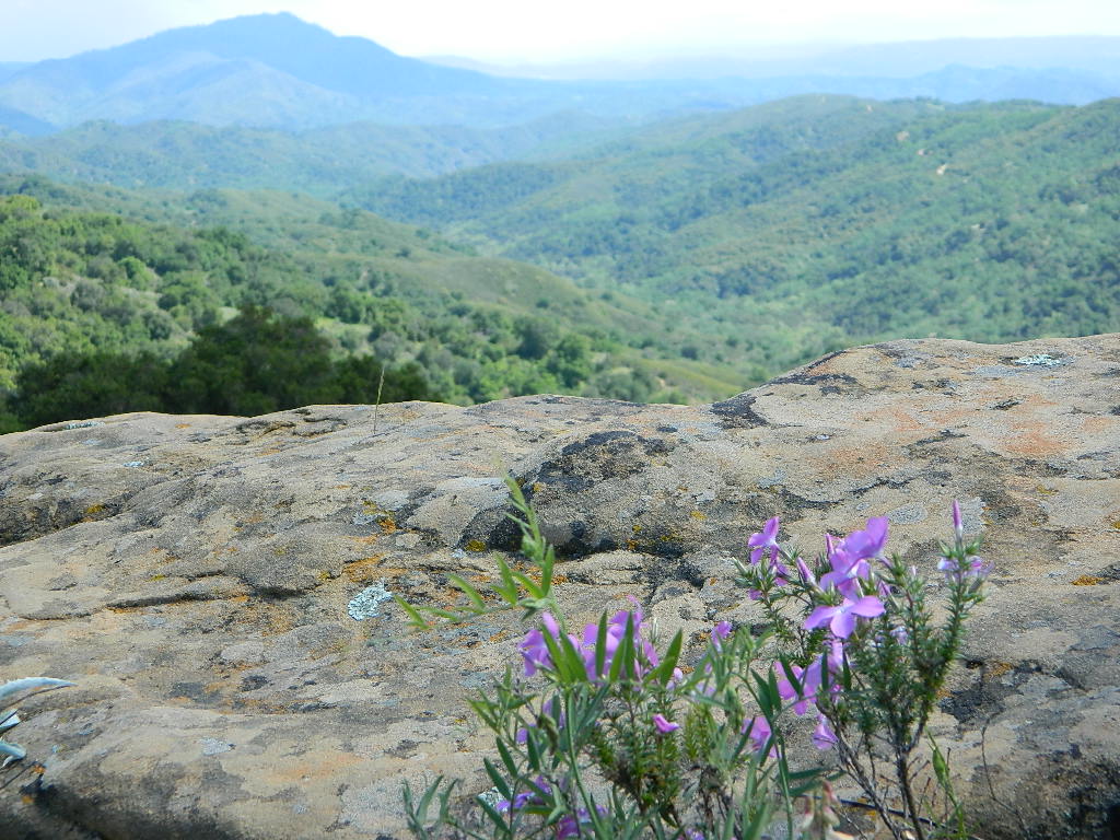
Garcia Wilderness

Garcia Wilderness, Los Padres NF

14,100 acres
Garcia Peak – 3146′ elevation
Los Padres National Forest
Huasna River
Pozo Creek

himtncampgroundcampgrounds nearby –

American Canyon Campground
Hi Mountain Campground
La Panza Campground
Lake Lopez Campground
Navajo Campground

trailheads for Garcia Wilderness

  • Hi Mtn
  • Santa Lucia
  • Garcia OHV

POZO ROAD is also known as

  • Pozo La Panza Rd
  • Hi Mountain Rd
  • Pozo Arroyo Grande Rd

San Luis Obispo’s Los Padres Pozo Rd is a 4×4 route that accesses the Garcia Wilderness; the dirt route connects Lake Lopez to Pozo Saloon, out near Santa Margarita. Los Padres National Forest 

Located inland from the Pismo Coast in south San Luis Obispo county.
Garcia Peak OHV Route, off Pozo Road behind Lake Lopez, Arroyo Grande, CA

  • backpackingLupine on Pozo Rd
  • camping
  • hiking
  • mountain biking
  • off roading
  • waterfalls
  • wildflowers

Steep lush coastal mountains, rugged, remote landscapes close to Central Coast San Luis Obispo.

Garcia Ridge Road #30S18

Garcia Ridge Trail #15E11

Hi Mountain Road #30S11


DSCN5297

also nearby – Machesna Mountains Wilderness and Santa Lucia Wilderness

Split Mountain Anza Borrego Desert

Split Mountain Road

Fish Creek Wash
Anza Borrego Desert State Park
Ocotillo Wells, CA

Fish Creek Wash @ Split Mountain

Explore Anza Borrego State Park desert deeper for the secluded hidden treasures. Find yourself traveling the east San Diego county desert, on Highway 78 eastbound on the way to the Salton Sea. Passing the turn offs for Borrego Springs, slow down and look for the intersection of off-roaders & ATVs @ Ocotillo Wells, California. Ocotillo Wells State Vehicluar Recreation Area is on the north (left) side of the highway and Split Mountain is on the right.

From highway turn south (right) on to Split Mountain Road, which leads to numerous back road destinations. Ranch homes and private property line the first mile of the road, neighborhood general store and a tiny saloon, RV park and an ATV rental shop.

Old Kane Springs Road is a main dirt road that parallels the highway from the narrows at San Felipe Wash to the Salton Sea. Old Kane Springs Rd intersect the Split Mountain route about 1 mile south of highway.


View Larger Map

Split Mountain ranger station is before the Elephant Trees nature trail. Near the railroad track, the paved road turns into Fish Creek Wash near Fish Creek Campground. If you have a low rider passenger car, you might wanna park it here and walk in to the canyon. Within the first few miles there is a lot to explore – fossils in walls, huge cliffs, wind caves, narrow canyons.

The actual “split in the mountain” section is located just beyond the campground on a sandy desert road.

Anza Borrego’s Split Mountain

Fish Creek Wash continues south, deep into the Carrizo badlands where 4×4 is definitely needed. The trail system eventually loops back over to paved S2 @ Canebrake, via Pinyon Mountain w/ the Squeeze, or Canon Sin Nombre. Unlimited primitive camp sites, found inside every other nook and cranny. Numerous hidden slot canyons, sandstone cliffs and wide sandy washes becomes a literal maze of off-road trails so you better carry a good back roads topographic map.

Sturtevant Falls

Santa Anita Canyon, Sturtevant Falls

a day hike in the San Gabriel Mountains

Day hikes near Los Angeles, CA

Santa Anita Canyon, Angeles National Forest
From the 210 freeway, in San Gabriel Valley. East of Pasadena, exit Santa Anita Ave.
Head North/East, through neighborhood, where road becomes Chantry Flats Rd (aka, Forest Road #2N40)
proceed up the mountain to paved parking lot @ Chantry Flat. Falls Trailhead #11W14

  • 5 miles RT hike
  • 4600′ elevation
  • steep canyon w/ creek crossings
  • falls and creek subject to seasonal dry up; water flow varies
  • backpack camping only, no developed campground


more photos on trailhead


View Larger Map

Mineral King Camping

DSCN0019

Mineral King is a magnificent canyon in the southern portion of Sequoia National Park, east of  Visalia, CA. So magical indeed that Disney tried to purchase the rugged scenic lands for a wilderness ski theme park in 1960. Thankfully that project never happened, due to strong opposition from preservationists. Mineral King became part of Sequoia National Park in 1978.

Mineral King is the Great Western Divide, where high peaks separate the foothills from the taller Eastern Sierra range. Upper Kern River Canyon lies beneath as the main south drainage from the very tallest peak, Mount Whitney @ 14,494′
sierra topo maps

Mineral King Road is a paved off shoot from Highway 198, just to the east of the town of  Three Rivers, CA. The road is steep and curvy and 25 miles long. No gasoline at all. No RV motorhomes or trailers are permitted to travel this scenic and amazing back road. Certain portions of the road are dirt and usually graded, but most of the route is paved.  Snow closes the road in winter months – NOV-MAY.

We usually get less than a half year to enjoy this special place, so make plans in advance to fit this destination into your schedule JUNE-JULY-AUG-SEPT.

And do not even think of trying to cram spectacular Mineral King into an already packed Sequoia Park weekend trip. The Giant tree Sequoia groves, Hume Lake and Kings Canyon are over an hour north (hwy 198), to other side of the park.

If you have a full week to hang out in the Sequoia National Park area, then obviously Crystal Cave and Mineral King should be on the list, but keep in mind taht each destination will take a full day to drive to and explore.

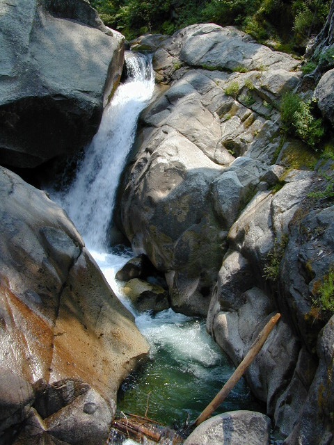
Driving the distance on Mineral King Road, the wonders abound on every curve. Wildlife, waterfalls, water flowing and the dense forests.

Atwell Mill Campground is located at an old wood mill site and has a good hike to a footbridge at Kaweah River. There is a small cabin community called Silver City which caters to summer crowds and family campers. Only open during the warm season.

At the very end of Mineral King Road is the gravel parking. Step out into high elevation (7830′ above sea level), breathe deep and enjoy the granite bowl of alpine bliss with creeks, meadows, wildflowers, picnic spots, hiking trails and scenery everywhere. Mid day sunshine can be bright. Black bears and marmots are very common.

Cold Springs Campground is the last developed campground, located next to a raging creek. The hike-in sites are the best choice for seclusion at this camp.

South Fork Campground is the smallest of the campgrounds in this area; located in the foothills at 3600′ elevation, open all year. From Highway 198 (W of the town of Three Rivers), take South Fork Drive 13 paved miles to camp.
KaweahFalls

mineral king backpacking

Mineral King is a favorite destination among backpackers as it gives instant access to many high country trailheads with mostly paved road driving. Located deep in the forest at end of a long road, near the center of the Sierra Nevada range gives ample hiking in every direction. The hikes are steep and challenging, but the rewards are solitude, true wildness and grandeur scenery. Although inviting, these steep passes might not be adequate for beginner backpackers, so please keep that in mind when planning. Fishing lakes, day hikes, horseback trails, waterfalls, creeks, and jagged mountain peaks.

From Mineral King you can access the these popular spots – PCT, the Great Western Divide, the Golden Trout Wilderness, Sequoia National Park, Kings Canyon High Country, Keasarge Pass, John Muir Wilderness.

top maps for the region –
Nettle Springs Campground

Nettle Springs

Apache Canyon Campsites

Cuyama Camping near Highway 33

Los Padres National Forest 

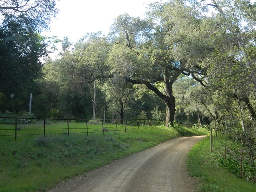
Way back off there beyond the boonies, 10 miles on a bumpy dirt road #8N06, and far from the pavement. Seclusion, peace and quiet, plus privacy is what this canyon can offer. This small campground is rarely busy, unless a huge family or hunting group has taken over camp. Most of the time it’s so quiet you can hear the wind in the trees, birds chirping and bugs buzzing.

N of Ojai (about an hour), scenic drive Highway 33 N of Ozena @ Lockwood is a little-known signed route called Apache Canyon. Los Padres Road #8N06 leads from the south end of Cuyama River Valley east to the dead end badlands canyon w/ Nettle Springs Camp. OHV trails and Chumash Wilderness access.

Elevation: 4,400′
Number of Sites: 8
Camping Reservations: No
Sites Available: First come, First serve
Vehicle Accessibility: small RV ok
Length of Stay: 14 Days
Water: No Piped; seasonal creek iffy
Toilet: Vault
Season: Open all year
Fee: No
Operated By: National Forest Service
Closest Towns: Frazier Park, CA & Ojai, CA

Los Padres National Forest
Lockwood Ranger Station
661-245-3731

Secluded Campground and Spacious Camp Sites


Saddlebag Lake Campground

Saddlebag Lake, Yosemite East Side

Inyo National Forest @ Tioga Pass, Hwy 120

Yosemite High Elevation Campground

Yosemite Lake View Camp Sites

Tioga Pass camping on the eastern side of Yosemite National Park, just outside park boundaries is Inyo National Forest lands. Snow is usually epic up here and some of the deepest on the range of light.

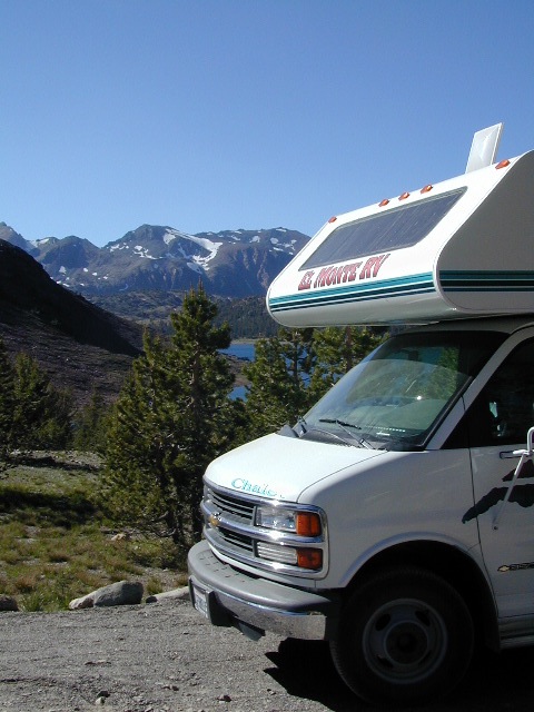
Several prime campgrounds line this popular Sierra pass, highway 120. Most camps are located along the busy highway just outside the National Park gate. Behold, this prime choice destination is a few miles back off the highway, at the end of a graded dirt road. Smaller RVs okay.

Saddle Bag Lake

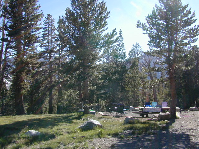
High altitude, tree line, thin air, snow melt everywhere, spectacular elevations and dark skies make this an awesome stargazing spot. Summer is busy with trailers, boat rentals, horses and day hikers. Locals and fishermen use this small campground often, so tourists should feel lucky to find such a rare camp here. First come, First serve, when it is open (only half the year).

Elevation: 10,000′
Number of Sites: 19
Camping Reservations: No
Sites Available: First come, First serve
Vehicle Accessibility: Vehicle limit 22 ft. max.
Length of Stay: 14 Days
Water: Piped; lake, creek nearby
Toilet: Vault
Season: Closed during winter & spring
Fee: Yes
Operated By: National Forest Service
Closest Town: Lee Vining, CA

Inyo National Forest
Bishop Ranger Station
760-873-2400

RV Camper Lake

Lily Pad Campground

Lilypad Campground @ Lake Wishon Reservoir
Sierra National Forest, California

The long journey up the mountain into the Sierra National Forest is only for the true adventure seekers. First off, get a good forest map. Second, plan several days if not a full week off of work to explore this region in depth. It is a long drive from most anywhere in California, and this spot is way, way tucked back in there right up against the High Sierra peaks and wildness.

East of in Fresno, historic village of Clovis is a good lunch stop in route. Drive up mountain on Hwy. 168, turn right at Shaver Lake on to Dinkey Creek Rd. Now you will clock the mileage 28.7 miles to the camp. Drive past McKinley Grove and past Dinkey Creek. Follow signs to Wishon Reservoir. This campground is located adjacent to the road before you reach the dam.

All this travel time will have you asking ‘is it worth it’? The answer is ‘yes’….. if you want an uncrowded lake with plenty of wilderness surrounding you. Granite rock and forest all around. Lake Wishon is a hydroelectric reservoir operated by PG&E

Lily Pad Campground

Central Sierra Camping – Wishon Lake

High Sierra Rangers Office: 559-855-5355

• Elevation: 6,500′
• Number of Sites: 15
• Camping Reservations: No
• Sites Available: First come, First serve
• Vehicle Accessibility: 35′ limit on RVs & trailers
• Length of Stay: 14 Days
• Toilet: Vault
• Water: Piped
• Season: Closed in Winter Snow
• Fee: Yes

camp sites at lake

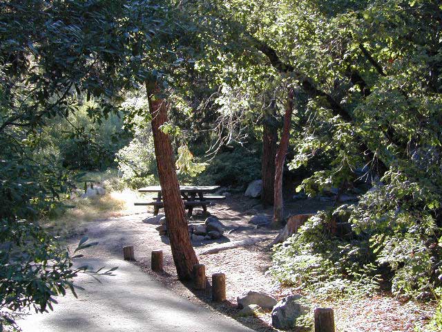
Large granite boulder coves provide cubby-hole privacy w/ shady trees and well spaced camp sites. Very unique design with paved driveways, adequate for handicapped camping with some sites with better access than others. 4 camp sites are considered walk-in sites.

Lake views from camps are only a mere climb up to the top of the nearest granite, which will show you just how close you are sleeping to the big water.

As with any Sierra location, holiday and summer weekends are the most busy. Tourists, family campers and RVers are all out enjoying the sunshine. Mid-week camping is good for fishing, relaxing w/ peace and quiet. Off season is best for having the place to yourself.

Outdoor recreation in the area include – hiking, camping, backpacking, rock climbing, mountaineering, sightseeing, kayaking, canoeing, mountain biking, off-roading, creek fishing, lake fishing.


Neighboring Wishon Village has a small general store, RV park w/ wifi & boat rentals.


Mokelumne Wilderness

Central Sierra Nevada Mountains, California

Mokelumne Wilderness Area

topo mapsMokelumne Map

Mokelumne (pronounced moo-ka-la-mi)
Backpacking, Camping, Fishing, Hiking, Kayaking Mokelumne River / Mokelumne Fishing / Mokelumne Trail / Mokelumne Wilderness Topographic Map

Vast alpine ranges located in the middle of the Sierra Nevada, between Highway 88 (Carson Pass) & Highway 4 (Ebbetts Pass). The Mokelumne Wilderness is a 105,165-acre federally designated wilderness area located 70 miles east of Sacramento, California. It is within the boundaries of three national forests: Stanislaus, Eldorado and Toiyabe. First protected under the Wilderness Act of 1964, the Mokelumne’s borders were expanded under the California Wilderness Act of 1984 with the addition of 55,000 acres. The wilderness takes its name from the Mokelumne River, which was named after a Mi-wok Indian village located on the riverbank in California’s Central Valley.

The wilderness encompasses an area of the Sierra Nevada mountain range between Ebbetts Pass to Carson Pass. There are two sections separated by the Blue Lakes Road and an Off-Road Vehicle corridor. Elevations range from 4,000′ to 10,381′. The highest point is Round Top 10,364′, a remnant volcano from which the wilderness area’s volcanic soils are derived from and is located on the east side of the Sierra crest.

recreation –

  • backpacking
  • camping
  • creeks
  • fishing
  • hiking
  • ice climbing
  • kayaking
  • lakes
  • mountaineering
  • rivers
  • wildflowers

surrounding forest lands –

National Forest & Wilderness Permits –

USDA Stanislaus
Lake Tahoe Basin Management

More Mokelumne Wilderness Info & Links –

sierrawild.gov/wilderness/mokelumne
summitpost.org/mokelumne-wilderness
Mokelumne Wiki
Mokelumne River

Sunset at Mosquito Lakes

Thousand Lakes Wilderness

NorCal hiking & backpacking

Thousand Lakes California

Although the name suggests more, the number of lakes in this region is approximately seven: Eiler Lake and Box Lake are the 2 largest lakes within the Wilderness boundary. Logan Lake and North Battle Creek Reservoir are on the outskirts. Trout fishing is a popular recreation sport all around Lassen. Thousand Lakes Wilderness is part of the Cascade Range in northern California. 16,335 acres and 21 miles of trails, all managed by Lassen National Forest. The area lies midway between the mountain town of Burney and Lassen Volcanic National Park.

Volcanic activity and glaciers have combined to create the Lassen topography. Dominated by Crater Peak 8677′, which is the highest point in Lassen National Forest, this area is a reminder of the glacial action that eroded the original, much larger Thousand Lakes Volcano and created the many small lakes and ponds scattered throughout the region. Wildlife includes black-tailed deer, black bear, pika, pine marten, northern goshawk, spotted owl, pileated woodpecker, and Clark’s nutcracker. Even elk have been known to visit occasionally.

Lassen National Forest
Lassen Volcanic National Park


View Larger Map

Thousand Lakes Wilderness

Roads and trailheads surrounding Thousand Lakes Wilderness and the Wild Woods

Lassen Forest Road #16 – Ashpan Winter Recreation Area @ Hwy 44, leads to hikes on the west side of the Wilderness. Bunchgrass trailhead and Magee trailhead. LaTour State Forest, Ashpan Butte, Huckleberry Mountain, Fredonyer Peak, Crater Peak, and Whittington Butte. Lassen Route 16 is a graded dirt road that connects to Tamarack Road #4M001 at Burney Creek, near the north side of the Wilderness.

Road #32N17 – access to North Battle Creek Reservoir
Road #32N16
Road #32N24

Thousand Lakes Wilderness Map
Road #32N31 – access to North Battle Creek Reservoir

Road #32N18 leads to PG&E North Battle Creek Reservoir
North Battle Creek Campground: elevation 5600? / 15 camp sites / open Apr-Oct

Road #26 on the north side of the Wilderness, connects Hwy 89 @ Hat Creek, west to Road #32N22. Cypress trailhead is located on a side route nearby.

Road #32N23 is up on Burney Mountain elev. 7863′, another hang glider launch site.

Road #33N25 leads to the Tamarack trailhead
Road #34N78 off Hwy 44, near Logan Lake and route leads to McElroy Flat

Road #32N35 behind Burney connects to Hat Creek (the back way).


LASSEN AREA MAPS –

Lassen National Forest Map
Thousand Lakes Wilderness Map


List of Thousand Lakes Wilderness trailheads:

Bunchgrass Trailhead
Magee Trailhead
Cypress Trailhead
Tamarack Trailhead


List of nearby towns:

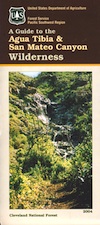
Agua Tibia Wilderness

Agua Tibia Wilderness Area

  • 15,900 acres
  • chaparral & oak at lower elevations
  • pine & fir forest at high elevations
  • elevations range 1,700′ – ­5,000′
  • 25 miles of trail
  • summer temperatures exceed 100°F
  • occasional snow in winter
  • best in winter through spring
  • wood fires prohibited
  • portable stoves permitted
  • water scarce
  • no overnight use of pack or saddle stock
  • groups limit – 15 people
  • visitor permits required
Agua Tibia lies right on the RIVERSIDE
& SAN DIEGO COUNTY border

Cleveland National Forest
Palomar Ranger District
1634 Black Canyon Road
Ramona, CA 92065
760-788-0250

Agua Tibia Map

Agua Tibia Trailhead

This is the trailhead for Agua Tibia Wilderness located at Dripping Springs Campground on Highway 79, near Temecula CA.

See more: Agua Tibia Mountain hike details

hiking SoCal

Atwell Mill Campground

Atwell Mill Campground
Mineral King Camping, Sequoia National Park

Atwell Mill is near the East Fork of the Kaweah River, situated in an old logged sequoia grove with the southern Sequoia National Parks impressive Mineral King Canyon. Located 19 mi from Highway 198 near Three Rivers, CA. About 1 mi West of Silver City and 6 miles before the end of road at Mineral King.

mill_i
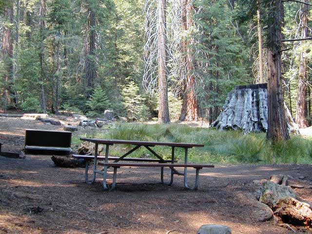
Meadows with pines at this campground

• Elevation: 6,650′
• Number of Sites: 21
• Camping Reservations: No
• Sites Available: First come, First serve
• Vehicle Accessibility: No RVs; tents only
• Length of Stay: 14 Days
• Toilet: Pit
• Water: Piped
• Season: Closed in Winter Snow
• Fee: Yes

site4

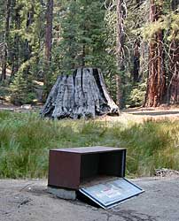
Bear Box in Mineral King Campground

Bear lockers for food storage are required in this region. Nice shady camp spots spaced out well at this small developed campground. Hikers parking lot is located at one end of the campground. Big bonus for hiking trails nearby.

FOOTBRIDGE HIKE: Great half day hike down to the Kaweah River. Small wooden bridge down at the river crossing and numerous trails lead off into plenty backpacking destinations around Mineral King.


View Larger Map

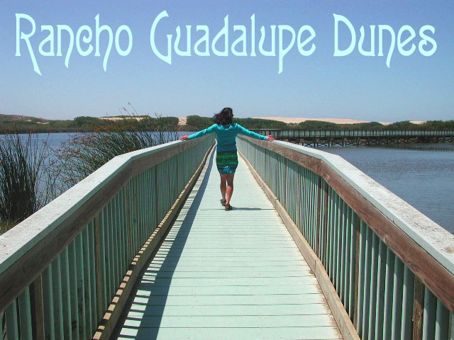
Rancho Guadalupe Dunes Park

Guadalupe Dunes / Rancho Guadalupe Dunes County Park

Gualupe Dunes Park

Beach sand dunes on the Central California coastline, located in between Point Sal and Pismo Beach. Three different wildlife preserves (and one oil refinery) make up this sandy beach strand W of Guadalupe, CA

From the north

  • Oceano Dunes SVRA – also known as Pismo Dunes this is where all the yahoos can get their thrills riding quads and driving on the beach dunes. One of the few spots in ca, where you can drive your vehicle on the beach, right at the tideline.
  • OSO FLACO LAKE – estuary with boardwalk on the California Central Coast, surrounded by sand dunes and farm lands. Birdwatch right from the middle of the lagoon. Bring a picnic too!
  • Guadalupe-Nipomo Dunes National Wildlife Refuge – the refuge is situated between Oso Flaco Lake & Ranch Guadalupe Dunes. The main office is located along Highway 1, at 1045 Guadalupe Street, Guadalupe, CA
  • Rancho Guadalupe Dunes County Park – just north of Point Sal is this public access beach. Well known for miles of pristine sand dunes. This is a place to truly enjoy nature and solitude. Near to Pismo Dunes, Rancho Guadalupe is a county park in the Santa Barbara County Parks system. This protected wildlife area is north of Lompoc & south of Pismo Beach CA.  The refuge was established to protect breeding habitat for the endangered species.

All this located west of Santa Maria & Nipomo CA. The Santa Maria River meet the Pacific ocean here at this estuary and sand dune area. From Coast Hwy 101, exit Main Street in Santa Maria; follow Hwy 166 west, past the small town of Guadalupe, CA & past the farmlands – straight to the coast.

6999 W Main St
Guadalupe, CA 93434
805-343-2354


View Larger Map

Horses & dogs are not allowed in the preserve. Off-road vehicle play area is to the north of Oso Flaco Lake. The fence line is visible from the beach hike and engine noises can be heard from Oso Flaco. Enter the Ocean Dunes SVRA (State Vehicular Recreation Area), further up Hwy 1 at Oceano CA

more info
dunescenter.org
Some photos

Rock Climbing Southern California

Idyllwild Camp Granite

Rock Climbing in SoCal is limited to the awesome southern deserts with boulders, boulders & yep, more boulders. Joshua Tree is well known, but Mojave deserts boulders have much to offer, with less crowds. Meaning you’ll get more on exploring new routes, off the beaten path.

Bishop in the Eastern Sierra has the Buttermilks, but we wanna cover stuff further south for climbers. Numerous crags and peaks can be found in the mountain regions of San Diego. Many destinations are also great camp spots.

Good granite is hard to come by & big granite walls are non-existent down south. The most popular piece of Southern California granite among climbers is that of Tahquitz Peak in Idyllwild CA

Big Bear Lake

  • Bouldering @ various places
  • Idyllwild Rock Climbing

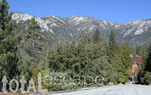
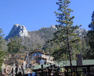
  • Tahquitz Peak in San Jacinto Wilderness: Tahquitz Peak Lookout stands at 8846′ elevation, towering above the pine village of touristy shops & cafes below. It’s a small slice of the Sierra Nevada (fabulous blue granite feeling) in SoCal & the rock climbers love it. Humber Park is at the base of the peak. The park is a family & tourist destination, especially during snow days. Paved parking lot is at the very top of the neighborhood, a well signed route. Follow the brown “Humber Park” signs. Hmmm, now is that ta-keets, ta-quits? Just ask a local – who grew up in Idyllwild.
  • Tahquitz Peak

    San Diego County climbing destinations:

    Army Rock
    Beirut
    Bonita
    Carlsbad Boulders
    Culp Valley
    Descanso Wall
    Dixon Lake
    El Cajon Mountain
    McCain Valley
    Mission Gorge
    Mt Everest
    Mt. Helix
    Mt. Woodson
    Otay Lakes
    Poway Crags
    Rock Mountain
    Santee Boulders
    Stonewall Peak
    Valley of the Moon

    For more on California rock climbing places, check out a few of our favorites resources:

    CA Rock Climbing Instruction

    Rock Climbing Ratings

    Rock Climbing Local Links

    California Rockclimbing.com

    Southern California rock climbing areas:

  • Idyllwild
  • Joshua Tree NP
  • Mojave NP
  • Southern California Maps that may be relevant:

    OC

    the OC: SoCal culture – beaches, surf, mountains

    Orange County. North of San Diego & south of L.A.

    surfergirl

    OC hikes

    A wonderful resource for Orange County outdoors is
    ocparks.com

    maps for local weekends, local hikes:

    oretga highway 74
    oretga highway 74

    Partington Cove Hike in Big Sur

    Big Sur – Partington Cove

    DSCN3026
    Go west to & visit the oceans edge or head east to explore a deep redwood canyon.big

    Approx. 5 miles South of Big Sur State Park and just north of Julia Pfeiffer Burn State Park, this unmarked dirt turnout area on Highway 1 is a rare find. Rocky shorelines at the historic point, plus the scenic tree lined waterfall & cross the highway & head east for a shady Redwood canyon forest with plenty of backpacking options into the Big Sur back country of Los Padres National Forest. From bright sunny ocean view hillsides to dark shady forests.

    This portion of the highway cuts into a deep bend along the coast & has no markings to the paradise that lies within. A steep dirt fire road (down to the cove) with metal gate is your only clue. Dirt parking area on both sides of the road indicate that people have parked here before.

    This un-signed secluded hide-away has a variety of landscape & sites to see. You could easily kill 6-8 hours just in this canyon alone!! Definitely not a hurry through kind of place. Take your time, enjoy the view, tide pools, bring your swim suits & refresh in the creek. Carry a picnic eastbound into a shady creek-bed canyon & watch the sun dance through the towering pines above.

    Driving northbound on Highway 1, look for large hair-pin turn out in canyon area – approx. 3-5 mi. North of Julia Pfeiffer State Park in wide dirt areas along roadside. Located in between Julia State Park & Pfeiffer Big Sur State Park.

    Hike down the dusty wide gated fire road in dry brush chaparral. The view of Redwood trees, the royal blue ocean in front of you, the sounds of a water falling creek. The trail forks off in 3 directions:

    Right / Rock Beach – this a boulder lined cove where the clear fresh water stream meets the ocean. Small pools & waterfalls can be found just upstream .

    Bridge Crossing / Point – through a wooden tunnel to a cliff area with tide pools & wooden structure (an old boat launch?)

    Left / Up Stream – a forested canyon w/ a variety of trees; dead ends a few hundred yards up into the canyon

    DSCN3021Another option to this canyon is the East side:
    Hike up inland (away from ocean) into a densely forested creek area. Redwoods, waterfalls & boulders. Deer sightings are quite common in this area. Shady & dark this trail climbs gradually in elevation. One fork of the trail leads to an old Redwood Grove. A portion of the trail is closed 2.5 mi. up due to a landslide. But overall the is a perfect option for backpackers wanting a short hike.

  • Los Padres Maps (USDA)
  • Big Sur Map (NatGeo)
  • Ventana Wilderness Map w/ Silver Peak
  • San Diego Trails

    San Diego Hiking – San Diego County Trails

    horse hiking

    Cedar Creek Falls
    3 mi RT / moderate; off Hwy 78

    From Santa Ysabel on Hwy. 78, drive E 6 mi, turn right on Pine Hills Rd.
    1.50 mi., bear right on Eagle Peak Rd.
    1.25 bear right again (signs point to Eagle Peak Ranch)
    Drive 8 mi. (dirt & paved) to Saddleback, 4 way junction.
    Park & hike the fire road downhill for 1.25 mi.
    At the fork, bear left & continue into the Cedar Creek bed
    Some rock scrambling down to the swimming hole

    Hot Springs Mountain
    5.5 miles RT/ strenuous (elevation gain/loss =1,250 feet)
    Near Warner Springs, 10 miles northeast of Lake Henshaw; Off Highway 79

    From Temecula Interstate 15, take Highway 79 East to Warner Springs
    Drive up Los Coyotes’ Indian Reservations main road, past the intersection of Middle Fork Borrego Palm Canyon (6.1 miles past the entrance gate )
    Turn left (west) and drive up the valley on a sandy road to reach a saddle above the valley 2.2 mi. farther
    At Nelson’s Camp, on the left side of the road, Park at the camp
    Begin hiking southwest up along a small tributary stream that flows north & west into Agua Caliente Creek.
    Follow an old Jeep trail up, gaining more than 500 feet in just over a mile.
    At the top, you’ll meet a better road that runs up the south slope to Hot Springs Mountain
    Turn left (west) on this road and climb another 1.6 miles along the ridge line to the tower.
    Pass through dense forests of black oak, Coulter pine and white fir, and across meadows dotted in late spring with wildflowers.
    Lookout tower, dilapidated and seemingly on its last leg, sits on the west shoulder of the mountain.
    Go a bit higher on the ridge by following a faint trail through thick brush and around boulders to the true summit. A flat concrete platform caps the summit block.
    option – Seven-mile dirt road going up the mountain’s southern slope (drive, hike or mountain bike)

    Maps Mountains / San Diego Maps

    see also – San Diego Anza Borrego 4×4

    San Diego Mountains

    San Diego Mountain / Hiking San Diego / SoCal Camping

    hiking San Diego

    San Diego forests & parks – 

    Cleveland National Forest

    Palomar Mountain State Park

    Anza Borrego Desert State Park

    San Diego maps & trails –

    San Diego mountain towns nearby Alpine, Descanso, Julian, Mount Laguna, Palomar, Ramona

    mt laguna lodge

    Split Mountain Anza Borrego

    Anza Borrego Desert State Park

    Fish Creek Campground

    E of Borrego Springs CA.

    Well off Highway 78, past the busy OHV area, quads at Ocotillo Wells, past all the rural homes & the redneck bar, past the Elephant Trees hike – where the road goes from pavement to graded dirt to a wild desert wash, in a few short miles. If you don’t know where you are, then you’re almost there.

    This is a large wild desert wash with huge unstable walls, several areas for wind caves and a few historic markers. Lots of 4×4 trails beyonf Split Mountain, to the south. No real water in sight, except maybe the puddle you are standing in as it starts to poor. The soft sand can give way to a few heavy rain drops. May not be a great area to be during a serious storm or flash flood possibility, unless you want to get buried alive. Check the weather forecast in advance.

    A ratty, small developed campground of Fish Creek is on the left side, upon the ledge. Fish Creek Campground is picnic tables & a pit toilet – at most. Ya may as well camp out in the open, off road, like the pioneers did. You can do that out here in Anza Borrego. (Just keep it clean & carry a metal fire container.)

    split mountain

    Split Mountain, Anza Borrego Desert State Park

    This portion of the “mountain” is less than a mile from Fish Creek Campground. Fossils can be found in these walls. Shade is good in summer months, when day temps reach 100+. The rest of the year is ideal weather. This mountain split from water, erosion, mega force. High walls, wind caves, desert washes, great primitive camping & 4×4 routes.

    This desert scenic drive will require you to get that SUV dusty. 4 wheel drive not required. No RVs past the campground. All low lying passenger cars are warned, there are uneven areas, soft sand & boulders.

    Duh, do not attempt this one when desert flash floods are possible.

    ANZA BORREGO STATE PARK

    ANZA BORREGO MAP

    SAN DIEGO BACKCOUNTRY MAP

    nearby towns –

  • BORREGO SPRINGS CA
  • OCOTILLO WELLS CA
  • SALTON SEA CA

    splitmountain

    Great desert back road exploring out here. A zillions washes & canyons.

  • Eastern Sierra Mountains

    Eastern Sierra Mountains / Eastern Sierras California

    mount tom

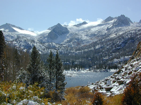
    Wilderness seeker John Muir called the Eastern Sierra, the range of light. It’s desery & drastic. Tons of granite & wild-ness. The impressive, tallest peak in the lower 48, Mount Whitney towers at elevation 14888′ over the Owens River Valley. Death Valley meets mountains. Ancient volcanoes & fresh granite. Creeks are alive throughout summer. Alpine lake hikes & their wild flowers are incredible. Horseback trails, rentals, pack trips are very popular. Total Escape even list high country Inyo 4×4 routes, that overlook Bishop.

    Eastern Sierra forest & parks –
    Inyo National Forest
    Toiyabe National Forest – north (Carson)
    Toiyabe National Forest – south (Bridgeport)

    Ancient Bristlecone Pine Forest

    Ancient Bristlecones

    inyo maps

    Eastern Sierra maps & trails –

    Eastern Sierra towns –
    Aspendell, Big Pine, Bishop, Crowley Lake, June Lake, Lee Vining, Lone Pine, Mammoth, Olancha, Toms Place

    south lake bishop

    cottonwood lakes

    Mount Charleston Vegas

    Mt Charleston Las Vegas NV

    Mount Charleston Las Vegas NV

    Mount Charleston Resort
    Mount Charleston Resort

    Mt Charleston cabin rentals, vacation homes and 2 mountain lodges are located near the Spring Mountain Recreation Area, just outside of the Sin City limits. The tall alpine mountains behind RedRock SP, NW of Las Vegas, Nevada are virtually unknown by many non-locals. Great hiking, mountain biking, camping and waterfalls, plus a small seasonal ski and snowboard resort are some of the highlights. Imagine snowboarding Vegas!

    Mt Charleston Hikes
    Red Rock Canyon Map

    Las Vegas Forest Hikes

    Vegas means “the meadows”, but it sure seems more like desert these days. The forest is just up the hill, past the red rock and tract homes, well past the Joshua Trees. Conifer forests, snow and high elevation, less than an hours drive from the Vegas strip. Toiyabe – Humboldt NF is this public land managed by the US National Forest system. Toiyabe also covers Eastern Sierra slopes. Get California Toiyabe NF maps. Get the Nevada State Park map here!

    Camping Vegas

    Due to extreme dry conditions and wildfire danger no open camp fires are allowed from mid-April to mid-November in the Mount Charleston region. Several developed campgrounds, plus a primitive (dirt road) camp area off Lee Canyon. Cabin rentals are located at the Charleston Lodge.

    • Vegas trails
    • Hiking in Vegas
    • Mount Charleston skiing
    • Mt Charleston hikes