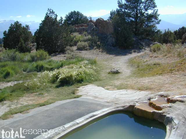
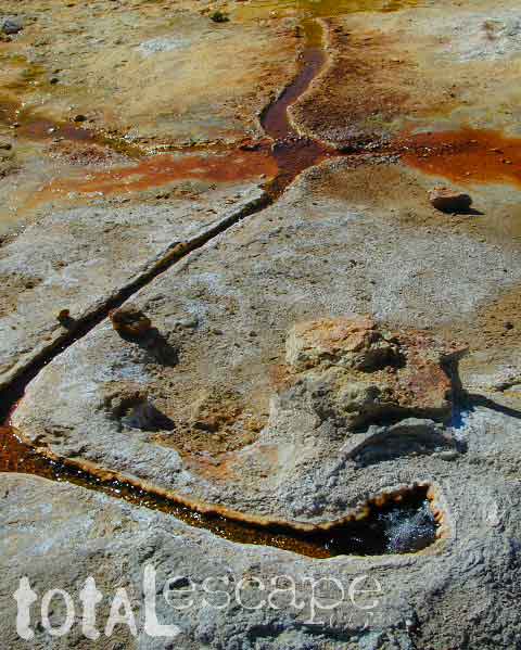
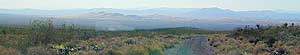
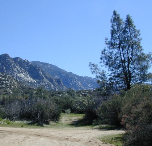
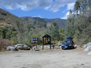
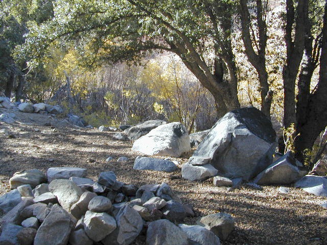
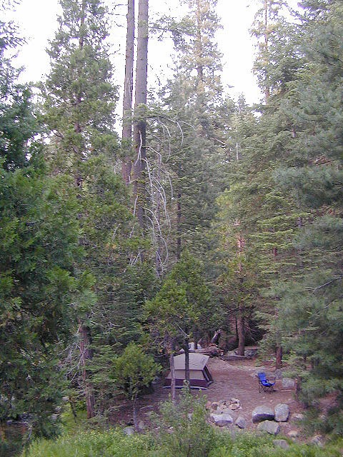
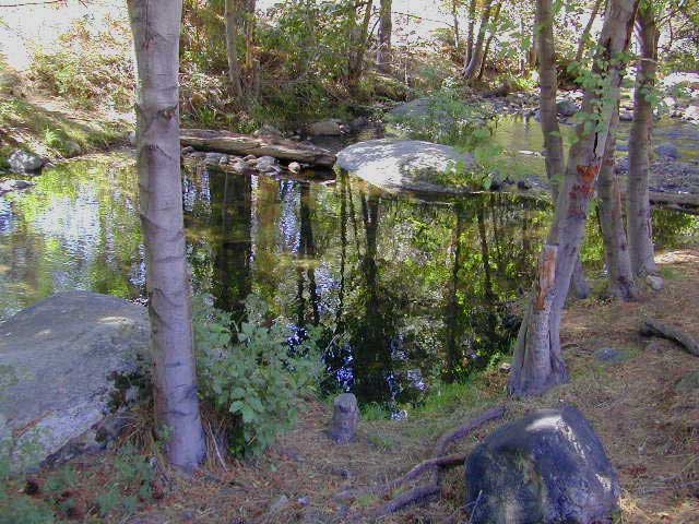
Take the road next to the Ranger Station (South of Bridgeport, along Hwy 395); Drive up the hill and past the rock quarry. Bear right & look for dirt parking lot. Two pools, short walk, no shade, wonderful views of the Sierra Nevada mountains.
Popular with local commuters and travelers, with easy access off the highway. Great spot for views westward w/ sunset picnic and soak.
No overnight camping allowed at Travertine hot springs (posted signs)
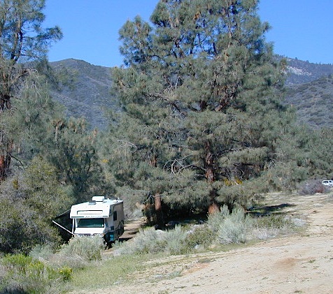
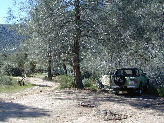
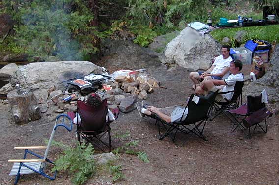
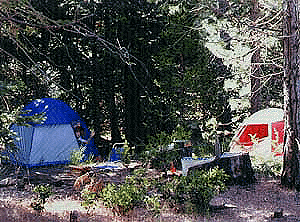
Plenty of great, free, camping nearby:
Primitive or developed Campgrounds.
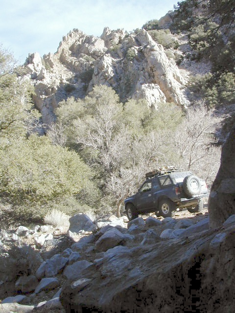
Explore side dirt roads on the east or west side of Hwy. 395; Plenty forest land w/ free camping all up & down the Eastern Sierra corridor. (Just make sure you obey private property signs).
Nothing beats fresh, cold, clean water from the California mountains, in the summertime. Find time to exit the urban rat race, soon. Escape the smoggy city life and the triple-digit heat for a road trip to the higher elevations.
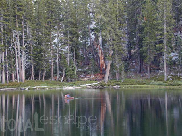
Crocker Mountain @ Lake Davis, California
Lake Campgrounds are abundant in California, where man-made reservoirs and recreation abound. Alpine lakes in pine forests are also numerous in the west, although only accessible for a portion of the year, they draw in the campers all summer long. A majority of the small lakes are located inside the California National Forests.
USDA / USFS / NFS
Larger reservoirs can often be managed by California State Park system. State Parks, SRA, State Recreation Area. Suburban lake locations can be local County Parks. A few locations listed could even be desert lakes.
Many ideal secluded lakes are only accessible with a 4WD vehicle, by foot or horseback. Super scenic, backcountry lakes are so far out – that a day hike is usually required.
developed campground
primitive campsites
RV campground
wilderness access
No motorized boats, camping on west shoreline only, no fishing from the dam, catch & release?
No access for trailers? Individual rules for each lake are different. Learn the basic before you get out there.
CAMPGROUND RESERVATIONS
Lake Campgrounds are so popular in California that many require reservations during summer. Many locations accept reservations online and we have links for those too. Other lakes are so small and remote, that only the fishermen, hikers and 4×4 gear-heads know of them.
outdoor recreation found at or near lakes
backpacking
boating
camping
canoeing
creeks
fishing
floating
four-wheelin
hiking
horseback riding
house boating
jetski
kayaking
mountain biking
OHV trails
picnicking
rivers
river rafting
swimming
water skiing
waterfalls
Lake destinations listed here have some sort of campground facilities. Some may be mini resorts with boat launch, marina or bait shop/general store. RV hook-ups, maybe. Dump station, it will cost you. Usually these bigger lakes are busy centers of tourists activity with boat rentals, RV camping and certain locales are even walking distance from ‘town’.
Fine dining is a rare find on the lakes, but some lake side restaurants (open seasonally & with limited hours) can be found. Most will require reservations, especially on the weekends.
Other lake camps listed are literally on the edge of wilderness – with trails to the high country. The best little lakes will have one dirt road access. Below is a wide variety of lake destinations within California.
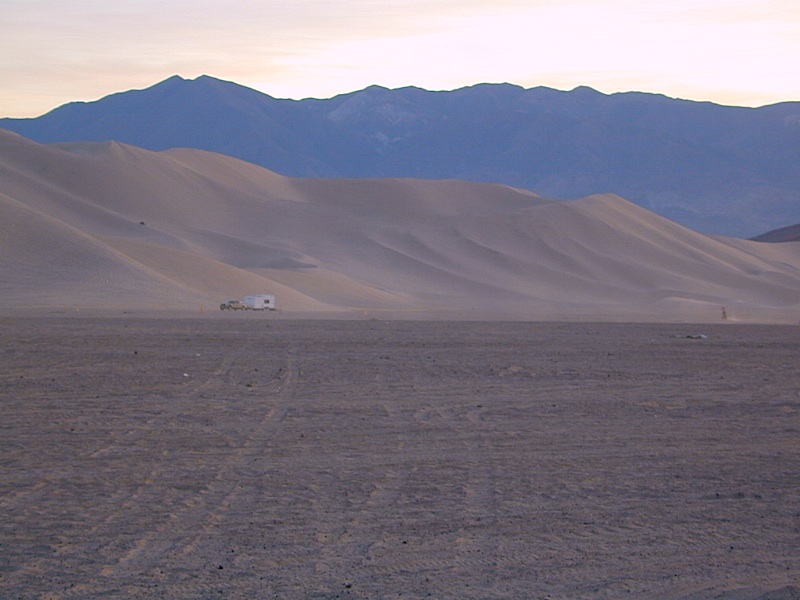
Fortunately, those places do not allow driving on the dunes, which is exactly what the off-road boys want to do. Sand flying, motors screaming, music blasting, bon fires blazing and no silence found until the wee hours of early morning.
Autumn, Winter & Spring are the busy months for ‘froaders in the deserts, since summer temps can soar into triple digits heat daily.
Camping out near “the dunes” is usually a big, freaking, free-for-all, outdoors with the latest in motorized toys. Recreation Vehicles encircling bonfires (camp formation for a large group), toy box haulers, trailers, families, and maybe a massive BBQ setup.
OHV (off highway vehicle) Vehicular Recreation Area
California BLM Desert Sand Dunes
Below is a list of California Sand Dunes overseen by the Bureau of Land Management.
Arroyo Salado / Ocotillo Wells
Motorcycle, 4WD, ATV, Dune Buggy / Sand Rail
Located 10 mi. west of Highway 86 on Highway 78. Rolling hills and sand washes. Designated “Open Area” consisting of 4,800 acres. Adjacent to Ocotillo Wells Vehicular Recreation Area. Near Split Mountain, Anza Borrego Desert
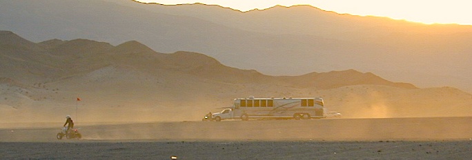
Dumont Dunes Mojave
Motorcycle, 4WD, ATV, Dune Buggy / Sand Rail
Located 30 mi. north of Baker on Hwy 127, off Dumont Dunes Rd. Steep and tall sand dunes. Designated “Open Area” of 8,150 acres. South of Death Valley National Park.
Dumont w/ the Saabaru AWD
Glamis / Gecko Road
Motorcycle, 4WD, ATV, Dune Buggy / Sand Rail
Holiday weekends = NUTS!! Approximately 22,000 acres. Located 25 mi. east of Brawley on HIGHWAY 78. Sand Dunes. Designated “Open Area” Danger: Adjacent to military bombing range. Contact the El Centro BLM
Imperial Sand Dunes / Buttercup Valley
Motorcycle, 4WD, ATV, Dune Buggy / Sand Rail
Approximately 11,000 acres. Located 10 mi. southeast of Niland on the Niland Glamis Rd. Sand Dunes are designated “Open Area”. Watch for closed area boundary at south end of area. CA Highway 78 near Brawley. Contact the El Centro BLM
Mojave El Mirage / Shadow Mountains
Motorcycle, 4WD, ATV, Dune Buggy / Sand Rail
Located 10 mi. west of Adelanto on Crippen/El Mirage Road. Dry lake Bed. Heavy use area. many non-motorized and motorized recreation – including aircrafts. Area consists of 24,000 acres.
Plaster City / Yuha Basin
Motorcycle, 4WD, ATV, Dune Buggy / Sand Rail
South side of Anza Borrego Desert State Park. 15 mi. west of El Centro. Located on county Highway S-80. Consists of 41,000 acres of rolling hills and desert flats. Military bombing range north of area is closed to entry. Contact the El Centro BLM
Superstition Mountain
Motorcycle, 4WD, ATV, Dune Buggy / Sand Rail
Located 15 mi. NW of El Centro via Highway S-8, Huff, and Wheeler Roads. Varied terrain consisting of 13,000 acres; dry lakes, badlands, rocky mountains, and sand dunes. Military bombing range north and south of area is closed to entry. Contact the El Centro BLM
Rasor OHV Recreation Area
Motorcycle, 4WD, ATV, Dune Buggy / Sand Rail
Located 45 mi. northwest of Barstow, CA on Rasor Road. Sand washes and dunes, mesquite thickets. Designated “Open Area” consisting of 22,500 acres. Contact theBarstow BLM
Rice Valley Dunes
Motorcycle, 4WD, ATV, Dune Buggy / Sand Rail
Located 5 mi. south of Rice Valley off of Highway 62. Access is Santa Fe Road. Sand dunes. Designated “Open Area” consisting of 3,770 acres. Area of little use. Danger: Contaminated with unexploded ordinance.
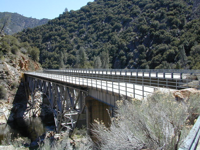
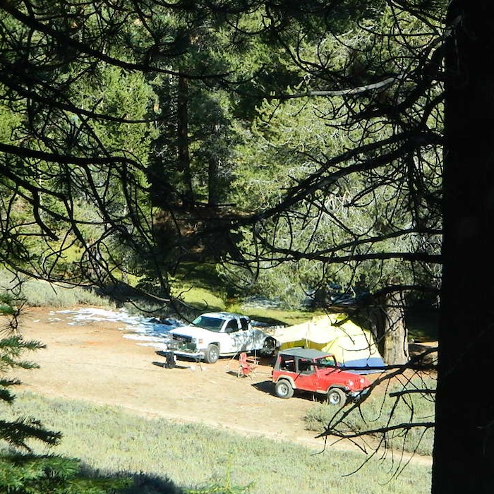
Located north of the small community of Riverkern and south of the Johnsondale Bridge, numerous flat camp spots adjacent to the rivers edge can be found.
Ant Canyon Dispersed Area Brush Creek Campground Calkins Flat Dispersed Area Chamise Flat Dispersed Area Chico Flat Campground Corral Creek Campground Springhill Dispersed Area
Kern River Road
Sierra Way in Kernville travels north along the Upper Kern River & becomes Mountain Hwy 99 – which eventually connects with the Western Divide Highway in Giant Sequoia National Monument.
Dispersed Camping Areas along the Kern River
Open Year Round! These FREE camp areas are called dispersed camping sites. No pavement, no picnic tables, no bathrooms, no piped water. Portable toilets & trash bins may be available in the busier summer months. Campfire permits are required for all campfires, BBQs, and camp stoves. Fire restrictions are common in extreme dry conditions. 14 day limit on camping.
Many flats are signed w/ small brown signs, while others are not. Some are actually flat and easy to access, while others are steep, eroded dirt trails unsuitable for RV travel.
Kelly’s Hole, overgrown, unknown, well-known or burnt beyond recognition? Roads End is no more.
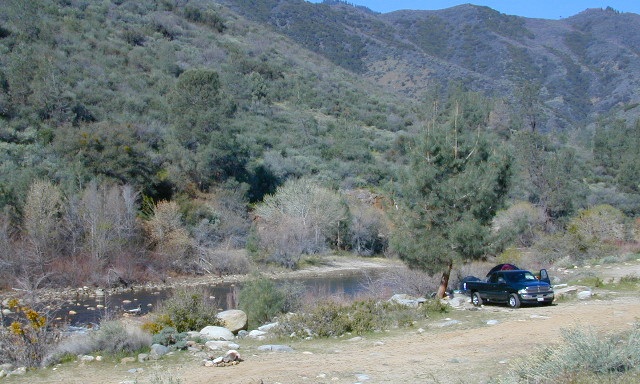
Camp sites listed on this page are dispersed camping areas around the Kern River Area. Not all camp spots are listed, cuz many are unnamed. Bring your GPS to mark your favorite camp sites and you can arrive in the dark, late at night, anytime, (avoiding city traffic after work).
Several spots known as “dirt flats” are easy accessible right off the pavement of Sierra Way. Primitive river camping, fishing spots and raft launch areas north of town. Vault toilets might be available during busy summer months, but you’re on your own the remainder of the year. Bring a shovel and take a hike, away from the water flow. And if that sounds like too much work for a potty break, maybe you are not cut out for the primitive kinda camping style. No garbage service either: pack it in, pack it out.
Wildflowers are abundant in the Kern Canyon nearly every Spring season (April & May), which is a popular time to enjoy this region. Autumn brings minimal fall colors to this dry, desert mountainous landscape, but the fishing is decent at that time of year.
CAMPING OUTSIDE OF CAMPGROUND means you must obtain a free fire permit from the local rangers. Sometimes these dispersed spots are fire-safe areas, and you are allowed to have camp fires. Other times campfire restrictions are in place w/ wildfire dangers too extreme and no fires are allowed, anywhere. (Not even inside a developed campground!)
WILDERNESS NOTE: The USDA National Forests web site states that “Camping and campfires within 25 feet of the water’s edge is prohibited due to the Wild and Scenic Designation”, but that doesn’t seem to stop some from setting up right on the fragile rivers edge. Doubtful that this rule is being enforced by the rangers, but consider yourself warned unless they start to get serious about this restriction. Many believe that the free camping along the Kern river is destroying it, so don’t be surprised if these areas get closed or barriers placed at the flats.
Caulkins FLAT has some new boulder barriers put in place which prevent cars from reaching certain ideal camp spots (right at the waters edge). Tough luck. Now we have to hike more.
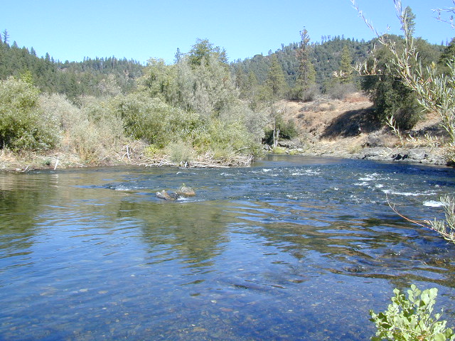
Upper Kern River North of Kernville, CA
all camps below listed from south to north
ALL CAPS = developed campgrounds managed by US Forest Service, w/ links to Kern River Campgrounds.
Ant Canyon
Just north of Goldledge Campground, along the Upper Kern River.
South of Salmon Creek; Hike to Salmon Creek Falls.
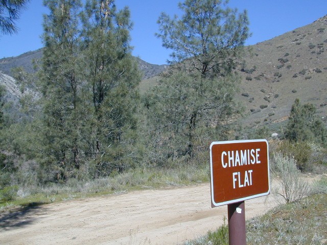
Chamise Flat
12 miles north of Kernville, CA
This camping bluff could be the most forested of all the ‘kern flat’ camping areas, but river is a short hike down a very steep cliff. Fishing is excellent in this stretch.
Calkins Flat
15 miles north of Kernville, along the Upper Kern River. Just south of Fairview (McNalley’s). Sign at the location reads a different spelling of “Caulkins Flat”. Kayak and rafting put-in spot. One of the best sites for large groups. Area is also known as simply “Lower Campground” on GoogleMap.
Brush Creek
3600′ elev
Just south of Sherman’s Pass Road turnoff. This place also serves as a Day Use Area, where Brush Creek meets the Kern. Kayaking put in spot. Popular fishing area. Large open dirt parking lot with a vault toilet.
Lower Kern River Southwest of Kernville, CA
Lake Isabella has some shoreline camping with wide open access to the lake. Paradise Cove perhaps?
Historic Keyesville – “off-roaders camping paradise” along the river, but no swimming is allowed due to the extremely dangerous section of river. OHV trails lead (west) down river for many miles. Dirt bikes love the rugged boulder-scapes and steep hills. FREE camping; BLM Kern.
SANDY FLAT CAMPGROUND (NFS) – Open all year long! Terraced & paved hillside with numerous camp sites and plenty of room to spread out. RV campers like this location, due to the proximity to Hwy 178. elev 2300
Remington Hot Springs can be a zoo at times w/ the amount of people who love to stop here. A busy dirt parking lot, right across from the Remington trailhead sign. Many vehicles park here daily for day hikes, hot springs, fishing – and people also like to camp out, although camp sites are on slopes (not ideal), only a few and they fill up fast (before sunset).
Total Escape TIP: The very best camps at Remington are actually the ones you hafta hike down to. Less than a half mile down to the rivers edge to find a private mini beach. Pack light and arrive prepared to walk several miles (back & forth, several times).
Old Kern Canyon Road parallels Sierra Highway 178 and sits well above the river, so any flat spots you find will have great views w/ minimal river access.
Lower Kern River has very limited camping options.
Big Meadow: Forest Road# 22S12 – Sequoia National Forest
Take Sierra Hwy. N of Kernville, past Fairview & over the Johnsondale bridge; Right turn on Sherman’s Pass Road & drive up to a signed intersection (near a snow gate). NOTE: This area may not be accessible during winter months.
Turn right on Big Meadow Road, aka Forest Service Rd# 22S12. This is a very long road which is paved for the first few miles. 22S12 becomes a graded dirt road, suitable for horse trailers; it forks off to other smaller dirt roads, as it progresses through the forests & dead ends back by Cannell Meadow. The main routes are passenger car accessible, but some of the smaller dirt roads can get quite bumpy. A truck or SUV would be advisable to explore these secondary routes. Certain areas have suffered from wildfires 2000-2002.
Horses & equestrian camping are very popular in this region. There is also a fair amount of backpackers heading into the Domeland Wilderness and mountain bikers looking for premium backcountry rides, away from the crowds at the Kern River.
NFS developed Horse Meadow Campground can be found on the right via road# 23S08. Located at 7400′ elevation w/ 41 spots, in the forest. Trailhead to Salmon Creek leads directly from camp.
SPUR – side routes include:
#23S14 Cherry Hill – a few camp spots near creek & a meadow with views at the very end
#23S41 Poison Meadow
#23S13 Salmon Creek
#22S07 Big Meadow – loop road around the “Big Meadow”. Plenty of primitive camp sites around Big Meadow, but they are the first ones to fill up during a popular summer weekend. The region is perfect for backpackers or day hikers wanting to access Manter Mdw. & the Domelands Wilderness.
#24S13 feeds the last stretch of road to Rattlesnake Meadow. Taylor Creek near 24S43, features numerous waterfalls leading to the South Fork of the Kern River
#24S12 Cannell Meadow & Pine Flat. The Cannell Meadow National Recreation Trail runs thru here, from Big Meadow down to Kernville, CA.
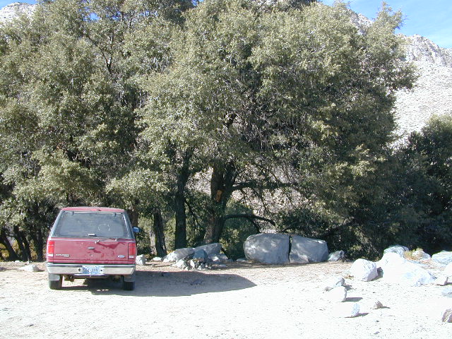
Just south of Olancha, off US Hwy 395 is a dirt road that takes you 5 miles up to an oak canyon lined with rocks. There are several primitive camp sites along the Walker Creek. A high clearance vehicle may be needed in some sections, but 4×4 is not required. Small RVs might attempt this, but if the first mile frightens you, turn around while you’re ahead.
This private, shaded, creek area is perfect for those traveling Highway 395, looking for a quick and free camp spot near Olancha, CA
Shady picnic or camp spots above 4000′ elevation.
Hiking trails at the end of the road lead deep into the mountains. One on the right takes you to waterfalls. The trail on the left will take you to meet up with the Sage Flat Trail, which leads up to Olancha Pass, Summit Meadows & a small lake, in the South Sierra Wilderness. The Pacific Crest Trail runs the ridges here, just west of Monache Meadows, which is at 8000′ elevation, way above here – up on top.
US 395 highway – the dirt road turn off is very close to a gas station, and it maybe be signed, or not. The gas stop may be in business, or perhaps not. This is rural California, wide open desert and things come and go quickly.
On a good topo map, located Olancha Creek and Summit Creek to the south. Walker Creek is the canyon in between those two, just so know where you are going and can visualize. This one is an easy-to-miss dirt road turn off – especially if you are going over 50 mph.
Open Camping in Sequoia National Forest – Forest Road Camping
Seeking secluded campsites? This is one of the best areas to camp in pine forest w/ privacy, relatively close to Southern California. Plenty of primitive car camping on the dirt roads throughout this whole Sequoia & Kern River area.
No facilities. No picnic tables, no toilet, no fees. Just a rock campfire ring & a clearing. Previously used sites have already been established usually near streams. Try to use these first, if at all possible. It takes a bit of exploring but you will find the perfect spot. Don’t even attempt to try to find these kinds of camp spots at night. They are often buried deep in the forest with no visible markers what-so-ever. But in trade, you will be lulled to sleep by your own private mini waterfall & no RV generators. Many of these back roads are closed & gated during winter months due to snow & rock slides.
No amenities are available in this neck of the woods, but plenty of seclusion & wilderness. Check official Wilderness rules for proper knowledge of the area restrictions. You must get a free camp fire permit from the ranger station in order to build a fire outside of a developed campground. A large shovel, plus bucket w/ water are a bare minimum for the privilege of camping like this. Certain dry seasons (summers into autumn) have very strict camp fire restrictions. Check with the ranger to see the latest on building campfires on the back roads.
A Sequoia Forest Service Map is highly advised for this area. There are so many dirt roads for dispersed primitive camping on the back roads. Due to weather & erosion, some roads may require 4×4 or high clearance, so come prepared with a plan B.
Camping Checklist to make sure you’ll have what you need. The drive up from the Los Angeles area averages 3-4 hours and is well worth the trip. Once you’ve found that perfect spot, take detailed note of it, for the next time you visit the area. Then, you will be able to get there easily in the middle of the night, if need be.
Backroad Camping Sequoia: Follow the forest road numbers with your Sequoia map to discover amazing back road camping options. Your own private stream or meadow. Secluded campsites with your own mini waterfall.
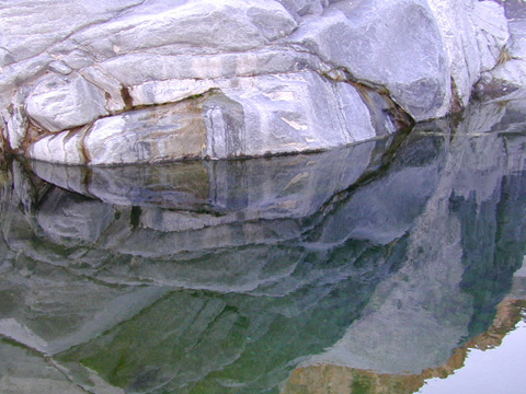
elevation 5800′ – Canyon Creek connects Lake Faucherie, Sawmill Lake and Bowman Reservoir in the Sierra, Tahoe National Forest. 20+ miles of backroad travel, off I-80.
While many consider Faucherie to be the most beautiful scenic lake, Sawmill Lake just downstream a couple of miles is still quite attractive – with dense forests and a granite mountain backdrop. Sawmill is especially nice for those who like to primitive camp, ouside of developed campgrounds. Way off the interstate @ Hwy 20, tucked in way back behind Bowman Lake a few miles, you can find Sawmill Lake.
Fishing and camping, kayaking and canoeing are all popular recreation around this lake. A trailhead on the northend of the lake leads out to even more alpine lakes (a day hike “lake loop” or backpacking option). The Pacific Crest Trail is also routed nearby.
No motorized boats or watercraft allowed. No boat ramps, no pavement, no picnic tables, no bathrooms, no fees.
4×4 Lake
Fishing Lake
Free Camping Lake
The north shoreline is abundant with dispersed campsites: metal fire rings and a clearing only; no picnic tables, no toilets. Self sufficient campers only. Campfire permits, a water bucket and a shovel are required. During extreme fire restrictions campfires may not be allowed. Check with local rangers for up to date info.
Most campsites are drive up and park, while others closer to the shoreline have only walk-in access. Hauling your gear down hill won’t seem unthinkable once you’ve seen the lakeside views. There is even a camp below the dam, next to the waterfall.
The main access Road #843-037 is very rocky and 4x4s love to frequent the area. The backroads here are best suite for truck travel, high clearance vehicles, off-roaders and SUVs. No small RVs or trailers. Passenger cars are not recommended. The access roads around the lake and up to the lake are dusty and rugged. The road below the dam is quite rough w/ rocks.
The water at Sawmill Lake is crystal clear snowmelt. The lakes around here are managed by Nevada Irrigation District, so this is why there are no engines allowed on the lake. This canyon area closes to public entry during winter months (NOV-APRIL), due to deep snow.
Bear Meadow: Forest Rd# 23S64 – Packsaddle Creek, Sequoia National Forest
For the more adventurous & ones seeking some seclusion, Bear Meadow is located up the dirt road a bit from Thompson Camp Spring . From Forest Road #23S16 @ Thompson Camp Spring – continue straight on the dirt road #23S64, cross over the one lane wooden bridge; within a mile, turn left into a secluded creek side camping area. Note: Bears are common here (hence the name Bear Meadow)!
Packsaddle Creek runs thru this forest. Very primitive area with rutted dirt roads & sometimes overgrown; there are several campsites back in here for the ones who seek the wild. (Yes, bears & wild animals are very common way back here). If you continue on straight on the main dirt road Packsaddle Meadow also has camping spots & small corral. The last time we were out this way (2002-ish), the dirt road does not connect with highway to the west, as indicated on the map; due to landslide.
Saline Valley Hot Springs
Saline Valley Warm Springs
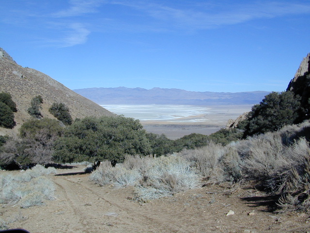
NORTH Death Valley National Park, in a super remote desert valley located in the vast mountains in between Big Pine CA Route 168 & Death Valley (west) Highway 190.
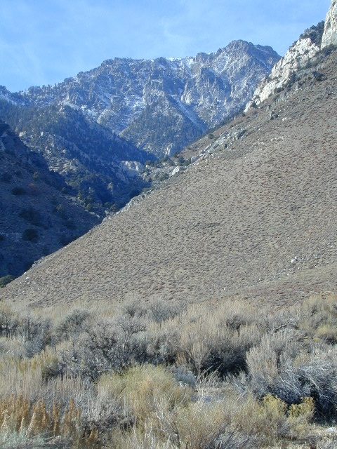
Inyo National Forest: Inyo mountains are a towering range of high elevation desert peaks running in between Owens Valley and Saline Valley.
desert wilderness access: 4 dirt road routes lead into Saline Valley – 2 backcountry 4×4 trails from the upper reaches of the park and 2 main dirt roads. All routes require a high elevation pass, so snow is likely in winter months (Nov-May).
Wilderness routes road conditions can change often, seasonally with winter snows, mud and summer thunderstorms. The most popular access are the main routes (both long dirt roads, subject to snow and closure at any time) – the North Pass (Big Pine) and the South Pass (Panamint). Detailed directions on those further below. Both backcountry roads Steele Pass and Lippincott Road, originate from the northern, desolate areas of the National Park and both require 4 wheel drive, with a recommended locking differential. No developed campground facilities. Clothing optional my ass — nudity is the norm here.
Since the challenging drive in to this remote desert valley is so grueling and time consuming, plan to spend a minimum of 4 nights. Anything less is way too rushed to totally enjoy the experience. Best way to enjoy this place is a full week off of work, and as much firewood, food and ice as you can haul. Some folks spend weeks camping here. The NPS limits your camping stay to 30 days! If you plan on driving out to Lone Pine for camping supplies and returning the same day, you best leave at dawn – cuz the entire round trip ‘beer run’ will take 6 hours or more.
High clearance vehicle a must & 4 wheel drive is highly recommended in all this region. All wheel drive wagons and passenger cars have been known to bottom out, break down and pop tires out here in the harsh conditions, so a first challenge may be to obtain a dependable and capable off-road vehicle.
Topographic GPS & decent back road maps are highly advised. One way drive is easily 4 hours, from any paved highway. Pack like you’re gonna live out here, if need be. Warning: this is a very long off-road journey for any average camping trip. This isn’t a weekend kinda place. First timers beware – it’s a full day journey to travel here!
Air Strip? The fly in option is a dirt landing strip called ‘Chicken Strip’, but National Park Service has yet to closed it.
NORTH PASS to Saline Valley Road:
from Big Pine, take Hwy 168 N from Hwy 395, turn right onto Death Valley Road (some maps may have this one listed as Waucoba Springs Road or just Waucoba Road). Proceed on the main route to the hard to read entrance sign marking the Saline Valley Road, past a few old structures and down to the main valley. Winter snow can be deep, so carry chains. 4×4 is best to access this remote valley, AWD high clearance might make it and normal passenger cars, 2WD SUVs should be warned about weather and access to the real world. Many times all mountain passes are snowed in – people do get trapped at Saline and cannot get out for weeks. So take that into account when requesting days off of work for this epic journey.
SOUTH PASS to Saline Valley Road:
from Olancha, take Highway 190 E, turn N off Hwy. 190 to Saline Valley Rd. Rugged 50+ mi. of hard core dirt roads. 4×4 and high clearance a must. Winter months expect snow, springtime rock slides and summers torrential downpours cause overflowing creeks w/ impassable washouts. Grapevine Canyon can be a challenging drive, but with patience and skill you can be down on the main valley floor in about an hour and a half (if you’re lucky). Did I mention the dozen or more miles of heavy washboard road conditions, at the base of the alluvial fan of mountain rock? Newbies and first timers should attempt the North Pass.
———————-
Near the marsh, when you finally reach the sand dunes area, you know the turn off is close-by, so slow down and stop to read the landscape. Know that the hot springs are located above the sand dunes to the east slope of the red volcanic mountains. When you see the metal bat sign and the mass of palm trees in the lower grove, you know you’ve arrived.
You’ve only truly arrived, when your whole body is immersed in hot water looking up at the stars and you learn to relax again. Breathe the deepest you have all year.
CAUTION: Stopping for those vehicles distressed on the side of the road is also a common practice. Many people break down on this route, Jeeps slide off cliffs. Harsh landscapes, plus weather are unforgiving and people die, so realize that this camping trip is no walk in the park.
Saline Valley Road Conditions & discussions can be found on Saline Valley Talk, the Saline Valley Message Board forum.salinepreservation.org
Mason Valley Truck Trail refers to a network of dirt roads on the west side of San Diego County Road S2, on the steep mountain slopes overlooking the desert badlands of Anza Borrego State Park. These primitive back roads lead up to the Pacific Crest Trail (PCT) on the edge of Laguna Recreation Area.
Oriflamme Canyon, Chariot Canyon & Rodriguez Trail are all in the area. Chaparral mountain trails lead off in many directions with dead end canyons and side routes. This high desert region consists of private property, ranches with gates, various trails and desert dirt roads – between 2400′ and 4000′ elevation.
A good portion of the lands on the west side of paved S2 are not inside the State Park boundary, but Oriflamme is the exception. The Anza Borrego Desert State Park borders includes this particular back road canyon, almost up to the Cleveland National Forest. Awesome locals little secret!
Oriflamme Mountain @ 4611′ elevation
Chariot Mountain @ 4644′ elevation
The main access to Mason Valley Truck Trail is located near the bottom of Box Canyon (on Co. Rd. S2). The sign at the turn off reads Oriflamme Canyon. The first sandy mile or so gets kinda confusing, as the ranch road, dirt trails and natural desert wash merge with the seasons and rains. You might encounter locked gates if you take the wrong turn. In the wash look for signage for Oriflamme.
Approximately 2 miles from S2 the dirt road splits. To the left is Mason Valley Truck Trail, which continues up Oriflamme Canyon and into wooded Chariot Canyon, eventually connecting with Hwy 78 (at Banner Grade). And the other choice on the right is a rugged 4×4 route called Rodriguez Truck Trail which is 7 miles long and meets back up with the main Oriflamme road about a mile from the highway. These back roads encircle the biggest peak around called Chariot Mountain.
Mountain bikers, hikers, horses and vehicles all use these routes, so be prepared to see others out exploring and please, always yield to equestrian traffic.
Several open, free camp spots lower in the canyon w/ large cottonwood trees. More hidden camps to be found higher up the mountain. A decent topo map, a campfire permit and a metal fire bucket is highly advised.
PCT: Pacific Crest Trail traverses the ridge line near 4000-6000′ and the desert valley below is nearing 2000′ elevation. The ambitious plan for the California Riding and Hiking Trail is still under construction and routed nearby as well.
Butterfield RV Ranch and the historic adobe Vallecito Stage Stop, are the closest thing to civilization you will find around these parts Don’t count on gasoline or cell phone coverage anywhere near here.
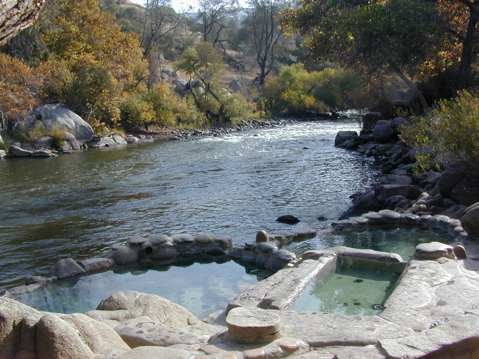
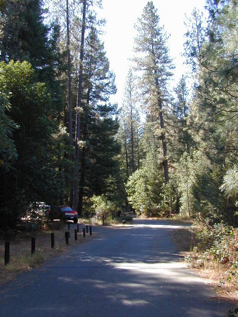
From Lake Isabella down to Bako, along Hwy 178, numerous natural hot springs can be found in this lower Kern river canyon. Old Kern Canyon Road has plenty of primitive spots to camp along the road, way above the Kern River. This Southern Sierra Nevada scenic route, a 20 mi winding narrow paved road, is the old highway that leads up to Bodfish CA.
At least a dozen dispersed camp sites can be found along the Old Kern Cyn Rd, some spots with views over canyon, some hidden & shady, many spots are level & large – suitable for RVs. No facilities, no fees, just a flat, dispersed site. Campfire permits are required for fires outside of developed Campgrounds & fire restrictions are often high, so no fires are allowed much of the year. Most of the gates on the Lower Kern are now locked & only accessible by Forest Service personnel, ranchers or local rafting companies with permits.
2 developed Lower Kern Campgrounds are located on the Old Kern Canyon Road, which parallels the 4 lane portion of the highway: Hobo Campground & Sandy Flat Campgrounds, if you really need a picnic table & bathroom. You can reserve camps by clicking the links.
Miracle Hot Springs – next to Hobo Campground. This hot tub park is closed for good. A few portable bathrooms, picnic tables & trash bins, the hiking trails clear; 2 shallow pools partially filled. Maybe enough room to soak your butt, but not fully submerse yourself. Someone really needs to renovate this place! Update 2012 – the signs for Miracle are now completely gone.
This one is by far the most popular now that Miracle is gone. The hike-in only access doesn’t deter people much and many choose to set camp overnight close by. The local authorities are always making the rounds to double check on the area – which is good for security and bad for the 2 AM party animals.
Democrat Hot Springs
private resort now open? Heck, I dunno. (2017, democrathotsprings.com is down. They might be trying to promote a River Festival held in May.)
The hotel and cottages were constructed to accommodate guests that came in stage coaches to dine and relax during the early 1900’s. Five springs on the property flow at 115 degrees into large soaking tubs and a swimming pool. Closed to the public for more than thirty years, the resort is once again ready to be brought to life for groups and private events only.
The hot springs listed below are Private Property, so don’t get caught – and don’t get shot:
Delonegha Hot Springs
Concrete tubs were built by homesteaders, later a hotel and boarding house were constructed. Stage coaches from the San Joaquin Valley took 2 days to get visitors to this area. The hotel closed in 1912, when more accessible areas of Democrat and Hobo were built. Remaining cement tubs run along a rock peninsula overlooking the Kern River; water temperatures average 112 degrees. This private property is fenced.
Scovern Hot Springs
Also known as the Hot Springs House. 1902 mud baths were being offered and the wooden tubs were replaced by galvanized tubs. A swimming pool and bath houses were added when the Scoverns bought the property in 1929. Bath house burned to the ground in 1971 and only a vacant lot remains. Steam can still be seen in the fields across from the springs, where water runs at 140 gallons a minute @ 115 degrees.
Where to set Camp in California?
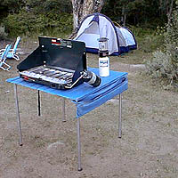
Small campgrounds have fewer facilities than the larger developed campgrounds, but less sites means more nature and less people. Roughing it on the back roads with dispersed camping is by far the best experience for seclusion and privacy
real peace and quiet.
Primitive, free camping requires more thought and planning than just pitching a tent in a flat spot at a developed campground.
Campfire permits are usually required for camp stoves, BBQs and any open fires. (bucket & shovel needed).
And most importantly, since California is known for its super dry climate and seasonal wildfires, make sure to check with local rangers to find out about any current campfire restrictions.
some tips for a good camping experience – without scoldings or citations from Mr. Ranger:
Choose existing campsite in a used area – rather than creating another rock ring & trampling a fresh spot.
Always know fire conditions; get a fire permit if you have a campfire outside of a developed campground.
Set up camp away from other people. The majority of people go to the wilderness to experience quiet, peace, & solitude. There is plenty space for everyone, so spread out.
mountains
Never set camp in a meadow. It is a very fragile ecosystem.
Use an existing camp site when possible. Rebuilding and cleaning campfire pits is part of the job!
Camping right on the a creek bed or lake shore is damaging to the vegetation and wildlife areas. Place tent at least 20+ feet away from waters edge. Many camp site already exist in prime areas on creek front, so seek out those first. The deeper you go into the wood, the more you will find. Seclusion is possible, if you want to drive beyond the pavement.
Do not camp beneath large dead trees. Check tent spots for old overhanging branches too.
Do not camp near a mine shaft; Toxic heavy metals or radioactive debris could be present in the dirt.
Camping next to a lake, wetlands or a meadow can often result in abundant mosquitoes & insects overall.
Snow is possible anytime from October to May above 5000′ elevation. Chilly nights are common in summer.
deserts
Avoid camping inside desert canyons when the threat of rain is approaching: possible flash floods.
Consider the benefits of potential windbreaks in desert terrain. Large rocks, bushes, trees, your vehicle & even a hillside.
Picking a camp spot on a ridge line means sun exposure and windy conditions. Breezes will keep the bugs away and you can’t beat the better view, but wind can pick up at any time especially in desert regions.
Low elevation in late spring and fall means very warm temps; summer is triple digit heat most days.
Do not camp near a mine shaft; Toxic heavy metals or radioactive debris could be present in the dirt.
coastal
Avoid camping on fragile coastal cliffs; unstable, which can give way, caving in, resulting in danger to you.
Camping on the beach means watching the tides. Know where high water mark is before you set camp up.
Beach camping in early summer means low clouds and fog are likely. June Gloom can last months.
countryside
Avoid building campfires up against a large boulders or against a rock face.
Rivers controlled by hydroelectric dam systems mean that the water levels can change at any time without warning.
Never set camp in a wildflower meadow. It’s too fragile of an ecosystem.
Lower elevations in summer time means potential triple digit heat during mid-day.
Do not camp near a mine shaft; Toxic heavy metals or radioactive debris could be present in the dirt.
Open car camping is allowed in several places inside Cleveland National Forest, although NO campfires are permitted in the backcountry (trailside or dirt roads) – due to the high fire danger. Your best for FREE, open, dispersed camping (with a campfire) is Anza Borrego Desert State Park. Lower elevations w/ summertime temperature can get very hot, so plan for higher elevation camps. The more you explore, the more you can find.
Northern California river camping. Douglas City is hardly even a town much less a city. A post office and a general store is the majority of what makes up this riverfront locale.
Tucked away on the scenic Trinity River, this small campground is perfect for those wanting to explore the Trinity River, Trinity Lake or the Trinity Alps region. Region is well known for fishing, hiking, kayaking and rafting. A small beach allows for river access. Group picnic area, picnic tables, telephone, beach, paved loop road are just a few amenities.
From Douglas City, drive half mile west on Hwy 299 to Steiner Flat Road. Follow signs to the developed camp. Numerous dirt roads lead to river edge, so there are primitive camping options available along Steiner Flat Road for those seeking free overnight stays.
• Elevation: 1,500′
• Number of Sites: 20
• Camping Reservations: No
• Sites Available: First come, First serve
• Vehicle Accessibility: Vehicle limit 28 ft. max.
• Length of Stay: 14 Days
• Water: Piped; river nearby
• Toilet: Flush & Vault
• Season: Closed for winter, Nov-April
• Fee: Yes
• Operated By: Bureau of Land Management
• Closest Town: Douglas City, CA
Southern Sierra Nevada Mountain / Domeland / Dome Lands
Kern Plateau, Sequoia National Forest
Dome Land Wilderness
130,081 acres
55 miles of trails (hiking & horseback)
Located at the southern end of the Kern Plateau about 20 miles east of Kernville, granite domes give this area its name. Domeland Wilderness is a unique geologic area with semi-arid to arid mountainous regions. Elevations ranging from 3,000′ to 9,730′ – it is surrounded by National Forest, where the Sierra mountains meet the North Mojave Desert. The Wilderness is the southernmost habitat for the Golden Trout. The South Fork of the Kern and tributary streams attract many fishermen. Vegetation is mostly mixed conifer and piñon (pinyon pine).
The Domeland Wilderness is located at the southern end of the Kern Plateau. This land was first protected by the Wilderness Act of 1964 as a 62,695 acre wilderness and was later expanded to 130,081 acres in 1984 to include the delicate transition ecosystems that meet to the east, south, and north of the original wilderness. These new additions, now jointly managed by the Bureau of Land Management and Sequoia National Forest, are rugged and dry.
Though it is considered within the Sierra range, the Domeland Wilderness includes the overlap of several ecosystems to form unique plant and animal communities. The banks of the South Fork of the Kern River offer important riparian habitats of cottonwoods and meadows which stand in sharp contrast against the characteristic smooth domes and bold granite outcroppings. Domes that range from the size of a cottage to football fields across and spear-like jagged spires can be found in the Domeland. This range is one of the driest in the Sierra with the semi-arid mountains of the north and east crumbling into desert.
East side access near Rockhouse Meadow and at the Long Valley Campground (BLM). Access is via Nine Mile Canyon Road (J41) from US Highway 395 or Chimney Peak Road (graded dirt road) via State Highway 178 , the main route that passes Lake Isabella.
West side trailheads are at Big Meadow and Taylor Meadow. Two trails from Big Meadow can be reached from Kernville via Tulare County Road M99, Sherman Pass, and Cherry Hill Roads. Leading to Manter Meadow, the upper Big Meadow Trail is a rugged hike while the lower Big Meadow Trail follows more gentle terrain. The trail from Taylor Meadow (southeast of Big Meadow) also leads to Manter Meadow. North side access is available from the Blackrock/ Sherman Pass Road via the Dark Canyon and Woodpecker trails.
Manter Meadow is popular along with other camp sites located at Little Manter Meadow, Woodpecker Meadow, Rockhouse Meadow, and in the Bartolas Country at the south end of the Wilderness.
Off road destination, palm canyon in Baja California Norte
East of San Diego
SW of El Centro / Mexicali
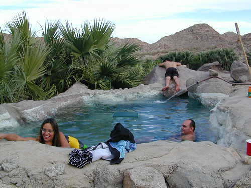
Imagine a palm oasis canyon in a remote area of the Baja desert; Cool springs that feed the lush landscape with huge boulders & cliff diving waterfalls. With each campsite featuring it’s very own custom hot springs tub. This place was a paradise 20 years ago, but is now over-developed w/ large groups, parties and camping families. If you can handle the 30+ miles of unimproved dirt roads, this spot is worth a visit mid-week. Winter months are prime time to visit the desert. Temperatures are moderate, days are pleasant & midweek has minimal tourists. Avoid holiday weekends as crowds a can get rowdy and disrupt the peaceful setting. Summer is triple digit heat for months. This canyon is hard to reach and inside a third world country, but well worth the distant journey.
Plenty of great hiking and petroglyph canyons, cool pools and waterfalls, granite boulders, soothing warm waters & gorgeous desert scenery. Summers are usually roasting out here, so plan your vacation accordingly. Palalpas (built for shade) add to the charm & unique look. Each campsite is unique & has a different lay out. Reservations are recommended.
A family run set of campgrounds within a steep palm canyon. Hot Springs are piped to individual pools at each campsite for a maximum of privacy. A cold creek runs through the canyon as well, feeding the palm grove below & waterfalls way up canyon. A desert oasis set upon the slopes of the Sierra Juarez Mountains in Baja.
getting there is a journey –
Recommended high clearance vehicle, sport utility vehicle, or truck. The last 35 miles of the trip is through rough & rugged sandy roads.

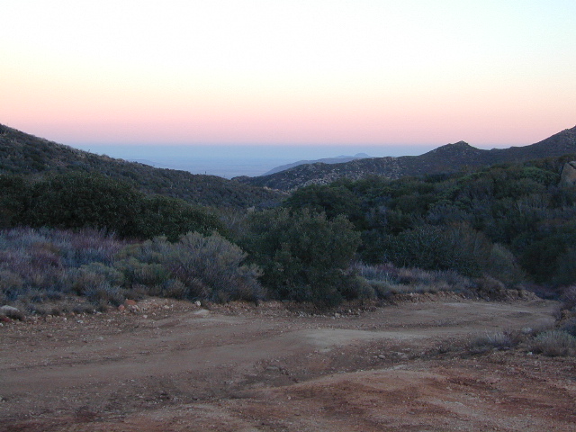
 South of Bridgeport, California
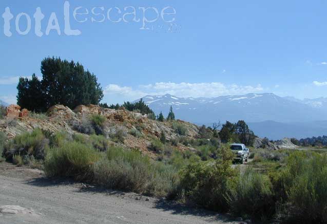


 CAMPGROUND RESERVATIONS


 WILDERNESS NOTE: The USDA National Forests web site states that “Camping and campfires within 25 feet of the water’s edge is prohibited due to the Wild and Scenic Designation”, but that doesn’t seem to stop some from setting up right on the fragile rivers edge. Doubtful that this rule is being enforced by the rangers, but consider yourself warned unless they start to get serious about this restriction. Many believe that the free camping along the Kern river is destroying it, so don’t be surprised if these areas get closed or barriers placed at the flats.
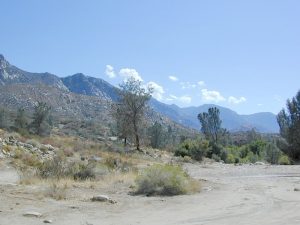


