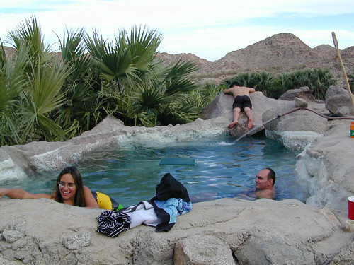
Plumas National Forest Camping – Primitive Camp Sites
Spanish Creek, Quincy, CA
Plumas Forest Camping
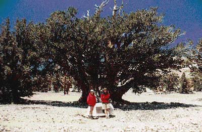
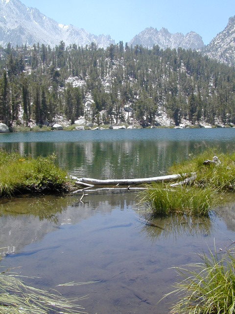
North Sierra Nevada, Northern California
Listed below are primitive campgrounds w/ minimal facilities or open camping areas in Plumas National Forest. Plumas has excellent fishing as the big rivers & numerous creeks run thru this northern Sierra Nevada landscape. Open camping is allowed on almost any dirt road w/ a current campfire permit
Brady’s Camp
[on Pine Creek near Argentine Rock]
near Quincy, CA – east on Squirrel Creek Rd. & go 8 mi. to the campground. Elevation 7200′ / Open May – October
Bucks Lakehas numerous NFS Campgrounds and PCT access; Overall elevation 5000′ w/ abundant boating, fishing and hiking. Snow in winter closes roads. Cabins, marina, lodge, restaurants. Bucks Lake Wilderness, Gold Lake, Silver Lake
Deanes Valley Campground
[along Rock Creek] Hwy.70 Quincy, go 3.5 mi. west on Buck Lake Rd. Head south & 7 mi. to the campground. Elevation 4400′ / Open April – October
Backpacking trails w/ dirt road access. Above Chico, beyond Cohassett; on the border of Tehema Co. and Butte Co. (Lassen NF & Plumas NF)
Inskip, CA – Way up beyond the Ridge, well past Magalia and Stirling City – find dense forests, dirt roads and camping. Philbrook Reservoir w/ West Branch Campground NFS. Elevation 5546′
Ohio Valley – Seneca Road
[off Hwy 89 to southside] Primitive forest camping near Lake Almanor. ATV trails, hunting. Creeks and river camping closer to Seneca. High clearance or 4WD may be needed on these dirt back roads – depending on snow and mud. There is plenty dirt roads back here to explore.
Snake Lake
[good fishing area] Hwy.70 Quincy, go 5 mi. west on Buck Lake Rd. Head north & 5 mi. to the campground at the lake. Elevation 4200′ / Open April – October
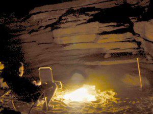
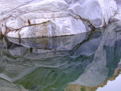
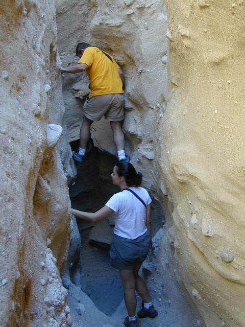
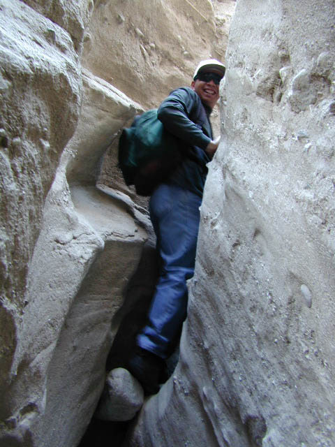
Canon Sin Nombre – Anza Borrego
Mud Caves and Slot Canyon Hikes
Desert Slot Canyons – South Anza Borrego State Park region, just off County Road S-2 east of the ‘badlands overlook’ view point is a whole network of narrow walkways & skinny canyon trails to explore. Some are so tight you have to turn side ways to fit through. There are more than one of these sandstone topless caverns. Finding a new one each time you visit is a fun challenge. Just north in the Diablo canyon there are dry mud tunnels & trails as well. Explore & be careful not to get lost. And don’t camp at the canyon openings during the threat of heavy rains…duh.
Drive down steep, sandy road into Canon Sin Nombre entrance (the dirt road just to the north of Badlands Overlook). A high clearance vehicle is recommended and 4WD may be required in soft sand. 2WD SUVs/trucks should keep their speed up through the soft sandy areas & try not to turn or stop suddenly. Go slow in narrow sections of the canyon & slow over the rocks to save your oil pan.
Clock your mileage 1 mile exactly from the paved road (s2) & park out in desert wash, pull over between the smoke trees. Hike over to the left side & look for an opening in the canyon walls to a deep secluded trench. A campsite may exists here.
Hike up the first canyon which does require some rock scrambling. The gorge lets you out at the very top with an impressive view over the Sweeney Pass area. The canyon walls are so tight in some spots you may have to turn sideways to fit through. Upper body strength is needed to climb high ledges & boulder scramble through this natural maze.
Once on top, wander on the ridge & check out the views; keeping to the right & then follow the next wash down to start the much longer & easier exit. Hike down in the main slot canyon which leads out to a big camp site & clearing. Exit slot area and turn right, walking back to the vehicle in the big wash.
This particular hike is a blast on a full moon night, but not for a first timers try.
Best time to visit: October – April
HIGH CLEARANCE VEHICLE access to reach trailhead. Moderate hike, boulder scrambling w/ dangerous mud walls. Flash floods here are possible during rains.
Plenty of 4×4 roads, SUV trails, & box canyons in the desert region.
A decent list of California Lakes, Reservoirs and Ponds, in the Sequoia region of the Southern Sierra mountains ….spanning from the Kern River to the Kings River. Some are well known recreation lakes with boating available, while others are secluded lakes or small ponds. Enjoy nature – it’s free!
All the hikes listed here are to super remote alpine lakes w/ granite mountain peaks all around. The Sierra gems are located in the steep, granite, high altitudes, that require hours of strenuous hiking and backcountry skills. These are not paved granny trails by any means. They are the total opposite.
Long, steep trails, with the freshest thin air. Know your physical conditioning (or lack thereof) before taking on a 10 mile day hike. It will wipe you out!!! Backpackers should obtain a wilderness permit before venturing overnight into the back country.
Lodgepole Lakes in Sequoia National Park.
Beyond the waterfalls, in the high country backpacking or day hikes –
Moose Lake
Big Bird Lake
Pear Lake
Heather Lake
Aster Lake
Emerald Lake
Kings Canyon Lakes, Kings Cyn NP at the very end of Hwy 180.
Backpack or day hike trails, from moderate elevation canyon to alpine high country w/ rivers, waterfalls and lakes –
Anza Borrego Desert State Park & Borrego Springs Campgrounds
Anza Borrego Desert is the largest of the California State Parks. Borrego Palm Canyon Campground is the official name of this popular palm oasis & developed campground located very close to Borrego Springs CA. Hike or bike to town. There is also a private RV Park named Palm Canyon Resort in town, just to confuse you.
Desert wildflowers blooms, popular hiking & biking trails, plus mud caves & slot canyons draw plenty visitors here, mostly in the winter months. Summer high temps exceed 90 degrees for months at a time.
There are hundreds of miles of dirt roads to explore, and one could easily spend every weekend for a full year, checking out all there is to see in this vast desert, where elevations range from near sea level to 5000′ peaks.
BORREGO PALM CANYON CAMPGROUND
main campground near Visitors Center, in town Borrego Springs, CA
120 camp sites for tents & RVs, flush toilets, overnight / day use fees reservations accepted
TAMARISK GROVE CAMPGROUND
27 camp sites, flush toilets, fee
on S-3 @ Highway 78 jct (closed June – Sept) reservations accepted (Oct-May)
Vern Whitaker Horse Camp
equestrian campground w/ corrals, 10 camp sites, flush toilets
elev, 960′, located N of Borrego Springs, near scenic and rugged Coyote Canyon. reservations accepted
Backcountry Campgrounds Anza
Arroyo Salado
16 miles east of Borrego Springs on County Road S-22
Blair Valley Camping Area
open car camping & RV spots, vault toilets
on SAN DIEGO County Rd S-2 near Highway 78 jct
Bow Willow Campground
elev, 950′, hwy access, 16 camp sites, pit toilets, overnight fee
near Sweeney Pass & badlands overlook; located on S-2, 9 miles N of Interstate 8
Canon Sin Nombre
off S-2 near Sweeney Pass; entrance near Badlands Overlook; slot canyon hikes
Coyote Canyon Camping
N of Borrego Springs via Di Giorgio Road
rugged backcountry dirt road, tent camping only
car camping near ocotillo gardens; 4×4 needed @ creek crossing & Sheep Canyon
Culp Valley Campgound
elev, 3400′, hwy access, 8 camp sites, pit toilets, free camp
located on S-22, atop Montezuma Grade
Culp Valley Boulders
elev, 3700′, dirt road access, primitive camp sites, free
located off S-22, 4×4 near Montezuma Grade
Fish Creek Campground
Hwy 78 near Ocotillo Wells & Split Mountain
elev, 280′, dirt road access, 8 camp sites, pit toilets, free camp
from hwy, go 12 milies south on Split Mountain Road
Yaqui Well
5 mi. south of Borrego Springs on County Road S-3 & right on Yaqui Pass Road, go 6 miles to camping area on right side
Yaqui Pass
5 mi. south of Borrego Springs on County Road S-3 & right on Yaqui Pass Road, go 4 miles to camping area on left side
Culp Valley trails, North Anza Borrego SP, SoCal Deserts
All Desert Campgrounds Nearby
AGUA CALIENTE HOT SPRINGS
(San Diego County Park)
88 camp sites for tents & RVs, flush toilets, overnight / day use fees, 760-765-1188
located on Co. Rd S-2, 22 miles N of Interstate 8 (closed June-Aug)
BOX CANYON RDMecca, CA – in between Joshua Tree NP and Anza Borrego Desert
BLM camping in Box Canyon & Mecca Hills Wilderness Park
LEAPIN LIZARD RV RANCH
(Private Campground Resort)
85 acres, 60 camp sites
located on Split Mountain Road, Ocotillo Wells, CA
OCOTILLO WELLS SVRA
(State Vehicular Recreation Area)
elev. 160′, 4×4 and off road camp sites for trailers & RVs
no water, no hook-ups, pit toilets, no fees, 760-767-5391
located on Highway 78 (closed June-Sept)
PALM CANYON RV RESORT
(Private Campground Resort)
located in town, Borrego Springs, CA
SALTON SEA SRA
(State Recreation Area & Campground)
Mecca Beach, Corvina Beach, Salt Creek Campgrounds
located on Highway 111 on east side of inland sea
SLAB CITY @ SALTON SEA
old Camp Dunlap in California desert badlands
free & open RV camping near Salton Sea
located off Highway 111 on east side of inland sea
TRUCKHAVEN HILLS
(OHV trails & camp spots)
elev. 300′, 4×4 and off road camp sites for car camping, touy hauler trailers & RVs
no water, no hook-ups, no fees,
located on S-22, East of Borrego Springs, CA
VALLECITO PARK
(San Diego County Park)
44 camp sites for tents & RVs, no hook-ups, toilets, overnight / day use fees, 760-765-1188
located on S-2, 22 miles N of Interstate 8 (closed June-Aug)
FREE CAMPING ANZA– Let us also remind you that this is the best place to camp in California for primitive car camping (camping outside of a developed campground). Open all year long – always! Super secluded, darkest skies, free and always located on the back roads. 4×4 is not required in all areas, so there are plenty of options. Blair Valley or Coyote Canyon Gardens are popular camp spots, but there are thousands of hidden canyons and washes in this giant State Park, just awaiting your tent. You’ll need a decent topographic map. For more info on free camping click here.
Although Sequoia trees can be found in the southern Sierra, the National Park is located more in the mid-Sierra. From the Kern River to Kings River, the southern stretch of Sierra Nevada is home to the southern most Sequoia groves, the longest river in California, and the granite dome wonderlands that overlook the Mojave Desert.
The Tehachapi range is on the tail end to the south w/ Hwy 58, while Kings Canyon Park borders more High Sierra Wilderness to the north end. If you are heading up from SoCal, this is the most accessible portion of the Sierra Nevada range.
While the Kern River Valley can get hot in the summer months, the rivers, streams & higher elevations surrounding it, make it a prime destination for folks seeking cooler mountain breezes, creeks and dark skies. Springtime is one of the best times of year to visit the Kern River. While summer is best for the high wilderness areas, since the snow usually doesn’t melt until May.
Mountain Home State Forest is a little known haven for campers & hikers seeking less-crowded Sequoia groves. With the Tule River, fishing ponds, waterfalls, swimming holes & meadows, this place provides a nice solitude to the busier parks to the north. Balch Park is a county park w/ large campground, that sits adjacent to Mountain Home Forest.
Both National Parks (Seqouia & Kings) are both busy in summer & tourists can be seen lining the main road, Highway 198. Crystal Cave & Boyden Cavern both offer daily tours during the warmer months. Sequoia National Park is open during winter months & is popular among winter sports enthusiasts. Kings Canyon National Park & Hwy 180 are also open during winter, with winter sports recreation.
Big Meadows Road (14S11)offers great camping options for those that wish to camp outside the National Park boundaries.
is located in the western foothills of the Central Sierra Mountains
Historic Highway 49 is the Gold Country Hwy, which begins down near Yosemite and leads north, thru the foothills, up to Sierra Buttes & ends out near Loyalton, CA
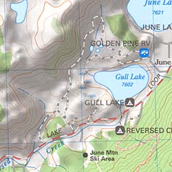
Topographical maps feature the terrain of a wilderness or hiking area, through colored shading & thin contour lines to represent elevations. Park boundaries, trail routes, trail heads & campgrounds are noted, as well as major landmarks like lakes, rivers, creeks, meadows, peaks, canyons, hot springs, waterfalls & all roads (dirt or paved).
Backpackers & hikers must rely on such maps for planning & trekking their journey. Hard copy, printed, waterproof maps are top choice, but topo maps now come in digital format for download as well. DanaMite has recently started including these digital map links within the Total Escape Map Shop – totalescape.net/shop/
Here in California we are lucky to have so much public land available to us for enjoyment. Numerous map vendors make maps for nearly all of the regions across California.
QUADS: 7.5 minute topographic quadrangle maps, available from the USGS, can be found online w/ Avenza Maps (often for free) and also, direct from the government site https://www.usgs.gov/products/maps/topo-maps
A while back, the NFS offered handy books of these sought-after topo maps. They were compiled into booklet form called an ATLAS, with sturdy covers & a spiral bound. Overall size is close to 9″x12″ & they are much easier to handle than the individual paper maps. Look forForest Topo Atlases
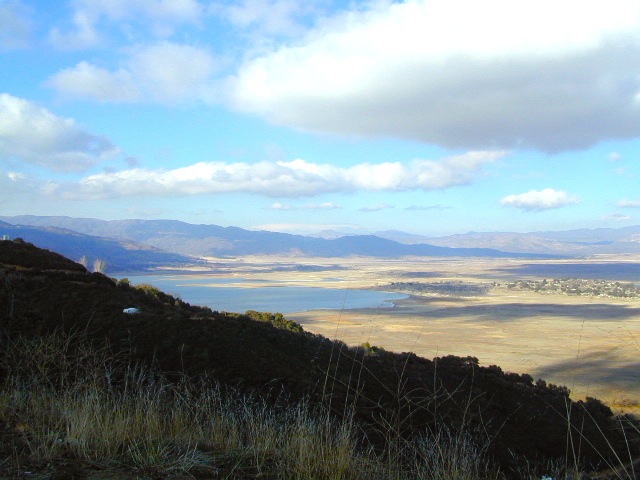
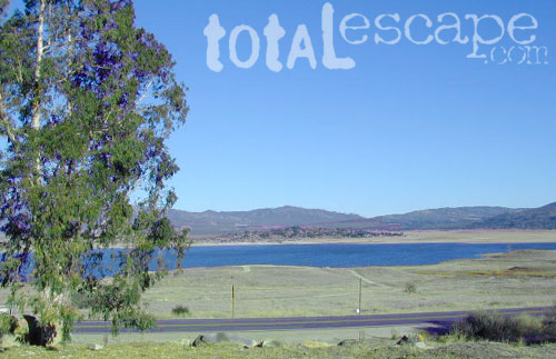
If you are imagining a forested alpine lake near Palomar Mountain, this is not it. Henshaw is a countryside area w/ meadow setting near ranches with open skies and open terrain. Can be windy at times! Can be hot in late summer.
Perfect remote spot for stargazing. Henshaw is the nearest body of water to Mount Palomar & is located on Hwy. 76, but the terrain is quite the contrast to the pine topped mountain nearby.
TREES: Lake Henshaw has very few trees; mostly large open spaces & fields surrounding it. Cattle grazing & rolling hills w/ mountain backdrop. Stargazing and fishing cabins is more fitting of a description. This bare bones basic, little cabin resort offers a true get away from civilization for maximum relaxation close to SoCal cities.
Lake Henshaw specs: elevation: 2740′ surface area: 1137 acres
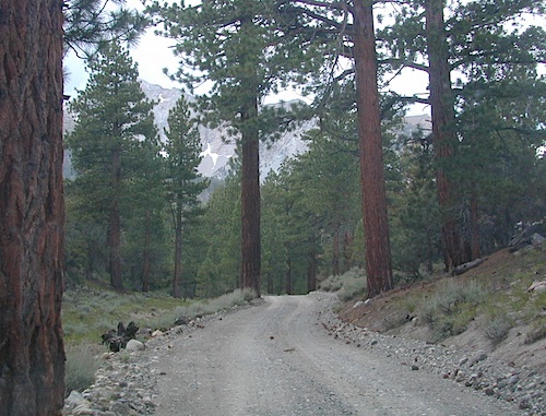
Steep, rocky, gravel road, way up above (and behind) Convict Lake. 4WD may be needed during wet or snowy weather. High clearance is always advised. Locked GATE at the bottom means the NFS rangers have closed the route (seasonally) for deep snow, rock slides, avalanches, or other erosion hazards.
Laurel Canyon, US Hwy 395
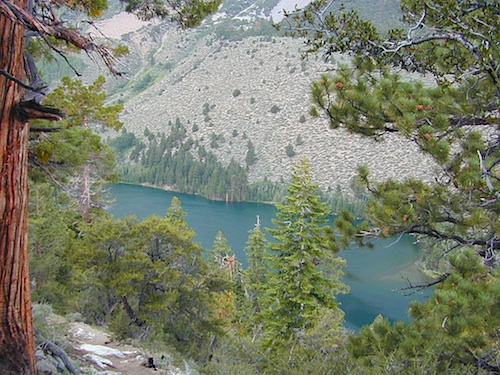
Laurel Creek
Laurel Lakes
Oldest, exposed rock in the Sierra Nevada mountains range. Buckling granite w/ volcanic rocks. Evidence of glacial activity including, terminal, lateral, and recessional moraines, glacial striations and polish, erratic boulders, and of course the numerous lakes. see more
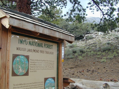
1 mile walk downhill to Walker Lake; very steep trail with 800′ elevation decent.
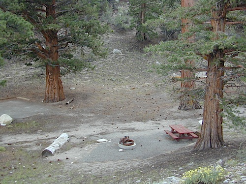
Vault toilet & one campsite at parking lot.
Trailhead camp for backpackers who arrive late. Nearby Parker Creek offers more in the line of free camping, more creeks, private setting.
Slim pickins on campsites, means have a plan B or C ready in case these few ideal canyons are full. Minimal camping spots, down on the main drag Road #1N17
Bloody Canyon leads further up the steep ravine to Upper & Lower Sardine Lakes.
Bohler Canyon near #1S19 (locked gate)
private property along some portion of this lake, so be aware of signage
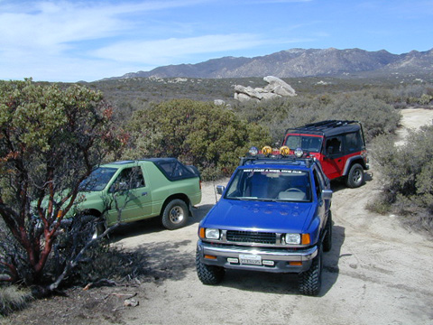
An avenue made of dirt, earthen highways, dirt trails, forest roads, fire roads, jeep road, graded roads. Dirt driving trails that lead into the middle of nowhere. No stop signs, no billboards, no stores, no one else around… for miles. Enjoy less crowds and more open space.
If you are fed up with city life, sitting in traffic & need to vacate your mind among the barren hills of California (if only for a weekend), then Total Escape is your place. You seek solitude, peace, maybe a mini tailgate party & BBQ on a dry lake bed, with the heavenly stars above. Imagine the warm camp fire light reflecting off the high canyon walls, your music echoing, moonlight hikes for a few miles.
California has some awesome spots to drive on dirt, get way back in nature. Right up to the edge of the Wilderness boundary. That’s what this one silly “dirt street” page is all about… helping you get out there, the easiest & best way possible. We even got you the right maps!
Most of this is just dirt road driving, graded, some hills, easy stuff. But on occasion you might come across a 4×4 required sign – or perhaps a triple black diamond trail. Having several good maps on hand will help you enjoy these roads, instead of stressing & wondering if there is a lock gate at the other end – 18 miles in.
Some dirt streets lead to campgrounds, some to waterfalls, some to viewpoints, some have loop options & others are just dead end; sometimes at old mines. Get ready to explore with your truck or SUV. 2WD or low clearance vehicles (such as passenger cars) should be ready to turn back if the road get too nasty. Any decent precipitation can make any unpaved road much worse & may require 4 wheel drive, so have a plan B or C as a backup idea.
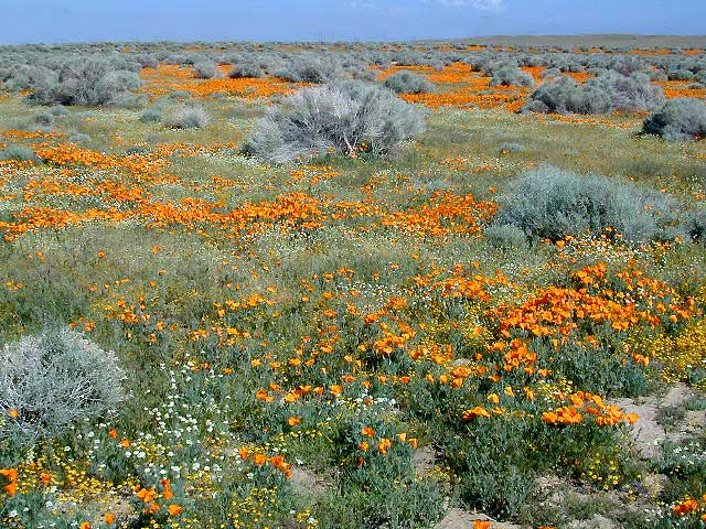
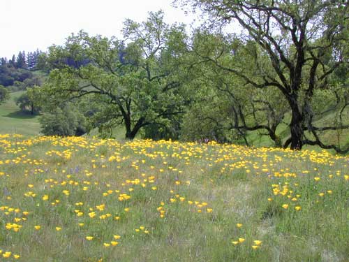
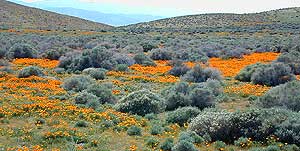
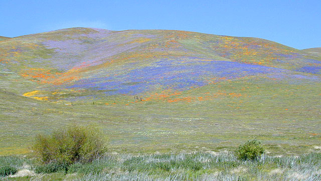
The official state flower of California is the POPPY
Spring usually means it’s warming up, to a great wildflower season in California. Time to get outdoors more! Hike, bike and picnic near the wildflowers and see some poppies.
California Golden Poppies can be found throughout the state, in small patches near the roadways, rolling hills behind vineyards, in high desert flats (where wind gets whipping) or even out near a ranch, with oak hills and fields of golden orange.
POPPIES can blanket hillsides, resulting in a show stopping event – which can be deadly on freeways? N of L.A. interstate 5 (the Grapevine) TEJON PASS (Lebec, Gorman, Junction 138) >> Please pull to nearest exit and stop the car. (It will be safest and well worth the 10 minute stretch break.)
Golden poppies can be found all over California. Flowers like lupine and owls clover can often be found nearby. Wildflowers may only last a few weeks, so go enjoy them while they last.
Bright yellow, gold, deep orange – or any shade in between!
best places to find poppies
NORTHERN CALIFORNIA
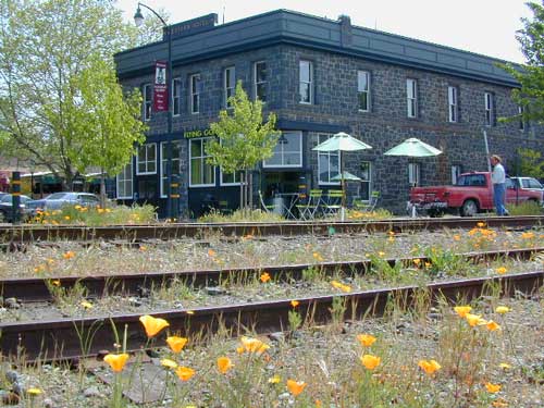
Table Mountain @ Cherokee Road
North of Oroville, CA
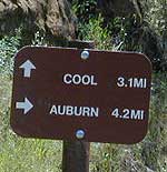
Auburn, CA Central California Reservoirs Located all around most rivers w/ dams (reservoirs) poppies can easily be found along highways, rural roads and on oak hillsides.
SOUTHERN CALIFORNIA
Boulder Creek Road (dirt) Descanso to Julian, CA
San Diego Mountain Foothills
Remember, stay on thetrail! Getting a picture of that one really nice poppy will crush all the plants along the way, and compact the ground leaving lifeless bare dirt for the next year or longer. If someone else has started a trail, do not add to the damage. Please be a responsible park visitor and leave the park as nice as you found it.
Or you can avoid the crowds & tour buses at the Poppy Park to head off on your own adventure. All along both sides of high desert Hwy 138 you can find fields of California Poppies, from the small town of Neenach, CA east to Hwy 14. Plus the hills of Gorman are usually full of color.
If you are a backpacker wanting to easily access the John Muir Wilderness, the paved parking area of Maxson is the trail head for you. The Courtright Reservoir is located at over 8000′ elevation, w/ granite domes & alpine scenery all around. This place is way back behind Dinkey Creek, past the McKinley Sequoia Grove inside a deep granite gorge. The Sierra National Forest is the region, which is south of Yosemite National Park. The paved route is a long one from Shaver Lake, via Dinkey Creek Road, but the rewards are great. An all day adventure and a side trip not to be rushed.
Warning: You could spend a whole day just driving & sightseeing in this area! Meadows, wildflowers, dirt roads, trails, Big Creek, McKinley Grove of Sequoias,Wishon Reservoir, the list goes on. All the way out to the Wilderness boundary, Courtright Lake is not a quick or easy drive.
The hikers trailhead is located at the end of Courtright Rd. Cross over the big dam to the right & drive approx one mile; look for signs on the right side of the road. There are minimal areas to set camp at this granite , windswept face. Good luck getting a tent stake in the ground. Rock rules here. There are a few developed Campgrounds on the opposite side of the lake which may be a better choice for car camping. This Maxson parking lot is primarily for backpackers.
Dusy Ershim 4×4 route start right here too – on the opposite side of the road. It’s second only to the Rubicon Trail, as far as High Sierra rocks & terrain.
Rock Climbers also love this spot for the granite domes & walls. Hiking all the way around this lake is a full day trip, with lunch and sightseeing stops. A pleasure not to be rushed.
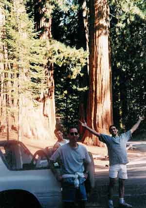
As if the government wasn’t confusing enough, now they have named so many areas of the Sierra Nevada “Sequoia” that it confuses people even more. For Pete’s sake, all we wanna do is see some big trees, hike, fish, camp and really relax.
The largest trees in the whole wide world are grounded right here in Cali, deep in the forests of the incredible Sierra Nevada mountains. The giant Sequoia groves are found in several parks in the Sierra, and are not specific to just the parks boundaries. You can find them as far south as the Western Divide Hwy, up past California Hot Springs – in the newest Giant Sequoia park, and you can find them as far north as Gold Rush Country.
Giant Sequoia National Monument (the newest NationalMonument, currently administered by Sequoia National Forest)
These massive Sierra redwoods are not be be confused with the tallest trees – the California Coastal Redwoods, which are found along the Pacific Ocean, from the canyons of Big Sur to rocky shores of Crescent City. The oldest living trees are the Ancient Bristlecone Pines, east of Bishop CA
Open car camping is allowed in several places inside Cleveland National Forest, although NO campfires are permitted in the backcountry (trailside or dirt roads) – due to the high fire danger. Your best for FREE, open, dispersed camping (with a campfire) is Anza Borrego Desert State Park. Lower elevations w/ summertime temperature can get very hot, so plan for higher elevation camps. The more you explore, the more you can find.
Off road destination, palm canyon in Baja California Norte
East of San Diego
SW of El Centro / Mexicali
Imagine a palm oasis canyon in a remote area of the Baja desert; Cool springs that feed the lush landscape with huge boulders & cliff diving waterfalls. With each campsite featuring it’s very own custom hot springs tub. This place was a paradise 20 years ago, but is now over-developed w/ large groups, parties and camping families. If you can handle the 30+ miles of unimproved dirt roads, this spot is worth a visit mid-week. Winter months are prime time to visit the desert. Temperatures are moderate, days are pleasant & midweek has minimal tourists. Avoid holiday weekends as crowds a can get rowdy and disrupt the peaceful setting. Summer is triple digit heat for months. This canyon is hard to reach and inside a third world country, but well worth the distant journey.
Plenty of great hiking and petroglyph canyons, cool pools and waterfalls, granite boulders, soothing warm waters & gorgeous desert scenery. Summers are usually roasting out here, so plan your vacation accordingly. Palalpas (built for shade) add to the charm & unique look. Each campsite is unique & has a different lay out. Reservations are recommended.
A family run set of campgrounds within a steep palm canyon. Hot Springs are piped to individual pools at each campsite for a maximum of privacy. A cold creek runs through the canyon as well, feeding the palm grove below & waterfalls way up canyon. A desert oasis set upon the slopes of the Sierra Juarez Mountains in Baja.
getting there is a journey –
Recommended high clearance vehicle, sport utility vehicle, or truck. The last 35 miles of the trip is through rough & rugged sandy roads.


 North Sierra Nevada, Northern California


 Desert Slot Canyons – South
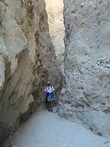


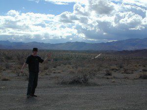
 California Terrain

 TREES: Lake Henshaw has very few trees; mostly large open spaces & fields surrounding it. Cattle grazing & rolling hills w/ mountain backdrop. Stargazing and fishing cabins is more fitting of a description. This bare bones basic, little cabin resort offers a true get away from civilization for maximum relaxation close to SoCal cities.
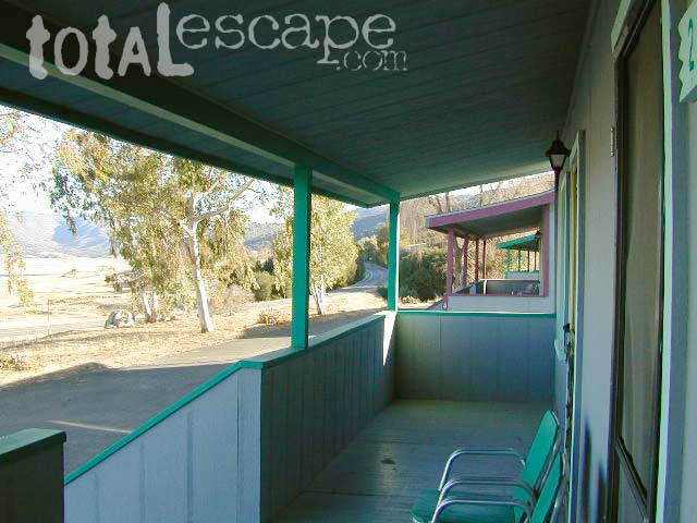


 If you are fed up with city life, sitting in traffic & need to vacate your mind among the barren hills of California (if only for a weekend), then Total Escape is your place. You seek solitude, peace, maybe a mini tailgate party & BBQ on a dry lake bed, with the heavenly stars above. Imagine the warm camp fire light reflecting off the high canyon walls, your music echoing, moonlight hikes for a few miles.
 or C as a backup idea.