Category Archives: Wilderness

Hoover Wilderness

Dunderberg Meadow

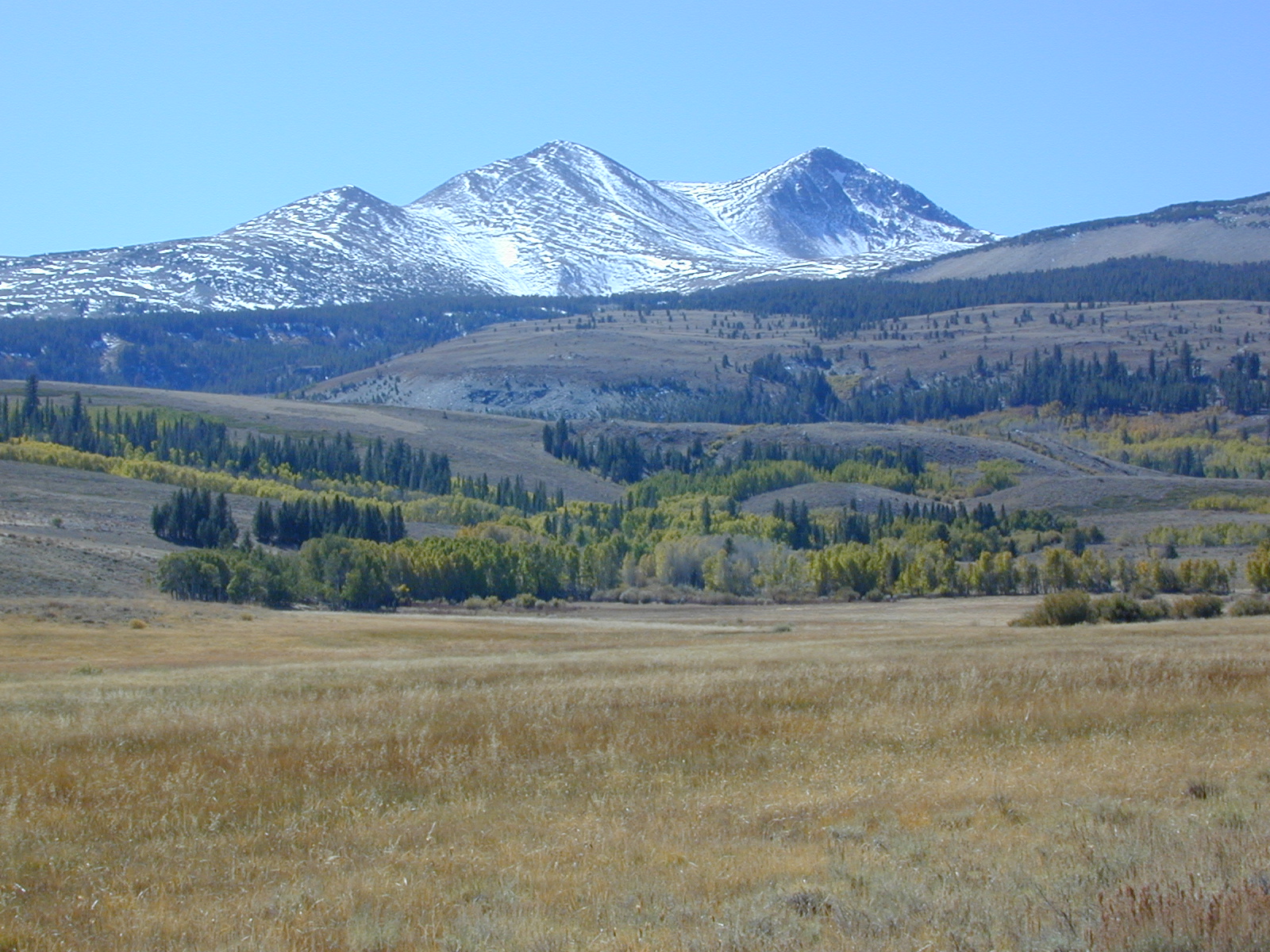
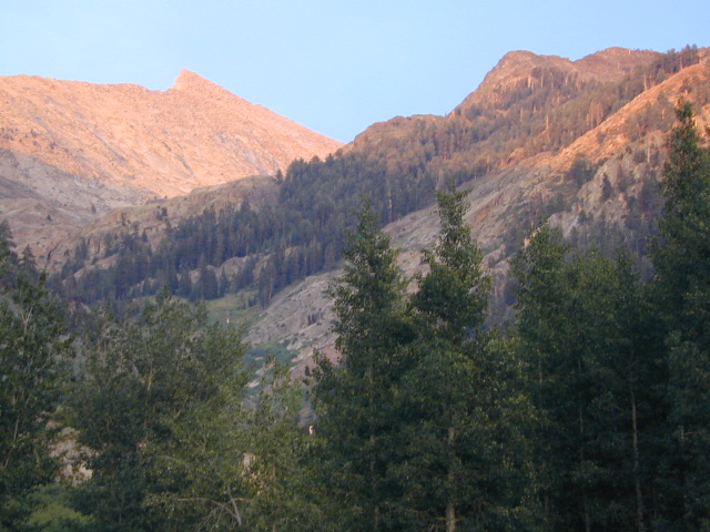
 Dunderberg Peak capped with snow about half the year @ 12,374′ elevation. Dunderberg Meadow is a side route off Green Creek Rd. Upper Summer Meadow Rd is another side route off Green Creek Rd.

Eastern Sierra Hoover Wilderness

East Yosemite National Park

48,601 acres
10 miles South of Bridgeport, CA
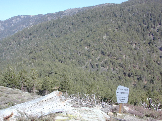
Toiyabe National Forest Autumn Eastern Sierras
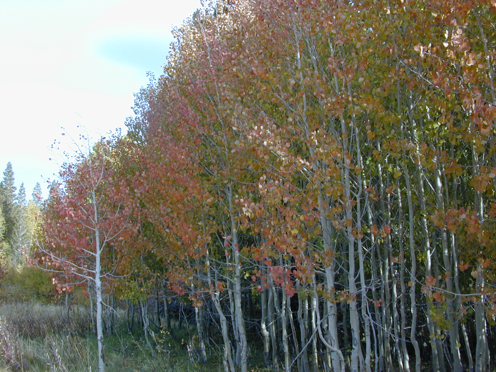
and Inyo National Forest

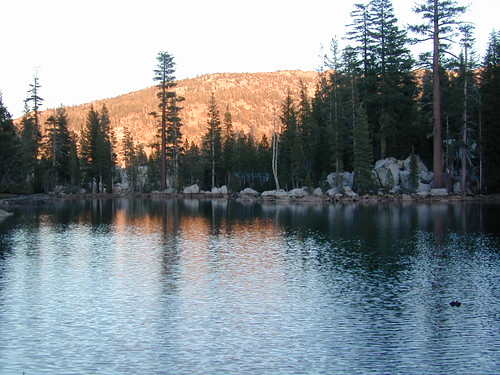
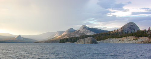
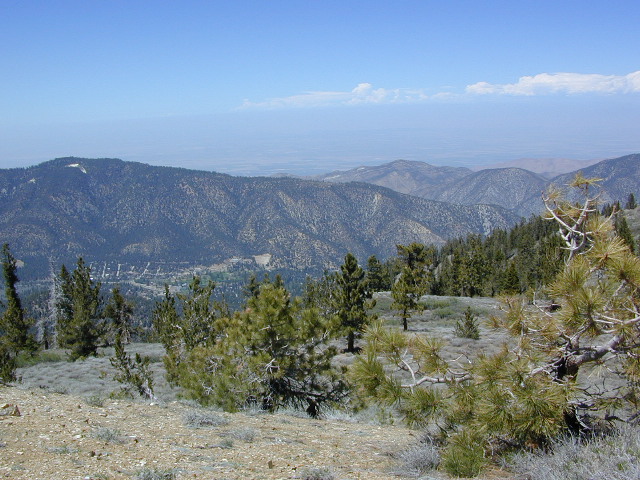
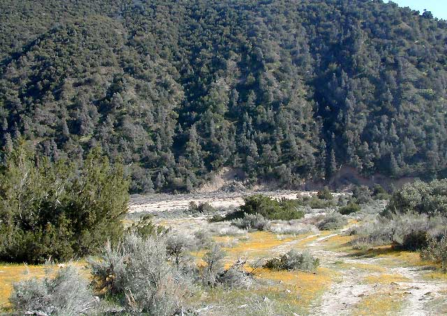
Hoover Wilderness spans  the mountain ranges from Sonora Pass to Tioga Pass, with high elevation peaks ranging from 10,000 to over 12,000′ elevation. Emigrant Wilderness lies to the west of Hoover, with Yosemite National Park & Inyo National Forest to the south.

  • Twenty Lakes Basin
  • Virginia Pass
  • Virginia Lakes Basin
  • Lundy Pass
  • Bond Pass
  • Hoover Lakes
  • Return Creek
  • Little Walker River
  • West Walker River
  • Matterhorn Peak – 12,264′ elev

towns nearby –

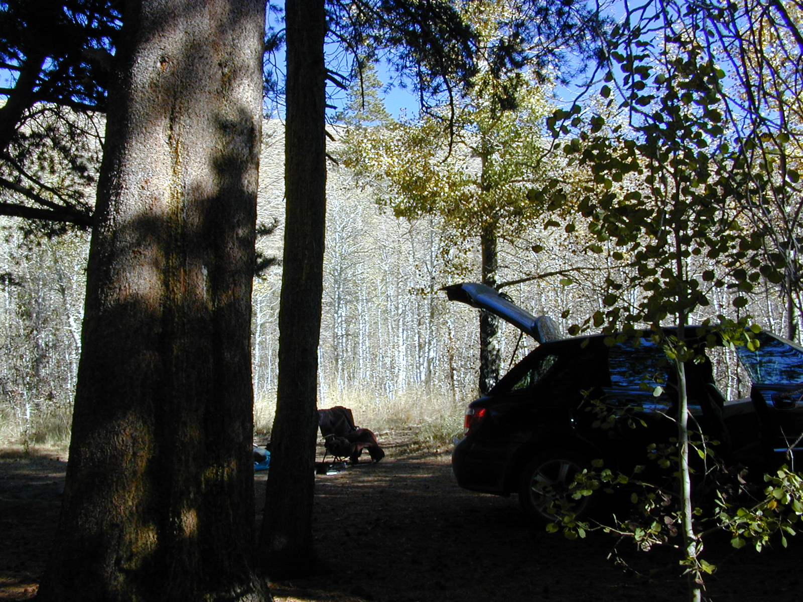
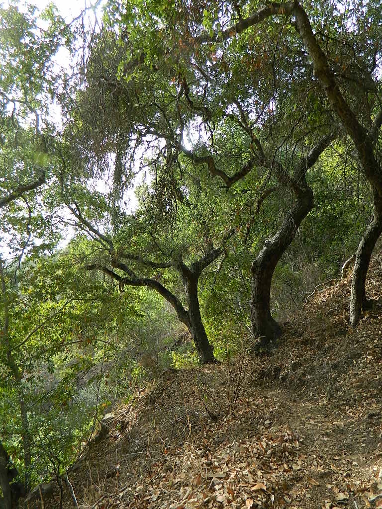
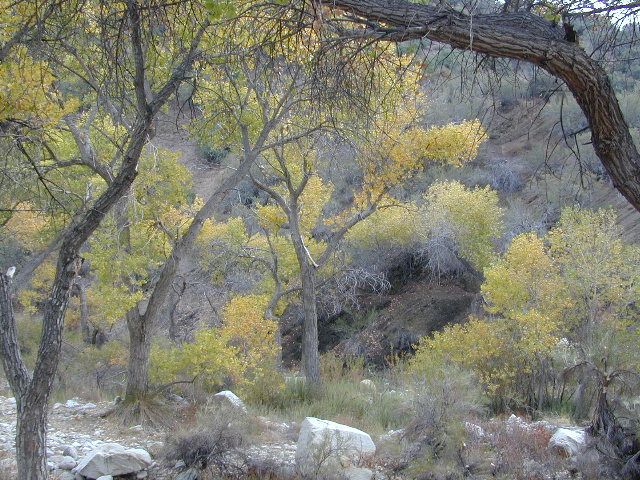
Aspen groves in the Eastern Sierra are some of the best autumn colors in the whole state. Fall car camping includes nighttime temps in the teens w/ fishing and hunting nearby.

PCT trails, Eastern SierraPacific Crest Trail passes partially through Hoover Wilderness inside  Yosemite National Park.

Hoover trails are not all dirt road access, but most are. There are 2 major trail heads along Highway 120 inside Yosemite NP, which lead north to Hoover.

Hoover trailheads –

California SR Highway 120 (Yosemite NP):

off US Highway 395:Hoover Trail Map

Twin Lakes area:

  • Robinson Creek
  • Horse Creek
  • Cattle Creek
  • Tamarack Lake
  • Buckeye

Little Walker River area:

  • Bort Canyon
  • Emma Lake
  • Molybdenite Creek

California SR Highway 108 (Sonora Pass):

hoover wilderness map

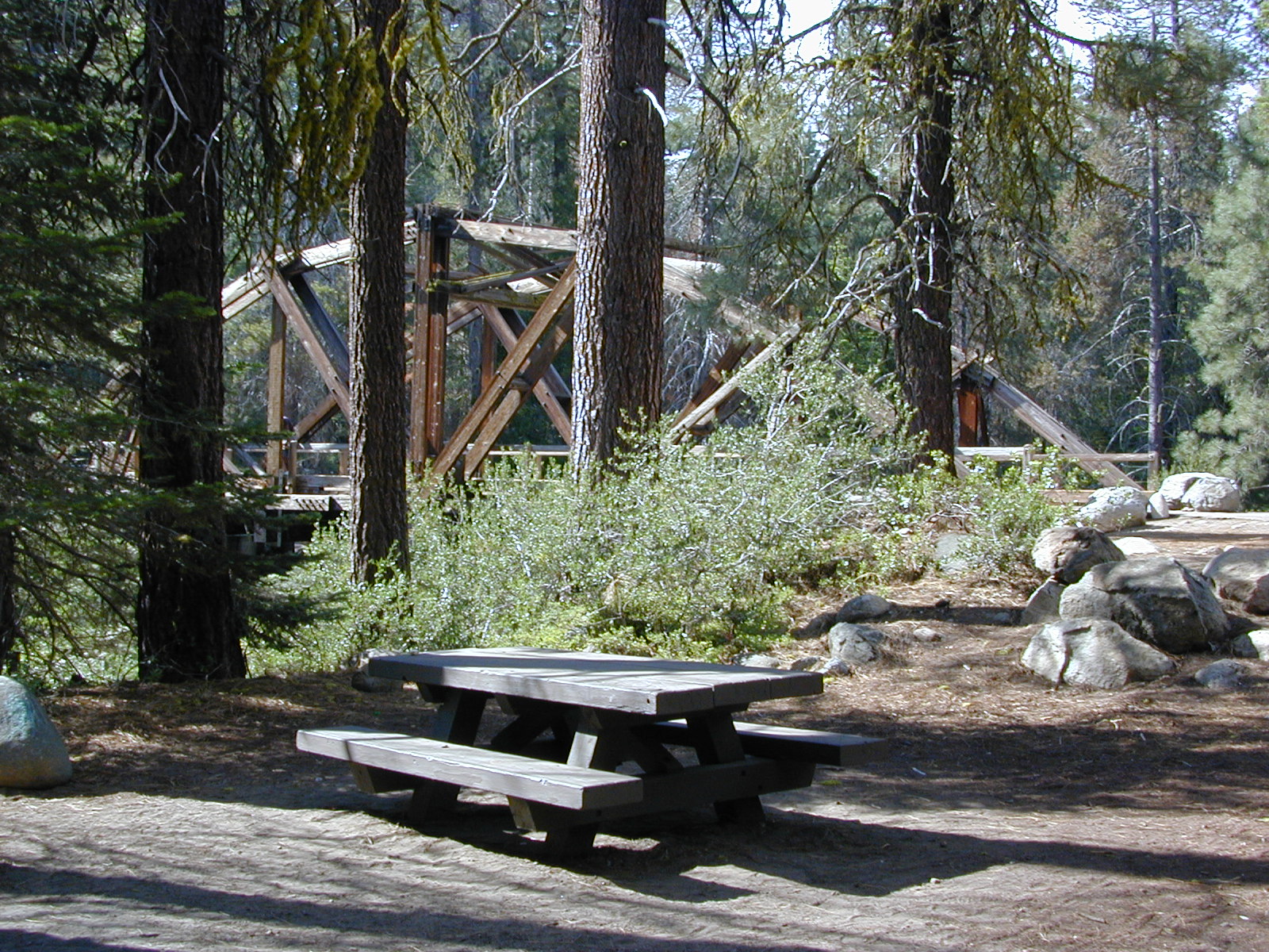
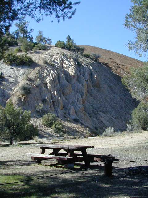
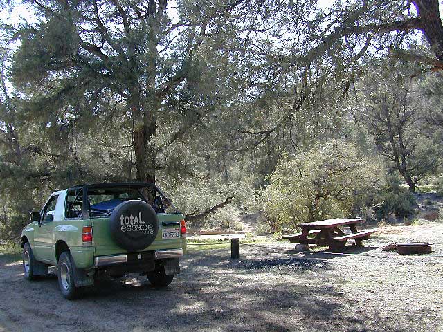
Green Creek Road is a signed dirt road on US Highway 395, near Virginia Creek Settlement and across from the Bodie ghost town turn off. Green Creek Campground  (a developed NFS campground) also has trailhead parking for Hoover hiking trails. Primitive free camp site can be found all along this major graded dirt road.

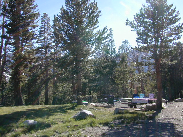
Many developed campgrounds in the surrounding areas – Saddlebag, Lundy, Virginia, Green Creek, Twin Lakes, Buckeye, Obsidian. Off Sonora Pass, Levitt Lake usually gets the most snow depth around and is only acessible in summer months. Super remote primitive camping for those with a high clearance vehicle.

FRee Camping Green Creek


Silver Peak Wilderness

Hiking the Southern Big Sur Coastline

faded public lands
Sun-bleached, wooden Los Padres sign – near Salmon Creek trailhead.

Silver Peak Wilderness, Big Sur Coast

Central California Coast

31,555 acres

8 miles South of Gorda, CA
along Pacific Coast Hwy 1
near Big Sur, CA
Los Padres National ForestBig Sur Wilderness Map

Backpacking and hiking trails on the Pacific Coast, steep terrain next to ocean. Coastal redwood canyons, oaks hills, great views. The neighboring Ventana Wilderness is located just north of Silver Peak hiking trails.

Southern Redwood Botanical Area

Silver Peak –3,590′ elevation
Alder Peak –3,744′

trailheads

  • Salmon Creek Trail #5E09
  • Hwy 1 @ connection Trail #5E10
  • Alder Creek Trail #5E09

mm

mile markers along Pacific Coast Highway 1
(Monterey County)

  • Cruickshank Trailhead – 6.5 mm
  • Soda Springs Trailhead – 3.8 mm
  • Buckeye Trailhead – 2.4 mm
  • Salmon Creek Trailhead – 2.2 mm

developed campgrounds nearby –

nearby towns –

Ocean View Hikes Big Sur


View Larger Map

Oak Foothills

Dinkey Lakes Wilderness

Central Sierra Nevada

Wilderness lakes
Courtright Reservoir w/ CLIFF LAKE trailhead

Dinkey Lakes California

Dinkey Creek Road
Tom Harrison Dinkey Map East of Shaver Lake, Hwy 168

30,000 acres

Sierra National Forest

Located in the high elevations between Shaver Lake and Courtright Reservoir is the Dinkey Lakes region. Granite domes and alpine lakes are the key feature of this mid-Sierra forest. John Muir Wilderness is located on the east (right) side of Courtright, while Dinkey Lakes Wilderness is on the opposite west (left) side.

  • alpine lakes
  • backpacking
  • camping
  • creeks & streams
  • cross country ski
  • fishing
  • granite domes
  • horseback trails
  • hiking trails
  • off-roading
  • rock climbing
  • snowmobiling
  • snowshoe
  • stargazing
  • wildflowers
  • wildlife viewing

4 wheel drive trails serve some of the Wilderness boundaries. Dusy Ershim OHV Trail (pronounced ‘doosey’) crosses the boulder strewn terrain for 30 rugged miles, from Courtright to Kaiser Pass. Road #8S10 is known as ‘Red Lake Road’ and pretty popular among 4x4s and fishermen. This high clearance 4×4 trail accesses both scenic lakes – Red Lake and Coyote Lake, as well as Dinkey Wilderness trailheads.

Trailhead Access:

Access the trailheads on the north side of Dinkey Creek Road, a paved route which connects Shaver Lake to the Sequoia McKinley Grove and then on to Wishon and Courtright. Rock Creek Road #9S10 becomes dirt and leads up to the Dinkey Lakes hiking trails.

Paved Dinkey Creek Road leads out to the Trails End trailhead. Dinkey Creek and main Campground is located at 5840' elevation and tucked deep in the forest, about 10 miles east of Shaver Lake. Beyond the Sequoia grove is Wishon & Courtright Reservoirs w/ Cliff Lake trailhead. All the other trailheads located at these large lakes lead over to John Muir Wilderness.

Paved Dinkey Creek Road leads out to the Trails End trailhead. Dinkey Creek and main Campground is located at 5840′ elevation and tucked deep in the forest, about 10 miles east of Shaver Lake. Beyond the Sequoia grove is Wishon & Courtright Reservoirs w/ Cliff Lake trailhead. All the other trailheads located at these large lakes lead over to John Muir Wilderness.

The Dinky Creek locale (on most maps) is located at the main Dinky Creek Campground, along Dinky Creek near the historic Dinky bridge on a small, paved, side route north of the main road. Although this summer vacation area is well signed, people can often miss this turn, especially at night.

DSCN0005

USDA map Two main hiking trail systems can be accessed from the west, via Tamarack Ridge (parking at Hwy 168). Both dirt routes from highway, Road #9S09 and Road #8S10 lead out to Dinkey trails, although one is rugged 4×4 trail, Red Mountain OHV, and the other is a long, graded dirt road.

Kaiser Pass Road to the north side has even more trails leading into Dinkey. Badger Flat and White Bark trailheads are closest points to Huntington Lake, CA. Bolsillo trailhead is way back near Florence Lake, which also has a major trailhead and paved parking.

NFS


local rangers:

Sierra National Forest
High Sierra Ranger District
29688 Auberry Rd
Prather, CA 93651
559-855-5355

Secluded Camping
4×4 Camping at Coyote Lake


Ishi Wilderness

Bridge and Chute from top of Black Rock

NorCal Ishi Wilderness

41,840 acres
20 miles N of Chico, CA
Lassen National Forest

  • Barkley Mountain (elev. 4488′)
  • Black Rock Campground
  • Deer Creek
  • Flat Iron Mountain (elev. 4400′)
  • Iron Mountain (elev. 3274′)
  • Indian Ridge Campground
  • Mill Creek
  • Peligreen Place
  • Pine Creek
  • Pinnacle Peak (elev. 3293′)
  • South Antelope Campground
  • Twentymile Hollow

Up in the mountains behind Chico sits a rugged landscape of deep canyons lined with bizarre rock formations and roaring mountain creeks. Wilderness encompasses lower elevations – ranging from 1500′ – 3500′  – making this outdoor destination a winter haven, when the rest of the backcountry is covered in several feet of snow. One of the most historic wilderness areas in the state, as the aboriginal existence of the Native Americans came to an end in this area.

COHASSET ROAD climbs up the volcanic fin of Cohasset Ridge into the pine forests high above the valley floor. The paved road becomes dirt and the road name changes to Ponderosa Way (Lassen Road# 28N29). The Ishi Wilderness can also be accessed from the north side via Highway 32, near the Tehama State Game Refuge.


View Larger Map

  • backpacking trails
  • hiking trails
  • fishing creeks
  • horseback trails
  • wildlife viewing


Ishi Wilderness mapIshi Wilderness Map

Ishi Wilderness


Trinity Alps Trailheads

Trinity Alps Wilderness Trailheads
NorCal Hiking Vacations

Meadow on Trinity Alps Long Canyon Trail

Northern California, Trinity Lakes
Shasta Trinity National Forest

  • backpacking
  • camping
  • fishing lakes
  • hiking trails
  • horseback trails
  • waterfalls

Trinity Alps Wilderness

hike


Trinity Wilderness trailhead locations –

trailheads from Highway 3:

  • Scott Mountain (PCT access)
  • Bear Creek
  • Eagle Creek
  • Stoddard Lake
  • Boulder Creek
  • Big Flat
  • Swift Creektrinityalps_lg

trailheads from Highway 299:

  • Canyon Creek
  • Hobo Gulch
  • French Creek
  • Green Mountain
  • Jim Jam Ridge
  • East Fork
  • New River
  • Grizzly Camp

trailheads from Highway 96:

  • Tish Tang
  • Red Cap Lake
  • Bear Hole
  • Mill Creek Lake
  • Salmon Summit

trailheads from north @ Salmon River, Cecilville Rd #1C02:

  • Hidden Horse
  • Trail Creek
  • Carter Meadows Summit (PCT access)
  • Middle Boulder

Trinity Alps Wilderness Trail
Overview @ SummitPost

Trinity Alps Lakes & Waterfalls

Trinity Wilderness Lakes & Waterfalls

Grizzly Falls -- Trinity Alps Wilderness

Northern California Lakes
Shasta Trinity National Forest

NFS


Trinity Alps Wilderness

lake


Lakes & Waterfalls in the Trinity Alps region –

Canyon Creek Fallstrinityalps_lg
Trinity Lake
Josephine Lake
Hidden Lake
Caribou Lake
Lost Lake
Grizzly Lake
Sapphire Lake
Papoose Lake
Emerald Lake
Conway Lake
Barker Lake
Foster Lake
Boulder Lake
Cecil Lake
Lion Lake
Ward Lake
Mirror Lake
Long Gulch Lake
Trail Gulch Lake
Fox Creek Lake
Red Cap Lake
East Boulder Lake
Middle Boulder Lake
Big Boulder Lake
Big Bear Lake
Big East Fork Lake
Little Bear Lake
Canyon Creek Lakes


Trinity Alps Lake

West Kern

festivals kern

CA Kern / western Kern county

Kern County is known for its oil, its agriculture, and outdoor recreation. The Kern River is the highlight of the region with lush, green and grey granite canyons, a big reservoir & the Sequoia trees just up the road. On the western side of Kern County are small towns like Frazier Park, the golfing cabin community of Pine Mountain Club, plus the oil meccas of Maricopa and Taft. Expansive Lockwood Valley enters into Ventura County. Cuyama River borders Santa Barbara & SLO counties.

Much of the western Kern area is rural ranch land, desert or forest. Los Padres National Forest, Chumash Wilderness, Bittercreek Wildlife Refuge, Wind Wolves Preserve, Buena Vista Reservoir, Ballinger Canyon, Hungry Valley and Fort Tejon State Park all call this region home, right on the mighty tangent of the San Andreas fault line. The San Emigdio range and the surrounding mountains of Mt Pinos and Mount Able design a perpendicular range to the Central Cali coastline, connecting the huge Mojave desert to the ocean. Cerro Noroeste is a very scenic drive.

The 17 mile long Quatal Canyon, where the indian camp of Mahu Tasen hosts a Bear Dance every summer is also a wild place of bird watching, camping and hunting. The indian word for Mount Pinos is “Iwihinmu” – a sacred spot for Chumash Indians, as well as others; Chumash call it the ‘center of the world’. Locals respond regularly with music, hikes, star gazing, drum circles (seasonally) and local festivals (annually) .

PHOTOS: Los Padres Photos | Miller Jeep Trail Off Roading Photos

Drum Camp Pinos | Drumming Cerro Noroeste

Tecuya Ridge

Tecuya Ridge, Cuddy Valley 4×4 trails can keep you busy for a whole weekend of back road exploring.

boating, camping, dirt biking, fishing, hiking, horseback, hunting, mountain biking, off roading, skydiving, xc skiing

DSCN0029

Quatal Canyon

Chumash Wilderness

Chumash Wilderness
Los Padres National Forest

38,150 acres
Mount Pinos – 8831′ elevation
Cerro Noroeste – 8286′ elevation
Los Padres National Forest

Terrain consists of high mountain peaks, badlands of Quatal Canyon Wash & Lockwood Valley; Steep slopes of forests, rock outcroppings, sparse forest areas, on border of Kern County & Ventura County. This area is sacred to the native California Chumash tribe.

Quatal Canyon Rd #9N09

DSCN0042Mount Pinos, Mount Abel, Cerro Noroeste, Westside Park, Hudson Ranch Road, Mil Potrero Highway, Lockwood Valley Road, East Dry Canyon, Apache Canyon, Cuyama River

campgrounds nearby –

The Peak to Peak Hike is a 7 mile, high elevation, ridge line day hike that traversed 2 of the tallest peaks in Kern County – Mt Pinos (elevation 8831′) and Mt Abel (8286′). Day hikes, equestrian trails, backpacking, mountain biking areas nearby. Steep, granite, chaparral, lightly forested w/ ponderosa and Jeffrey pines. From this ridge trail you have a 360 degree view over the entire region. The cabin community of Pine Mountain Club is to the north side (and IF the skies are really clear, you can see the Sierra Nevada mountain range too); Lockwood Valley & Ozena Valley are located to the south; Cuyama Valley to the west and the Tejon Pass w/ Frazier Park to the east.

Off road use 4×4, dirt bikes, ATVs, and quads are common in Quatal Canyon, Apache Canyon, East Dry Canyon leading up to the wilderness edge. Rangers will ticket if they find you on the Chumash side of Quatal wash. The secluded yet inviting, wide, white sandy washes are just too tempting for some bad boys.

Chumash trailheads are located

  • about a mile before Camp-O-Alto Campground (Mount Abel)
  • along lower end of Quatal Canyon Wash (OHV areas parallel)

nearby towns –


DSCN0060


View Chumash Wilderness Area in a larger map

Garcia Wilderness

Garcia Wilderness, Los Padres NF

14,100 acres
Garcia Peak – 3146′ elevation
Los Padres National Forest
Huasna River
Pozo Creek

himtncampgroundcampgrounds nearby –

American Canyon Campground
Hi Mountain Campground
La Panza Campground
Lake Lopez Campground
Navajo Campground

trailheads for Garcia Wilderness

  • Hi Mtn
  • Santa Lucia
  • Garcia OHV

POZO ROAD is also known as

  • Pozo La Panza Rd
  • Hi Mountain Rd
  • Pozo Arroyo Grande Rd

San Luis Obispo’s Los Padres Pozo Rd is a 4×4 route that accesses the Garcia Wilderness; the dirt route connects Lake Lopez to Pozo Saloon, out near Santa Margarita. Los Padres National Forest 

Located inland from the Pismo Coast in south San Luis Obispo county.
Garcia Peak OHV Route, off Pozo Road behind Lake Lopez, Arroyo Grande, CA

  • backpackingLupine on Pozo Rd
  • camping
  • hiking
  • mountain biking
  • off roading
  • waterfalls
  • wildflowers

Steep lush coastal mountains, rugged, remote landscapes close to Central Coast San Luis Obispo.

Garcia Ridge Road #30S18

Garcia Ridge Trail #15E11

Hi Mountain Road #30S11


DSCN5297

also nearby – Machesna Mountains Wilderness and Santa Lucia Wilderness

Mineral King Camping

DSCN0019

Mineral King is a magnificent canyon in the southern portion of Sequoia National Park, east of  Visalia, CA. So magical indeed that Disney tried to purchase the rugged scenic lands for a wilderness ski theme park in 1960. Thankfully that project never happened, due to strong opposition from preservationists. Mineral King became part of Sequoia National Park in 1978.

Mineral King is the Great Western Divide, where high peaks separate the foothills from the taller Eastern Sierra range. Upper Kern River Canyon lies beneath as the main south drainage from the very tallest peak, Mount Whitney @ 14,494′

sierra topo maps

Mineral King Road is a paved off shoot from Highway 198, just to the east of the town of  Three Rivers, CA. The road is steep and curvy and 25 miles long. No gasoline at all. No RV motorhomes or trailers are permitted to travel this scenic and amazing back road. Certain portions of the road are dirt and usually graded, but most of the route is paved.  Snow closes the road in winter months – NOV-MAY.

We usually get less than a half year to enjoy this special place, so make plans in advance to fit this destination into your schedule JUNE-JULY-AUG-SEPT.

And do not even think of trying to cram spectacular Mineral King into an already packed Sequoia Park weekend trip. The Giant tree Sequoia groves, Hume Lake and Kings Canyon are over an hour north (hwy 198), to other side of the park.

If you have a full week to hang out in the Sequoia National Park area, then obviously Crystal Cave and Mineral King should be on the list, but keep in mind taht each destination will take a full day to drive to and explore.

Driving the distance on Mineral King Road, the wonders abound on every curve. Wildlife, waterfalls, water flowing and the dense forests.

Atwell Mill Campground is located at an old wood mill site and has a good hike to a footbridge at Kaweah River. There is a small cabin community called Silver City which caters to summer crowds and family campers. Only open during the warm season.

At the very end of Mineral King Road is the gravel parking. Step out into high elevation (7830′ above sea level), breathe deep and enjoy the granite bowl of alpine bliss with creeks, meadows, wildflowers, picnic spots, hiking trails and scenery everywhere. Mid day sunshine can be bright. Black bears and marmots are very common.

Cold Springs Campground is the last developed campground, located next to a raging creek. The hike-in sites are the best choice for seclusion at this camp.

South Fork Campground is the smallest of the campgrounds in this area; located in the foothills at 3600′ elevation, open all year. From Highway 198 (W of the town of Three Rivers), take South Fork Drive 13 paved miles to camp.

KaweahFalls

mineral king backpacking

Mineral King is a favorite destination among backpackers as it gives instant access to many high country trailheads with mostly paved road driving. Located deep in the forest at end of a long road, near the center of the Sierra Nevada range gives ample hiking in every direction. The hikes are steep and challenging, but the rewards are solitude, true wildness and grandeur scenery. Although inviting, these steep passes might not be adequate for beginner backpackers, so please keep that in mind when planning. Fishing lakes, day hikes, horseback trails, waterfalls, creeks, and jagged mountain peaks.

From Mineral King you can access the these popular spots – PCT, the Great Western Divide, the Golden Trout Wilderness, Sequoia National Park, Kings Canyon High Country, Keasarge Pass, John Muir Wilderness.

top maps for the region –

Ventana Wilderness

ventana hikes

Central Coast California
Backpacking Big Sur

Ventana Wilderness is a 40 mile stretch of protected land located in the Santa Lucia Mountains on the Big Sur coastline in between the Monterey peninsula and the Nacimeinto-Fergusson Road #4004. Fort Hunter Liggett lies to the east side and the Pacific Ocean to the west. Ancient volcano peaks called “cones” line the pine ridges – Ventana Cone,  Ventana Double Cone, South Ventana Cone, Black Cone & Cone Peak.

240,026 acres
Cone Peak – 5155′ elevation
Los Padres National Forest
San Antoni River
Sykes Hot Springs
Tassajara Creek
Tassajara Hot Springs

campgrounds bordering area –

hiking trailheads –

  • Cone Peak
  • Escondido
  • China Camp
  • Arroyo Seco
  • Bottchers Gap

redwood hikes

nearby towns –

Central Coast Big Sur Maps

ventana map

Los Padres Forest Maps

NatGeo Big Sur Topographic Map

Pinnacles National Monument Map

Ventana Wilderness Topo Map

Smaller Silver Peak Wilderness (31,555 acres) is also featured on the same map, situated south of Ventana and north of the San Simeon Hearst Castle area.


Ventana Wilderness Alliance
Ventana Wildlife Society

Sespe Wilderness

Sespe Wilderness & Hiking Trails

Los Padres National Forest
Campgrounds & Trailheads

Sespe Wilderness is located in the mountains W of Interstate 5, North of Los Angeles. The chaparral region lies in between Lockwood Valley and the Santa Clara River Valley (Hwy 126). Higher elevation Mount Pinos lies to north side of Sespe and Ojai Valley to the south. The infamous 4×4 Miller Jeep Trail is located on the north side near Alamo Mountain, which is also accessible via Hungry Valley.

The 2006 Day Fire burnt a good portion of the Sespe Wilderness, so you can expect to see some black and toasted areas. Sespe Creek is also referred to as Sespe River. and certain waterways may dry up during drier months. Piru Creek, Alder Creek, Aqua Blanca Creek, Tarr Creek, Mutau Creek, Snowy Creek are several worthy of note. Expect heat and high temperature in the summer & fall month, and possible campfire restrictions during extreme wildfire season.

219,700 acres
6 areas of hiking trails

Los Padres National Forest
Lockwood Ranger Station
661-245-3731

Sespe Trail Map
Sespe Trails, Tom Harrison Topographic Map

Sespe hiking trailheads located at –

Highway 126 – Fillmore, CA
Sespe Condor Sanctuary – Dough Flat Trailhead

Highway 150 – Ojai, CA
Sisar Canyon Day Hike / Road #4N15

Highway 33 – Ojai, CA
Rose Valley Road #6N31, Rose Valley Falls, Day Hike
Piedras Blanca Trailhead for the National Recreation Trail
Pine Mountain Rd # – Reyes Peak Trailhead

Lockwood Valley Road – Frazier Park, CA
Reyes Creek, Camp Shiedeck – Pine Mountain Trailhead
Half Moon Mutau Flat Trailhead, Sespe Hot Springs

Interstate 5 Tejon Pass @ Hungry Valley
Hard Luck Trailhead


rd7N03

Los Padres Campgrounds near Sespe Wilderness

  • Frazier Park Camping
  • Ojai Campgrounds
  • Twin Pines Campground, Road # 18N01
    Alamo Mountain via Hungry Valley OHV
  • Lockwood Creek Campground
  • Half Moon Campground, Lockwood #7N03
  • Thorn Meadows Campground, Lockwood #7N03
  • Dome Springs Campground, Lockwood #8N40
  • Reyes Creek Campground, Lockwood Valley Rd
  • Pine Mountain Road @ Reyes Peak (dispersed)
  • Nettle Springs Campground, Cuyama Hwy 33
  • Ozena Campground (closed)letswalk
  • Tinta Campground, Hwy 33
  • Rancho Nuevo Camp, Hwy 33
  • Rose Valley Campground, Hwy 33
  • Wheeler Gorge Campground, Hwy 33


nearby parks & lakes –

nearby towns –

Backpackers at Sespe Hot Springs

Nettle Springs Campground

Nettle Springs

Apache Canyon Campsites

Cuyama Camping near Highway 33

Los Padres National Forest 

Way back off there beyond the boonies, 10 miles on a bumpy dirt road #8N06, and far from the pavement. Seclusion, peace and quiet, plus privacy is what this canyon can offer. This small campground is rarely busy, unless a huge family or hunting group has taken over camp. Most of the time it’s so quiet you can hear the wind in the trees, birds chirping and bugs buzzing.

N of Ojai (about an hour), scenic drive Highway 33 N of Ozena @ Lockwood is a little-known signed route called Apache Canyon. Los Padres Road #8N06 leads from the south end of Cuyama River Valley east to the dead end badlands canyon w/ Nettle Springs Camp. OHV trails and Chumash Wilderness access.

Elevation: 4,400′
Number of Sites: 8
Camping Reservations: No
Sites Available: First come, First serve
Vehicle Accessibility: small RV ok
Length of Stay: 14 Days
Water: No Piped; seasonal creek iffy
Toilet: Vault
Season: Open all year
Fee: No
Operated By: National Forest Service
Closest Towns: Frazier Park, CA & Ojai, CA

Los Padres National Forest
Lockwood Ranger Station
661-245-3731

Secluded Campground and Spacious Camp Sites


Saddlebag Lake Campground

Saddlebag Lake, Yosemite East Side

Inyo National Forest @ Tioga Pass, Hwy 120

Yosemite High Elevation Campground

Yosemite Lake View Camp Sites

Tioga Pass camping on the eastern side of Yosemite National Park, just outside park boundaries is Inyo National Forest lands. Snow is usually epic up here and some of the deepest on the range of light.

Several prime campgrounds line this popular Sierra pass, highway 120. Most camps are located along the busy highway just outside the National Park gate. Behold, this prime choice destination is a few miles back off the highway, at the end of a graded dirt road. Smaller RVs okay.

Saddle Bag Lake

High altitude, tree line, thin air, snow melt everywhere, spectacular elevations and dark skies make this an awesome stargazing spot. Summer is busy with trailers, boat rentals, horses and day hikers. Locals and fishermen use this small campground often, so tourists should feel lucky to find such a rare camp here. First come, First serve, when it is open (only half the year).

Elevation: 10,000′
Number of Sites: 19
Camping Reservations: No
Sites Available: First come, First serve
Vehicle Accessibility: Vehicle limit 22 ft. max.
Length of Stay: 14 Days
Water: Piped; lake, creek nearby
Toilet: Vault
Season: Closed during winter & spring
Fee: Yes
Operated By: National Forest Service
Closest Town: Lee Vining, CA

Inyo National Forest
Bishop Ranger Station
760-873-2400

RV Camper Lake

Jennie Lakes Wilderness

horse meadow trails

Sequoia / Kings Canyon / Mitchell Peak

outta print

USDA MAP may be out of print 2017

Jennie Lakes Wilderness is located in between two popular National Parks, via the paved back roads off Sequoia Generals Highway 198. Monarch Wilderness is north of Jennie Lakes, bordering Kings Canyon.

10,500 acres
26 miles of trail

Two lakes, Jennie Ellis Lake and Weaver Lake, set among granite outcroppings. Majority of the wWilderness is above 7,000 feet w/ red fir, lodgepole pine, and western white pine forest near treeline; abundance of spring wildflowers fill meadows. The two main lakes and Rowell Meadow are primary destinations for most backpackers wanting to camp overnight.


Sequoia National Park

Kings Canyon National Park

Monarch Wilderness

Impressive granite canyons, super steep. LOts of rugged rocky terrain, lower elevation to peaks of 11,000′. KINGS RIVER – Longest raging river in the Sierra, headwaters originating near Mount Whitney.

Road#14S11 – Big Meadows Road

National Forest & Wilderness Permits –

USDA Sequoia NF

More Wilderness Info & Links –

sierrawild.gov/wilderness/jennie-lakes
summitpost.org/jennie-lakes
Jennie Lakes Wilderness Wiki

Marvin Pass trailhead
Marvin Pass trailhead, 12 miles down Rd#14S11

Another Big Meadows?
Indeed, southern SEQ NF, on the East Kern Plateau.

Dome Land Wilderness

Southern Sierra Nevada Mountain / Domeland / Dome Lands
Kern Plateau, Sequoia National Forest

Dome Land Wilderness

130,081 acres

55 miles of trails (hiking & horseback)

Located at the southern end of the Kern Plateau about 20 miles east of Kernville, granite domes give this area its name. Domeland Wilderness is a unique geologic area with semi-arid to arid mountainous regions. Elevations ranging from 3,000′ to 9,730′ – it is surrounded by National Forest, where the Sierra mountains meet the North Mojave Desert. The Wilderness is the southernmost habitat for the Golden Trout. The South Fork of the Kern and tributary streams attract many fishermen. Vegetation is mostly mixed conifer and piñon (pinyon pine).

The Domeland Wilderness is located at the southern end of the Kern Plateau. This land was first protected by the Wilderness Act of 1964 as a 62,695 acre wilderness and was later expanded to 130,081 acres in 1984 to include the delicate transition ecosystems that meet to the east, south, and north of the original wilderness. These new additions, now jointly managed by the Bureau of Land Management and Sequoia National Forest, are rugged and dry.

Though it is considered within the Sierra range, the Domeland Wilderness includes the overlap of several ecosystems to form unique plant and animal communities. The banks of the South Fork of the Kern River offer important riparian habitats of cottonwoods and meadows which stand in sharp contrast against the characteristic smooth domes and bold granite outcroppings. Domes that range from the size of a cottage to football fields across and spear-like jagged spires can be found in the Domeland. This range is one of the driest in the Sierra with the semi-arid mountains of the north and east crumbling into desert.

Notable Wildfires: Dome Fire 1996. Manter Fire in 2000.

Dome Land trailhead locations:

East side access near Rockhouse Meadow and at the Long Valley Campground (BLM). Access is via Nine Mile Canyon Road (J41) from US Highway 395 or Chimney Peak Road (graded dirt road) via State Highway 178 , the main route that passes Lake Isabella.

West side trailheads are at Big Meadow and Taylor Meadow. Two trails from Big Meadow can be reached from Kernville via Tulare County Road M99, Sherman Pass, and Cherry Hill Roads. Leading to Manter Meadow, the upper Big Meadow Trail is a rugged hike while the lower Big Meadow Trail follows more gentle terrain. The trail from Taylor Meadow (southeast of Big Meadow) also leads to Manter Meadow. North side access is available from the Blackrock/ Sherman Pass Road via the Dark Canyon and Woodpecker trails.

dome land mapManter Meadow is popular along with other camp sites located at Little Manter Meadow, Woodpecker Meadow, Rockhouse Meadow, and in the Bartolas Country at the south end of the Wilderness.

Dome Land Wilderness Map USDA


surrounding lands & forests –

Sequoia National Forest
Ridgecrest Desert BLM

nearby towns –

National Forest & Wilderness Permits –

USDA Sequoia NF

More Dome Land Wilderness Info & Links –

sierrawild.gov/wilderness/domeland
summitpost.org/domeland-wilderness
Dome Land Wiki

Mokelumne Wilderness

Central Sierra Nevada Mountains, California

Mokelumne Wilderness Area

topo mapsMokelumne Map

Mokelumne (pronounced moo-ka-la-mi)
Backpacking, Camping, Fishing, Hiking, Kayaking Mokelumne River / Mokelumne Fishing / Mokelumne Trail / Mokelumne Wilderness Topographic Map

Vast alpine ranges located in the middle of the Sierra Nevada, between Highway 88 (Carson Pass) & Highway 4 (Ebbetts Pass). The Mokelumne Wilderness is a 105,165-acre federally designated wilderness area located 70 miles east of Sacramento, California. It is within the boundaries of three national forests: Stanislaus, Eldorado and Toiyabe. First protected under the Wilderness Act of 1964, the Mokelumne’s borders were expanded under the California Wilderness Act of 1984 with the addition of 55,000 acres. The wilderness takes its name from the Mokelumne River, which was named after a Mi-wok Indian village located on the riverbank in California’s Central Valley.

The wilderness encompasses an area of the Sierra Nevada mountain range between Ebbetts Pass to Carson Pass. There are two sections separated by the Blue Lakes Road and an Off-Road Vehicle corridor. Elevations range from 4,000′ to 10,381′. The highest point is Round Top 10,364′, a remnant volcano from which the wilderness area’s volcanic soils are derived from and is located on the east side of the Sierra crest.

recreation –

  • backpacking
  • camping
  • creeks
  • fishing
  • hiking
  • ice climbing
  • kayaking
  • lakes
  • mountaineering
  • rivers
  • wildflowers

surrounding forest lands –

National Forest & Wilderness Permits –

USDA Stanislaus
Lake Tahoe Basin Management

More Mokelumne Wilderness Info & Links –

sierrawild.gov/wilderness/mokelumne
summitpost.org/mokelumne-wilderness
Mokelumne Wiki
Mokelumne River

Sunset at Mosquito Lakes

Golden Trout Wilderness

Golden Trout Wilderness Area

granite Upper Kern River is Mount Whitney snow melt
  • 303,511 acres
  • elevation range 1,000′ – ­13,000′
  • pine forest, chaparral
  • granite walls, domes
  • 379 miles of trail
  • summers are busy
  • snow in winter
  • best in early spring
  • wood fires may be restricted
  • portable stoves permitted
  • water plentiful
  • rock climbing & mountaineering
  • fishing
  • backpacking
  • primitive hot springs
  • waterfalls, swimming holes
  • wilderness permits required for overnight
Golden Trout Wilderness surrounds the mighty gorge of the Upper Kern Canyon, south of Mount Whitney.
Inside

TULARE COUNTY

bordering

Inyo National Forest

Sequoia National Forest

Eastern Sierra Interagency Center
760-876-6200

Golden Trout / South Sierra Wilderness Map USDA

Golden Trout Trail Map

Located in the South Sierra Nevada mountains alongside the Southern Sierra Wilderness. Inside the remote rugged peaks of a deep, granite crevasse known as the Upper Kern River with ancient Sequoia forest to the west and to the eats, some of the tallest peaks in the Sierra range. This wild land area is home to the California golden trout and is the main water flow southward from the tallest peak in the lower 48  – Mount Whitney on the Eastern Sierra front.

Sequoia National Forest
Monache Meadows
Inyo National Forest
Mountain Home State Forest
Sequoia National Park
Mineral King

Golden Trout Wilderness

Roads, campgrounds and trailheads surrounding Golden Trout Wilderness

Eastern Sierra –

Horseshoe Meadows Road (paved) leads up to high elevation meadows from the high deserts of Lone Pine, CA. Pacific Crest Trail (PCT) access; Mount Whitney and John Muir Wilderness are to the north. Equestrian corrals and horse trails. Camping is limited to a one night stay at any of the 3 campgrounds up here.

Golden Trout Trailhead Campground: elevation 10,000′ / 12 walk-in sites / closed winter
Horseshoe Meadows Campground: elevation 10,000′ / 18 walk-in sites / closed winter
Cottonwood Equestrian Camp: elevation 10,000′ / 10 horse corrals / closed winter

Forks of  the Kern –

Fork of the Kern / Loyds Meadow Road #22S82 – This main paved road connects the Kern River (Sierra Hwy Road #99) to the lower elevation, granite slopes of the Western Divide, and the route dead ends at Jerky Meadow parking lot. Camp 1-6 are primitive camp areas located on dirt side roads and 4×4 might be required on some of them. Obtain a campfire permit from rangers in Kernville. Fishing, camping, waterfalls and swimming holes are popular in this region. The big developed camp along this road, is located 10 miles up, in a pine filled valley on Peppermint Creek on the west side of the street and is within the Giant Sequoia National Monument.

Lower Peppermint Campground: elevation 5300′ / 17 camp sites / open year round

Lloyd Meadows @ Sequoia Forest Road# 20S67 – is the Forks of the Kern Trailhead & the dirt road that accesses it, is very popular among equestrian campers.

Western Divide Highway –

Road #20S79 leads from Western Divide Hwy to Lewis trailhead.
Road #20S50 leads from Western Divide Hwy to 2 hiking trailheads.

Sequoia National Park, Three Rivers, CA –topo maps

South Fork Road leads up Kaweah River at Southfork trailhead.
Mineral King Road is only open seasonally, access to high country lakes and trailheads.


SEQUOIA AREA MAPS –

Golden Trout Wilderness Maps
Sequoia National Forest Map USDA
Inyo National Forest Map USDA
Mineral King Map
Sequoia & Kings Canyon NP Map
NatGeo Sequoia Kings Map

Golden Trout Wilderness trailheads:

east side –
Cottonwood Trailhead (near Lone Pine)
Blackrock Trailhead (Monache Mdws)

south side –
Jerky Trailhead
Forks of the Kern Trailhead
Lewis Camp Trailhead (Western Divide)
Summit Trailhead (Western Divide)
Clicks Creek Trailhead (Western Divide)
Camp Wishon Trailhead (Western Divide)

west side –
South Fork Trailhead (Three Rivers)
Atwell Mill Trailhead (Silver City)
Franklin Pass Trailhead (Mineral King)

List of nearby towns:

Thousand Lakes Wilderness

NorCal hiking & backpacking

Thousand Lakes California

Although the name suggests more, the number of lakes in this region is approximately seven: Eiler Lake and Box Lake are the 2 largest lakes within the Wilderness boundary. Logan Lake and North Battle Creek Reservoir are on the outskirts. Trout fishing is a popular recreation sport all around Lassen. Thousand Lakes Wilderness is part of the Cascade Range in northern California. 16,335 acres and 21 miles of trails, all managed by Lassen National Forest. The area lies midway between the mountain town of Burney and Lassen Volcanic National Park.

Volcanic activity and glaciers have combined to create the Lassen topography. Dominated by Crater Peak 8677′, which is the highest point in Lassen National Forest, this area is a reminder of the glacial action that eroded the original, much larger Thousand Lakes Volcano and created the many small lakes and ponds scattered throughout the region. Wildlife includes black-tailed deer, black bear, pika, pine marten, northern goshawk, spotted owl, pileated woodpecker, and Clark’s nutcracker. Even elk have been known to visit occasionally.

Lassen National Forest
Lassen Volcanic National Park


View Larger Map

Thousand Lakes Wilderness

Roads and trailheads surrounding Thousand Lakes Wilderness and the Wild Woods

Lassen Forest Road #16 – Ashpan Winter Recreation Area @ Hwy 44, leads to hikes on the west side of the Wilderness. Bunchgrass trailhead and Magee trailhead. LaTour State Forest, Ashpan Butte, Huckleberry Mountain, Fredonyer Peak, Crater Peak, and Whittington Butte. Lassen Route 16 is a graded dirt road that connects to Tamarack Road #4M001 at Burney Creek, near the north side of the Wilderness.

Road #32N17 – access to North Battle Creek Reservoir
Road #32N16
Road #32N24

Thousand Lakes Wilderness Map
Road #32N31 – access to North Battle Creek Reservoir

Road #32N18 leads to PG&E North Battle Creek Reservoir
North Battle Creek Campground: elevation 5600? / 15 camp sites / open Apr-Oct

Road #26 on the north side of the Wilderness, connects Hwy 89 @ Hat Creek, west to Road #32N22. Cypress trailhead is located on a side route nearby.

Road #32N23 is up on Burney Mountain elev. 7863′, another hang glider launch site.

Road #33N25 leads to the Tamarack trailhead
Road #34N78 off Hwy 44, near Logan Lake and route leads to McElroy Flat

Road #32N35 behind Burney connects to Hat Creek (the back way).


LASSEN AREA MAPS –

Lassen National Forest Map
Thousand Lakes Wilderness Map


List of Thousand Lakes Wilderness trailheads:

Bunchgrass Trailhead
Magee Trailhead
Cypress Trailhead
Tamarack Trailhead


List of nearby towns:

Desolation Wilderness

Desolation Wilderness Area

63,690 acres, a federally protected wilderness area located along the crest of the Sierra Nevada mountain range – in between Lake Tahoe and the Gold Country, on the western slopes. This is back country Tahoe @ tree-line, where big, bare granite rock of the High Sierra meets the snow melt in 80 alpine lakes; several streams; hiking, fishing horseback riding, and backpacking. Elevation range approx. 6000′ – 9,985′

El Dorado National Forest

916-573-2600

The Tahoe Rim Trail and Pacific Crest Trail pass through the wilderness.

Desolation Wilderness Map
(National Forest Service USDA)

Desolation Wilderness Topo Map
Desolation Trail Map
(Tom Harrison Maps)

List of Desolation Wilderness trailheads:

  • Loon Lake Trailhead
  • Buck Island Trailhead
  • Van Vleck Trailhead
  • Rockbound Trailhead
  • Twin Lakes Trailhead
  • Lyons Trailhead
  • Twin Bridges Trailhead
  • Ralston Trailhead
  • Echo Trailhead
  • Echo Lakes Trailhead
  • Glen Alpine Trailhead
  • Mount Tallac Trailhead
  • Bayview Trailhead
  • Eagle Falls Trailhead
  • Meeks Bay Trailhead
  • Horsetail Falls Trailhead

List of nearby towns:


View Larger Map