Category Archives: Campgrounds

Frazier Park Camping

Mount Pinos Camping & Frazier Park Campgrounds

Drum Circle Camp
Mount Pinos Fire Circle Camp Spot
camp5
Gold Hill Campground (which is now closed) – right next to Piru Creek.

camp

Frazier Park and neighboring towns, like freeway-close Lebec and Gorman, is where the Los Angeles hills meet the Kern County mountains. Mojave Desert meets to Coastal Range. EXIT I-5 @ Tejon Pass (elev 4144′)

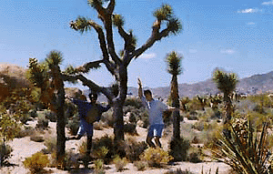
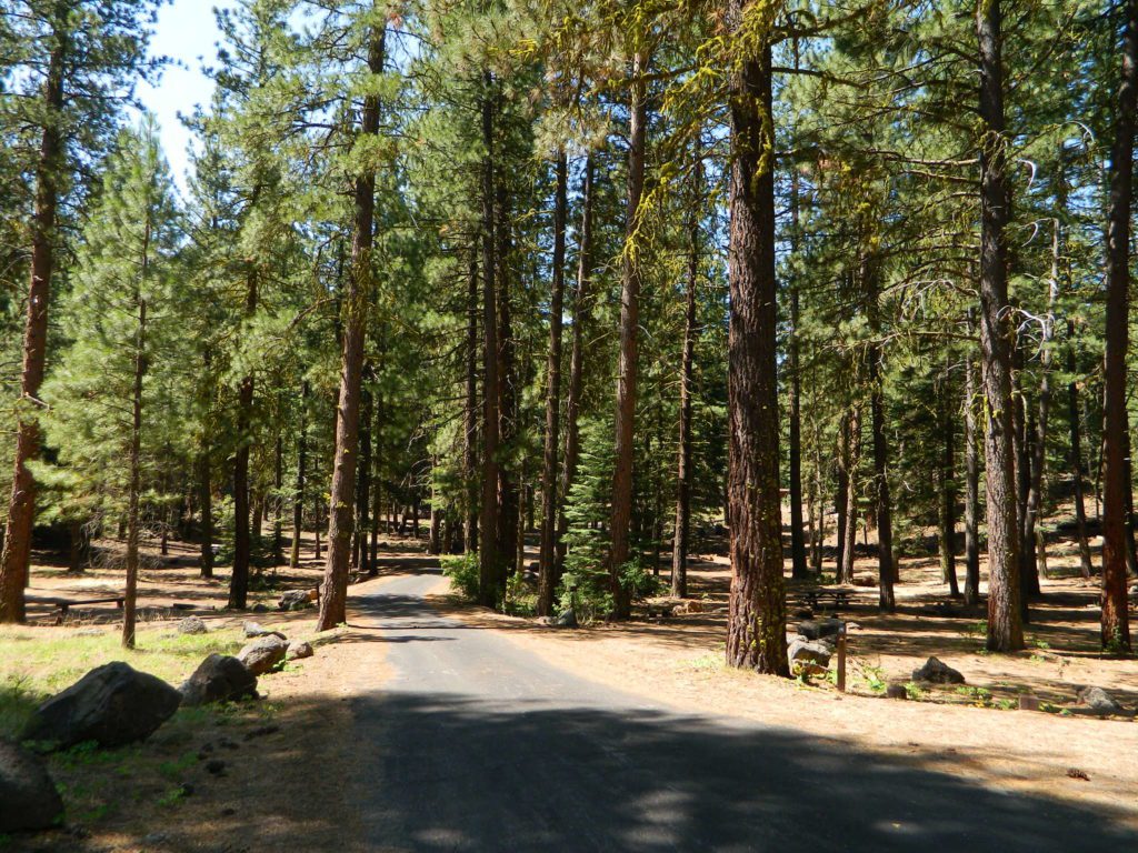
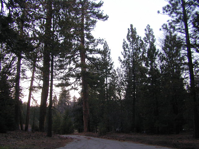
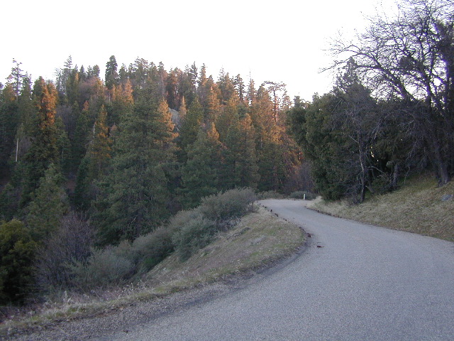
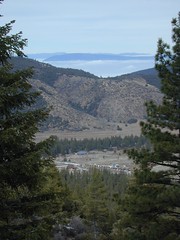
Wildflower hills, seasonal creeks, forested peaks, high desert canyons. Bike trails, hike trails, off road routes. High elevation backpacking, hang gliding, mountain biking and camping in every direction.

MTB SOCAL
Mountain Bikers love the trails at Mount Pinos.

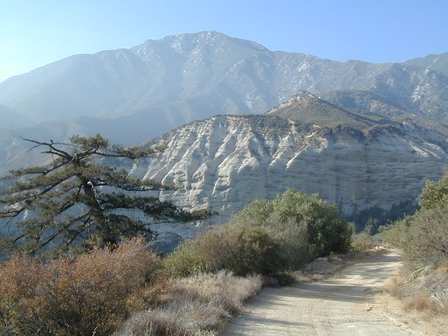
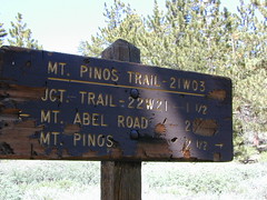
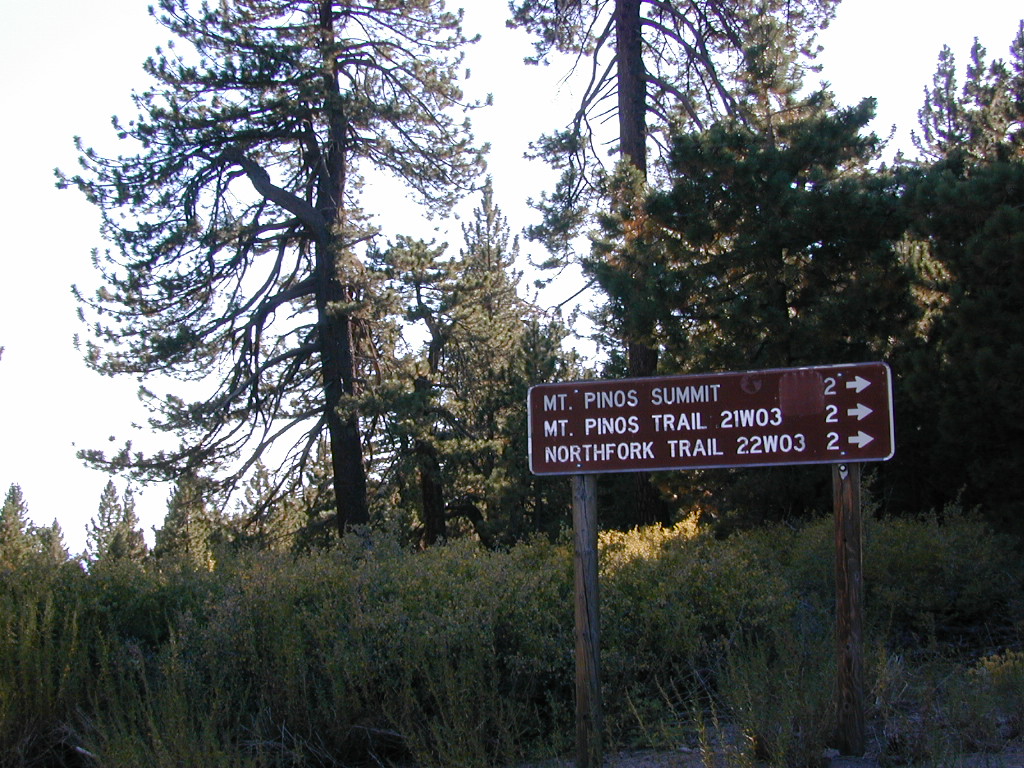
High desert washes, oak creeks, pinyon pine forests, mountain meadows and numerous peaks – Frazier Peak, Reyes Peak, Alamo Mountain, Mount Pinos, Mount Abel (Cerro Noroeste) and north facing San Emigdio ridge.

Mt. Pinos District:

campground elev spots veg toilet water notes
Aliso Park, Cuyama 3200′ 11 oak pit no Aliso Cyn Rd. (#10N04)
Ballinger OHV Camp 3000′ 20 pinyon vault no Rd# 9N10, Cuyama Valley
Camp-O Alto 8286′ 12 jefferey pit no ridge, Cerro Noroeste
Caballo Campground 5850′ 5 oaks pit no Rd# 9N27, Cerro Noroeste
Cherry Creek 4×4 5200′ 2 oak no spring 4WD trail, Cuddy Valley
Chuchapate Campground 6000′ 30 pines vault piped Rd# 8N04, closed winter
Chula Vista Walk-In Camp 8300′ 12 pines vault no walk-in camps & RV lot
Cottonwood Campground 4600′ 2 ctnwd no creek 4WD only trail, fish
Dome Springs Camp 4800′ 4 oak pit no Rd# 8N40, Lockwood
Dutchman Camp 6800′ 8 pines no no Rd# 7N01, 4WD trails
Half Moon Campground 4700′ 10 pines pit no Rd #7N03, May-Oct
Kings Campground 4250′ 7 pinyon vault no OHV & Piru Creek
Marian Campground 6600′ 5 pine pit no closed in winter
McGill Campground 7500′ 50+ pine vault seasonal mountain biking
Mount Pinos Campground 7800′ 19 pine vault seasonal closed winter
Nettle Springs Camp 4400′ 9 pinyon vault no Rd# 8N06, Apache Cyn
Ozena Campground 3660′ 12 cottnwd vault no Lockwood Rd
Pine Springs Camp 5800′ 12 pinyon pit no Road #7N03
Pleito Campsite 5000′ 2 mixed no no dirt rd access, dispersed
Rancho Nuevo 3550′ 2 mixed no no river crossing
Reyes Creek 4000′ 30 oaks vault yes creek camping
Reyes Peak Pine Mt 5200′ 6 pines none no ridge camping
Salt Creek 4×4 3000′ 2 mixed no no 4WD only
Sunset Campground 4300′ 2 cottonwd no no Lockwood / Piru Creek
Thorn Meadows 5000′ 5 pine pit no Rd# 7N03C, horse corral
Tinta Campground 3600′ 3 pinyon pit no river crossing
Toad Springs Camp 5700′ 5 pinyon pit no Rd# 9N09, Quatal Cyn
Twin Pines Camp 6600′ 5 pine vault no Dry weather only
Valle Vista Camp 4800′ 7 mixed pit no condors, new toilet

See Mount Pinos Recreation Campgrounds only

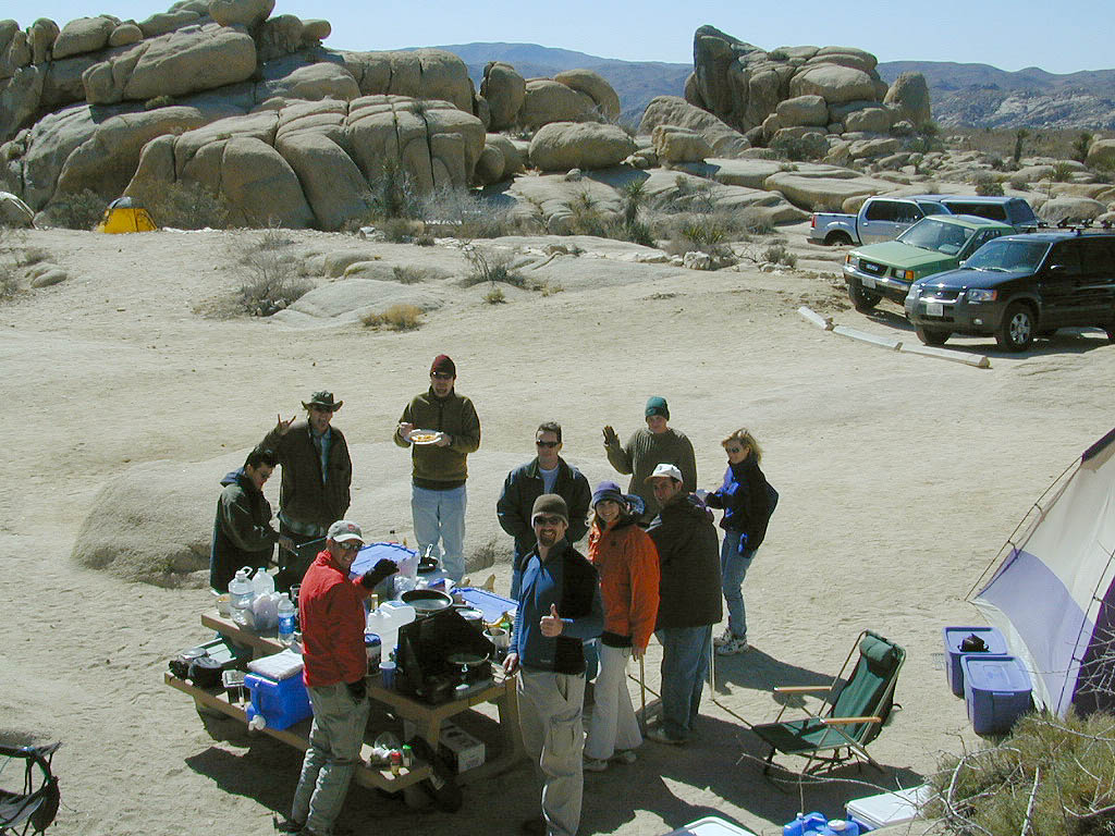
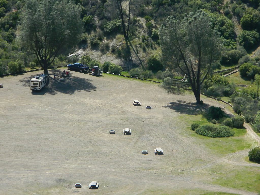
Group Camping Sites in Los Padres Forest

Hiking Pinos Signs
Mount Pinos – Peak to Peak hike.

Maps of Los Padres NF –nettle spring camp

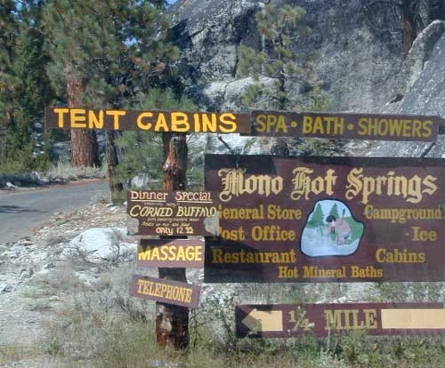
Los Padres mountain towns –

DSCN0043

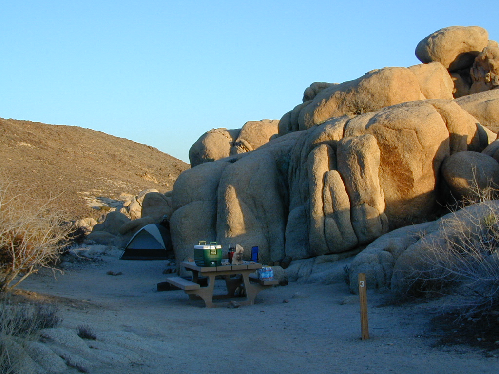
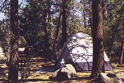
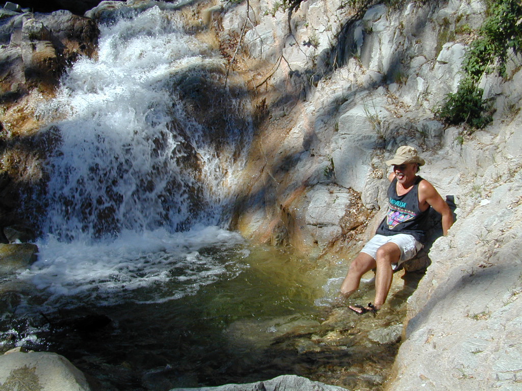
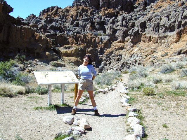
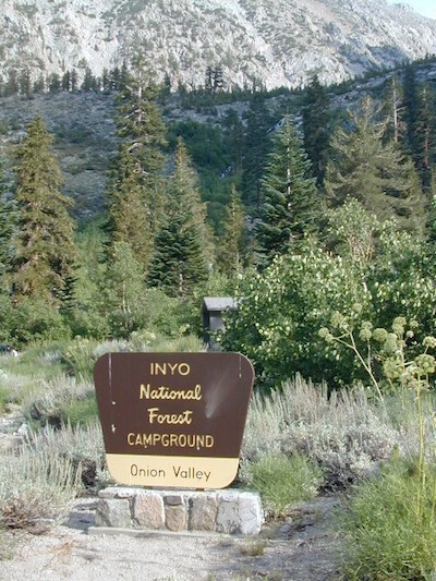
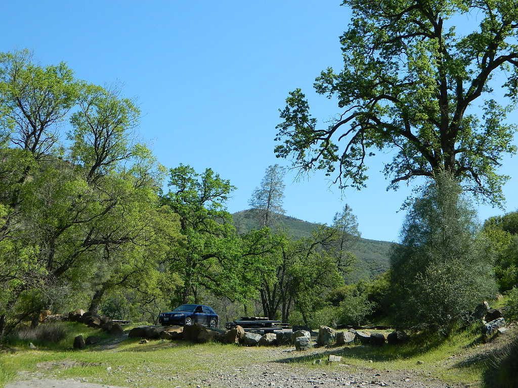
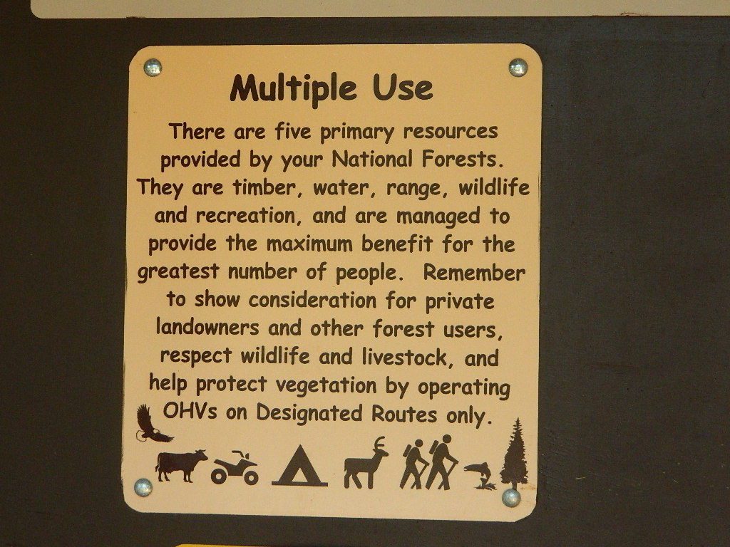
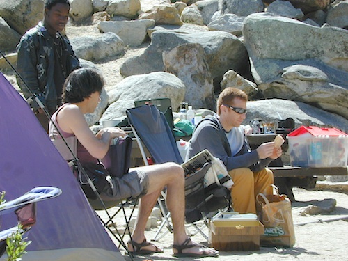
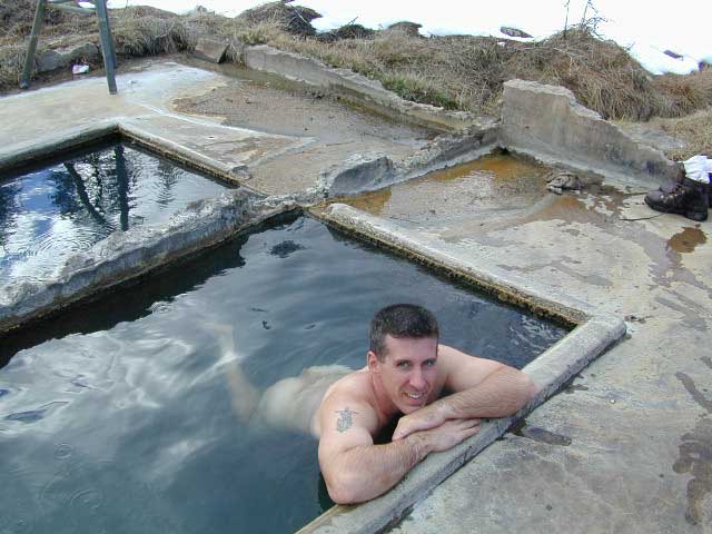
Toad Springs Campground atop Quatal Canyon. Small camps located in Los Padres NF have no fees, and often no toilets – so bring the shovel.

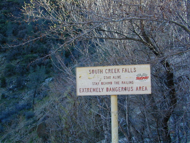
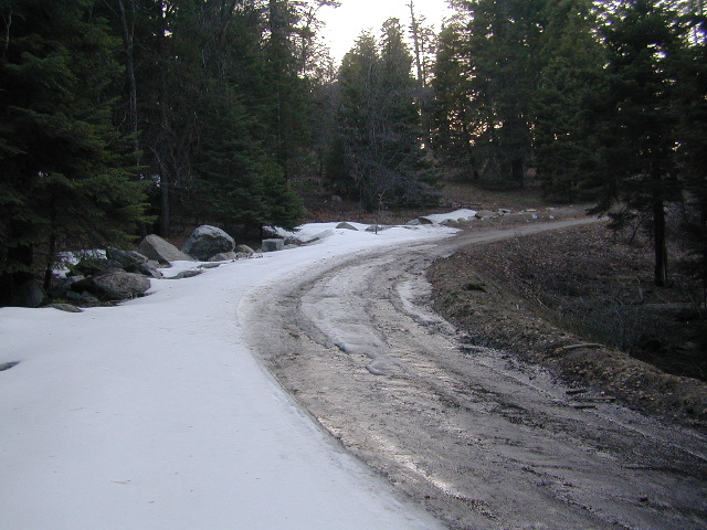
Many dirt roads are gated seasonally for wet weather or snow. Call rangers to find out which routes are open before you plan your weekend. Or have a plan B and C camp site ready if route is closed. Flashfloods, thunderstorms, and erosion means you may all-of-a-sudden need to use your 4WD. This is the mountains after all. UNpredictable weather is common.

frazier park camping

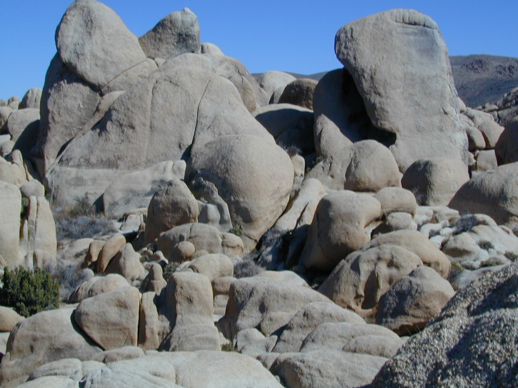
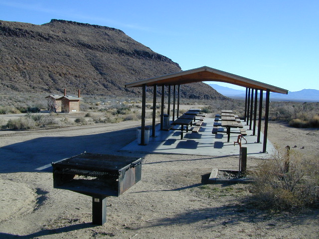
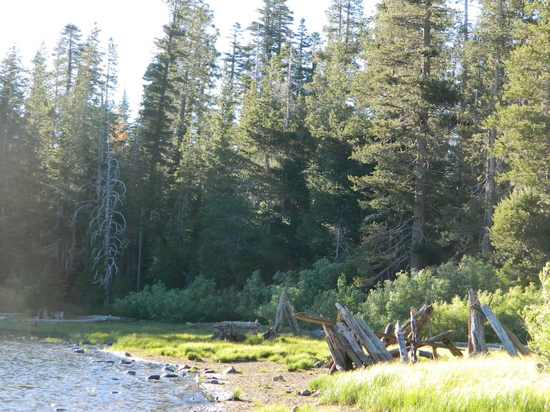
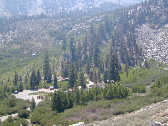
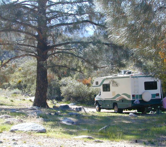
Primitive Camping in Quatal Wash, next to the OHV Route and the Chumash Wilderness

PeaktoPeak
Peak-to-Peak Hike: the toughest climb you’ll do, this decade.


White Tank Campground

White Tank @ Joshua Tree

quiet camp

Joshua Tree National Park
White Tank Campground

desert hikers and rock climbers
love this small camp

hiker

whitetank

White Tank & Belle campgrounds are the smallest camps Joshua Tree National Park has to offer. On the east side of park both campgrounds are located half a mile from one another.

This Southern California desert lunar-scape National Park is more popular & crowded because of the proximity to major urban areas. The south east side of the park entrance station, Cottonwood, is the least busiest gate.

  • bouldering
  • camping
  • hiking
  • stargazingawesome rocks


From the town of 29 Palms (on Highway 162) take National Park entrance South on Gold Park Rd. At intersection with Loop Rd. (do not turn right) Go straight through onto El Dorado Mine Rd. about two miles drive leads the 2 campgrounds.

camp

Joshua Tree National Park
760-367-5500
760-367-7511

breakfastclub

campground  elev. spots  veg toilet water fee
White Tank  3800′ 15 josh vault none no

joshes

chair4marc
In the years between 2000-2005  founder of Total Escape, DanaMite, lead several guided camping trips to Joshua Tree and liked this specific area the best.

desert

danarocks

Campground San Bernardino

whitecliffs

Big Bear – San Bernardino National Forest Camping & Campgrounds

areas include:
Big Bear Lake, Fawnskin, San Gorgonio, Lake Arrowhead, Forest Falls, Green Valley Lake & Idyllwild

Listed below are all the San Bernardino National Forest campgrounds, public lands for outdoor recreation. SoCal campground reservations can be booked online with the linked campsites below.

Big Bear Campgrounds near Big Bear Lake & Fawnskin area

campground elev spots veg toilet water notes
Applewhite Campground 6800′ 42 pines vault piped disabled access, RV 30′
Barton Flats Campground 6300′ 52 pines vault shwrs disabled access, RV 45′
Big Pine Flats Horse Camp 6800′ 17 pines vault piped Way back 3N14, year round
Cold Brook Campground 7000′ 36 pines vault piped RV max 25′
Crab Flats Campground 6200′ 29 pines vault piped 3N16, Green Valley Lk
Dogwood Campground 7000′ 90 pines vault piped disabled access, RV 22′
Green Valley Campground 7000′ 37 pines vault piped Green Valley Lake
Hanna Flat Campground 7000′ 88 pines vault RV max 25′
Heart Bar Campground 6900′ 94 pines vault seasonal Hwy 38, equestrian
Holcomb Valley Campgr 7400′ 19 pines vault no Rd 3N16, year round
Horse Springs Campgr 5800′ 17 pines vault no Rd 3N17, year round
North Shore Arrowhead 5100′ 27 vault piped disabled access
Pineknot Campground 6400′ 48 vault piped disabled access, RV 45′
San Gorgonio Campground 7000′ 54 pines vault shwrs Hwy 38, disabled, RV 43′
South Fork Campground 6400′ 24 pines vault piped Hwy 38, RV max 30′

site12

San Jacinto Campgrounds near Idyllwild area

campground elev spots veg toilet water notes
Black Mountain Group 6000′ 16 pines pit piped group site
Boulder Basin Campground 7300′ 34 pines pit piped CLOSED
Dark Canyon 5800′ 22 pines pit piped CLOSED
Fern Basin Campground 6000′ 22 pines vault piped Rd# 4S02
Marion Mountain Campground 6400′ 24 pines vault piped Rd# 4S02
Pinyon Flat Campground 4000′ 18 pinyon vault piped bighorn sheep, year round
Santa Rosa Springs Camp 7000′ 3 pines pit no no RVs, Toro Peak
Thomas Mountain Camp 6800′ 6 mixed vault no no RVs, Rd 6S13; Lk Hemet
Tool Box Spring Campground 6500′ 6 mixed vault piped no RVs, above Lake Hemet
Toro Campground 7800′ 5 pines pit no Santa Rosa Wilderness

Southern California Camping see also –

Topo maps, wilderness hiking maps, Equestrian trails, OHV maps –

SoCal mountain communities include:

Big Bear Campsites

Heart Bar Campground

Heartbar

San Bernardino National Forest: Heart Bar Campground
National Forest Service

At Hwy 38 & Forest Road #1N02 is a huge, pine forested valley, right next to San Gorgonio Wilderness. Heartbar Campground, Heart Bar Horse Camps, RV Dispersed Sites. Highway 38 – SE of Big Bear Lake, California; Mountain Bike, Hiking & Equestrian Trails with ridges of 10,000′ elevation. SAN GORGONIO peak nearby. Best high elevation scenery for SoCal by far.

  • backpacking
  • camping
  • fishing
  • hiking
  • mountain biking
  • mountain peaks
  • waterfalls
yellows
Primitive Camps on the Back Road #1N02

Heart Bar Campground

Big Bear Forest –  HEART BAR

This gorgeous valley is a developed recreation area w/ 89 camp sites, plus big equestrian area. Picnic, hiking, mountain biking, horseback trails, plenty RV spots, even a creek. (Oooops I meant the Santa Ana River) Highway 38 is kinda the long way into Big Bear Lake, up thru Angelus Oaks. Locals call this stretch of the highway Barton Flats.

spot79

horse camp
Bring the Horses & RVs

Group Campground facilities
Barton Flats – San Gorgonio Recreation Area

out back

Leading out the back way of HeartBar, past the horse camp – is a nice one lane dirt road, narrow in spots, with random, primitive camp sites along the roadway. Authorities refer to these spots as yellow post camp sites.

This backcountry route is marked as Forest Service Rd #1N02 – graded dirt road that leads back to Coon Creek Cabin.

Coon Cabin
Coon Cabin Backside

Big Bear Discovery Center
at Big Bear Lake
909-382-2790

ranger

Southern California forest 

San Bernardino maps:

nearby mountain communities:

ForestFalls
Forest Falls, late afternoon

Forest Falls is well worth a stop for a quick picnic or hike – and head dunk. Weekends can be busy and crowded. Since this location is close to Southern California and the population centers, expect weekends to be busy in the Big Bear mountains. Plan a trip for week days to experience less people, and more nature.


Black Rock Campground

Black Rock, California

At least 5 camping grounds called Black Rock around California.

Sierra Blackrock Reservoir

desert

SouthernCal Desert

Black Rock Campground @ Joshua Tree National Park

NPS

This popular camp is in Southern California, near the town of Yucca Valley, California. This is a NPS Campground w/ fee, reservations are recommended. Open all year long.

Joshua Tree National Park is nearby, but the campground is not located inside the park. It is however, a close to the town of Yucca Valley.

Black Rock Campground NPS
760-367-3001

• Elevation: 4,000′
• Number of Sites: 100
• Vehicle Accessibility: RV 40′
• Campsites Reservation: Yes
• Length of Stay: 14 Days
• Season: Open all year
• Trailheads: Warren Peak, High View Nature Loop, Panorama Loop

joshuatrees

Black Rock Horse Camp located next door, can accommodate up to 20 horses w/ corrals and room for RVs. With California Hiking & Riding Trail, group camp and equestrian facilities.

horseback


Sierra Nevada Mountains

LGVR
La Porte camping at the big Reservoir.

LGVR has a Black Rock Campground NFSlogo
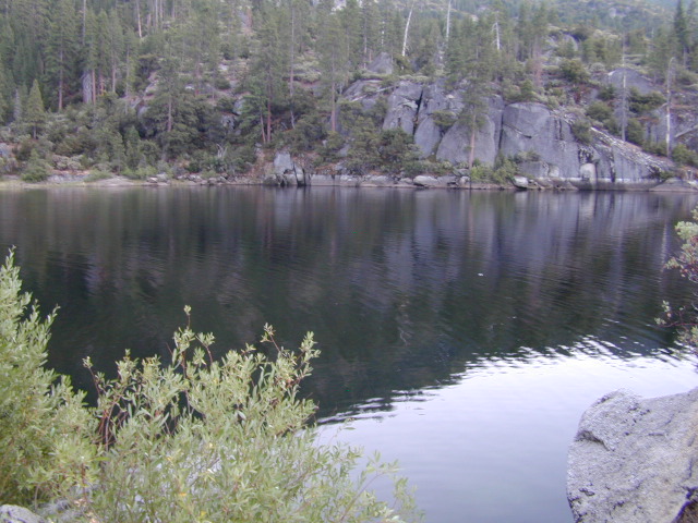
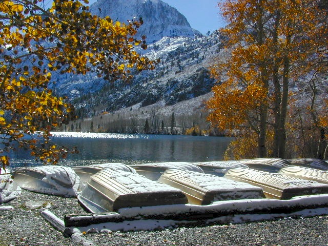
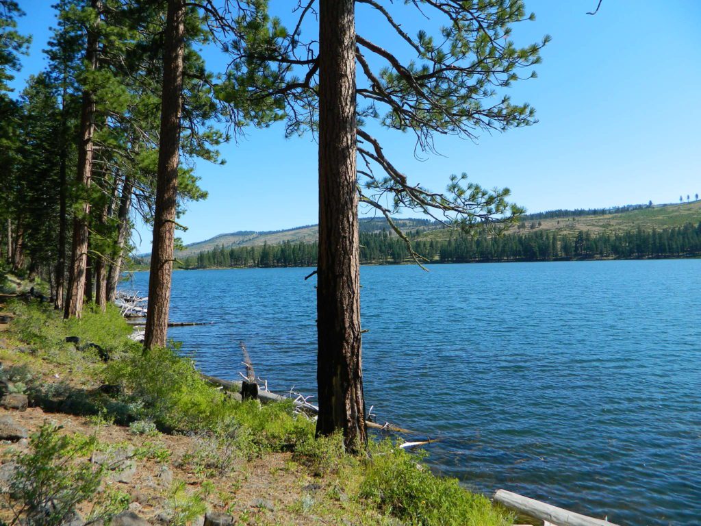
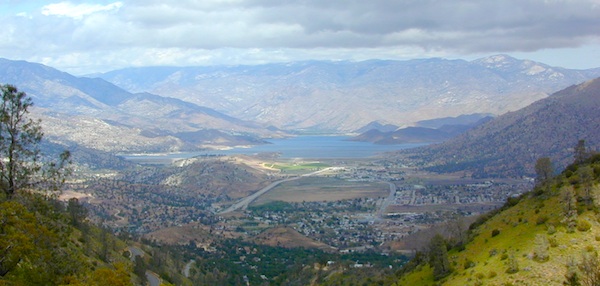
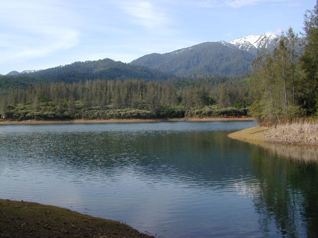
and boat ramp @ 5000′ elevation in Plumas National Forest. This is the only campground on the western shore of Little Grass Valley Reservoir – La Porte Road, La Porte, CA


northkings
North fork of Kings River , upstream.

Black Rock Lake (also known as Black Rock Reservoir) is located in the lower Kings Canyon region. North fork of the Kings River in Sierra National Forest; West of Kings Canyon National Park.NFSlogo

Sierra Forest Road #11S12 – a one lane, paved road – narrow, steep, RVs and trailers are not allowed.  Small campground, granite rocks, fishing, no boating.

gorgeview
Road #11S12, gorge view

NorthernCal

In the rugged volcanic canyons above Chico, CA – the Ishi Wilderness splits the landscape into volcanic rock ridges. Geologically, one of the oldest rocks in the Lassen National Forest. A small, rustic campground is way back in here – and if you are adventurous w/ a proper vehicle and bored – you could to go find it.

Black Rock Campground NFS

• Elevation: 2,100′
• Number of Sites: 6
• Vehicle Accessibility: High Clearance, maybe 4WD
• Camp Fee: No
• Campsites Reservation: No
• Length of Stay: 14 Days
• Vegetation: Oaks
• Season: Open all year
• Trailheads: Ishi Wilderness, Mill Creek Rim

hiker

Very long dirt road. Minimal facilities. Rustic and remote. No RVs.

Access from Highway 36, East of Red Bluff. Take Ponderosa Way.

Access from Cohassett Road in Chico. Cohassett Road all the way – up to Campbell Ridge, and then take Ponderosa Way.

Ponderosa Way is Lassen Forest Road #28N29, a dirt road access of 20+ miles. Unmaintained most of the year. Landslides and erosion are common on long dirt roads, so take caution and call ahead for road conditions.

In this wild canyon area, there are no services, maybe limited cell phone signal too. Beautiful views of the Ishi Wilderness, Mill Creek Rim and great swimming holes on Mill Creek.

This campground is not easy to reach. High clearance required on this route, but 4×4 is usually recommended.

You may need a chain saw depending on the time of year. Flash floods are possible in drainage from Mount Lassen, so check the weather forecast.

  • backpacking
  • camping
  • fishing
  • hiking
  • horseback
  • hunting
  • mountain biking
  • OHV trails
  • swimming

see more on Mill Creek California


butterfly

Black Rock City is a reference to the Burning Man festival

Annual event held in late August, on a dry lake bed in Nevada. Black Rock Desert BLM land, north of Reno, NV

4x4

Also similarly named Black Canyons & Black Mountains –

(located in Mojave Desert)

Black Canyon Road near Barstow, CA. Rainbow Basin, Owl Canyon Campground, Inscription Canyon petroglyphs. BLM Barstow

Black Mountain Wilderness

horseback

blackrockgroup
Mojave National Preserve Group Campground

Black Canyon Group Campground – high desert camping; near the Hole-in-the-Wall hiking trail in the Mojave National Preserve.
760 252-6108

  • group camping
  • equestrian camps
  • picnic areas
  • hiking trails
  • freeway close
mojavehikes
Mojave Hikes @ Hole in the Wall

Snag Lake California

Snag Lake California


Lakes Basin Recreation Area
Snag Lake

A free lake camp in between Truckee & Quincy, CA

This is one of many small lakes situated within the Lakes Basin Recreation Area , in the Northern Sierra Nevada mountains. Just north of Downieville & Historic Gold Country. Snag Lake is nothing special compared to the rest of the scenic lakes close by, but it is worth a mention due to a few fun facts.

Sierra Nevada Lake

One thing this small lake campground does have is convenience, located right on the Gold Lake Highway – next to Goose Lake, plus hiking distance to the largest of the lakes, Gold Lake. The second feature is the campground is small, 16 primitive sites, picnic tables & one vault toilet. The third thing is that this is a FREE campground; no charge.

campsite snag lake

Snag Lake Campground

• Elevation: 6600′
• Number of Sites: 16
• Vehicle Accessibility: Small RVs
• Campsites Reservation: No
• Camp Fee: No
• Length of Stay: 14 Days
• Season: June – October
• Trailheads: Gold Lake

Boulder Hopping

dirt drive (no pavement)

No motorized boats allowed. No paved boat ramps. Kayaks & canoes can hand launch from several spots. The dirt driveway is easily missed, especially at night. The old wooden, forest service sign is not reflective. The vault toilet is close to the highway and the camp sites are along the lake edge. No pavement anywhere!

Upon arrival, camper trailers will want to get out and select the best route to a camp site. The small boulders, dead trees, root and rock obstacles are abundant on the dirt road entry, all around the campground, and at each camp site. High clearance vehicles would fair best at this camp, but some passenger cars may be able to manage the rocky entrance. Get out and look at the road, before scraping across the biggest rock. Slowly, carefully, maybe… and preferably an arrival before dark.

LOCALS TIP: The wind tends to pick up at night around these lakes, so brace your tent well and position your vehicle appropriately.

NFS lake camping lake fishin hiking lakes lakes

fishing lake?

rainbow trout

Obviously with a name like SNAG, you can imagine that the fishing here is not the best, since roots and old tree stumps make up a good portion of the shoreline. Luckily there are a dozen alpine lakes within a 20 mile radius to choose from for another fishing spot. Some lakes are hike-in only, some require 4×4 to reach and others have cabin resorts.

towns nearby –

sierra snow

SEASONAL SNOW CLOSURES

snowmobile
Gold Lake Hwy (or Gold Lake Road) closes in the winter months (NOV-APRIL) due to snow and the region is used as a winter recreation area. Cross-country skiing and snow-mobiling are both popular activities.

driftwood

Lassen – Snag Lake

ANOTHER SNAG LAKE in NorCal, can be found by foot, hiking into the Lassen Volcanic Wilderness. Backpacking the lake loop is approx 17 miles RT and includes 3 lakes – Snag Lake, Widow Lake, and Jakey Lake. Trailhead is located at Juniper Lake, at the north shore.

read more about this hike

hiker

SIERRA LAKES

4×4 lakes
backpacking lake
camping lakes
canoeing lake
fishing lakes
hiking lake
kayaking lakes
waterfalls

Silver Lake @ June

June Lake Loop

Silver Lake @ June Lake Loop

(Mono Co)

7700′ elev. Hwy 158, Backside of June Lake Loop, north of Mammoth.

Prime hiking and fishing destination of the Eastern Sierra, California. With impressive Carson Peak (10,909′) towering as a granite backdrop for the lake, every day out here is super scenic. Unless, of course, blizzard white-out conditions occur – which is possible during winter.

fish
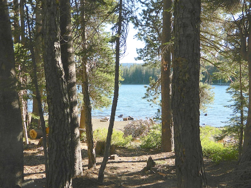
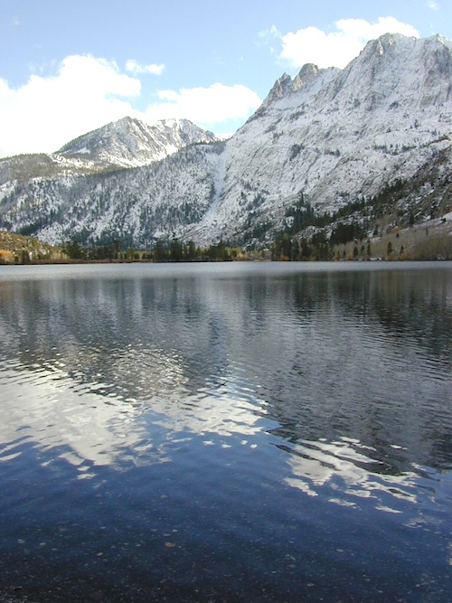
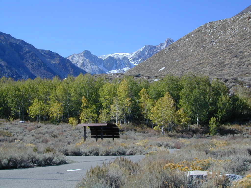
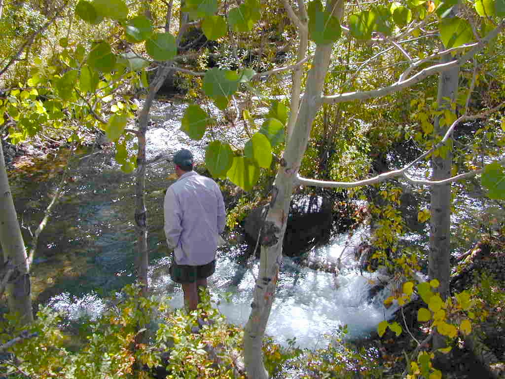
October-November, Autumn colors – at this particular location – tend to be fantastic, with aspen groves encompassing the lake, nearby streams and steep canyons.

fish: Reverse Creek, Rush Creek, Silver Lake, Grant Lake, Gem Lake, Gull Lake, June Lake

golden glow june

Winter weather & deep snow can close the paved highway loop, so know road conditions and weather forecast before you go. This beautiful Silver Lake is within walking distance of two lodges – Whispering Pines & Double Eagle Resort, so if rain or snow is predicted make your reservations.

  • aspen groves
  • autumn colors
  • backpacking
  • camping
  • canoeing
  • fishing lake
  • hiking trails
  • horseback trails
  • kayaking
  • mountaineering
  • picnic grounds
  • RV camp

Rental Boats

Ansel Adams Wildernesshiker
Inyo National Forest
June Lake, CA

This gorgeous, 80 acre alpine lake is a popular campground for fishing, picnicking, hiking, summer and autumn camping. Accommodates tent camping and RVs. Boat ramp, grocery store, coin-op laundry – all nearby. Camp closes for snow annually.

Silver Lake Campground NFS campground

• Elevation: 7600′
• Number of Sites: 28
• Vehicle Accessibility: RV 20′
• Campsites Reservation: Yes
• Camp Fee: Yes
• Toilets: Flush
• Water: Piped/Potable
• Length of Stay: 14 Days
• Season: April – October

NFS
Inyo National Forest
Mono Lake Ranger Station
North US Hwy 395
Lee Vining, CA 93541
760-647-3044

lets go fishing

stars

See all Silver Lakes in California

Onion Valley Campground

whiteVWcamper

Spectacular Small Campground located inside a granite bowl above 9000′ elevation, on the edge of the granite, near the John Muir Wilderness trails.camp

Inyo National Forest near Independence, CA
Eastern Sierra California

One of the best high elevation trailhead camp for backpackers in the Sierra.

High Sierra Lake Hikes

Onion Valley Campground

Onion Valley CA

  • Elevation: 9,200′
  • Number of Sites: 29
  • Vehicle Accessibility: no RVs
  • Camp Fee: Yes
  • Campsites Reservation: Yes
  • Toilet: Vault
  • Water: Piped
  • Length of Stay: 14 Days
  • Season: June – Sept
  • Trailhead Parking

Inyo National Forest hiker
Mount Whitney Ranger District
760-876-6200

Trailhead parking & camping for these High Sierra destinations –

onionsign

wild mountain onions?

High elevation NFS campground, located in a huge granite valley w/ waterfalls, wildflowers and aspen groves. The setting is breathtaking and the high altitude valley is nothing less than grand.

The views (east to the Owens valley) are from the paved road up, or from the hiking trails leading up outta camp. Gotta hike up (on foot) to see the views! Any visitor that does not hike, will be missing out on the best features of this destination. Plan to spend more than one day at Onion Valley.

ONLY OPEN for summer months! This small, developed campground closes annually.  Big winters and deep snow is the norm w/ elevation this high.

 walk-in camp sites

tent campas well as car camping sites.

  • picnic tables
  • fire rings
  • vault toilets
  • piped water
  • bear boxes

ONION VALLEY ROAD
access via Independence, CA

The paved road is long and very winding; sheer cliffs, steep drop offs, hairpin curves, minimal guard rails. RV motorhomes are not allowed on this route, due to the steepness of the terrain and the narrow roadway. conradkid2001

  • backpacking
  • camp
  • hiking
  • horse pack trips
  • lake fishing
  • mountaineering
  • rock climbing


horsepacks hiking Mountains

Rae Lakes Loop Map
Topo Hiking Map

HIKING LAKES in the Sierra

goldentroutlakecanyon
Golden Trout Lake Canyon

Gilbert Lake @ Kearsarge

see Onion Valley photos from –
Onion Valley Autumn 2008
Onion Valley Summer 2002

South Warner Wilderness

Warner Mountains
Modoc Country
Northeast California

Road 64

Wide open spaces, mountains, rivers and ranch lands. The very last of the unexplored high country of California. Rural and rustic regions are full of forested mountain ranges with sage brush meadows lying below. Valleys are high elevation deserts with a base terrain sitting above 4000′; Peaks @ 8000′ above sea level.

South Warner Wilderness

70,000 acres
80 miles N of Susanville, CA
Modoc National Forest
NFS

South Warner Wilderness is in the southern portion of the Warner Mountains, a north south positioned range, located in the top corner of the golden state. Surprise Valley lies to the east, bordering the Nevada state line and Alturas w/ US Hwy 395 on the west side.

California SR 299
Hwy 299, the only paved thoroughfare cuts right through the middle of the Warner Mountains. Paved Parker Creek Road #56 climbs up Parker Creek from Alturas, accessing camping, hiking, dirt back roads and wilderness trailheads. Warner Mountains State Game Refuge is north of the wilderness area.

One dirt route skirts the wilderness boundary – West Warner Road #5, which leads from Parker Creek due south to Jess Valley Rd #64. Blue Lake Road, Patterson Mill and Road #39N15 are nearest to East Creek. Winter driving tips from NFS.

butterfly

  • backpacking
  • camping
  • creeks
  • fishing
  • hiking
  • horseback riding
  • hot springs
  • lakes
  • waterfalls
  • wildflowers
  • wildlife

South Warner Lakes & Reservoirs lake

  • Clear Lake
  • Patterson Lake
  • Porter Reservoir (elev 6682′)
  • West Valley Reservoir (elev 4761′)
  • Blue Lake
  • Sworinger Reservoir (elev 5868′)

South Warner Trailheads hikes

  • Summit North Trailhead (Road #31)
  • Pine Creek Trailhead (Road #5)
  • Mill Creek Trailhead (Road #40N24)
  • Clear Lake Trailhead (Road #5)
  • Summit South Trailhead (Road #64)

mill creek falls modoc

South Warner Campgrounds camp

All these campgrounds listed can be accessed by a vehicle, most by narrow back roads (some dirt). If you prefer to drive on paved roads only, then you’ll need to choose Blue Lake or Mill Creek Falls. Deep snow closes forest roads and campgrounds are generally only open a few months per year, from May to October.

South Warner Mountain Peaks

  • Squaw Peak (elev 8646′)
  • Warren Peak (elev 9710′)
  • Dusenbury Peak (elev 9710′)
  • Eagle Peak (elev 9892′)
  • Cole Peak (elev 8970′)
  • Emerson Peak (elev 8989′)
  • Hat Mountain (elev 8737′)
  • Red Rock Mountain (elev 8518′)

south warner mountains map

Wilderness permits can be obtained at local ranger station: NFS
Modoc National Forest
225 West 8th Street
Alturas, CA 96101
530-233-5811

Blue Lake Modoc
Blue Lake Modoc

nearby towns –

McGee Creek Campground

McGee Shade

NFSlogo

McGee Creek Campground NFS

near Crowley Lake, CA
Inyo National Forest Campground, Eastern Sierra Nevadacamp

• Elevation: 7600′
• Number of Sites: 28
• Vehicle Accessibility: RV 22′
• Camp Fee: Yes
• Campsites Reservation: Yes
• Length of Stay: 14 Days
• Season: May – September
• Trailheads: McGee Creek, John Muir Wilderness

mcgee camp sign

Mc GEE CREEK CAMP is located –
8 miles north of Mammoth Lakes exit
4 miles from Lake Crowley
2 miles from McGee Creek Canyon trailhead

Aspen trees line McGee Creek that flows down from the Eastern Sierra peaks. Autumn is short and sweet, when the fall colors come and go – usually within a week or two. First snow fall of the season is generally in October and the camp closes for the winter season.

Located about a mile away from Highway US 395 in the wide open high desert. Sage meadows w/ minimal trees at camp. USFS has built shade structures for each camp site, so your time here is not spent in direct sunlight. Summer can get hot  and it can also be quite windy at this location.

  • backpacking
  • camping
  • fishing
  • hiking
  • mountain biking

mcgee creek

more McGee?

Closer to US 395 highway, there is a McGee Creek Lodge & Restaurant, right along the frontage road (Crowley Lake Drive).

And also, a more commercial camp called McGee Creek RV Park & Campground at the junction of McGee Creek Road.

Silver Lake @ Carson

silkysilver

Silver Lake @ Carson Pass

(Alpine Co)

7250′ elev.
on Highway 88 near Carson Pass, California
El Dorado National Forest
near Kirkwood Ski Resort & the Bear River

Large, granite, alpine lake in the Central Sierra Nevada Mountains. Abundant trout fishing, swimming, camping, boating, hiking, floating, kayaking, picnic sites, and high altitude backpacking trailheads. Shoreline fishing is just as good as by boat. Fishing boats can be rented at Kit Carson Lodge.

granitesilver

The high altitude location makes this a winter wonderland half the year w/ snow ski resorts nearby! It is an awesome summertime family vacation destination as well. Fishing is excellent through Autumn months. Campgrounds close up shop in October, generally when the snow starts. High Sierra – Deep snow pack means they will not reopen until May (at the earliest).

Carson is major Sierra Pass highway, but it closes for big snows, so always check CalTrans before you make the drive up the mountain. Carson Pass is California State Route 88, which connects the Gold Country (on the western slopes) to the South Lake Tahoe region (on the eastern border), near Nevada.

Check Current Highway Conditions for HWY 88
roads.dot.ca.gov
Cal Trans 800-427-7623

Silver Lake Day Use Areas

fishing lakes picnic grounds fishing lakes boat ramp

These areas listed below are operated by El Dorado Irrigation District and they do charge a day-use fee for many of the amenities provided. Boat Launch fee? Yep. Parking fee? Maybe. Picnic stop! How much? Eat fast!

  • Ferguson Point is located on the north shore of Silver Lake: 10 picnic tables & vault toilets.
  • Sandy Cove is on NW shore of Silver Lake: Wheel-chair access to lake edge, 5 picnic tables, piped water & vault toilets.
  • Oyster Creek Rest Area, up along Highway 88, 1 mile NE of Silver Lake: 10 picnic tables & vault toilets.

kaysresortsign

Historic Memories: Camp Minkalo, Camp Silverado & Kays Silver Lake Resort are all closed now.

Many small businesses come and go in the rural mountains of California. Throughout the decades, some do survive, but many change hands, change names, or have a difficult time ‘making it all work’ in the off-season. Always call ahead (real phone w/ real person) before you make a big drive to a remote location.

National Forest Campgrounds in this lake vicinity:

East Silver Lake Campground – 62 sites
West Silver Lake Campground – 42 sites
Kirkwood Lake Campground – 12 sites

campground RV campground

Silver Lake Campground NFS

• Elevation: 7200′
• Number of Sites: 62
• Vehicle Accessibility: RV 30′
• Campsite Reservations: Yes
• Camp Fee: Yes
• Toilet: Vault
• Length of Stay: 14 Days
• Season: June – October
• Trailheads: Hidden Lake, Sandy Cove

NFS
El Dorado National Forest
Amador Ranger District
26820 Silver Drive
Pioneer, CA 95666
209-295-4251

silver from highway

Older lodges, resorts, camps and cabins at Silver Lake were mainly built in the 1920s, while the oldest resort dates back to the mid 1800s. Wow, how cool is that! Much history in this mountain region w/ Kit Carson Emigrant Trail, all stories totally worth exploring.

Kit Carson Lodge
Rustic Silver Lake Cabins & Restaurant
kitcarsonlodge.com
209-258-8500

Historic Plasse’s Resort
One of the Oldest Camps in the USA
plassesresort.com
209-258-8814

Gold Miners

See all Silver Lakes in California

Mill Creek Falls Modoc

mill creek falls

Mill Creek Falls
Modoc National Forest

Just found another MILL CREEK in Northern California; a waterfall on the west side of the South Warner Wilderness. Located at the headwaters to the Pit River; about 6 miles east of Likely, CA

A small developed campground on a wooded slope; with new bathrooms, shady camp sites, a paved loop, and a short hike to the falls.Hiking trailhead leads into the wilderness area for fishing, hiking, lakes and backcountry access.

Open less than half the year, due to winter snow. Campground access off US Hwy 395, via Jess Valley Road #64

Mill Creek Falls Campground NFS

• Elevation: 5,680′
• Number of Sites: 20
• Vehicle Accessibility: RV 22′
• Camp Fee: Yes
• Campsites Reservation: No
• Piped Water: Yes
• Length of Stay: 14 Days
• Season: June – October
• Trailheads: South Warner Wilderness, Clear Lake

millcreek modoc

NFSlogo

Modoc National Forest
Warner Mountain Ranger District
530-279-6116

mill creek falls modoc

paved camp loop

Modoc Blue Lake Campground is also located off  Jess Valley Road.

south warner sign

Parking area for day use hikers and overnight backpackers. Hiking trail to waterfall is a short, half mile hike.

Clear Lake is further upstream, above the falls. If you want to find swimming holes, below the falls – then head down river from camp.

elevation 5680

see more MILL CREEKS in California


Campgrounds in Mendocino

Mendocino Campgrounds

Camping in Northern California / Camp Mendo

foutspicnic

2018 & 2019
Hit especially hard by wildfires recently. Certain campgrounds and roads are closed to the public, due to the significant fire damage.

Mendocino National Forest has an abundance of small campgrounds and 4×4 camps, many of which, due to snow & elevation, can only be accessed in summer months. Many developed campgrounds are located on dirt roads, so know the road conditions before you get out there.

NOTE: all camps 2000′ elevation or lower are OPEN ALL YEAR LONG
Red text for OHV = off road use, dirt bikes, quads, 4x4s, trailers.

campground elev spots veg toilet water notes
Atchison Campground 4300′ 6 mixed yes creek road# 22N11
dispersed
Bear Creek Campground 2000′ 16 yes creek CLOSED
Cedar Camp Campground 4300′ 5 pines yes no No trailers, June-Oct
Davis Flat Campground 1700′ 28 vault no Fouts Springs OHV
Deer Valley Campground 3700′ 13 yes no Upper Lake
OHV
Dixie Glade Campground 3700′ 8 mixed yes no CLOSED
Eel River Campground 1500′ 16 oaks vault piped bike trails
Fouts Campground 1700′ 11 mixed vault piped Fouts Springs OHV
Georges Valley Campground 5000′ 3 no no Yolla Bolly Wilderness
Green Springs Campground 6000′ 4 pines yes spring Yolla Bolly Wilderness
Hammerhorn Lake Campground 3500′ 9 pines vault piped 1 handicap spot
Howard Lake Campground 3500′ 12 vault lake high clearance vehicle
Kingsley Glade Campground 4500′ 4 vault piped June-Oct
Letts Lake Campground 4500′ 44 no CLOSED
Little Doe Campground 3600′ 13 pines vault no June-Oct
Little Stony Campground 1500′ 8 pines vault no OHV trails
Lower Nye Campground 3300′ 6 mixed vault no May-Sept
Middle Creek Campground 2000′ 12 yes no Upper Lake
OHV
Mill Creek Campground 1700′ 5 yes no Fouts Springs OHV
Mill Valley Campground 4200′ 16 vault piped OHV trails
Navy Camp Campground 1800′ 20 vault piped PG&E Camp @
Lake Pillsbury
North Fork Campground 1700′ 10 oaks yes creek Snow Mountain
Oak Flat Campground 1700′ 12 pines yes no Lake Pillsbury
Old Mill Campground 3700′ 10 pines yes no narrow road
Plaskett Meadows Campground 6000′ 35 pines yes piped Plaskett Ridge
Penny Pines Campground 3600′ 5 pines yes piped Upper Lake OHV
Pogie Point Campground 1900′ 50 oaks yes piped Lake Pillsbury
Soldier Ridge Campground 6000′ 3 no no Yolla Bolly Wilderness
South Fork Campground 1700′ 4 vault creek Stony Creek, OHV
Sugar Spring Campground 5400′ 3 vault no Burnt Creek / Eel River
Sugarfoot Glade Campground 4200′ 4 mixed vault creek May-Nov
Sunset Campground 1800′ 54 mixed vault creek May-Nov
Surveyor Camp 3900′ 2 yes no OHV, Rd# 7
Sycamore Grove Camp 300′ 30 mixed yes no Red Bluff,
open all yr
Three Prong Campground 4800′ 6 pine vault piped June-Oct
Wells Cabin Campground 6300′ 15 pines vault piped July-Oct
Whitlock Campground 4300′ 4 mixed vault piped June-Oct

OFF-ROADERS NOTE: 3 OHV camps are located in higher elevations; the rest are 2000′ or lower and open year round. Always check with National Forest for road closures and conditions.

Mill Creek Camp @ Mendo
Mill Creek Camp @ Fouts Springs

Mendocino Ranger Stations can be found on link below

NFSMendocino National Forest


MENDO GROUP CAMPGROUNDS
(reservations required)

GRAY PINE GROUP CAMP @ Stonyford

MASTERSON GROUP CAMP @  Plaskett Lakegroup campground

multiuse_sign

cement_table

group camps Mendocino

Mendocino & North Coast Maps

Kern River Campgrounds

limestonerun

Kern River Campgrounds – NFS

canoe
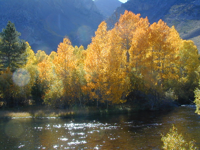
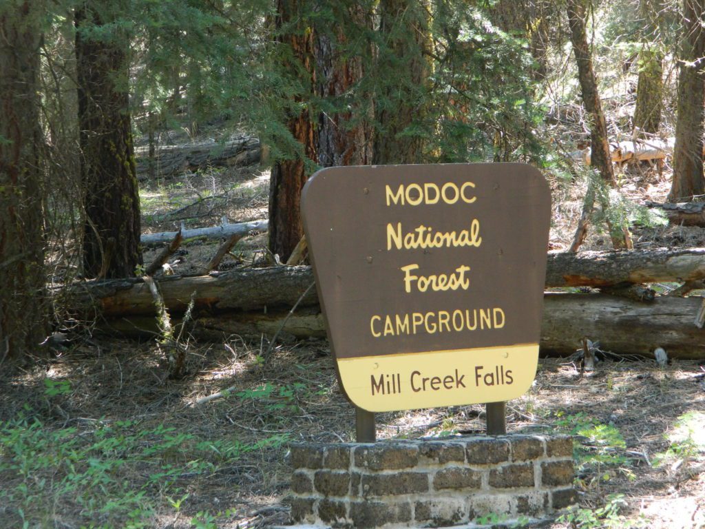
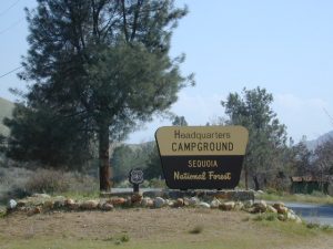
Sequoia National Forest Campgrounds
Kern River, Southern Sierra Nevada

All the developed campgrounds listed below charge an overnight fee. Some are open year round, while others close for winter. Few are walking distance to the market, some may have piped running water, and garbage collection. Most have paved loop driveways and can accommodate large RVs. All campgrounds have bathroom facilities.

kern campgrounds California NFS Kern RVing

Upper Kern River
North of Kernville, California

campground

elev

spots

veg

toilet

notes

Fairview Campground

3500′

55

mixed

vault

Upper Kern; RV 45′

Gold Ledge Campground

3200′

37

mixed

vault

Upper Kern; RV 30′

Headquarters Campground

2800′

44

alder

vault

Kern River; RV 27′

Hospital Flat Campground

3000′

40

alder

vault

Kern River; RV 30′

Limestone Campground

3800′

22

mixed

vault

Upper Kern; RV 30′

gold ledge lupine
Gold Ledge – blooming Lupine in Springtime

fishNo day use parking lot inside the campgrounds. Park outside the camping grounds for recreation: fishing, hiking, mountain biking, rafting or wildflowers.

This entire canyon is dedicated to outdoor recreation w/ very few residential streets. Southern Sierra Nevada mountains – the whole Kern River area draws a lot of traffic from its proximity to Southern California.

headquarters kern

eriklovinglife
Outdoors, enjoying lIfe


South Creek Falls
South Creek Falls

RV campgrounds campgrounds hiking fishing campgrounds mt biking campgrounds

Lake Isabella
Lake Isabella, Kern Canyon California

Lower Kern River
South of Kernville, California

Granite Boulders

campground

elev

spots

veg

toilet

notes

Sandy Flat Campground

2300′

38

mixed

vault

open all year

Hobo Campground

2300′

35

mixed

vault

2019 closed due to landslide

NFS
Sequoia National Forest
Kernville Ranger Station
760-376-3781

Additional Info on Kern Camping –

Kern Flats Camping: Free Camps
Lake Isabella
Keyesville OHV

North Meadow

Big Meadow Sequoia 

dirtbikescamp hiker

Kennedy Meadows, South Fork of Kern River
Chimney Peak Backcountry Byway
Dome Land Wilderness

Kern River Canyon
Kern River Hot Springs

Road’s End Resort
(destroyed by wildfire 2002)

Forks of the Kern
Lloyds Meadow Road #22S82

kernrvcamper

28S06 – Sequoia NF

breckenviews
Southern Sierra views from Breckenridge

Breckenridge Road: Forest Rd# 28S06 – Sequoia National Forest

breckenridge

Also known as Kern County Rd# 218 (or old Benchmark Atlases have it marked as road #28S03).

Breckenridge Mountain is the southern most portion of Sequoia National Forest, a 7500′ peak between Kern River & Tehachapi, CA. Breckenridge Road can also be reached just N of Lamont, CA. Meadows, pine forest & a few secondary dirt roads. The 30 mile narrow route thru Breckenridge Mountain ridge line is paved the whole way from Caliente Bodfish Rd (County Rd# 483) @ Havilah Canyon all the way to Hwy 58, but often closes in winter months due to snowfall.

28S07
Camp Road # 28S07

Breckenridge Campground, via dirt road# 28S07, is the only developed campground up here. It is very forested, has 8 basic camp sites @ elevation 6600′. Windy and cold, sometimes.

breckendusk

Side route# 28S62 leads 5 mi, out to a fire lookout tower.
#28S22 leads to Munzer Meadow.

breckensign

Southern Sequoia National Forest

NFSlogo


longwayup

nearby towns:

snowispossible
Snow is possible, above 5000′ elevation

regional maps:

Cold Springs Campground

Cold Springs

Mineral King Campground, Sequoia NP

NPSSequoia National Park: Cold Springs Campground in Mineral King Area

A large developed camp ground with bear lockers, a raging creek, some walk in sites, & access to the Sierra Nevada high country trails.  This is the last real campground in the main valley, everything beyond this spot is pure alpine highcountry.

9000′-13,000′ peaks – in the Southern Sierra Nevada mountains. Car camp, tent camping or bring a backpack and climb to pristine lakes and into the real Wilderness.

Cold Springs Campground, California

on the East Fork of the Kaweah River, closest campground to the hiker trailheads @ Mineral King Valley. Mineral King Road open May-October (depending on snow)

Atop the mighty canyon sits mountain passes, peaks and lakes above 10,000′ elevation. A rocky alpine valley of wonder and water, granite, dark skies and a good night sleep. Black bears and hikers are everywhere, anytime.

This sweet spot river campground has more than 25 camp sites, but there is not a lot to choose from way back here on the dead end back road known as Mineral King in California.  Just up the road a piece from Silver City. Nearest real town is Three Rivers near Sequoia NP south gate, California State Route 198.

Western Sierra /

Sequoia South Camping –

37 camp sites in Mineral King @ 7500′ elevation
vault toilets, river and piped water, bear boxes
first come, first served camping

Max Camper Length: 0
(RV, motorhomes, camper trailers are not allowed)

Rangers Office: 559-565-3768

Cold Springs Campground has several campsites right on a river with other sites set up a steep forested hills. There are good number of walk-in camp sites at the end of this campground, ideal for backpackers arriving late at night. The actual walk is more like a hike, so be prepared to carry your stuff a mile down a steep forested trail. You will be rewarded with a great camp spot, near the river, away from the parking lot and noise of the car campers above. Tar Gap hiking trail leads out of Coldsprings campground and straight into the back country.

Coldsprings Camp & Atwell Mill are the only options for local tent camping.
Strapping on a backpack and heading for the high country is what most visitors do, as this is an ideal high country trailhead accessible from the western reaches of the Sierra Nevada range.

Mineral King trailheads lead out to – 
alpine fishing lakes
mountain peaks
Great Western Divide
Kings Kern Divide
Kern Canyon Wilderness
South Sierra Wilderness
Golden Trout Wilderness
Sequoia National Park
Kings Canyon NP
Sequoia National Forest
Mountain Home State Forest
Giant Sequoia National Monument
John Muir Wilderness
ROAD CONDITIONS:

East of Three Rivers, CA on Highway 198 – Mineral King Road peels off to the right, south east to a vast 30 mile long canyon. This mostly paved route closes for winter months when snow is present and rock slides are common. There is a few miles of unpaved, graded 2 lane road, but the majority is paved. Late spring (May) is typically the opening season for this road. RVs, buses, and trailers are not allowed on this narrow, winding road!

MineralKing

BIG TREES NOTE: Although this gorgeous, secluded canyon is located within Sequoia National Park, there are no Sequoia redwood trees in this particular canyon. And you might need to drive an hour up the other mountain to reach them. Just a consideration. If you have your heart set on the seeing the big trees, go do that on another trip. Mineral King is a journey and after your drive that road you will understand a few times.

HIKER PARKING: The NPS rangers station is walking distance from Cold Springs Campground. A beautiful meadow walk to the east of the campground. Bears are known to frequent the area, so locking all food in the provided metal bear lockers is a must.

Badgers are a problem too. Them critters eat radiator hoses – no joke! A good roll of chicken wire could be needed if you plan to leave your car unattended for any length of time.

View Mineral King Camping in a larger map

Mono Hot Springs

High Sierra Nevada
Mono Hot Springs

Sierra Snowmobile Destination

Mono Hot Pools @ San Joaquin River
Sierra National Forest

Best of both worlds, way back in the boonies – two primitive tubs soaking perched on a soggy hill next to a big river, developed campground below, and a small resort w/ cabins, camping, restaurant and private soaking areas on the other side of the river.

Sierra hot springs15 mi. NE of Huntington Lake off Kaiser Pass Rd. Huntington Lake & Hwy. 168

Two squared cement tubs overlooking the San Joaquin River, deep in the Sierra Nevada Mountains.

The coolest thing about this primitive hot springs is that it is a great destination for a one day snowmobile adventure. Rentals are in the nearby community of Lakeshore & the plowed paths are fairly easy to follow. If you plan on visiting the springs, you must not play around in the meadow much, there is plenty great Sierra scenery to be had. The snomo trip is a good 5 hours round trip with a lunch break & dip at mineral spring tubs.

  • backpacking
  • boating
  • camping
  • cross country skiing
  • fishing
  • hiking
  • horseback
  • kayaking
  • mountain biking
  • mountaineering
  • snow mobiling
  • stargazing
  • swimming
Sierra Snow-Mobiling
Sierra Snow-Mobilin’

snomo sierra hot springs

Kasier Pass WildernessWinter: road is closed half the year due to heavy snow. Summer: snow is gone and the road is open.

KAISER PASS ROAD
Large motorhomes, RVs are not allowed on this long, steep, narrow paved route.

Max vehicle length: 25 feet

Take Hwy.168, turn right on Kaiser Pass Rd, just past the big ski resort. Pass the large meadow & follow signs to Mono Springs & Lake Edison. Make sure not to miss the left turn or you may end up at Florence Lake.

Parking near the green bridge over the San Joaquin River & hike over to the tubs on the hillsides. If there are other vehicles parked here, expect to see naked people nearby; Soaking should never be rushed. Clothing is optional – in California.

Green Bridge at San Joaquin Headwaters
camp

Mono Hot Springs Campground NFS

• Elevation: 6700′
• Number of Sites: 30
• Vehicle Accessibility: RV 25′
• Camp Fee: Yes
• Campsite Reservation: Yes
• Toilet: Vault
• Length of Stay: 14 Days
• Season: June – September
• Trailheads: Ansel Adams & John Muir Wilderness

NOTE: This USFS Campground, should not to be confused with the neighboring business, a privately run camp called –

Mono Hot Springs Cafe w/ Cabin Resort

Mono Springs Sign

closest forest, lakes, & destinations:NFS

topo maps for this region:

Parking Spot

Shasta Lakes Camping

camping whiskeytown

Unbeknownst to most California tourists, the “Shasta” region encompasses most of the northern part of the state. From the majestic Trinity Alps to raging Burney Falls; the huge, snow capped peak of Mount Shasta can be seen by half of NorCal. From the high country on the north side, to the Sacramento Valley on the south side. Shasta dominates this region all around Redding and I-5.

Northern California has numerous camping lakes, most of which are very RV friendly. Boating, fishing, hiking, kayaking & even houseboat rentals are available at Lake Shasta.

The Big Lake you see from Interstate 5 is named Shasta Lake, the main drain from the northern reaches of Oregon. The big reservoir in the middle of the North State.

canoeWhiskey Town Lake is west of Redding, with Trinity Lake tucked way back up in the hills – N of Weaverville.

You could spend a lifetime exploring all the lakes in the Shasta area. On foot, by bike, with a fishing pole and a pack llama. Maybe just an old funky motorhome.

camptruck

Lake Road Trinity


boatramp

towns nearby with camping –

Weaverville, CA
Trinity Center, CA
Douglas City, CA
Lewiston, CA
French Gulch, CA
Shasta, CA
Redding, CA
Shasta Lake, CA
O’Brien, CA
Lakehead, CA
Dunsmuir, CA
McCloud, CA
Mount Shasta, CA
Burney, CA
Weed, CA

Santa Barbara Camping

Campground Santa Barbara – Lake Cachuma
Los Padres / Santa Barbara District:

campground elev spots veg toilet water notes
Cachuma Campground 2100′ 8 mixed vault creek year round creek
Fremont Campground 1000′ 14 oaks flush piped March-Sept
Lower Caliente Camp 1800′ 2 oaks vault no hot springs
Middle Santa Ynez 1500′ 9 trees vault creek shady
Mono Campground 1400′ 4 trees vault creek shady, 3 walk-in
Paradise Campground 1000′ 13 oaks flush piped reservations
P-Bar Campground 1500′ 4 vault creek water can close
Upper Oso Campground 1200′ 23 oaks flush piped corrals, OHV traffic

Some of these camps above may have been damaged in recent wildfires, so it’s best to inquire before you make the drive. Call rangers to verify or have a backup alternative (plan B). See more campsites @ Santa Barbara Beach Camping

Los Padres Forest Headquarters
Goleta CA
805/968-6640

Santa Barbara District
Santa Barbara CA
805/967-3481

San Lucia District
Santa Maria CA
805/925-9538

NFSlogo

Los Padres National Forest

maps of the Los Padres region –

dscn5027
Upper Oso Campground in oak hills behind Lake Cachuma w / horse corrals

Mount Pinos

Mt. Pinos

Sierra Views from Pinos
Originally uploaded by danamight

Mount Pinos Recreation Area

The Mt Pinos Recreation Area is located on the border of Southern and Central California, inside Los Padres National Forest. After passing Frazier Park, the winding, paved, mountain road starts atop Cuddy Valley and is approximately 12 miles from Interstate 5 @ Tejon Pass. The 8831′ peak is the tallest in Kern County and is a popular spot for both summer and winter recreation: cross country skiing, snow shoeing, backpacking, hiking, mountain biking. The snow gates often close during heavy snow.

Mount Pinos Road starts atop Cuddy Valley Rd, at the “Y” – where it intersects with Mil Potrero Highway, which heads out to Pine Mountain Club, California.

One mile up the Mount Pinos route, you will find McGill trailhead on the right side (it is popular w/ mountain bikers) and then the first snow gate at Burbank Rd. Another 4 miles up hill, you come to the only set of dirt roads accessible on this range. A left turn will take you winding thru pine forest to the valley below. 4×4 is not required, but a National Forest map could be very handy. Unfortunately all the private properties at the bottom have locked gates & no thru access to Cuddy Valley is allowed. Although it is an awesome drive to just go exploring in the woods, there is no way out (once you get down the hill), so you must return the same way you came.

Back on the main route, shortly after the dirt roads is McGill Campground on the right side & another snow gate. In another mile and a half you will reach Mt Pinos Campground on the left side; the entrance is easy to miss. From here you are less than 2 miles from the end of the main road.

Mountain Bike, Hike, Backpack, Camp, XC Ski, Snow Sled

Darkest Skies for Stargazing in Southern California

The huge paved parking lot is the dead end (2 miles from the peak of Pinos) – very popular with astronomers, mountain bikers, plus the families and snow sledders in winter (if the gates are open). A National Ski Patrol’s Nordic Base, the only building you will see up this way. At 8300′ elevation, the large parking area is perfect overnight spot for amateur astronomers, so be considerate when visiting night. New moon (no moon) weekends APR-OCT are optimal viewing months. In busy summer months you can often find motorhome campers all set up with expensive equipment tracking the heavens all night long. Please be respectful of their hobby & eyes; Turn off headlights when you approach the parking area at night.

hiker

There is also a hike-in, freebie camp ground called Chula Vista; an easy quarter mile walk from the parking lot to 12 camp sites & a pit toilet. Mountain bikes dig this area too. A large meadow here blooms with wild irises in summer, only sometimes.


Trail 21W03 Mt Pinos

Originally uploaded by danamight

ROAD CONDITIONS to Mount Pinos, call the rangers 661-245-3731

Pinos – Peak to Peak Hike

The trailhead for Pinos Summit starts at this parking lot. It is a 2 mile moderate, but steep hike on an old fire road. The neighboring peak to the west is called Mount Abel @ 8286′ elevation (aka Cerro Noroeste). The infamous peak to peak hike along the ridge line from Mt Pinos to Mt Abel is 6.5 miles one way – and very popular in summer months. This hike requires 4-6 hours & a car shuttle should be arranged in advance. The Chumash Wilderness sits between Mount Pinos and the tiny community of Pine Mountain, which can be seen below on many places along the hike.

camp

There are 3 developed campgrounds in the Mount Pinos Recreation Area:

McGill Campground accepts reservations online. Campgrounds are often closed during winter months, due to snow. (Oct-April)

DARK NIGHT SKIES: Amateur Astronomers unite!

thebigboys
Pinos star gazers out in force
summitsign
Hiking Trails to Mount Pinos, California


drummersout
Drummers Solstice Campout

flagspinos

LOS PADRES MAPS:

Los Padres National Forest Map

Los Padres Forest Topo Atlas

NatGeo Los Padres East Map 

Sespe Wilderness Trail Map

Dick Smith Wilderness Map

NEAREST TOWNS:

Chumash Wilderness
Mt Abel trailhead looking East to the Mount Pinos range. Pine Mountain Club, and the Sierra Nevada mountains can both be seen from this vantage point

see the neighboring mountain peak, Mount Abel

Camp O Alto @ Cerro Noroeste