Sherman’s Pass, Sequoia National Forest
Big Meadow borders Dome Land Wilderness
in the Southern Sierra Nevada mountains
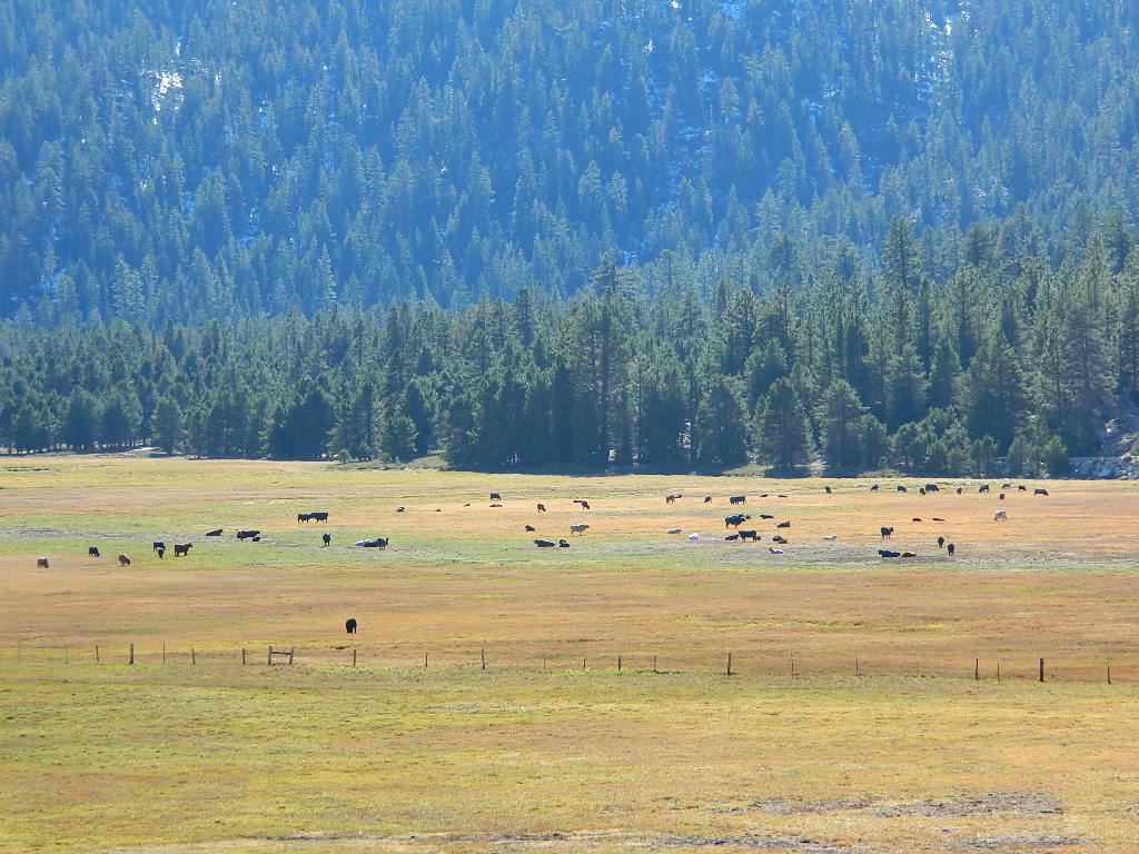
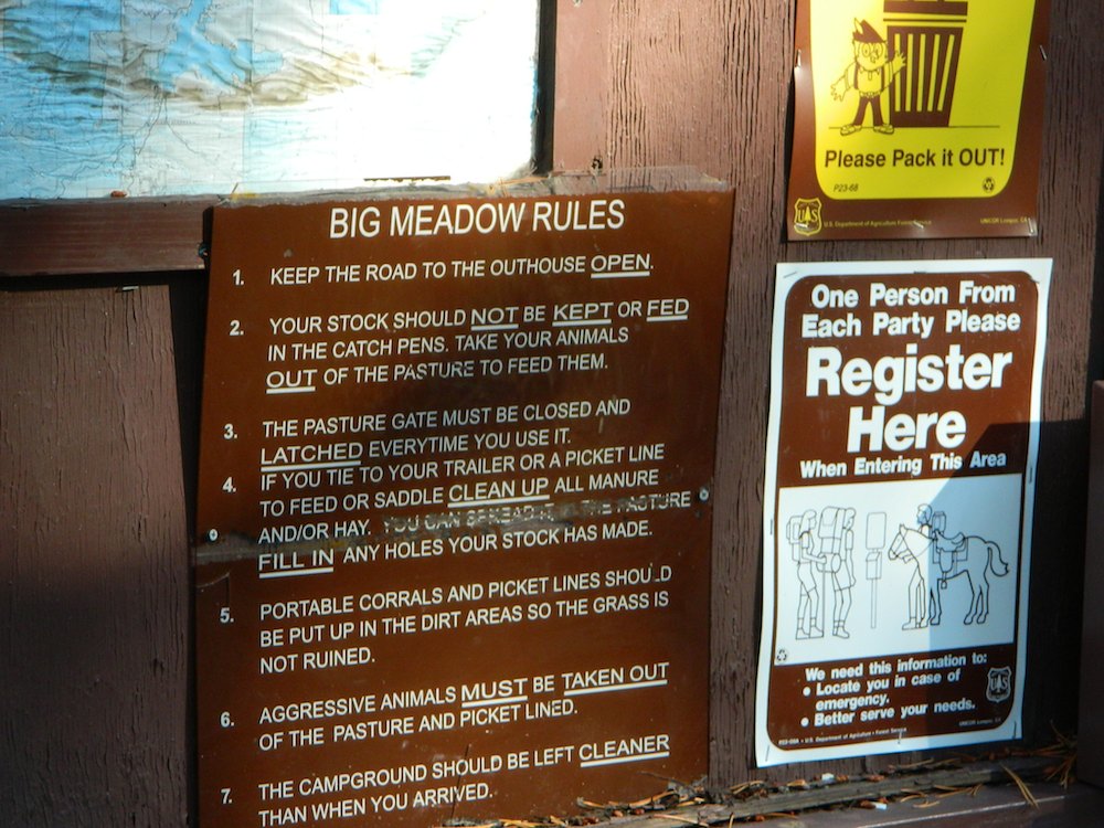
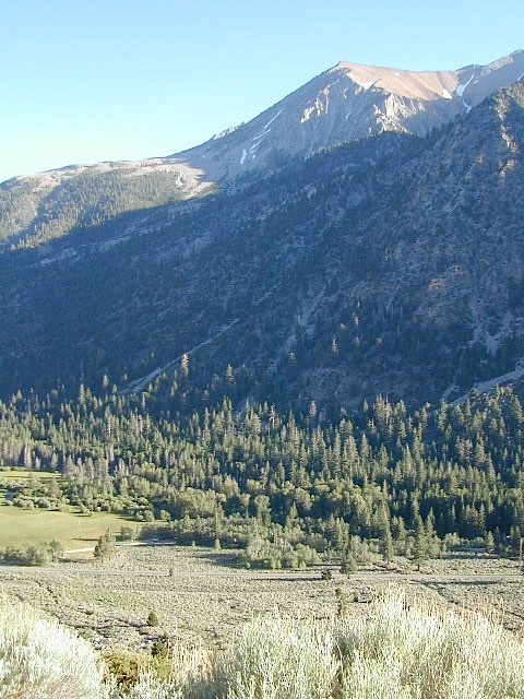
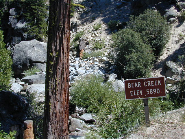
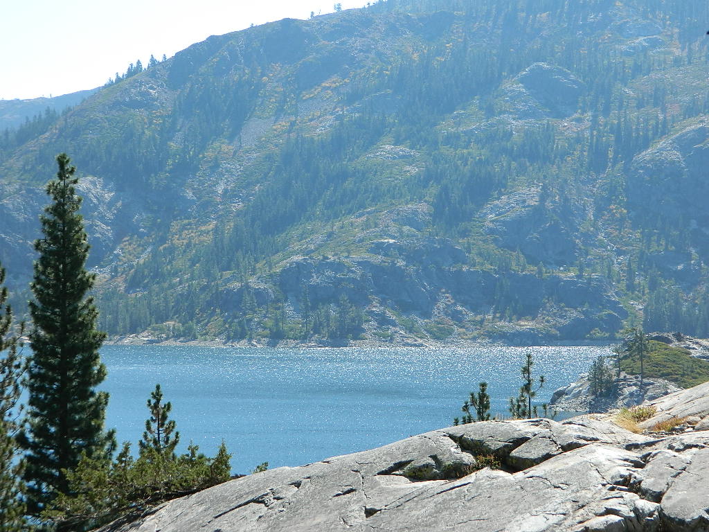
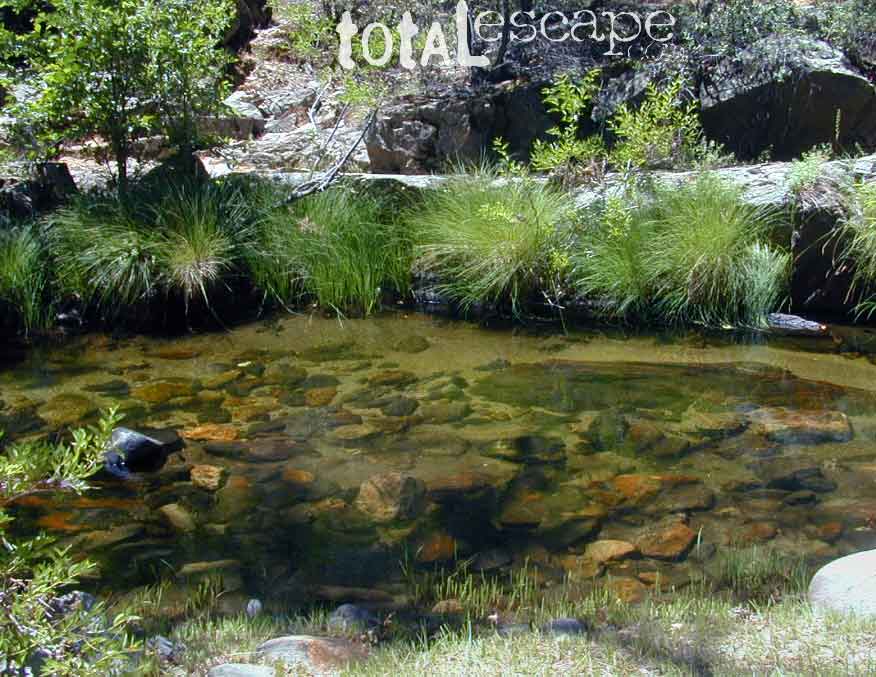
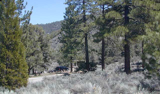
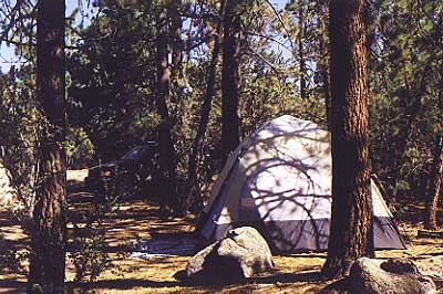
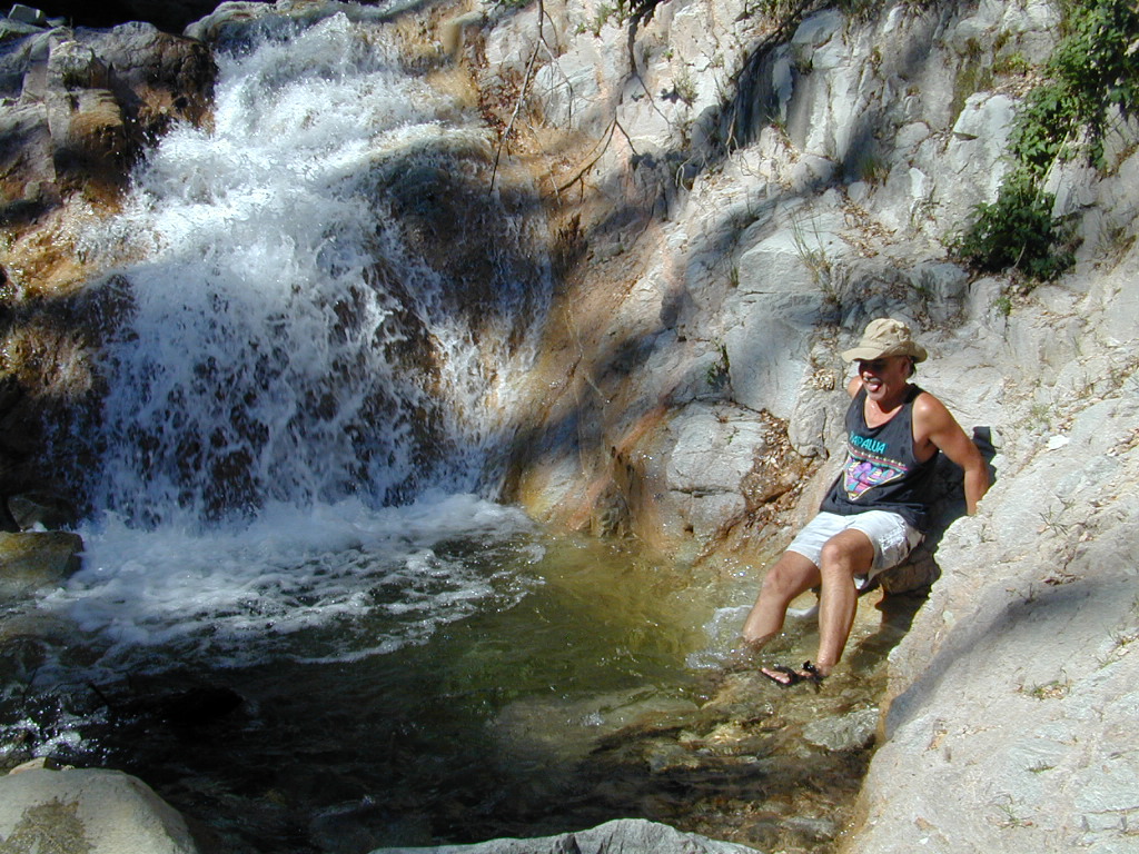
There are many large and gorgeous meadows inside Sequoia National Forest, but none compare in ‘grandeur’ to this southern Sierra public pasture. BIG MEADOW KERN
Find your way north of Kernville and the river really comes into view. Up close, right there! Stop, get out of the vehicle for a stretch break and breathe; take it all in. This is only the start of the adventure. Gorgeous Big Meadow is located up on the Kern Plateau, 3000′ above the river on the eastern ridges. Only accessible half the year due to snow, this meadow is a must see for those exploring the eastern side of the Kern River.
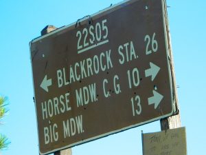
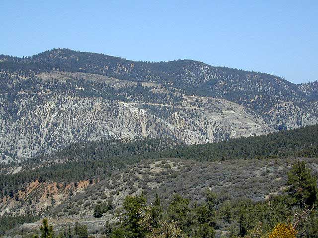
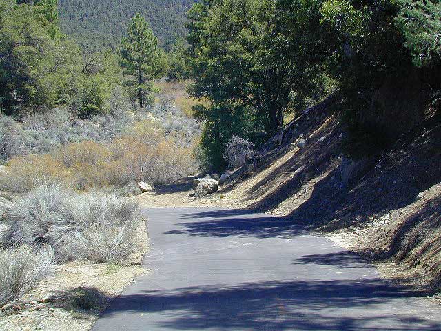
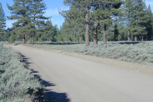
Sherman’s Pass Road #22S05 is a hard right turn after the Johnsondale Bridge. It is well signed and still easy to miss. Climb out of the dryness and into the dense forests and meadows of higher altitudes. Driving this southern Sierra-crossing route, Sherman’s Pass Rd. will require all of your concentration. Steep, curvy road without guard rails. Plus epic, scenic views (NOT to die for).
At this point – Rock slides, snow gates and road closure are typical in winter months. Check w/ rangers in Kernville about road conditions (before you head up this way).
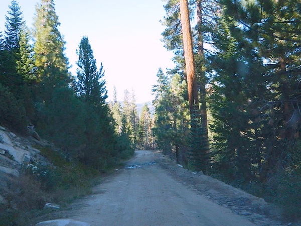
The partially paved road will lead south a few miles, then becomes GRADED DIRT and ventures another 15+ miles – way, way out into dead-end territories. Not one road connects down to Lake Isabella!
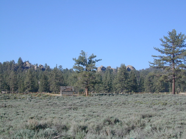
Spur roads (all one lane, dirt roads) lead out to various places like – Cherry Hill, Big Meadow, Horse Meadow Campground, Dome Land Wilderness Trailheads, Manter Meadow, Salmon Creek Falls, Cannel Meadows, dozens of trails and spurs. Plenty of primitive camping back in these forest areas. A high clearance rig may be required the further back you go. Mud and snow are quite common in spring and fall.
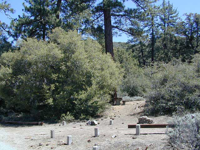
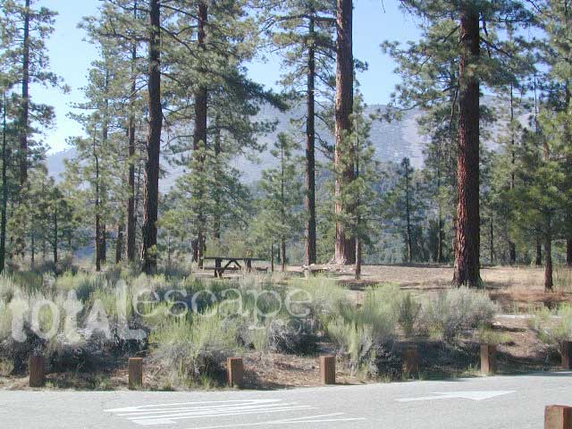
Extra Large Camp Sites
BIG MEADOW is a favorite camp area among –
backpackers (trailheads)
equestrian (horse campers)
hunters
mountain bikers
off-road campers
westside drive: ample parking and camping for horse trailers
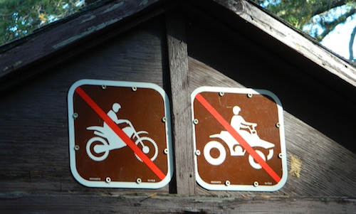
no ‘froading on meadows
Back Loop Road, around the Big Meadow. Narrow & muddy
Or perhaps this is not the Big Meadow near Sequoia that you are seeking. The scenic, giant, public horse pasture listed above is not to be confused with #14S11 Big Meadows Road, also in National Forest land, located in between popular Sequoia National Park and Kings Canyon. (100 miles north of here)
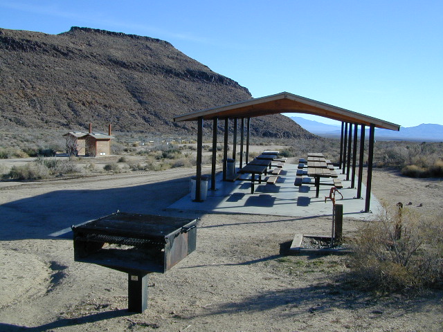
Kelbaker Road is one of the well-traveled back roads in the Mojave Desert connecting two major Eastern California routes of Interstate system. The I-40 to the south and the I-15 to the north, spanning 50 miles from one to the other.
Kelbaker Rd continues south to T up w/ historic Route 66 near Amboy, CA. Gasoline is very iffy in Amboy, so remember gas up in Barstow.
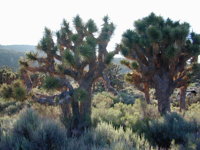
This region is super scenic portion of Kelbaker Road, which cuts thru the western edge of Mojave National Preserve. The Kelbaker pavement reaches to an elevation of 4024′ at Granite Pass, about 6 miles north of the exit @ interstate 40. Boulder outcroppings, bare mountain peaks, secluded cove camp sites w/ dirt roads, and old mines all over. Joshua tree forest and pinyon pine forest encircle the Mid Hills region.
Some roads are suitable for passenger cars, but many are NOT. Dirt slides, erosion gullies, wash outs and rocks are common on these roads, so drive slow and pay attention. Have a spotter get out and take a look at the road conditions. Have a stroll, in the dark w/ the flashlights.
Or risk bottoming out, getting stuck in a deep rut. RVs should be very cautious. Daylight arrival is usually key for getting a perfect camp site, unless of course, you had it way-pointed on the GPS. Bingo! But the torrential thunderstorms, rearranged the valley since then, so use your brains.
There are private property ranches, active railroad tracks & BLM lands along the Kelbaker route. Some of the boundaries of NPS have been extended, so best to bring a decent topo map.
Free camping is abundant in this desert region, but it’s all primitive w/ no facilities and all are on dirt roads when your turn off Kelbaker. Some of the best camping areas are around 4000 feet (above sea level), so serious wind and even snow is quite possible in the winter months. Go prepared w/ plenty firewood.
Historic Mojave Trail (aka Mojave Road) is out this way. Dirt bikes, off roaders love this trail that connects the Colorado River @ Avi Casino to Afton Canyon near Barstow.
WILDFLOWERS – joshua tree, yucca, barrel cactus
Higher elevation deserts bloom in late Spring, generally March thru May. Perfect rainfall timing in the autumn, can determine wild blooms and flora months later. Providence Mountains SRA can be a good location for wildflower viewing.
Kelso, CA
Kelso Depot: historic spot, centered around the old train depot, which has been restored and has become the new visitors center and museum. Totally worth a 2 hour stop and HIKING/WALKING stretch break. The road heads north from Kelso and the name changes to: Kelbaker-Cima Road
Cima, CA
Cima Store, 20 miles to the north is one of the few businesses in this region. Post Office next door, maybe. Cima Road connects to I-15 in approximately 15 miles north. Kelbaker Road splits again and it heads up to I-15 @ Baker, CA
Yosemite East – Tioga Pass Hwy 120
Inyo National Forest
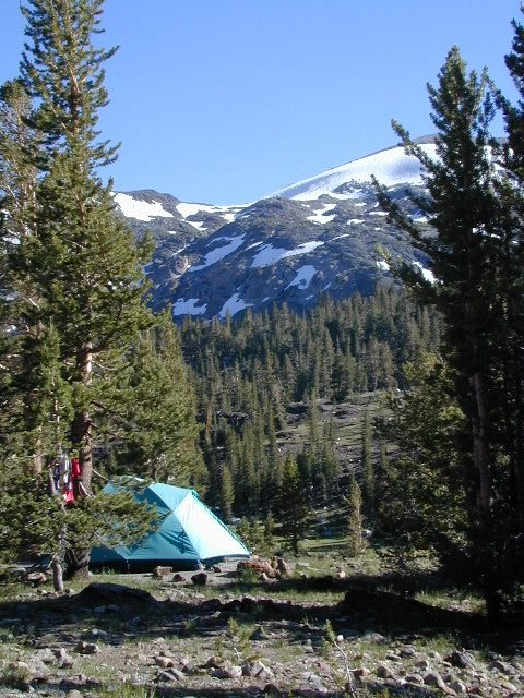
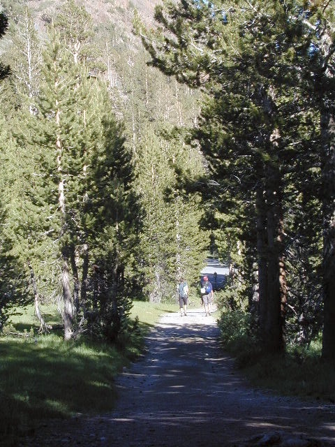
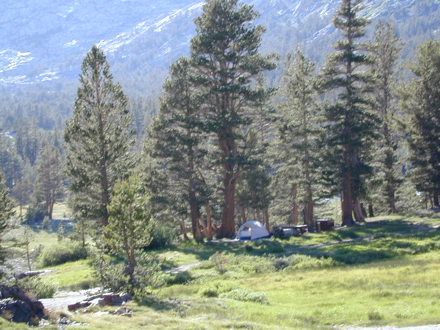
Wanna little exercise with your campsite? Well this spot is by far, a hikers dream. Located in the Sierra Crest, the High Sierra Inyo National Forest. On the east side of Yosemite National Park (just outside the park boundary) and accessible only half the year – due to deep snow. This spot is walking distance to numerous hikes, lakes, peaks and historic Tioga Pass Resort.
walk in to tranquility and beauty
From California Highway 120, east of Tioga Pass, locate the paved Saddlebag Lake Road. This super scenic hike-in campground is located on the left side of the road, just before Saddlebag Lake.
tote road
The foot trail to the camp sites require that you physically carry (haul) your gear at least a half mile. Picnic tables and fire rings, plus a vault toilet. Bare bones, but the scenery is oh so worth it!
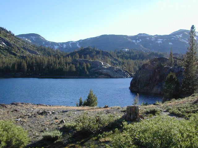
Located in a scenic canyon with the headwaters to Lee Vining Creek. Super high elevation with the darkest skies around. Camp sites are set on an embankment above a meadow and creek bed below. Impressive snow capped peaks surround the whole area.
The small parking lot is limited to 15 parking spots. Most campsites have room for two tents. Each campsite a locker for food storage. (bear country = store food properly)
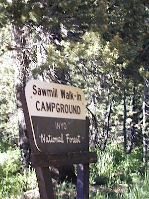
Sawmill Campground
• Elevation: 9,800′
• Number of Sites: 12
• Camping Reservations: No
• Sites Available: First come, First serve
• Vehicle Accessibility: none
• Length of Stay: 14 Days
• Water: No piped water
• Toilet: Vault
• Season: Closed during winter & spring
• Fee: Yes
• Operated By: National Forest Service
• Closest Town: Lee Vining, CA
This Sawmill Camp should not be confused w/ Sawmill Lake, a 4×4 camping lake, inside Tahoe National Forest, near Donner Pass i80
Inyo National Forest @ Yosemite East
Tioga Pass Hwy 120
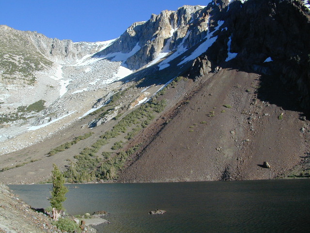
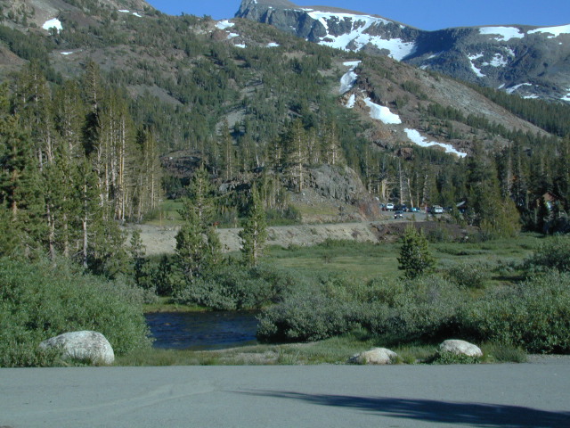
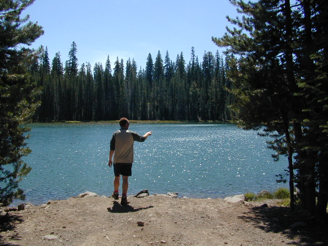
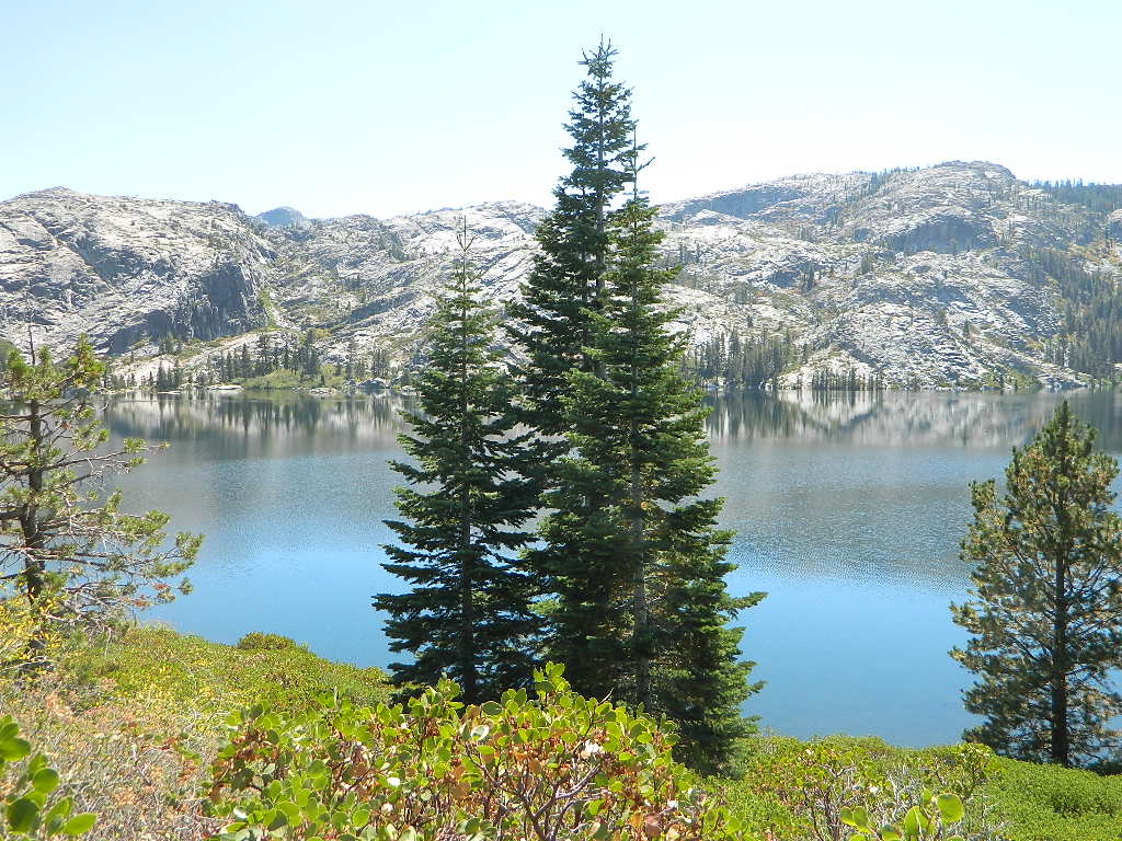
This spectacular setting has a top-of-the-world feeling to it. Gorgeous meadow area, right along the main highway, with a small lake next to giant rock slides and impressive granite mountains.
The air is thin, the sky is clearest blue, the snow is melting, the stream is trickling and the nights are chilly – even in summer. Bring a winter coat and extra blankets, if you plan to camp.
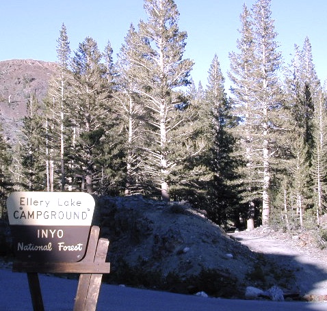
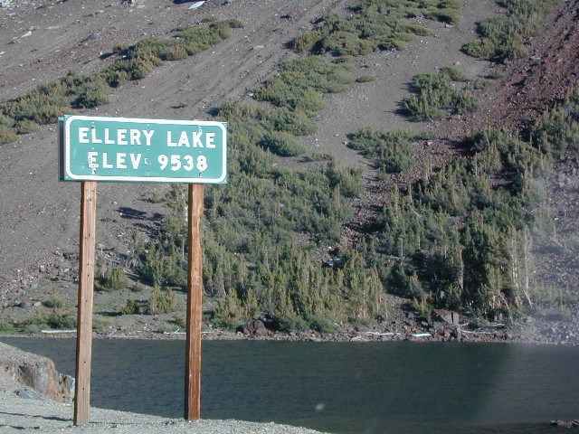
Ellery is small campground is located just outside the EAST GATE of Yosemite National Park, along Highway 120 Tioga Pass. Easily accessible and fully paved, this camp is only open half the year due to deep snowpack. The snow usually melts by June, and camp often closes early due to higher elevation weather, sometime in October or November.
Lee Vining Canyon is to the east and Mount Dana is to the west.
Ellery Lake is one of those magical places, where you can spend all day out in nature – without needing to drive anywhere. Gorgeous high country scenery surrounds you in every direction. Walk over to nearby meadows, creeks or neighboring lakes. Climb mountain peaks or enjoy extended day hikes. Watch wildlife from camp or fish in the lake. Stargaze at night w/ the darkest skies around.
Or how about, walk to dinner? This place is easy walking distance to the historic Tioga Pass Resort, where you can enjoy a real, sit-down meal at the cafe. (Hope they will re-open 2020)
Ellery Lake – camp, hike, fish or kayak. No motor boats allowed.
Travelers heading to or from the National Park, often stop at Ellery to take photos and walk around. There is always a flurry of activity around easily accessible lakes and this one is no different. The busy highway and constant traffic may be heard from camp, but the ideal location and epic lake makes up for the inconvenience.
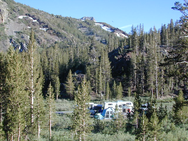
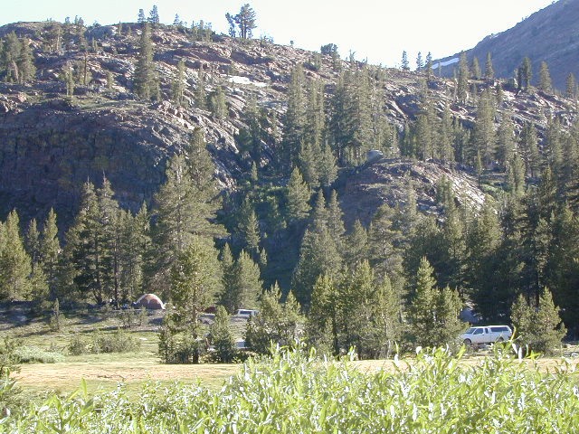
This NFS campground is one of many small camps located along the highway, on the east side of Yosemite National Park. This special place is in high demand, can fill up fast and is quite busy most of the summer.
perfect for tent campers
Small parking areas, tight walkways, landscape and minimal campsites makes this a “no-turn-around” kinda campground, so don’t bring that huge RV (cuz it won’t fit).
Most sites do not have enough room to park a second vehicle at all. Each campsite has a locker for food storage. (bear country = store food properly)
Ellery Lake Campground
• Elevation: 9,538′
• Number of Sites: 12
• Camping Reservations: No
• Sites Available: First come, First serve
• Vehicle Accessibility: Vehicle limit 28 ft.
• Length of Stay: 14 Days
• Water: Potable water
• Toilet: Vault
• Season: Closed during winter & spring
• Fee: Yes
• Operated By: National Forest Service
• Closest Town: Lee Vining, CA
Inyo National Forest @ Tioga Pass, Hwy 120
Yosemite High Elevation Camp
Tioga Pass camping on the eastern side of Yosemite National Park, just outside park boundaries is Inyo National Forest lands. Snow is generally deep and the road doesn’t open until late spring or early summer.
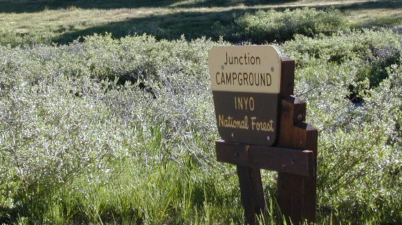
Inyo Junction Campground – located at the intersection of Tioga Pass Hwy 120 and Saddlebag Lake Road.
Several prime campgrounds line the busy Tioga Pass, highway 120. Most NFS campgrounds are small and located along the busy highway just outside the National Park gate. This one is set back (slightly) from the main road and accessible by RVs. It is also located next to the historic Tioga Pass Resort, walking distance and on the same side of the highway.
High altitude small lakes, great views, thin air, snow melt, spectacular elevations and dark skies makes this an awesome stargazing spot. Summer is busy with travelers, tent campers and day hikers. First come, First serve, when it is open (only half the year).
Junction Campground
• Elevation: 9,600′
• Number of Sites: 13
• Camping Reservations: No
• Sites Available: First come, First serve
• Vehicle Accessibility: Vehicle limit 28 ft.
• Length of Stay: 14 Days
• Water: No water spigots; lake nearby
• Toilet: Vault
• Season: Closed during winter & spring
• Fee: Yes
• Operated By: National Forest Service
• Closest Town: Lee Vining, CA
Inyo Forest Campgrounds – Eastern Sierra Campgrounds
areas include: Lone Pine, Mount Whitney, Independence, Onion Valley, Ancient Bristlecone Pines, Big Pine, Bishop [Hwy 168], High Sierra, Owens River, Lake Crowley, Rock Creek, Mammoth Lakes [Hwy 203], June Lake Loop [Hwy 158], Lee Vining & East Yosemite National Park [Hwy 120]. Camping on Eastern Sierra Highway 395
Eastern Sierra recreation – backpacking, horse packing, day hiking, creek fishing, mountain biking, mountaineering, rock climbing
Listed below are Inyo National Forest campgrounds, County Parks, BLM public camps for outdoor recreation. Many campgrounds are closed for winter months. Blue links lead to more camp information. Boldface links to detailed information & photos on campground.
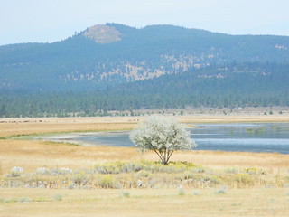
Lassen Volcanic Park is surrounded by beautiful mountains and lakes, some inside the National Park boundary, but most outside. Lassen National Forest, Thousand Lakes Wilderness, Lake Almanor, Hat Creek and Burney Falls encompass this pristine water wonderland of NorCal. Outdoor recreation all over – rivers, fish, hunt, camp, mountain bike, off road.
Backpack camps, RV campground, fishing lakes, day hikes, off-road and lake side camp sites, we have it all listed on Total Escape.
Hiking, camping, fishing all over this region! Mountain bike, kayak, or relax all day in the hammock – in a shady spot with a view. Water flows freely and annual snow melt is abundant in this part of California. Some locales may not open until July 4th weekend. Always check with the Lassen NFS rangers to make sure.
(lakes on the trail)
Crumberg Lake
Twin Lakes
Jakey Lake
Snag Lake 6076′
Horseshoe Lake
Willow Creek
Long Lake
Lassen National Forest lakes:
Majority of these lakes require dirt road driving to reach them. Often forest roads close for snow, usually during winter months (DEC-MAY)
Wilson Lake 5267′ Crater Lake ^ 6800′
Echo Lake
Widow Lake
Star Lake 6362′
Rising River Lake
Baum Lake
Murken Lake
Haynes Reservoir
Heart Lake
Willow Lake
Shotoverin Lake
Killer Camp @ Echo Lake
Caribou Wilderness:
Campsites with hiking lakes and wilderness trailhead access, right next to Lassen Volcanic National Park.
Echo Lake ^
Caribou Lake ^
Silver Lake ^ – Silver @ Lassen
Triangle Lake
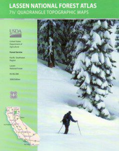
Find Lassen Maps, NFS Topo Atlas
Thousand Lake Wilderness:
North of Mount Lassen is the less-popular Wilderness Area w/ many miles of dirt roads to travel.
North Battle Creek Lake ^ 5571′
Logan Lake
Buckhorn Lake 4776′
Lake Eiler
Terry Lake
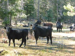
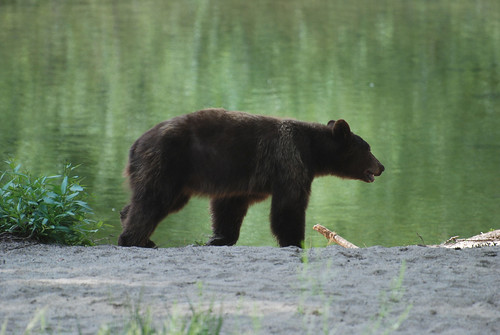
Although the grizzly bear image graces the state flag, grizzlies were killed off during the gold rush days. Black bears are found in California mountains and foothills, down to lowest elevations in NorCal. California black bears come in more than one color – light brown, cinnamon, dark brown, and of course, black. For the most part, bears usually stay away from people.
Some areas are more prone to bear problems due in large part to the overpopulation of tourists and abundance of food provided by them. Certain California National Parks are particularly notorious for their brazen bear populations. Concentrated bear problems are sometimes posted so be very aware and read signs. If you see steel bear boxes, leave no food or drink in your vehicle. Use the boxes to keep bears from breaking into your car!
Follow some simple rules:
Keep a very clean campsite
Clean up all dirty dishes & beverage containers (especially before bedtime)
Keep clothing & sleeping bags free from food odors or heavy scents
Never leave any type of food garbage ‘bagged up’, sitting outside of a cabin rental, motorhome, trailer, or mountain home
Store garbage properly inside a locked, sturdy container inside garage or a shed
Stay away from bear cubs, there is sure to be a protective (aggressive) mother in close proximity
Try not to hike alone. Make noise & sing on trails to scare away any unwanted animals.
Bear storage canisters are available at sporting good stores & at stores in most National Parks.
Proper Food Storage Outdoors:
Store food in closed up automobile, not visible. Store food correctly: in trunk of your car, or hidden from sight; in campground food lockers when available.
Lock all food, beverages and coolers in the provided metal bear boxes or bear lockers where available.
Toothpaste, deodorant & anything that has a scent should be thought of as food and stored accordingly.
Bears are so strong they can rip your car door open (in places like Yosemite, where bears are problem and you can get cited for not storing food items properly)
Bears are so strong they can break open a garage door to get to the smelly trash inside, so make sure you utilize the curbside pickup service available in some mountain communities or take a trip to the dump once per week.
DO NOT LEAVE FOOD OUT, UNATTENDED, outdoors…
during a picnic lunch, a quick snack, maybe a barbeque, or dinner around the campfire.
Birds, dogs, squirrels and wild animals can move in quickly.
Backpackers should hang food in nylon bag & drape over weak branch in high in tree: hang your food using the counterbalance method. Ranger who issues your wilderness permit can explain the hanging procedure;
2 stuff sacks (with drawstrings) for your food items, and 60 feet of medium weight cord. 2 carabiners make hanging much easier.
When primitive car camping on a dirt road, which does not have campgrounds, nor bear lockers, it is possible to store food in the vehicle. BEST location is on the front floorboards with towel over it. With the car alarm set at bedtime, any ruckus should trigger a decent alarm. Any large animal trying to break in will get blasted with alarm siren & most likely will run away. The noise will wake you up as well, to deal with the intruder, if need be.
If a bear does get into your camp area:
At night, bring bear repellent can into tent, storing it close to the door. Bring a weapon for added protection.
Make as much noise as possible: yell, bang pots/pans, whistle, air horn and get your bear mace or pepper spray ready in hand
Raise your hands up to appear larger; lift clothing, increase appearance of size and yell aggressively toward bear.
Get your entire camp group together, join hands and spread out; Everyone at the camp should be outside the tents in order to be as effective as possible
Throw rocks & small objects; pots, pans, chairs
If possible, try to get to your car for protection
Sound the alarm on a vehicle &/or honk the horn
If you encounter a bear on a hiking trail:
Make as much noise as possible while walking solo. Hum, sing, talk to the birds. Sing or talk to yourself – out loud. Bear bells can be worn on hiking boots. Do not hike w/ headphones on listening to music/radio.
Carry bear spray (mace or pepper) in a belt holster, or easy to reach pack.
If a bear approaches: stand still, slowly retreat, say a few calming words in a friendly voice and calmly retreat, keep eyes on the bear
Tucked way back in the granite high elevations, near Donner Pass is a wilderness water flow called Canyon Creek. Connecting small lakes and big reservoir, this creek is part of the Nevada District water supply. The Sierra Nevada region is Tahoe National Forest and the terrain is abundant rock.
Campground is perched on the edge of rock overlooking the impressive whitewater; sounds of crashing water at certain campsites is deafening. Half of the campsites are located in a forest loop and the rest are out in the open, with much granite and fewer trees, perfect for star watchers.
Canyon Creek California
Lake Faucherie is a mile up the creek and Sawmill Lake is a mile down stream, so it’s a great fishing location, as well as hiking, kayaking and canoeing destination. The Pacific Crest Trail (PCT) is also routed close by. A hiking trailhead at the north end of Sawmill Lake leads to a loop hike of small lakes.
roughest roads in the region
Campground loop is paved, but the 12+ mile access road is NOT.
Twenty plus miles of paved & gravel backroads in boulder-hopping bliss, leads to granite lined lakes and forested campsites. Two different driving routes into this canyon:
One is the longer way Road 18 – paved access off of Gold Country Highway 20, which becomes an 8 mile long, rocky, rough, one-lane road around Bowman Lake.
The other is slightly shorter, county road #843 that comes in the back way from Jackson Meadow Reservoir (off Hwy 89, N of Truckee).
Both of these primitive roads join at Jackson Creek Campground, a favorite among off-roaders.
Canyon Creek Campground is another few miles up Road ##843-037, a rugged canyon route towards Lake Faucherie, where the road comes to a dead end.
Don’t let the old maps fool you: these National Forest Roads are labeled as gravel roads, but boulders and rock slides are quite common. 4×4 would be nice, but high clearance is recommended.
Minimal signs designate trails, roads and lake access; What signs that do exist are old, faded and broken. No warning signage reading ‘high clearance’ or ‘4WD recommended’ – so obviously Tahoe NF won’t be installing new signs anytime soon.
backpacking
camping
canoeing
fishing
hiking
kayaking
stargazing
Faucherie, Sawmill and Bowman Lakes are all along this waterway called Canyon Creek.
National Forest Campground Latitude: 39.436863 Longitude: -120.579564
Canyon Creek Campground
• Elevation: 6600′
• Number of Sites: 20
• Toilet: Vault
• Vehicle Access: High Clearance Vehicle, no trailers
• Campsites Reservation: No
• Camp Fee: No
• Length of Stay: 14 Days
• Season: June – October
• Trailheads: Faucherie & Sawmill Lakes
• Managing agency: Nevada Irrigation District
530-265-5302
Canyon Creek Campground is an excellent campground for staying away from the crowds, which seem to focus more around Bowman Lake & Jackson Meadows Reservoir.
All campsites at this campground have steel bear boxes – for proper food storage in black bear country.
Prefer camping outside of developed campgrounds? then the primitive camp sites that line Canyon Creek will be a welcomed surprise. Most are clearly marked with small signs and some may require 4×4 to access. When fire restrictions are tight, campfires are only allowed in the developed campgrounds.
Yuba county, city and river are located in the upper Sierra Nevada, north Gold Country. Only a few small towns around here, but lotsa National Forest land and gorgeous granite rock. Yuba City is well known for its orchards, agriculture and diverse population. Yuba River is a recreation hot spot most of the year – spanning from the foothill canyons up to higher elevation alpine lakes. Camping, kayaking, fishing, camping, hiking, swimming holes & waterfalls.
Most of us want to dunk ourselves in a cool mountain stream when the temperatures get beyond 100 degrees, which is summer months in Central California. Big rivers, like the Yuba are popular spots for all kinds of outdoor recreation and they really draw the crowds. Find your own piece of solitude by getting a good topo map of the region and exploring well away from the main road.
This Yuba River gold country region of the Sierra Nevada mountains, is only about an hour drive up the hill from Sacramento; obviously, the further you drive the better it gets. Tons of one lane and dirt roads to explore. Fishing and camping almost everywhere.
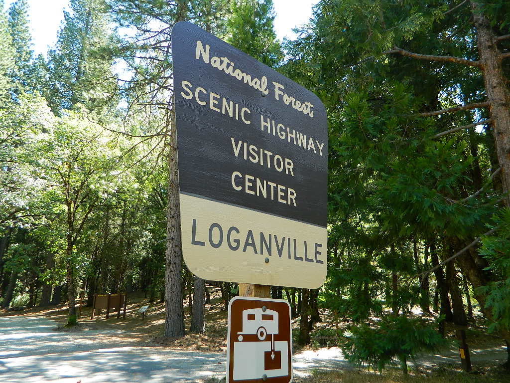
Loganville CampgroundIndian Valley Campground, Tahoe National Forest
Several NFS Campgrounds, line the North Yuba River right along the Highway 49, between Bassetts and North San Juan, CA
Wild Plum Campground
Loganville Campground
Union Flat Campground
Cannon Point Campground
Ramshorn Campground
Rock Rest Campground
Indian Valley Campground
Fiddle Creek Campground
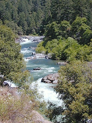
MIDDLE FORK of the YUBA
This water comes from the rugged and remote Henness Pass area. The long, dirt, historic route Road 293 which connects Reno, NV to the old mining camps along Highway 49 @ Camptonville, south of Downieville.
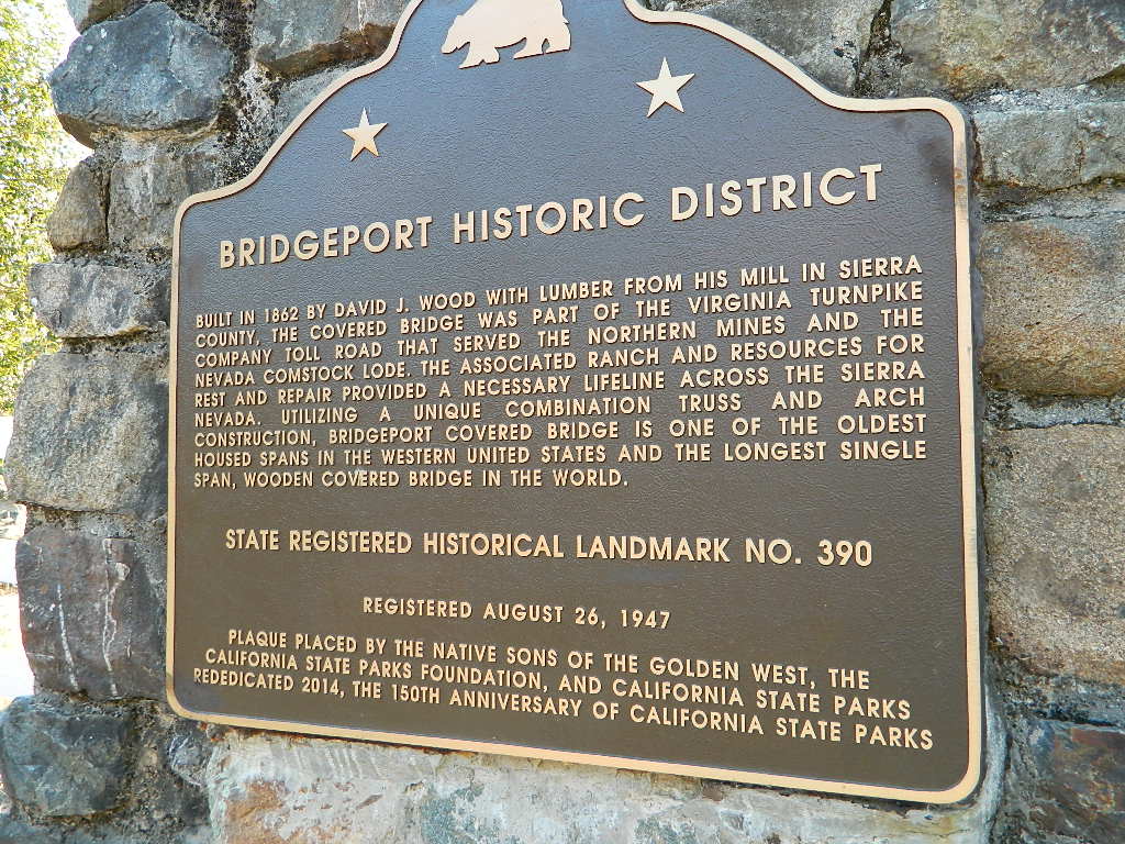
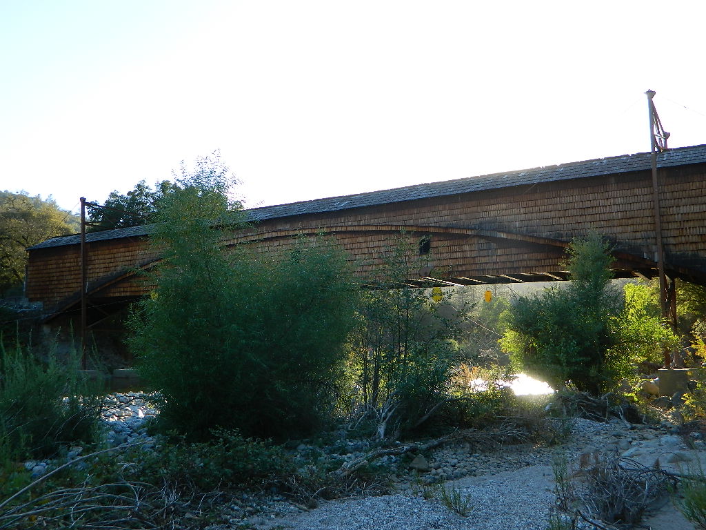
The Oregon covered bridge and the Bridgeport covered bridge run along this fork of the river. There is another State Park down @ Bridgeport; although bridge may be in reconstruction 2020.
A nice place to dip into the this fork of the river – is right off main Highway 49 on Moonshine Road, a secondary road that leads over to Bullards Bar Lake. Minimal parking spots and a steep hike down to the river; and you may have the whole place to yourself (on a weekday morning.)
SOUTH FORK of the YUBA
Donner Pass in the Truckee region, North side of Interstate 80. Snowmelt becomes creeks, around alpine lakes like Spaulding, Bowman, which all flow west. Graniteville & Washington, CA
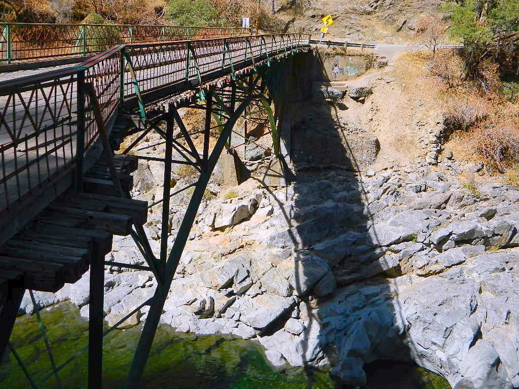
Edwards Crossing from 1898
A very popular State Park for South Yuba is located along Hwy 49, north of Nevada City, CA. Many backpacking trails, mountain biking trails and day hiking trails, plus several old bridges (crossings), built before 1900 still exist and in use. Bureau of Land Management has the quietest and cheapest developed campground around these parts, accessible only by dirt road (North Bloomfield Road).
Few National Forest Campgrounds are located on the South Fork. Many scenic, small lakes exist up in these higher altitudes, where the best camping is. Granite peaks, numerous creeks, forests and gravel roads.
Big Bowman Lake
BEAR RIVER, Lake Faucherie, Sawmill Lake and Bowman Lake are all part of this Yuba watershed, along with about a dozen other lakes. Rugged granite gravel rock rocks will lead deep into these areas. 4WD or high clearance vehicle may be needed to reach these destinations.
The whole region gets buried DEEP feet in snow, so access is usually limited to summer and autumn only.
Clear cool stream waters flow from snow melt at 10,000′ elevation, down to these pristine camps at under 4000′ on both sides of the Sierra. The further you drive up the mountain, the better it gets. Where the Eastern Sierra side tends to be more dramatic desert like with sage brush, the western range is much more lush with ferns & dense trees.
Everyone dreams of it. The perfect camp, along the creek. Maybe a waterfall or two, a shady hammock spot & plenty of trees, a flat tent spot, maybe a view. A big, sturdy, rock fire ring (without a bunch of broken glass in it).
This dreamy camp isn’t only in your imagination, nor is it at the local county campground a few miles from home. This kinda beauty & rare finds are out there, deep in the back woods, the mountains. You gotta know where to look & what to bring in order to have a good, easy, relaxing time.
These secluded sites really are around in your favorite forest, way back there. Best of all, they are free.
Having the opportunity to camp in your very own private, secluded spot, along dirt roads, outside of the annoying rules and fees of a developed campground is a privilege. Use these lands wisely and be a responsible camper. Camp eco-wise! Respecting the land, knowing some basics and following fire safety precautions is all mandatory. A topographic hiking map or a National Forest map is optional, but highly recommended.
Creek water can make an easy refrigerator if the cooler is full. Chill that bottle of wine, keep the watermelon cool .. just don’t forget about it. (cuz that kinda litter maybe a welcomed good surprise for the next camper.) Secure your wet creek valuables. Even a heavy watermelon can float! Put some rocks around items or tye them in a mesh bag, with rope, something to keep them from getting away in the swift water.
There is nothing that beats a good detailed forest map of where you are going. If you are the type of person who can never make a straight B-line for home on Sunday afternoon, and find yourself wandering just for the sake of wandering – then it’s best to have a larger state wide map like this beauty from Benchmark Maps.
If you are the kinda sport who can really rough it, you may learn to love it. After your first real back woods camping experience, the privacy, serenity and beauty of the land will inspire and relax you so much, that the drawback on the lack of toilet won’t bother you.
Make a new hobby of learning how to stay away from the crowds. The less cars you see at camp, the better. Learn to be immersed within nature and enjoy your space outside. Unwind, next to the creek in the shade, with a chair and read for hours, or bring the sketchbook, or just daydream as butterflies go floating by.
Remember to be camp clean, California is black bear country.
capable vehicle – SUV or Truck, high clearance is best. 4×4 is NOT required. AWD wagons should be more cautious when venturing out on the back roads. 2WD is fine for most graded dirt roads, but way out exploring dirt roads, deep mud and snow is quite possible.
destination – Pick a locale. A general area you wanna check out. Not a quickie overnight deal, but an enjoyable lazy multi-day camping trip.
exploration – Narrow down a canyon or river that you have always wanted to explore. The Sierra Nevada & NorCal is the place to concentrate your efforts, as SoCal is near desert climate w/ way too much development.
The more homework you do before hand, the better chances of finding that secret camp spot, especially on holiday weekends. Go ahead & call the forest rangers. Have your decent topo maps handy, along with pen and paper. That’s what they are there for. Have a list of questions on specific areas you want more info on. If you do the prep work well in advance, it makes a more enjoyable camp trip. Cuz you’ll be less worried about finding the ultimate places (before dark, or before the other guy does). With your new profound Wilderness Vision, you will have not only a plan B ready, but a plan C as well.
what to look for:
getting permits – If you really wanna camp like this, all secluded on the dirt back roads without the hordes of other campers nearby…. you’ll need a capable vehicle, a camp fire permit & the understanding of the concept “totally self sufficient campers”. This means bringing your own water, a bucket, a shovel, maybe some firewood, plus packing out all your own garbage, plus any litter left over by the last campers. It’s the least you can do, not having to make reservations. Visit the FireSafe page
it’s on your map – After you have a general area narrowed down, some place you always wanted to go, then it’s time to get your maps out & start reading them. Or at least staring at them – maybe over a meal, whenever you have free time to study it. Look for dirt roads, the further off the paved roads is not necessarily the better. Some of the best camp sites are within a few short miles from the pavement, so get them maps out & start visualizing.
gas up – Make sure you fuel your vehicle before you head into remote areas (like the ones we are mentioning). Maybe even an extra can of gasoline too, just in case.
the blue lines – You’ll know a decent road when you see it. When you start planning at home, you need to concentrate of what dirt roads are along what water sources. And will these streams be flowing at this time of year? Many are seasonal creeks & can dry up in summer. The most likely place to find great water flow is to look for the streams flowing directly into a major river or Lake/ Reservoir.
Are you willing to clean up your camp, before & after, leaving it pristine?
Yes indeed, it is free to camp outside of developed campgrounds.
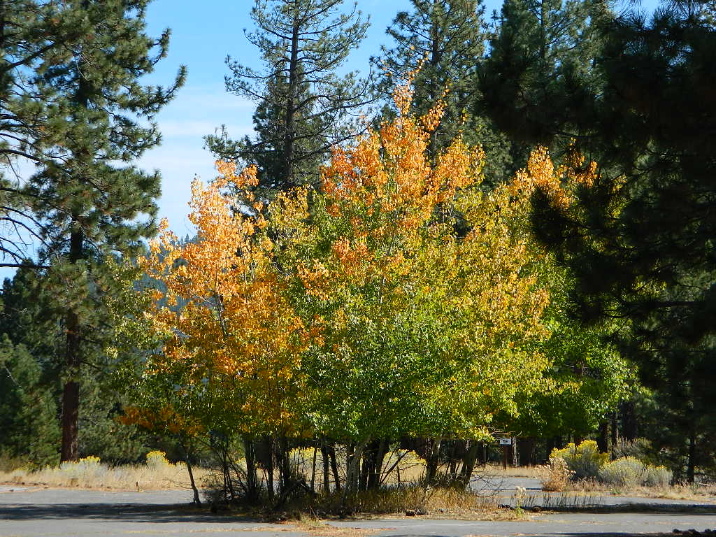
Amazing autumn colors can be found through OCTOBER and NOVEMBER in California, but you’ll need to leave the city in order to find the very best colors and scenic beauty. Fall season happens quickly (within weeks) in the high country and slower (months) in the lowlands. Plenty canyons and parks in the urban centers have hiking trails thru some nice trees, but nothing compares to the backroads, creeks and rivers of the big mountains.
Elevations, the higher the better, is where you’ll find the real displays of color. Aspen groves can be found along mountain slopes, creek canyons from 5000′-10,000′ in elevation. Cottonwood trees are found in the drier regions, in ranching areas and in desert canyons – up to about 6000′ elevation. Aspen trees start to turn yellow as soon as the chill of nights drop; if the temperature shift is subtle, the aspen leaves become more orange as the days go into the fall season. If an early snow or freeze happens, just one night, the glorious foliage becomes dead brown crispies dangling in the wind.
CAMP FIRE RESTRICTIONS are still be in place from the dry summer, and now comes the autumn winds. Any decent amount of rain can change the fire burn status, so make sure to check with the rangers for up-to-date fire info.
Best Autumn Campgrounds in California
Many of these campgrounds are located in or near aspen groves & are simply spectacular during the fall months. Some may be located near alder groves. Maple trees located along rivers turn golden between September and October.
Higher elevation (7000′-9000′) colors will change faster and earlier in the year (as soon as September), whereas the lower countryside may wait until late October.
Pack warmly, cuz the cooler temps at night (20-30 degrees) is what makes these awesome, little autumn leaves change colors. The change can happen very fast (in days). When the early season snows move in – usually a minimal dusting by October, fall colors can fade fast.
The North Sierra Nevada Mountains covers the region with Lake Tahoe and Donner Pass, and north Gold Country. River canyons with fall colors include American River,Yuba River, and the Feather River.
Aspen Group Campground
@ Jackson Meadows Reservoir
near Truckee, CA
Berry Creek, CA
Milsap Bar, Middle Fork of the Feather River
Bucks Lake, CA
Haskins Valley & Grizzly Creek Campground
Oro-Quincy Highway – Plumas NF
The Eastern slopes of the Sierra Nevada is the ‘place to be’ for Autumn Colors in California. The dramatic desert meets the tallest granite peaks. Every canyon is a different scene, many lakes lined with aspen groves, some have a creek with aspens.
Aspendell, CA
North Lake Campground
Lake Sabrina Road
Bishop Pass (high country hikes)
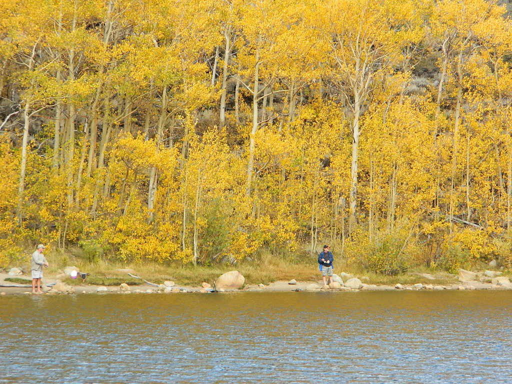
Lee Vining, CA
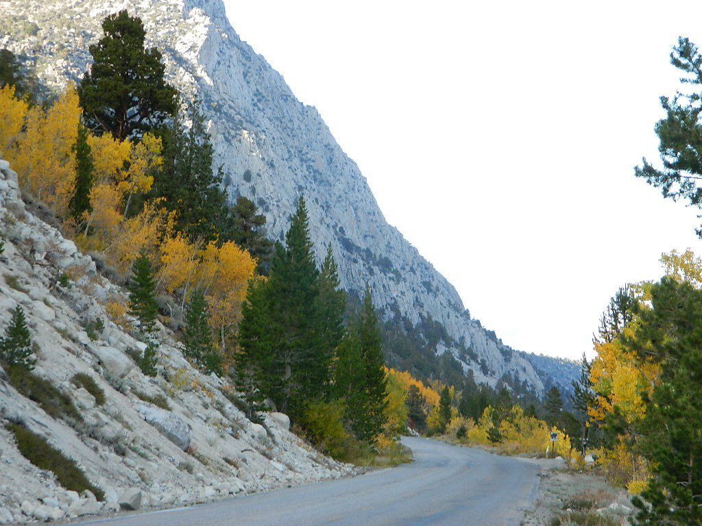
Lee Vining Canyon / Hwy 120
One of the biggest aspen grove canyons in the state of California.
NFS Campgrounds in Lee Vining Canyon: Big Bend, Aspen Grove, Boulder, Moraine, and Cattleguard Campground.
NFS Camps @ Yosemite’s EAST GATE (9000′ elev): Ellery Lake, Junction, Saddlebag Lake, and Sawmill Campground.
Impressive Rock Creek Road #4S12 in Rock Creek Canyon, one of the very best “Scenic Autumn Drives” in the whole Eastern Sierra. Numerous NFS Campgrounds on this road; many of which close for the season, just about the time then fall colors peak.
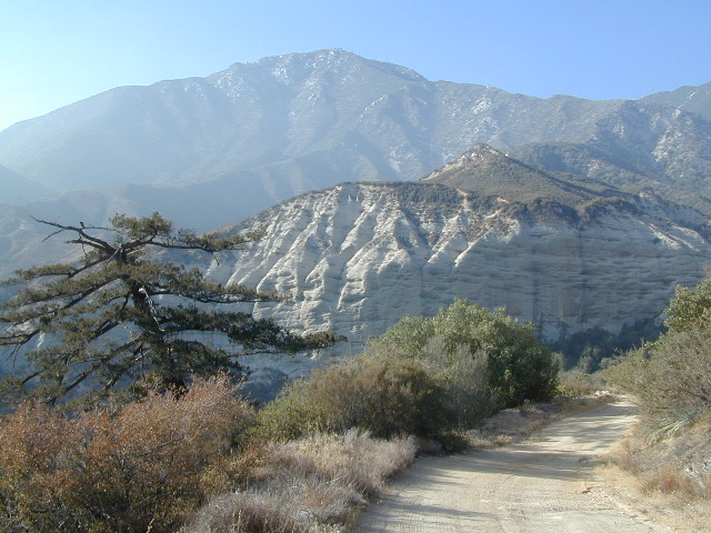
Los Padres National Forest, Mount Pinos Ranger District
Forested campground, paved access; Up behind the Lockwood ranger station
campground
elev.
spots
veg
toilet
water
comment
Chuchupate
6300′
29
pines
vault
no
open year round
open year round; campground reservations 805-434-1996
Pinyon w/ jeffrey pines, a high desert feel to this mountain side ideal camp – where the Mojave desert merges with the coastal ranges in Lockwood. Up high near the Tejon Pass @ Gorman. Sage brush slopes w/ forested campground is approx. 6 mi. off Lockwood Valley Rd. via paved road #8N04 (also called, Frazier Mountain Road).
Adequate for RVs, small creeks around this camp provide
decent vegetation. The sites on the outside back loop are best
for shade & seclusion. Good for a base camp for the weekend
& drive out to see the rest of Los Padres National Forest.
For the mtn. biker, this is a prime spot for hitting up the dirt
back roads on Frazier Mtn. Plenty of hiking and nice views
of the valley around too.
Small campground w/ fee. On forested slopes of Frazier Mountain.
The easy to reach USFS campground can accommodate motorhomes, RVs, camper trailers up to 26 feet long. Paved access road is narrow and curvy and climbs the hill behind the large ranger station on Lockwood Valley Road.
Attention fair weather campers: Snow is possible in this location from DEC-APRIL. Call head for local conditions and know weather forecast before you climb the I-5 (Grapevine).
On the eastern mountain slopes of Big Bear Lake, Holcomb Creek creates a forested sage valley – called Holcomb Valley, located only a few miles away from the big lake. A graded dirt road leads out to this pine forest & a prime campground area. Perfect location for picnics and sightseeing.
Although the developed campground is open all year long, please take into consideration that SNOW and mud is the norm for winter months.
Nice shady sites to beat the summer heat. Camp spots spaced out fairly well. Hikers parking lot is located at one end of the campground. Bears are well known in the region, so please lock all food in the provided metal bear lockers.
The epic Pacific Crest Trail runs right through the Holcomb Valley. Doble Trail Camp is out this way for PCT parking, next to Holcomb Valley Road #3N16 which encircles this whole forested area inside San Bernardino National Forest.
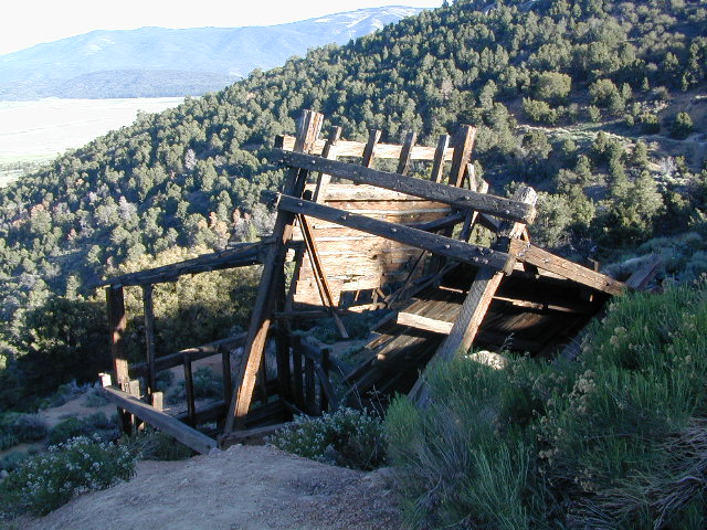
Holcomb Valley has a historic cabin to see. Numerous old mines exist around this area. Nearby Gold Mountain is a popular 4WD route.
The dirt back road leads east down to the high desert @ Highway 162. Down to Pioneertown and Yucca Valley, and eventually Joshua Tree National Park.
Mount Pinos Fire Circle Camp SpotGold Hill Campground (which is now closed) – right next to Piru Creek.
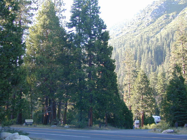
Frazier Park and neighboring towns, like freeway-close Lebec and Gorman, is where the Los Angeles hills meet the Kern County mountains. Mojave Desert meets to Coastal Range. EXIT I-5 @ Tejon Pass (elev 4144′)
Wildflower hills, seasonal creeks, forested peaks, high desert canyons. Bike trails, hike trails, off road routes. High elevation backpacking, hang gliding, mountain biking and camping in every direction.
Mountain Bikers love the trails at Mount Pinos.
High desert washes, oak creeks, pinyon pine forests, mountain meadows and numerous peaks – Frazier Peak, Reyes Peak, Alamo Mountain, Mount Pinos, Mount Abel (Cerro Noroeste) and north facing San Emigdio ridge.
Many dirt roads are gated seasonally for wet weather or snow. Call rangers to find out which routes are open before you plan your weekend. Or have a plan B and C camp site ready if route is closed. Flashfloods, thunderstorms, and erosion means you may all-of-a-sudden need to use your 4WD. This is the mountains after all. UNpredictable weather is common.
Primitive Camping in Quatal Wash, next to the OHV Route and the Chumash Wilderness
Peak-to-Peak Hike: the toughest climb you’ll do, this decade.
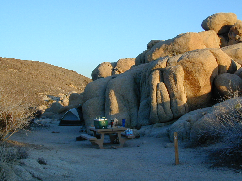
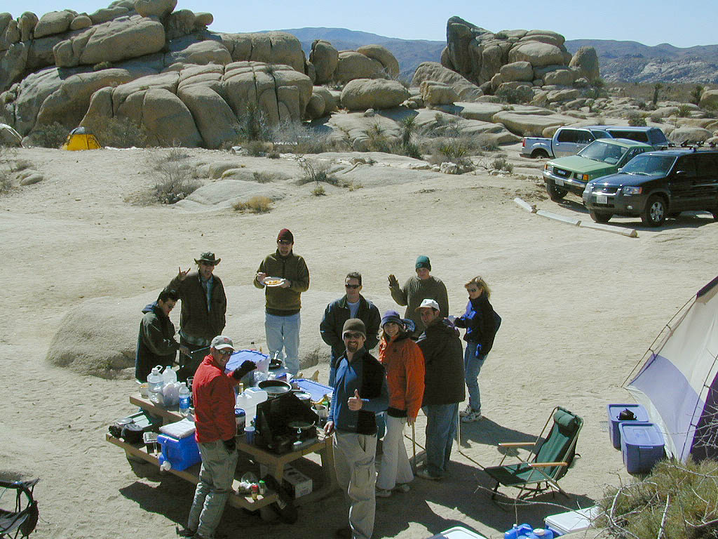
desert hikers and rock climbers love this small camp
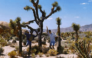
White Tank & Belle campgrounds are the smallest camps Joshua Tree National Park has to offer. On the east side of park both campgrounds are located half a mile from one another.
This Southern California desert lunar-scape National Park is more popular & crowded because of the proximity to major urban areas. The south east side of the park entrance station, Cottonwood, is the least busiest gate.
bouldering
camping
hiking
stargazing
From the town of 29 Palms (on Highway 162) take National Park entrance South on Gold Park Rd. At intersection with Loop Rd. (do not turn right) Go straight through onto El Dorado Mine Rd. about two miles drive leads the 2 campgrounds.
In the years between 2000-2005 founder of Total Escape, DanaMite, lead several guided camping trips to Joshua Tree and liked this specific area the best.
Big Bear – San Bernardino National Forest Camping & Campgrounds
areas include:
Big Bear Lake, Fawnskin, San Gorgonio, Lake Arrowhead, Forest Falls, Green Valley Lake & Idyllwild
Listed below are all the San Bernardino National Forest campgrounds, public lands for outdoor recreation. SoCal campground reservations can be booked online with the linked campsites below.
San Bernardino National Forest: Heart Bar Campground
At Hwy 38 & Forest Road #1N02 is a huge, pine forested valley, right next to San Gorgonio Wilderness. Heartbar Campground, Heart Bar Horse Camps, RV Dispersed Sites. Highway 38 – SE of Big Bear Lake, California; Mountain Bike, Hiking & Equestrian Trails with ridges of 10,000′ elevation. SAN GORGONIO peak nearby. Best high elevation scenery for SoCal by far.
backpacking
camping
fishing
hiking
mountain biking
mountain peaks
waterfalls
Primitive Camps on the Back Road #1N02
Heart Bar Campground
Big Bear Forest – HEART BAR
This gorgeous valley is a developed recreation area w/ 89 camp sites, plus big equestrian area. Picnic, hiking, mountain biking, horseback trails, plenty RV spots, even a creek. (Oooops I meant the Santa Ana River) Highway 38 is kinda the long way into Big Bear Lake, up thru Angelus Oaks. Locals call this stretch of the highway Barton Flats.
Bring the Horses & RVs
Group Campground facilities
Barton Flats – San Gorgonio Recreation Area
Leading out the back way of HeartBar, past the horse camp – is a nice one lane dirt road, narrow in spots, with random, primitive camp sites along the roadway. Authorities refer to these spots as yellow post camp sites.
This backcountry route is marked as Forest Service Rd #1N02 – graded dirt road that leads back to Coon Creek Cabin.
Forest Falls is well worth a stop for a quick picnic or hike – and head dunk. Weekends can be busy and crowded. Since this location is close to Southern California and the population centers, expect weekends to be busy in the Big Bear mountains. Plan a trip for week days to experience less people, and more nature.
At least 5 camping grounds called Black Rock around California.
SouthernCal Desert
Black Rock Campground @ Joshua Tree National Park
This popular camp is in Southern California, near the town of Yucca Valley, California. This is a NPS Campground w/ fee, reservations are recommended. Open all year long.
Joshua Tree National Park is nearby, but the campground is not located inside the park. It is however, a close to the town of Yucca Valley.
• Elevation: 4,000′
• Number of Sites: 100
• Vehicle Accessibility: RV 40′
• Campsites Reservation: Yes
• Length of Stay: 14 Days
• Season: Open all year
• Trailheads: Warren Peak, High View Nature Loop, Panorama Loop
Black Rock Horse Camp located next door, can accommodate up to 20 horses w/ corrals and room for RVs. With California Hiking & Riding Trail, group camp and equestrian facilities.
Black Rock Lake (also known as Black Rock Reservoir) is located in the lower Kings Canyon region. North fork of the Kings River in Sierra National Forest; West of Kings Canyon National Park.
Sierra Forest Road #11S12 – a one lane, paved road – narrow, steep, RVs and trailers are not allowed. Small campground, granite rocks, fishing, no boating.
In the rugged volcanic canyons above Chico, CA – the Ishi Wilderness splits the landscape into volcanic rock ridges. Geologically, one of the oldest rocks in the Lassen National Forest. A small, rustic campground is way back in here – and if you are adventurous w/ a proper vehicle and bored – you could to go find it.
Black Rock Campground NFS
• Elevation: 2,100′
• Number of Sites: 6
• Vehicle Accessibility: High Clearance, maybe 4WD
• Camp Fee: No
• Campsites Reservation: No
• Length of Stay: 14 Days
• Vegetation: Oaks
• Season: Open all year
• Trailheads: Ishi Wilderness, Mill Creek Rim
Very long dirt road. Minimal facilities. Rustic and remote. No RVs.
Access from Highway 36, East of Red Bluff. Take Ponderosa Way.
Access from Cohassett Road in Chico. Cohassett Road all the way – up to Campbell Ridge, and then take Ponderosa Way.
Ponderosa Way is Lassen Forest Road #28N29, a dirt road access of 20+ miles. Unmaintained most of the year. Landslides and erosion are common on long dirt roads, so take caution and call ahead for road conditions.
In this wild canyon area, there are no services, maybe limited cell phone signal too. Beautiful views of the Ishi Wilderness, Mill Creek Rim and great swimming holes on Mill Creek.
This campground is not easy to reach. High clearance required on this route, but 4×4 is usually recommended.
You may need a chain saw depending on the time of year. Flash floods are possible in drainage from Mount Lassen, so check the weather forecast.


 Some roads are suitable for passenger cars, but many are NOT. Dirt slides, erosion gullies, wash outs and rocks are common on these roads, so drive slow and pay attention. Have a spotter get out and take a look at the road conditions. Have a stroll, in the dark w/ the flashlights.
 WILDFLOWERS – joshua tree, yucca, barrel cactus


 Eastern Sierra communities include:


 Although the grizzly bear image graces the state flag, grizzlies were killed off during the gold rush days. Black bears are found in California mountains and foothills, down to lowest elevations in NorCal. California black bears come in more than one color – light brown, cinnamon, dark brown, and of course, black. For the most part, bears usually stay away from people.
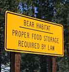 provided by them. Certain California
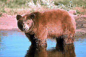


 Holcomb Valley has a historic cabin to see. Numerous old mines exist around this area. Nearby Gold Mountain is a popular 4WD route.


