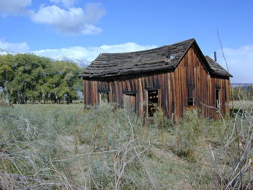
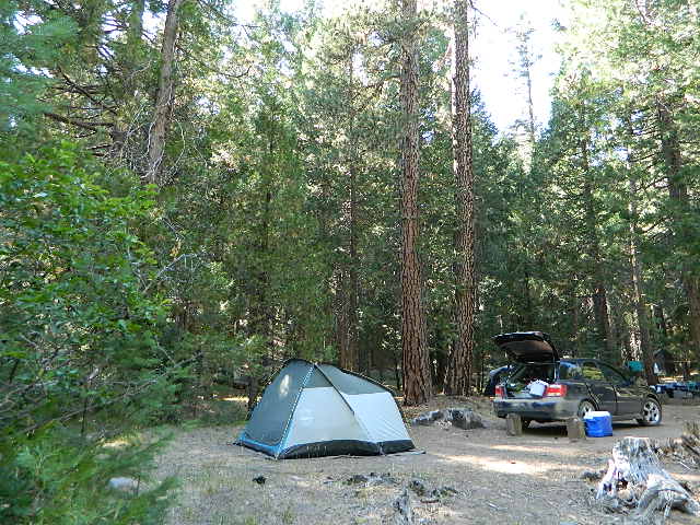
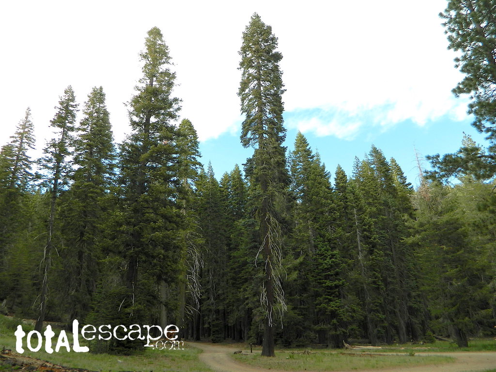
Hole-in-the-Ground Campground NFS Lassen National Forest
dirt road access #28N06, off Hwy 172 @ Mill Creek, CA
South of Highway 36, near jct Hwy 89
• Elevation: 4,300′ • Number of Sites: 13 • Vehicle Accessibility: No trailers • Campsite Fee: Yes • Campsite Reservation: No • Campsite Water: hand-pump well • Toilet: vault • Length of Stay: 14 Days • Season: April – October • Trailheads: Mill Creek Trail
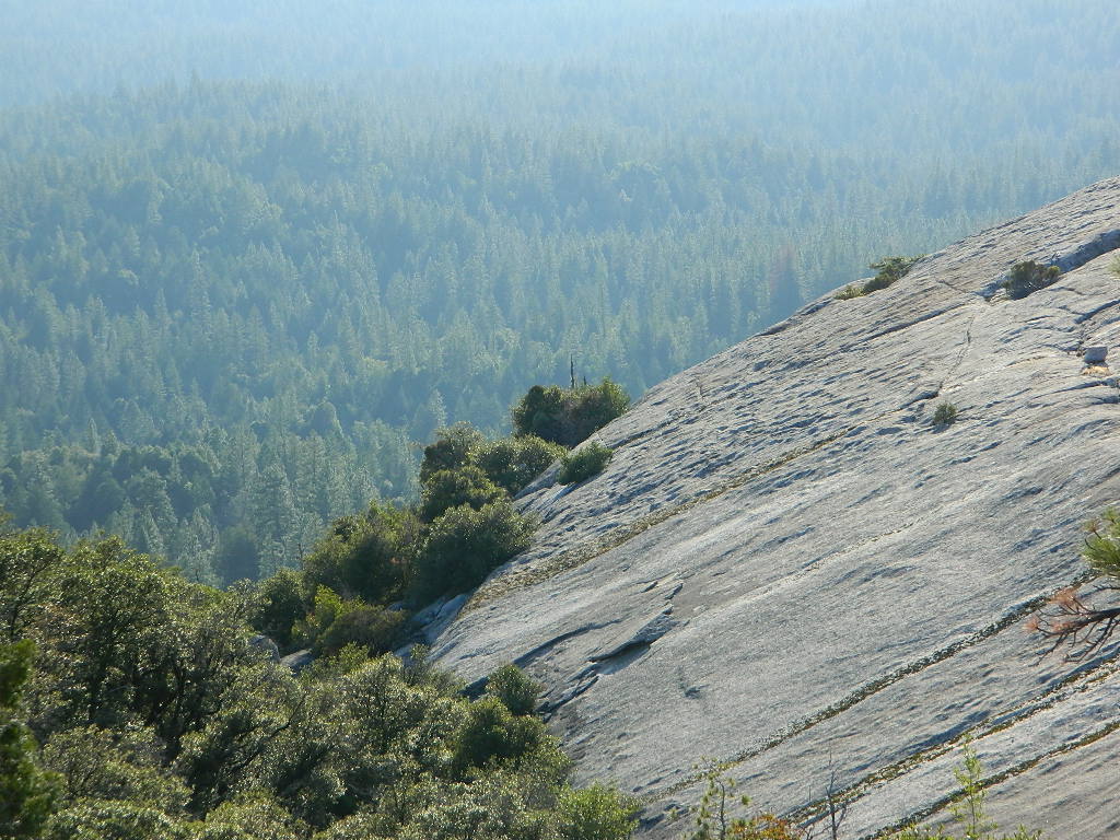
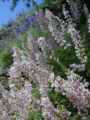
Shady pines campground situated near the wild and raging Mill Creek, on the south side of Mount Lassen. Outside of the Lassen National Park, this NFS camp offers a real backwoods feel and more seclusion. Easy foot access to Mill Creek and also theIshi Wilderness.
Picnic tables and metal campfire rings provided at these campsites. Summers can be busy, but mid week you may have the whole place to yourself. NOTE: 3 miles dirt road access Lassen Forest Road #28N06. Trailers and large RVs are not recommended on this dirt road.
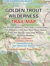
Hole in the Ground, is also the name of a remote wilderness canyon deep in the Sierra Nevada mountains. Located on the Upper Kern River – in Grasshopper Flat near Hockett Peak (8551′ elev). All inside the Golden Trout Wilderness; accessible only by horseback or hiking trail. Find it on foot @ Jerky Trailhead on National Forest Road# 22S82
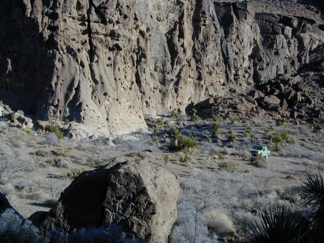
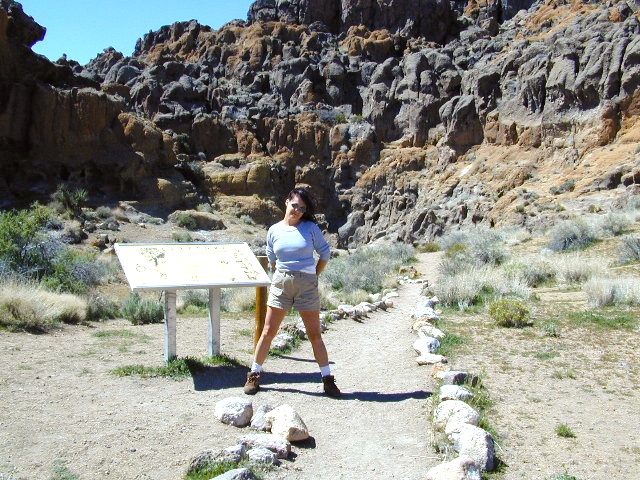
Hole in the RockBackside Hole in the Wall, Mojave NP
Hole in the Wall, California
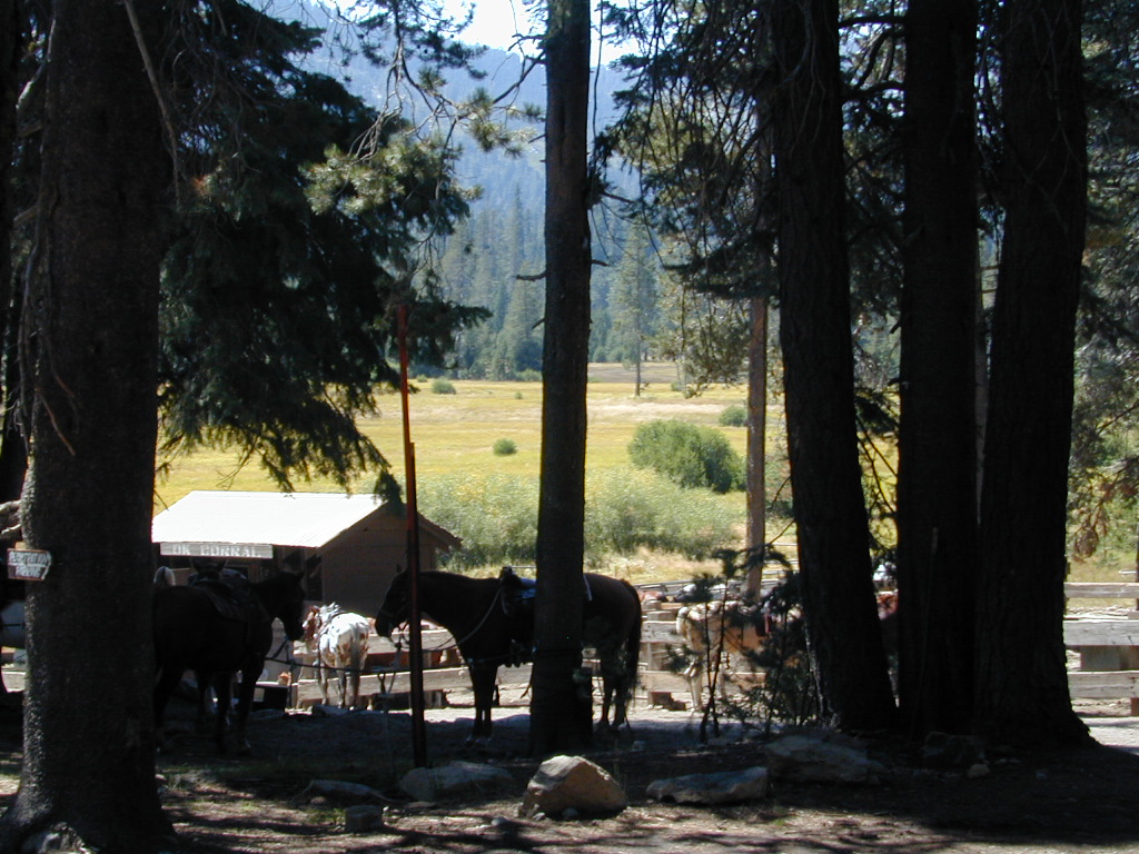
Similarly named, Hole in the Wall Campground is a popular spot in the Mojave National Preserve. Group facilities, horse corrals, developed campgrounds, centrally located, yet close to Interstate 40.
Stop by the “Hole in the Wall” Information Center (760) 252-6104, for more info and maps. The most popular hike, the Ring Trail, will leads thru rock face (above) to the campground on Black Canyon Road, on the other side of this huge rock wall.
Mid Hills Campground (nearby) has better choice on secluded camping, but rougher road to access. Mojave desert has abundant camping, so there is plenty space for everyone!
Trailhead at Top of Zink Road in Berry Creek, California
This route is Straw Rd on GoogleMaps
In summer 2017 this trail from Zink saddle to the Big Bald Rock was so dense and overgrown that I only made it half a mile, before I quit and turned back.
SEPT 8, 2020 #BearFire cleared it all in one night.
CALIF WILDFIRE:
Bear Fire, North Complex Fire @ Berry Creek, CA
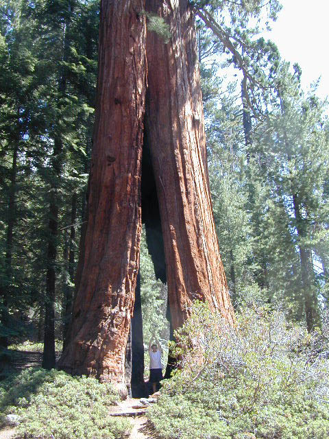
Sequoia Swipe
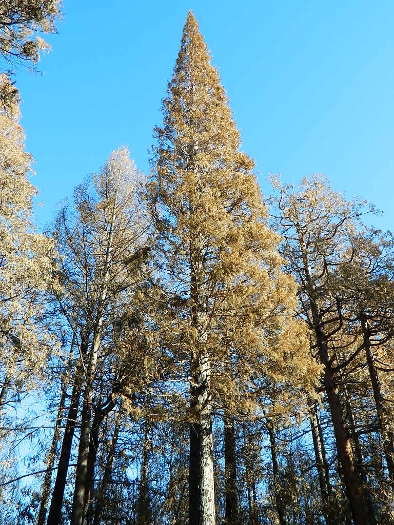
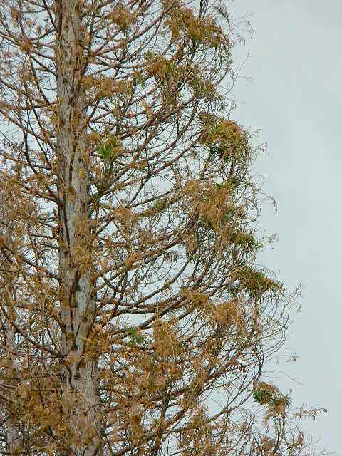
No this is not Sequoia National Park, nor Giant Sequoia National Monument, although certain historic groves did burn this past summer – inside Mountain Home SF.
This Sequoia here, is the best tree in our front yard.
Some say that older Sequoia trees can withstand fire, but not if the fire burns the crown (tippy top). Since our tree is young (60+ years old), compared to most Sequoia trees, we’re not too sure if ours will survive. But we have been watering it for months and hoping for a good winter rain w/ snow.
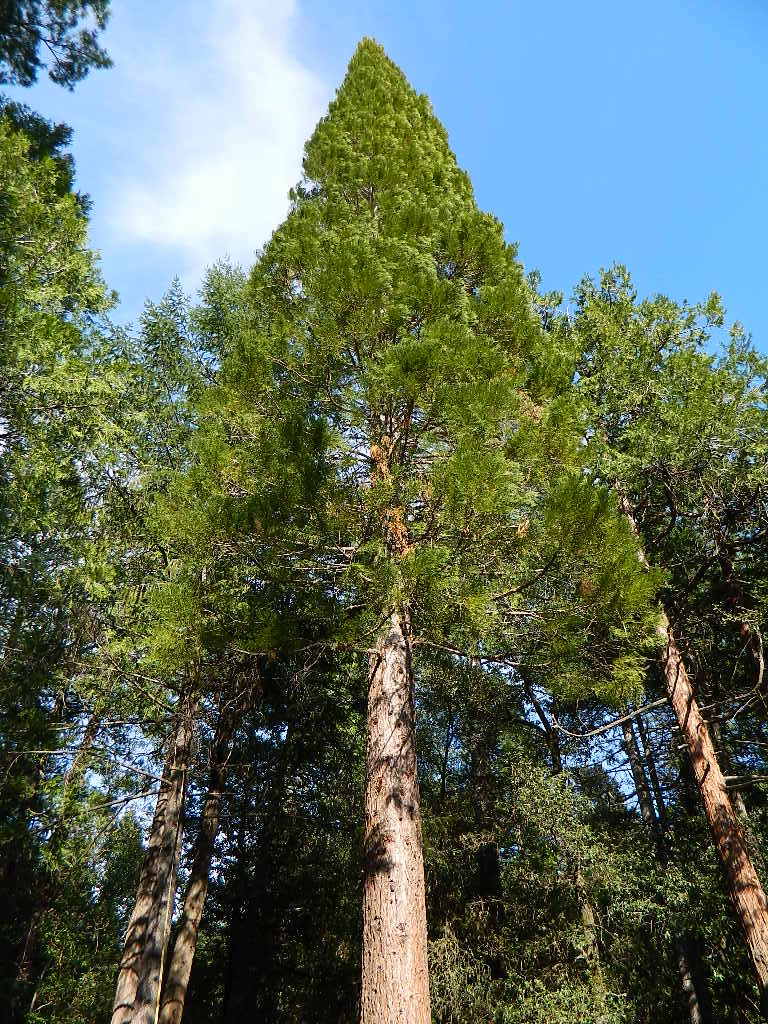
UPDATE DEC 2021
Puff of green started appearing late Spring. However minimal, I still got excited enough to photograph it.
Mostly brown, but green appearing May 2021.Holding out hope for the Sequoia.
We watered this Sequoia all summer (2021) long and now we have a good rain spell in Autumn heading into Winter, so I am hoping our Sequoia – plus the neighbors 2 Sequoias, can make a serious come back.
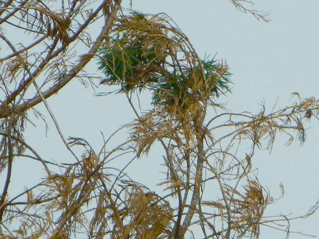
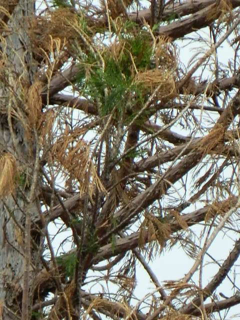
SEQUOIA PROGRESS
Will keep posting our growth progress, as soon as I see more green – mid 2022.
No one is sure when these Sequoia trees in the Berry Creek region were established, since these pre-date our knowledge and the county records.
June & Curly may have planted these back in 1950; or maybe Mr. Coe or Sorensen around 1960. Could it have been the Maidu tribe (native Americans) who transplanted seeds from south to north? Doubtful.
22,700 acres
Kaiser Pass Road
Sierra National Forest
2020 wildfire: CREEK FIRE has burnt the majority of this wilderness, roads, trails, lake shores and most campgrounds
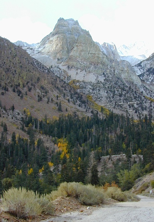
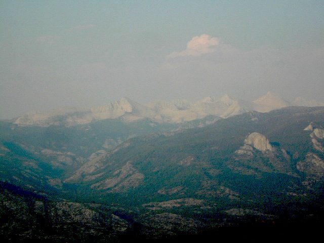
Central Sierra Nevada Mountains/ Kaiser Pass & Kaiser Peak / Highway 168
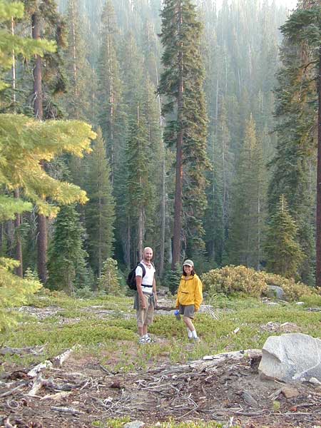
One of the best cell phone coverage areas for any California Wilderness location, this central Sierra region is located south of Yosemite National Park and known primarily for Shaver Lake.
California Hwy 168, along with Dinkey Creek Road (southward) and Kaiser Pass Road (northward) leads off in all splintered directions to secluded campsites, rivers, creeks, lakes, developed campgrounds and amazing forest scenery. Off road trails and hiking trails, everywhere back here! But it is best to have several good maps for cross reference.
Dusy Ershim Trail 4×4 travels past Kaiser Peak and the cell phone towers. Several primitive camp sites with views on ridge. Numerous developed NFS Campgrounds out this way along Kaiser Pass Road.
Trailheads for horseback, hiking, backpackers, mountaineers, rock climbers. Snowmobiles love this amazing route when the snow is deep; some west coast winters can be better than others. Know before you go!
Kaiser Wilderness are granite mountain peaks, near Huntington Lake & the China Peak ski resort, formerly called Sierra Summit Ski; One lane narrow backcountry paved roads: Kaiser Pass Road 80 (east of Huntington Lake) and Stump Springs Road 5 is West Kaiser (west of Huntington Lake)
Sierra Views in 2002White Fir CampsiteChina Peak Hike w/ Map
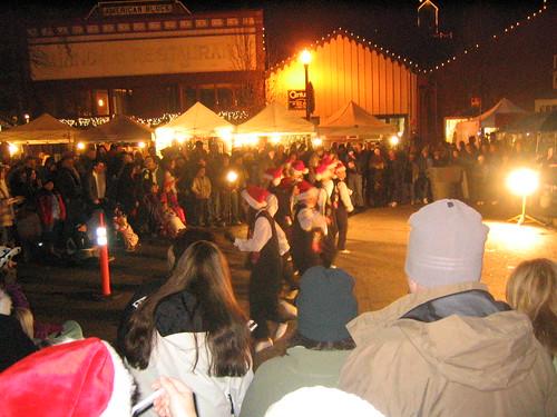
From 5-9pm the whole community is invited to share in the holiday fun. Crafters and artists will have their wares on sale for that special one-of-a-kind Christmas gift. Great food and entertainment, pictures with Santa. Shops and restaurants open. Holiday Open House in all the old town village shops!
Annual event; December – multiple days
(2 different Saturday nights)
Thousands of places – all local, in California; Millions of possibilities for your road trips.
25 years worth of photographs: the ever-growing Total Escape image bank is on flickr
Recent feeble attempts at trying to manage over 50,000 photos from 2+ decades worth of California travels has lead me to flickr.com.
Residing in several locations – first, Southern California, then the Kern County mountains, then over to the Central Coast, San Luis Obispo county and now living in Northern California – traveling all over California to explore. Utah, Baja, Sierra Nevada, Shasta, the Lost Coast, Lakes, Deserts, mountains – all of it. All California back roads & small towns.
Why should a small biz like me need to pay for monthly bandwidth hosting photos, when most of you just wanna look at beautiful vacation photos? (bored at work presumably).
Way back sometime, I decided flickr was an easy enough venue for me to host my best work for you to see, plus tell stories, rave reviews, add recommendations. From mud-whomping to hot springing, petroglyphs, fishing creeks, hiking, camping – DanaMite has a lot of adventures, ready to share & inspire you to get outside this weekend.
While the majority of this image library is not focused on Southern California, it can lead SoCal residents to where they really wanna go – REAL WILDERNESS. California is a big, tall state with forests, mountains and lakes.
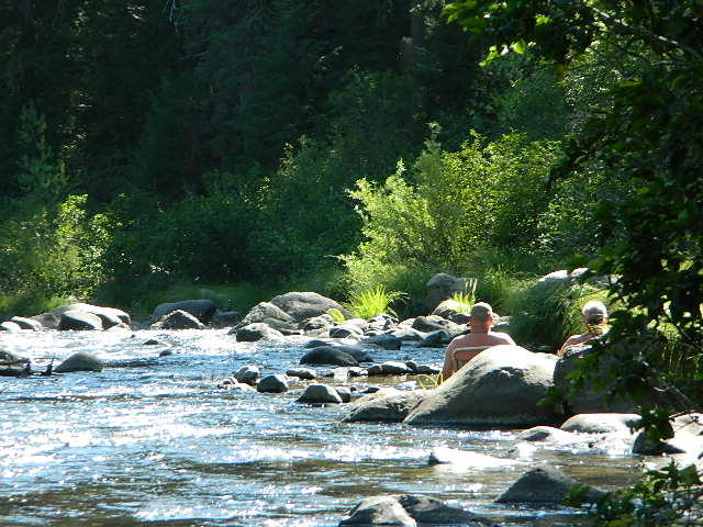
There are many gorgeous rivers in California that are perfect for camping and fishing, but none are located in Southern California. None! Yep, you read that right. If you think about it, the golden state is about half desert! The majority of our natural water in our state is coming from the north – so take this as a warning: you might need to drive a few hours to find your ideal river camp.
The easy-to-access waterways are found mostly along highways in the Sierra Nevada – or way up in NorCal. Deep granite gorges carved out by glaciers, surrounded by forested peaks is only half the appeal. High elevation lakes, waterfalls, big trees, abundant wildlife, and the alpine villages are all part of the Sierra Nevada experience. Raft, kayak, fly fish, hike, bike or just camp out next to a big, rushing, flowing river. Our selection of California maps will get you narrowed down to a specific region, so you can find that perfect river campground, or explore and discover the back roads – for the most seclusion.
KERN RIVER: The Kern River is one of the most popular of all the Sierra rivers due to its proximity to SoCal. Hurried, stressed-out, Angelinos (LA) can be at this destination in under 3 hours – which makes it a very busy place most months.
So, let it be told, that summer is not the best time to enjoy the Kern. If you do plan a summer outting, make sure you head for the Upper Kern (10+ mi N of Kernville & Lake Isabella) or the North Fork of the Kern (out in Monache Meadows) where 4×4 is often needed.
The Lower Kern River has only 2 developed campgrounds: Hobo (closed for damage 2019) andSandy Flat (open all year). Numerous primitive camp spots are available along Old Kern Canyon Rd, which parallels the Hwy 178 on the south side. None of which are located at the rivers edges. Remington Hot Springs is a popular spot for soaking. Fishing trails, mountain biking trails and hiking trails, all over. Fire danger is great in this area, so pay extra close attention to signs and fire restrictions.
Kern River above Lake Isabella and Kernville is a better choice for camping availability.
Everybody loves Yosemite! This is the most popular park in the whole state; maybe the whole nation.
The majority of campers want to stay “right on the river” when they visit Yosemite NP, but that is just plain old impossible, since reservations go fast and there is only so much room for everyone in this enclosed, narrow, precious valley.
This particular park has some major floods (1997 & 2005) that wiped out bridges, road ways; all the old wooden cabins (at Yosemite Lodge) are gone and only half of the campgrounds are still available. Yosemite has had 11 winter floods since 1916 that have caused substantial damage to property. That number is expected to increase, as winter precipitation is getting less predictable.
Reservations are taken for camping and cabins – far in advance; like one year. No joke!
3 Yosemite Campgrounds are located next to the Merced River (inside spectacular Yosemite Valley)
Way up in the Yosemite high country, which is only open a few months outta the year, the beautiful Tuolumne Meadows Campground is located next to lush meadows and the scenic Tuolumne River. All Yosemite campsites must be reserved well in advance, so visit links above – if you are serious about a Yosemite camping trip anytime soon.
MOKELUMNE RIVER: Way up the road, deep in the western Sierra, Gold Country. Small NFS campgrounds, right on the river; Access is long, narrow paved, switch-back road, not suitable for RVs or trailers.
STANISLAUS RIVER: The Sonora Pass, the fishing is very decent way back in this granite gorge. Highway 108 is only open a few months outta the year, due to deep snow & rock slides – so time is of the essence. Summer time is prime vacation weather up here. Several campgrounds are located right on the river, or on the major feeder streams. Or you can opt for secluded primitive camping on the back roads. Find Sonora camping in Stanislaus National Forest.
YUBA RIVER: The biggest play time river in the northern Gold Country, this runs along Hwy 49 near Downieville and also has a major South Fork for the best swimming holes and primitive camping in this region. Tubing, rafting, kayaking, fishing, camping, gold panning, you name it, Yuba has it. Look for more on the South Yuba Recreation Map, or the USDA issued Tahoe National Forest Map
FEATHER RIVER: Top fishing river in the Lassen to Oroville area. Chester and Lake Almanor in the upper reaches. High Bridge Campground is nice paved-camp-site camping; a forested spot where you can fish 2 rivers on the same day. A Plumas NF or Lassen NF map would be quite helpful for this region. Lower down the mountain, lower Feather Rivers which include all 4 forks which feed Lake Oroville – West Fork (Paradise, CA), North Fork, Middle Fork Feather, (Berry Creek, CA) and the South Fork (Lumpkin). Lots of waterways and creeks worth exploring in between Chico and the mountain town of Quincy.
KINGS RIVER: This one particular river is the longest in the Sierra Nevada mountain range, pulling snow melt from the upper reaches of the High Country and Mount Whitney. The river area just to the West of the National Park, over to Pine Flat Reservoir, is all prime for outdoor recreation. Several river rafting companies work this stretch of river.
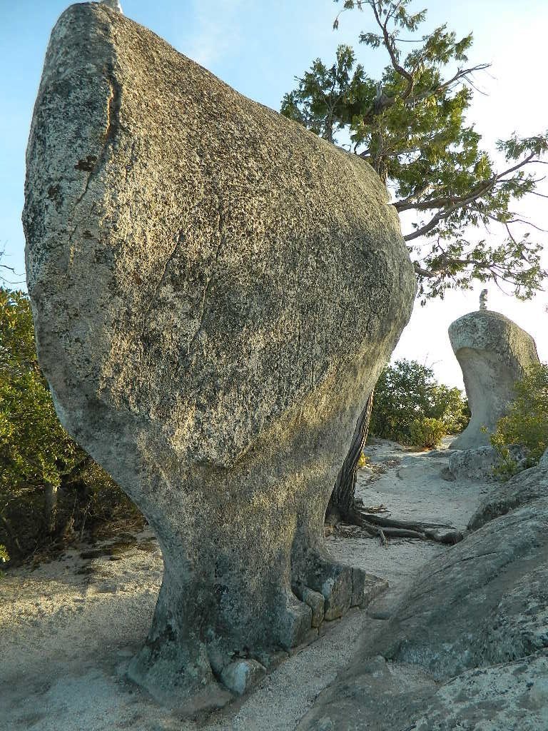
GIANT SEQUOIA: in between Sequoia & Kings Canyon, inside Sequoia NF
This chunk of National Forest land is perfectly located in between 2 very popular National Parks – Kings Canyon and Sequoia. This primary paved road leads to some great camping, a perfect option for NOT camping inside the crowed National Parks.
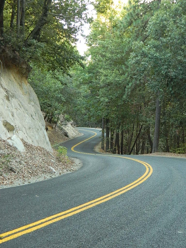
Turn east off of Sequoia ‘Generals Highway’ 198, on to the well signed Big Meadow Rd. There is primitive camping all over this area & a few developed campgrounds along this route. Motorhomes be warned: the road narrows to one lane with no “turn outs” or U turn spots for the last 10 miles (on a steep cliff w/ large overhanging rocks)
In the first few miles, the dispersed camp sites on the right side have great views & some situated on fairly flat granite slabs, perfect for astronomer campers or adventurous RVs. To the left side of the road is more primitive style campsites in wooded areas. The whole area is also a very popular cross country ski & snowmobiling spot for winter recreation. Hunters also like these camps during hunting season (in September).
There is a developed Horse Camp on the left side of the road for equestrian campers. This camp is located across from the biggest meadow and may be the first place you notice on this drive.
Buck Rock Campground (7600′ elevation, 5 spots) & Big Meadows Campground (7600′ elevation, 25 spots) are both family style camps, perfect for those who want picnic tables, plus bathroom nearby. Sorry no flush toilets out here, only pit toilets.
Buck Rock Fire Lookout Tower @ 8500′ elevation – is located to the north on Forest Rd # 14S02. It’s a great spot for some impressive views – if you aren’t afraid of heights. To reach the tower you must climb several flights of steel steps. This place is worth a stop if planning a sightseeing day.
Big Meadows Guard Station @ 7500′ elevation (also known as Big Meadows Cabin), is located next to the BIG MEADOW and is available for rent on a weekend basis from the NFS. Hiking Jennie Lakes Wilderness and fly fishing Big Meadows Creek are favorite activities to be enjoyed.
Big Meadows Road is long & narrow – 12+ miles. RVs are not recommended beyond the Big Meadow Campground, as the road is one lane in some spots & it skirts a cliff edge. The views are incredible the farther you go & many creeks feed the region.
The narrow, long paved road eventually forks off into several smaller dirt roads back near Horse Corral Meadow. Way back here, the dirt roads lead out to trail heads for backpacking, horse packing or day hiking in Jennie Lakes & Monarch Wilderness. Backcountry access to either Sequoia or Kings Canyon National Park! Have a good map if you plan to venture out this far. Pay attention & don’t get lost.
GPS would be helpful in this area. Some of the smaller of the dirt roads are not even on the NFS maps. Make sure to GPS way-point your favorite camp site, so you can find in next time…. in the dark.
Southern Sierra mountains and the Giant Sequoias, inside Sequoia National Forest. In the Camp Nelson area, south of the busy National Parks.
SEPT 2021: Closed due to the Windy Fire
GIANT SEQUOIA HWY 190 – Western Divide Highway is the 7000′ ridge line that separates the Upper Kern River from the great Central Valley to the west.
From the San Joaquin Valley – get to Porterville or Springville, continue up the mountain on the main highway, to the paved road turn off (Road #22S94) on the right side of the highway;
After Pierpoint Springs and before Camp Nelson. This quiet campground is located off the highway more than a mile, so traffic noise will not be an issue for the light sleepers. (Unless of course, a loud 4×4 rig screams by at midnight headed to the backwoods, or a horse trailer cruises by at 5am). This camp does border the Tule River Indian Reservation.
Western Divide Highway 190
Giant Sequoia Campground
Sequoia Road #22S94 is a loop road leading to many forest meadows, groves, primitive camps and trailhead destinations. Bear Creek and Coy Creek flow near CoyFlat Campground, which both merge north into the Middle Fork of the Tule River @ the highway.
Belknap Grove is nearby, with Black Mountain Grove a few miles further on the dirt back road (Road #22S94) as it continues to Bateman Ridge and Road #21S12, near the Tule Indian lands. Mountain biking, rock climbing, backpacking and hiking all great in this region.
22S94 continues in forest to 8500′ elevation @ Windy Gap, where the Summit National Recreation Trail intersects road. Popular trail among horse riders. 22S94 connects back to Western Divide Highway, in between Ponderosa and Trail of 100 Giants. Awesome loop drive for those seeking seclusion on the dirt roads, away from the tourists and RVs. Call ahead to make sure that the dirt roads and gates are open, before you plan a weekend vacation around it.
• Elevation: 5,000′
• Number of Sites: 19
• Reservations:Yes
• Sites Available: First come, First serve
• Vehicle Accessibility: Vehicle 22 ft. max.
• Length of Stay: 14 Days
• Water: Piped; Seasonal creek nearby
• Toilet: Vault
• Season: Closed for winter months
• Fee: Yes
• Operated By: National Forest Service
• Closest Town: Camp Nelson, Califronia
Sequoia National Forest
Giant Sequoia Ranger Station
559-539-5230
Due to the spread of invasive insects, firewood from outside the area is not permitted. Help protect our forests by purchasing or collecting firewood at or near your camping destination and burning it on-site.
The Western Divide Highway, at 6000 feet elevation, connects the Kern River Valley w/ granite peaks, dome rock, aspen groves & the Giant Sequoia trees! This is one of the southernmost Sequoia groves in the Sierra Nevada mountains. The easy hike is more of a nature trail, wheel chair accessible & approximately 1 mile long. Large Sequoia trees, picnic grounds, near campground.
SEPT 2021: Closed due to the Windy Fire
On busy weekends and holidays the rangers charge a “day use” parking fee, for those wishing to park in the paved parking lots. Avoid this fee by finding additional parking along the highway. Only a few good free parking spots along this busy 3 mile stretch of highway, and don’t forget to park all the way off the pavement.
SOUTHERN SIERRA: Great destination for camping families & sightseers traveling through the Southern Sierra Nevada mountains.
Western Divide Campgrounds
The USDA National Forest Campground across the road from the Trail of One Hundred Giants is called Redwood Meadow Campground. There is also a separate parking lot for the picnic grounds w/ a similar name.
Giant Sequoia National Monument has numerous dirt back roads for free, primitive, car camping. You’ll need a good topo map to find the best ones. Some roads may be muddy, overgrown or extremely rocky, depending on recent weather. Know you vehicles limitations. There is no tow truck service available way back here in the boonies.
Fumaroles and Boiling Mudpots Hot Springs near Lassen Peak Volcano
South side of Mount Lassen, outside the National Park boundary several non-soakable hot springs exist:
Growler Hot Springs (private land)
Morgan Hot Springs (private land)
* Measured temperatures of these hot springs range from 126 to 207°F (52-97°C), so basically SCALDING HOT & dangerous
Little Hot Springs Valley (within the National Park boundary) is also not fit for public use either. Although it may be appealing as a sightseeing destination, (accessible by dirt road) it is far from soaking quality.
Hot Springs Creek flows south into Mill Creek
DixieFire 2021 ravaged California’s Volcanic National Park. Morgan Mountain lightning strike fire merged with the monster fire to the east. NPS fire crews and CalFire lit a back fire near the Visitors Center on Hwy 89 – to burn and meet the bigger oncoming fire. Winds from the north forced the giant wildfire from the peaks and down hill to Mill Creek and Child Meadows, where firefighters were able to control the leading edge of the fire.
the only real hot springs worth visiting around Lassen National Park
rumors have it that the resort may still be standing – after the fire!
Built in 1900, this historic, rustic mountain meadow resort is accessible by dirt road through Warner Valley – north of Chester, CA. They have a swimming pool, naturally heated by the local hot springs. Plus rental horses, hiking trailheads and a developed campground nearby.
JULY 2021 – Drakesbad is CLOSED due to wildfire Dixie Fire
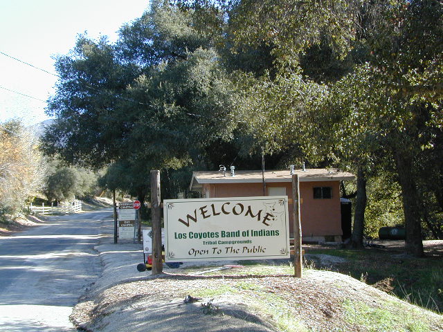
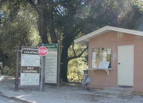
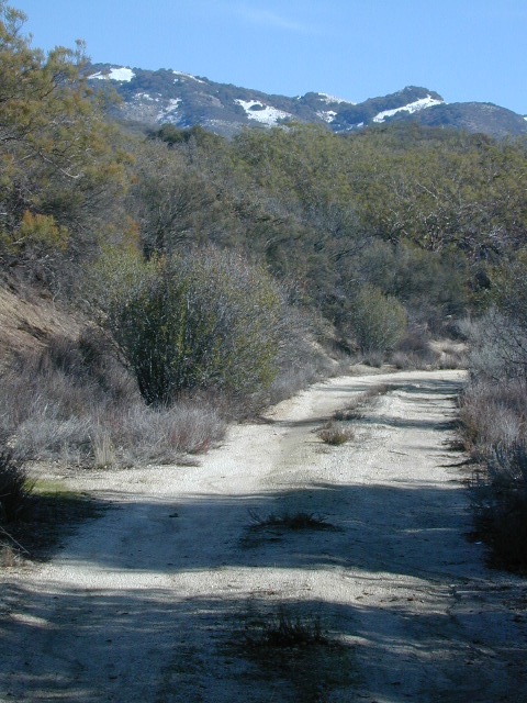
Great rural location, in-route to many destinations in Southern Cal. Temecula wine country, Warner Springs, Culp Valley, Anza Borrego Desert State Park, Borrego Springs.
Campground is a popular spot with locals, so note that some weekends can get rowdy. Ask about a more secluded camp site option if needed. There is plenty of primitive land out here.
Oak trees and boulder hills, dirt roads, near Hot Springs Mountain. North San Diego County.
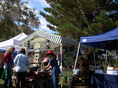
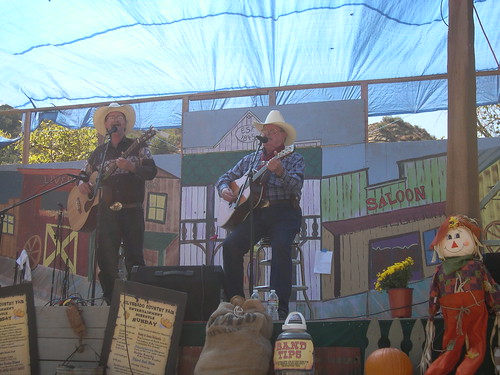
A good ole country style fair in the heart of SoCal. The 40th+ annual event, music and art festival in Silverado Canyon, Orange County. Explore the wonders of canyon history and culture, music, tasty food, handmade arts and crafts, games and silly contests, all nestled under the oak trees below the infamous Saddleback Mountain. Wild West theme! Folk, Country, Bluegrass, and Classic Rock bands will entertain through 2 days.
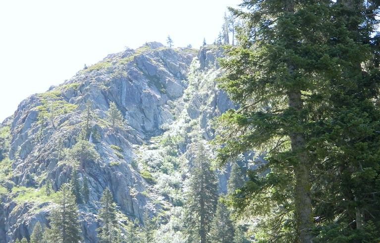
Jamison Creek Canyon: the small stream flows all year long
Small Sierra Nevada camp on Upper Jamison Creek in a granite canyon, within a gorgeous red fir forests, wildflowers and fresh mountain air.
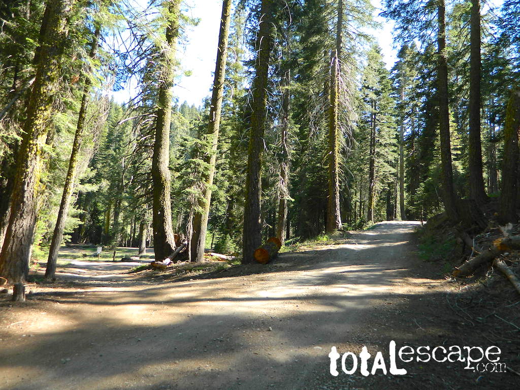
high clearance vehicle recommended
Gravel (rocky) road access, and here we use the word “road” loosely: Plumas County Road #507
Plumas Forest Route 507
also known as Johnsville Road; Johnsville McRea Road (misspelled McCrea on Google Maps)
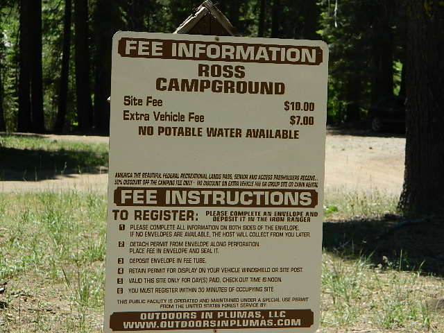
Ross Campground NFS
• Elevation: 6,070′
• Number of Sites: 5
• Vehicle Accessibility: High clearance; No RVs or trailers
• Camp Fee: Yes
• Campsite Reservation: No
• Toilet: Vault
• Water: Creek only
• Length of Stay: 14 Days
• Season: May–October
• Trailhead: McRea Ridge & PCT
camping
dirt roads
hiking
mountain biking
off-roading
swimming holes
stargazing
wildflowers
RUSTIC CAMP: No Picnic Tables!
4 camp sites are located at this turnoff @ driveway. Another single camp spot is located half mile up road, next to 2 nice swimming holes. Although the National Forest web site states that this place has 3 sites, it does indeed have 5 camp fire rings. All are available on a first come basis.
No OHV off-road riding in camp.
Snow is possible at this elevation, between October-April. Thunderstorms are common in summer in the Sierra Nevada mountains. 4×4 will be needed to access this area, if winter weather sets in.
Across Jamison Creek from Ross Camp
is Mount Fillmore @ 7715′ elev. Up canyon is Mc Rae Ridge PCT trailhead Mt Etna @ 7063′ Blue Nose Mtn @ 7290′
USFS just started charging a fee for this remote creekside camp. It used to be free, but no more.
Sierra Madre Road Sierra Madre Ridge, San Rafael Wilderness
Los Padres National Forest Forest Road #32S13
off of Cuyama Valley Hwy 166
East of Santa Maria, CA – along Highway 166 (on the south side of the pavement) are several dirt roads that lead up to the main ridge road that access this part of Los Padres National Forest.
backpacking
camping
dirt bike trails
dirt roads
hiking
horse camping
mountain biking
off road routes
petroglyhs
wildflowers
4WD not required, but high clearance is helpful. Open almost all year. Rainy season gate closures (at hwy) during winter months.
Sierra Madre Ridge is forest road #32S13, which parallels Hwy 166 (Cuyama River) for over 50 miles on the Sierra Madre Ridge at approx. 5000 feet elevation.
NOTE: A good stretch of this dirt road is closed to vehicle traffic. Although it connects to Santa Barbara Canyon near Ventucopa, you cannot drive it. Only hike or mountain bike!
NFS Gate locked at the HOG PEN trailhead, and from there you can bike or walk all the way the other end at Santa Barbara Canyon near Cuayama Fire Lookout @ Dick Smith Wilderness
Small campgrounds in the region:
off Highway 166 Miranda Pine Campground (on 32S13 @ 11N03) Bates Canyon Campground (via Cottonwood Canyon Rd) also known as White Oaks Campground Aliso Canyon Campground (via Aliso Canyon Road) not accessible by vehicle, from dirt road 32S13; only by trail
in the backcountry Painted Rock Camp (hike-in) Sycamore Camp (hike-in)
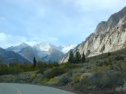
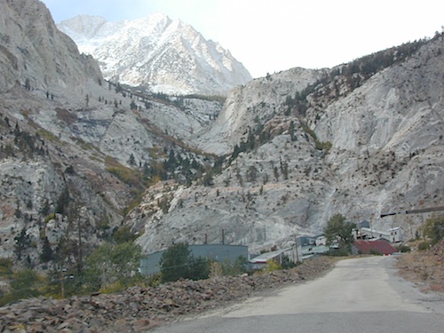
Paved route that dead ends at a huge, old tungsten mill. Impressive peaks and slopes, steep granite; spires and beehive shaped mountains. This region has a very ALPS FEELING, with an “Italy Pass” high above on the wilderness ridge lines.
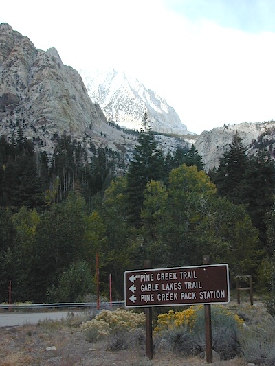
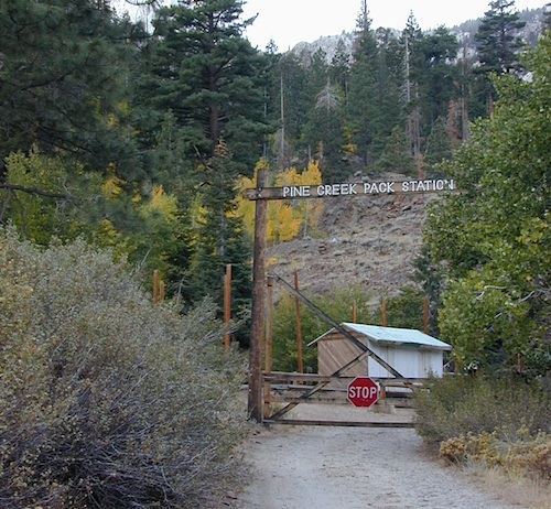
Pine Creek Road has minimal camping and maybe a half day worth of sightseeing (at most). A few creekside camp spots, only rock dirt road access. Campfire permits required. No facilities. No developed campgrounds. Hiking trails, wilderness access and a horse pack outfitter.
PINE CREEK PACK STATION
85 Pine Creek Road
Bishop, CA 93514
760-387-2797
NO developed NFS Campground exist up here, so don’t think about bringing that motorhome up this steep incline.
Mount Tom (elev 13,652′)
Gable Lakes
Pine Lake (9942′)
Bear Creek Spire (13,713′)
Spire Lake
Scheelite Canyon
Lower Morgan Lake (10,708′)
Round Valley Peak (11,943′) Round Valley
Rovana, CA
Sugarloaf Ridge, Greenhorn Mts
Alta Sierra, Kern River Canyon
Sugarloaf Road, above Kern River Canyon
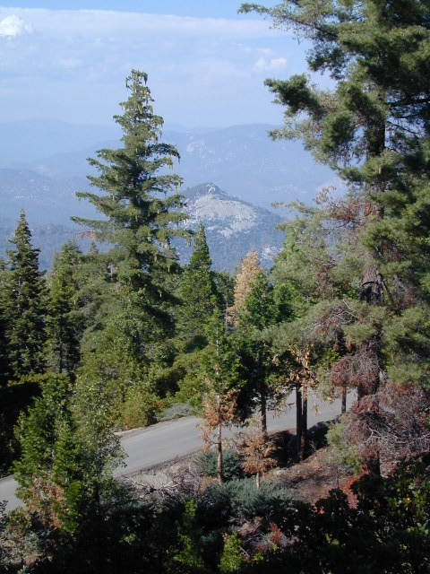
SOUTH SIERRA: This route is located in between the Western Divide Highway and the cedar community of Alta Sierra, CA
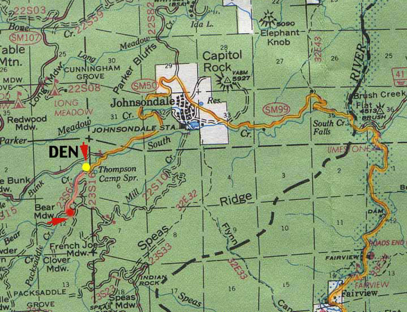
Sugarloaf Ridge: Forest Rd# 23S16 – Thompson Camp Spring, The Den @ Sequoia National Forest
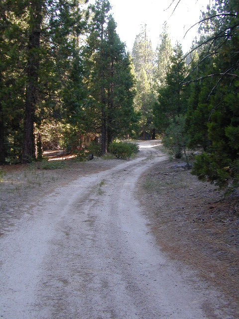
Driving north on Sierra Hwy N of Kernville, California; Passing Fairview & the Johnsondale bridge; After the R Ranch @ Johnsondale, take the left fork on the main highway; After you climb in elevation, look for brown signs on right side of road & turn left on Forest Service Rd# 23S16. Primitive camp sites are located throughout this area along Packsaddle Creek. Do not turn left up Sugarloaf Rd. There are no good camp sites up that way (unless you wanna make one).
RV campers are very common at Thompson Camp Spring, as this road is paved up to this point. The paved road is windy & narrows after this point. It is not advised for trailers or long motorhomes past Thompson.
For the more adventurous, Bear Meadow & Packsaddle Mdw are located up the dirt road a bit on #23S64.
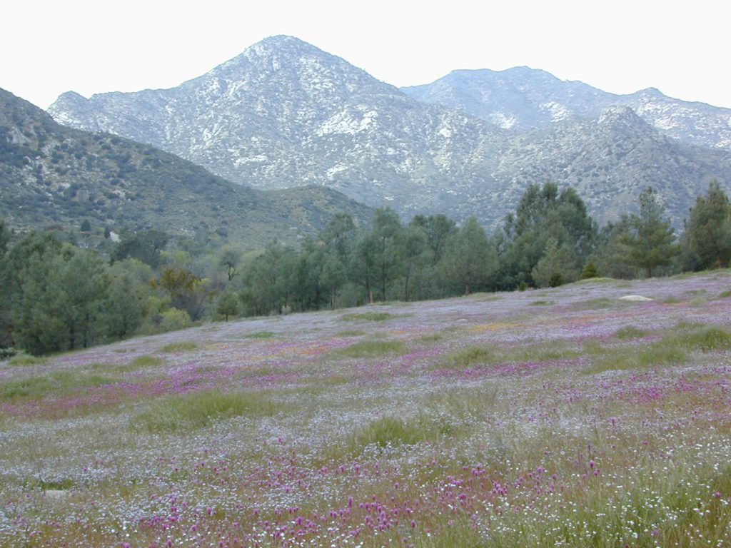
Paved Sequoia route# 23S16 continues to climb, which leads to the Speas Meadow, the Greenhorn Mountains & you best have a real good map if you are heading up this way. 20 miles of awesome open meadows, small streams, dense forest, wildflowers, some primitive camp sites & great viewpoints overlooking the Kern Canyon. All passenger car accessible! Elevations between 6000-7000′. Sugarloaf Peak has cross country skiing.
Side route #23S05 will take you to White River Campground w/ 12 spots. The paved road winds west down the mountain to Posey & eventually Glennville on Hwy 155.
Instead, to easily reach Hwy 155 – you’ll need to get on dirt for a few miles. While on 23S16, look for the Panorama Campground (@ 7400′ elevation w/ 10 sites). Take dirt road #24S15 to get back to civilization @ Alta Sierra, California.
Car campers in Southern California dream of the perfect setting: an uncrowded campsite, in a lush forest, with tall trees & flowing stream of crystal clear water. A swimming hole nearby, plus a place for the hammock. They also want it less than a 2 hours drive from their home. Unlikely.
The real California rivers & mountains are in the northern half of the state, while the lower is more like a desert. You will need to drive hours to reach these kinda spots. The Sierra Nevada mountains are the closest bet for finding a creek side camp. Lassen is next, for exploring numerous dirt roads that lead to secluded spots. Northern California, above Redding usually has water flowing and decent fishing, even in the driest years.
Read more on specific California camping techniques:
Developed campgrounds located next to rivers, creeks, or streams can be found on the back roads of California. Below is just a sample of small towns that have creek campgrounds nearby:
Many of the best creek camp spots are located outside of developed Campgrounds. Most we suggest on this site are located on dirt roads. Some routes may require a 4×4 vehicle, or high clearance 2WD.
thin blue lines – You’ll know a decent road when you see it. But when you are starting out at home, you need to concentrate of what dirt roads are along what water sources. And will these streams be flowing at this time of year? Many are seasonal creeks & can dry up in late summer. The most likely place to find great water flow is to look for the streams flowing directly into a major river or Lake/ Reservoir.
And if you are really not into to roughing it, but wanna find a CABIN on RIVER or CREEK, check out our extensive list of all vacation cabins here, California Cabin Rentals
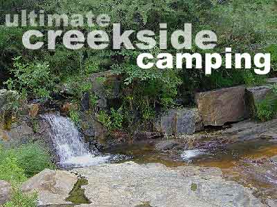
Lassen Camping near a creek in Northern California
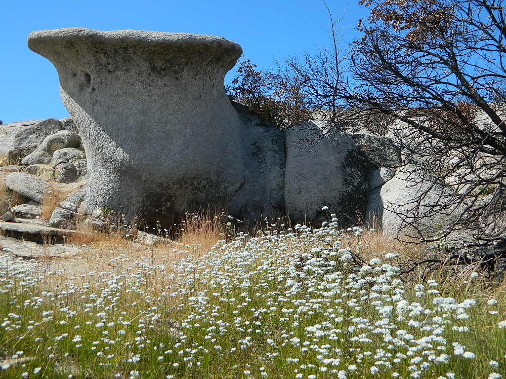
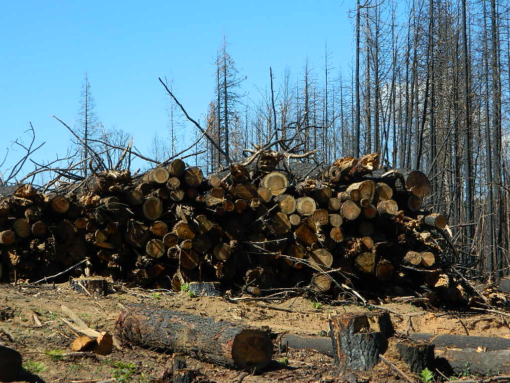
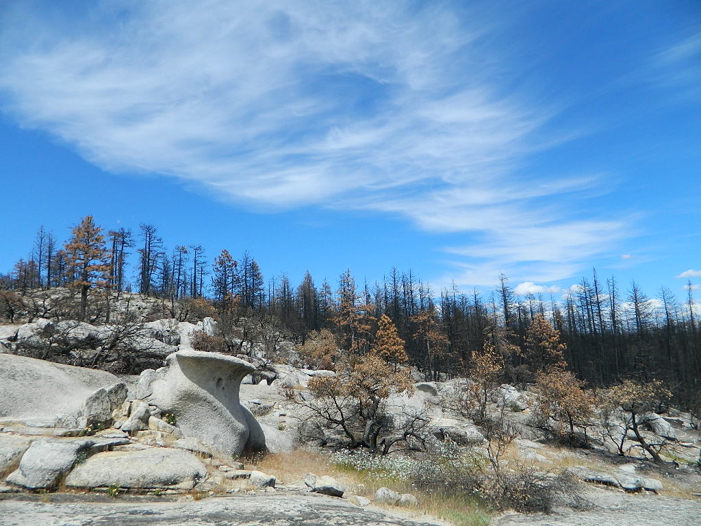
Decimated forest at Bald Rock: Trail Closed 2020-2021
Bald Rock, North Sierra Nevada Mountains
Big Bald Rock
elevation: 3350′
2021: CLOSED due to wildfire damage
Bald Rock Trailhead, Berry Creek, CA Located above Lake Oroville and near the Middle Fork of the Feather River, this well known trailhead is a 1 mile (short, steep & sweet) climb on top of granite rocks – to a wonderful view over the North Sacramento Valley. Dirt parking lot w/ bathroom in a forested setting. Can get muddy during winter. Seasonal creek runs along first part of the hiking trail. Locals like to party here at night. Families hike during daylight and sunset hour. Trailhead sign is well marked on paved Bald Rock Road, about 6 miles from the Oro Quincy Highway.
The granite dome hike (above) is often confused with a neighboring trail to the south, called Bald Rock Dome, located at the granite gorge of the Middle Feather River. A much longer hike w/ a canyon view, switchbacks, and longer dirt road access…..
Another dome hike in the same area as above, but on the other side of the pavement; gravel parking lot, and trailhead via dirt road; a right turn off Bald Rock Road (when going north). Near the residential forest of Berry Creek, CA
The official map for Lake Oroville SRA has a granite dome marked as Little Bald Rock @ 3334′ elev. The USDA Plumas National Forest map has both a Little Bald Rock and a Bald Rock Dome (3509′) located on this side of Bald Rock Road.
As you can see listed below, giant granite domes or mountain peaks or river canyons often have the generic name of ‘bald rock’ There are also a heck of a lotta Bald Mountains inside the golden state.
also, in the vicinity –
Bald Rock Canyon is downstream from the big waterfall, Feather Falls, on the Middle Fork of the Feather River; This stretch of wilderness waterway is called Feather Falls Scenic Area which includes, Milsap Bar Campground; Maybe be accessible, by 4×4 and steep foot trail – from the opposite side of the river. Off Lumpkin Road, which is off Forbestown Road (@ 162 above Lake Oroville) 2021: CLOSED due to wildfire damage
Bald Rock Peak (elev 7166′) a mountain peak near Chilcoot Campground and Frenchman Lake, N of Hwy 70 in East Plumas National Forest
Bald Mountain (5780′) off the Skyway, next to Stirling City, CA
Fire Lookout CDF, weather cam & antenna site
On the north side of the lake is Grass Valley Bald Mountain (5906′ elev) in between Black Rock Creek and the northern shore.
The La Porte Bald Mountain Peak (5906′ elev) is located in dense forest, in Plumas National Forest; In between LGVR and the town ofLa Porte, CA 4959′
Area accessible via a long and curvy La Porte Road, which closes in winter on the north end (East Quincy). This Plumas County area is popular w/ snowmobiling due to the amount of snow they receive.
Bald Mountain Range, due north of Truckee and Stampede Reservoir. Near the CA / NV border. Babbitt Peak @ 8790′ is the tallest peak within this range. Historical Henness Pass Road passes through this area.
Bald Mountain Peak @ Sugarloaf Ridge State Park (2279′ elev) located in between Napa Valley and Sonoma Valley.
M22 Mendocino Forest, eastside Forest Route #M22 is on Valentine Ridge, east of South Yolla Bolly (elev 8092′) and near Bald Rock Mountain (7762′). Road M-22 is also known as Bald Rock Road. Mendocino National Forest – Two trailheads up this way are Ides Cove and Horsepacker. M22 wraps around south to Ball Rock @ 6663′ elevation, near Rocky Cabin Campground. Cold Springs Guard Station, Ball Mountain 6557′ and Whitlock Campground are on this route. Much this region has been burnt in recent wildfires of 2020 #ElkhornFire
Popular, local snow ski destination for “the southland”; south of Pasadena, near Rancho Cucamonga, in the San Gabriel Mountains.’
Bald Mountain Road, also known as Inyo Forest Road #01S05, near Indiana Summit and the Mono Craters. East of the Eastern Sierra & US 395; south of Mono Lake, California.
Bald Mountain Road, near Bummerville, California.
Gold Country Sierra Forests, East of Hwy 49 @ Jackson, CA
Bald Mountain Road, rural ranches & residential;
and Bald Mountain Nursery in Browns Valley, near Marysville, CA
Bald Hills Road, Redwoods NP
Bald Hills Road, Northern California
Well- traveled, graded dirt road connecting the Redwood National Park to the Klamath River @ Hwy 96. Primitive camping, but check on fire restrictions. Must have camp fire permit. Active logging roads on National Forest land, so weekdays could be busy: watch for equipment and big trucks.


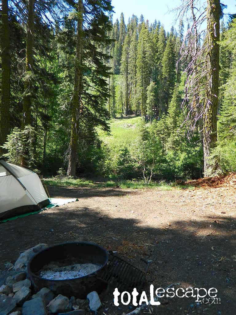
 Small Sierra Nevada camp on Upper Jamison Creek in a granite canyon, within a gorgeous red fir forests, wildflowers and fresh mountain air.
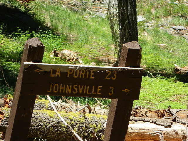


 nearby destinations: