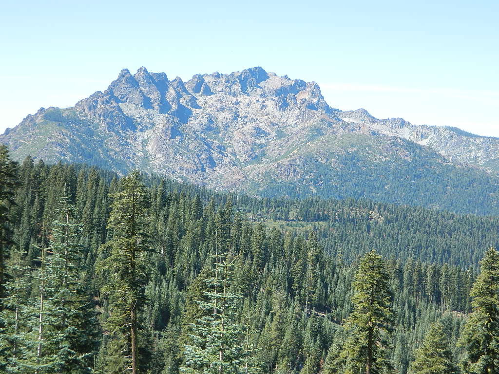
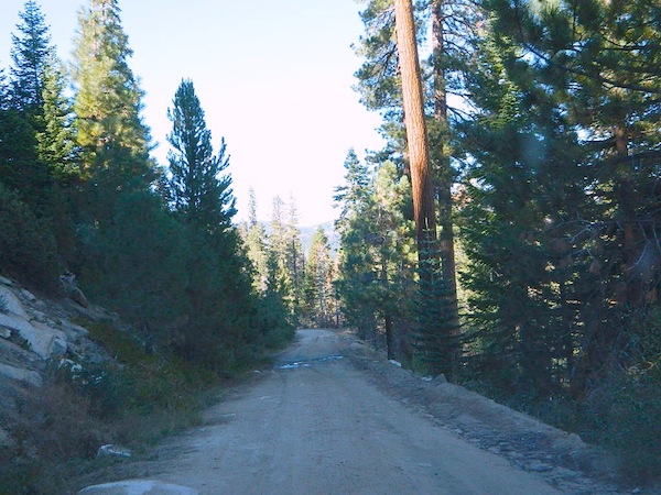
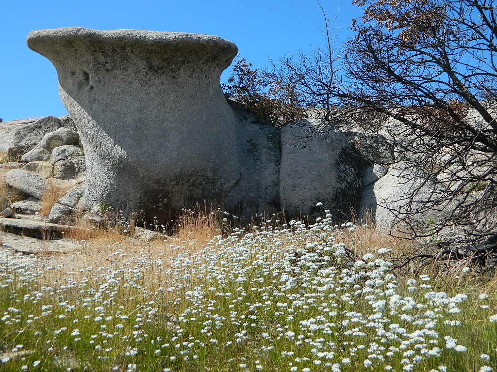
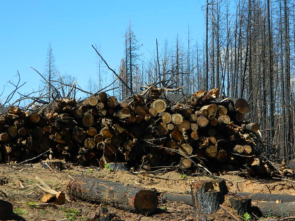
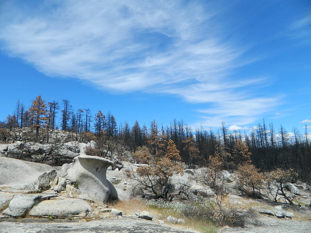
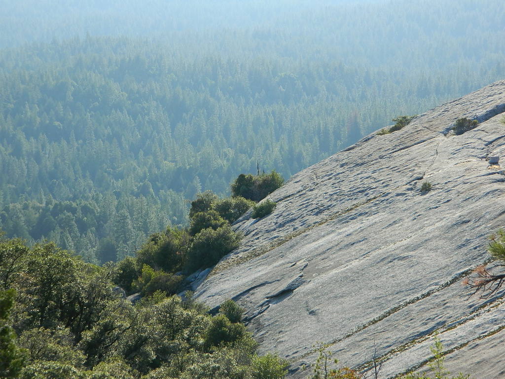
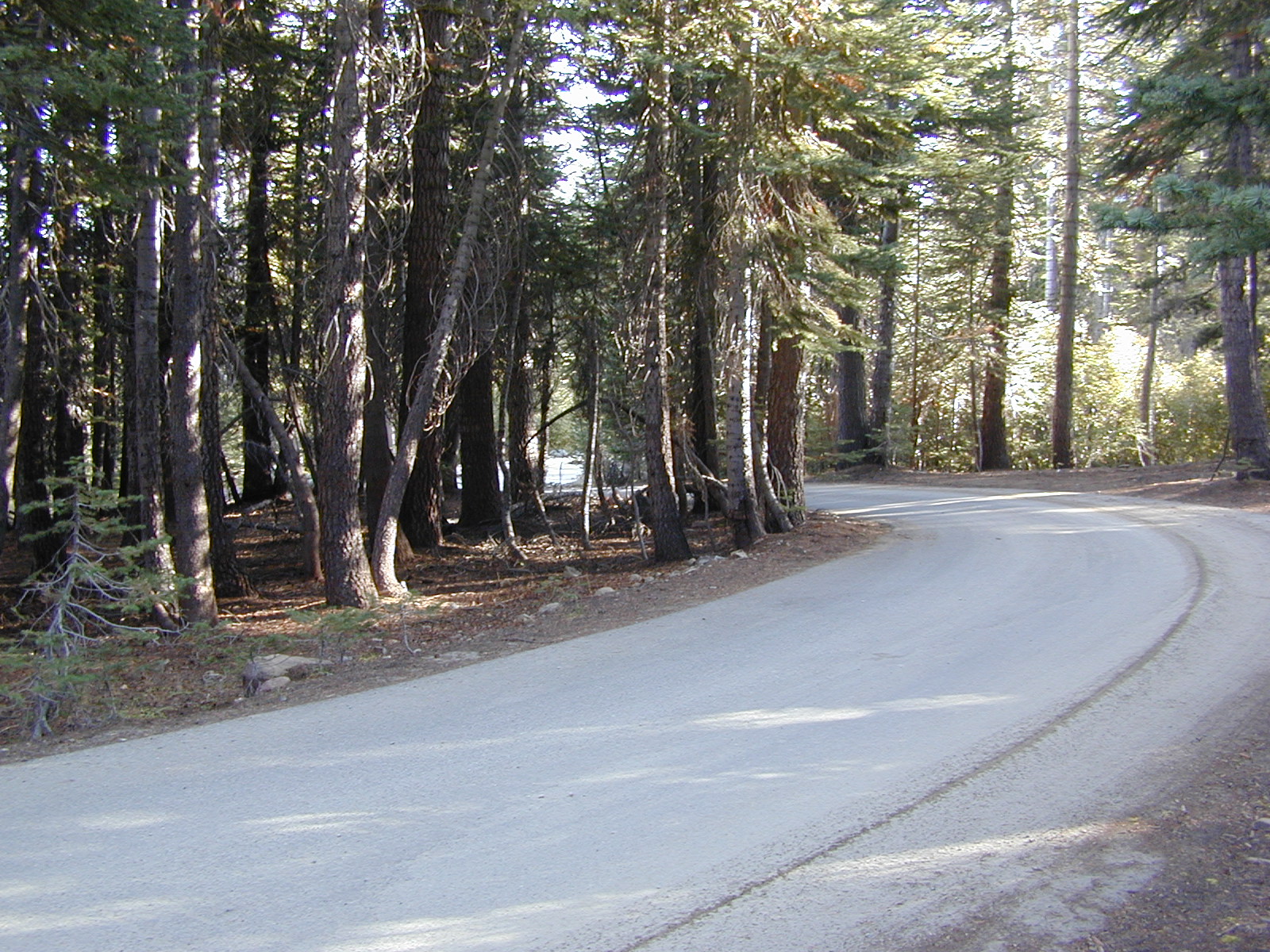
Decimated forest at Bald Rock: Trail Closed 2020-2021Bald Rock, North Sierra Nevada Mountains
Big Bald Rock
elevation: 3350′
2021: CLOSED due to wildfire damage
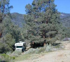
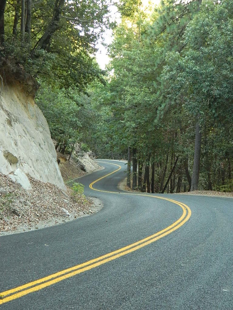
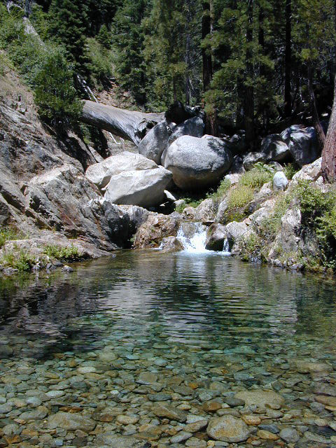
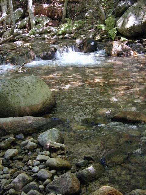
Bald Rock Trailhead, Berry Creek, CA Located above Lake Oroville and near the Middle Fork of the Feather River, this well known trailhead is a 1 mile (short, steep & sweet) climb on top of granite rocks – to a wonderful view over the North Sacramento Valley. Dirt parking lot w/ bathroom in a forested setting. Can get muddy during winter. Seasonal creek runs along first part of the hiking trail. Locals like to party here at night. Families hike during daylight and sunset hour. Trailhead sign is well marked on paved Bald Rock Road, about 6 miles from the Oro Quincy Highway.
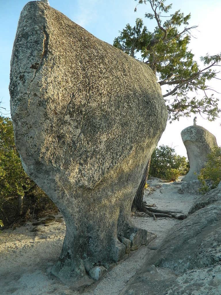
The granite dome hike (above) is often confused with a neighboring trail to the south, called Bald Rock Dome, located at the granite gorge of the Middle Feather River. A much longer hike w/ a canyon view, switchbacks, and longer dirt road access…..
Another dome hike in the same area as above, but on the other side of the pavement; gravel parking lot, and trailhead via dirt road; a right turn off Bald Rock Road (when going north). Near the residential forest of Berry Creek, CA
The official map for Lake Oroville SRA has a granite dome marked as Little Bald Rock @ 3334′ elev. The USDA Plumas National Forest map has both a Little Bald Rock and a Bald Rock Dome (3509′) located on this side of Bald Rock Road.
As you can see listed below, giant granite domes or mountain peaks or river canyons often have the generic name of ‘bald rock’ There are also a heck of a lotta Bald Mountains inside the golden state.
also, in the vicinity –
Bald Rock Canyon is downstream from the big waterfall, Feather Falls, on the Middle Fork of the Feather River; This stretch of wilderness waterway is called Feather Falls Scenic Area which includes, Milsap Bar Campground; Maybe be accessible, by 4×4 and steep foot trail – from the opposite side of the river. Off Lumpkin Road, which is off Forbestown Road (@ 162 above Lake Oroville) 2021: CLOSED due to wildfire damage
Bald Rock Peak (elev 7166′) a mountain peak near Chilcoot Campground and Frenchman Lake, N of Hwy 70 in East Plumas National Forest
Bald Mountain (5780′) off the Skyway, next to Stirling City, CA
Fire Lookout CDF, weather cam & antenna site
On the north side of the lake is Grass Valley Bald Mountain (5906′ elev) in between Black Rock Creek and the northern shore.
The La Porte Bald Mountain Peak (5906′ elev) is located in dense forest, in Plumas National Forest; In between LGVR and the town ofLa Porte, CA 4959′
Area accessible via a long and curvy La Porte Road, which closes in winter on the north end (East Quincy). This Plumas County area is popular w/ snowmobiling due to the amount of snow they receive.
Bald Mountain Range, due north of Truckee and Stampede Reservoir. Near the CA / NV border. Babbitt Peak @ 8790′ is the tallest peak within this range. Historical Henness Pass Road passes through this area.
Bald Mountain Peak @ Sugarloaf Ridge State Park (2279′ elev) located in between Napa Valley and Sonoma Valley.
M22 Mendocino Forest, eastside Forest Route #M22 is on Valentine Ridge, east of South Yolla Bolly (elev 8092′) and near Bald Rock Mountain (7762′). Road M-22 is also known as Bald Rock Road. Mendocino National Forest – Two trailheads up this way are Ides Cove and Horsepacker. M22 wraps around south to Ball Rock @ 6663′ elevation, near Rocky Cabin Campground. Cold Springs Guard Station, Ball Mountain 6557′ and Whitlock Campground are on this route. Much this region has been burnt in recent wildfires of 2020 #ElkhornFire
Popular, local snow ski destination for “the southland”; south of Pasadena, near Rancho Cucamonga, in the San Gabriel Mountains.’
Bald Mountain Road, also known as Inyo Forest Road #01S05, near Indiana Summit and the Mono Craters. East of the Eastern Sierra & US 395; south of Mono Lake, California.
Bald Mountain Road, near Bummerville, California.
Gold Country Sierra Forests, East of Hwy 49 @ Jackson, CA
Bald Mountain Road, rural ranches & residential;
and Bald Mountain Nursery in Browns Valley, near Marysville, CA
Bald Hills Road, Redwoods NP
Bald Hills Road, Northern California
Well- traveled, graded dirt road connecting the Redwood National Park to the Klamath River @ Hwy 96. Primitive camping, but check on fire restrictions. Must have camp fire permit. Active logging roads on National Forest land, so weekdays could be busy: watch for equipment and big trucks.
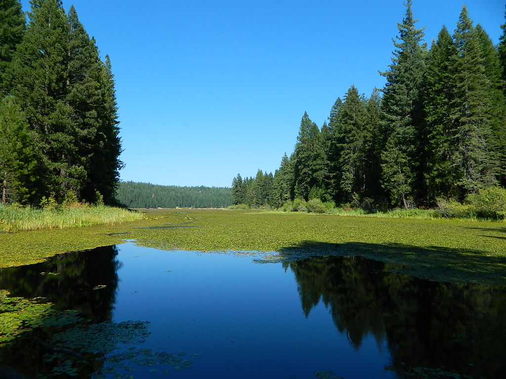
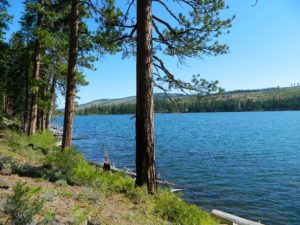
ADA Camping (Americans with Disabilities) Handicap accessible camp sites at Blue Lakes, near Hope Valley, CA
Blue Lake Campgrounds
highest lake campgrounds in the vicinity
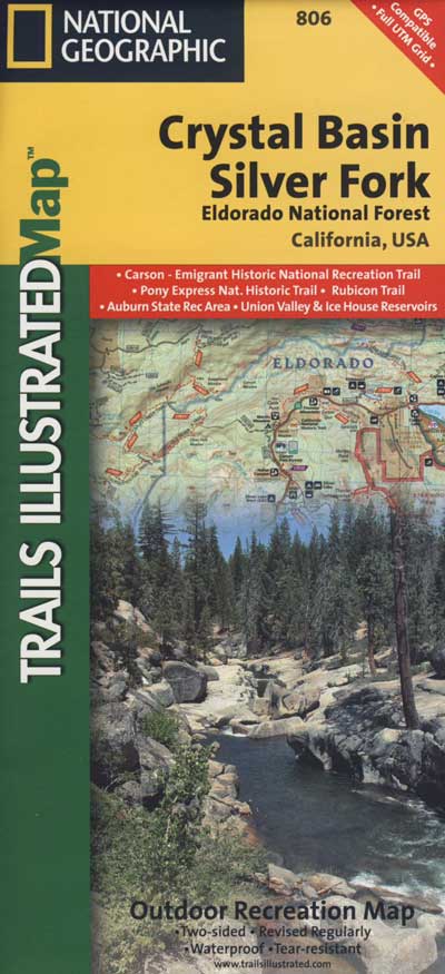
Eldorado National Forest in Amador Ranger District; a forest south of Lake Tahoe in the central portion of the Sierra Nevada mountain range. This set of scenic, alpine lakes sits in between both Eldorado, Toiyabe National Forests and the Mokelumne Wilderness. But please take note that the Blue Lake facilities are owned and operated by utility company PG&E
No Reservations. most camp sites are available first-come, first-serve
RV limitations: 30 feet
69 miles east of Jackson, CA on Highway 88 and then another 12 miles south on Blue Lakes Road. This area is close to Hope Valley, south of Lake Tahoe, CA
Blue Lakes consist of several developed campgrounds. Blue Lakes Rd# 13 is a well signed, paved road off Hwy 88, just east of Carson Pass (8560′ elev). The route is closed during winter snow, while it serves as a winter recreation area. The main paved road becomes dirt near the campgrounds. A dirt road continues past the lakes and south to Deer Creek and meets w/ Hwy 4 near Ebbett’s Pass.
RV campers, fishing folks, hikers, kayakers and disabled travelers like this lake camp area due to the easy access, paved parking and campground amenities. Handicapped camp sites are also prime lake front locations.
Group Campgrounds are reservable. Picnic Areas, Group Sites and campfire rings. Piped water, bear boxes and vault toilets. No RV hookups, no dump station, no showers. Unimproved boat ramps are available at Upper and Lower Blue Lakes.
Upper Blue Lake Campground elev. 8136′
camp sites: 32
Overflow Camp camp sites: 34
Backpackers and day hikers: Sierra trailheads out here lead south into the Mokelumne Wilderness Area. The infamous Pacific Crest Trail also passes thru this high elevation region: PCT access @ Carson Pass, Upper Lake & Tamarack Lake
BLUE LAKE CAMPGROUND
NorCal region of the South Warner Wilderness in Modoc National Forest. That’s way out near Alturas. Likely, CA is the turn off US 395. Northeast California, real seclusion.
EASTBOUND Paved Road #64 is Jess Valley, which leads along the Pit River, cool volcanic cliffs, and up to forested Blue Lake Campground, elevation 6051′
Wildlife viewing @ Blue Lake Modoc
Donner Blue Lake
DONNER PASS – Sierra Nevada
Interstate 80 BLUE LAKE CAMPGROUND
i80 Donner Pass, near Truckee, CA; a PGE Campground w/ 4×4 access and hike-in only. First come, first serve. No tables or restrooms, elevation 5900′
Lake side resort w/ boat rentals and fishing, near Upper Lake, CA
elevation 1357′
A small resort w/ hotel suites and a lakeside setting w/ abundant nature. Two small lakes, kinda close to the highway. Non motorized boats only, kayaks, paddle boards, canoe, swimming, birdwatching, bike paths and fishing. Wedding venue next to lake. Wineries, restaurants, and a casino nearby.
An abundance of tasty citrus, from fresh fruit samples offered by local growers to market products featuring the Sierra foothill’s mandarin oranges. Thousands of filled orange mesh bags await and jams, jellies, infused olive oils, balsamic vinegar, barbecue sauces and body care products are all available for purchase. Visitors are delighted to discover that the food vendors offer everything from mandarin pizza to mandarin glazed wings, mandarin doughnuts and mandarin pulled pork, just to name a few.
Oak foothills of the Historic Gold Country, at the edge of the Sierra Nevada mountains.
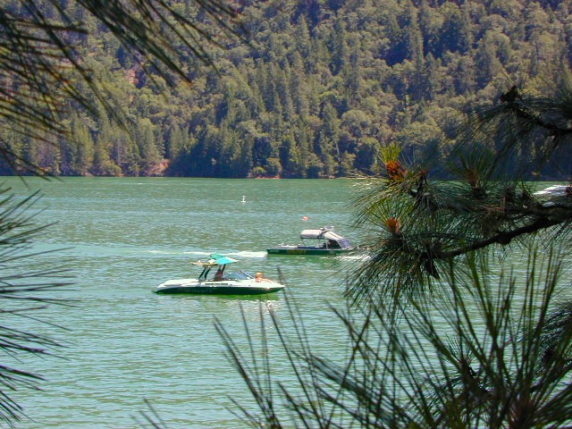
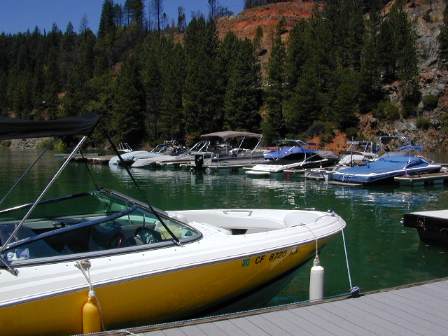
boating
canoe
camping
fishing
hiking
houseboats
kayaking
wildflowers
Most Central Valley Reservoirs have blooming wildflowers in early springtime. Summer heat can measure triple digits for months as most of these lakes are located below 1000′ elevation.
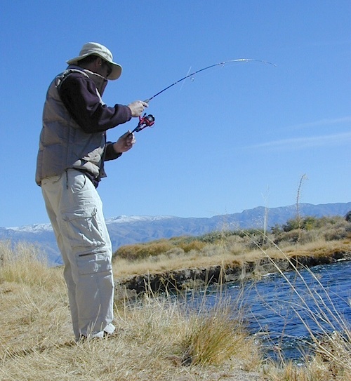
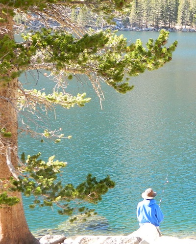
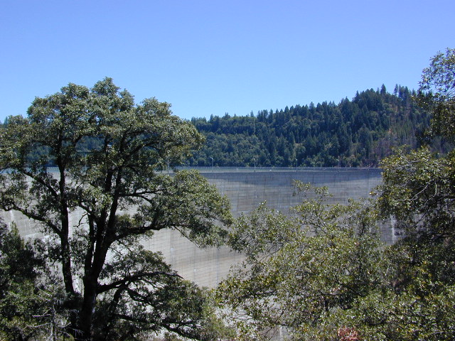
California fishing recreation ranges from sport-fishing, an open sea adventure, to solo casting in deep river canyons. Big Sierra Reservoirs near Gold Rush Country to High Country Alpine Lakes, the golden state has the water – and the outdoor recreation you crave.
Below is an alphabetical list of popular fishing destinations within California. Mountains to coastline, there are many maps to choose from.
BULLARDS BAR Dark Day is a lakeside walk-in campground on a small reservoir, located deep in the Gold Country foothills. Flush toilets and hiking trails, kayak rentals and fishing.
West of Highway 49. Huge dam for hydro-electric power. Minimal roadways along the lake and steep canyons make for optimum hiking and boating. Floating and fishing. Relaxing in the mountains, with fresh water!
On most maps the official name of this lake may read New Bullards Bar Reservoir, or Lake Bullards Bar, but locals just call it simply – Bullards Bar!
Sierra Nevada Foothills. Yuba River, California.
Northern Gold Country, California
Near Camptonville, West off Hwy 49
in between Oroville and Nevada City, CA
Located not far from historic Downieville, Bullard’s Bar is an excellent base camp location for exploring the upper reaches of the Gold Country region. Old mining locations, museums, a covered bridge, various parks, Yuba River, Sierra Buttes, Lakes Basin. Grass Valley & Nevada City are also nearby. Mountain bike trails, river rafting and hiking all around.
roads around lake: Marysville Road (south of lake and east side w/ Hwy 49), Moonshine Road (south of lake), Oregon Hill Road (west side), Pendola Road (north side), and Forest Route #47 (dirt road on north side)
One of the few lakes in the Sierra Nevada that offer boat in camping at developed camp sites, and also to allow boaters primitive camping along the shoreline. No drinking water is available. No pit toilets, so a portable chemical toilet is always required. Plus, pack out all garbage.
No charge for DAY USE areas: parking or boat launch ramps
NOTE: Dark Day & Schoolhouse Campgrounds are the only car camping & RV accessible camping on this lake. These both have flush toilets and drinking water piped in. Hiking trails & boat launch nearby. Wheelchair accessible campsites are available.
CAMPS OPEN: APRIL – OCTOBER Campgrounds @ BullardsBar are usually open from April to October annually and all are closed for winter months.
Located 5 miles northwest of Dark Day Boat Ramp on the west side of the reservoir. Boat in only access. It is used as an over flow campground. There are campsites, but no bathrooms. Portable chemical toilet required. More info call Emerald Cove Marina at (530) 692-3200
Second Spillway – in the works?
Yuba Water Agency has just committed to building a $160 million second spillway at the New Bullards Bar Dam; beginning in 2021, with a completion date of 2025.
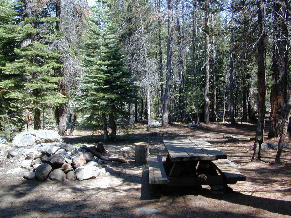
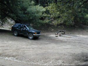
BALCH PARK campground is on a first come basis; no campground reservations needed.
2021 – THIS CAMPGROUND IS CLOSED indefinitely, due to the Castle Fire 2020
Balch Park open May to October
Park info # 559 539-3896
Hedrick Pond lined w/ Sequoia trees
Balch County Park is right in the middle of Mountain Home State Forest, which is within the bigger Sequoia National Forest (aka Giant Sequoia National Monument). But don’t let all the bureaucracy mislead you, this is an ideal park and location, well worth your trip. The campground is the most developed one within the area – with paved roads, RV spaces, flush toilets and a fee to go along with all that. Even gotta fishing pond.
Bears are a big deal in these neck of the woods. Please store all your food properly to avoid a un-welcomed visitor
A Sequoia Grove is nearby with plenty of creeks & meadows.
Trailers not recommended due to the long curvy road leading up the mountain.
Balch Park & Campground NOT TO BE CONFUSED with utility company residences of BALCH CAMP between Pine Flat & Blackrock Reservoirs
Located right on the middle north fork of the Tule River
Inside an unknown area called Mountain Home State Forest, this small campground has a few spots that fill up quickly on weekends and at anytime during in the summer months. Campground closes seasonally, for winter snow.
Usually open: MAY-OCT
HIDDEN FALLS CAMPGROUND
• Elevation: 6,150′
• Number of Sites: 8 walk-in camp sites
• Reservations: No
• Sites Available: First come, First serve
• Vehicle Accessibility: 20′ max.
• Length of Stay: 14 Days
• Water: River nearby
• Toilet: Vault
• Bear Boxes: Yes
• Season: Closed for winter
• Fee: Yes
• Operated By: National Forest Service
• Closest Town: Springville, California
tent camping on river
Motorhome RV campers beware; no hook-ups, no paved roads. This is a primitive style camp, way back on a dirt road – not suitable for large vehicles.
NOTE $ This used to be one of our favorite FREE spots, but they recently started charging an overnight fee for this campground.
Views from Camp
bike
camp
fish
hike
picnic
stargaze
Golden Trout Wilderness trailheads nearby. Plenty of hiking opportunities, great scenery and several Sequoia groves to visit.Mountain biking is allowed on the dirt roads. Single track trails may be overgrown or even off-limits, due to the fragile eco-system around Sequoia trees.
You may actually love this little camp so much, you won’t want to go anywhere else. How ’bout just chillin out: relaxing near the water. Shady swimming holes. Fishing in the Tule River.
Pack a picnic: Back road exploration is a great day trip, for there are many dirt roads weaving in and around this park, near the Giant Sequoia.
Tule River, North Fork
Hidden Falls is accessible via a long, narrow, paved mountain road; then a dirt road, leading 3 miles back to two very secluded campgrounds: this one & neighboring Moses Gulch Campground.
western south sierra
North of Springville on Highway 190, turn left (north) on to J37, some call it Balch Park Road (Google Maps has it as Wagner Drive) and follow it up 3.5 miles to Bear Creek Road (#220). Drive 17.5 miles on curvy Bear Creek Road, turn right and follow signs to campground.
Rock climbing, backpacking, fly fishing creeks, snowmobiling, you name it. No matter what kind of trail you seek in California, we have the maps to get you out there, this weekend. If you seek a week long adventure in the Sierra high country, or a weekend getaway destination you’ve never heard of, or a quick after work hike near your home town, we just might have it listed. And we probably have the waterproof, topographical map too.
DOGS & BIKES on TRAILS:
Dog friendly trails include almost anything within the CA National Forests. Remember that most National Parks & State Parks literally forbid dogs on hiking trails. Mountain bikes can access only certain trails in parks, but in the National Forests nearly every trail or dirt road is up for grabs.
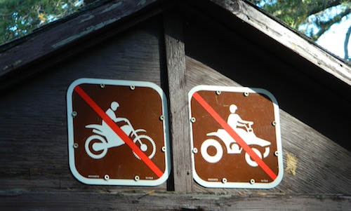
OHV ROUTES:
Motorized vehicles, such as quads, ATVs, dirt bikes, Jeeps & 4x4s must stick to designated routes signed specifically for OHV (off highway vehicle) & you won’t be finding many of those inside National Parks & State Parks, so it’s best to look for BLM or NF lands. Many regular, forest, back roads close in winter due to heavy snow pack & thus become cross country ski, snowshoe or even snowmobiling trails. The best ones can be found in the Sierra Nevada mountains.
And if you ever get bored with “reading” text about trails, you can always search the visual database of amazing Cali scenery over at DanaMite’s flickr site
Merced Lake is one remote destination along the High Sierra Camp Loop, Yosemite Wilderness.
Tent Cabins & Yurt Rentals
around California
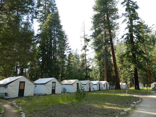
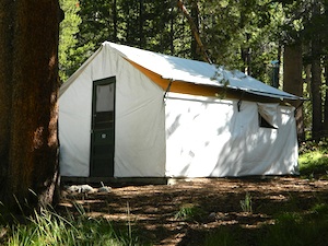
Tent cabins are made up of wooden floors, canvas walls & a canvas roof – a combination between a tent & a rustic cabin. Most have sleeping cots for beds; some have heaters, wood burning stoves or electrical outlets. A shared community bathroom is often close by.
Yurts are round versions of this same concept, with a wooden floor, real beds and usually nicer decor. Often these places request that you bring your own bed linens and towels, but each resort is different, so check the web links for detailed info.
Hike-in locations in the wilderness, rural river resorts or an easy drive to campground right off the freeway. These popular lodging accommodation are often marketed as GLAMPING, as in Glamour Camping – for the (luxury loving) princess who likes to try out nature – in a very controlled setting. Just watch out for mountain lions and bears.
Below are unique places in California that offer tent cabins, tree houses and yurt rentals.
Yosemite Lakes Resort
Cabins & Yurt Rentals
South Fork of the Tuolumne River
31191 Hardin Flat Rd
Groveland, CA
209-962-0121
800-533-1001 Western Sierra Nevada
Yosemite Pines RV Park
20450 Old Highway 120
Groveland, CA
209-962-7690 Western Sierra Nevada
HSC: HIGH SIERRA CAMP
Yosemite National Park Tent Cabins:
(advanced reservations required)
White Wolf Lodge
Backcountry wilderness area along Highway 120, Yosemite NP
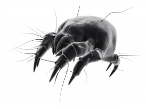
ALLERGY NOTE: Most tent cabins are constructed out of heavy canvas material (fabric), which can mold when exposed to moisture (rain, fog, snow). Often they get dismantled, cleaned and stored properly over each winter season, sometimes not; All depends on weather, terrain difficulty and individual resort practices. If you suffer w/ allergies, moldy tent walls and dust mites can trigger asthma or other allergic reactions. If in doubt speak to the innkeeper or caretaker ahead of time.
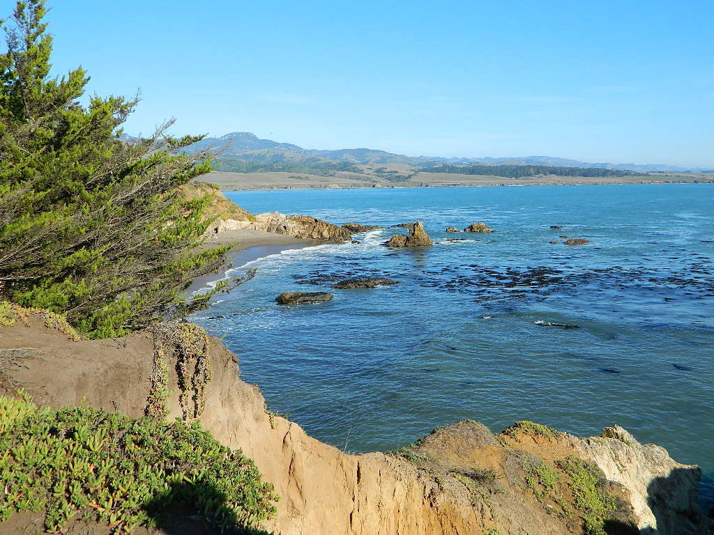
San Simeon SP. Central Coast of California
Rent a Treehouse
Post Ranch Inn
Tree-House Rentals in California
Big Sur, CA Big Sur Coastline
California Camping Rentals: Outdoor gear rentals in California are more common in big cities with large retailers and harder to find in specific, small towns on the back roads. Plan ahead trying to rent gear. Recreation destinations such as Joshua Tree, Mammoth & Bishop might have rental shops, but finding a rental store in an unfamiliar area could be ‘just chancing it’.
Be sure, before you go.
DanaMite has revised this handy list for your wilderness vacation planning, recreational equipment and rental needs.
2020 UPDATE: Recently deleted 4 shops on this page, so don’t be surprised if more gear rental shops vanish.
There are many reason people rent gear. Tourists or vacationers passing through, wanting to experience a non-hotel night outdoors; Beginner backpackers wanting to try out equipment before committing to a big purchase; College students on an impromptu road trip; Novice cross country snow skiers; Doggy now packs in his own food & water too.
A new concept now being delivered is online gear rental, from camping to fly fishing. Seriously. They can ship you quality rental gear, and you can use it, test it, review it, all hands-on, out in the field. These 2 players in the West both ship nationwide. Imagine what else the web will rent in the future?
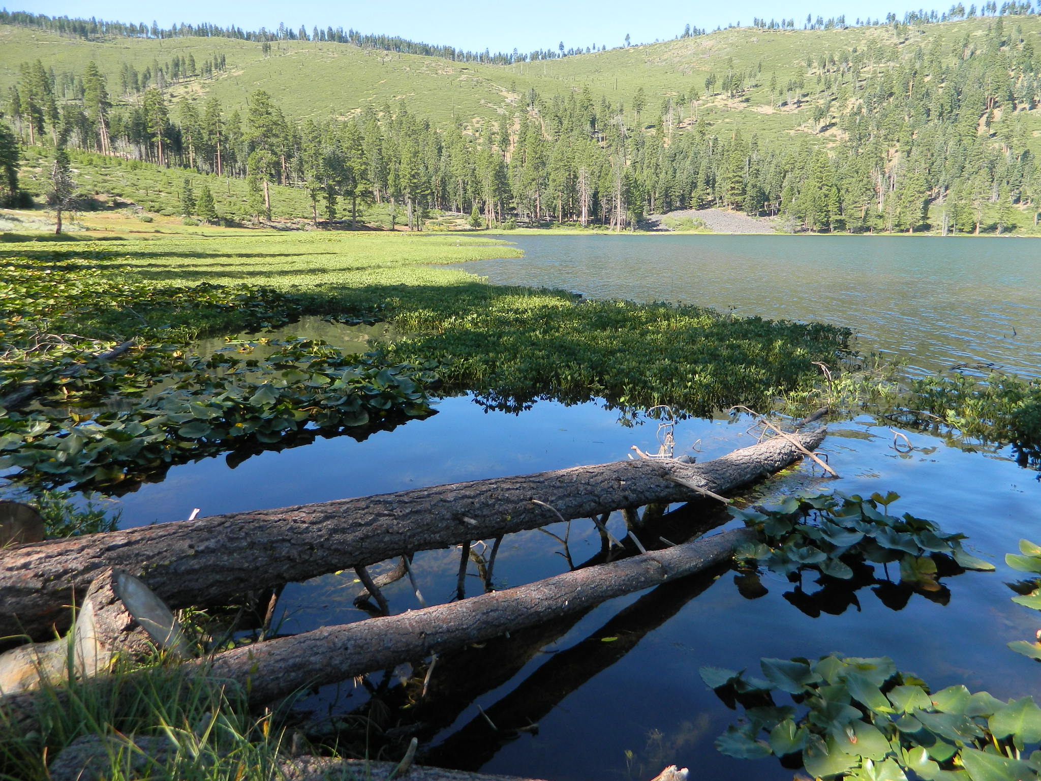
Gold Lake, Sardine Lake, Upper Sardine, Smith Lake, Packer Lake, Grass Lake, Sand Pond, Goose Lake, Snag Lake, Long Lake, Jamison Lake, Round Lake, Deer Lake, Tamarack Lakes, Young America Lake, Frazier Falls
California is the land of granite peaks. Rocky, exposed mountains that stick up out of the landscape for all to see. Southern Cal has a few of them, but most granite peaks in California are found in the Sierra Nevada.
US 395 Eastern Sierra impressive ridge lines are the highest and most photographed and Lake Tahoe has plenty of big granite surrounding it. The farther you go north, the less granite you will see – not because it isn’t there, mostly cuz it is just buried with tall dense forests.
lakes basin day hikers
NORTH SIERRA – The Sierra Buttes are the impressive granite peaks located in between the North fork of Yuba River and Sardine Lake.
SE of Mount Lassen and NW of Lake Tahoe, at the tippy top of the historic gold country. Gold Lake Road #24 connects Gold Country Highway 49 to North of Tahoe Highway 89. Road #24 is often closed for winter snow, so most visitors enjoy this region in the summer months.
The infamous PCT (aka. Pacific Crest Trail) passes the peak and goes north through this basin of alpine lakes, so backpackers are often seen. Tent camping is very popular, as well as RV camping w/ numerous developed campgrounds and open camping as well. Some of the hard to reach primitive camp sites (next to lakes) can be accessed via 4×4 vehicle. Gotta have a good topo map.
Downieville is well known for the mountain biking trails, so this whole region is covered with amazing trails. Snowmobilers and cross country skiers love the area during a good winter snow and they can access this area from the north off Hwy 89.
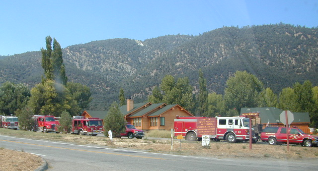
locking down the forests, before they burn (again)
Outside of developed campgrounds and permitted facilities, igniting, building, maintaining or using a fire on national forests in California will be prohibited.
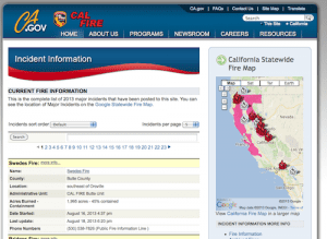
List of Current Fire Restriction Orders for all USFS National Forests in California w/ links.
Fire Restrictions are now in effect for most all public lands in California. Data and news change weekly, so follow links for most up-to-date restrictions, before you make your drive.
These are the earliest and most restrictive campfire orders ever. No? Maybe the long drought years would be equivalent. Below is a brand new list broken down by federal land regions – forest and deserts, including BLM camping areas.
Looks like we are already into Stage II Restrictions for the begining of summer 2020.
NOTE: BBQ grills, all stoves, smoking, firecrackers, welding, chainsaws, off roading, dirt biking, hunting and target shooting are restricted within these orders. A few of these fire restrictions are dated to extend until DEC 31, 2025
More details and specifics can be found on each forests .gov web site, so please use THESE LINKS BELOW (before they break).
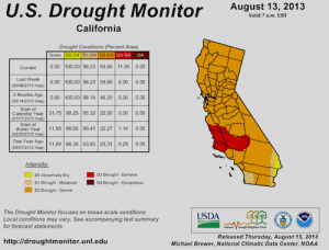
The land is dry and wildfire threat is an ongoing battle in California.
FOREST-WIDE FIRE RESTRICTIONS IN PLACE
Wildfires ravage California wild lands every year. Severity, longevity, most deadly. Let this year be different.
Northern California
BLM (Bureau of Land Management)
no campfires outside of developed campgrounds (statewide) (APR 29, 2020 – DEC 31, 2025)
see the current 2020 BLM Campfire Map
USDA PDF map shows only 26 places that you have have a campfire inside Modoc. The far drive could be worth it – for minimal crowds, darkest skies and maximum fishing. Best for week long road trips, super lazy summer style.
Persons with a valid California Campfire Permit are not exempt from the prohibitions.
However, persons with a valid California Campfire Permit may use a portable campfire ring/pit, stove, or lantern ( 5+ feet from flammable materials) IF THE UNIT burns gas, kerosene, jellied petroleum or pressurized liquid fuel, and is EQUIPPED w/ a shut-off valve.
Wow, what a mouthful. Guess the propane campfire is okay?
SUSANVILLE, Calif. May 29, 2020 – Lassen National Forest is enacting campfire restrictions… effective immediately and until further notice. Outside of developed campgrounds and certain permitted facilities, igniting, building, maintaining or using a fire on national forests in California will be prohibited.
Lassen Camping near a creek in Northern California
BLM Eagle Lake
no campfires outside of developed campgrounds (APR 29, 2020 – DEC 31, 2025)
see the current 2020 BLM Campfire Map
North Sierra where the granite meets the volcanic rock of Lassen. Feather River Watershed, Lake Oroville SRA, Bucks Lake Wilderness, Bald Rock, Quincy, Lakes Basin Recreation Area
Deane’s Valley Campground, way off the main road, between Quincy and Bucks Lake.
Donner Summit and Lake Tahoe get a majority of the Sierra Nevada snowfall and traffic. Deepest snowpacks are measured way up here, with dozens of small lakes surrounded by granite. Less snow means drier forests for 2020, and more tourists means more campfires. One spark is all it takes!
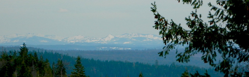
Tahoe National Forest (snowy mountains) April 2020, taken from Oro-Quincy Hwy looking southeast to Donner.
Yosemite’s west side w/ Bass Lake, Mammoth Pool, Granite Creek, Dinkey Creek, McKinley Grove, Shaver Lake, Huntington Lake, San Joaquin River, Mono Hot Springs, Edison Lake, Florence, Ward, Courtright, Wishon, Blackrock, and the Kings River. Biggest water reservoirs draws the largest crowds. Be fire safe and camp inside of a developed campground this summer.
Sonora Pass and the Gold Country have been hit hard by recent wildfires in the past decade, so now we pay the price w/ much tighter campfire restrictions. Popular mid Sierra region, easy access w/ many lakes and reservoirs; highways of CA 108 & CA 44
Campfires banned throughout the Eastern Sierra region until the end of 2022, within both the USFS and BLM campgrounds. US Highway 395, Mount Whitney, Mammoth, June Lake Loop & Mono Lake
Tighter than normal campfire rules for the drier Southern Sierra. Kern River Canyon, Kennedy Meadows, Chimney Peak and beyond. Drive up hill, gaining levation to Sherman’s Pass or the Western Divide Highway and find a cooler campground in the dense trees. Forget the triple digit heat, brushy river and the masses, and climb to a higher altitude for the Big Trees and Big Meadows. Breckenridge, Horse Meadow, Long Valley, Mountain Home.
The possession or use of any steel jacketed or steel core ammunition of any caliber. This would include handgun, rifle and shotgun ammunition unless a person is in possession of a valid State of California hunting license and is actively engaged in the legal take/pursuit of game and non-game species in accordance with current California hunting regulations, and
During the issuance of Red Flag Warnings and Fire Weather Watches, as determined by the National Weather Service (NWS), all recreational shooting and use of campfires, is temporarily suspended to reduce the potential of unintended wildland fire ignitions for the period of the event.
Stage II Restriction:
All the restriction in Stage I above, and
Setting, building, maintaining, attending, or using open fire of any kind is prohibited, except campfires within approved fire pits and grills provided for in developed recreation sites; or campfires within the Imperial County Special Recreation Management Areas with a valid California Campfire Permit. Controlled flame devices such as portable stoves and lanterns with shut-off valves,using gas, jellied petroleum, or pressurized liquid fuel are allowed and require a valid California Campfire Permit, and
Smoking, except within an enclosed vehicle or camp trailer or while stopped or standing in a three-foot diameter area barren or cleared of all flammable materials and away from federal facility doors, windows and air ducts.
Stage III Restriction:
All the restrictions in Stage I above, and
Setting, building, maintaining, attending, or using open fire of any kind is prohibited. Controlled flame devices such as portable stoves and lanterns with shut-off valves,using gas, jellied petroleum, or pressurized liquid fuel are allowed with a valid California Campfire Permit, and
Smoking, except within an enclosed vehicle or camp trailer unless prohibited by State or local laws.
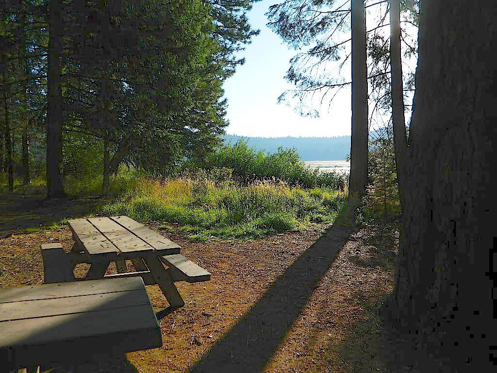
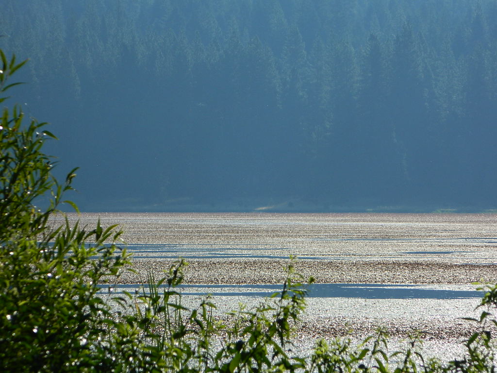
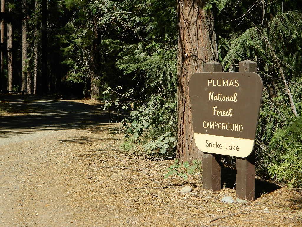
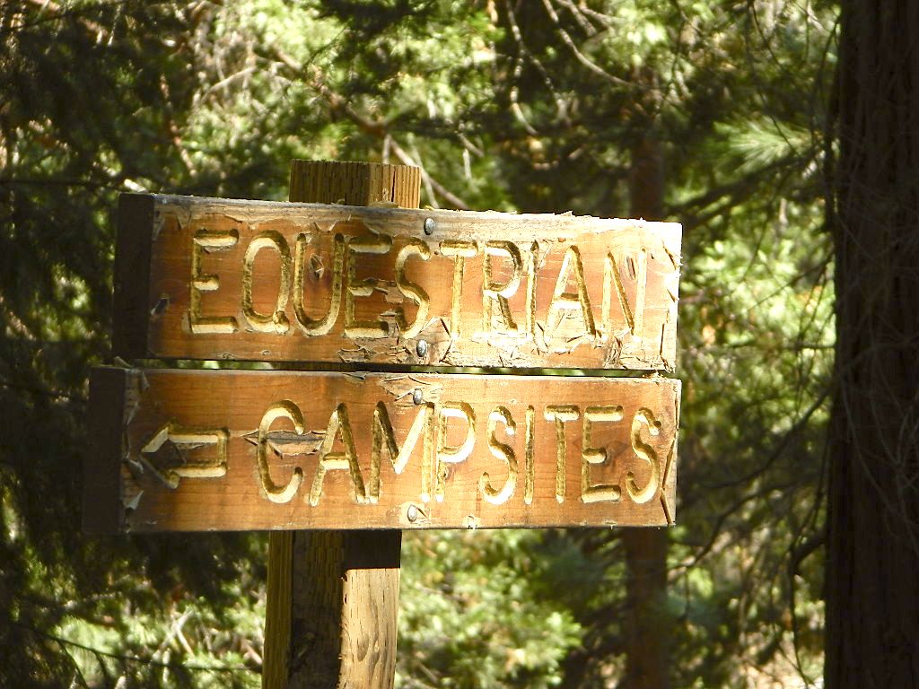
Don’t let the name frighten you, Snake Lake is a very scenic fishing lake – but you will NOT want to swim in it. Lily pads cover the water surface most of the year so it is considered “frog heaven” during the warmer months. NFS has been upgrading these camping facilities recently. Snake Lake Campground has new picnic tables, camp fire rings, bear boxes, vault toilet and expanded equestrian camps and corrals. No piped water, so bring your own. A bucket & shovel are always required for proper campfire maintenance.
One of the best campgrounds in the region, Plumas National Forest and close to Quincy, CA. Paved road access means an easy 3 miles off the main road (Bucks Lake Road, aka Oroville-Quincy Highway, Oro Quincy Hwy). 7 miles west of the town of Quincy, the green, metal, one-lane bridge is easy to spot, but the small sign for “Snake Lake 3” is easy to miss, if driving 50 mph or faster. Turn off is located in between Quincy and Meadow Valley.
Equestrian camp sites, horse corrals, OHV trails, group picnic areas. Hiking, fishing, mountain biking, off roading, horseback trails, kayaking or canoe.
Snake Lake Campground NFS
• Elevation: 4200′
• Number of Sites: 17
• Vehicle Accessibility: small RV
• Campsites Reservation: No
• Camp Fee: Yes
• Length of Stay: 14 Days
• Season: May – October
• Trailheads: OHV, Horse & Winter Rec
This lake camp serves as a central hub for travelers, motorcyclists, campers, hikers, fishermen, off roaders and equestrians alike. Mountain biking & OHV trails go off in numerous directions and horseback trails are readily accessible. Winter Recreation Area means snowmobile trails too.
Another smaller lake, Smith Lake, is a short drive or short hike (on dirt road) further into the woods, with the Butterfly Valley Botanical Area neighboring it.
another Snake Lake?
Another SNAKE LAKE exist inside Plumas National Forest. The smaller Snake lake can be accessed by off-road trail Road#12E66, off the Gold Lake Highway; 4×4 is required to reach this one. West of Gold Lake in the Lakes Basin Recreation Area. The PCT is routed nearby one mile away.
Free Campgrounds in the Sierra Nevada Mountains, California
no charge camp, no fee camping, free campgrounds
No fee camping: Bare bones. California Sierra Campgrounds without the fee.
Developed BLM or NFS campgrounds, where you can still have a campfire. Vault toilets, panic tables and fire rings. Use bear boxes when provided for proper food storage.
secluded campgrounds
Below is a good long list of some favorite free developed campgrounds in the Sierras. Many will require dirt road driving, as most are located well of the highway. Perhaps the 12 mile rough road will thin out the crowds. Free overnight stay!
2020 update:this list is shrinking, as more California National Forests start charging for the smallest of campgrounds.
Pack in your drinking water and pack out your trash. Campfire permits are not required at developed campgrounds; but a bringing a water bucket and shovel is necessary for tending your campfire. Piped water is not always available, or perhaps, not in working order at these primitive style camps. Be prepared to rough it a little.
Free camping outside of a developed campground, for a self-contained camper who wants seclusion and privacy. Real relaxation in total peace and quiet. More nature, less people and minimal vehicles.
Free Campsites • Dispersed Camps • Open Camping • Boondocking
primitive camp sites –the bare minimum. a clearing for a tent, maybe a fire ring. no toilet, no fees; dirt road access.
campfire permits required. And it is up to you to know the current fire restrictions in the area you seek to camp overnight.
The further out you are willing to drive, the more remote you can be. Good topo maps of the region help you to find these ultimate, secret camping spots. National Forests & BLM Lands require a free camp fire permit to have a campfire.
Fire safety is always a big concern in wildfire prone areas like California. Additional Permits & Passes may be needed in some forests or parks; each location is different. Check with the local ranger station for up to date restrictions.
Many dirt roads lead avid campers to the best out-of-the-way camp sites. Camps may have picnic tables or just a fire ring, but usually NO toilets. Have the “No Bathroom Blues”? Don’t sweat it. check out the page onCamp Potty
Some camp sites are as bare as a small clearing, a rock fire ring if you’re lucky. A detailed backcountry map is always advised. If you count on your digital mobile device and online access for mapping, you could find yourself very lost. GoogleMaps is known for mislabeling the smallest of back roads – and they do not feature dirt roads either.
Turtle Mountain Road, SoCal
A high clearance vehicle may be needed to reach certain camp spots, but many can be accessed with a standard passenger car. Low riders will likely bottom out and motorcycle riders will get dusty.
Know your vehicles limitations for any off-road use and don’t get stuck in a bad situation. Soft sand is quite common in deserts and 4×4 might be needed. There aren’t any tow trucks out in the boonies and if you do find one, it’ll cost you something fierce. Watch for large rocks, deep ruts or tree limbs in the road (at any time) and watch low overhanging branches when driving a motorhome in to such spots. Some dedicated, hard-core RV campers prefer to camp in remote locations.
Southern California has something called yellow post camps, but we’ve really ONLY seen them inside San Bernardino National Forest areas, which includes Idyllwild and Mount San Jacinto, plus all the Big Bear Lake Mountains.
YELLOW STICK? These are fire safe spots w/ picnic table; secluded in the forest, some accessible by passenger cars, while other camps require a 4×4 to reach. Yellow post sites campfires are often off limits during fire restrictions, when only fires are allowed inside the larger developed campgrounds.
dirt road and trailheads
Backpackers trailheads often have a few camp sites near the parking lot, but these may be busy during summer months. Dirt roads leading to trailheads can have primitive camp sites along them as well. Long, big creeks in the forests are notorious for having awesome camp sites. Big river camp sites are sometimes free, if you know where to look. Sometimes the smallest of California campgrounds have no charge, first come, first serve (BLM, National Forest, or State run).
Before it got labeled BOONDOCKING: Primitive Camping in remote spots was what we lived for. Camp outside of developed campgrounds, for free. Campfires will usually be banned on these back roads during the driest part of the year. Check with local ranger stations for current fire restrictions.
Inyo High Country RoadsMcCloud #39N06 – Grizzly Peak Lookout Rd
pros and cons
possible dirt road access, seclusion, privacy, darker skies, no fees, no crowds, real peace & quiet
no toilet, no picnic tables, no pavement, no hospital, a long hike out, no cell phone service?
always be prepared to hike out (if need be).a giant tree can come down and block your exit road. landslides often happen on dirt back roads. the vehicle could break down or become disabled. get a topographic map and know how to read the terrain, without your device/phone.
PAY extra close attention when driving in (visually with terrain and your eyes and your map). You never know when you may need to back track – or turn around to find a PLAN B campsite.
Avid camper people are indeed known to GPS waypoint their favorite pick campsites (way on the back roads), so they can arrive after work, in the dark, on a Thursday night. Now that’s planning ahead!
Lassen National Forest roads and trailheads, surrounding Lassen NP
Lassen National Park is completely encompassed by National Forest land with dirt roads, off road trails, serene lakes, secluded camp sites, hiking trailheads and wilderness access
California State Route 89 (highway 89) runs north/south thru the middle of the park and closes for months due to winter snow.
California State Route 36 (highway 36) runs east/west on the south side of the National Park, connecting Red Bluff to Susanville, CA
California State Route 44 (highway 44) runs east/west on the north side of the National Park, connecting Redding to Susanville, CA
East of Lassen National Park
Lassen Forest Road #10
Echo Lake, Silver Lake, Caribou Lake. Campgrounds, trailheads, backpacking, day hikes, parking, equestrian.
Crater Lake on the north side of Hwy 44
Lassen Forest Road #318
Juniper Lake Road (aka Chester Juniper Lake Rd)
N of Chester, CA
paved first 5 miles, then becomes graded dirt road for another 5.
Benner Creek runs along the first half of this route w/ Banner Creek Campground: elevation 5562′ / 9 camp sites / open May-Nov
Juniper Lake at end of road w/ NPS campground
elevation 6792′ / 18 camp sites / open June-Sept
Lassen Forest Road #312
Warner Valley Road (aka Drakesbad Road)
N of Chester, CA
10 miles long, paved most of the way, then becomes graded dirt road out to Drakesbad meadow.
Wilson Lake Road, connects Hwy 36 to Road #312
Domingo Springs Campground: elevation 5060′ / 18 camp sites / open May-Nov
Lassen Road #29N18
W of Chester, CA
Loop route off Forest Road #311 w/ North Fork of the Feather River, leading to Elizabeth Lake trailhead
Lassen Road #29N19
W of Chester, CA
Graded dirt road w/easy access. Connects Forest Road #311 to highway, paralleling Hwy 36. Lost Creek runs along this route w/ Willow Springs Campground: elevation 5100′ / 14 camp sites / open May-Nov
West of Lassen National Park
Lassen Forest Road #17
W of Lassen NP
North-South dirt road that connects highway 36 to highway 44.
Heart Lake trailhead
At the south end on Hwy 36 is Battle Creek Campground: elevation 4800′ / 50 camp sites / open April-Oct
Lassen Forest Road #29N22
Mineral Road connects Hwy 89 to Viola on Hwy 44
McGowan Lake Winter Recreation Area at South entrance of Lassen National Park
Camping North Lassen
North of Lassen National Park
Lassen Forest Road #32N13 Lassen Forest Road #32N22 (PCT crosses this route)
Twin Bridges networks dirt roads @ Hat Creek.
near Old Station Visitors Center (junction Hwy 89 & 44).
Hat Creek and Cave Campground on highway 89, Big Pine Campground off highway; Numerous dirt back roads for dispersed camping, near the viewpoint on highway 44
Road #32N20 Road #32N56 – road just south of Subway Cave near Old Station, off SR Hwy 44 lead to small Baker Lake.
Road #32N92Y side route leading from Hwy 44 to Road #32N21 along Butte Creek.
Butte Lake Ranger Station and Butte Lake Campground: elevation 5600′ / 20 camp sites /open May-Oct
Road #32N09 connects Forest Road #10 to Widow Lake trailhead and Butte Lake. Road #32N60 is Bogart Winter Recreation Area, at Hwy 44
Hat Creek Lassen Road #18 runs north/south along Hat Creek Rim. Dirt road parallels Hat Creek Valley on the east side of Hwy 89 Road #22 connects Hwy 89 to Hat Creek Rim. A popular hang glider launch area after the University of California Radio Astronomy Observatory, then the road continues eastbound to cross Pittville Rd #111 and ends up at Little Valley
Lassen NF Road #111 is Pittville Rd, runs north/south paralleling Hat Creek Rim to the east side. This 30 mile long route connects Hwy 44 to Pitt River at Hwy 299 near Fall River Mills, CA
Sherman’s Pass, Sequoia National Forest
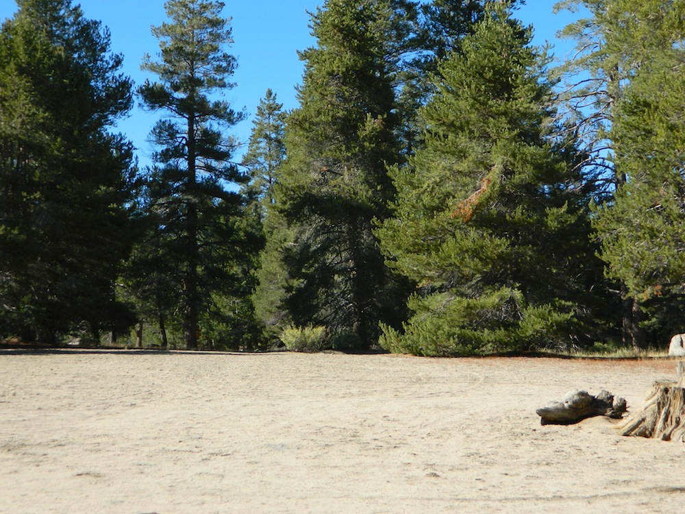
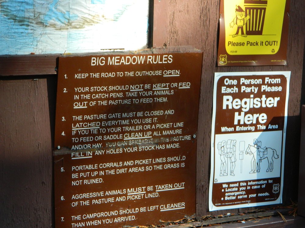
Big Meadow borders Dome Land Wilderness
in the Southern Sierra Nevada mountains
There are many large and gorgeous meadows inside Sequoia National Forest, but none compare in ‘grandeur’ to this southern Sierra public pasture. BIG MEADOW KERN
Find your way north of Kernville and the river really comes into view. Up close, right there! Stop, get out of the vehicle for a stretch break and breathe; take it all in. This is only the start of the adventure. Gorgeous Big Meadow is located up on the Kern Plateau, 3000′ above the river on the eastern ridges. Only accessible half the year due to snow, this meadow is a must see for those exploring the eastern side of the Kern River.
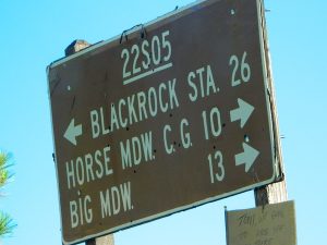
Sherman’s Pass Road #22S05 is a hard right turn after the Johnsondale Bridge. It is well signed and still easy to miss. Climb out of the dryness and into the dense forests and meadows of higher altitudes. Driving this southern Sierra-crossing route, Sherman’s Pass Rd. will require all of your concentration. Steep, curvy road without guard rails. Plus epic, scenic views (NOT to die for).
At this point – Rock slides, snow gates and road closure are typical in winter months. Check w/ rangers in Kernville about road conditions (before you head up this way).
The partially paved road will lead south a few miles, then becomes GRADED DIRT and ventures another 15+ miles – way, way out into dead-end territories. Not one road connects down to Lake Isabella!
Spur roads (all one lane, dirt roads) lead out to various places like – Cherry Hill, Big Meadow, Horse Meadow Campground, Dome Land Wilderness Trailheads, Manter Meadow, Salmon Creek Falls, Cannel Meadows, dozens of trails and spurs. Plenty of primitive camping back in these forest areas. A high clearance rig may be required the further back you go. Mud and snow are quite common in spring and fall.
Extra Large Camp Sites
BIG MEADOW is a favorite camp area among –
backpackers (trailheads)
equestrian (horse campers)
hunters
mountain bikers
off-road campers
westside drive: ample parking and camping for horse trailers
no ‘froading on meadows
Back Loop Road, around the Big Meadow. Narrow & muddy
Or perhaps this is not the Big Meadow near Sequoia that you are seeking. The scenic, giant, public horse pasture listed above is not to be confused with #14S11 Big Meadows Road, also in National Forest land, located in between popular Sequoia National Park and Kings Canyon. (100 miles north of here)


 Bald Rock Canyon is downstream from the big waterfall, Feather Falls, on the
 On the north side of the lake is Grass Valley Bald Mountain (5906′ elev) in between Black Rock Creek and the northern shore.


 Motorized vehicles, such as quads, ATVs, dirt bikes, Jeeps & 4x4s must stick to designated routes signed specifically for OHV (off highway vehicle) & you won’t be finding many of those inside National Parks & State Parks, so it’s best to look for BLM or NF lands. Many regular, forest, back roads close in winter due to heavy snow pack & thus become cross country ski, snowshoe or even snowmobiling trails. The best ones can be found in the Sierra Nevada mountains.