Category Archives: California Rivers

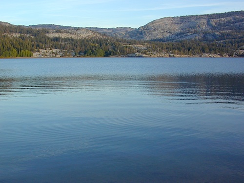
Silver Lake @ Carson

silkysilver

Silver Lake @ Carson Pass

(Alpine Co)

7250′ elev.
on Highway 88 near Carson Pass, California
El Dorado National Forest
near Kirkwood Ski Resort & the Bear River

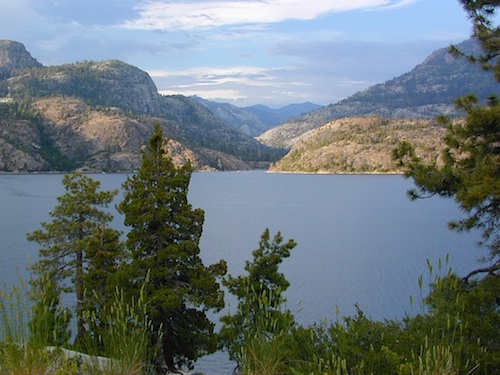
Large, granite, alpine lake in the Central Sierra Nevada Mountains. Abundant trout fishing, swimming, camping, boating, hiking, floating, kayaking, picnic sites, and high altitude backpacking trailheads. Shoreline fishing is just as good as by boat. Fishing boats can be rented at Kit Carson Lodge.
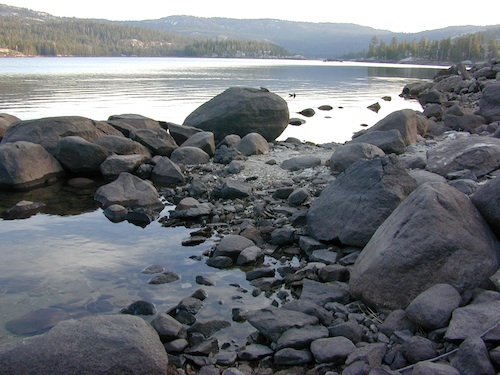
granitesilver

The high altitude location makes this a winter wonderland half the year w/ snow ski resorts nearby! It is an awesome summertime family vacation destination as well. Fishing is excellent through Autumn months. Campgrounds close up shop in October, generally when the snow starts. High Sierra – Deep snow pack means they will not reopen until May (at the earliest).

Carson is major Sierra Pass highway, but it closes for big snows, so always check CalTrans before you make the drive up the mountain. Carson Pass is California State Route 88, which connects the Gold Country (on the western slopes) to the South Lake Tahoe region (on the eastern border), near Nevada.

Check Current Highway Conditions for HWY 88
roads.dot.ca.gov
Cal Trans 800-427-7623

Silver Lake Day Use Areas

fishing lakes picnic grounds fishing lakes boat ramp

These areas listed below are operated by El Dorado Irrigation District and they do charge a day-use fee for many of the amenities provided. Boat Launch fee? Yep. Parking fee? Maybe. Picnic stop! How much? Eat fast!

  • Ferguson Point is located on the north shore of Silver Lake: 10 picnic tables & vault toilets.
  • Sandy Cove is on NW shore of Silver Lake: Wheel-chair access to lake edge, 5 picnic tables, piped water & vault toilets.
  • Oyster Creek Rest Area, up along Highway 88, 1 mile NE of Silver Lake: 10 picnic tables & vault toilets.
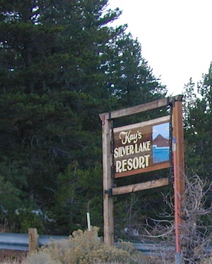
kaysresortsign

Historic Memories: Camp Minkalo, Camp Silverado & Kays Silver Lake Resort are all closed now.

Many small businesses come and go in the rural mountains of California. Throughout the decades, some do survive, but many change hands, change names, or have a difficult time ‘making it all work’ in the off-season. Always call ahead (real phone w/ real person) before you make a big drive to a remote location.

National Forest Campgrounds in this lake vicinity:

East Silver Lake Campground – 62 sites
West Silver Lake Campground – 42 sites
Kirkwood Lake Campground – 12 sites

campground RV campground

Silver Lake Campground NFS

• Elevation: 7200′
• Number of Sites: 62
• Vehicle Accessibility: RV 30′
• Campsite Reservations: Yes
• Camp Fee: Yes
• Toilet: Vault
• Length of Stay: 14 Days
• Season: June – October
• Trailheads: Hidden Lake, Sandy Cove

NFS
El Dorado National Forest
Amador Ranger District
26820 Silver Drive
Pioneer, CA 95666
209-295-4251
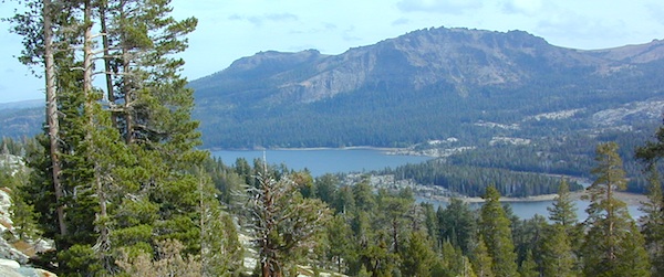
silver from highway

Older lodges, resorts, camps and cabins at Silver Lake were mainly built in the 1920s, while the oldest resort dates back to the mid 1800s. Wow, how cool is that! Much history in this mountain region w/ Kit Carson Emigrant Trail, all stories totally worth exploring.

Kit Carson Lodge
Rustic Silver Lake Cabins & Restaurant
kitcarsonlodge.com
209-258-8500

Historic Plasse’s Resort
One of the Oldest Camps in the USA
plassesresort.com
209-258-8814

Gold Miners

See all Silver Lakes in California

Cold Springs Campground

Cold Springs

Mineral King Campground, Sequoia NP

NPSSequoia National Park: Cold Springs Campground in Mineral King Area

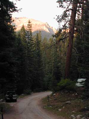
A large developed camp ground with bear lockers, a raging creek, some walk in sites, & access to the Sierra Nevada high country trails.  This is the last real campground in the main valley, everything beyond this spot is pure alpine highcountry.

9000′-13,000′ peaks – in the Southern Sierra Nevada mountains. Car camp, tent camping or bring a backpack and climb to pristine lakes and into the real Wilderness.

Cold Springs Campground, California

on the East Fork of the Kaweah River, closest campground to the hiker trailheads @ Mineral King Valley. Mineral King Road open May-October (depending on snow)

Atop the mighty canyon sits mountain passes, peaks and lakes above 10,000′ elevation. A rocky alpine valley of wonder and water, granite, dark skies and a good night sleep. Black bears and hikers are everywhere, anytime.

This sweet spot river campground has more than 25 camp sites, but there is not a lot to choose from way back here on the dead end back road known as Mineral King in California.  Just up the road a piece from Silver City. Nearest real town is Three Rivers near Sequoia NP south gate, California State Route 198.

Western Sierra /

Sequoia South Camping –

37 camp sites in Mineral King @ 7500′ elevation
vault toilets, river and piped water, bear boxes
first come, first served camping

Max Camper Length: 0
(RV, motorhomes, camper trailers are not allowed)

Rangers Office: 559-565-3768

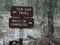
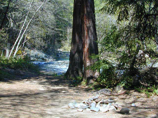
Cold Springs Campground has several campsites right on a river with other sites set up a steep forested hills. There are good number of walk-in camp sites at the end of this campground, ideal for backpackers arriving late at night. The actual walk is more like a hike, so be prepared to carry your stuff a mile down a steep forested trail. You will be rewarded with a great camp spot, near the river, away from the parking lot and noise of the car campers above. Tar Gap hiking trail leads out of Coldsprings campground and straight into the back country.

Coldsprings Camp & Atwell Mill are the only options for local tent camping.
Strapping on a backpack and heading for the high country is what most visitors do, as this is an ideal high country trailhead accessible from the western reaches of the Sierra Nevada range.

Mineral King trailheads lead out to – 
alpine fishing lakes
mountain peaks
Great Western Divide
Kings Kern Divide
Kern Canyon Wilderness
South Sierra Wilderness
Golden Trout Wilderness
Sequoia National Park
Kings Canyon NP
Sequoia National Forest
Mountain Home State Forest
Giant Sequoia National Monument
John Muir Wilderness
ROAD CONDITIONS:

East of Three Rivers, CA on Highway 198 – Mineral King Road peels off to the right, south east to a vast 30 mile long canyon. This mostly paved route closes for winter months when snow is present and rock slides are common. There is a few miles of unpaved, graded 2 lane road, but the majority is paved. Late spring (May) is typically the opening season for this road. RVs, buses, and trailers are not allowed on this narrow, winding road!

MineralKing

BIG TREES NOTE: Although this gorgeous, secluded canyon is located within Sequoia National Park, there are no Sequoia redwood trees in this particular canyon. And you might need to drive an hour up the other mountain to reach them. Just a consideration. If you have your heart set on the seeing the big trees, go do that on another trip. Mineral King is a journey and after your drive that road you will understand a few times.

HIKER PARKING: The NPS rangers station is walking distance from Cold Springs Campground. A beautiful meadow walk to the east of the campground. Bears are known to frequent the area, so locking all food in the provided metal bear lockers is a must.

Badgers are a problem too. Them critters eat radiator hoses – no joke! A good roll of chicken wire could be needed if you plan to leave your car unattended for any length of time.

View Mineral King Camping in a larger map

California Mountain Maps

The Mountains of California

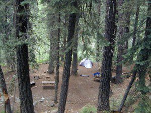
Camping El Dorado NF, on the Consumnes River

If you know you wanna head up in elevation, higher altitudes – to the pine forests of California, but have no clue where to start, this page may be very helpful in determining your ultimate destination. We have hundreds of pages on adventures & locations throughout the golden state. We sell all California maps for outdoor recreation, hiking topos to off road routes.

Wanna camp under the stars this weekend – and avoid the crowds too? You will need a good back road map to find this awesome camp site, guaranteed. Need a hammock spot, small swimming hole & total seclusion? Or how about a large family camp w/ Sequoia grove nearby? Total Escape has something for every ones budget & lifestyle. See below for an extensive breakdown of California mountain regions.

#1
SoCal mountains have tighter restrictions on campfires, larger number of people camping in a smaller amount of space, minimal primitive camping options in the forests, more fees to access these lands.

#2
The Sierra Nevada mountains are the prime outdoor destination for many in the Central California region. High elevations w/ granite slabs to lower country reservoirs & riverside oak flats. Folks come from all over the world to visit parks and lakes within this mountain range. Indeed, 4 National Parks call the Sierras home: Lassen, Yosemite, Kings Canyon and Sequoia NP – not to mention the 10 National Forest and 15+ Wilderness Areas.

#3
You want big water? Cabins next to a prime fishing river or camping near lakes, creeks with dense forests, then you will have to drive to the mid Sierra or even NorCal to find ’em.

Wilderness maps

California Mountain Regions Defined –
find the details on specific region for California mountains

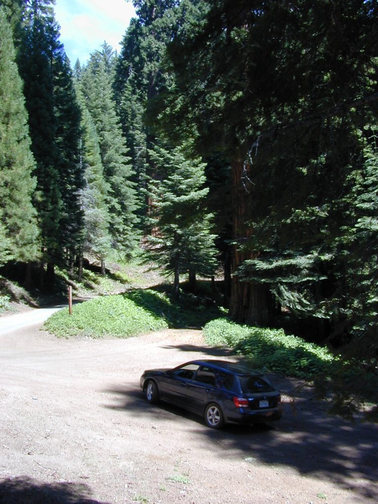
saabaru_forest
Mountain Home Sequoias

epic finds

Find little known parks, camps and forests within our vast California BACK ROADS data base. Below is a small sampling of our picturesque mountain pages, where you can find the best seclusion: hiking, camping, fishing, mountain biking trails, rivers, creeks and peaks.

NFSlogo

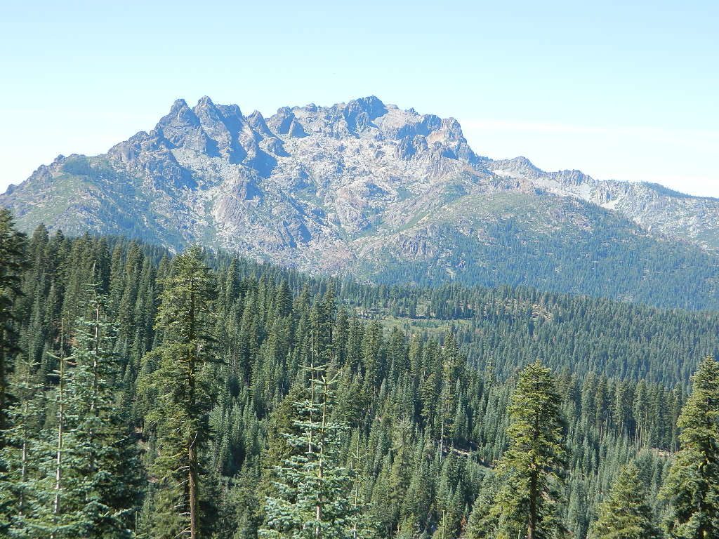
Sierra Buttes
The Sierra Buttes, Northern Sierra near Gold Lake

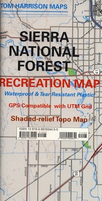
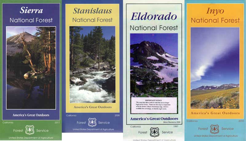
sierra National Forest map

Outdoor Recreation Maps of California:

inyohighroad
Inyo high roads, of the Eastern Sierra


Cottonwood Campground

High Sierra access:

Cottonwood Lakes / Horse Camps

Cottonwood Pass – 11,200′

Cottonwood Lakes Campground, Golden Trout Campground & Horseshoe Meadows Campground… all next to Mount Whitney. This is a prime side option for Whitney & Southern High Sierra packing. Perfect for equestrian travelers, backpackers & day hikers.

Sitting at Tuttle Creek Campground at dusk, just outside of Lone Pine , in the Eastern Sierra – you may have wondered what the hell those lights were. Way off in the distance – to the south. Way up high.

There must be another road that also heads up into the Sierra’s. Yep! Go find this special valley. It is well worth the drive, even for just a day trip. A long and winding drive up from Hwy. 395, in Lone Pine CA – take Whitney Portal Rd up to Tuttle Creek Campground, see the road called Horseshoe Meadows Road on the left. Take it, all the way up, you will be glad you did. Allow hours for the drive, views, hike, & the picnic. It’s bear country so be concerned about your food. Use bear lockers, even for day trips.

mdws1

Cottonwood Campground is located in the Inyo National Forest , this area is just south of Mt. Whitney, is by far much quieter than the masses at the Portal. Although camping is limited to a ‘one nights stay’, the terrain is spectacular with ample parking for backpackers, sightseers & horse trailers alike. The paved switchback road is steep & long, to say the least. RV are not recommended on this Eastern Sierra Horse Shoe Meadows Road.

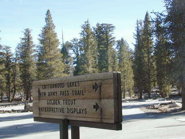
This area is definitely geared towards Sierra backpackers & equestrian trips. The parking lots are pretty roomy, plus there is a one night stay limit on the campgrounds: Golden Trout, Cottonwood Lakes, Horseshoe Meadow. New Army Pass & the Golden Trout Wilderness are both accessed from these high Sierra trail heads. Meadows up here are large & lined with pines. They can range from lush wildflowers to golden dry. Granite, horses & high elevations!

newarmypass
Trailheads to the High Country Sierra

walk-in camp sites:

These campgrounds up here are large and spacious with walk in access only. A common parking area is shared, along with the community fire rings & steel bear boxes. Wide open areas with tons of room for star gazing. The camp areas are not considered secluded. Very open skies & perfect for stargazing.

These camp sites are designed for overnighters preparing for their backpacking ventures into the nearby Sierra wilderness. This high altitude mountainous area closes for winter snows (anytime between October-May) & the campgrounds/trail heads will not be accessible. If road is open in early Spring, I imagine the cross country skiing & snow shoeing would be incredible in those huge meadows. Sierra wildflowers are abundant on certain years.

From Hwy 395 & Lone Pine CA, take Whitney Portal Rd. up to Horseshoe Meadow Rd & turn left. Follow this long & steep road due south hugging the mountain’s edge. This steep winding entrance will take you to some spectacular views over the dry desert Owens Lake & Lone Pine. Then turns sharply west headed straight into the pine filled Southern Sierras. This region is so high in elevation that you can actually see ‘tree line’. At 10,000′ alpine glory, this is prime backpackers country. Exposed granite mountain peaks loom above the tall ponderosa pines.

INYO National Forest: Cottonwood Lakes Campground

campground elevation spots vegetation toilet water fee
Cottonwood Campground 10,000′ 100+ ponderosa vault none yes
parking
Common Parking Lot

LONE PINE CA; Lone Pine Camping
Inyo National Forest
Mt. Whitney Ranger District
760-876-6200

Camping Cottonwood
Camping Cottonwood @ JTNP

ADDITIONAL COTTON:
There’s more than one Cottonwood Campground in California.

JTNP – A more popular spot is the Cottonwood Campground, on the south end of Joshua Tree National Park, near the Interstate 10 park entrance. Click here for camp information.

ABPF – Cottonwood Canyon –  4×4 accessible route which leads to aspen grove and old cabin, on the eastern side of the White Mountains and near the Ancient Bristlecone Pines. Cottonwood Basin is a result of Cottonwood Creek, which flows east toward the state of Nevada.


Sacramento River Camping

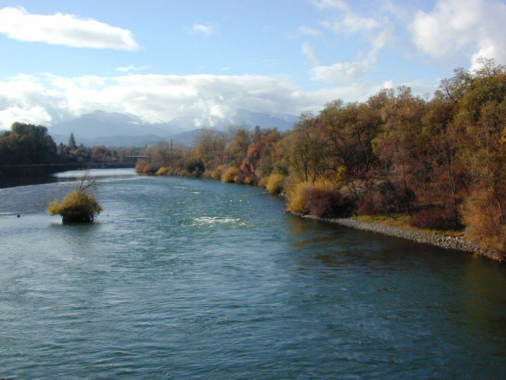
The Sacramento River of Northern California

The main artery from the North; the Big River of California

Sac River California

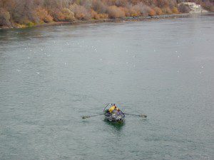
Mighty Mount Shasta snowmelt flows south, bound to meet the giant Lake Shasta, which merges with the Pit River and numerous other major waterways, becoming the big Sacramento River. Running right down the center of the North Sacramento Valley to merge into the California Delta. Shipping channel links the State Capital city of Sacramento with the San Francisco Bay and the Pacific Ocean. Agriculture and wildlife depend on this river heavily.

tent camping camp sites, campground camping, RV camps, dump stations, marinas, bait, gasoline, public boat ramps, boating, fishing, kayak rentals

Redding Winters

CAMPGROUND PARKS below listed from NORTH to SOUTH

JGW RV Park
Riverland Drive
South Redding, CA

Sacramento River RV Park
Riverland Drive
South Redding, CA

Wildlife Refuge
Sacramento River National Wildlife Refuge
Willows, CA
~ Camping is not permitted on the Sacramento NWR. Along the Sacramento River, camping is permitted on GRAVEL BARS for up to 7 days during a 30 day period. For waterfowl hunting, overnight stay is permitted in a vehicle or RV in designated areas. Tents are prohibited. No person may build or maintain fires except in portable gas stoves.

Orchards

Chico Area

Lake Red Bluff Recreation Area
Red Bluff, CA

Driftwood RV & Fishing Resort
@ Mill Creek Park
Los Molinos, CA

Hidden Harbor Marina & RV Park
Los Molinos, CA

River’s Rest Resort
Los Molinos, CA

Woodson Bridge RV Park
Corning, CA

State Parks
Woodson Bridge State Recreation Area
Historic State Park w/ Campground
South Avenue (A9)
Corning, CA

Bidwell-Sacramento River State Park
Chico, CA

Colusa Landing & RV
Butte Slough Road
Colusa, CA

State Parks
Colusa-Sacramento River State Recreation Area
Colusa SRA Camping

Camping Colusa
Tent Camping Colusa SRA

California Delta Region

State Parks
Brannan Island State Park
Rio Vista, CA

Sandy Beach Solano County Park
2333 Beach Drive
Rio Vista, CA

Vieira’s Resort
California Delta
Isleton, CA

State Parks
Old Sacramento State Historic Park
Downtown
Sacramento, CA

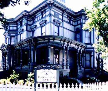
Sacramento Hostel, see more budget lodging

Green Creek Road

Mono County Wildlife Area
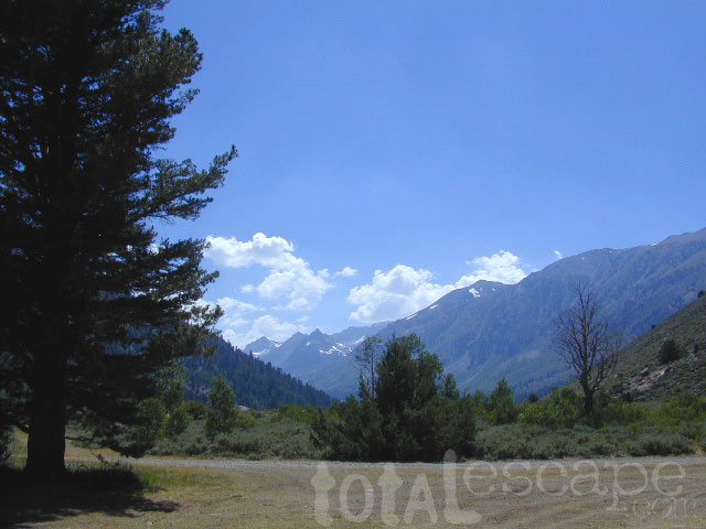
Mono County Wildlife Area, Green Creek Road- off Hwy 395, near Bodie

Green Creek California

Eastern Sierra

S of Bridgeport, CA
MONO – Road #142NFS

Toiyabe National Forest
Bridgeport Ranger District

If you are thinking about fishing or camping the Eastern Sierra, North of Bishop & you are not up for the crowds at Mammoth or June Lakes, then try the Bridgeport area, north on Hwy 395. Rural ranch lands along main road, Bodie ghost town turn off across the highway and Virginia Creek Settlement are also nearby

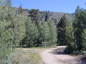
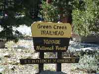
Green Creek is a 11 mile long dirt road in the lush Eastern Sierra the northern portion. The wide, graded dirt road is signed and dead ends at a Toiyabe National Forest campground called Green Creek Campground. The drive up can be washboard bumpy in some parts, but that doesn’t stop the hundreds of adventurous motorhomes that make this trek annually. This place features some of the best prime Sierra back roads camping options for RVs.

Another dirt route, Dunderberg Meadow Road peels off to the left. Dunderberg departs  off Green Creek a couple of miles from the highway and well maintained. This route leads to meadows, aspens, picture perfect scenery and much more seclusion. Passenger car accessible, wide graded dirt roads to wilderness edges. Two-track one lane trails lead to meadow edges and more creeks. Very impressive views of the Sierra peaks over here on this side. Meadows are sensitive areas, wonderful for picnics and you should always minimize impact.

State Park California

Green Creek Wildlife Area
Mono County, California

Aspen Grove Camping for RVs

  • alpine lakes
  • backpacking
  • bird watching
  • camping
  • creeks
  • day hikes
  • fishing
  • hiking
  • horseback
  • hunting
  • mountain biking
  • wildlife
  • wilderness

Plain old passenger cars can easily make this route deep into the Eastern Sierra aspen canyon. Graded dirt and4x4 could be needed winter months. Backpackers can enjoy easy access to the Hoover Wilderness trailheads. There is plenty semi-primitive camping spots along the way, right on the creek, for free…. so no need to sleep in your vehicle upon arrival.

Autumn Aspen Groves: fall colors peak in October, which is usually when the first snows for the winter season start. November – usually the freeze gets them and lifeless brown leaves dangle, until the Sierra Nevada wind gust blow real good.

camp

Green Creek Camping

DIRT ROAD CAMPING

  • alpine lakes
  • backpacking
  • car camping
  • day hikes
  • fishing camping
  • meadows
  • RV camping
  • tent camping

Hoover Wilderness

Dispersed, primitive camp spots along this main dirt road are on a first come basis. You’ll need a fire permit. Many flat camps are set along the creek in aspen groves, some pines, others have  cubby hole privacy. Large granite valley, big creek, bird, scenery and nature everywhere.  Some folks spend weeks camping out here in the warm weather months. Fishing is a big attraction.

Old Cabin in autumn leaves, up near the top of the dirt road deep in the aspen grovesNFS

Green Creek Campground USFS
7500 elevation
11 camp sites
fee, open May – October
trailhead parking nearby

hiking trails lead to

hikes

TOPOGRAPHIC MAPS:

Aspen Camp

California Water Information

California Reservoirs
California Water Resources

water resources / water scarcity / land and water

snow flakes

SNOW PACK

State Snow Depths – Wunderground
SNOTEL Snow Depth Reports
http://www.wunderground.com/StateSnowDepth.asp?state=CA

California Snow Water Equivalents
Sierra Snow Pack Data
https://cdec.water.ca.gov/snow/current/snow/

Eastern Sierra Snow Pack by Sierra Wave
Article published Feb 2014
http://www.sierrawave.net/tag/eastern-sierra-snowpack/

Eastern Sierra Avalanche Center
Snowpack summaries published Dec 2014
http://www.esavalanche.org/content/snowpack-summaries-begin-soon

Sierra Avalanche Center
Sierra Nevada Mountain Snow in California
http://www.sierraavalanchecenter.org/


snow flakes

LAKES & RESERVOIRS

The Lowest Lake Levels in California
List of Reservoirs below 30% full, as reported Jan. 2015


Conditions for Major Reservoirs in California

http://cdec.water.ca.gov/

  • Trinity Lake
  • Lake Shasta
  • Lake Oroville
  • Folsom Lake
  • New Melones Lake
  • Millerton Lake
  • San Luis Reservoir
  • Don Pedro Reservoir
  • Pine Flat Lake
  • Pyramid Lake
  • Castaic Lake

San Diego River & Reservoir Data
Map of San Diego Hydrology, Water Storage
http://www.cnrfc.noaa.gov/

San Luis Obispo Reservoir Data
Lakes on the Central Coast of California
http://www.slocountywater.org/

  • Lake Nacimiento
  • Whale Rock Reservoir
  • Lake Lopez
  • Santa Margarita Lake
  • Twitchell Reservoir

Ventura County Watershed Map
Watershed Protection District
http://www.vcwatershed.net/

snow flakes

RIVER FLOWS

California River Forecast Center Map
Overview for recent rainfall data, snow depths, and ocean temperature
http://www.cnrfc.noaa.gov/google.php

California Current River Conditions
CA.gov Dept of Water Resources
http://cdec.water.ca.gov/river/rivcond.html

California River Forecast
California Nevada River Forecast Center
http://cdec.water.ca.gov/rivforecasts.html
Drought Info
http://www.cnrfc.noaa.gov/droughtInfo.php

Upper Sacramento River Forecast
Northern Sacto River
http://cdec.water.ca.gov/cgi-progs/rivfcast/USACBUL

snow flakes

NEWS & STATISTICS

Irrigated Lands in California – Farming Map

Dry Wells in California – DanaMite’s Map
More than 1,480 domestic well failures in 36 counties have been reported to the state of California recently.

California will need 11 trillion gallons of water to end epic drought by Mashable.com
http://mashable.com/

California Department of Water Resources
http://www.water.ca.gov/

Water in California – Wikipedia
Reservoirs, Water Sources, Aquaducts, Water Distribution
https://en.wikipedia.org/wiki/Water_in_California

Residential Per Capita Water Use across California
Water conservation measures and stats per city
http://www.californiadrought.org/

Aquafornia, the Water Education Foundation
California water news from various news sources
http://www.watereducation.org/aquafornia

Association of California Water Agencies
Largest statewide coalition of public water agencies
http://www.acwa.com/content/water-information

USGS Water Data for California
The United States Geological Survey
http://waterdata.usgs.gov/ca/nwis

EPA – Environmental Protection Agency
California Drinking Water | Local Drinking Water Information
http://water.epa.gov/drink/local/ca.cfm

California Water Impact Network, C-WIN
Advocates for equitable and environmentally sensitive use of California’s water
http://www.c-win.org/

California Drought Map
National Drought Mitigation Center
http://droughtmonitor.unl.edu/Home/StateDroughtMonitor.aspx?CA


snow flakes

PACIFIC OCEAN

Heal the Bay
Volunteer, Beach Cleanups, Santa Monica Pier Aquarium
http://www.healthebay.org/

The Pacific Genocide

  • Fukushima Meltdown
  • Acidification of Oceans
  • Overfishing
  • Pollution & Oil Spills
  • Marine Life Watch

Klamath Fire

Klamath Fire

InciWeb: California Fires 2018

NorCal – Klamath River: 2017 fire season provided significant firefighting challenges. In order to meet future challenges in the most effective way possible, the NFS will continue to use prescribed burning as a tool in our mission to reduce build-up of hazardous fuels, restore forest ecosystems, and improve resiliency and safety of communities within the wild-land urban interface.

Planned projects include burning piles of stacked materials and low to moderate intensity understory burns of vegetation on the forest floor. The main goals of these projects are to reduce the severity of future wildfires and provide added protection for communities in the wild-land urban interface. In addition, the burns will promote a diverse and more resilient forest, and improve habitat for wildlife.

NorCal River Camping, Fishing, Kayaking, Rafting, Recreation.

Klamath burns will take place on the Salmon River, Scott River, Happy Camp, Oak Knoll and Goosenest Ranger Districts between April and June 2018. The actual dates of ignition will depend on local weather and fuel conditions.

Expect smoke in the Klamath for spring time!

Great Camping all summer long. June – September

https://totalescape.net/shop/marble-mountain-wilderness-map/

Find a Creek

Finding a Creek in California

Creek Bound Campers

California Stream Fishing
California Creek Camping

Since SoCal is more of a desert terrain, big water in California can be found elsewhere throughout the state. Natural waterways flow primarily from NorCal and from the backbone of the west coast, the Sierra Nevada mountain range. Determining the region to explore is a first step, then narrowing it down to several possible camp spots after you’ve found a good printed map (a hard copy, non digital, non electricity, the old fashioned kind).

California Rivers are popular destinations for the outdoor vacationer. The most desirable streams or creeks in California flow into a reservoir, not out of. The wilder scenery above the lake, deeper up the canyons are the secluded places we seek. Some accessed only by dirt back roads. 4×4 camps are commonly positioned near creeks.  Wilderness trail heads can lead to even more privacy if you are willing to huff it.

SELECTING A MAP

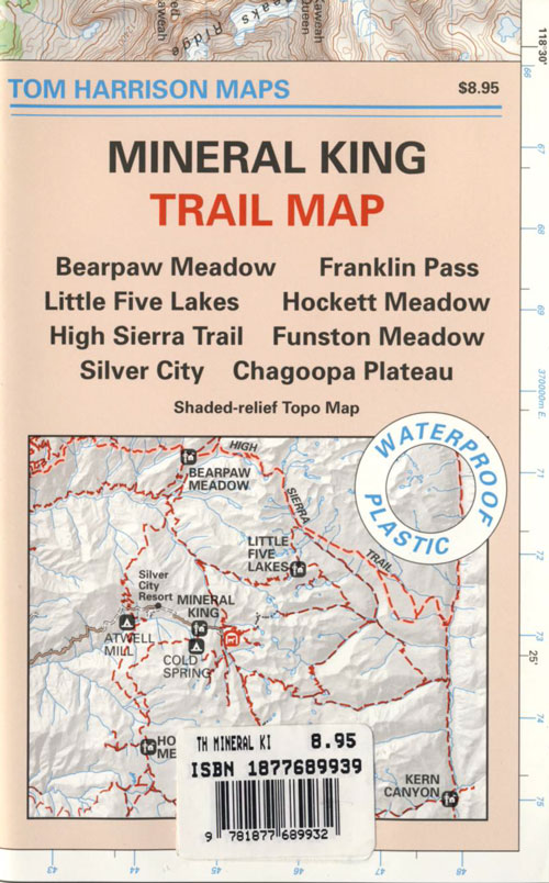
Full color, waterproof maps show every creek, stream, river, paved road, dirt road

Topographic maps show more detail on terrain, elevation, trails, roads; Less colorful.

READING THE MAP

look for the tiny blue lines, the bolder the better

– is your choice a main blue line?
– does this one creek feed into another larger stream?
– is it a creek that will be flowing strong?
– how far from a paved road is it?

How to find a streamside camp

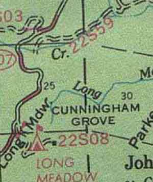
Forest Service Back Roads are usually one lane dirt roads and have strange long numbers attached to them. Maybe signed, but don’t count on it. In the illustration: Look Road #22S59 is right along a creek, and maybe 22S08 has some water sources, but has a developed campground w/ possible fee. 22S59 is very likely to have some dispersed sites along it. You always have options open when you have a good map; make your back up choices when planning your destination. Have a few plan B roads chosen, just in case your first choice is too steep of a slope, or packed with RV families, or totally muddy and impassable with your vehicle.


Creekside Camping in California

MIneral KIng Walkin Camps

4WD needed?

Spring snow melt is when the dirt roads are still closed (gated) and often quiet muddy. Some primitive camp sites may be best access with a 4-wheel drive, but each river or creek side camp spot is unique at different times of the year, due to the snow depth and land erosion process. For easy-going exploring purposes, small all-wheel-drive vehicles work well too, but clearance can be a limiting factor. You wouldn’t believe what passenger cars we see on the back roads of Baja. Almost anything goes anywhere, slowly, as long as it runs and rolls.

last tip – mosquito, where?

Screen room tents may appear unsightly, but those hungry, annoying mosquitoes don’t really care what flavor you are. Them lil suckers are abundant in areas with water, standing or still water, meadows, creek beds, especially active in the warmer summer months. Beat ’em before they hatch – camp in the springtime. By autumn their numbers seem to dwindle with the night time chilly temps, but make sure to come prepared for those colder nights.

California Countryside Hikes

California Wine Country Hikes, Gold Country Hiking, Sierra Foothills, River Trails

DSCN1649

7N83 – Stanislaus NF

whitehorse

Forest Road #7N83 – Clark Fork Rd
Paved spur road, off Highway 108, Sonora Pass

Stanislaus National Forest
Clark Creek, flows west to Middle Fork Stanislaus River
Horse camping, Campground Camping, close to trailheads

NFS Campgrounds on this road:
NFS

Clark Fork Campground
Clark Horse Campground
Sand Flat Campground

Clark Canyon is a popular horse camping area in Stanislaus, located in between 9000′ – 10,000′ elevation peaks. This Sierra Nevada area is known for volcanic features and nice meadows. A small set of (hidden) cabins and pay phone along highway will be the best landmark for identifying the Clark turn off.

Hiking trailheads on this road:

Iceberg Meadow Trailhead
Carson Iceberg Wilderness Area

Forest Road #6N06, a dirt road to higher elevations and primitive camps, is also close by. Traversing up above the Fence Creek Campground (NFS).

Topo Maps of this Region:

Stanislaus National Forest Map USDA
Carson Iceberg Wilderness Map USDA
Carson, Emigrant, Mokelumne Map NatGeo
Sierra Nevada Topo Map

clarkstrails

Closest towns:

Dardanelle, CA
Pinecrest Lake, CA
Twain Harte, CA

California Camping Maps

California Campground Maps

Maps are the key to finding your very own slice of heaven in the Wilderness. Online map sources can barely get you to your city destination correctly, much less the remote waterfall you desire. You will need a real map for your adventure. A topographical map, with all the details, dirt roads & hiking trails. If you are seeking to stay away from the touristy crowds, this is the best possible place you can be…. on this site, searching for ways to make it happen – this weekend.

BACKPACKERS BACKPACKING MAPS –

maps of California
Mount Whitney, John Muir & way beyond the High Sierra. DanaMite has all the California Wilderness maps on the new map shop. Various brands and types of maps. Most are printed on waterproof plastic now & are tear-resistant.

CAR CAMPING MAPS –

El Dorado Camping
Planning on camping outside of the developed campgrounds & finding that perfect stream side spot without the reservation & the fees? Then you will need a free fire permit (from a ranger station), plus a good map of the forests & a vehicle capable of handling the rugged the back roads. Much of California is prone to wildfires, so make sure campfires are even allowed on the backroads, before you get out there. Call the “field rangers” for back road advice and current recommendations.

CALIFORNIA OFF ROAD MAPS –

Wanna take that 4×4 vehicle somewhere really special this season? Camp well beyond the masses, way down that dirt road. We have OHV maps for SoCal, the deserts & all the National Forest maps too.

CALIF CAMPGROUND MAPS –

Start your search on the perfect campground or camp site with the destination in mind. Mountains, deserts, coastal. Parks & forests all have their own maps with all nearby camp grounds listed. We feature all the National Forest maps, as well as some State Park & National Park maps

See all California topo, hiking, camping maps

Sierra Nevada maps

coolsprings

  • California A to Z
  • California Camping
  • California Elevations
  • Camp Firewood
  • Camp Potty
  • RV camping deep in the Sierra
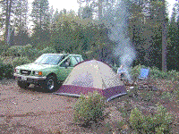
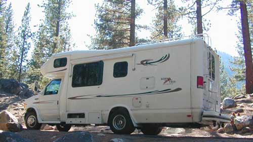
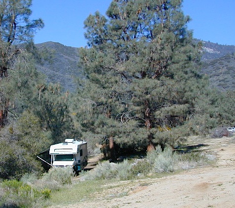
    RV camping at it's best in the Sierra; This rig found themselves deep in the alpine lush meadows with towering trees and a view and a very private camp site.
    Big Bend CA
    Big Bend Ranger Station, off I-80

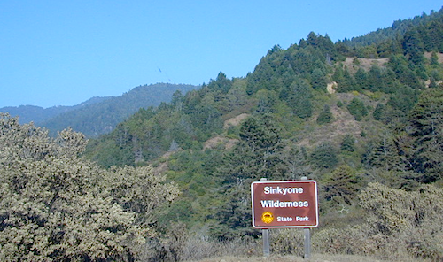
    Sinkyone Wilderness

    Lost Coast of California

    Lost Coast California Sinkyone Wilderness State Park

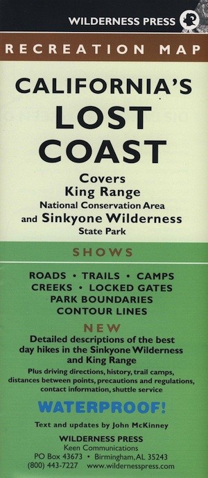
    NPS  King Range National Conservation Area

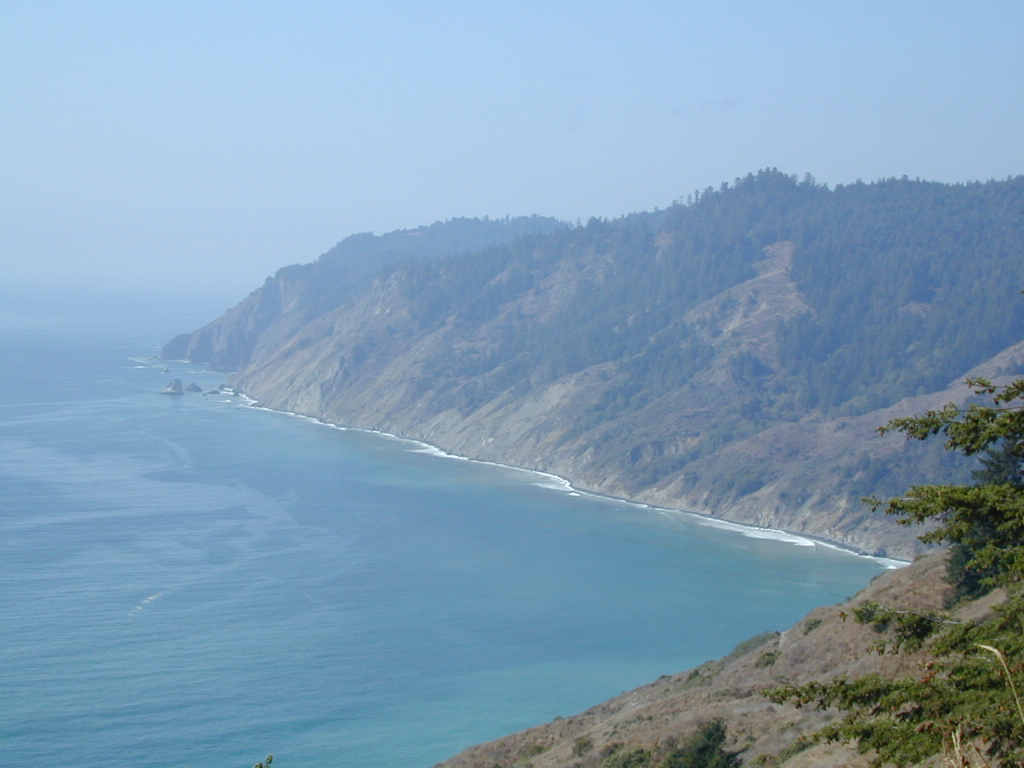
    Redwood groves and wilderness meet the Pacific Ocean at the infamous Lost Coast of California. Northern California is NorCal – steep trails, creeks, waterfalls, ocean views, and coastal cliffs. Mendocino and Humboldt County has numerous redwood parks and picnic grounds located near Pacific Coast Hwy 1 & US Hwy 101. This particular wilderness area is located in between Westport and Shelter Cove, just west of Leggett, CA. Situated on the west side of US Hwy 101 and only accessible via a long dirt road. The Sinkyone wild lands are managed under the California State Park system.

    Sinkyone Wilderness hike Ranger Station 707-986-7711

    Sinkyone Wilderness access –

    North end – Needle Rock: 36 miles southwest of Garberville & Redway, California. Briceland Road west from Redway, this road becomes Mendocino County Road 435. The last 3.5 miles are unpaved, steep, & narrow. South end – Usal Beach: Approximately one hour north of Ft Bragg on PCH or 15 miles west of Leggett on PCH from Highway 101. Look for mile marker 90.88 on PCH. Turn north on small dirt road; 6 miles to Usal on unpaved, steep, narrow road.

    ROADS MAY BE IMPASSABLE IN WET WEATHER. RV’S & TRAILERS NOT RECOMMENDED.

      View Larger Map

    dscn0147 Usal Campground

    LOST COAST CAMPING

    Usal Campground – USA Lumber Company staged a logging operation here in the early 1900’s. Now this remote spot is a popular back road campground accessibly only by a long dirt road drive. 4×4 and car camping only; No trailers or RV campers!

    NEARBY TOWNS

    Wilderness State Park

    Dinkey Creek

    Dinkey Creek, California

    dinky what?

    Dinkey Creek California
    Dinkey Creek really ain’t all that small is it?

    Dinkey Creek elevation 5700′

    Dinkey is a major feeder creek originating with high altitude lakes in the Wilderness above, flowing down to the Kings River. Dinkey Creek has a seasonal large campground and a general store that is open during the summer months. Campground Reservation are common since this is a well-known destination of the Western Sierra.

    in the mountains above Fresno

    Located deep in the Sierra National Forest, 15 miles south of Hwy 168 @ Shaver Lake, via a very long, winding, paved road. Not suitable for large motorhomes.

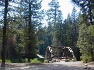
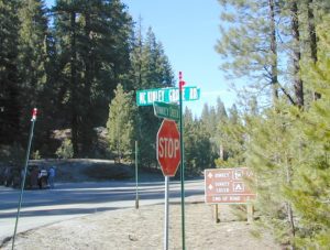
    Dinkey Creek Road becomes McKinley Grove Road @ intersection of historic, wooden Dinkey Creek Bridge. McKinley Grove Rd  leads further south, past Sequoia trees, numerous other NFS campgrounds and on to the 2 big reservoir lakes (Wishon & Courtright). The Dinkey Road is usually only open during warmer months (MAY-OCT), snow & weather permitting.

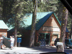
    Dinkey Creek Store

    A very popular place for summer vacations, fishing, hiking and picnicking. The day use area near the historic wooden bridge has numerous dirt parking lots, trails, picnic tables and pit toilets. Excellent place for exploring on foot with the family, or creek fishing from the boulders.

    mountains backroad horseback trails picnic fishing mountain bike camps hikesnight skiesNFS

    wooden bridge
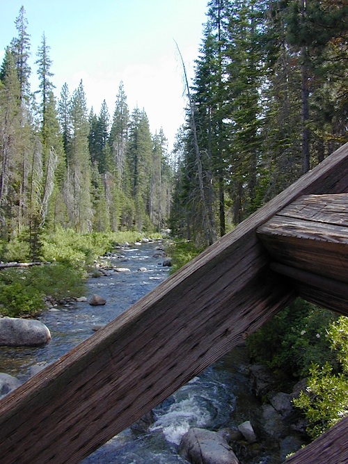
    Historic Dinkey Creek Bridge

    Dinkey Creek Campground RV camping

    • Elevation: 5,700′
    • Number of Sites: 128
    • Water: piped
    • Toilets: flush
    • Amenities: showers, horse corrals
    • Vehicle Accessibility: 30′ max RV
    • Campsites Reservation: Yes
    • Length of Stay: 14 Days
    • Season: May – September
    • Trailheads: Dinkey Lakes Wilderness

    Mckinley Grove intersection

    hikesDinkey Lakes Wilderness 

    Dinkey Lakes Wildernesstopo mapsDinkey Lake Trail Map


    Back roads are abundant around Dinkey, leading higher up to large, granite reservoirs (with more camping options) and numerous forest dirt roads zig-zag across the mountain terrain wherever possible.

    Dusy Ershim Trail is a famous Sierra 4×4 route that connects Courtright Lake to the Kaiser Pass. Granite everywhere, slow-go rock crawling, skirting in between two Wilderness Areas.

    Sierra Forest Road #11S12, is a dirt road that leads downhill, past the North Fork of Kings River, from high elevations near Dinkey to the Black Rock Reservoir and meeting up with Kings River near Pine Flat. An excellent loop trip for those wanting to experience dispersed camping on the back roads, but a high-clearance vehicle is required. This road is gated and closed for winter, so call ahead to the rangers, to see if it is open before you make the journey.

    Wilderness Wishon California
    Wilderness Wishon

    This whole Western Sierra is home to major hydroelectric dams that create a water supply for farms and cities located in the Central Valley below.

    nearby lakes –


    Kern Flats Camping Free

    chamise flat

    Dispersed Camping Kern River

    boondocking
    primitive camping
    undeveloped sites

    KERNVILLE, CA

    Located north of the small community of Riverkern and south of the Johnsondale Bridge, numerous flat camp spots adjacent to the rivers edge can be found.

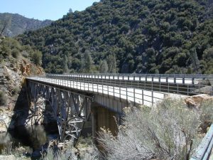
    johnsondale bridge @ KERNAnt Canyon Dispersed Area
    Brush Creek Campground
    Calkins Flat Dispersed Area
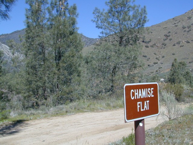
    Chamise Flat Dispersed Area
    Chico Flat Campground
    Corral Creek Campground
    Springhill Dispersed Area


    Kern River Road
    Sierra Way in Kernville travels north along the Upper Kern River & becomes Mountain Hwy 99 – which eventually connects with the Western Divide Highway in Giant Sequoia National Monument.

    California NFS Kern RVing kern campgrounds open camping

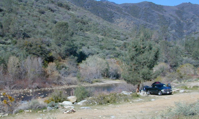
    truckcamping

    Dispersed Camping Areas along the Kern River

    Open Year Round! These FREE camp areas are called dispersed camping sites. No pavement, no picnic tables, no bathrooms, no piped water. Portable toilets & trash bins may be available in the busier summer months. Campfire permits are required for all campfires, BBQs, and camp stoves. Fire restrictions are common in extreme dry conditions. 14 day limit on camping.

    Mountain Biking Kernville kern hiking fishing Kern snow Kern

    camping, fishing, kayaking, mountain biking, rafting

    Many flats are signed w/ small brown signs, while others are not. Some are actually flat and easy to access, while others are steep, eroded dirt trails unsuitable for RV travel.

    Kelly’s Hole, overgrown, unknown, well-known or burnt beyond recognition? Roads End is no more.

    Camp sites listed on this page are dispersed camping areas around the Kern River Area. Not all camp spots are listed, cuz many are unnamed. Bring your GPS to mark your favorite camp sites and you can arrive in the dark, late at night, anytime, (avoiding city traffic after work).

    chamise pre-wildfire

    Several spots known as “dirt flats” are easy accessible right off the pavement of Sierra Way. Primitive river camping, fishing spots and raft launch areas north of town. Vault toilets might be available during busy summer months, but you’re on your own the remainder of the year. Bring a shovel and take a hike, away from the water flow. And if that sounds like too much work for a potty break, maybe you are not cut out for the primitive kinda camping style. No garbage service either: pack it in, pack it out.

    Wildflowers are abundant in the Kern Canyon nearly every Spring season (April & May), which is a popular time to enjoy this region. Autumn brings minimal fall colors to this dry, desert mountainous landscape, but the fishing is decent at that time of year.

    campfiresCAMPING OUTSIDE OF CAMPGROUND means you must obtain a free fire permit from the local rangers. Sometimes these dispersed spots are fire-safe areas, and you are allowed to have camp fires. Other times campfire restrictions are in place w/ wildfire dangers too extreme and no fires are allowed, anywhere. (Not even inside a developed campground!)

    Kern RV spot

    river Kern WILDERNESS NOTE: The USDA National Forests web site states that “Camping and campfires within 25 feet of the water’s edge is prohibited due to the Wild and Scenic Designation”, but that doesn’t seem to stop some from setting up right on the fragile rivers edge. Doubtful that this rule is being enforced by the rangers, but consider yourself warned unless they start to get serious about this restriction. Many believe that the free camping along the Kern river is destroying it, so don’t be surprised if these areas get closed or barriers placed at the flats.
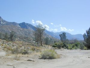
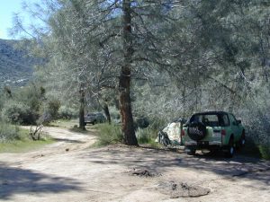
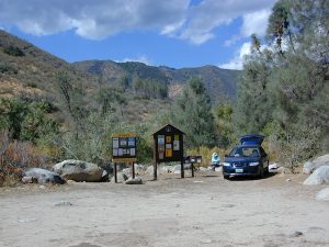
    Caulkins FLAT has some new boulder barriers put in place which prevent cars from reaching certain ideal camp spots (right at the waters edge). Tough luck. Now we have to hike more.

    California rivers

    kern flat camping

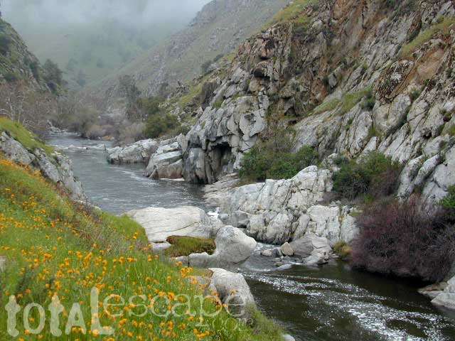
    Upper Kern River
    North of Kernville, CA

    all camps below listed from south to north

    ALL CAPS = developed campgrounds managed by US Forest Service, w/ links to Kern River Campgrounds. California NFS

    HEADQUARTERS CAMPGROUND (NFS)

    Both Halfway & Thunderbird used to be dispersed camps, but they were converted to reservation-only Group Campgrounds by the National Forest in 2014

    Chico Flat
    2500′ elev
    Just south of Hospital Flat Campground.
    This camp area is known as “Chico Flat Campground” on GoogleMaps.

    HOSPITAL FLAT CAMPGROUND (NFS)

    Corral Creek
    3200′ elev
    Hike to Corral Creek Beach & Picnic Area.
    This camp area is known as “Corral Creek Campground” on GoogleMaps.

    Spring Hill
    This camping area is marked as “Upper Springhill Campground & “Lower Springhill Campground” on GoogleMaps.

    GOLD LEDGE CAMPGROUND (NFS)

    Ant Canyon
    Just north of Goldledge Campground, along the Upper Kern River.
    South of Salmon Creek; Hike to Salmon Creek Falls.

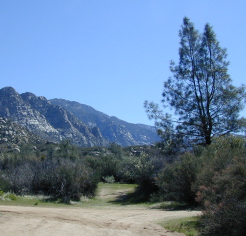
    Chamise Flatchamisespot
    12 miles north of Kernville, CA
    This camping bluff could be the most forested of all the ‘kern flat’ camping areas, but river is a short hike down a very steep cliff. Fishing is excellent in this stretch.

    Calkins Flat
    15 miles north of Kernville, along the Upper Kern River. Just south of Fairview (McNalley’s). Sign at the location reads a different spelling of “Caulkins Flat”. Kayak and rafting put-in spot. One of the best sites for large groups. Area is also known as simply “Lower Campground” on GoogleMap.

    free kern river camp

    FAIRVIEW CAMPGROUND (NFS)

    LIMESTONE CAMPGROUND (NFS)

    Brush Creek
    3600′ elev
    Just south of Sherman’s Pass Road turnoff. This place also serves as a Day Use Area, where Brush Creek meets the Kern. Kayaking put in spot. Popular fishing area. Large open dirt parking lot with a vault toilet.


    California rivers

    Lower Kern River
    Southwest of Kernville, CA

    Lake Isabella has some shoreline camping with wide open access to the lake. Paradise Cove perhaps?

    Historic Keyesville – “off-roaders camping paradise” along the river, but no swimming is allowed due to the extremely dangerous section of river. OHV trails lead (west) down river for many miles. Dirt bikes love the rugged boulder-scapes and steep hills. FREE camping; BLM Kern.

    SANDY FLAT CAMPGROUND (NFS) – Open all year long! Terraced & paved hillside with numerous camp sites and plenty of room to spread out. RV campers like this location, due to the proximity to Hwy 178. elev 2300

    HOBO CAMPGROUND (NFS)

    Remington

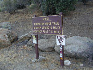
    Remington Hot Springs can be a zoo at times w/ the amount of people who love to stop here. A busy dirt parking lot, right across from the Remington trailhead sign. Many vehicles park here daily for day hikes, hot springs, fishing – and people also like to camp out, although camp sites are on slopes (not ideal), only a few and they fill up fast (before sunset).

    Total Escape TIP: The very best camps at Remington are actually the ones you hafta hike down to. Less than a half mile down to the rivers edge to find a private mini beach. Pack light and arrive prepared to walk several miles (back & forth, several times).

    Old Kern Canyon Road parallels Sierra Highway 178 and sits well above the river, so any flat spots you find will have great views w/ minimal river access.

    Lower Kern River
    Lower Kern River has very limited camping options.

    Lake Mohave

    viewpoint mohave

    Lake Mohave NRA

    Lake Mohave National Recreation Area

    Mojave Reservoir @ Colorado River: AZ / NV / CA
    @ the V, bottom of Nevada state = Arizona – Nevada – California, all merge together

    National Park Service

    The Colorado River travels through the southwest desert, splitting the Grand Canyon and further south, separating California from Arizona at the southern tip of Nevada. Agriculture lines the big river down to Baja, Sea of Cortez, Mexico.

    Up near Las Vegas and down to Searchlight, NV

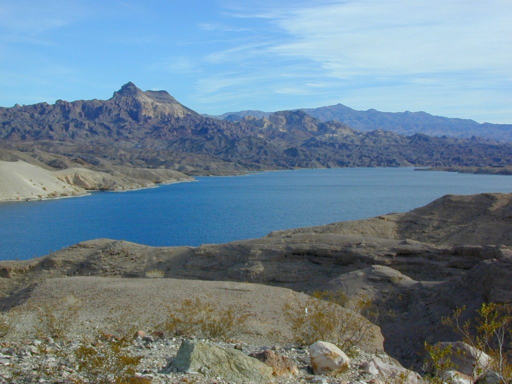
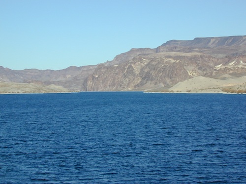
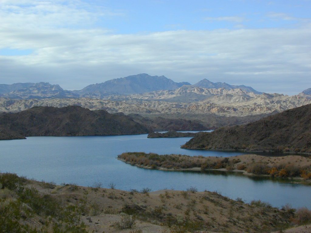
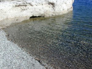
    Above Hoover Dam is Lake Mead, sediment from Utah National Parks. Red dirt and silt shorelines. South of Hoover dam is a super deep rock gorge w/ hike-in hot springs. Beyond that, this beauty called Lake Mohave – with the super clear water, secluded coves and abundant fishingfish

    Lake Mohave: elevation 647′

    Desert peaks in this region are around 2000-3000′ elevation. Mohave Lake is actually a wide section of the Colorado River, spanning the region from massive Black Canyon south to busy Laughlin w/ river casinos. This lake is long and skinny in spots with lots of shoreline cliffs, canyons and coves. Minimal vegetation, so please bring your own firewood and don’t chop down the few trees trying to survive. Summer temps exceed 100 degrees, so plan your visit for the winter time.

    boatrampLake Mohave Ranger Stations
    Cottonwood Cove
    Katherine Landing

    boating, camping, fishing, hiking, hot springs, kayaking, off-road, picnics, viewpoints

    camping areas below listed from north to south

    Willow Beach RV Park & Campground
    Arizona side, off Hwy 93
    928-767-4747

    car camp mohave

    El DORADO CANYON

    El Dorado Canyon Road, main paved route can be accessed near California’s state border. North of Searchlight, Nevada – off main highway 95, on side route 165 to Nelson, NV

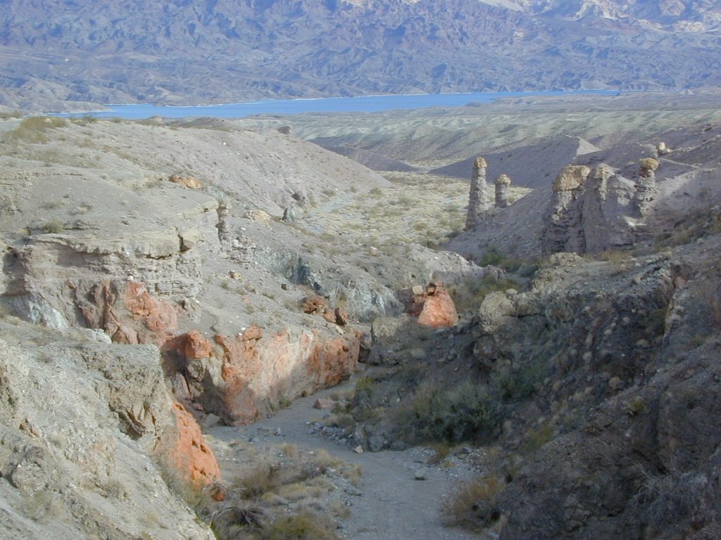
    Secluded dirt roads up and down canyons near El Dorado Canyon Rd. Minimal vegetation, maximum open scenery and dark skies. Kayak rentals @ El Dorado Canyon.

    desert badlands erosion

    deep washes
    Ireteba Peaks Wilderness

    4×4 camping routes: 15 day camping limit

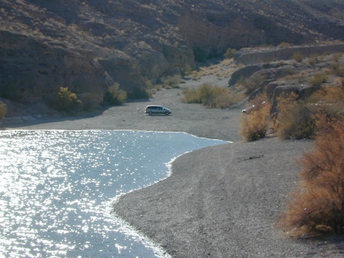
    Find your own route with many to choose from, drive the soft sandy washes (with a few boulders to dodge) and camp for free, right at the waters edge. Adventurers: Only for the self-contained campers. Some routes marked 4WD only, so pay attention to signs. AWD (all wheel drive) vehicles should fare well on the sandy roads; but standard passenger cars and vans will need to keep their speed up in the soft sand areas.

    No garbage collection. Pack it in, pack it out.
    No facilities, no fees. No buildings. No campfire rings, no picnic tables, very few vault toilets. Bring your shovel!

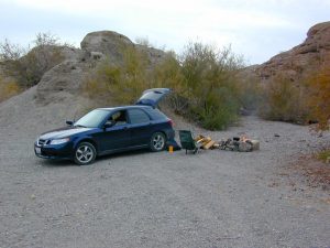
    Driving off the roads is strictly prohibited. Primitive camp sites can be found both at numerous coves and also inland inside the canyons. The ridges get windy in the deserts, but are favorable for night sky views and self contained camper vans.

    Always know the weather forecast, cuz flash floods are possible and these dirt roads will be impassible during big rain. This is the main drainage to the big river!

    Dogs Allowed

    DRIVING TIPS

    Most desert washes here are signed routes 4×4, but mini vans, AWD sport-wagons, trucks, SUVs, small RVs can all be found camping near Lake Mohave. That is – if you know how to ‘drive off road’, which is not fast, but not too slow either.

    Avoid getting stuck in the deep sand: keep speed up, do not turn sharply and do not brake hard. Carry tow strap in case you need an emergency pull. Be nice to strangers and you may find help.

    Campfires are allowed, but you need to bring firewood. Dogs are allowed. Party animals tend to trash these desert coves, so be warned that there is a fair amount of litter. Bring a black trash bag and take some out! This trash problem could get the area closed off to vehicles so keep that in mind.

    The canyons here have giant power lines that cross @ Aztec Wash; they can easily be avoided.

    montana wash

    primitive camping 4x4 camping boat camping

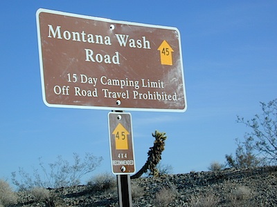
    4×4 recommended @ MOHAVE:

    Eagle Wash Road #46 – popular spot
    Montana Wash #45 – camping ok
    Placer Wash #47 – no camping

    The rangers don’t wanna be pulling your ass out of the sand, which is why they post the 4×4 signs. Don’t expect to find help without walking a few miles first, or waiting several hours.


    desert wilderness

    Several wilderness areas are located along the west side of this lake & river. Often dirt roads will parallel a portion of the wilderness boundary, providing excellent access to secluded coves and beaches. Emergency CALL boxes are placed in remote parts of these shores.

    • Ireteba Peaks Wilderness (northwest, next to El Dorado Canyon)
    • Nellis Wash Wilderness (western side)
    • Spirit Mountain Wilderness (southwest)
    • Bridge Canyon Wilderness (southwest, near Laughlin)

    mohave2011

    RV camp campground marina

    COTTONWOOD COVE
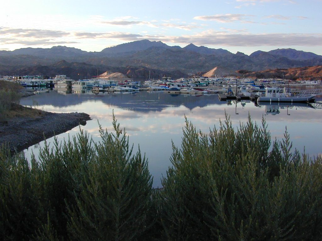
    developed campground, boat launch, marina, lodging, hiking, picnic areas

    Cottonwood Cove Resort
    near Searchlight, NV
    702-297-1464

    primitive camping boat camping RV camp campground marina

    LAUGHLIN, NV
    Nevada, California and Arizona states join down in this part of the world. Katherine Landing, full service marina, slip rentals, lodging, city services and casinos.

    Lake Mohave Resort
    928-754-3245

    katherine landing camping
    Katherine Landing offers back roads camping, via rough dirt roads.
    Laughlin Marina
    Laughlin Marina @ Katherine

    Lake Mohave NRA
    NPS Headquartersnevada_atlas
    601 Nevada Way
    Boulder City, NV 89005
    Visitor Center open daily
    702-293-8990

    maps of the region:

    covecamps

    Mojave Desert – This river-created lake is located on the Colorado River, in between Las Vegas, Nevada and Needles, California. The river water here is crystal clear, very swimmable and the fishing is decent.  No paved boat rampsclearest water

    nearby towns: (with elevation)

    Avi Casino
    Bullhead City, AZ (540′)
    Laughlin, NV (535′)
    Kingman, AZ (3340′)
    Needles, CA
    Nelson, NV (2954′)
    Nipton, CA (3042′)
    Oatman, AZ
    Searchlight, NV (3470′)


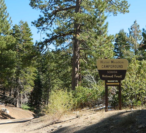
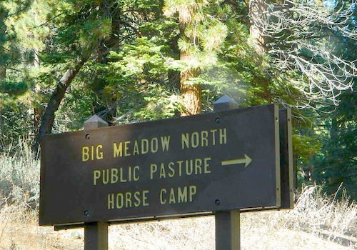
    Horse Meadow Campground

    Kern Meadows Camping

    Horse Meadow Campground

    Salmon Creek, Kern Plateau –
    Sequoia National Forest

    horse camping National Forest Camps Mountain Biking Kern Hikes fish Trailer access camping
    Looking to stay away from the masses camping at the Kern River?

    Horse Meadow Campground can be found on the east side of the Kern River, up on the Kern Plateau. Up the infamous, steep and rugged Shermans Pass Road. How exciting!

    Steep Grades

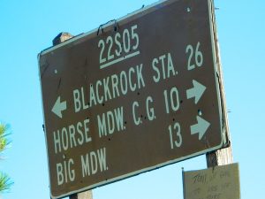
    Climb the hill slowly and cautiously, no guardrails. Up the grade, Shermans eastbound – out of the dryness of the Kern canyon. Find Cherry Hill Road, that is also the Big Meadow turn off: Forest Road# 22S12, a long, narrow dirt road leads from paved Shermans Pass Road, 10 miles out to this ideal campground. Far enough off the main road, so you won’t see much of a crowd out here.

    22s05 sherman pass

    Hunters, horse campers and hikers really like this spot. Mountain bikers are known to frequent the region as well. Forest, meadows, trails, creeks, nature, all around. Dome Land Wilderness is close by; Waterfalls hikes, swimming holes, viewpoints. Fishing, hunting, horseback trails. Dirt roads and single track trails all over – all within the vicinity of Big Meadow.

    Kern Meadows Camping

    From the main Rd #22S12, the camp access road #23S08 will lead out to the NFS Campground – HORSE MEADOW. Located at higher elevation forests – 3000′ feet higher than the Kern River!

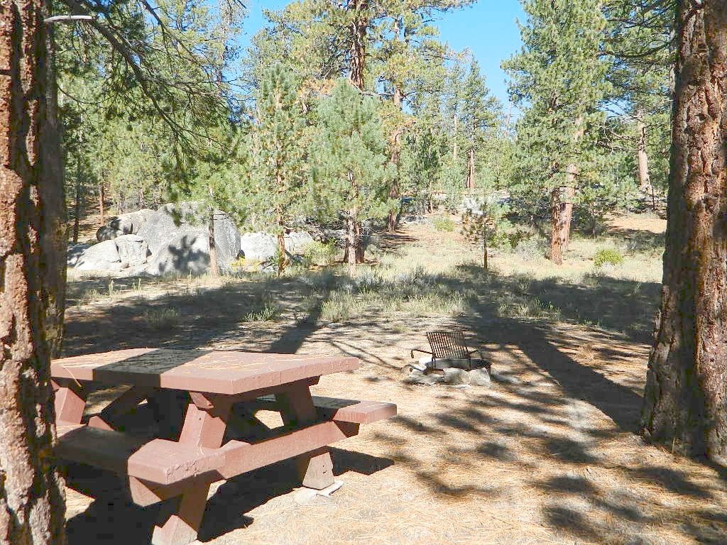
    Nice forested, high country camp spots in a developed campground. The long, access road is worth it for all the scenery and seclusion. Vault toilets, piped water, maybe a small fee. Open summer into autumn, closes for winter months.

    Horse Meadow Campground

    • Elevation: 7600′
    • Number of Sites: 41
    • Vehicle Access: RV 23′ max
    • Campsites Reservation: No
    • Camp Fee: Yes
    • Length of Stay: 14 Days
    • Season: June – November
    • Trailheads: Salmon Creek

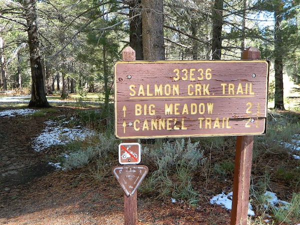
    33e36trailhead
    Developed Campground @ Salmon Creek Trail #33E36. Hiking trailheads lead off to various destinations like, Salmon Creek Falls, Big Meadow, Cannel Meadows and Dome Lands.

    Sequoia Kern Map

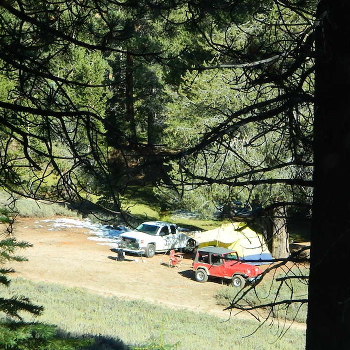
    Sunny Campsite

    SUMMERTIME: If you are coming in from Kennedy Meadows on the EAST (or the Mojave desert US 395) – first verify that the Sherman Pass is OPEN for through traffic. Ask road conditions with local rangers ahead of time. ANY amount of snow will close this whole paved route for the winter season, up until June sometimes.

    Over 30 miles (one way) to the nearest general store for supplies. Pack ‘block ice’ in the cooler, instead of cubes.

    nearby towns:
    Fairview
    Kennedy Meadows
    Kernville
    Lake Isabella
    Mojave

    Big Meadow is closeby. Check it out!

    Big Meadow Kern

    22S12 – Sequoia NF

    open camping

    Big Meadow: Forest Road# 22S12 – Sequoia National Forest

    Take Sierra Hwy. N of Kernville, past Fairview & over the Johnsondale bridge; Right turn on Sherman’s Pass Road & drive up to a signed intersection (near a snow gate). NOTE: This area may not be accessible during winter months.

    Turn right on Big Meadow Road, aka Forest Service Rd# 22S12. This is a very long road which is paved for the first few miles. 22S12 becomes a graded dirt road, suitable for horse trailers; it forks off to other smaller dirt roads, as it progresses through the forests & dead ends back by Cannell Meadow. The main routes are passenger car accessible, but some of the smaller dirt roads can get quite bumpy. A truck or SUV would be advisable to explore these secondary routes. Certain areas have suffered from wildfires 2000-2002.

    Big Meadow Sequoia

    Horses & equestrian camping are very popular in this region. There is also a fair amount of backpackers heading into the Domeland Wilderness and mountain bikers looking for premium backcountry rides, away from the crowds at the Kern River.

    NFS developed Horse Meadow Campground can be found on the right via road# 23S08. Located at 7400′ elevation w/ 41 spots, in the forest. Trailhead to Salmon Creek leads directly from camp.

    SPUR – side routes include:

    • #23S14 Cherry Hill – a few camp spots near creek & a meadow with views at the very end
    • #23S41 Poison Meadow
    • #23S13 Salmon Creek
    • #22S07 Big Meadow – loop road around the “Big Meadow”. Plenty of primitive camp sites around Big Meadow, but they are the first ones to fill up during a popular summer weekend. The region is perfect for backpackers or day hikers wanting to access Manter Mdw. & the Domelands Wilderness.
    • #24S13 feeds the last stretch of road to Rattlesnake Meadow. Taylor Creek near 24S43, features numerous waterfalls leading to the South Fork of the Kern River
    • #24S12 Cannell Meadow & Pine Flat. The Cannell Meadow National Recreation Trail runs thru here, from Big Meadow down to Kernville, CA.

    North Meadow

    Sequoia National Forest

    Sequoia National Forest MAP

    DOME LAND Wilderness MAP

    Nearby towns include:

    Long Valley Campground

    Secluded Camp Sites

    Long Valley Campground BLM

    Southern Sierra Nevada
    secluded camp, fishing & hiking trails
    (free campground, open all year long)

    South Fork of Kern River & DomeLand Wilderness

    20+ miles from the nearest paved road; a remote camp on Long Valley Loop Road, off Canebrake Road. Both are dirt roads: high clearance vehicle recommended!

    High Desert meets the Sierra Mountains

    Back in the dry pinyon hills east of Kernville, beyond Sherman’s Pass; high above the Mojave desert and north of Canebrake & Highway 178. Long dirt roads, remote campground w/ fishing & hiking trails. Wilderness access.

    hiking fishing trails horse trails back roads back roads sierra mountains

    Chimney Peak Back Country Byway
    Canebrake, California

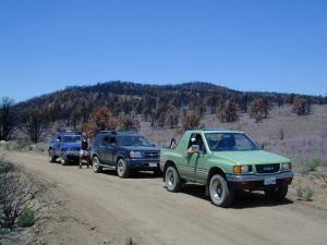
    These dirt back roads listed above skirt the edge of Dome Land Wilderness & Sequoia National Forest winding through BLM Land bordering the Mojave. The byway networks recreation areas between Kennedy Meadows and Canebrake, east of Lake Isabella. Eastern Kern County, California.

    backpacking
    camping
    fishing
    hiking
    horseback trails
    mountain biking
    rock climbing
    stargazing
    wildflowers

    Trailheads Domeland

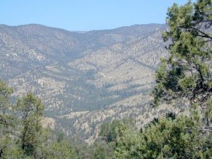
    People come way out here for the seclusion – the peace & the quiet. Mid-week you can have the whole place to yourself. Abundant hiking trails & fishing access. Into the Dome Land Wilderness you will find incredible scenery and diverse terrain – giant granite domes, waterfall canyons, and the South Fork of the Kern River (3 mi hike to river). PCTThe infamous Pacific Crest Trail passes close to Long Valley Campground, but Chimney Creek Campground is much closer to the PCT.
    BLM Camping

    Long Valley Campground

    • Elevation: 5200′
    • Number of Sites: 13
    • Vehicle Accessibility: High Clearance Vehicle
    • Facilities: picnic tables, fire rings, vault toilet
    • Campsites Reservation: No
    • Camp Fee: None
    • Length of Stay: 14 Days
    • Season: Open all year
    • Operated by: BLM
    • Trailheads: S. Fork Kern River & Domeland Wilderness

    Bureau of Land Management
    BLM Bakersfield Field Office
    661-391-6000
    Find a BLM page w/ map & info

    Recent Domeland Wild Fires:
    Manter Fire (2000)
    McNally Fire (2002)

    Long Valley Loop
    Long Valley Loop Road (2001)

    2016 NOTE: The part of the LOOP of Long Valley Loop Road that connects this campground to Kennedy Meadows (to the north) is CLOSED due to a huge washout. The Long Valley campground is accessible from the south side, from Hwy 178 @ Canebrake – and requires many miles of dirt road driving. High clearance vehicles are recommended; 4×4 needed in wet weather or snow.

    towns nearby:

    CANEBRAKE
    KENNEDY MEADOWS
    KERNVILLE
    LAKE ISABELLA
    MOJAVE

    High Desert Sagebrush
    High Desert Sagebrush & Dirt Roads
    Wildfire Burn
    Manter Wildfire Burn Area (2001)

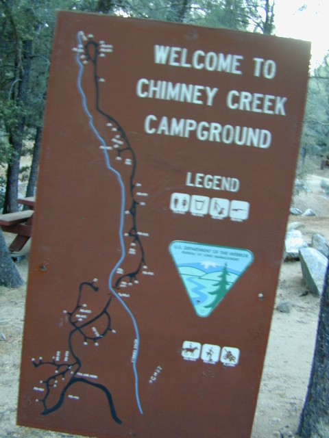
    Chimney Creek Campground

    campmap

    Chimney Creek Campground
    BLM Kern / Mojave

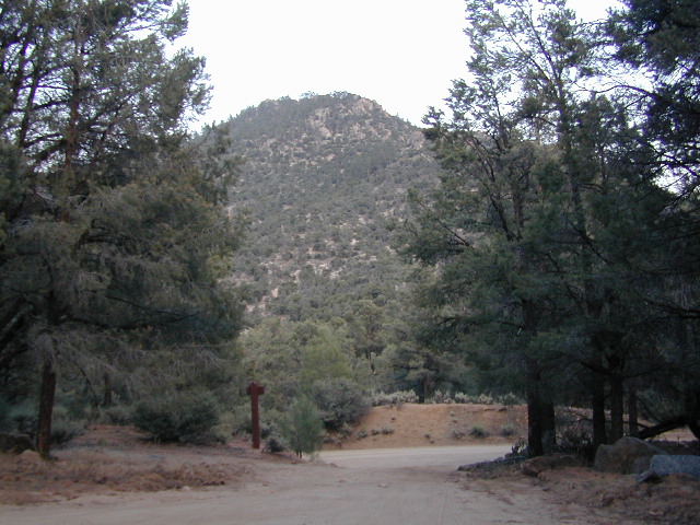
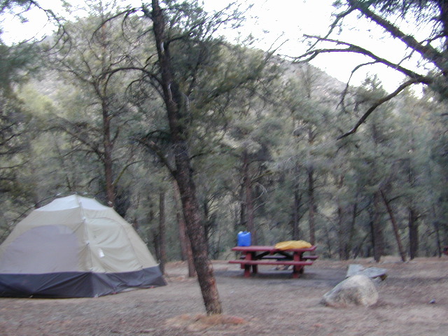
    High mountain desert camp is mislabeled on some maps as “Chimney Peak Campground” or “Chimney Rock Campground”. Pinyon pine forest on Chimney Creek, near hiking trailheads, wildflowers and Chimney Peak Wilderness. Southern Sierra ridge near Mojave Desert and California SR 178.

    peakpinyons

    Canebrake Road is a graded dirt road that makes up part of Chimney Peak Back Country Byway. This rural route is a major graded dirt road located north of Highway 178 – which connects Canebrake to Long Valley up near Kennedy Meadows. Pacific Crest Trail passes next to this campground in the Southern Sierra mountains. The campground turn off is way east of Lake Isabella Hwy 178 is (near Walker Pass & PCT) and follow dirt road north to Kennedy Meadows in the far eastern reaches of Sequoia National Forest

    Chimney Peak BLM
    • Elevation: 5,700′
    • Number of Sites: 32
    • Camping Reservations: No
    • Sites Available: First come, First serve
    • Vehicle Accessibility: RV limit 28′ max
    • Length of Stay: 14 Days
    • Water: Piped (April – Sept)
    • Toilet: Vault
    • Season: Open all year
    • Fee: No
    • Operated By: BLM
    • Closest Town: Lake Isabella, CA

    Bureau of Land Management
    BLM Bakersfield Ranger Station
    661-391-6000

    Lamont Peak
    Lamont Peak – elev 7510′

    nearby destinations –
    Camp Kern Backroads

    Chimney Peak Wilderness
    Lamont Peak
    Long Valley Campground
    Dome Land Wilderness
    Owens Peak Wilderness
    Jawbone Canyon
    Sequoia National Forest
    Sacatar Trail Wilderness
    Kiavah Wilderness
    Kennedy Meadows
    Lake Isabella
    Kern River
    Monache Meadows


    View Chimney Creek Campground in a larger map