Category Archives: Sightseeing

Silver Lake @ Carson

silkysilver

Silver Lake @ Carson Pass

(Alpine Co)

7250′ elev.
on Highway 88 near Carson Pass, California
El Dorado National Forest
near Kirkwood Ski Resort & the Bear River

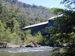
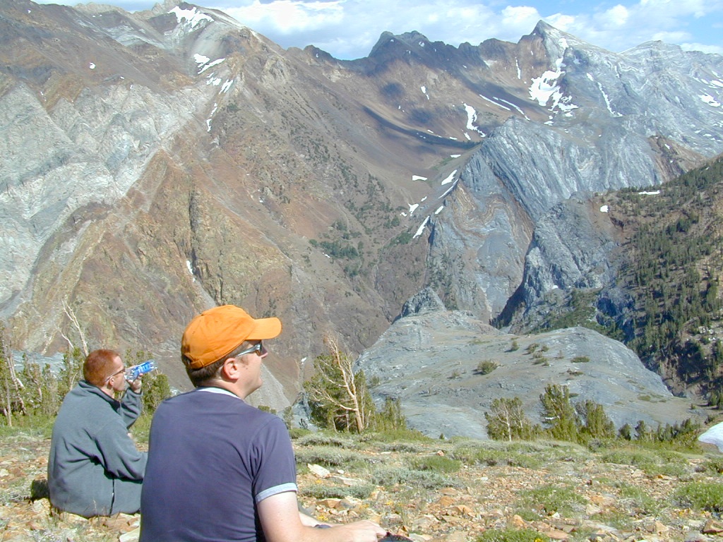
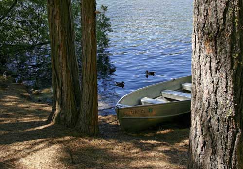
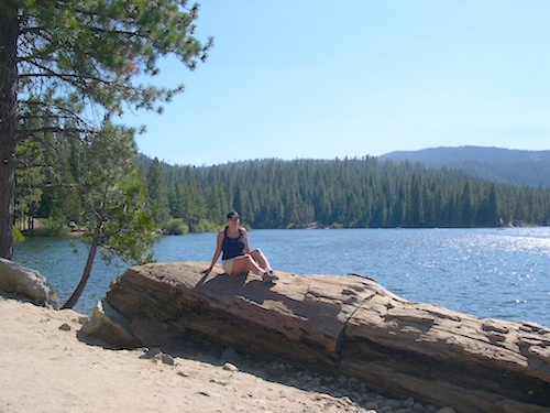
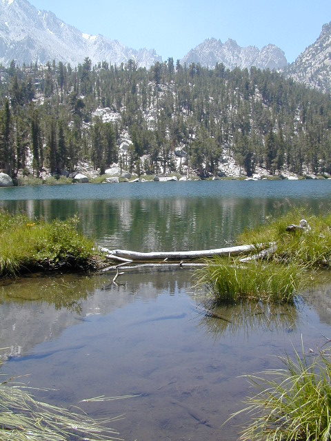
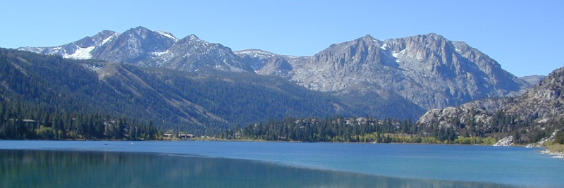
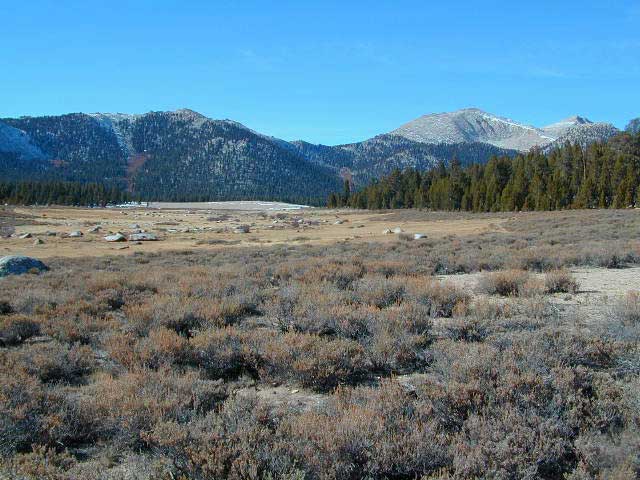
Large, granite, alpine lake in the Central Sierra Nevada Mountains. Abundant trout fishing, swimming, camping, boating, hiking, floating, kayaking, picnic sites, and high altitude backpacking trailheads. Shoreline fishing is just as good as by boat. Fishing boats can be rented at Kit Carson Lodge.

granitesilver

The high altitude location makes this a winter wonderland half the year w/ snow ski resorts nearby! It is an awesome summertime family vacation destination as well. Fishing is excellent through Autumn months. Campgrounds close up shop in October, generally when the snow starts. High Sierra – Deep snow pack means they will not reopen until May (at the earliest).

Carson is major Sierra Pass highway, but it closes for big snows, so always check CalTrans before you make the drive up the mountain. Carson Pass is California State Route 88, which connects the Gold Country (on the western slopes) to the South Lake Tahoe region (on the eastern border), near Nevada.

Check Current Highway Conditions for HWY 88
roads.dot.ca.gov
Cal Trans 800-427-7623

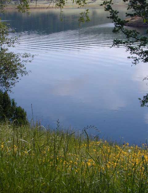
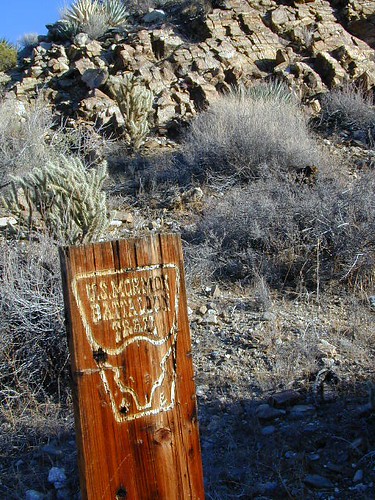
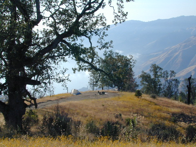
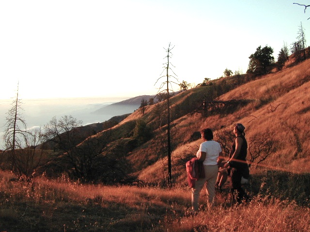
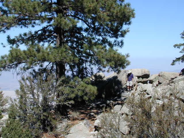
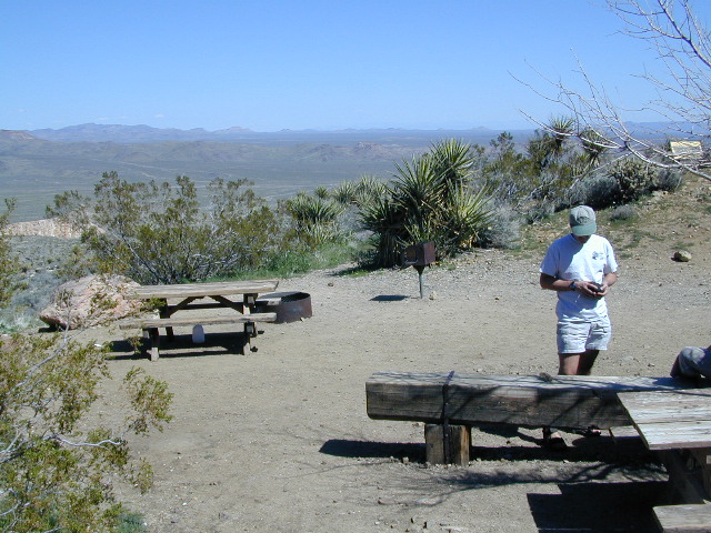
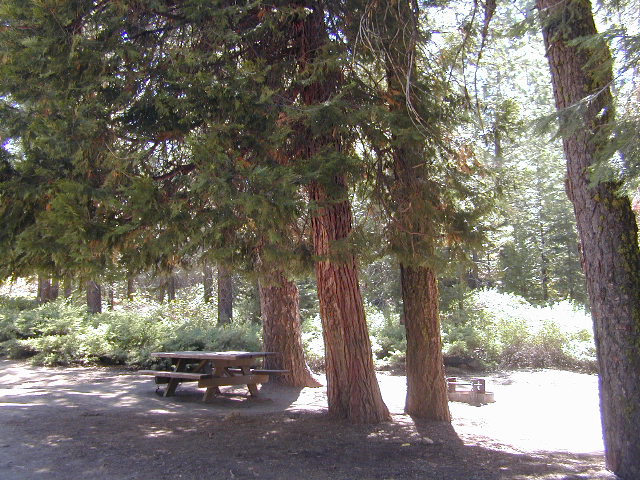
Silver Lake Day Use Areas

fishing lakes picnic grounds fishing lakes boat ramp

These areas listed below are operated by El Dorado Irrigation District and they do charge a day-use fee for many of the amenities provided. Boat Launch fee? Yep. Parking fee? Maybe. Picnic stop! How much? Eat fast!

  • Ferguson Point is located on the north shore of Silver Lake: 10 picnic tables & vault toilets.
  • Sandy Cove is on NW shore of Silver Lake: Wheel-chair access to lake edge, 5 picnic tables, piped water & vault toilets.
  • Oyster Creek Rest Area, up along Highway 88, 1 mile NE of Silver Lake: 10 picnic tables & vault toilets.

kaysresortsign

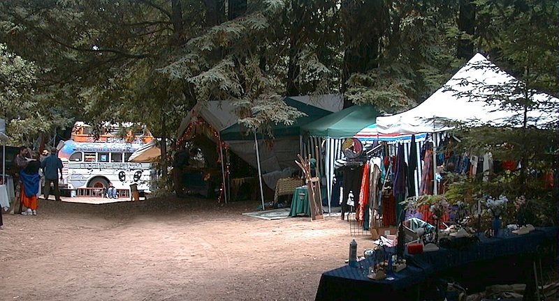
Historic Memories: Camp Minkalo, Camp Silverado & Kays Silver Lake Resort are all closed now.

Many small businesses come and go in the rural mountains of California. Throughout the decades, some do survive, but many change hands, change names, or have a difficult time ‘making it all work’ in the off-season. Always call ahead (real phone w/ real person) before you make a big drive to a remote location.

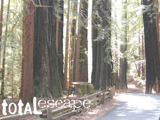
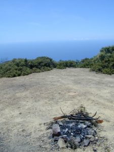
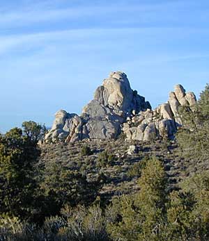
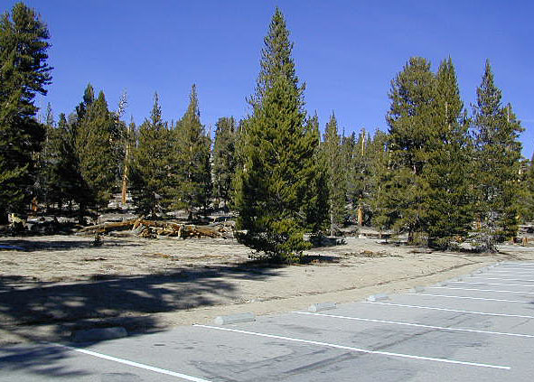
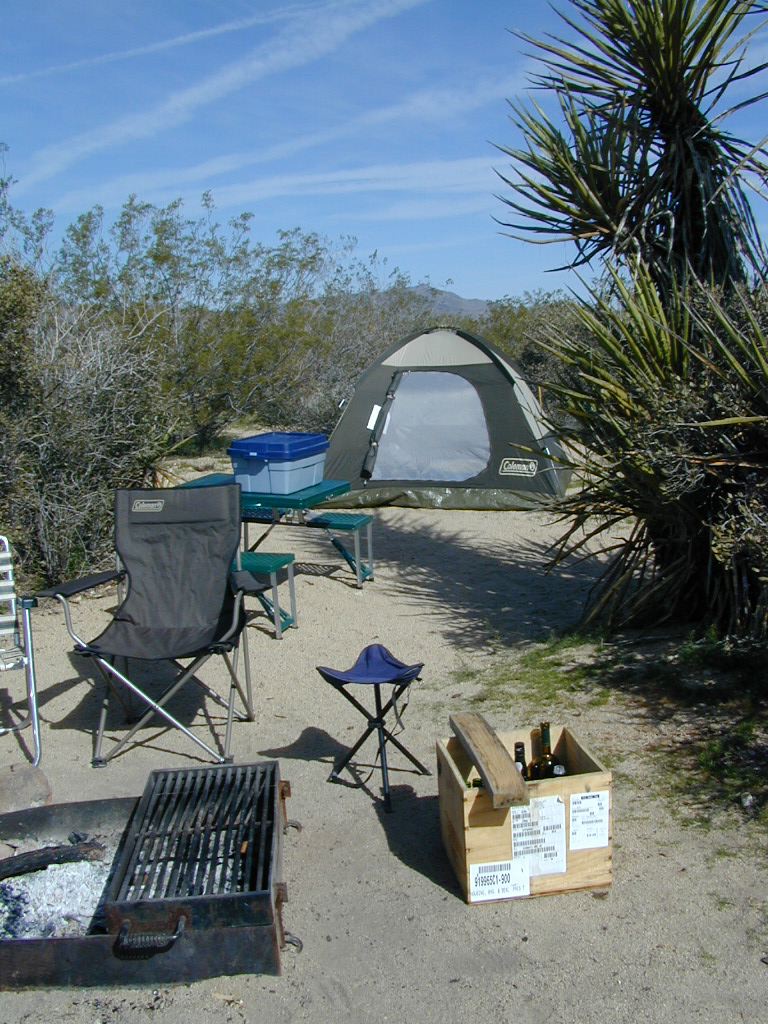
National Forest Campgrounds in this lake vicinity:

East Silver Lake Campground – 62 sites
West Silver Lake Campground – 42 sites
Kirkwood Lake Campground – 12 sites

campground RV campground

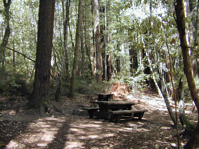
Silver Lake Campground NFS

• Elevation: 7200′
• Number of Sites: 62
• Vehicle Accessibility: RV 30′
• Campsite Reservations: Yes
• Camp Fee: Yes
• Toilet: Vault
• Length of Stay: 14 Days
• Season: June – October
• Trailheads: Hidden Lake, Sandy Cove

NFS
El Dorado National Forest
Amador Ranger District
26820 Silver Drive
Pioneer, CA 95666
209-295-4251

silver from highway

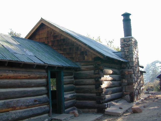
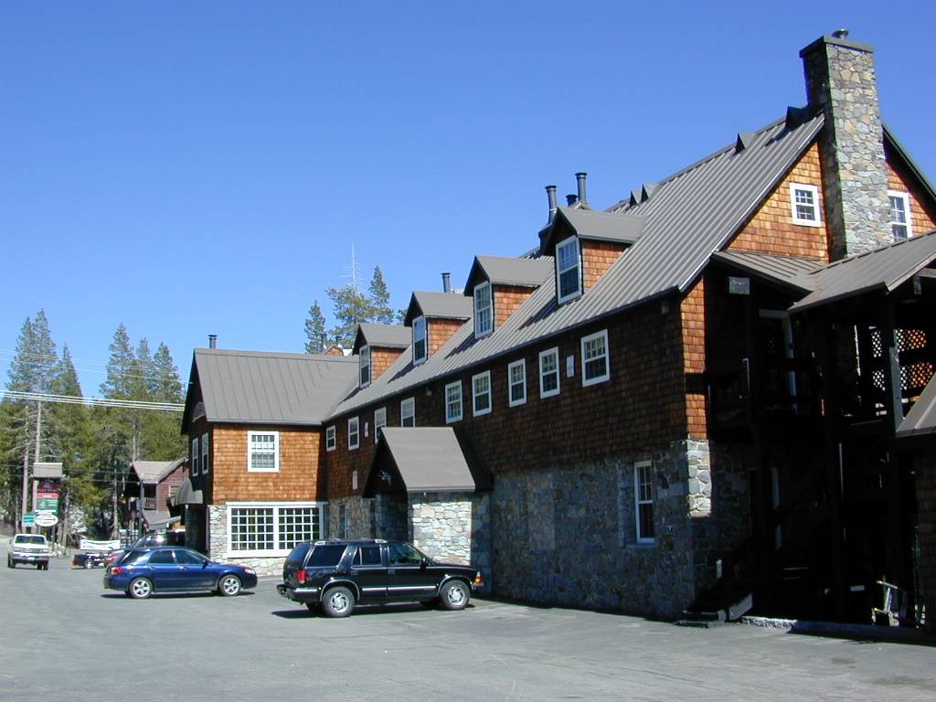
Older lodges, resorts, camps and cabins at Silver Lake were mainly built in the 1920s, while the oldest resort dates back to the mid 1800s. Wow, how cool is that! Much history in this mountain region w/ Kit Carson Emigrant Trail, all stories totally worth exploring.
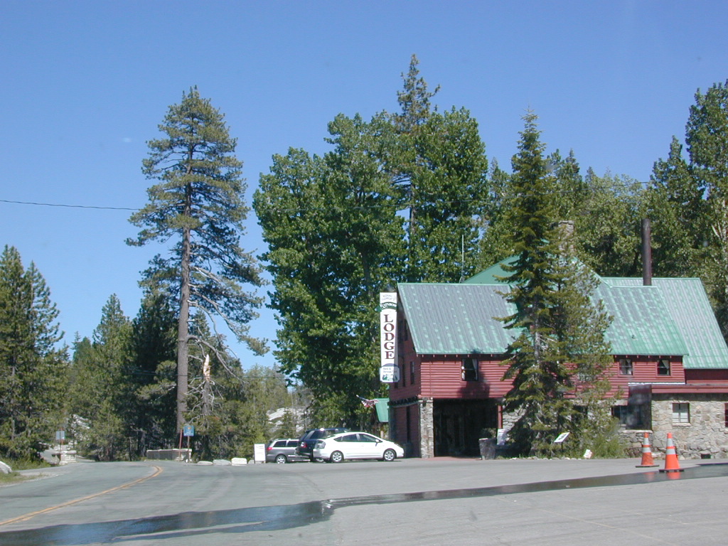
Kit Carson Lodge
Rustic Silver Lake Cabins & Restaurant
kitcarsonlodge.com
209-258-8500

Historic Plasse’s Resort
One of the Oldest Camps in the USA
plassesresort.com
209-258-8814

Gold Miners

See all Silver Lakes in California

California Locations

La Porte Road
One Eyed Jacks Market & Grill – on La Porte Road. Clipper Mills, CA

Abundant on California Locations

califrepublic

depot desert
Kelso Depot, Mojave National Preserve

train

Subway Cave California

ranger

bridge kings
Kings River, California

hiker

kongsberg_town


California Fire Lookout

Dome Land from Bald Mtn, KERN
Bald Mountain (elev 9382′) Lookout in Sequoia National Forest

NFS Fire Lookout Towers

JULY 2019 – Many thanks goes to Pike County Lookout for initially spotting the #RockFire – in the Plumas National Forest, near Berry Creek, CA

Lookouts in the California National Forests

Ready to see far and wide – with wild terrain? Views for 100 miles out and the best scenery California has to offer. Be prepared to off road or hike to reach one of these destinations.

Below is a list of historic look out towers & cabins used for spotting wildfires. Some are located on steep granite peaks, ridge lines or dirt roads. 4WD may be recommended to reach some of these. Road conditions can change w/ harsh mountain weather, so be prepared to rough it. Thunderstorms are common on these mountain ridges.

Several of these places are cabins, some are stone houses, but most fire lookouts are basic metal towers – with high climbing staircases, so you must be in decent physical strength to haul your ass up this high.

rangers cabin mountains hikers vacation

Cabins are also called guard stations, huts, bunkhouses. Most are located on mountain tops, but a few exist in desert regions. Some are refurbished & available for overnight rentals. Bare bones furnishings, so forget the frills. People come up here for the thrills. To be outside w/ epic views, way away from the urban grind & to feel on top-of-the-world.

Coon Creek Cabin


NFSlogoSee the full list of overnight accommodations on mountain peaks & ridges, some near meadowsNational Forest Cabin Rentals

El Dorado National Forest USFS

Robbs Peak Lookout
Robb’s Hut / Robbs Cabin
6686′ elev near Placerville, Gold Country California

Cuyama Peak
Cuyama Lookout is a rough road up. Off Hwy 33, Los Padres NF

Los Padres National Forest

4x4Cuyama Peak Lookout Tower (pictured above) off Hwy 166 & via Santa Barbara Cyn, 4×4 recommended. Sorta near jct w/ Hwy 33

Big Bear Lake 2002
Big Bear Lake, Southern California

San Bernardino National Forest USFS

Butler Peak Fire Lookout
elev. 8537′ (no overnight stays)
located in between Green Valley Lake and Fawnskin

Morton Peak Fire Lookout
(no longer available for overnight stays 2019)

Strawberry Peak Fire Lookout
(no overnight stays)
above Rimforest, off Bear Springs Road, N of Hwy 18

Tahquitz Peak Fire Lookout
elev. 8846′ (no overnight stays)
highest lookout in the San Bernardino NF

hiker

Sequoia National Forest USFS

Bald Mountain Lookout (no overnight stays)
off of Sherman’s Pass Road #22S05, 4×4 may be needed.
Bald Mountain 9382′ elevation; in between the Kern Plateau & Kern Riverranger

Big Meadows Cabin
Big Meadows Guard Station
off Big Meadows Rd #14S11
7600′ elevation; located in between Sequoia NP & Kings Canyon NP

Mountain Home Guard Station
Mountain Home State Forest, Sequoia Groves
6000′ elev. near Springville, CA

Needles Fire Lookout
(destroyed in structure fire 2011)

Poso Guard Station Cabin Rental
open all year round 4500′ elev. near Kernville, CA

pinetree

Sierra National Forest USFS

Camp Four and a half Cabin
Camp 4 ½ Cabin Rental
Lower Kings River, open all year round
1100′ elev. near Pine Flat Reservoir


Six Rivers National Forest USFS

Bear Basin Butte Cabin & Fire Lookout
elevation 5300′ in Six Rivers NF / Smith River NRA
(road damage & access issues 2017)

4x4

Tahoe National Forest USFS

Calpine Lookout Cabin Rental
near Sierraville, CA

Pike County Lookout (no overnight stays)
near Challenge, CA & New Bullards Bar Reservoir

Sardine Peak Fire Lookout
overlooking the Sierra Buttes and serene Lakes Basin, Yuba Rivers, North Gold Country CA

lakes basin views

BEWARE:
California is the land of wildfires!

campfireAlways check for local fire conditions at nearest
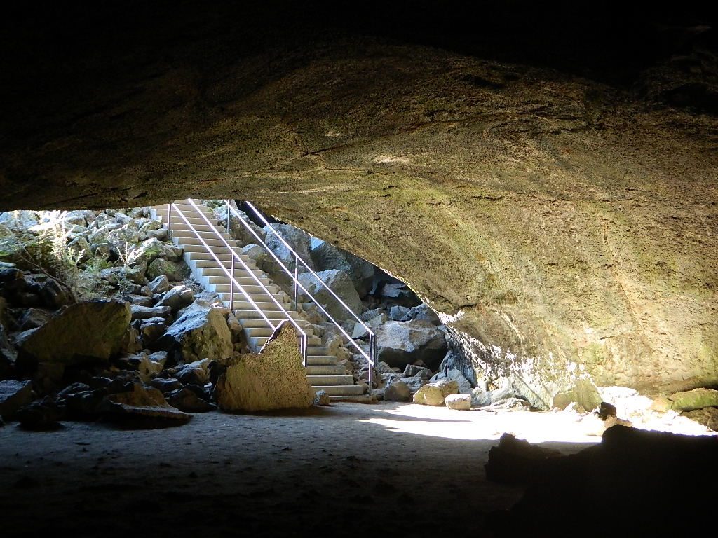
 ranger station, obtain a free campfire permit when camping outside of developed campgrounds, and always practice fire safety when visiting our public lands. You can be held liable for wildfires. Outta control campfire, cigarettes, idling vehicles on tall, dry grass. Be very cautious with fires on the often dry, west coast.

see also –  National Forest Cabin Rentals

Great Overland Stagecoach Route of 1849

Canon Sin Nombre
Sunset view of Canon Sin Nombre

San Diego County Road S-2

Great Overland Stagecoach Route of 1849Canon Sin Nombre
San Diego County Rd S2
San Diego County Highway S2

The awesome southern California desert, a stretch of road that traverses north-south direction on the west side Anza Borrego Desert; from Interstate 8 up to to Lake Henshaw @ San Felipe Road. Driving north you gain elevation from sandy badlands into the mountains, but trees are few and far off. Exit I-8 at 400′ elevation above sea level and gradually climb to 3000′ – over near Lake Henshaw & Palomar Mountain.

San Diego Road S-2 is about 50 miles long, through very scenic desert with interesting vegetation and paved the whole way. Perfect for RV travelers, as it has many camping options – from freebie, primitive camp spots to private campground resorts. Palm canyon hide-aways, secret shady spots, endless hiking canyons, and a campground with hot springs.

Carrizo Gorge TrestleS2 Road intersects California SR 78 at Scissors Crossing and continues north through the barren San Felipe Hills. The Southern California portion of the Pacific Crest Trail parallels the ridge line on the east side, with the town of Borrego Springs lying behind that ridge at 590′ elevation. The historic mountain town of Julian sits in the hills above Banner Grade (Hwy 78).

California Historical Landmarks, along S2

# 304 VALLECITO STAGE DEPOT
# 472 BOX CANYON (Anza Borrego Desert)
# 639 PALM SPRINGS (Anza Borrego Desert)
# 647 BUTTERFIELD OVERLAND MAIL ROUTE
# 793 SAN FELIPE VALLEY AND STAGE STATION

points of interest along this route:

California Interstate 8
Ocotillo, CA
Yuha Desert
Fossil Shell Canyon (BLM)
Anza Borrego Desert State Park
Mortero Canyon
Dos Cabezas
Carrizo Gorge Wilderness
Carrizo Palms
Carrizo Gorge Railroad Trestle
Carrizo Badlands & Overlook
Canon Sin Nombre
Coyote Mountains Wilderness
THSDmapHollywood & Vine
Fish Creek Wash
Old Carrizo Stage Station
Sweeney Pass
Bow Willow Campground
Canebrake
Agua Caliente Hot Springs
Vallecito County Park
Oriflamme Canyon
Box Canyon Stagecoach Route
Blair Valley
Ghost Mountain
Vallecito Mountains
Pinyon Mountains
Earthquake Valley
Shelter Valley
Scissors Crossing (@ Hwy 78)
Volcan Mountains Wilderness Preserve
San Felipe Creek
PCT – Pacific Crest Trail


View Larger Map

Antique signs still on trail (2001)

Smile Cheps

Oriflamme Canyon Anza

Sequoia Lakes

XTERRA KEN

Sequoia National Park Lakes

Southern Sierra Nevada Lakes

A decent list of California Lakes, Reservoirs and Ponds, in the Sequoia region of the Southern Sierra mountains ….spanning from the Kern River to the Kings River. Some are well known recreation lakes with boating available, while others are secluded lakes or small ponds. Enjoy nature – it’s free!boatramp

camp canoe

onatrunk

Hiking Lakes around Sequoia NP

hikerAll the hikes listed here are to super remote alpine lakes w/ granite mountain peaks all around. The Sierra gems are located in the steep, granite, high altitudes, that require hours of strenuous hiking and backcountry skills. These are not paved granny trails by any means. They are the total opposite.

Long, steep trails, with the freshest thin air. Know your physical conditioning (or lack thereof) before taking on a 10 mile day hike. It will wipe you out!!! Backpackers should obtain a wilderness permit before venturing overnight into the back country.

Mineral King Canyon, backpacking or day hikes to high country alpine lakes
Base camp: Cold Springs Campground fish

  • Franklin Lakes
  • Amphitheater Lake
  • Columbine Lake
  • Big Five Lakes

Lodgepole Lakes in Sequoia National Park.
Beyond the waterfalls, in the high country backpacking or day hikes –

  • Moose Lake
  • Big Bird Lake
  • Pear Lake
  • Heather Lake
  • Aster Lake
  • Emerald Lake

Kings Canyon Lakes, Kings Cyn NP at the very end of Hwy 180.
Backpack or day hike trails, from moderate elevation canyon to alpine high country w/ rivers, waterfalls and lakes –

gilbert lake
Gilbert Lake near Keasarge Pass – High Sierra Hiking

NFSlogo

Parks & Forests in Sequoia / Sierra Nevada –

back road maps & hiking trail maps of this Sequoia area –4x4

Lake Isabella, Kern River Canyon

see also –campfire

McKinley Grove, near Dinkey Creek & Wishon Reservoir

All Sequoia Groves in California

Sequoia Camping on the Back Roads


Mount Pinos

Mt. Pinos

Sierra Views from Pinos
Originally uploaded by danamight

Mount Pinos Recreation Area

The Mt Pinos Recreation Area is located on the border of Southern and Central California, inside Los Padres National Forest. After passing Frazier Park, the winding, paved, mountain road starts atop Cuddy Valley and is approximately 12 miles from Interstate 5 @ Tejon Pass. The 8831′ peak is the tallest in Kern County and is a popular spot for both summer and winter recreation: cross country skiing, snow shoeing, backpacking, hiking, mountain biking. The snow gates often close during heavy snow.

Mount Pinos Road starts atop Cuddy Valley Rd, at the “Y” – where it intersects with Mil Potrero Highway, which heads out to Pine Mountain Club, California.

One mile up the Mount Pinos route, you will find McGill trailhead on the right side (it is popular w/ mountain bikers) and then the first snow gate at Burbank Rd. Another 4 miles up hill, you come to the only set of dirt roads accessible on this range. A left turn will take you winding thru pine forest to the valley below. 4×4 is not required, but a National Forest map could be very handy. Unfortunately all the private properties at the bottom have locked gates & no thru access to Cuddy Valley is allowed. Although it is an awesome drive to just go exploring in the woods, there is no way out (once you get down the hill), so you must return the same way you came.

Back on the main route, shortly after the dirt roads is McGill Campground on the right side & another snow gate. In another mile and a half you will reach Mt Pinos Campground on the left side; the entrance is easy to miss. From here you are less than 2 miles from the end of the main road.

Mountain Bike, Hike, Backpack, Camp, XC Ski, Snow Sled

Darkest Skies for Stargazing in Southern California

The huge paved parking lot is the dead end (2 miles from the peak of Pinos) – very popular with astronomers, mountain bikers, plus the families and snow sledders in winter (if the gates are open). A National Ski Patrol’s Nordic Base, the only building you will see up this way. At 8300′ elevation, the large parking area is perfect overnight spot for amateur astronomers, so be considerate when visiting night. New moon (no moon) weekends APR-OCT are optimal viewing months. In busy summer months you can often find motorhome campers all set up with expensive equipment tracking the heavens all night long. Please be respectful of their hobby & eyes; Turn off headlights when you approach the parking area at night.

hiker

There is also a hike-in, freebie camp ground called Chula Vista; an easy quarter mile walk from the parking lot to 12 camp sites & a pit toilet. Mountain bikes dig this area too. A large meadow here blooms with wild irises in summer, only sometimes.


Trail 21W03 Mt Pinos

Originally uploaded by danamight

ROAD CONDITIONS to Mount Pinos, call the rangers 661-245-3731

Pinos – Peak to Peak Hike

The trailhead for Pinos Summit starts at this parking lot. It is a 2 mile moderate, but steep hike on an old fire road. The neighboring peak to the west is called Mount Abel @ 8286′ elevation (aka Cerro Noroeste). The infamous peak to peak hike along the ridge line from Mt Pinos to Mt Abel is 6.5 miles one way – and very popular in summer months. This hike requires 4-6 hours & a car shuttle should be arranged in advance. The Chumash Wilderness sits between Mount Pinos and the tiny community of Pine Mountain, which can be seen below on many places along the hike.

camp

There are 3 developed campgrounds in the Mount Pinos Recreation Area:

McGill Campground accepts reservations online. Campgrounds are often closed during winter months, due to snow. (Oct-April)

DARK NIGHT SKIES: Amateur Astronomers unite!

thebigboys
Pinos star gazers out in force
summitsign
Hiking Trails to Mount Pinos, California


drummersout
Drummers Solstice Campout

flagspinos

LOS PADRES MAPS:

Los Padres National Forest Map

Los Padres Forest Topo Atlas

NatGeo Los Padres East Map 

Sespe Wilderness Trail Map

Dick Smith Wilderness Map

NEAREST TOWNS:

Chumash Wilderness
Mt Abel trailhead looking East to the Mount Pinos range. Pine Mountain Club, and the Sierra Nevada mountains can both be seen from this vantage point

see the neighboring mountain peak, Mount Abel

Camp O Alto @ Cerro Noroeste

24N10 – Plumas NF

Lake Davis Loop Drive

Lake Davis Loop: Plumas Forest Road #24N10

Plumas National Forest

also known as the Beckwourth Taylorsville Road

5,800′ elevation
Portola, CA

Lake Davis

Lake Davis Loop is a 20 mile circle around the lake. Drive or mountain bike route. Scenic drive on dirt roads, or an easy bike ride. Average ride time 2 hours for biking.

A flat, easy loop around Lake Davis is best in summer months, as snow usually closes this area in winter. The whole route is a mix of paved, dirt and gravel road. There are picnic areas along the way, lake views, bird and wildlife viewing, wildflowers.

NFSlogo


Numerous primitive camp sites and secondary dirt roads fork in various directions, off of this main loop.  Volcanic ridges line the west side of the lake, dense forest and seclusion can be found all around. Bald eagles fly overhead and wild life is abundant.

  • boat
  • camp
  • fish
  • hike
  • mountain bike
  • stargaze
  • wildlife

CROCKER GUARD STATION

campCrocker Station is for rent and reservations are required. This wooden 2-story home was built in 1912 for Forest Service personnel, and later staffed as a fire station until the 1980s.

Situated at 5700′ elevation, its alpine beauty and cooler temps make it a much sought after, especially in summertime. Located a few miles from the lake and 10 miles northeast of Portola, California. There is a small campground next door called Crocker Campground. A dirt road access to Crocker Meadow is quickest from lake, but the paved route around is longer.

Camp 5 sign

DIRECTIONS:
From California SR 70 (Highway 70) in Portola take West Street approximately 7 miles to the Lake Davis Dam. Park at the information kiosk and get acquainted with maps and the area info.

Drive or bike the lake loop. Travel 1.7 miles west to Forest Service Road 24N10, travel on that for 8.1 miles until you reach the junction with County Road 112. Then turn east and continue around the lake, past the Grizzly Campground a half mile, turn South on Country Road 126 and continue back to the dam.


View Larger Map

Plumas National Forest
Plumas Map USDA


DSCN0077


Best View Camp Sites

view campsite

Great Overlooks for Camping

Best View Camp Site in California 

Overlook Camps, View Spot Camp Sites

This camp list is comprised of primitive camp sites and developed campgrounds with good views overlooking a large area (valley, town, canyon, desert, river, ocean). Many ideal spots may require dirt road driving, and a few might need a 4-wheel drive vehicle to reach.

Prewitt Ridge, Big Sur Coast

We were suggesting this very spot way back in 1999, well before anyone else was ‘blogging’ about it. This area is by far the best, free coastal camping on the Central Coastline of Big Sur. Dirt roads traverse 10 miles out to vacant ridges overlooking the Pacific, with steep hills down to the highway. Camp above the fog layer and above the crowds. Explore the beaches during the day, and camp above the traffic & crowds at night.

Dry brush is abundant on the mountains of Los Padres National Forest. Camp fire restrictions should be of utmost concern in this area, since wildfires burn here often. Camp fire permits are required for camping on the back roads, and much of the time camp fires are banned in this region. Call ahead to the rangers to find out the current conditions.

Swinger

Julia Pfieffer Burns State Park
Big Sur Coastline

Two prime walk-in camp sites, on a shady point, high above a beach cove w/ scenic waterfall.

Called “environmental camps” these highly desirable spots need advanced reservations w/ fees many months in advance. Tables, fire rings and a vault toilet. Bare bones basics, but the ideal location is worth it. A forested cliff on the edge of the ocean, high above a secluded cove. This location a can get windy if a storm moves in (generally October – March).

Los Padres National Forest

Kirk Creek Campground
on Highway 1 @ Nacimiento Road
Big Sur CA

Willow Creek Road # 23S01
primitive camping on dirt road, above Hwy 1 @ Gorda, CA

sunset watch

Reyes Peak Camping
North of Ojai, CA
Pine Mountain Summit, CA Hwy 33

Off Cerro Noroeste Road, W of Pine Mountain, CA

Above Santa Maria, Highway 166
West of New Cuyama, CA

  • Miranda Pines Campground @ 4100′ elev
    Located well off hwy. on Road #32S13

Mendocino National Forest

There are several primitive campsites off of M10 with views of chaparral and canyons. Just above Stonyford, CA, on the way up to Fouts Springs. Unfortunately Mendocino National Forest is may be closed for 2019 due Ranch Fire (wildfire 2018) w/ Snow Mountain Wilderness completely 100% burnt.

Planning more scouting of this region summer 2019. Stay tuned.

Angeles National Forest

  • Mount Pacifico Campground
    Angeles Forest Highway
  • Lightning Point Group Campground
    near Jackson Lake @ Hwy 2
Fire Safe Spot
Random ridge spot in Big Sur
john bull camp spot
john bull 4×4 camp

San Bernardino National Forest

Toro Peak Campground Rd# 7S02

toro_campsite

  • San Berdu has more than a few trail camps for 4×4 enthusiasts. Weekends can be busy all year long. Snow usually closes some routes. Pine forest in southern California means very tight campfire restrictions. All yellow post camp sites include table and a fire ring. Campfire permits are required.
  • East ridge line, rocky, dusty, 4WD-only route, the John Bull Trail (near Holcomb Valley) has ONE real awesome view camp spot with great spans over the Mojave desert w/ smog and city lights @ night.
  • Mesa Campground @ Silverwood Lake SRA

I-8 East of San Diego, CA

  • Larkin Campground
    McCain Valley BLM OHV
  • Mar Tar Awa above Viejas Casino
  • Sweetwater Summit Co Park San Diego

I-5 North of San Diego, CA

  • San Elijo Campground, San Elijo State Beach
    Coastal cliffs, overlooking beach and ocean
    Solana Beach, CA

S-22  East San Diego County

Montezuma Grade, overlooking Borrego Springs & Anza Borrego Desert

  • Culp Valleyboulders, primitive camps on dirt roads; better views off-road. Vault toilet. Few tables, no signs. Small campground at the highway is easy to find. Boulders and bouldering. Mountain biking and hiking. Wildflowers in spring.

providence

Interstate 15 & I-40 Mojave Desert

view spot mojave

US Hwy 395 Eastern Sierra

inside Death Valley National Park

  • Mahogany Flat Campground steep dirt road access. Trailhead for tallest peak in the park, Telescope Peak (11,049′ elev)
  • Tucki Mine, 4×4 route. Unmarked dirt road inside Emigrant Canyon, off Wildrose Road.

inside Inyo National Forest

ohridgeview
oh ridge view
    • Coyote Flat @ Pinyon Boulders – 4×4 required, one primitive camp w/ great views overlooking the Owens Valley & peaks to the east. Coyote Flat has views toward the Sierra
    • Oh! Ridge Campground Off the main highway 158, June Lake Loop
      (148 sites @ 7600′ elev.) near June Lake, CA
    • Onion Valley Campground – High Sierra @ 9200′ elevation. Trailhead to Kearsarge Pass. W of Independence, CA

4x4 Camps

Western Sierra Nevada Mountains
Sierra National Forest

cabin rental

NFSsee also – NFS Fire Lookouts & Rental Cabins
many of which have excellent views of the wilderness areas; a hike or climb may be necessary

Colorado River Camping

Multiple riverside RV havens, county parks, and campgrounds near Parker, AZ

Riverside RV parks in Blythe, CA

Riverside RV parks in Lake Havasu, CA

coloradoriverRV
colorado river camping


Lakes Basin Recreation Area

Lakes Basin Area, California

Golden gems of California, a collection of alpine lakes on the north end of Historic Gold Country, North Yuba River, Northern Sierra Nevada

lake dunk
EAST of Downieville, CA

California’s Gold Lake and surrounding lakes; the granite spires of the Sierra Buttes and the creeks, waterfalls, headwaters of the Yuba River — total wild beauty. Steep, granite, river canyon from Downieville drive east on Highway 49 from Sierra City to Bassetts, a gasoline and market stop; they have a small hotel there too.

Historic Lodges

Take the left turn, north on to the Gold Lake Highway. The alpine and extremely scenic Lakes Basin Area consist of all small lakes in between Hwy 49 to Hwy 89, along GOLD LAKE HWY [Road S620] some maps read Road #24 or call this Gold Lake “Road” instead of highway. Snow closes in this route during winter months.

The impressive Lakes Basin Gold Lake Region is in the north part of Tahoe National Forest, on the border of Plumas National Forest. Plumas Eureka State Park is also nearby.

Hiking, Camping, Backpacking, Picnicking, Wildflowers, Stargazing, Fishing, Kayaking, XC Skiing, Snowmobiling

Lakes Basin Map

Lakes Basin Campground

California best lake destinations

lakes basin views

Lakes Basin Recreation Area

Sierra Buttes Map


McKinley Sequoia Grove

McKinley Grove

McKinley Grove Big Trees

Sierra National Forest

Mc Kinley Grove is a small grouping of Sequoia trees in the Central Sierra Nevada; Located off Hwy 168 & way down Dinkey Creek Road (Sierra Rd #40). deep inside Sierra National Forest, past the Dinkey Creek Campground turn off. It’s a good stretch break and picnic stop on your way to Wishon & Courtright Reservoirs.

Located 17 miles; East of Shaver Lake CA

McKInley Sequoia

camp

Sierra National Forest Map USDA

closest campgrounds –

hikes


nearby destinations –

NFS

local rangers:

Sierra National Forest
High Sierra Ranger District
29688 Auberry Rd
Prather, CA 93651
559-855-5355

Sequoia campsite


California Mountain Maps

The Mountains of California

Camping El Dorado NF, on the Consumnes River

If you know you wanna head up in elevation, higher altitudes – to the pine forests of California, but have no clue where to start, this page may be very helpful in determining your ultimate destination. We have hundreds of pages on adventures & locations throughout the golden state. We sell all California maps for outdoor recreation, hiking topos to off road routes.

Wanna camp under the stars this weekend – and avoid the crowds too? You will need a good back road map to find this awesome camp site, guaranteed. Need a hammock spot, small swimming hole & total seclusion? Or how about a large family camp w/ Sequoia grove nearby? Total Escape has something for every ones budget & lifestyle. See below for an extensive breakdown of California mountain regions.

#1
SoCal mountains have tighter restrictions on campfires, larger number of people camping in a smaller amount of space, minimal primitive camping options in the forests, more fees to access these lands.

#2
The Sierra Nevada mountains are the prime outdoor destination for many in the Central California region. High elevations w/ granite slabs to lower country reservoirs & riverside oak flats. Folks come from all over the world to visit parks and lakes within this mountain range. Indeed, 4 National Parks call the Sierras home: Lassen, Yosemite, Kings Canyon and Sequoia NP – not to mention the 10 National Forest and 15+ Wilderness Areas.

#3
You want big water? Cabins next to a prime fishing river or camping near lakes, creeks with dense forests, then you will have to drive to the mid Sierra or even NorCal to find ’em.

Wilderness maps

California Mountain Regions Defined –
find the details on specific region for California mountains

saabaru_forest
Mountain Home Sequoias

epic finds

Find little known parks, camps and forests within our vast California BACK ROADS data base. Below is a small sampling of our picturesque mountain pages, where you can find the best seclusion: hiking, camping, fishing, mountain biking trails, rivers, creeks and peaks.

NFSlogo

Sierra Buttes
The Sierra Buttes, Northern Sierra near Gold Lake

sierra National Forest map

Outdoor Recreation Maps of California:

inyohighroad
Inyo high roads, of the Eastern Sierra


Central Sierra Nevada Mountains

Small Camping Lake
Kirkwood Lake Campground

Central Sierra Nevada: Sequoia to Donner

Although Sequoia trees can be found in the southern Sierra, the National Park is located more in the mid-Sierra. From the Kern River to Kings River,  the southern stretch of Sierra Nevada is home to the southern most Sequoia groves, the longest river in California, and the granite dome wonderlands that overlook the Mojave Desert.

The Tehachapi range is on the tail end to the south w/ Hwy 58, while Kings Canyon Park borders more High Sierra Wilderness to the north end. If you are heading up from SoCal, this is the most accessible portion of the Sierra Nevada range.

While the Kern River Valley can get hot in the summer months, the rivers, streams & higher elevations surrounding it, make it a prime destination for folks seeking cooler mountain breezes, creeks and dark skies. Springtime is one of the best times of year to visit the Kern River. While summer is best for the high wilderness areas, since the snow usually doesn’t melt until May.

Mountain Home State Forest is a little known haven for campers & hikers seeking less-crowded Sequoia groves. With the Tule River, fishing ponds, waterfalls, swimming holes & meadows, this place provides a nice solitude to the busier parks to the north. Balch Park is a county park w/ large campground, that sits adjacent to Mountain Home Forest.

Both National Parks (Seqouia & Kings) are both busy in summer & tourists can be seen lining the main road, Highway 198. Crystal Cave & Boyden Cavern both offer daily tours during the warmer months. Sequoia National Park is open during winter months & is popular among winter sports enthusiasts. Kings Canyon National Park & Hwy 180 are also open during winter, with winter sports recreation.

Big Meadows Road (14S11) offers great camping options for those that wish to camp outside the National Park boundaries.

Sequoia groves

Sequoia forest & parks –

Sequoia National Forest
Mountain Home State Forest
Sequoia National Park
Kings Canyon National Park

Sequoia maps & trails –

Sequoia towns nearby –
Alta Sierra, Camp Nelson, Fairview, Kennedy Meadows, Kernville, Lake Isabella, Mineral King, Ponderosa, Springville, Three Rivers, Wofford Heights

Sierra Nevada

Central Sierra Nevada forest & parks –


Sierra National Forest

Yosemite National Park

Stanislaus National Forest

Eldorado National Forest

Tahoe National Forest

Sierra Nevada

Central Sierra Highways –

Central Sierra Nevada maps & trails –

Rancheria Falls
Rancheria Falls, Huntington Lake, CA

Central Sierra Nevada towns nearby –
Bass Lake, Fish Camp, Huntington Lake, Pine Flat Reservoir, Shaver Lake

stanislaus sonora pass

Gold Country California

is located in the western foothills of the Central Sierra Mountains

Historic Highway 49 is the Gold Country Hwy, which begins down near Yosemite and leads north, thru the foothills, up to Sierra Buttes & ends out near Loyalton, CAgold miner

Cottonwood Campground

High Sierra access:

Cottonwood Lakes / Horse Camps

Cottonwood Pass – 11,200′

Cottonwood Lakes Campground, Golden Trout Campground & Horseshoe Meadows Campground… all next to Mount Whitney. This is a prime side option for Whitney & Southern High Sierra packing. Perfect for equestrian travelers, backpackers & day hikers.

Sitting at Tuttle Creek Campground at dusk, just outside of Lone Pine , in the Eastern Sierra – you may have wondered what the hell those lights were. Way off in the distance – to the south. Way up high.

There must be another road that also heads up into the Sierra’s. Yep! Go find this special valley. It is well worth the drive, even for just a day trip. A long and winding drive up from Hwy. 395, in Lone Pine CA – take Whitney Portal Rd up to Tuttle Creek Campground, see the road called Horseshoe Meadows Road on the left. Take it, all the way up, you will be glad you did. Allow hours for the drive, views, hike, & the picnic. It’s bear country so be concerned about your food. Use bear lockers, even for day trips.

mdws1

Cottonwood Campground is located in the Inyo National Forest , this area is just south of Mt. Whitney, is by far much quieter than the masses at the Portal. Although camping is limited to a ‘one nights stay’, the terrain is spectacular with ample parking for backpackers, sightseers & horse trailers alike. The paved switchback road is steep & long, to say the least. RV are not recommended on this Eastern Sierra Horse Shoe Meadows Road.

This area is definitely geared towards Sierra backpackers & equestrian trips. The parking lots are pretty roomy, plus there is a one night stay limit on the campgrounds: Golden Trout, Cottonwood Lakes, Horseshoe Meadow. New Army Pass & the Golden Trout Wilderness are both accessed from these high Sierra trail heads. Meadows up here are large & lined with pines. They can range from lush wildflowers to golden dry. Granite, horses & high elevations!

newarmypass
Trailheads to the High Country Sierra

walk-in camp sites:

These campgrounds up here are large and spacious with walk in access only. A common parking area is shared, along with the community fire rings & steel bear boxes. Wide open areas with tons of room for star gazing. The camp areas are not considered secluded. Very open skies & perfect for stargazing.

These camp sites are designed for overnighters preparing for their backpacking ventures into the nearby Sierra wilderness. This high altitude mountainous area closes for winter snows (anytime between October-May) & the campgrounds/trail heads will not be accessible. If road is open in early Spring, I imagine the cross country skiing & snow shoeing would be incredible in those huge meadows. Sierra wildflowers are abundant on certain years.

From Hwy 395 & Lone Pine CA, take Whitney Portal Rd. up to Horseshoe Meadow Rd & turn left. Follow this long & steep road due south hugging the mountain’s edge. This steep winding entrance will take you to some spectacular views over the dry desert Owens Lake & Lone Pine. Then turns sharply west headed straight into the pine filled Southern Sierras. This region is so high in elevation that you can actually see ‘tree line’. At 10,000′ alpine glory, this is prime backpackers country. Exposed granite mountain peaks loom above the tall ponderosa pines.

INYO National Forest: Cottonwood Lakes Campground

campground elevation spots vegetation toilet water fee
Cottonwood Campground 10,000′ 100+ ponderosa vault none yes
parking
Common Parking Lot

LONE PINE CA; Lone Pine Camping
Inyo National Forest
Mt. Whitney Ranger District
760-876-6200

Camping Cottonwood
Camping Cottonwood @ JTNP

ADDITIONAL COTTON:
There’s more than one Cottonwood Campground in California.

JTNP – A more popular spot is the Cottonwood Campground, on the south end of Joshua Tree National Park, near the Interstate 10 park entrance. Click here for camp information.

ABPF – Cottonwood Canyon –  4×4 accessible route which leads to aspen grove and old cabin, on the eastern side of the White Mountains and near the Ancient Bristlecone Pines. Cottonwood Basin is a result of Cottonwood Creek, which flows east toward the state of Nevada.


California Elevations

conradkid
High Sierra hiking @ 12,000 feet above sea level

elevation

high altitude towns    well above sea level

The majority of California cities are located near sea level, with low lying farmlands and populated coastlines common throughout world geography. California has super diversity w/ the population, as well as the elevation and the terrain. Vast rugged deserts bordering Nevada, from high deserts (8000′ @ Bodie ghost town) to low deserts (below sea level for Mecca) near the Salton Sea. Towering granite peaks with minimal vegetation, to fern canyons and redwood groves at the coast, California has quite the unique landscape.

The beautiful golden state is also home to the highest and lowest point within the lower 48 states; and those points are only about 100 miles apart – Death Valley  (-282′ elev) and  Mount Whitney  (14,494′ elev).

I-80 Donner PassMTN TOWN: upper elevation mountain towns w/ forests and flowing water, are primarily located in the Sierra Nevada range which runs the backbone of California in a north-south direction,  separating the Pacific Ocean from the Great Basin. High altitudes are abundant in California, especially in the Eastern Sierra – but most are only accessible by foot.

Mountain communities in Southern California includes places like Mount Laguna, Palomar, Big Bear, Arrowhead, Idyllwild and Mount Pinos.

The coastal mountain range and the Sierra Nevada  encompasses most of Central California. The rest of the space is dedicated to large cities, farmlands and farming towns – which are most lower elevation. Orchards and vineyards can be found in the foothills (200′-2000′ elevation)

Northern California has more mountains and rivers, generally higher elevations and plenty more space to explore. Secluded forests, rivers, creeks, lakes, and reservoirs can be found above 2000′ elevation, north of Sacramento. The bigger mountains in the far north part of the state are part of the Cacade Range, which is volcanic in nature. (Mt. Lassen & Mt. Shasta). More water, more trees and more land – NorCal is very different than the lower half of the golden state.

hwy33overlook
North of Ojai, CA – Highway 33 winds up to Los Padres NF

California Elevation Breakdown

  • Alpine lakes, streams, forests, mountain peaks, granite scenery is abundant above 6000′ elev.
  • Pine forests, junipers, sage chaparral, manzanita, joshua trees can be found between 3000-6000′
  • Hot Springs, creek canyons and cottonwoods are usually discovered above 2000′ elev.
  • Oak hills, ghost pines, creek beds, river canyons  and most agriculture range from 1000-3000′
  • Under 1000′ elevation is the majority of the populated cities and towns within California; coastline, urban areas, foothills, farmland and a few reservoirs
Mecca Hills
Mecca Hills, below sea level

GoogleMaps – groundbreaking tool for trip planning and checking out trailheads, camps and dirt roads from overhead

USGS Viewer – topographic overlays for altitude estimates, and various imagery

California Elevations Map

shaverMS

snowflake
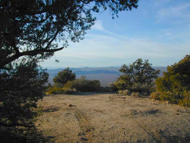
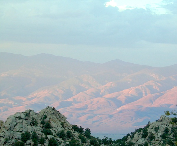
Snow is always a factor in mid to high altitude towns with road conditions being unpredictable with each mountain range and each micro-climate. Winter months range from late October to May, so be warned. Above 3000′ elevation usually gets some snow. Serious snow above 5000′. Some High Sierra Passesdon’t open until JULY (Yosemite Hwy 120 & Sonora Hwy 108). Carry tire chains or have 4×4 to travel safely on snowy roads. Guard rails are seldom around every curve.

list of California towns
by elevation


Rainbow Lodge California

bishopbelow
Above Owens Valley (US 395) at sunset, as seen from the Sierra side (8000′ elev)

California Covered Bridge

Covered Bridges of California

Oregon City Bridge
Oregon City Bridge, off Cherokee Rd, N Oroville, CA

Overland pioneers and miners flooded the Sierra Nevada mountains after 1848, when gold was discovered, transforming the natural landscape and native life of California – in horrendous ways. Industrius, eager and using the abundance of natural resources available to build homes, divert creeks, and construct a new way of life. Mining for precious metals was not a hobby, it was a ‘way of life’ for many who sought westward locales. Most traversed a continent on foot with covered wagons to get out here.

Many early bridges made of wood have disappeared in California. Historic places, such as these few wooden bridges of the West, need to be protected and preserved. So no carving your initials; spray paint (tagging), littering – nor bullet holes.

Felton Covered Bridge
Santa Cruz Mountains & Redwoods
Railway Train Rides
Felton, CA

Bridgeport Covered Bridge
(built in 1862)
South Fork of the Yuba River
Northern Gold Country Hwy 49
Nevada City & Downieville, CA

Honey Run Bridge
on Butte Creek @ Skyway
Historic Landmark from 1894
in between Chico & Paradise, CA

Knights Ferry BridgeState Park
State Historic Park

on Sacramento River
North of Sacramento, CA

oregoncitymarker

Oregon City Bridge
(see photo at top of page)
Oregon Gulch, North Lake Oroville
via Table Mountain @ Cherokee Road
North of Oroville CA

Oregon Covered Bridge
Middle Fork of the Yuba River
Northern Gold Country Hwy 49
in between Nevada City & Downieville, CA

Woodson Bridge SRAState Park
State Recreation Area

Woodson Bridge Campground Campgrounds
on Sacramento River, in betweenRV camping
Chico & Corning, CA

Honey Run Bridge
HoneyRun Bridge of Butte County, California

Volcanic Buttes of Chico
Volcanic Buttes of Chico California

Central Valley CA

happyvalleycow
Happy Valley Cow

The Great Central Valley of California – the San Joaquin Valley (on the south side) & the Sacramento Valley (on the north) together make up some of the most fertile farmland on the whole West Coast. Agriculture thrives, water flows & smog settles.

This huge valley, bordered by the Pacific Ocean on the west & the Sierra Nevada mountain range on the east side, is the one of the biggest farm land regions of the U.S. The food that feeds the world is grown right here in the Center of California. Vegetables, rice, fruits, citrus, garlic, onions, nuts, you name it.

redlettuce

Central Valley residents can easily enjoy fresh produce year round. Centrally located they can access the neighboring Central Coast, Historic Gold Country, and the Sierra Nevada mountains, plus The City (San Francisco) is not too far away either.

Since the capital city of Sacto has a “port of entry”, the California Delta & surrounding waterways, make for excellent fishing, boating & camping.

Unfortunately this low lying area is one of the worse smog basins on the west coast. The upper & lower Central Valley see the worst of it, as wind pushes the emissions right up against the mountains. Triple digit temperatures are common throughout the summer months. The super heat just magnifies the poor quality of air.

cauliflower

California Country – CA Countryside Communities

California Central Valley Map

Counties, Cities & Towns of the San Joaquin Valley:
(south to north)

Kern County
Tulare County
Kings County
Madera County
Fresno County
Merced County
Stanislaus County
San Joaquin County
Solano County
Sacramento County
Yuba County
Sutter County
Yolo County
Colusa County
Glenn County
Butte County
Tehama County
Shasta County

Reservoirs

blue links lead to more info on camp services. camp RV Camping

Central Valley Parks & points of interest:

Henry W Coe State Park
George J. Hatfield State Recreation Area
Carnegie SVRA
Dos Reis County Park, San Joaquin River
San Juan Bautista State Historical Park
Hollister Hills OHV Park
Pinnacles National Monument
Hernandez Reservoir
Los Banos Creek Reservoir
Caswell Memorial State Park
Colonel Allensworth State Historic Park
Codorniz CampgroundEastman Lake
Kern National Wildlife Reserve
Kesterson National Wildlife Reserve
San Luis National Wildlife Reserve
Merced National Wildlife Reserve
Modesto Reservoir Regional Park
Honey Run Covered Bridge
Oroville Wildlife Area
Spenceville Wildlife Management & Recreation Area
Lake Oroville State Recreation Area
Mount Diablo State Park
Auburn State Recreation Area
Sherman Island Waterfowl Management Area
Grizzly Island Waterfowl Management Area
Cache Creek
Sutter National Wildlife Reserve
Gray Lodge Wildlife Area
Colusa Sacramento River State Recreation Area
Colusa National Wildlife Reserve
Delevan National Wildlife Reserve
Sacramento National Wildlife Reserve
Mill Creek Wilderness
Ishi Wilderness
Tehama State Wildlife Area
Red Bluff Recreation Area
Shasta-Trinity NRA
Whiskeytown Reservoir NRA

California Central Valley Lakes & Reservoirs

walk in camps

for more lakes in California, check the BIG LAKES LIST

Santa Cruz Redwoods

hippytownway
BSA Camp Cutter

Santa Cruz Mountains & Santa Cruz Redwood Parks

overnight in the redwoods

Camping out in the Santa Cruz mountains can be a magical experience. It is here where some city dweller first get a glimpse of the coastal giant trees. Towering above in several Redwood Parks, the hiking & camping are endless. Backpacking, day hiking, mountain biking and horseback riding are all popular activities in this region.

NOTE: There is no off-roading, 4×4, OHV trails in these coastal mountains, so it will be more peaceful. Peace and quiet, remember that?

redwoods Santa Cruz

Since this mountain range is in between the Santa Cruz coastline and THE CITY, San Francisco, and situated right next to the mega-city “Bay Area”, you can always expect a few tourists about and lots of locals out enjoying their backyard (at all times of the year).

Make campground or cabin reservations as far in advance as possible. Summers are the busiest months!

State Park hikes tent camp RV

Tent Cabins
Tent Cabins: Big Basin Cabins can be arranged at Big Basin State Park. Campgrounds can be found at all State Parks and some county parks. Private vacation homes are found nearby; a few small towns on Hwy 9 offer hotel accommodations. On the coastal side of this ‘mountain’ is the small community of Pescadero w/ Butano SP.

Small towns nearby offer lodging & dining:

Big Basin Redwoods Camping

Tour of California

oldestrocks
Day hiking near Mammoth Lakes, CA

Tour of California, by Total Escape

DSCN1584

California has so much land and sheer beauty, it’s hard to wrap your mind around the vastness, much less the amazing and awe inspiring scenery. Snow skiing, kayaking, horseback, snowmobile, sleigh rides, dinner cruises, beer trains, wine tasting and so much more.

Drive California top to bottom (from Shasta to Baja) and you could be looking at months of prime vacation time. If you have that kinda luxury free time. If not, you might be looking for a local weekend of adventure, cave history or sightseeing. Total Escape has been featuring California tours for decades. We have something perfect just for you!

see camping & guided tours by Total Escape Adventures

Tour California

viewfromtent

Self Guided Tours of California:

viewfromtent

Looking for the CYCLING EVENT ‘Tour of California’?

kern

Our Food

local farming

According to a new report by the National Center For Health Statistics, nearly 40 percent of all U.S. adults are now officially obese. An all-time record high. More than 70 percent of us are now officially overweight.

GIVE THANKS, we live in the “illusion of prosperity”

Now, it’s time to get serious and educated on the matters at hand.

The majority of the population does not even understand what is being done to them. Major food corporations know that eating heavily processed foods is addictive and an edible path to heart disease, cancer, diabetes and other deadly diseases, but they keep pushing those foods on us anyway. Junk food is making them rich and making us sick!

  • energy drinks
  • soda pop
  • candy
  • fast food

The average American diet is extremely self-destructive, and it is well time for a change. Which is why we at Total Escape decided to focus on the topic of FOOD for this autumn month of Thanksgiving.

On the towns pages we link to local farmers markets, health food stores, community co-ops, family farms, organic farms, farm stays and vineyards.

our food

OMG, GMO – soy, corn, sugar
* May contain ingredients partially produced with genetic engineering.

High fructose corn syrup, soy lecithin, natural flavors….
you may not realize how much GMO is in your food.

Why Care about Food

If you are concerned with your physical health & well-being, you already know that nutritious, real food is the best for your daily diet. You are what you eat!

Almost half of California voters voted to label genetically engineered foods, way back in 2012. So if you didn’t understand about healthy food choices 5 years ago, you might be willing to look at the food issue more closely these days.

mission corn chips

Although the labeling law did not pass, many companies begin putting GMO-free or NON-GMO labels on the front of the food packages anyway. Health food manufacturers, major national brands, and especially food produced inside California – can be found with the non-gmo verified label.

FOOD as medicine, in light of recent news:
Americans are the fattest culture ever; Declining bee population, continued environmental pollution, and the link to our epic diseases. Gut disorders, allergies, autism, cancer, diabetes, the list goes on and on.

Most Prevalent Pesticides

Glyphosate is a potent and dangerous chemical found in Monsanto’s Roundup weed killer, the most commonly used herbicide in history.  Glyphosate has contaminated the planet, and is now found in mother’s milk, our bloodstreams, and in our food and water supply. The World Health Organization announced in 2015 that glyphosate ‘probably’ causes cancer.

Levels of the herbicide Roundup in human urine have increased dramatically among California residents in the past two decades, a new study reports. Roundup is used to protect genetically modified corn and soy crops from weeds; Also sprayed on wheat and oats, during harvest; And blindly used by public and private land owners to control weeds on their property, which ends up in run-off water, as poison to lakes and rivers.

This chemical corporate push in agriculture is a decades-long experiment with our very own ecosystem: Our health and the health of our planet.

____________________________________________

Watch Food Documentary Films to find out more on this topic.

Organic is Non GMO & More

Granges are now Guild Halls?

Follow the Food Babe blog online

Favorite West Coast Pioneers:

Amy’s Kitchen
Bragg’s Apple Cider Vinegar
Bob’s Red Mill
Cal-Organic
Cliff Bar
Dr. Bronner’s Soap
Full Belly Farm
Lundberg Family Farms
Masumoto Family Farm
Organic Valley Coop

califricebag

Los Angeles Mountains

LA forest / Los Angeles Mountain / LA National Forest

wrightwood

Los Angeles forest & parks –

San Bernardino National Forest
Angeles National Forest
Los Padres National Forest

Santa Monica Mountains NRA
Malibu Creek State Park
Verdugo Mountains Park
Mount San Jacinto State Park

+ numerous Wilderness Areas

Los Angeles Mountains
Maps & Hiking Trails –

Los Angeles mountain towns –
Big Bear, Angelus Oaks, Arrowhead, Forest Falls, Green Valley Lake, Idyllwild, Wrightwood

Tunnel thru Rock

Angeles Crest Highway
Angeles Crest Highway 2