Indian Rock is a beach (day use only) on the west side.
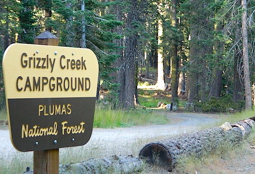
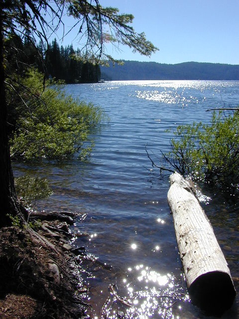
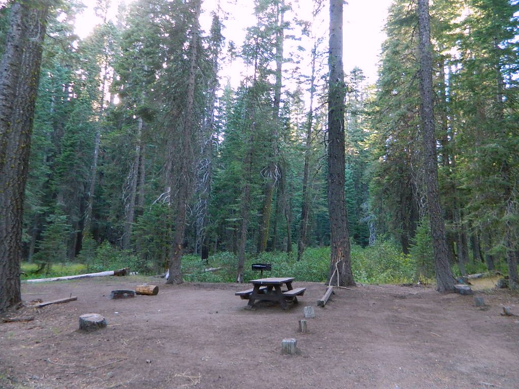
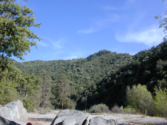
Bucks Lake, California
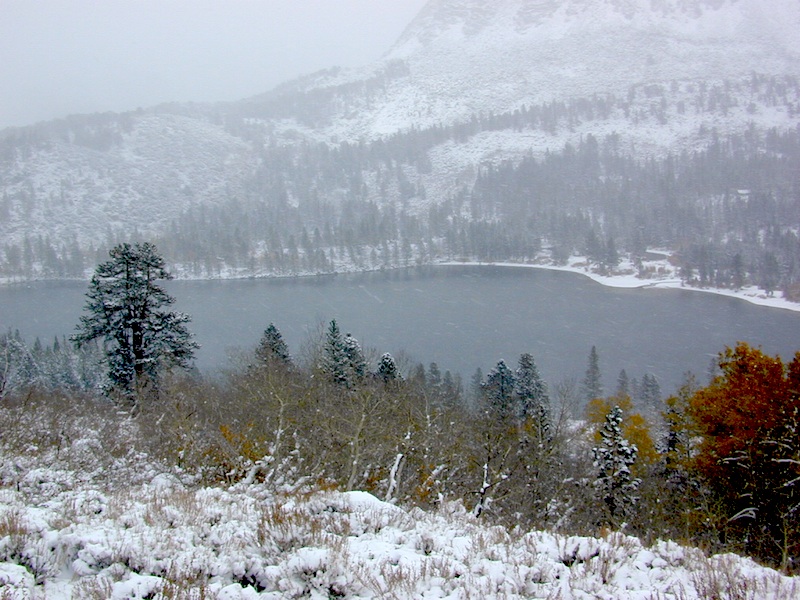
Below is a list of all the developed campgrounds & RV Parks surrounding the Bucks Lake region of Plumas National Forest in the Northern Sierra Nevada mountains. The infamous Pacific Crest Trail (PCT) runs through Bucks Lake Wilderness, so there are also trailhead camps and backcountry camp sites that are not in this list. This high elevation region closes the campgrounds for winter: NOV- APRIL
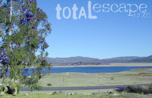
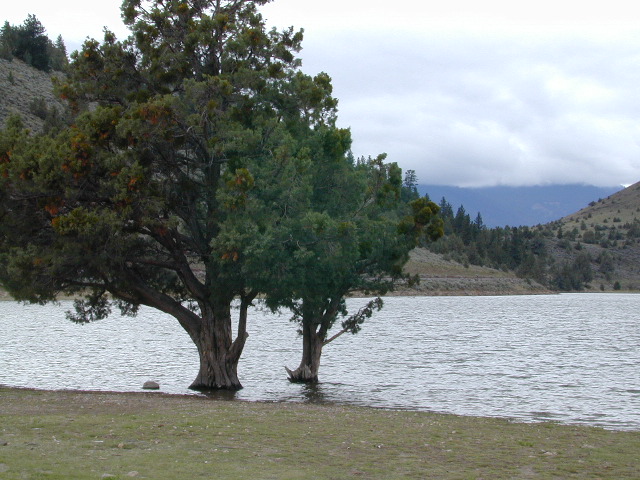
If you are imagining a forested alpine lake near Palomar Mountain, this is not it. Henshaw is a countryside area w/ meadow setting near ranches with open skies and open terrain. Can be windy at times! Can be hot in late summer.
Perfect remote spot for stargazing. Henshaw is the nearest body of water to Mount Palomar & is located on Hwy. 76, but the terrain is quite the contrast to the pine topped mountain nearby.
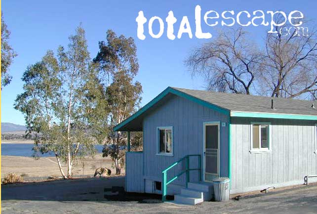
TREES: Lake Henshaw has very few trees; mostly large open spaces & fields surrounding it. Cattle grazing & rolling hills w/ mountain backdrop. Stargazing and fishing cabins is more fitting of a description. This bare bones basic, little cabin resort offers a true get away from civilization for maximum relaxation close to SoCal cities.
Lake Henshaw specs: elevation: 2740′ surface area: 1137 acres
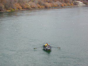
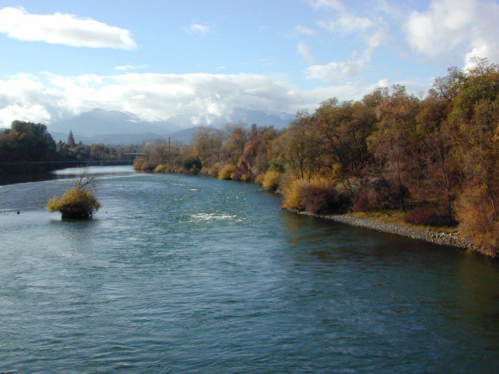
The main artery from the North; the Big River of California
Mighty Mount Shasta snowmelt flows south, bound to meet the giant Lake Shasta, which merges with the Pit River and numerous other major waterways, becoming the big Sacramento River. Running right down the center of the North Sacramento Valley to merge into the California Delta. Shipping channel links the State Capital city of Sacramento with the San Francisco Bay and the Pacific Ocean. Agriculture and wildlife depend on this river heavily.
Sacramento River National Wildlife Refuge
Willows, CA
~ Camping is not permitted on the Sacramento NWR. Along the Sacramento River, camping is permitted on GRAVEL BARS for up to 7 days during a 30 day period. For waterfowl hunting, overnight stay is permitted in a vehicle or RV in designated areas. Tents are prohibited. No person may build or maintain fires except in portable gas stoves.
This is California – the beautiful, where millions flock on vacation. California is crowded: the population & tourists are only increasing each year. Thousands of people are looking for hiking mountains or better, a hiking lake – each weekend. Many are using the web for destinations, like the research you are doing right now. All folks seeking nature, water, cooler temps, fresh air & views. High Sierra, NorCal, SoCal Reservoirs, we list the best of these hiking lakes below.
Some of the lakes have mountaineering routes nearby; equestrian trails, regular hiking trails, campgrounds, some even have sorta level paved (granny) trails for biking, hiking & skating around.
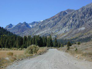
High elevation or alpine lakes can be accessed best in summer months. Mountain bike, backpack, horseback into these hidden treasures. With any Sierra Nevada destination, snow pack deep can be in certain seasons. Major Highways (Sierra Passes) can be closed into June or July, due to rock slides and late snow melt. Snow shoes, snowmobile or 4×4 vehicles may be needed to reach such lakes, any months OCT-MAY (fall to spring). Winter can come early & stay late at these higher elevations of California; Be prepared for true Wilderness experience.
But maybe you are just looking for some easy hiking, loop trails & picnic spots; Or perhaps an overnight stay near a lakeside camp w/ kayak rentals. California reservoirs to alpine lakes, we have a wide variety listed below.
This page contains links to some favorite lakes with hiking trails around the lake, along the shoreline or routes on ridge lines overlooking the lake. If no good lake page could be found, we’ve linked to some photos of the lake on Flickr.
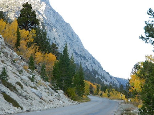
If you are thinking about fishing or camping the Eastern Sierra, North of Bishop & you are not up for the crowds at Mammoth or June Lakes, then try the Bridgeport area, north on Hwy 395. Rural ranch lands along main road, Bodie ghost town turn off across the highway and Virginia Creek Settlement are also nearby
Green Creek is a 11 mile long dirt road in the lush Eastern Sierra the northern portion. The wide, graded dirt road is signed and dead ends at a Toiyabe National Forest campground called Green Creek Campground. The drive up can be washboard bumpy in some parts, but that doesn’t stop the hundreds of adventurous motorhomes that make this trek annually. This place features some of the best prime Sierra back roads camping options for RVs.
Another dirt route, Dunderberg Meadow Road peels off to the left. Dunderberg departs off Green Creek a couple of miles from the highway and well maintained. This route leads to meadows, aspens, picture perfect scenery and much more seclusion. Passenger car accessible, wide graded dirt roads to wilderness edges. Two-track one lane trails lead to meadow edges and more creeks. Very impressive views of the Sierra peaks over here on this side. Meadows are sensitive areas, wonderful for picnics and you should always minimize impact.
Plain old passenger cars can easily make this route deep into the Eastern Sierra aspen canyon. Graded dirt and4x4 could be needed winter months. Backpackers can enjoy easy access to the Hoover Wilderness trailheads. There is plenty semi-primitive camping spots along the way, right on the creek, for free…. so no need to sleep in your vehicle upon arrival.
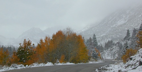
Autumn Aspen Groves: fall colors peak in October, which is usually when the first snows for the winter season start. November – usually the freeze gets them and lifeless brown leaves dangle, until the Sierra Nevada wind gust blow real good.
Green Creek Camping
DIRT ROAD CAMPING
alpine lakes
backpacking
car camping
day hikes
fishing camping
meadows
RV camping
tent camping
Dispersed, primitive camp spots along this main dirt road are on a first come basis. You’ll need a fire permit. Many flat camps are set along the creek in aspen groves, some pines, others have cubby hole privacy. Large granite valley, big creek, bird, scenery and nature everywhere. Some folks spend weeks camping out here in the warm weather months. Fishing is a big attraction.
Old Cabin in autumn leaves, up near the top of the dirt road deep in the aspen groves
Steep, rocky, gravel road, way up above (and behind) Convict Lake. 4WD may be needed during wet or snowy weather. High clearance is always advised. Locked GATE at the bottom means the NFS rangers have closed the route (seasonally) for deep snow, rock slides, avalanches, or other erosion hazards.
Laurel Canyon, US Hwy 395
Laurel Creek
Laurel Lakes
Oldest, exposed rock in the Sierra Nevada mountains range. Buckling granite w/ volcanic rocks. Evidence of glacial activity including, terminal, lateral, and recessional moraines, glacial striations and polish, erratic boulders, and of course the numerous lakes. see more
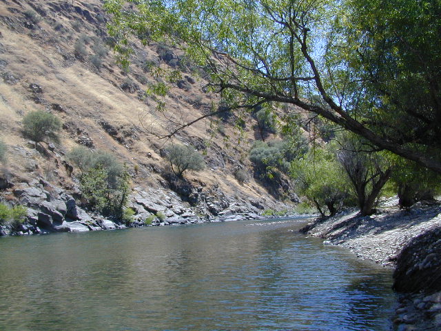
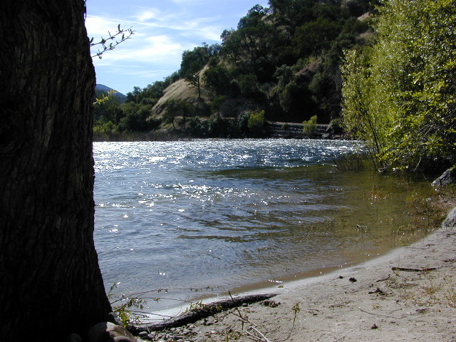
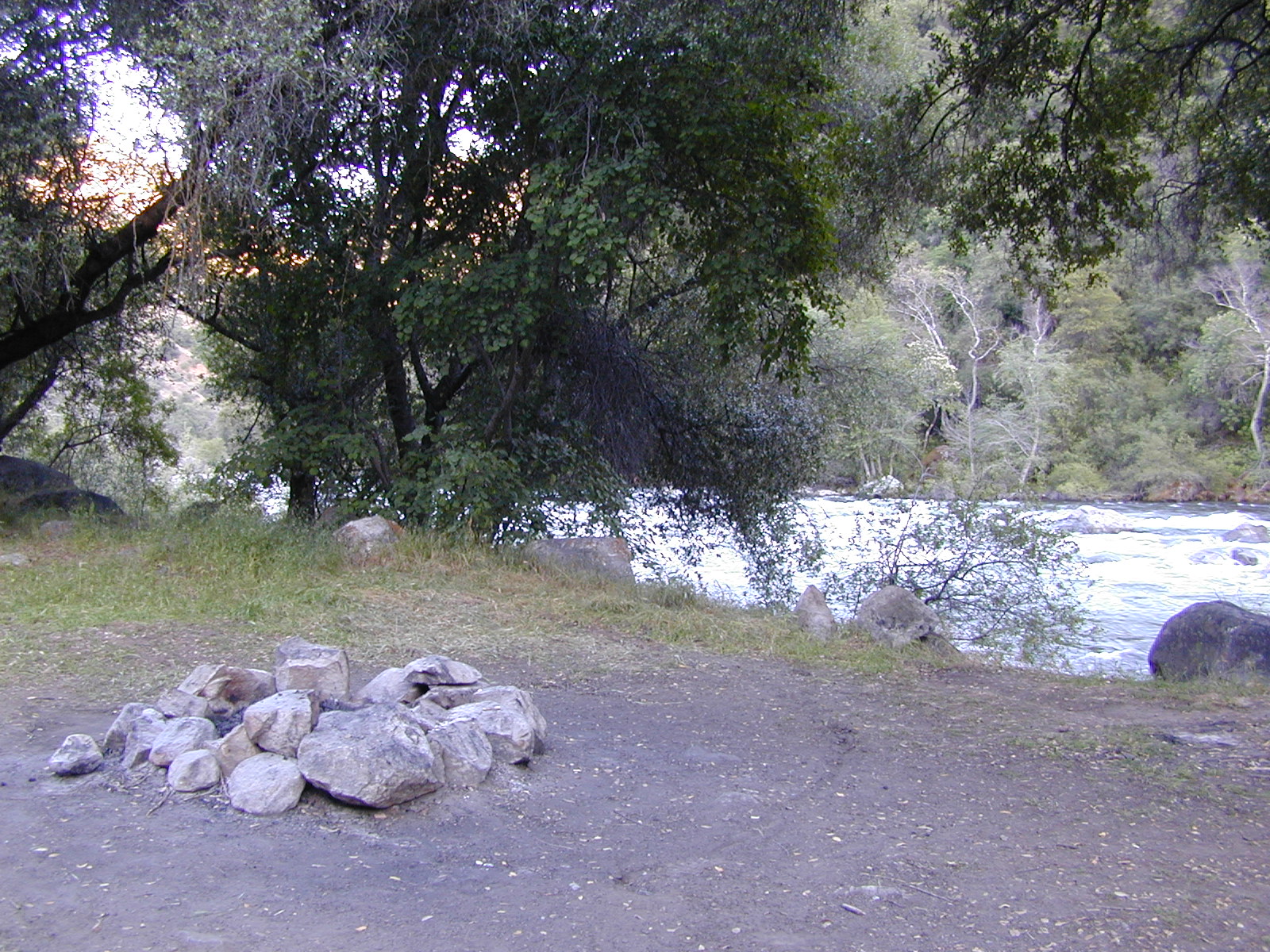
Low elevation Western Sierra: a big river at the beginning of Kings Canyon. Fishing, biking and hiking. The Kings Cyn National Park is directly east, upriver.
Oak woodlands, steep granite canyons, waterfall hikes, rock beaches, river fishing, mountain biking and wildflowers. Day time temperatures get triple-digit in summer months, so best time to visit is the rest of the year. Small RV accessible, paved road, river close – and best of all, open all year long!
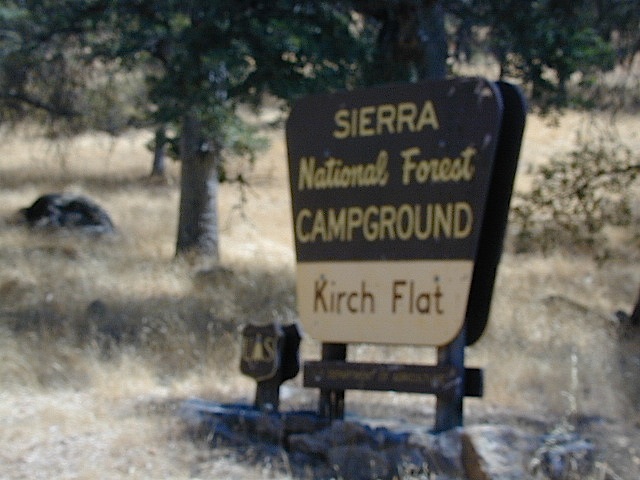
Kirch Flat Campground
Due EAST of Fresno, California in a large river canyon, Western Sierra Nevada
Located 18 miles up Trimmer Springs Road (paved), 5 miles above Pine Flat Lake. Sierra National Forest; River rafting take-out spot for Middle Kings River.
• Elevation: 1100′
• Number of Sites: 17
• Camp Fee: No
• Vehicle Accessibility: RV 22′ max
• Campsites Reservation: No
• Length of Stay: 14 Days
• Season: Open Year Round
• Trailheads: Kings River
Sierra Road number 9 is a north turn off of Trimmer Springs Road. Marked as National Forest Rd #10S69, as well as just plain NINE. Big Crk. canyon is after the Maxson Road junction, and before the Balch Camp / Blackrock Reservoir turn off on #11S12. The area is known for abundant wildflowers in the early season.
A popular dirt road drive for the western Sierra – Pine Flat Lake region. A forested, south facing canyon in the Southern Sierra Nevada Mountains. Big Creek, wide, graded, dirt road w/ primitive camp sites. 4×4 could be needed in wetter months.
The higher you go on this route, the more pine trees you will experience. Winter weather can close this route. A campfire permit is required to camp along this road.
The lower part of the canyon has rock features, small waterfalls, swimming holes, picnic spots and sometimes cattle grazing. Several prime unmarked, primitive camp sites along this road – but few and far between. High clearance or 4WD may be needed, depending on road conditions.
Soaproot Saddle Road is a not-so-obvious left fork (dirt, without signs) that leads steeply up away from main road. Climbs a steep hillside, way up above and along Rush Creek; continues for many miles. Less people back this way, if you are seeking seclusion. Few primitive camp sites on right side of road, near where the creek breaks away from road. Good for stargazing way back here. 4×4 may be needed. Road may or may not connect through to desired destination.
The mid-route climbs into pine forest and the dirt road switchbacks, steeply, with a few more camp sites available; usually found on short side roads off the main road.
At Sierra #9, a major junction w/ dirt road #10S69, called Dinkey Trimmer Road. This leads way off through the rugged terrain, many miles, over to the pavement at Dinkey Creek Jct – Campground, Trailhead and Dinkey Lakes Wilderness.
Big Creek will turn left (north), and follows the large Big Creek Canyon. Several steep miles climb up into the dense pine forest, following the creek the whole way. Several prime creekside camp sites fill up fast in this stretch. Great views, steep dirt roads. GPS waypoint these camp driveways – so you can find it next time, (first, before everyone) on Friday, Thursday before midnight.
Peterson Mill Road is Rd #10S02, found on the left (west) side of Sierra #9. That westbound route becomes pavement half way back to Highway 168. This way is the quickest way from Fresno, out to the developed NFS Bretz Campground.
Sierra #9 Big Creek Road arrives in the densest of forests. Many camp sites and side routes to explore. Dark, upper elevations, snow lingers long in the shade. 4WD may be needed in wet areas. Mud is quite common MOST of the year in this spot, so know your vehicles capabilities before you get yourself stuck (or stranded). It’s a very long walk to any kinda civilization!
Hunters like to use these upper camps during hunting season. A camp fire permit is required, so bring your shovel and bucket; self-sufficient campers enjoy the back roads most often.
Bretz Campground NFS is up here on the main road, number nine. Clock it w/ dash trip meter; 15 miles from the road start @ Pine Flat Lake. Popular with OHV and 4×4 groups. Max RV or trailer length = 24′
Open all year long; No fee.
Sierra Forest Road #9 the far north end, enters Blue Canyon @ #10S18, but the Rd #9 route continues NE as Providence Creek Road. Eventually intersecting @ Dinkey Creek Rd w/ Rock Creek & Dinkey Dome closeby. Great granite 4×4 Trail @ Bald Mountain (elev. 7832′) overlooking Shaver Lake.
Jeepers on granite @ Bald Mtn, above Shaver Lake, CA
California Stream Fishing California Creek Camping
Since SoCal is more of a desert terrain, big water in California can be found elsewhere throughout the state. Natural waterways flow primarily from NorCal and from the backbone of the west coast, the Sierra Nevada mountain range. Determining the region to explore is a first step, then narrowing it down to several possible camp spots after you’ve found a good printed map (a hard copy, non digital, non electricity, the old fashioned kind).
California Rivers are popular destinations for the outdoor vacationer. The most desirable streams or creeks in California flow into a reservoir, not out of. The wilder scenery above the lake, deeper up the canyons are the secluded places we seek. Some accessed only by dirt back roads. 4×4 camps are commonly positioned near creeks. Wilderness trail heads can lead to even more privacy if you are willing to huff it.
look for the tiny blue lines, the bolder the better
– is your choice a main blue line?
– does this one creek feed into another larger stream?
– is it a creek that will be flowing strong?
– how far from a paved road is it?
Forest Service Back Roads are usually one lane dirt roads and have strange long numbers attached to them. Maybe signed, but don’t count on it. In the illustration: Look Road #22S59 is right along a creek, and maybe 22S08 has some water sources, but has a developed campground w/ possible fee. 22S59 is very likely to have some dispersed sites along it. You always have options open when you have a good map; make your back up choices when planning your destination. Have a few plan B roads chosen, just in case your first choice is too steep of a slope, or packed with RV families, or totally muddy and impassable with your vehicle.
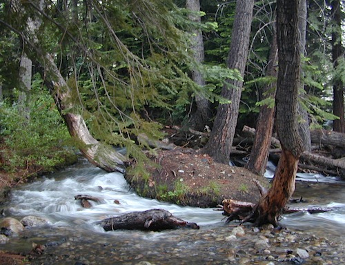
Creekside Camping in California
4WD needed?
Spring snow melt is when the dirt roads are still closed (gated) and often quiet muddy. Some primitive camp sites may be best access with a 4-wheel drive, but each river or creek side camp spot is unique at different times of the year, due to the snow depth and land erosion process. For easy-going exploring purposes, small all-wheel-drive vehicles work well too, but clearance can be a limiting factor. You wouldn’t believe what passenger cars we see on the back roads of Baja. Almost anything goes anywhere, slowly, as long as it runs and rolls.
last tip – mosquito, where?
Screen room tents may appear unsightly, but those hungry, annoying mosquitoes don’t really care what flavor you are. Them lil suckers are abundant in areas with water, standing or still water, meadows, creek beds, especially active in the warmer summer months. Beat ’em before they hatch – camp in the springtime. By autumn their numbers seem to dwindle with the night time chilly temps, but make sure to come prepared for those colder nights.
Kings River, Sierra National Forest Road #12S01 – Lower Kings
Located in between Kings Canyon National Park and Pine Flat Reservoir. Graded dirt road w/ trailhead parking & camping; Primitive car camping, vault toilets, some areas accessible by small RV. Campfire permits are required.
Long, (sometimes rough) dirt road, that parallels the north side of the Kings River. Dirt road used by families, fishermen, kayakers, campers, mountain bikers, rafters and rafting shuttle buses, seasonally. May be gated and closed off to the public in wetter months of the year.
Bear Wallow Trailhead
Kings River Trailhead
click to enlarge
Forest Route 12S01 crosses the river and leads to the south side of the river, near Green Cabin Flat. Mill Flat Campground is back this way.
Road 12S01 gains in elevation, turns to high-clearance, continuing up McKenzie Ridge thru a small slice Sequoia National Forest to the highway Kings Canyon National Park. 4×4 may be needed in wet/snowy weather.
Northern California is the top third of the golden state, the area north of the San Francisco Bay Area and north of the Napa wine country. North of the Sierra Nevada mountains, North of Lake Tahoe. The waters we focus on here are in and around Klamath National Forest
Lakes, rivers, creeks, waterfalls, waterfowl, fishing and fresh water are all plentiful in the Klamath region. Mount Shasta and the Klamath mountain range make up a portion of the Cascade range, that continue north to the Pacific Northwest. Klamath Falls and Klamath River originate up in Oregon, but the list below features the California regional lakes.
The dam projects of the Klamath River have always been a controversial subject for many local activists. The Klamath River Keeper web site currently warns us –
Inyo Forest Road #4S12
also known as Inyo Road 12, and also Rock Creek Rd.
Majestic mountain scenery. Popular paved route that leads from US 395 up to Rock Creek Lake, on the edge of granite wild lands; lake is situated above 9000′ elevation and the hiker trailheads are further up, beyond the lake at over 10,000 feet. Steep canyon, large canyon, rocky granite canyon, high elevation.
Super scenic drive, but open less than half the year, due to deep snow. Eastern Sierra Nevada mountains. Inyo National Forest
A popular and favorite place for summer camping, fishing and hiking. Backpacking, horse trails, high elevation lakes, mountain passes, peaks, wilderness areas. RV campgrounds, tent camping, car camping. Mountain biking in vast canyon, near campgrounds and creek. No bikes in the Wilderness (up and above Rock Creek)
Autumn colors, aspen groves usually best in early October. Snow closure in winter months (Nov-May).
elevation 7072′ @ Tom’s Place, CA (US Hwy 395)
elevation 9682′ @ Rock Creek Lake
elevation 10,272′ @ Trailhead Parking (end of road)
UP, UP, HIGHER & AROUND LAKE
One lane, paved route gets narrow, but keeps on climbing. Road #6S05 continues up – past Rock Creek Lake and ends at hiking trailheads, paved parking lot and a few picnic spots.
Iris Meadow Campground NFS
12 NFS Campgrounds in this region, starting with one at the highway, several along the way and the campgrounds at Rock Creek Lake.
No campfires are allowed in this canyon – outside of a developed campground. Not much in the way of primitive car camping options either, except for strapping on a backpack and heading into high elevation wilderness.
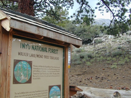
1 mile walk downhill to Walker Lake; very steep trail with 800′ elevation decent.
Vault toilet & one campsite at parking lot.
Trailhead camp for backpackers who arrive late. Nearby Parker Creek offers more in the line of free camping, more creeks, private setting.
Slim pickins on campsites, means have a plan B or C ready in case these few ideal canyons are full. Minimal camping spots, down on the main drag Road #1N17
Bloody Canyon leads further up the steep ravine to Upper & Lower Sardine Lakes.
Bohler Canyon near #1S19 (locked gate)
private property along some portion of this lake, so be aware of signage
This dirt road is a side canyon route; access to a whole mess of aspens @ Parker Creek. Fish the creek. Day hikes and backpackers trails; Picnic in the aspen groves.
Parker Lake Rd turn off is signed @ Road #1N17. All this is north of Highway 158 @ Grant Lake, on the June Lake Loop #1S63.
Primitive camping options only. No facilities, No developed campgrounds back here. Minimal camp sites and clearings, so have a backup plan B in case these few canyons are already occupied.
MUD NOTE: Dirt roads here can turn to mud, especially near creek beds – anytime in between October and May. Region is also prone to summer thunderstorms; Maybe even flash floods. Weather changes for June Lake and Lee Vining can be sudden so keep tabs on the current forecast.
Ancient volcanic peaks mix with Sierra Nevada granite rock, pine forests and fresh, clear, clean mountain water! California, of course.
Stanislaus Forest Road #7N01 leads down from Highway 4 to this popular series of alpine lakes and reservoirs. Camping, fishing, hiking and mountain biking. Sailing, canoeing, kayaking, swimming, floating and fishing are also popular water activities.
Rules of the Reservoir:
10 mph speed limit on Western Arm.
No motorized boating in Eastern Arm.
Camp only in developed Campgrounds.
2 NFS Campgrounds at west end of lake:
Spicer Campground (60 sites)
Spicer Group Camp (75 people max)
Campgrounds only open June-September. Some campsites at the campground are wheelchair accessible.
Additionally, Stanislaus River Campground w/ only 8 sites, is located just off the main access road #7N01, right near the river.
Numerous smaller lakes in the region make this a hot spot for summer vacations. Union and Utica Reservoirs (both with dirt road access) are good for kayaking and canoes, while power or sail boats prefer the larger Spicer Lake. Summit Lake and Elephant Rock Lake are perfect for quite picnics and day hikes. Trails (many unmarked) connect the lakes to each other. Area gets buried with snow in winter, so these roads are generally only open half the year.
Often called fly fishing lakes, or backpacking lakes, these are usually located in the mountainous parts of California. Remote lakes that are ‘hard to reach’ come in 2 varieties:
hike-in lakes
Backpacking Lakes, found in the Sierra Nevada Wilderness or Northern California Wilderness Areas.
These are often many miles down a dirt road or narrow paved route (neither which is recommended with a big trailer or large motorhome). Matter of fact, some of these lake destinations require 4 wheel drive to access them. You will need a good vehicle, maps, possibly more than one. You will need time to enjoy these. They require a fair amount of work to get to, but the rewards are immense.
Maps are the key to finding your very own slice of heaven in the Wilderness. Online map sources can barely get you to your city destination correctly, much less the remote waterfall you desire. You will need a real map for your adventure. A topographical map, with all the details, dirt roads & hiking trails. If you are seeking to stay away from the touristy crowds, this is the best possible place you can be…. on this site, searching for ways to make it happen – this weekend.
BACKPACKERS BACKPACKING MAPS –
Mount Whitney, John Muir & way beyond the High Sierra. DanaMite has all the California Wilderness maps on the new map shop. Various brands and types of maps. Most are printed on waterproof plastic now & are tear-resistant.
Planning on camping outside of the developed campgrounds & finding that perfect stream side spot without the reservation & the fees? Then you will need a free fire permit (from a ranger station), plus a good map of the forests & a vehicle capable of handling the rugged the back roads. Much of California is prone to wildfires, so make sure campfires are even allowed on the backroads, before you get out there. Call the “field rangers” for back road advice and current recommendations.
Wanna take that 4×4 vehicle somewhere really special this season? Camp well beyond the masses, way down that dirt road. We have OHV maps for SoCal, the deserts & all the National Forest maps too.
Start your search on the perfect campground or camp site with the destination in mind. Mountains, deserts, coastal. Parks & forests all have their own maps with all nearby camp grounds listed. We feature all the National Forest maps, as well as some State Park & National Park maps
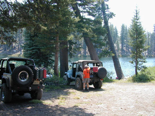
RV camping at it's best in the Sierra; This rig found themselves deep in the alpine lush meadows with towering trees and a view and a very private camp site.Big Bend Ranger Station, off I-80
The north coast of California is dubbed the Redwood Empire, and driving north on US Hwy 101 passing the well-known wine country and communities near Clear Lake, means you’ve entered the official redwood region of Cali.
With over 150 mile stretch between Ukiah & Crescent City, on the Oregon border, coastal redwoods thrive in this wet climate. All along US Highway 101 you can find every assortment of lodging, from standard hotels walking distance to village shops, to small secluded cottages tucked behind a winery. Sonoma & Mendocino vineyards merge on ridge lines, at the edge of oak countryside, with redwood forests & recreational rivers to the north.
BALD HILLS ROAD: Old logging roads lead way up in elevation, behind Redwood National Park, where you can find free camping spots and firewood piles all over the clearings. A real 4×4 vehicle will be needed in wet or snowy weather conditions. AWD wagons should be cautious of deep mud and know the weather conditions ahead of time. The main gravel/dirt route traverses the Bald Hills range at 3000′ elevation and ‘epic view’ campsites are abundant. Pine Creek Road drops east into Klamath River Canyon down to Klamath Hwy 96.
USAL BEACH: In the olden days, USA Lumber Company had a prime place on the Lost Coast. Now it is a wonderful destination w/ remote beach campground hidden in the trees, next to the redwoods and creek, and the cliffs – and a big sandy beach w/ giant driftwood!
Nothing beats fresh, cold, clean water from the California mountains, in the summertime. Find time to exit the urban rat race, soon. Escape the smoggy city life and the triple-digit heat for a road trip to the higher elevations.
Crocker Mountain @ Lake Davis, California
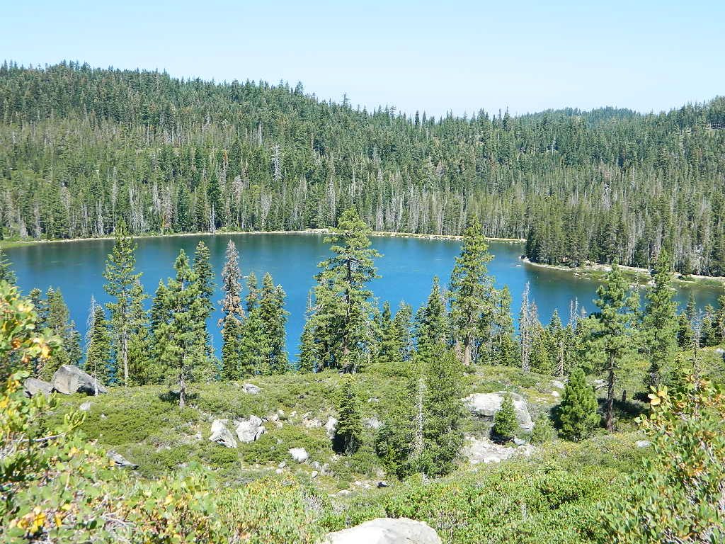
Lake Campgrounds are abundant in California, where man-made reservoirs and recreation abound. Alpine lakes in pine forests are also numerous in the west, although only accessible for a portion of the year, they draw in the campers all summer long. A majority of the small lakes are located inside the California National Forests.
USDA / USFS / NFS
Larger reservoirs can often be managed by California State Park system. State Parks, SRA, State Recreation Area. Suburban lake locations can be local County Parks. A few locations listed could even be desert lakes.
Many ideal secluded lakes are only accessible with a 4WD vehicle, by foot or horseback. Super scenic, backcountry lakes are so far out – that a day hike is usually required.
developed campground
primitive campsites
RV campground
wilderness access
No motorized boats, camping on west shoreline only, no fishing from the dam, catch & release?
No access for trailers? Individual rules for each lake are different. Learn the basic before you get out there.
CAMPGROUND RESERVATIONS
Lake Campgrounds are so popular in California that many require reservations during summer. Many locations accept reservations online and we have links for those too. Other lakes are so small and remote, that only the fishermen, hikers and 4×4 gear-heads know of them.
outdoor recreation found at or near lakes
backpacking
boating
camping
canoeing
creeks
fishing
floating
four-wheelin
hiking
horseback riding
house boating
jetski
kayaking
mountain biking
OHV trails
picnicking
rivers
river rafting
swimming
water skiing
waterfalls
Lake destinations listed here have some sort of campground facilities. Some may be mini resorts with boat launch, marina or bait shop/general store. RV hook-ups, maybe. Dump station, it will cost you. Usually these bigger lakes are busy centers of tourists activity with boat rentals, RV camping and certain locales are even walking distance from ‘town’.
Fine dining is a rare find on the lakes, but some lake side restaurants (open seasonally & with limited hours) can be found. Most will require reservations, especially on the weekends.
Other lake camps listed are literally on the edge of wilderness – with trails to the high country. The best little lakes will have one dirt road access. Below is a wide variety of lake destinations within California.

 TREES: Lake Henshaw has very few trees; mostly large open spaces & fields surrounding it. Cattle grazing & rolling hills w/ mountain backdrop. Stargazing and fishing cabins is more fitting of a description. This bare bones basic, little cabin resort offers a true get away from civilization for maximum relaxation close to SoCal cities.
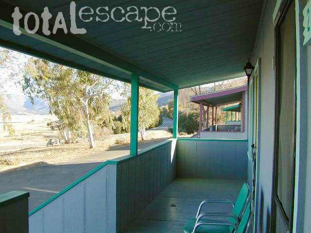


 Lakes, rivers, creeks, waterfalls, waterfowl, fishing and fresh water are all plentiful in the Klamath region. Mount Shasta and the Klamath mountain range make up a portion of the Cascade range, that continue north to the Pacific Northwest.


 The north coast of California is dubbed the Redwood Empire, and driving north on US Hwy 101 passing the well-known wine country and communities near Clear Lake, means you’ve entered the official redwood region of Cali.


 CAMPGROUND RESERVATIONS