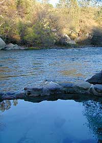
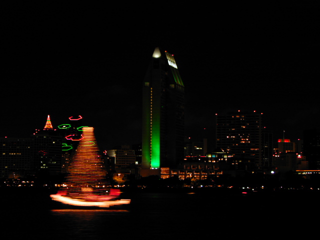
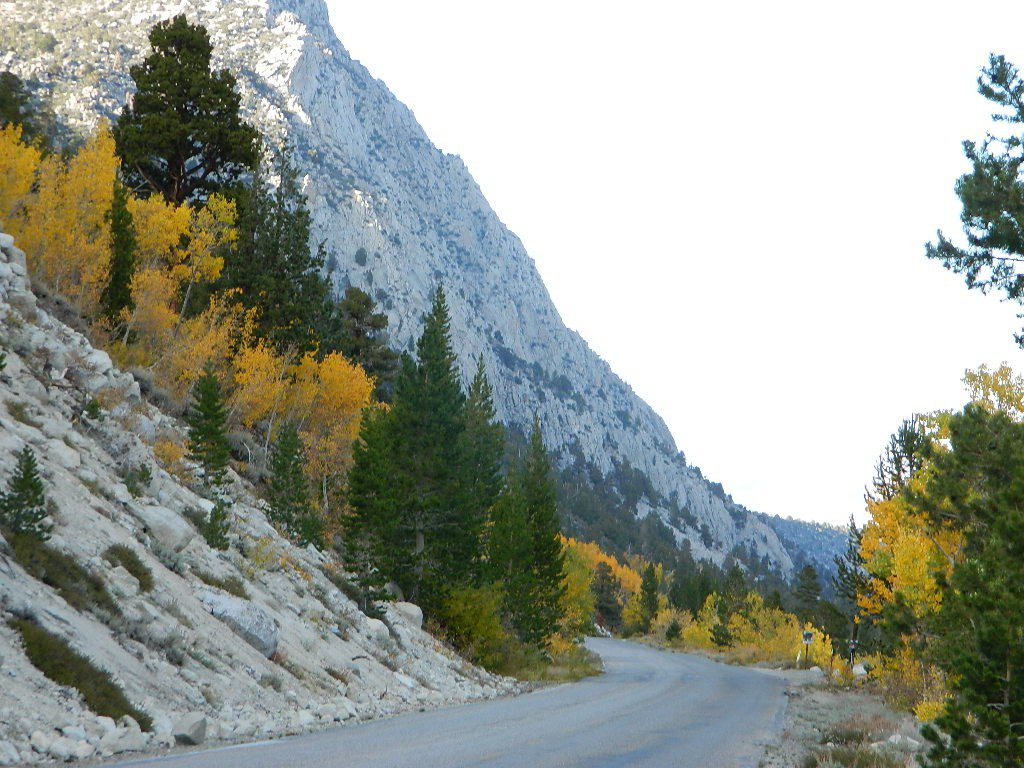
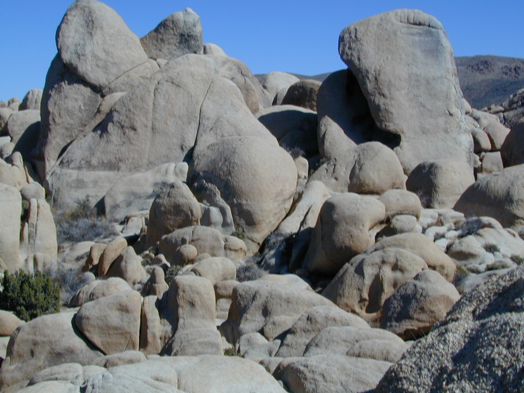
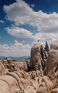
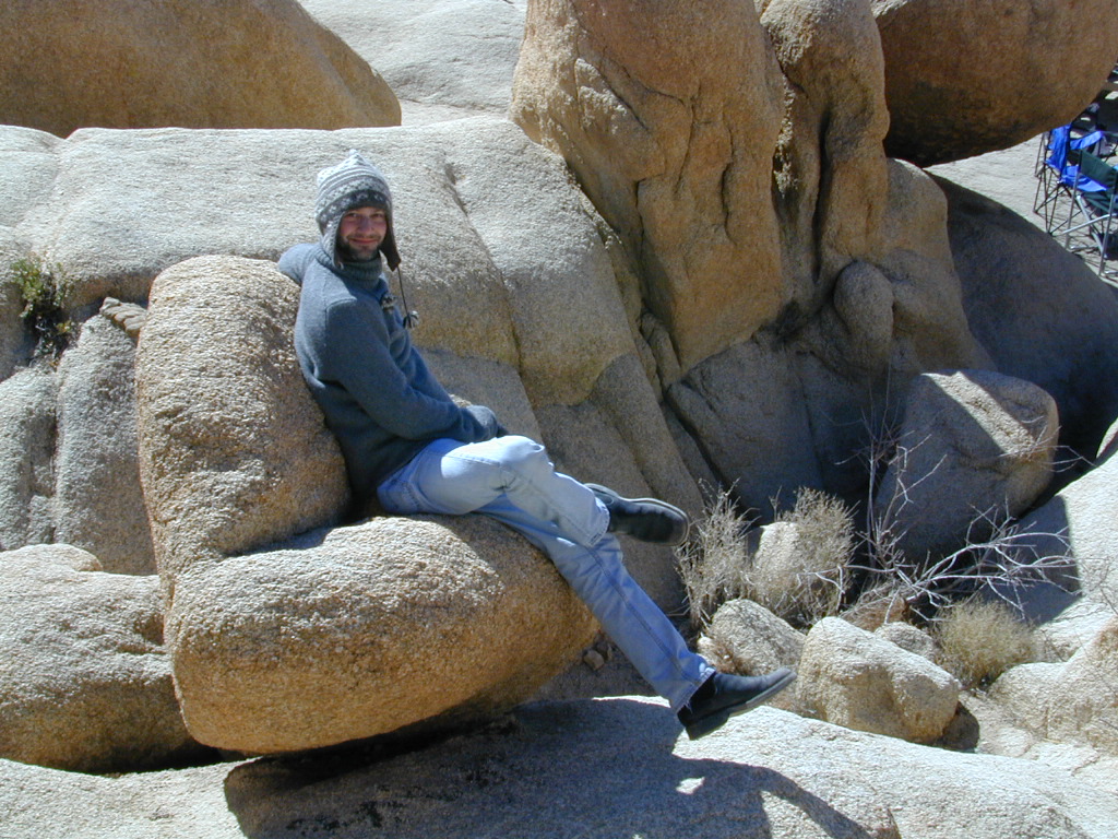
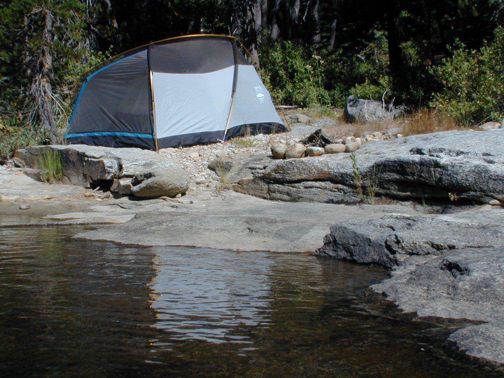
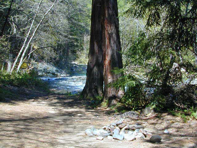
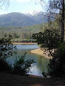
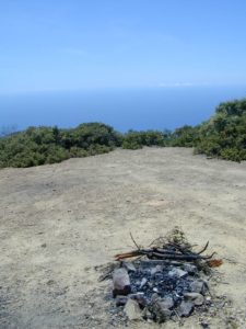
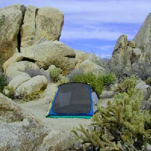
Tucked way back in the granite high elevations, near Donner Pass is a wilderness water flow called Canyon Creek. Connecting small lakes and big reservoir, this creek is part of the Nevada District water supply. The Sierra Nevada region is Tahoe National Forest and the terrain is abundant rock.
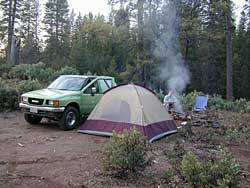
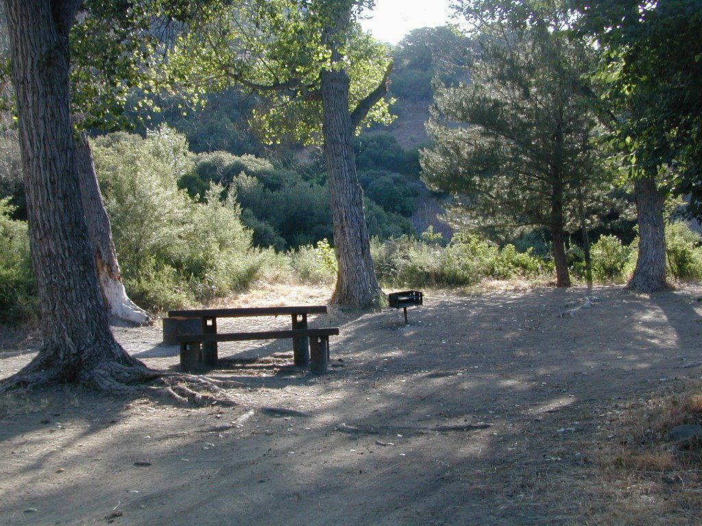
Campground is perched on the edge of rock overlooking the impressive whitewater; sounds of crashing water at certain campsites is deafening. Half of the campsites are located in a forest loop and the rest are out in the open, with much granite and fewer trees, perfect for star watchers.
Canyon Creek California
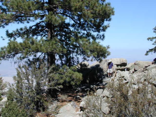
Lake Faucherie is a mile up the creek and Sawmill Lake is a mile down stream, so it’s a great fishing location, as well as hiking, kayaking and canoeing destination. The Pacific Crest Trail (PCT) is also routed close by. A hiking trailhead at the north end of Sawmill Lake leads to a loop hike of small lakes.
roughest roads in the region
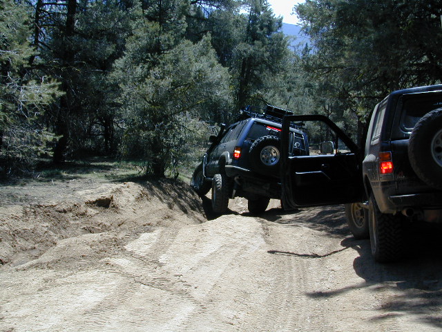
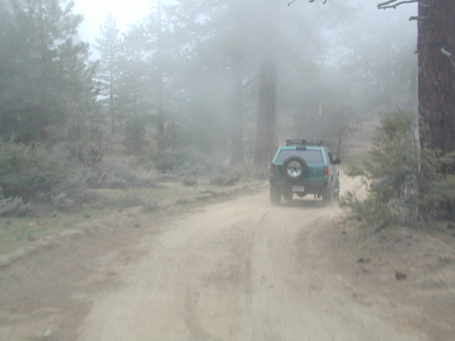
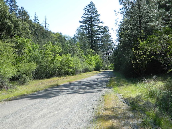
Campground loop is paved, but the 12+ mile access road is NOT.
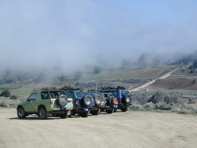
Twenty plus miles of paved & gravel backroads in boulder-hopping bliss, leads to granite lined lakes and forested campsites. Two different driving routes into this canyon:
One is the longer way Road 18 – paved access off of Gold Country Highway 20, which becomes an 8 mile long, rocky, rough, one-lane road around Bowman Lake.
The other is slightly shorter, county road #843 that comes in the back way from Jackson Meadow Reservoir (off Hwy 89, N of Truckee).
Both of these primitive roads join at Jackson Creek Campground, a favorite among off-roaders.
Canyon Creek Campground is another few miles up Road ##843-037, a rugged canyon route towards Lake Faucherie, where the road comes to a dead end.
Don’t let the old maps fool you: these National Forest Roads are labeled as gravel roads, but boulders and rock slides are quite common. 4×4 would be nice, but high clearance is recommended.
Minimal signs designate trails, roads and lake access; What signs that do exist are old, faded and broken. No warning signage reading ‘high clearance’ or ‘4WD recommended’ – so obviously Tahoe NF won’t be installing new signs anytime soon.
backpacking
camping
canoeing
fishing
hiking
kayaking
stargazing
Faucherie, Sawmill and Bowman Lakes are all along this waterway called Canyon Creek.
National Forest Campground Latitude: 39.436863 Longitude: -120.579564
Canyon Creek Campground
• Elevation: 6600′
• Number of Sites: 20
• Toilet: Vault
• Vehicle Access: High Clearance Vehicle, no trailers
• Campsites Reservation: No
• Camp Fee: No
• Length of Stay: 14 Days
• Season: June – October
• Trailheads: Faucherie & Sawmill Lakes
• Managing agency: Nevada Irrigation District
530-265-5302
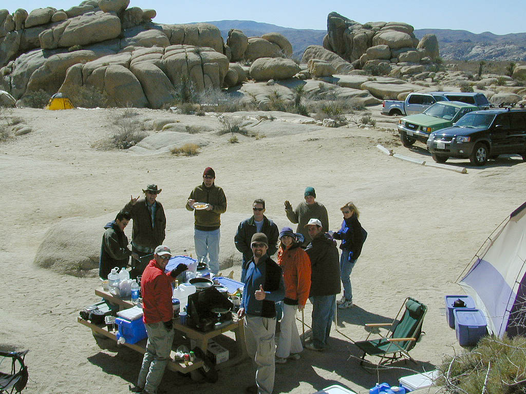
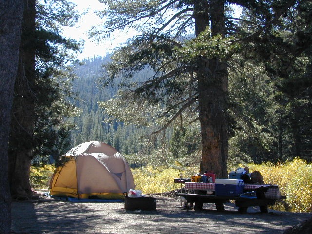
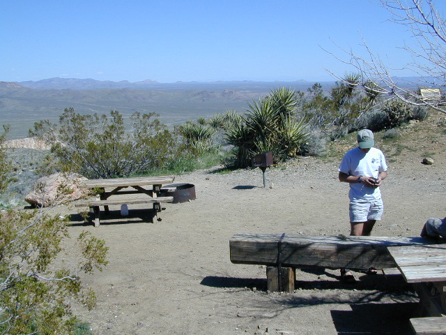
Canyon Creek Campground is an excellent campground for staying away from the crowds, which seem to focus more around Bowman Lake & Jackson Meadows Reservoir.
All campsites at this campground have steel bear boxes – for proper food storage in black bear country.
Prefer camping outside of developed campgrounds? then the primitive camp sites that line Canyon Creek will be a welcomed surprise. Most are clearly marked with small signs and some may require 4×4 to access. When fire restrictions are tight, campfires are only allowed in the developed campgrounds.
Graded dirt road near Clarks Fork junction @ SR 108. Dirt road travels up into forest, hiking trails and meadows; South side of the volcanic Dardanelles @ Tuolumne Co. & Alpine Co. boundary
County Line Trailhead
Wheats Meadow Trailhead
Carson Iceberg Wilderness Area
The Dardanelles (9524′ elev)
winter road closure, annually check with local rangers on road access and conditions.
Rd# 6N06, climbs to mountain scenery at upper elevations, well of the main highway. Route is a 2-lane wide road at times, narrower and private towards the end of roads; several dirt roads, overgrown 2 tracks w/ many camp sites to choose from. Dispersed primitive camping requires a camp fire permit.
OHV off-roaders will only find dead ends on dirt route 6N06. NO motorized access in nearby wilderness. Wheelers should try south of Highway 108 @ Niagra Campgrounds; Niagra Off Road #5N01 for all the noise-makers, gear heads, dirt bikes, and toy boxes. Niagra Creek, Niagra OHV, Niagra 4×4.
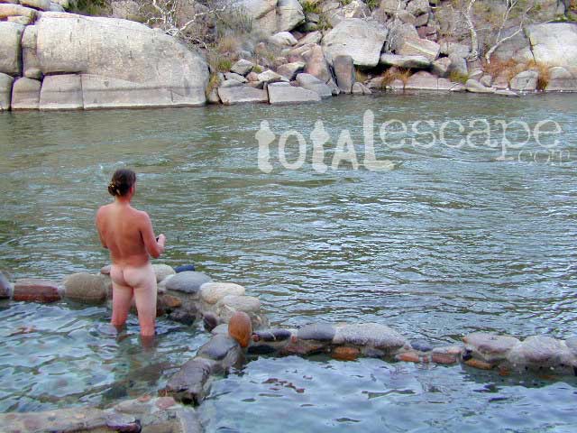
This place was the alternate choice to Miracle Hot Springs, but since that one is now closed – this is the main attraction out here, along the lower stretch of the Kern River.
USFS Forest Hobo Campground is about a mile away and it may be closed due to landslide repairs. There is also plenty primitive style camping options if you so choose.
Remington is by far, one of the nicest primitive hot tubs in the whole region and easy to access. If you can find it, the rewards are great!! Can be crowded on weekends. If the dirt parking lot is totally full, come back later or wait it out. You can find travelers, mountain bikers, dirt bikers, hikers, backpackers, campers, off-roaders, RVers, burners, desert rats, military boys, local kids, LA couples, techno DJs from Russia – a wide variety of people soaking at this not-so-secret spot.
These unique hand-crafted stone tubs are located on the Lower Kern, overlooking the big river and the fish. 3 volunteer built cement & river rock hot spring pools sit adjacent to the Kern River. There is also another small cooler tub on the trail perched above the thick brush.
This prime recreation spot is located a few miles west of Hobo Campground (old Miracle Hot Springs) is sometimes busy: dirt parking lot, minimal sign & the tubs are not viewable from the road. From parking area you must hike down a steep grassy trail for about a mile.
Bring towels, beverages & everything you will need from the vehicle, as turning around to go back & get everything half way down will prove to be a challenging trail up. Boulders & oaks on steep hillsides. A few campsites down along main trail. Wildflowers here are wonderful in Spring (April-May). Please pick up litter & keep this place beautiful.
West of Kernville & Lake Isabella, CA
along Kern River in the Lower Kern Canyon Gorge, Southern Sierra Nevada mountains
Remington primitive hot springs are located inside the lower Kern Canyon, southwestern part of Sequoia National Forest. Take Highway 178 east to the 4 lane portion, look for Borel Road right turn which climbs a steep hill up to Old Kern Canyon Road. At this stop sign you will see a sign for Remington Trail (3.5 miles) pointing to the right.
Remington Trailhead (signed) & dirt parking lot across from trail, is located on Old Kern Canyon Rd, which runs parallel to the 4-laner Hwy. 178 on the opposite side of the Kern River. The well known Kern Canyon Road is also labeled as “Cort 214” on GoogleMaps.
Remington Ridge Trail #32E51 – Mountain bike, hike and horseback trail
Breckenridge Road #28S06, access via Havilah, CA. Breckenridge has pine forest at higher elevation, and is the tallest mountain to the south of Kern River.
Minimal camping spots with very little privacy at the main dirt parking lot at Remington Hot Springs. The best tent camping is located down on the trails, so you may choose to hike-in to the secluded oaks to the sandy beach camps below. No facilities at Remington, no tables, no toilets, no electricity, so come very prepared to “rough it”.
USFS Sandy Flat Campground and Hobo Campground are a few miles away (to the east), on the same Kern Cyn Road; Breckenridge Campground is on a tall pine forested ridge just to the south, but requires a long drive around the mountain, or a super rugged 4WD vehicle for a steep dirt road.
Folks seeking more seclusion can choose to primitive camp along the narrow paved road leading to the west. Motorhome campers like the option of road side boondocking with great views; several level pullouts can accommodate most any camper. 4×4 camping is closer to Lake Isabella @ Keyesville or BLM River Camping. Primitive camp spots on numerous dirt roads are located in this Lower Kern River area, but you will need to check with Sequoia National Forest ranger for gate closures, fire permit & fire current restrictions.
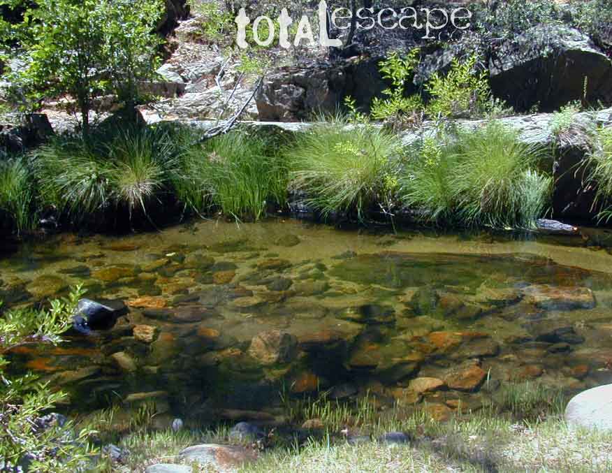
Clear cool stream waters flow from snow melt at 10,000′ elevation, down to these pristine camps at under 4000′ on both sides of the Sierra. The further you drive up the mountain, the better it gets. Where the Eastern Sierra side tends to be more dramatic desert like with sage brush, the western range is much more lush with ferns & dense trees.
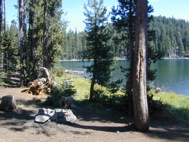
Everyone dreams of it. The perfect camp, along the creek. Maybe a waterfall or two, a shady hammock spot & plenty of trees, a flat tent spot, maybe a view. A big, sturdy, rock fire ring (without a bunch of broken glass in it).
This dreamy camp isn’t only in your imagination, nor is it at the local county campground a few miles from home. This kinda beauty & rare finds are out there, deep in the back woods, the mountains. You gotta know where to look & what to bring in order to have a good, easy, relaxing time.
These secluded sites really are around in your favorite forest, way back there. Best of all, they are free.
Having the opportunity to camp in your very own private, secluded spot, along dirt roads, outside of the annoying rules and fees of a developed campground is a privilege. Use these lands wisely and be a responsible camper. Camp eco-wise! Respecting the land, knowing some basics and following fire safety precautions is all mandatory. A topographic hiking map or a National Forest map is optional, but highly recommended.
Creek water can make an easy refrigerator if the cooler is full. Chill that bottle of wine, keep the watermelon cool .. just don’t forget about it. (cuz that kinda litter maybe a welcomed good surprise for the next camper.) Secure your wet creek valuables. Even a heavy watermelon can float! Put some rocks around items or tye them in a mesh bag, with rope, something to keep them from getting away in the swift water.
There is nothing that beats a good detailed forest map of where you are going. If you are the type of person who can never make a straight B-line for home on Sunday afternoon, and find yourself wandering just for the sake of wandering – then it’s best to have a larger state wide map like this beauty from Benchmark Maps.
If you are the kinda sport who can really rough it, you may learn to love it. After your first real back woods camping experience, the privacy, serenity and beauty of the land will inspire and relax you so much, that the drawback on the lack of toilet won’t bother you.
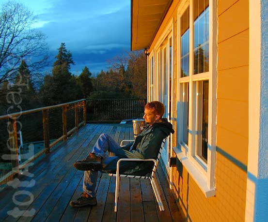
Make a new hobby of learning how to stay away from the crowds. The less cars you see at camp, the better. Learn to be immersed within nature and enjoy your space outside. Unwind, next to the creek in the shade, with a chair and read for hours, or bring the sketchbook, or just daydream as butterflies go floating by.
Remember to be camp clean, California is black bear country.
capable vehicle – SUV or Truck, high clearance is best. 4×4 is NOT required. AWD wagons should be more cautious when venturing out on the back roads. 2WD is fine for most graded dirt roads, but way out exploring dirt roads, deep mud and snow is quite possible.
destination – Pick a locale. A general area you wanna check out. Not a quickie overnight deal, but an enjoyable lazy multi-day camping trip.
exploration – Narrow down a canyon or river that you have always wanted to explore. The Sierra Nevada & NorCal is the place to concentrate your efforts, as SoCal is near desert climate w/ way too much development.
The more homework you do before hand, the better chances of finding that secret camp spot, especially on holiday weekends. Go ahead & call the forest rangers. Have your decent topo maps handy, along with pen and paper. That’s what they are there for. Have a list of questions on specific areas you want more info on. If you do the prep work well in advance, it makes a more enjoyable camp trip. Cuz you’ll be less worried about finding the ultimate places (before dark, or before the other guy does). With your new profound Wilderness Vision, you will have not only a plan B ready, but a plan C as well.
what to look for:
getting permits – If you really wanna camp like this, all secluded on the dirt back roads without the hordes of other campers nearby…. you’ll need a capable vehicle, a camp fire permit & the understanding of the concept “totally self sufficient campers”. This means bringing your own water, a bucket, a shovel, maybe some firewood, plus packing out all your own garbage, plus any litter left over by the last campers. It’s the least you can do, not having to make reservations. Visit the FireSafe page
it’s on your map – After you have a general area narrowed down, some place you always wanted to go, then it’s time to get your maps out & start reading them. Or at least staring at them – maybe over a meal, whenever you have free time to study it. Look for dirt roads, the further off the paved roads is not necessarily the better. Some of the best camp sites are within a few short miles from the pavement, so get them maps out & start visualizing.
gas up – Make sure you fuel your vehicle before you head into remote areas (like the ones we are mentioning). Maybe even an extra can of gasoline too, just in case.
the blue lines – You’ll know a decent road when you see it. When you start planning at home, you need to concentrate of what dirt roads are along what water sources. And will these streams be flowing at this time of year? Many are seasonal creeks & can dry up in summer. The most likely place to find great water flow is to look for the streams flowing directly into a major river or Lake/ Reservoir.
Are you willing to clean up your camp, before & after, leaving it pristine?
Yes indeed, it is free to camp outside of developed campgrounds.
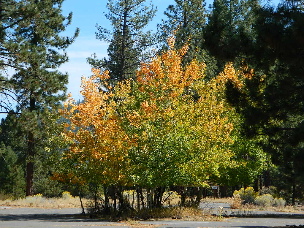
Amazing autumn colors can be found through OCTOBER and NOVEMBER in California, but you’ll need to leave the city in order to find the very best colors and scenic beauty. Fall season happens quickly (within weeks) in the high country and slower (months) in the lowlands. Plenty canyons and parks in the urban centers have hiking trails thru some nice trees, but nothing compares to the backroads, creeks and rivers of the big mountains.
Elevations, the higher the better, is where you’ll find the real displays of color. Aspen groves can be found along mountain slopes, creek canyons from 5000′-10,000′ in elevation. Cottonwood trees are found in the drier regions, in ranching areas and in desert canyons – up to about 6000′ elevation. Aspen trees start to turn yellow as soon as the chill of nights drop; if the temperature shift is subtle, the aspen leaves become more orange as the days go into the fall season. If an early snow or freeze happens, just one night, the glorious foliage becomes dead brown crispies dangling in the wind.
CAMP FIRE RESTRICTIONS are still be in place from the dry summer, and now comes the autumn winds. Any decent amount of rain can change the fire burn status, so make sure to check with the rangers for up-to-date fire info.
Best Autumn Campgrounds in California
Many of these campgrounds are located in or near aspen groves & are simply spectacular during the fall months. Some may be located near alder groves. Maple trees located along rivers turn golden between September and October.
Higher elevation (7000′-9000′) colors will change faster and earlier in the year (as soon as September), whereas the lower countryside may wait until late October.
Pack warmly, cuz the cooler temps at night (20-30 degrees) is what makes these awesome, little autumn leaves change colors. The change can happen very fast (in days). When the early season snows move in – usually a minimal dusting by October, fall colors can fade fast.
The North Sierra Nevada Mountains covers the region with Lake Tahoe and Donner Pass, and north Gold Country. River canyons with fall colors include American River,Yuba River, and the Feather River.
Aspen Group Campground
@ Jackson Meadows Reservoir
near Truckee, CA
Berry Creek, CA
Milsap Bar, Middle Fork of the Feather River
Bucks Lake, CA
Haskins Valley & Grizzly Creek Campground
Oro-Quincy Highway – Plumas NF
The Eastern slopes of the Sierra Nevada is the ‘place to be’ for Autumn Colors in California. The dramatic desert meets the tallest granite peaks. Every canyon is a different scene, many lakes lined with aspen groves, some have a creek with aspens.
Aspendell, CA
North Lake Campground
Lake Sabrina Road
Bishop Pass (high country hikes)
Lee Vining, CA
Lee Vining Canyon / Hwy 120
One of the biggest aspen grove canyons in the state of California.
NFS Campgrounds in Lee Vining Canyon: Big Bend, Aspen Grove, Boulder, Moraine, and Cattleguard Campground.
NFS Camps @ Yosemite’s EAST GATE (9000′ elev): Ellery Lake, Junction, Saddlebag Lake, and Sawmill Campground.
Impressive Rock Creek Road #4S12 in Rock Creek Canyon, one of the very best “Scenic Autumn Drives” in the whole Eastern Sierra. Numerous NFS Campgrounds on this road; many of which close for the season, just about the time then fall colors peak.
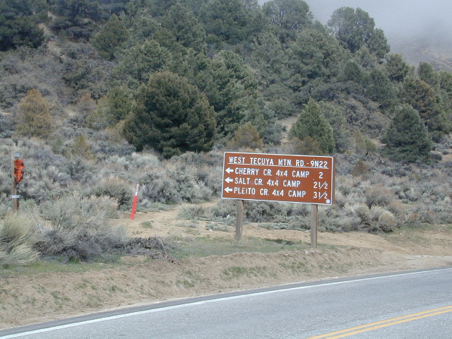
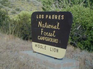
Tecuya Mountain 4x4camps, Los Padres National Forest
4×4 Camps @ Tecuya:
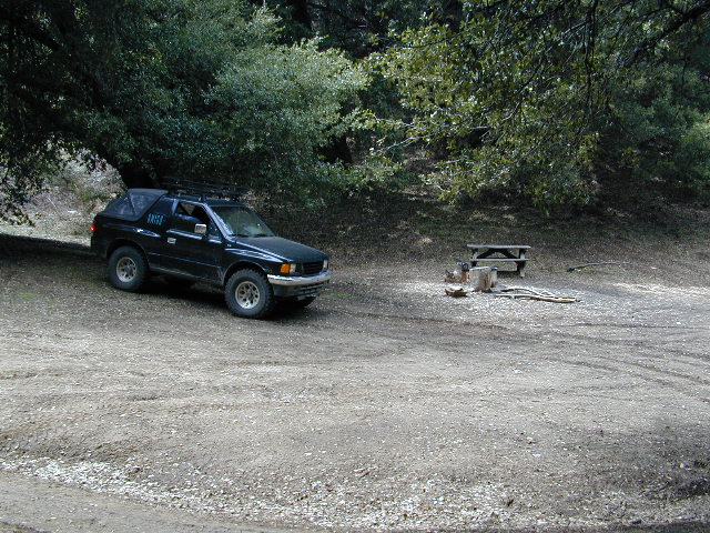
Cherry Creek Camp
Seeking a dark shady hole to spend the night? Then Cherry Creek canyon is choice for a quick overnighter near Frazier Park and the I-5 Tejon Pass. Steep dirt road access will challenge even the biggest skeptic.
free campsite
4WD only access
The 4×4 Camp (signed) turn off is along Cuddy Valley Road, on the north side of the pavement – just a few miles west of Frazier Park, inside Los Padres National Forest.
Oak trees and brush clog the dense hillsides. Owls live in this canyon. Deer and wildlife sightings are common – which makes this an ideal hunters camp for those looking to explore on foot.
The canyon gets narrower as it heads down hill (northward) w/ the single track route becoming a blanket of slick dark mud (in the wet months). Without trees on the worst section, making a self-rescue impossible.
Real 4 wheel drive is needed for this camp! All wheel drive vehciles (SUV & sportwagons) should not attempt this location without a tow strap or winch – AND another 4WD vehicle to help out. Yep, seriously. We know, because we had to rescue someone last time we were here.
Sparse accommodations w/ minimal sunlight reaching this steep canyonHigh clearance and articulation is a must.
desert hikers and rock climbers love this small camp
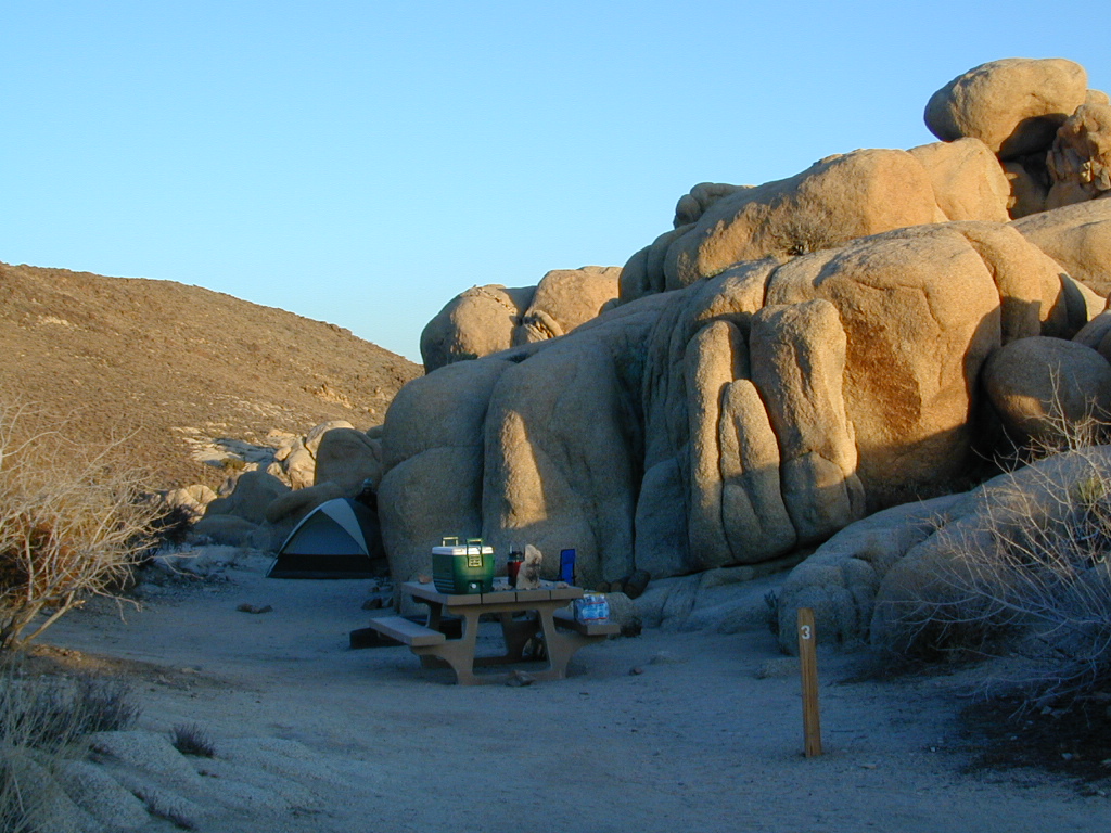
White Tank & Belle campgrounds are the smallest camps Joshua Tree National Park has to offer. On the east side of park both campgrounds are located half a mile from one another.
This Southern California desert lunar-scape National Park is more popular & crowded because of the proximity to major urban areas. The south east side of the park entrance station, Cottonwood, is the least busiest gate.
bouldering
camping
hiking
stargazing
From the town of 29 Palms (on Highway 162) take National Park entrance South on Gold Park Rd. At intersection with Loop Rd. (do not turn right) Go straight through onto El Dorado Mine Rd. about two miles drive leads the 2 campgrounds.
In the years between 2000-2005 founder of Total Escape, DanaMite, lead several guided camping trips to Joshua Tree and liked this specific area the best.
New to California? Never camped before? Haven’t been out in years? No idea of where to start? Total Escape is here to help with all your camping questions, local destinations and share tips; Introducing you to the big adventure in inexpensive vacationing, primarily outdoors. Find rural, remote locations, ranches, small towns, rivers, lakes, creeks, well away from the crowds. Get outta town more often for less money.
More & more people are venturing off the beaten path. Tourist flocks to Gold Country, and many do not even leave Highway 49. Get up the mountains, higher than the foothills.
Getting outta the developed campgrounds to discover the joys of dispersed back woods camping is a new adventure, not to be taken lightly.
With truck or SUV ownership come some great rewards! Order a good map & go find some dirt roads. Waterfalls, dense forests, secluded creekside camp sites & more await you. Obtaining a camp fire permit is mandatory for this style of camping.
Campfires are often banned in California, due to extreme wildfire danger. Since the gold mining foothills are usually oak and dry grass, with large steep river canyons, extra caution should be given. Always know the fire conditions before you build a campfire.
Discover the hidden back roads: like Caldor Road off of Grizzly Flat Rd. – above Placerville CA
Hey, now this is what we’re talking about. Plenty of great dispersed camping down by the Cosumnes River & Consumnes Mine Rd. There are hundreds of miles of small roads to discover back behind this historic mining area. Rivers, waterfalls & decent fishing too. Make sure you clean up some litter. This is the only price you pay for the beauty, serenity, peace & quiet & no neighbor campers next to you.
Out exploring these parts, you may run into a dead end road that peters out at some Private Property, which is usually signed & fenced. Make nice with the old crazy miner dude & turn your ass around politely, everything will be okay as soon as you are not within gun shot of him. Yes, there still are plenty of small time mining experts tucked away back here in the hills.
Plenty creeks and rivers run throughout this central Sierra region, so you can fish all day – until your hearts desire. River rafting and river kayaking opportunities are also great reasons to get wet.
Several mountain reservoirs around offer camping and boating too. Eldorado lakes are listed below.
Total Escape loves camping so much that this web site literally has hundreds of pages on the topic, but we won’t overwhelm you with the list on this page. Below is a good cross section of what camping pages we have & what to expect.
Camping in California is a blast! Enjoy nature, sleep under the stars, exercise & save money while vacationing. We show you road trips geared around nature, all local, all outdoors, all California. Exploring dirt roads for secluded spots and small campgrounds, learning new survival skills in the back country and enjoy the wilderness without the tourist crowds. The average weekend trip can run you as little as $100.00. This includes fuel, groceries, firewood and maybe camp or park fees. Once purchased your basic camping gear – tent, sleeping bag and stove can last you decades if properly cared for.
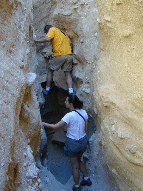
Canon Sin Nombre – Anza Borrego
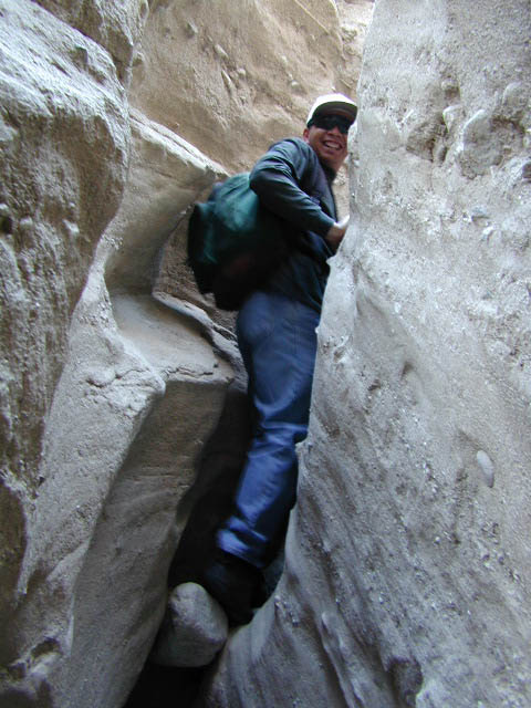
Mud Caves and Slot Canyon Hikes
Desert Slot Canyons – South Anza Borrego State Park region, just off County Road S-2 east of the ‘badlands overlook’ view point is a whole network of narrow walkways & skinny canyon trails to explore. Some are so tight you have to turn side ways to fit through. There are more than one of these sandstone topless caverns. Finding a new one each time you visit is a fun challenge. Just north in the Diablo canyon there are dry mud tunnels & trails as well. Explore & be careful not to get lost. And don’t camp at the canyon openings during the threat of heavy rains…duh.
Drive down steep, sandy road into Canon Sin Nombre entrance (the dirt road just to the north of Badlands Overlook). A high clearance vehicle is recommended and 4WD may be required in soft sand. 2WD SUVs/trucks should keep their speed up through the soft sandy areas & try not to turn or stop suddenly. Go slow in narrow sections of the canyon & slow over the rocks to save your oil pan.
Clock your mileage 1 mile exactly from the paved road (s2) & park out in desert wash, pull over between the smoke trees. Hike over to the left side & look for an opening in the canyon walls to a deep secluded trench. A campsite may exists here.
Hike up the first canyon which does require some rock scrambling. The gorge lets you out at the very top with an impressive view over the Sweeney Pass area. The canyon walls are so tight in some spots you may have to turn sideways to fit through. Upper body strength is needed to climb high ledges & boulder scramble through this natural maze.
Once on top, wander on the ridge & check out the views; keeping to the right & then follow the next wash down to start the much longer & easier exit. Hike down in the main slot canyon which leads out to a big camp site & clearing. Exit slot area and turn right, walking back to the vehicle in the big wash.
This particular hike is a blast on a full moon night, but not for a first timers try.
Best time to visit: October – April
HIGH CLEARANCE VEHICLE access to reach trailhead. Moderate hike, boulder scrambling w/ dangerous mud walls. Flash floods here are possible during rains.
Plenty of 4×4 roads, SUV trails, & box canyons in the desert region.
This camp list is comprised of primitive camp sites and developed campgrounds with good views overlooking a large area (valley, town, canyon, desert, river, ocean). Many ideal spots may require dirt road driving, and a few might need a 4-wheel drive vehicle to reach.
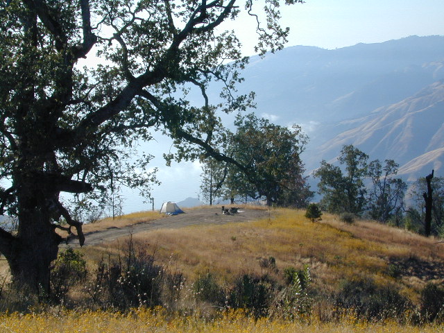
We were suggesting this very spot way back in 1999, well before anyone else was ‘blogging’ about it. This area is by far the best, free coastal camping on the Central Coastline of Big Sur. Dirt roads traverse 10 miles out to vacant ridges overlooking the Pacific, with steep hills down to the highway. Camp above the fog layer and above the crowds. Explore the beaches during the day, and camp above the traffic & crowds at night.
Dry brush is abundant on the mountains of Los Padres National Forest. Camp fire restrictions should be of utmost concern in this area, since wildfires burn here often. Camp fire permits are required for camping on the back roads, and much of the time camp fires are banned in this region. Call ahead to the rangers to find out the current conditions.
Two prime walk-in camp sites, on a shady point, high above a beach cove w/ scenic waterfall.
Called “environmental camps” these highly desirable spots need advanced reservations w/ fees many months in advance. Tables, fire rings and a vault toilet. Bare bones basics, but the ideal location is worth it. A forested cliff on the edge of the ocean, high above a secluded cove. This location a can get windy if a storm moves in (generally October – March).
There are several primitive campsites off of M10 with views of chaparral and canyons. Just above Stonyford, CA, on the way up to Fouts Springs. Unfortunately Mendocino National Forest is may be closed for 2019 due Ranch Fire (wildfire 2018) w/ Snow Mountain Wilderness completely 100% burnt.
Planning more scouting of this region summer 2019. Stay tuned.
Angeles National Forest
Mount Pacifico Campground
Angeles Forest Highway
Lightning Point Group Campground
near Jackson Lake @ Hwy 2
San Berdu has more than a few trail camps for 4×4 enthusiasts. Weekends can be busy all year long. Snow usually closes some routes. Pine forest in southern California means very tight campfire restrictions. All yellow post camp sites include table and a fire ring. Campfire permits are required.
East ridge line, rocky, dusty, 4WD-only route, the John Bull Trail (near Holcomb Valley) has ONE real awesome view camp spot with great spans over the Mojave desert w/ smog and city lights @ night.
Culp Valley – boulders, primitive camps on dirt roads; better views off-road. Vault toilet. Few tables, no signs. Small campground at the highway is easy to find. Boulders and bouldering. Mountain biking and hiking. Wildflowers in spring.
Interstate 15 & I-40 Mojave Desert
Providence Mountains SRA @ Mitchell Cavern. Campground is perched on rocky hill overlooking desert.
Boulder Outcroppings w/ primitive camp spots, tucked back on one lane dirt roads, behind Mid Hills Campground. Mojave National Preserve
Coyote Flat @ Pinyon Boulders – 4×4 required, one primitive camp w/ great views overlooking the Owens Valley & peaks to the east. Coyote Flat has views toward the Sierra
Oh! Ridge Campground Off the main highway 158, June Lake Loop
(148 sites @ 7600′ elev.) near June Lake, CA
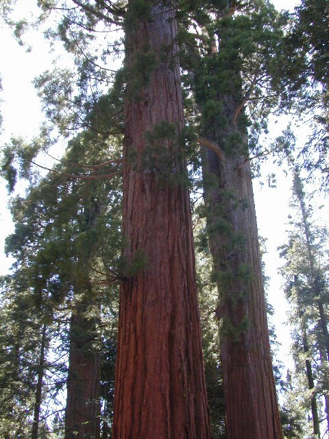
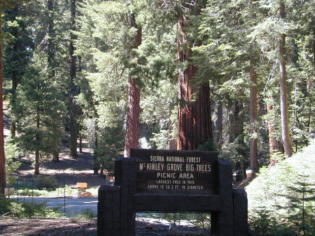
Mc Kinley Grove is a small grouping of Sequoia trees in the Central Sierra Nevada; Located off Hwy 168 & way down Dinkey Creek Road (Sierra Rd #40). deep inside Sierra National Forest, past the Dinkey Creek Campground turn off. It’s a good stretch break and picnic stop on your way to Wishon & Courtright Reservoirs.
The main road parallels the big wash. Quatal Road #9N09 is graded (annually) and usually passenger car accessible; side routes to camps in the big wash or up any canyons may require high clearance or 4WD vehicle. No services in this canyon at all; Cell service is minmal. Gasoline is somewhere along the hwy (near a pistachio orchard).
Anza Borrego Desert State Park & Borrego Springs Campgrounds
Anza Borrego Desert is the largest of the California State Parks. Borrego Palm Canyon Campground is the official name of this popular palm oasis & developed campground located very close to Borrego Springs CA. Hike or bike to town. There is also a private RV Park named Palm Canyon Resort in town, just to confuse you.
Desert wildflowers blooms, popular hiking & biking trails, plus mud caves & slot canyons draw plenty visitors here, mostly in the winter months. Summer high temps exceed 90 degrees for months at a time.
There are hundreds of miles of dirt roads to explore, and one could easily spend every weekend for a full year, checking out all there is to see in this vast desert, where elevations range from near sea level to 5000′ peaks.
BORREGO PALM CANYON CAMPGROUND
main campground near Visitors Center, in town Borrego Springs, CA
120 camp sites for tents & RVs, flush toilets, overnight / day use fees reservations accepted
TAMARISK GROVE CAMPGROUND
27 camp sites, flush toilets, fee
on S-3 @ Highway 78 jct (closed June – Sept) reservations accepted (Oct-May)
Vern Whitaker Horse Camp
equestrian campground w/ corrals, 10 camp sites, flush toilets
elev, 960′, located N of Borrego Springs, near scenic and rugged Coyote Canyon. reservations accepted
Backcountry Campgrounds Anza
Arroyo Salado
16 miles east of Borrego Springs on County Road S-22
Blair Valley Camping Area
open car camping & RV spots, vault toilets
on SAN DIEGO County Rd S-2 near Highway 78 jct
Bow Willow Campground
elev, 950′, hwy access, 16 camp sites, pit toilets, overnight fee
near Sweeney Pass & badlands overlook; located on S-2, 9 miles N of Interstate 8
Canon Sin Nombre
off S-2 near Sweeney Pass; entrance near Badlands Overlook; slot canyon hikes
Coyote Canyon Camping
N of Borrego Springs via Di Giorgio Road
rugged backcountry dirt road, tent camping only
car camping near ocotillo gardens; 4×4 needed @ creek crossing & Sheep Canyon
Culp Valley Campgound
elev, 3400′, hwy access, 8 camp sites, pit toilets, free camp
located on S-22, atop Montezuma Grade
Culp Valley Boulders
elev, 3700′, dirt road access, primitive camp sites, free
located off S-22, 4×4 near Montezuma Grade
Fish Creek Campground
Hwy 78 near Ocotillo Wells & Split Mountain
elev, 280′, dirt road access, 8 camp sites, pit toilets, free camp
from hwy, go 12 milies south on Split Mountain Road
Yaqui Well
5 mi. south of Borrego Springs on County Road S-3 & right on Yaqui Pass Road, go 6 miles to camping area on right side
Yaqui Pass
5 mi. south of Borrego Springs on County Road S-3 & right on Yaqui Pass Road, go 4 miles to camping area on left side
Culp Valley trails, North Anza Borrego SP, SoCal Deserts
All Desert Campgrounds Nearby
AGUA CALIENTE HOT SPRINGS
(San Diego County Park)
88 camp sites for tents & RVs, flush toilets, overnight / day use fees, 760-765-1188
located on Co. Rd S-2, 22 miles N of Interstate 8 (closed June-Aug)
BOX CANYON RDMecca, CA – in between Joshua Tree NP and Anza Borrego Desert
BLM camping in Box Canyon & Mecca Hills Wilderness Park
LEAPIN LIZARD RV RANCH
(Private Campground Resort)
85 acres, 60 camp sites
located on Split Mountain Road, Ocotillo Wells, CA
OCOTILLO WELLS SVRA
(State Vehicular Recreation Area)
elev. 160′, 4×4 and off road camp sites for trailers & RVs
no water, no hook-ups, pit toilets, no fees, 760-767-5391
located on Highway 78 (closed June-Sept)
PALM CANYON RV RESORT
(Private Campground Resort)
located in town, Borrego Springs, CA
SALTON SEA SRA
(State Recreation Area & Campground)
Mecca Beach, Corvina Beach, Salt Creek Campgrounds
located on Highway 111 on east side of inland sea
SLAB CITY @ SALTON SEA
old Camp Dunlap in California desert badlands
free & open RV camping near Salton Sea
located off Highway 111 on east side of inland sea
TRUCKHAVEN HILLS
(OHV trails & camp spots)
elev. 300′, 4×4 and off road camp sites for car camping, touy hauler trailers & RVs
no water, no hook-ups, no fees,
located on S-22, East of Borrego Springs, CA
VALLECITO PARK
(San Diego County Park)
44 camp sites for tents & RVs, no hook-ups, toilets, overnight / day use fees, 760-765-1188
located on S-2, 22 miles N of Interstate 8 (closed June-Aug)
FREE CAMPING ANZA– Let us also remind you that this is the best place to camp in California for primitive car camping (camping outside of a developed campground). Open all year long – always! Super secluded, darkest skies, free and always located on the back roads. 4×4 is not required in all areas, so there are plenty of options. Blair Valley or Coyote Canyon Gardens are popular camp spots, but there are thousands of hidden canyons and washes in this giant State Park, just awaiting your tent. You’ll need a decent topographic map. For more info on free camping click here.
alphabetically listed; cross reference by lake or campground name. reservations may be accepted for certain locations; follow links.
Developed Lake Campgrounds
inside California
Most of the lake campgrounds listed below are traditional style campgrounds with easy access: paved driveways, toilets, tables, maybe piped water. Various agencies manage these park campsites and additional links are provided.
Some of the campgrounds may be more primitive than others, with long dirt road access, gravel driveways, and minimal facilities. This list includes a wide range of lakes, from reservable group camps, to private RV resorts to back road beauties. Even a few campgrounds without fees!
Higher elevation locations close-up for the seasonal winter snow, which can last from NOV-MAY (or later, depending on snowmelt).
no motor boats?
no RVs?
wilderness lake fishing?
trailhead access?
Each lake camp is different, so know what is available at the location before you get out there. Many spots do not have a boat ramp. Some lakes do not allow swimming. Some might be 4×4 access only, w/ hairy granite rock road, 12 miles long. If you require a general store within walking distance, then get the maps out, follow links and make sure.
Determining the ideal tent location will vary on whether you are an ‘early riser’ or late night person, otherwise known as the “up-til-wee-hours ’round the campfire” kinda camper.
Night Owl
OK, all you wine-o’s and silly drunks, try to be a considerate camper and place your tent near the campfire if you plan to be up late. You and your partying cohorts will not disturb those who had planned to get ‘a good nights sleep’ and can stumble to your tent close by with ease. Make sure that you have a large bush, boulder or tree on the east side of your tent, as this is where the dreaded sunlight comes in.
Early Riser
If you are the kinda person who welcomes the sunrise, sitting on a boulder with a healthy cup of fresh brewed coffee, then you probably don’t wanna hear folks up late around the campfire discussing philosophy, right next to your pillow. Ear plugs can be good to pack if you plan to camp with more than a few folks. Setting up your tent well away (like 100 feet) from all communal areas will help you get a decent nights sleep, allowing others to do their normal thing without even bugging you.
Light Sleeper
If you wake at the slightest footsteps (or car alarm) you might wanna find a distant camp for your bedding spot. Camp outside of a developed campground for the most secluded and quiet of nature experiences. If you cannot stand anyone snoring, then kindly ask your neighbors ahead of time and position your tent accordingly.
Sunrise: Determining East & the North Star
If you fear the morning sunlight like a true vampire, make sure that your tent is not in the direct line of fire at 6 am, just in case you planned to sleep in until 9 am.
If you arrive at camp after dark & need to decipher where the sun comes up, just locate the North Star silly. Hmmm, sounds easy? Now where is that sucker. See the diagram below for gathering the astronomy part of the lesson.
Now, for all of you who didn’t get a decent high school education: Locating east can be easy if you always remember this small exercise. Standing up, point your face to the north, extend your right arm out sideways & this will be east . The same goes for left/west. South is right behind ya. The sun sit low in the winter months & follows more along the south horizon.
The familiar stars called the big dipper is a nice way to find the north star. Draw a line from the edge of cup — spilling out straight over to the brightest star.
Road 308 Ivory Mill Road. Located on the EAST SIDE of the coastal mountain range, west of Stony Gorge Reservoir.
South Fork of Elk Creek, California
Lodoga Stonyford Rd #306 – also known as just plain Stonyford Road, skirts the coastal foothills in a north south direction, on the east side of the range. Oaks and ranches, livestock grazing and fences everywhere. CHP out in force, so watch your speed (55). Public lands and forests are up the hill, above the valley, on the dirt roads. Free camping, off roading, hiking, creeks, lakes, mountains.
Drive up paved Road 308 passing the ranch lands and private properties.
Just inside the National Forest boundary, 308 peels off sharply to the left, uphill and steep, super sandy. The views over the valley, hills and reservoir are epic, but the dirt road is fluffy dry dirt, tight curves, no guardrails. A long and winding track, with very little spot to turn around. Maybe designated as OHV route?
This whole area is where the Ranch Fire of 2018 was burning; contained at road 308. The wildfire burnt half a million acres in Mendo NF (the largest fire in California history). Some of these roads may be closed off now. Call the rangers for current, up-to-date accessibility!
So… back at the National Forest boundary: Straight. Take the right fork instead, which goes straight into the forested canyon, up the creek. Elk Creek, south fork coming from the higher peaks above. This pleasant forest drive is called Mendocino Rd #20N01 and it climbs upward with hairpin turns; continues up to the top of the forested ridges @ 5000’+ elevation.
Wildflowers in Spring. Snow in winter. This back route may have been paved once in 1960, but it is nearly back to dirt again in most sections. Suitable for passenger car travel at slow speeds. Unless of course, it is raining or snowing, then 4WD may be best. And being that this is real Northern California territory, rain and snow are annual.
SPRINGTIME: Free Camps and Campfires on the Back Roads
Dispersed camping is allowed in this region with a valid fire permit.
Various camping spots near roadside, after mile 8. Reset trip meter when your turn off main drag (Lodoga Stonyford Road).
One of the better winter star shows. This well known meteor shower peaks in mid December, right in the middle of Christmas Rush. It’s a nice time to plan a desert camping trip around or a weekend away in the mountains. Look in the southern part of the nights sky these shootings stars.
The meteors from this shower are slow moving, can be seen in December and usually peak around the 13th – 14th of the month, with the date of highest intensity being the morning of the 14th. The shower is thought to be intensifying every year and recent showers have seen 120–160 meteors per hour under optimal conditions, generally around 02:00 to 03:00 local time.
The meteors in this shower appear to come from a radiant in the constellation Gemini (hence the shower’s name). However, they can appear almost anywhere in the night sky, and often appear yellowish in hue. Well north of the equator, the radiant rises about sunset, reaching a usable elevation from the local evening hours onwards.


 Desert Slot Canyons – South
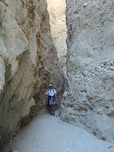

 Mitchell Cavern. Campground is perched on rocky hill overlooking desert.
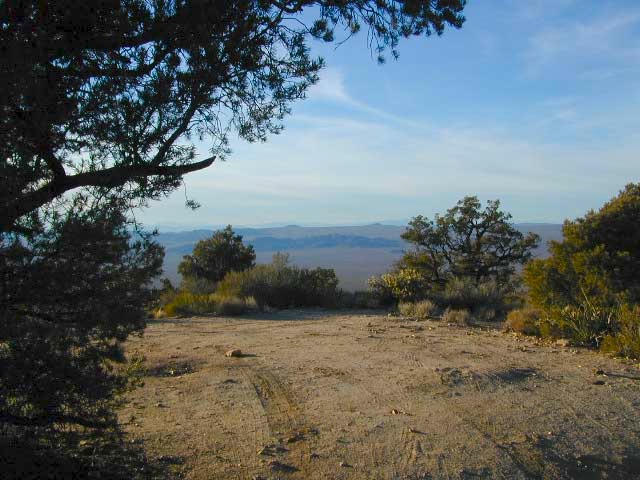


