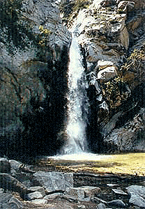
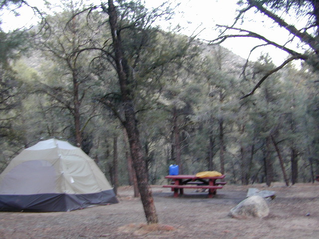
Millard Falls
2 mi RT; 1200′ elevation; oaks.
Arroyo Seco District –
of Angeles National Forest
818-790-1151 Altadena CA
From Interstate 210 in San Gabriel Valley, exit Lake Ave., go N & turn left/west onto Loma Alta Dr. & to Chaney Trail & follow signed dirt road
Sturtevant Falls
5 mi RT; 4600′ elevation; oaks, creek-crossings.
Santa Anita District –
of Angeles National Forest
818-899-1900
inside Big Santa Anita Canyon
From Interstate 210 in San Gabriel Valley, exit Santa Anita Ave.Go North/East, through neighborhood & up mountain to paved parking lot.
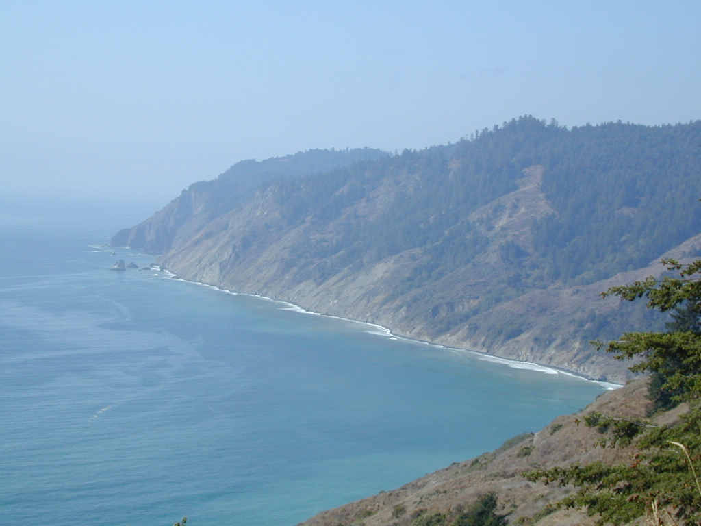
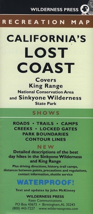
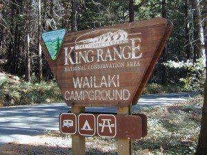
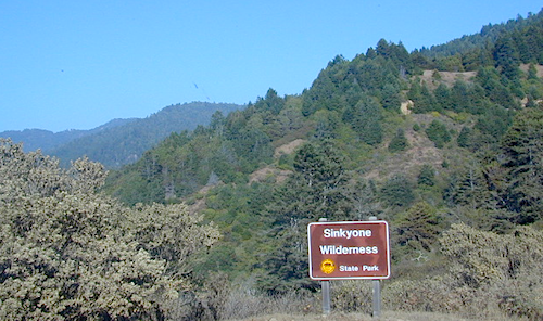
Lost Coast California Sinkyone Wilderness State Park
King Range National Conservation Area
Redwood groves and wilderness meet the Pacific Ocean at the infamous Lost Coast of California. Northern California is NorCal – steep trails, creeks, waterfalls, ocean views, and coastal cliffs. Mendocino and Humboldt County has numerous redwood parks and picnic grounds located near Pacific Coast Hwy 1 & US Hwy 101. This particular wilderness area is located in between Westport and Shelter Cove, just west of Leggett, CA. Situated on the west side of US Hwy 101 and only accessible via a long dirt road. The Sinkyone wild lands are managed under the California State Park system.
Sinkyone Wilderness Ranger Station 707-986-7711
Sinkyone Wilderness access –
North end – Needle Rock: 36 miles southwest of Garberville & Redway, California. Briceland Road west from Redway, this road becomes Mendocino County Road 435. The last 3.5 miles are unpaved, steep, & narrow. South end – Usal Beach: Approximately one hour north of Ft Bragg on PCH or 15 miles west of Leggett on PCH from Highway 101. Look for mile marker 90.88 on PCH. Turn north on small dirt road; 6 miles to Usal on unpaved, steep, narrow road.
ROADS MAY BE IMPASSABLE IN WET WEATHER. RV’S & TRAILERS NOT RECOMMENDED.
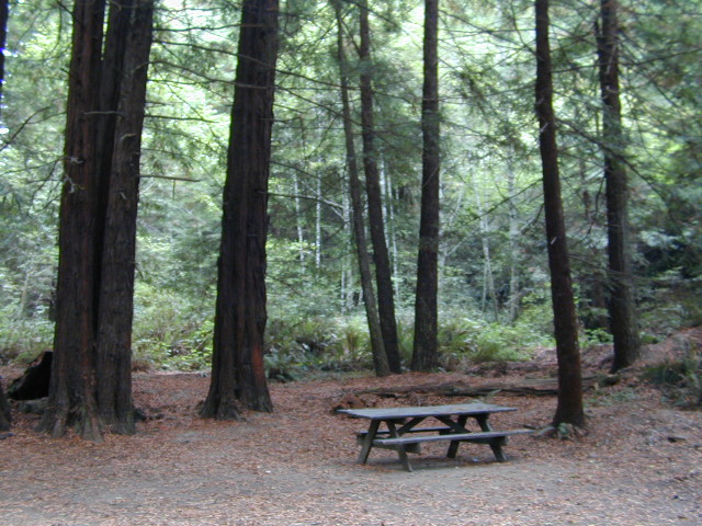
Usal Campground – USA Lumber Company staged a logging operation here in the early 1900’s. Now this remote spot is a popular back road campground accessibly only by a long dirt road drive. 4×4 and car camping only; No trailers or RV campers!
lake camp, hike, mountain bike, off-road, ski, snowmobile
Tahoe Trail Maps / Tahoe National Forest
Numerous State Parks dot the shoreline at Tahoe, while the National Forest lands and Wilderness Areas span most of the peaks above. Camping, backpacking, boating, kayaking, fishing, climbing, mountaineering, mountain biking, snow skiing, snowmobiling are all popular recreation in this Sierra region. US Highway 50 and Interstate 80 are the main western access routes to Lake Tahoe. US Hwy 395 leads to Tahoe, up from the Eastern Sierra and Southern California.
Wanna find every waterfall or every creek to fish? This is the place that will help you find them. Easily, with good old fashion printed maps. Hard copies, some waterproof & tear resistant, most with topographical data and all roads, trails, campgrounds and parks. Whether or not you water ski or cross country ski, these maps will save your ass – when you are way back there in the boonies.
Tahoe’s Rubicon Trail connects the historic Gold Country to the alpine lake via granite wilderness sky ways above 7000′ elevation, but a real 4×4 and overnights are required. The back roads and trails are endless in these parts of the Central Sierra Nevada mountains.
San Diego Backcountry
600,000 acres of SoCal desert
BLOOM: mid-March thru May Anza Park elevations range from low to high. Lowest near eastern border (next to the Salton Sea) to the upper reaches of the western slopes @ 4000′. Wide, deep, sandy, long desert washes, native petroglphs, wind caves, slot canyons and split mountain. This uncrowded state park has the most acreages than all of the parks.
OPEN CAMPING
Camp in a developed campground, a small back country site or camp primitive on nearly any dirt road. Car camping to 4×4, this park has lots to offer folks wishing to really escape. No ground fires allowed, so bring your metal campfire bucket and large trash bag to carry out your ashes. The last thing you want is to scar these pristine white desert washes.
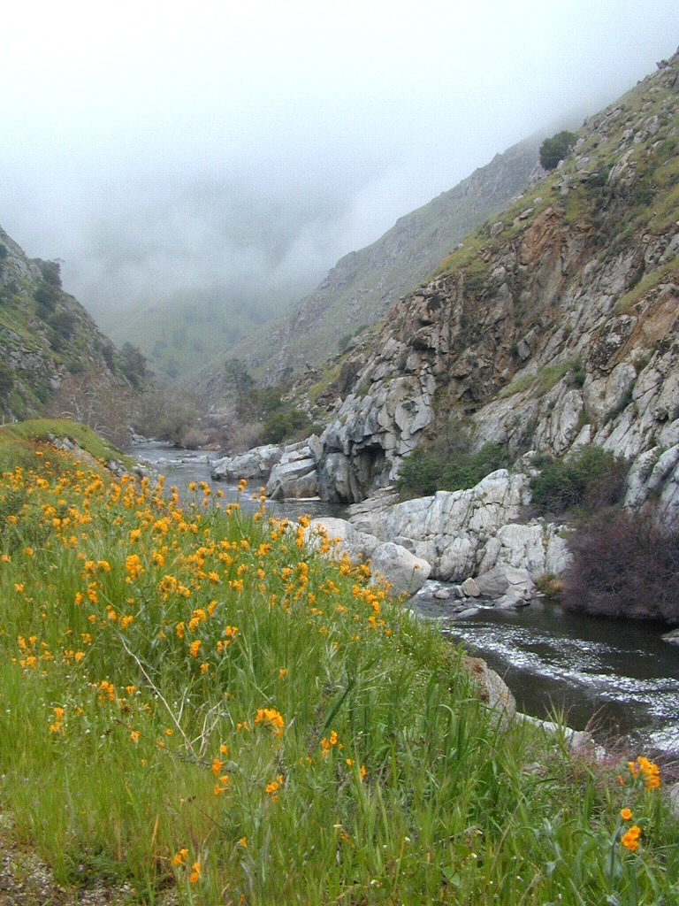
DESERT WILDFLOWERS
Steep rocky canyons on the Laguna mountain foothills can be challenging terrain, so bring good, sturdy hiking boots. Wildflowers can be abundant on certain years. Lower elevations sprout up first; Higher elevations along County Rd S-2 & S-22 bloom later in Spring. By June 1st most of the color is gone in and around Borrego Springs, so this is a real Winter and Spring vacation kinda spot. California desert wildflowers include primrose, barrel cactus, prickly pear, monkey flower, ocotillo & many more.
This is the largest State Park in California and “open car camping” is allowed on the back roads. (also referred to as primitive camping, free camping or 4×4 camping) One of the few places in Southern California that you can camp outside of a developed Campground and still have a campfire. You gotta bring a large metal bucket to have your campfire in – as ashes scar white sandy washes and ground fires are not allowed.
San Diego Backcountry
600,000 acres of SoCal desert
BLOOM: February thru May Anza Park elevations range from low to high. Lowest near eastern border of park (next to the Salton Sea) to the upper reaches of the western slopes @ 4000′ of the Laguna mountains. Lower elevations sprout up first; Micro flowers, Easter-egg-color splendor in the dry washes. Higher elevations bloom later (along w/ areas on San Diego County Rd S-2, the Great Overland Stage Route)
Drive from Temecula to Warner Springs, and then proceed east – out to the Salton Sea via Back Road Highway #S22 (Montezuma Grade). A great route to take thru the Borrego State Park – for the full gamut in vegetation & altitude. Grapevine Canyon is an alternate off road route down a scenic canyon. Culp Valley has a small campground, plus lots of boulders and decent views to the Borrego Valley. Off the highway, on dirt, one-lane side roads lead to many primitive spots. Perfect for private picnics, stargazing or overnight camping.
Southern California / San Jacinto Wilderness Area / San Jacinto Mountain / Palm Springs Mountain Hike
The well-photographed snowy mountain backdrop behind the desert deluxe resort-land known as Palm Springs, Mount San Jacinto is the second tallest peak in Southern Cal.
Mighty San Gorgonio peak, across to the east – on the other side of the valley, is the very highest mountain in this desert region. Granite Jacinto peak is located in between the mountains of Idyllwild and the low deserts of Palm Springs.
Day hikes, picnic in the forest, backpacking, horseback rodes w/ SUPER easy access via the fantastic Palm Spring Tram ride, up to 8000′ elevation.
The San Jacinto Wilderness is managed by 2 different agencies: The National Forest Service and California Department of Parks & Recreation.
If you are camping overnight in the forest, you must get your wilderness permit from the agency that administers the area where you plan to spend the night. Day-use permits can be obtained on the day of your trip by visiting one of the ranger stations below. Day-use permits issued by either agency are honored by both, except during the busy summer months when permits to enter the Wilderness via Devil’s Slide Trail can be obtained only from the National Forest Service.
Camping permits can be obtained in advance by mail, in person, or online w/ PDF. National Forest Service accepts requests up to 90 days in advance; Mount San Jacinto State Park accepts them up to 56 days in advance. You can also get them on the day of your trip, if any are available at that time.
USDA National Forest Service
San Jacinto Ranger District
54270 Pine Crest Ave
Idyllwild, CA 92549
951-659-2117
Mount San Jacinto State Wilderness
25905 Highway 243
Idyllwild, CA 92549
951-659-2607
Old Greyback, San Gorgonio Mountain – as seen from forest road #2N93
Southern California /San Gorgonio Wilderness Area / San Gorgonio Mountain Peak Hikes / Backpack Gorgonio
The tallest mountain peak in Southern California towers over the often smoggy basin of the Inland Empire, Riverside & San Bernardino. Coachella Valley lies to the southeast. Joshua Tree National Park lies due east.
Old Greyback is a fitting nickname for the peak. The massive, bald, decomposed granite gravel paves the whole top layer, above treeline (altitude nearing 12,000 feet above sea level) and this impressive peak can be seen from most of the Los Angeles basin and the Palm Springs desert. The expanding view of the Pacific Ocean can be seen 70 miles to the west, but only if the skies are clear. Windy, winter days are excellent conditions for viewing, but plan your hike accordingly as this peak could be covered in deep snow during winter or springtime.
This is a very popular backpacking weekend trip to escape from the big urban populations. San Diegans and Angelinos can easily access this location in a few hours from home, via Interstate 10 and some mountain driving on a 2 lane highway.
Rugged Sierra Nevada high country. The highest peaks in the Sierra Nevada mountains can be found inside this Wilderness. Many peaks are well above 13,000 feet. Granite, glaciated basins, big snow, alpine lakes, meadows, wildflowers, streams, creeks, cliffs, jagged peaks. Mount Whitney stands as the tallest mountain in the lower 48 states.
Hundreds of miles of hiking trails, some of the highest peaks in the nation. Trails open to equestrian and foot traffic only. Trailhead quotas limit the amount of day hikers and backpackers that an access the Wilderness daily. Wilderness permit required: Inyo National Forest Permits
Eastern Sierra Visitor Center Inyo Visitors Office
USDA National Forest
USFS, NPS, BLM
Eastern Sierra Interagency Office US Hwy 395 @ SR 136 Lone Pine, CA 93545 760-876-6200
Mojave Reservoir @ Colorado River: AZ / NV / CA
@ the V, bottom of Nevada state = Arizona – Nevada – California, all merge together
The Colorado River travels through the southwest desert, splitting the Grand Canyon and further south, separating California from Arizona at the southern tip of Nevada. Agriculture lines the big river down to Baja, Sea of Cortez, Mexico.
Up near Las Vegas and down to Searchlight, NV
Above Hoover Dam is Lake Mead, sediment from Utah National Parks. Red dirt and silt shorelines. South of Hoover dam is a super deep rock gorge w/ hike-in hot springs. Beyond that, this beauty called Lake Mohave – with the super clear water, secluded coves and abundant fishing.
Lake Mohave: elevation 647′
Desert peaks in this region are around 2000-3000′ elevation. Mohave Lake is actually a wide section of the Colorado River, spanning the region from massive Black Canyon south to busy Laughlin w/ river casinos. This lake is long and skinny in spots with lots of shoreline cliffs, canyons and coves. Minimal vegetation, so please bring your own firewood and don’t chop down the few trees trying to survive. Summer temps exceed 100 degrees, so plan your visit for the winter time.
Lake Mohave Ranger Stations
Cottonwood Cove
Katherine Landing
boating, camping, fishing, hiking, hot springs, kayaking, off-road, picnics, viewpoints
El Dorado Canyon Road, main paved route can be accessed near California’s state border. North of Searchlight, Nevada – off main highway 95, on side route 165 to Nelson, NV
Secluded dirt roads up and down canyons near El Dorado Canyon Rd. Minimal vegetation, maximum open scenery and dark skies. Kayak rentals @ El Dorado Canyon.
desert badlands erosion
Ireteba Peaks Wilderness
4×4 camping routes: 15 day camping limit
Find your own route with many to choose from, drive the soft sandy washes (with a few boulders to dodge) and camp for free, right at the waters edge. Adventurers: Only for the self-contained campers. Some routes marked 4WD only, so pay attention to signs. AWD (all wheel drive) vehicles should fare well on the sandy roads; but standard passenger cars and vans will need to keep their speed up in the soft sand areas.
No garbage collection. Pack it in, pack it out.
No facilities, no fees. No buildings. No campfire rings, no picnic tables, very few vault toilets. Bring your shovel!
Driving off the roads is strictly prohibited. Primitive camp sites can be found both at numerous coves and also inland inside the canyons. The ridges get windy in the deserts, but are favorable for night sky views and self contained camper vans.
Always know the weather forecast, cuz flash floods are possible and these dirt roads will be impassible during big rain. This is the main drainage to the big river!
DRIVING TIPS
Most desert washes here are signed routes 4×4, but mini vans, AWD sport-wagons, trucks, SUVs, small RVs can all be found camping near Lake Mohave. That is – if you know how to ‘drive off road’, which is not fast, but not too slow either.
Avoid getting stuck in the deep sand: keep speed up, do not turn sharply and do not brake hard. Carry tow strap in case you need an emergency pull. Be nice to strangers and you may find help.
Campfires are allowed, but you need to bring firewood. Dogs are allowed. Party animals tend to trash these desert coves, so be warned that there is a fair amount of litter. Bring a black trash bag and take some out! This trash problem could get the area closed off to vehicles so keep that in mind.
The canyons here have giant power lines that cross @ Aztec Wash; they can easily be avoided.
4×4 recommended @ MOHAVE:
Eagle Wash Road #46 – popular spot
Montana Wash #45 – camping ok
Placer Wash #47 – no camping
The rangers don’t wanna be pulling your ass out of the sand, which is why they post the 4×4 signs. Don’t expect to find help without walking a few miles first, or waiting several hours.
desert wilderness
Several wilderness areas are located along the west side of this lake & river. Often dirt roads will parallel a portion of the wilderness boundary, providing excellent access to secluded coves and beaches. Emergency CALL boxes are placed in remote parts of these shores.
Ireteba Peaks Wilderness (northwest, next to El Dorado Canyon)
Nellis Wash Wilderness (western side)
Spirit Mountain Wilderness (southwest)
Bridge Canyon Wilderness (southwest, near Laughlin)
COTTONWOOD COVE
developed campground, boat launch, marina, lodging, hiking, picnic areas
LAUGHLIN, NV
Nevada, California and Arizona states join down in this part of the world. Katherine Landing, full service marina, slip rentals, lodging, city services and casinos.
Mojave Desert – This river-created lake is located on the Colorado River, in between Las Vegas, Nevada and Needles, California. The river water here is crystal clear, very swimmable and the fishing is decent. No paved boat ramps
nearby towns: (with elevation)
Avi Casino
Bullhead City, AZ (540′)
Laughlin, NV (535′)
Kingman, AZ (3340′)
Needles, CA
Nelson, NV (2954′) Nipton, CA (3042′) Oatman, AZ
Searchlight, NV (3470′)
Horse Canyon is a dirt road up a high desert canyon, with joshua trees and wash outs. 7000′ elevation pinyon pine ridges above w/ PCT.
Most would say the see a whole-lotta-nothingness out here in these deserts…. when they zoom by at 70 mph on the blacktop highway.
at Total Escape, we beg to differ.
Intersection on Hwy 14 @ SC 65, dirt route will travel west into the mountains. Initial desert road follows Little Dixie Wash, but veers north up to Horse Canyon and the higher forested ridges.
Horse Cyn is a scenic, desert, dirt road that becomes a rugged 4×4 trail the higher it climbs in the canyon. The route traverses a ridge line and dead ends at the old cabin; No through route, no loop. The PCT continues on to the Walker Pass @ the 178.
The lower Horse Canyon is area quite accessible by standard truck or SUV. High clearance is recommended out on these kinda roads. Vegetation is quite sparse at first, but improves with the miles traveled. Wildflowers can be awesome, usually April-June. Picnic spots everywhere; primitive camping sites can be found out here, off the main dirt road. Please reuse existing camp sites when possible.
Passenger cars may attempt this, but should watch for unexpected deep dips and rocks, washed out in the road. (No tow service in the middle of nowhere). Road conditions do change with the seasons out in the boonies. Cell phone reception could be spotty back in the deepest of canyons.
PCT trail access: Pacific Crest Trail follows this ridge road for miles. They call this range the SCODIE Mountains; Old cabin at the end of the road.
Sage Canyon and Cow Heaven Canyon are both to the north, along with Freeman Canyon (CA SR 178). Bird Spring and Dove Spring Canyons are both to the south, along with the most popular regions of Red Rock State Park and the Jawbone OHV area.
Salmon Creek, Kern Plateau –
Sequoia National Forest
Looking to stay away from the masses camping at the Kern River?
Horse Meadow Campground can be found on the east side of the Kern River, up on the Kern Plateau. Up the infamous, steep and rugged Shermans Pass Road. How exciting!
Climb the hill slowly and cautiously, no guardrails. Up the grade, Shermans eastbound – out of the dryness of the Kern canyon. Find Cherry Hill Road, that is also the Big Meadow turn off: Forest Road# 22S12, a long, narrow dirt road leads from paved Shermans Pass Road, 10 miles out to this ideal campground. Far enough off the main road, so you won’t see much of a crowd out here.
Hunters, horse campers and hikers really like this spot. Mountain bikers are known to frequent the region as well. Forest, meadows, trails, creeks, nature, all around. Dome Land Wilderness is close by; Waterfalls hikes, swimming holes, viewpoints. Fishing, hunting, horseback trails. Dirt roads and single track trails all over – all within the vicinity of Big Meadow.
From the main Rd #22S12, the camp access road #23S08 will lead out to the NFS Campground – HORSE MEADOW. Located at higher elevation forests – 3000′ feet higher than the Kern River!
Nice forested, high country camp spots in a developed campground. The long, access road is worth it for all the scenery and seclusion. Vault toilets, piped water, maybe a small fee. Open summer into autumn, closes for winter months.
Horse Meadow Campground
• Elevation: 7600′
• Number of Sites: 41
• Vehicle Access: RV 23′ max
• Campsites Reservation: No
• Camp Fee: Yes
• Length of Stay: 14 Days
• Season: June – November
• Trailheads: Salmon Creek
Developed Campground @ Salmon Creek Trail #33E36. Hiking trailheads lead off to various destinations like, Salmon Creek Falls, Big Meadow, Cannel Meadows and Dome Lands.
SUMMERTIME: If you are coming in from Kennedy Meadows on the EAST (or the Mojave desert US 395) – first verify that the Sherman Pass is OPEN for through traffic. Ask road conditions with local rangers ahead of time. ANY amount of snow will close this whole paved route for the winter season, up until June sometimes.
Over 30 miles (one way) to the nearest general store for supplies. Pack ‘block ice’ in the cooler, instead of cubes.
Big Meadow: Forest Road# 22S12 – Sequoia National Forest
Take Sierra Hwy. N of Kernville, past Fairview & over the Johnsondale bridge; Right turn on Sherman’s Pass Road & drive up to a signed intersection (near a snow gate). NOTE: This area may not be accessible during winter months.
Turn right on Big Meadow Road, aka Forest Service Rd# 22S12. This is a very long road which is paved for the first few miles. 22S12 becomes a graded dirt road, suitable for horse trailers; it forks off to other smaller dirt roads, as it progresses through the forests & dead ends back by Cannell Meadow. The main routes are passenger car accessible, but some of the smaller dirt roads can get quite bumpy. A truck or SUV would be advisable to explore these secondary routes. Certain areas have suffered from wildfires 2000-2002.
Horses & equestrian camping are very popular in this region. There is also a fair amount of backpackers heading into the Domeland Wilderness and mountain bikers looking for premium backcountry rides, away from the crowds at the Kern River.
NFS developed Horse Meadow Campground can be found on the right via road# 23S08. Located at 7400′ elevation w/ 41 spots, in the forest. Trailhead to Salmon Creek leads directly from camp.
SPUR – side routes include:
#23S14 Cherry Hill – a few camp spots near creek & a meadow with views at the very end
#23S41 Poison Meadow
#23S13 Salmon Creek
#22S07 Big Meadow – loop road around the “Big Meadow”. Plenty of primitive camp sites around Big Meadow, but they are the first ones to fill up during a popular summer weekend. The region is perfect for backpackers or day hikers wanting to access Manter Mdw. & the Domelands Wilderness.
#24S13 feeds the last stretch of road to Rattlesnake Meadow. Taylor Creek near 24S43, features numerous waterfalls leading to the South Fork of the Kern River
#24S12 Cannell Meadow & Pine Flat. The Cannell Meadow National Recreation Trail runs thru here, from Big Meadow down to Kernville, CA.
Southern Sierra Nevada
secluded camp, fishing & hiking trails
(free campground, open all year long)
South Fork of Kern River & DomeLand Wilderness
20+ miles from the nearest paved road; a remote camp on Long Valley Loop Road, off Canebrake Road. Both are dirt roads: high clearance vehicle recommended!
High Desert meets the Sierra Mountains
Back in the dry pinyon hills east of Kernville, beyond Sherman’s Pass; high above the Mojave desert and north of Canebrake & Highway 178. Long dirt roads, remote campground w/ fishing & hiking trails. Wilderness access.
These dirt back roads listed above skirt the edge of Dome Land Wilderness & Sequoia National Forest winding through BLM Land bordering the Mojave. The byway networks recreation areas between Kennedy Meadows and Canebrake, east of Lake Isabella. Eastern Kern County, California.
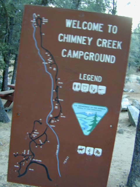
People come way out here for the seclusion – the peace & the quiet. Mid-week you can have the whole place to yourself. Abundant hiking trails & fishing access. Into the Dome Land Wilderness you will find incredible scenery and diverse terrain – giant granite domes, waterfall canyons, and the South Fork of the Kern River (3 mi hike to river). The infamous Pacific Crest Trail passes close to Long Valley Campground, but Chimney Creek Campground is much closer to the PCT.
Long Valley Campground
• Elevation: 5200′
• Number of Sites: 13
• Vehicle Accessibility: High Clearance Vehicle
• Facilities: picnic tables, fire rings, vault toilet
• Campsites Reservation: No
• Camp Fee: None
• Length of Stay: 14 Days
• Season: Open all year
• Operated by: BLM
• Trailheads: S. Fork Kern River & Domeland Wilderness
Recent Domeland Wild Fires:
Manter Fire (2000)
McNally Fire (2002)
Long Valley Loop Road (2001)
2016 NOTE: The part of the LOOP of Long Valley Loop Road that connects this campground to Kennedy Meadows (to the north) is CLOSED due to a huge washout. The Long Valley campground is accessible from the south side, from Hwy 178 @ Canebrake – and requires many miles of dirt road driving. High clearance vehicles are recommended; 4×4 needed in wet weather or snow.
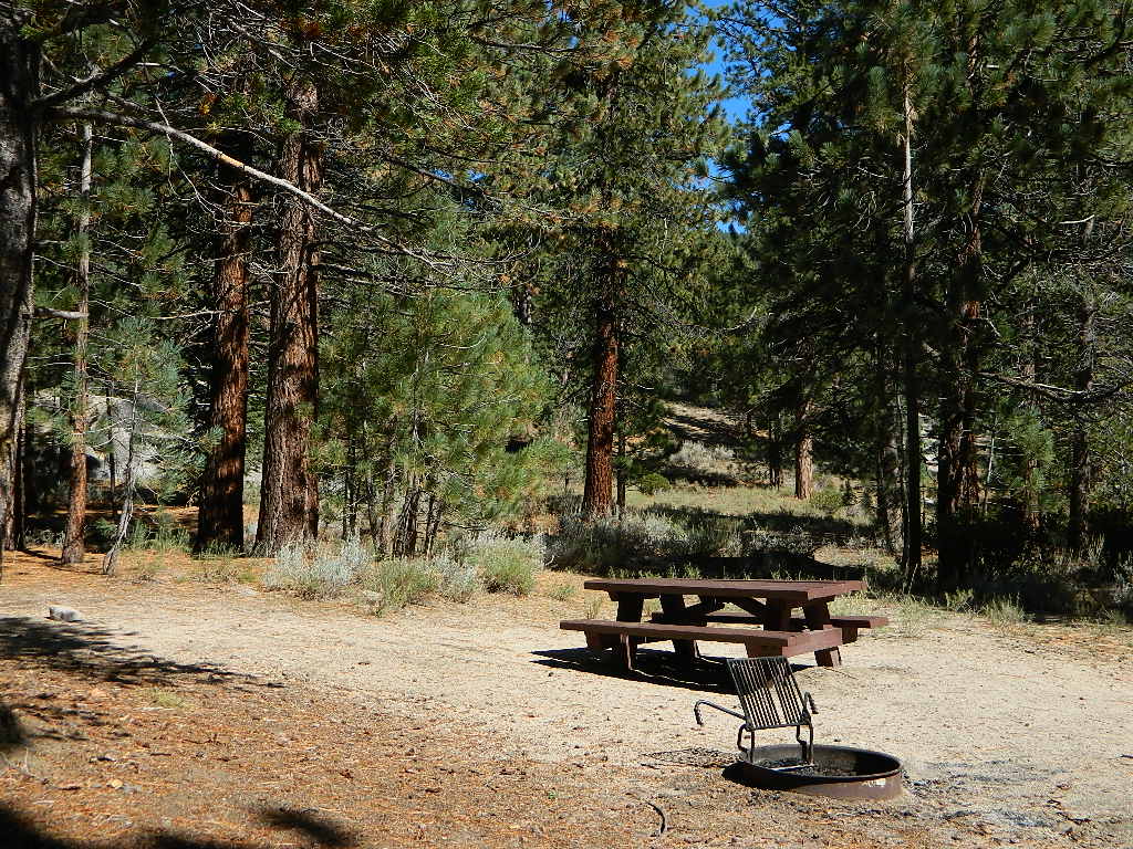
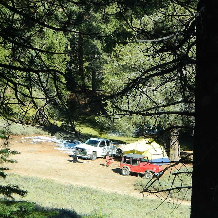
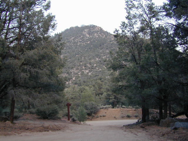
High mountain desert camp is mislabeled on some maps as “Chimney Peak Campground” or “Chimney Rock Campground”. Pinyon pine forest on Chimney Creek, near hiking trailheads, wildflowers and Chimney Peak Wilderness. Southern Sierra ridge near Mojave Desert and California SR 178.
Canebrake Road is a graded dirt road that makes up part of Chimney Peak Back Country Byway. This rural route is a major graded dirt road located north of Highway 178 – which connects Canebrake to Long Valley up near Kennedy Meadows. Pacific Crest Trail passes next to this campground in the Southern Sierra mountains. The campground turn off is way east of Lake Isabella Hwy 178 is (near Walker Pass & PCT) and follow dirt road north to Kennedy Meadows in the far eastern reaches of Sequoia National Forest
• Elevation: 5,700′
• Number of Sites: 32
• Camping Reservations: No
• Sites Available: First come, First serve
• Vehicle Accessibility: RV limit 28′ max
• Length of Stay: 14 Days
• Water: Piped (April – Sept)
• Toilet: Vault
• Season: Open all year
• Fee: No
• Operated By: BLM
• Closest Town: Lake Isabella, CA
Bureau of Land Management
BLM Bakersfield Ranger Station 661-391-6000
elevation 5800′ – Canyon Creek connects Lake Faucherie, Sawmill Lake and Bowman Reservoir in the Sierra, Tahoe National Forest. 20+ miles of backroad travel, off I-80.
While many consider Faucherie to be the most beautiful scenic lake, Sawmill Lake just downstream a couple of miles is still quite attractive – with dense forests and a granite mountain backdrop. Sawmill is especially nice for those who like to primitive camp, ouside of developed campgrounds. Way off the interstate @ Hwy 20, tucked in way back behind Bowman Lake a few miles, you can find Sawmill Lake.
Fishing and camping, kayaking and canoeing are all popular recreation around this lake. A trailhead on the northend of the lake leads out to even more alpine lakes (a day hike “lake loop” or backpacking option). The Pacific Crest Trail is also routed nearby.
No motorized boats or watercraft allowed. No boat ramps, no pavement, no picnic tables, no bathrooms, no fees.
4×4 Lake
Fishing Lake
Free Camping Lake
The north shoreline is abundant with dispersed campsites: metal fire rings and a clearing only; no picnic tables, no toilets. Self sufficient campers only. Campfire permits, a water bucket and a shovel are required. During extreme fire restrictions campfires may not be allowed. Check with local rangers for up to date info.
Most campsites are drive up and park, while others closer to the shoreline have only walk-in access. Hauling your gear down hill won’t seem unthinkable once you’ve seen the lakeside views. There is even a camp below the dam, next to the waterfall.
The main access Road #843-037 is very rocky and 4x4s love to frequent the area. The backroads here are best suite for truck travel, high clearance vehicles, off-roaders and SUVs. No small RVs or trailers. Passenger cars are not recommended. The access roads around the lake and up to the lake are dusty and rugged. The road below the dam is quite rough w/ rocks.
The water at Sawmill Lake is crystal clear snowmelt. The lakes around here are managed by Nevada Irrigation District, so this is why there are no engines allowed on the lake. This canyon area closes to public entry during winter months (NOV-APRIL), due to deep snow.
Lake Faucherie is set in spectacular scenery of granite mountains, with peaks and waterfalls all around. Many believe that you could only reach this kinda high elevation beauty by foot, with a backpack, but here it is – accessible by a very long, rough & rocky backroad.
No motorhomes, no camper trailers, no motorboats, no engine noises on the lake, no big families. Just well-deserved solitude, finally. Peace and quiet!
Perfect alpine lake for car-top boaters – those who carry their boats on top of a vehicle. But be warned very few ‘passenger cars’ make it back this far, due to the challenging roads.
No motorized boats or watercraft allowed. One public boat ramp; gravel parking area, vault toilets, gated entry for group campground. No more driving across dam (it is now gated).
Faucherie Lake Road – a spur road, off of the ‘843 Road’ leads up to both Sawmill & Faucherie Lakes, as well as the Canyon Creek Campground.
This primitive road forks off at Jackson Creek Campground, Tahoe NF, way, way back behind Bowman Lake. The rugged route is also known as Nevada County Rd #843-037. Conflicting numbers appear on USDA web site for this route, so don’t get confused.
The brown Forest Service signage is decent at Jackson Creek Campground – so if you get that far, you’re almost there. Sorta. Did I mention how crazy the road is? Any wet weather or snow will make this route “4×4 required”. This place is closed off about half the year, due to deep snow (NOV-MAY). Although on summer weekends, this area is busy for a remote high Sierra lakes region.
To reach this rugged Canyon Creek takes hours of driving with a good backcountry map and a reliable, high clearance rig. AWD Subies and mini SUVs beware, you’ll need a spotter on the bad sections of this road (or risk serious oil pan damage). Or perhaps maybe, we “shouldn’t be back on these kinda roads in that ‘lil sportwagon’ missy.”
Faucherie Lake Group Campground
(25 people maximum per site)
• Elevation: 6135′
• Number of Sites: 2
• Vehicle Access: High Clearance Vehicle, no trailers
• Campsites Reservation: Yes
• Camp Fee: Yes
• Season: June – October
• Trailheads: Faucherie Lake Falls, Five Lakes Basin, French Lake, Haystack Mountain
Faucherie Falls – Six waterfalls above lake:
Upper Faucherie Lake Falls #1: 39.4257 N, 120.5616 W
Upper Faucherie Lake Falls #2: 39.4257 N, 120.5606 W
Upper Faucherie Lake Falls #3: 39.4262 N, 120.5568 W
Upper Faucherie Lake Falls #4: 39.4268 N, 120.5550 W
Upper Faucherie Lake Falls #5: 39.4270 N, 120.5544 W
Upper Faucherie Lake Falls #6: 39.4272 N, 120.5538 W USGS Topo: English Mountain
In the hills and canyons above Chico many wonders can be found. North Sierra Nevada mountains, medium sized recreation lake surrounded by lush forest; N of Lake Oroville and S of Lake Almanor. North Fork Feather River canyon forms the northern boundary to this designated Wilderness Area. The area is popular with backpackers and PCT hikers, as well as equestrian and the region has over a dozen campgrounds. Backcountry terrain includes an impressive 6 mile long canyon wall.
The popular boating destination, Bucks Lake reservoir, is just outside the wilderness boundary, which makes for an excellent destination for day hikes. Boating, fishing, backpacking, hiking, camping, canoeing, kayaking, rock climbing, snowmobiling and mountain biking are just some of the outdoor recreation in the area. This Wilderness region features a Silver Lake and Gold Lake, as well as numerous other small, unheard-of lakes. A few can be accessed by vehicle, but more than half are hike-in only lakes.
backpacking
boating
cabin rentals
camping
canoeing
fishing
floating
hiking
kayaking
sailing
swimming
Bucks Lake Wilderness
23,958 acres
5200′ elevation at Bucks Lake
Alpine wilderness, mountain peaks, hiking trails, PCT trailheads, numerous small lakes, plus large recreational fishing lake
Bald Eagle Mountain – 7183′
Bucks Mountain Peak – 6819′
Mount Pleasant – 7067′
Small lakes around the Bucks Lake Wilderness Area
Bald Eagle Lake
Blue Lake
Cape Lake Gold Lake
Grassy Lakes
Jacks Meadow Pond
Kellogg Lake
Lost Lake
Mud Lake
Rock Lake Silver Lake Snake Lake
Smith Lake
Thompson Lake
Three Lakes
Upper Mud Lake
If you are a backpacker wanting to easily access the John Muir Wilderness, the paved parking area of Maxson is the trail head for you. The Courtright Reservoir is located at over 8000′ elevation, w/ granite domes & alpine scenery all around. This place is way back behind Dinkey Creek, past the McKinley Sequoia Grove inside a deep granite gorge. The Sierra National Forest is the region, which is south of Yosemite National Park. The paved route is a long one from Shaver Lake, via Dinkey Creek Road, but the rewards are great. An all day adventure and a side trip not to be rushed.
Warning: You could spend a whole day just driving & sightseeing in this area! Meadows, wildflowers, dirt roads, trails, Big Creek, McKinley Grove of Sequoias,Wishon Reservoir, the list goes on. All the way out to the Wilderness boundary, Courtright Lake is not a quick or easy drive.
The hikers trailhead is located at the end of Courtright Rd. Cross over the big dam to the right & drive approx one mile; look for signs on the right side of the road. There are minimal areas to set camp at this granite , windswept face. Good luck getting a tent stake in the ground. Rock rules here. There are a few developed Campgrounds on the opposite side of the lake which may be a better choice for car camping. This Maxson parking lot is primarily for backpackers.
Dusy Ershim 4×4 route start right here too – on the opposite side of the road. It’s second only to the Rubicon Trail, as far as High Sierra rocks & terrain.
Rock Climbers also love this spot for the granite domes & walls. Hiking all the way around this lake is a full day trip, with lunch and sightseeing stops. A pleasure not to be rushed.
Kern River Valley is one of the all time favorite Sierra Nevada destinations for SoCal escapees. First, it is the southern most ‘big river’ action for the Sierra range. The drive up from Los Angeles is easy access; only a coupe of hours. California Highway 178 leads from Bakersfield up the mountain to Lake Isabella (exit at 155 for Kernville destinations). The 178 continues east past the rural communities of Onyx, Canebrake, Weldon, and then on to the Northern Mojave desert & US Highway 395
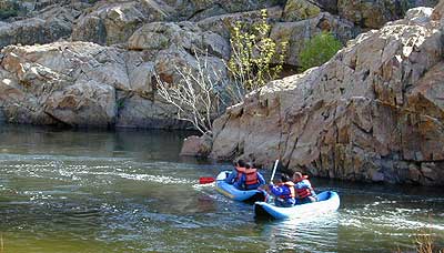
Second, Kern has an abundance of outdoor recreation, from fishing to boating, river rafting to kayaking, backpacking, mountain biking, rock climbing, horseback riding, hiking, camping, & soaking. Kernville is the “recreation headquarters” for the region, where you can find rafting outfitters, camping supplies and rental equipment.
Third, the mountain scenery is very diverse – with the dry shores of Lake Isabella, the granite lined Kern River, or the ridges with towering cedar forests, plenty sugar pines, plus a few Sequoia groves; Tons of dirt back roads to explore, granite & gorges for the rock climbers, prime wilderness access & several primitive hot springs.
The whole area is encompassed by the Sequoia National Forestwith wilderness areas to the North & East. Giant Sequoia National Monument is located along the Western Divide Hwy in the northern portion of the National Forest.
Whether you’re an RVer wanting a developed campground near town, a fisherman needing a primitive site right on the river, or a backpacker seeking the high country, the Kern has a little bit of everything. High elevations beyond 8000′ ridge lines, or the lush Lower Kern under 2000′ with granite boulders lining, Kern has it. 4 wheelers will love the extensive network of dirt back roads, or maybe the OHV areas of Keysville. Lake Isabella has numerous oak lined campgrounds & boat rentals available too. Summer is not the best time to visit as the temperatures soar to 100 degrees & the city crowds come in full force to the Kern Valley. Springtime, the best season to visit runs from March to May, or Autumn cools for September to December.


 Lake Mohave Ranger Stations


