Tag Archives: hiking

Hiking California Coast

California Coast Trails

Big Sur Coast 
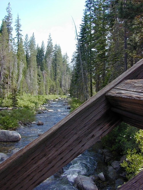
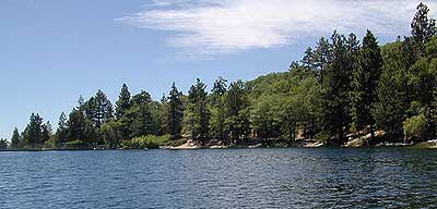
Coastal hikes are the mildest trails California has to offer, ranging from scenic strolls along the base of beach cliffs to steep redwood forested canyons. From Torrey Pines in San Diego to the multiple redwood parks along the North Coast, there is no shortage of hiking near the coastline. Southern California has more beaches than parks, with tide pool areas being a favorite destination for many. Central Coast has lush, fern canyons with year-round flowing creeks and numerous bluffs and rugged beaches. Bay Area has hiking trails nearly everywhere – along the bay, in the woods or on the coast. NorCal has all the wilderness, parks and remote beaches one could ever hope for. What are you waiting for? Get out there.

Pacific Valley Hiking

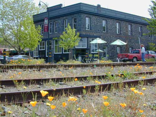
San Francisco Bay Area Hiking

Limekiln Hikes

hiking trail maps

NorthMarin
Channel Island National Park Map
Los Angeles Hiking Maps
Los Padres NF South (Ojai, Santa Barbara, Frazier)
Los Padres NF North (San Luis Obispo, Big Sur)
Marin Hiking Maps
Mendocino National Forest Map
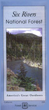
Six Rivers National Forest Map
Redwoods Map
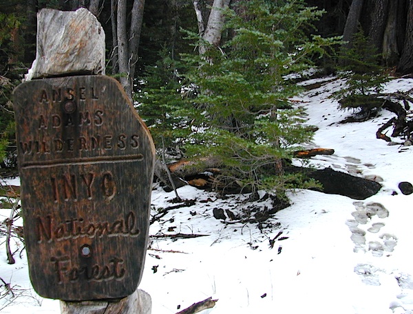
Ventana Wilderness Map w/ Silver Peak
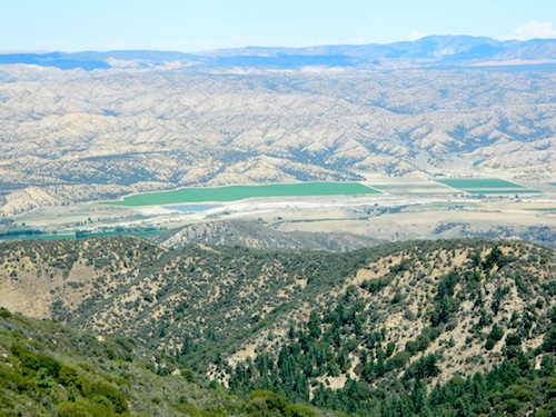
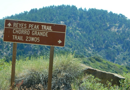
Sand Dollar Beach

Hiking Lake

Guide to Hiking Lakes in California

lakes Southern California

This is California – the beautiful, where millions flock on vacation. California is crowded: the population & tourists are only increasing each year. Thousands of people are looking for hiking mountains or better, a hiking lake – each weekend. Many are using the web for destinations, like the research you are doing right now. All folks seeking nature, water, cooler temps, fresh air & views. High Sierra, NorCal, SoCal Reservoirs, we list the best of these hiking lakes below.

Some of the lakes have mountaineering routes nearby; equestrian trails, regular hiking trails, campgrounds, some even have sorta level paved (granny) trails for biking, hiking & skating around.

High elevation or alpine lakes can be accessed best in summer months. Mountain bike, backpack, horseback into these hidden treasures. With any Sierra Nevada destination, snow pack deep can be in certain seasons. Major Highways (Sierra Passes) can be closed into June or July, due to rock slides and late snow melt. Snow shoes, snowmobile or 4×4 vehicles may be needed to reach such lakes, any months OCT-MAY (fall to spring). Winter can come early & stay late at these higher elevations of California; Be prepared for true Wilderness experience.

But maybe you are just looking for some easy hiking, loop trails & picnic spots; Or perhaps an overnight stay near a lakeside camp w/ kayak rentals. California reservoirs to alpine lakes, we have a wide variety listed below.

This page contains links to some favorite lakes with hiking trails around the lake, along the shoreline or routes on ridge lines overlooking the lake. If no good lake page could be found, we’ve linked to some photos of the lake on Flickr.

Baja California:

SoCal:

Central California / Sierra Nevada:

NorCal:

Blackrock Reservoir in Sierra Nevada

Lakes California Map: check out all the maps we have for lakes in Cali

Redwood Beach Camping

NorCal Redwood Coastal Camping

Redwood Campgrounds

Del Norte County, Northern California

redwood101

There are a few special places in California where redwood trees grow right down to the shore, but it is rare. Searching for place to pitch a tent (under the redwoods at the coast) is possible, but a bit harder to find than you might imagine. State Parks usually offer the standard paved camp site. Maybe need to drive dirt roads to find redwood seclusion.

Crescent City Camping

redwoodmap

Klamath Coast Camping

blue links lead to State Park pages with camp reservations.

State Park

Redwood Park Campgrounds State Parks

Redwood National Park National Park
Camping 

  • Demartin Campground
  • Flint Ridge Campground
  • Mill Creek Campground
  • Nickel Creek Campground (backcountry)

Eureka RV Campgrounds

redwood camping norcal

If you are seeking free or dirt cheap, primitive camping on the coast, then LOST COAST CAMPING on the Mendocino border is one option. Or head east, inland to the abundant National Forest. Dirt roads of the Six Rivers National Forest offer old logging roads, creeks, and secluded places to pitch a tent. Campfire permits are needed for dispersed camping, or ‘boondocking’ as some call it.

Dirt back roads can get muddy during the wet season, so know your vehicles capability and if you are unsure, check with the local rangers over the phone (preferably a ‘field ranger’) before venturing out. Remember that rain and mud are the norm, most of the year.

Fog is typical of the region. Enjoy the sunshine – when you can!

see more towns nearby –

Smith River
Crescent City
Klamath
Orick
Trinidad
Arcata
Eureka
Scotia
Ferndale
Petrolia
Garberville
Redway
Shelter Cove

Green Creek Road

Mono County Wildlife Area
Mono County Wildlife Area, Green Creek Road- off Hwy 395, near Bodie

Green Creek California

Eastern Sierra

S of Bridgeport, CA
MONO – Road #142NFS

Toiyabe National Forest
Bridgeport Ranger District

If you are thinking about fishing or camping the Eastern Sierra, North of Bishop & you are not up for the crowds at Mammoth or June Lakes, then try the Bridgeport area, north on Hwy 395. Rural ranch lands along main road, Bodie ghost town turn off across the highway and Virginia Creek Settlement are also nearby

Green Creek is a 11 mile long dirt road in the lush Eastern Sierra the northern portion. The wide, graded dirt road is signed and dead ends at a Toiyabe National Forest campground called Green Creek Campground. The drive up can be washboard bumpy in some parts, but that doesn’t stop the hundreds of adventurous motorhomes that make this trek annually. This place features some of the best prime Sierra back roads camping options for RVs.

Another dirt route, Dunderberg Meadow Road peels off to the left. Dunderberg departs  off Green Creek a couple of miles from the highway and well maintained. This route leads to meadows, aspens, picture perfect scenery and much more seclusion. Passenger car accessible, wide graded dirt roads to wilderness edges. Two-track one lane trails lead to meadow edges and more creeks. Very impressive views of the Sierra peaks over here on this side. Meadows are sensitive areas, wonderful for picnics and you should always minimize impact.

State Park California

Green Creek Wildlife Area
Mono County, California

Aspen Grove Camping for RVs

  • alpine lakes
  • backpacking
  • bird watching
  • camping
  • creeks
  • day hikes
  • fishing
  • hiking
  • horseback
  • hunting
  • mountain biking
  • wildlife
  • wilderness

Plain old passenger cars can easily make this route deep into the Eastern Sierra aspen canyon. Graded dirt and4x4 could be needed winter months. Backpackers can enjoy easy access to the Hoover Wilderness trailheads. There is plenty semi-primitive camping spots along the way, right on the creek, for free…. so no need to sleep in your vehicle upon arrival.

Autumn Aspen Groves: fall colors peak in October, which is usually when the first snows for the winter season start. November – usually the freeze gets them and lifeless brown leaves dangle, until the Sierra Nevada wind gust blow real good.

camp

Green Creek Camping

DIRT ROAD CAMPING

  • alpine lakes
  • backpacking
  • car camping
  • day hikes
  • fishing camping
  • meadows
  • RV camping
  • tent camping

Hoover Wilderness

Dispersed, primitive camp spots along this main dirt road are on a first come basis. You’ll need a fire permit. Many flat camps are set along the creek in aspen groves, some pines, others have  cubby hole privacy. Large granite valley, big creek, bird, scenery and nature everywhere.  Some folks spend weeks camping out here in the warm weather months. Fishing is a big attraction.

Old Cabin in autumn leaves, up near the top of the dirt road deep in the aspen grovesNFS

Green Creek Campground USFS
7500 elevation
11 camp sites
fee, open May – October
trailhead parking nearby

hiking trails lead to

hikes

TOPOGRAPHIC MAPS:

Aspen Camp

28E201 – Inyo NF

trailsdown

Road #28E201 – Inyo National Forest
also known as Inyo Road #4S86

Laurel Lakes Road
Inyo National Forest
Eastern Sierra, California

Southeast of Mammoth Lakes, CA
West of Crowley Lake, CA

Steep, rocky, gravel road, way up above (and behind) Convict Lake. 4WD may be needed during wet or snowy weather. High clearance is always advised. Locked GATE at the bottom means the NFS rangers have closed the route (seasonally) for deep snow, rock slides, avalanches, or other erosion hazards.

Laurel Canyon, US Hwy 395
Laurel Creek
Laurel Lakes

amigoaspens
Laurel Lake Road, Eastern Sierra

Find more INYO BACK ROADS

  • backpacking
  • camping
  • fishing
  • hiking
  • horseback
  • lakes
  • mountaineering

GenevieveLake

Trailhead to Lake Genevieve (pictured above), hike lake loop, snowy peaks.
NOTE: No easy access to the PCT (Pacific Crest Trail)

Laurel Mountain (elev 11,818′)
Bloody Mtn. (12,544′)

oldestrocks

gnarlyrocks
CLICK TO ENLARGE

Geologic:

Oldest, exposed rock in the Sierra Nevada mountains range. Buckling granite w/ volcanic rocks. Evidence of glacial activity including, terminal, lateral, and recessional moraines, glacial striations and polish, erratic boulders, and of course the numerous lakes. see more

Volcanic Eastern Sierra
Volcanic hikes in the Eastern Sierra

Sierra NF – Road #9

sierra10S69

Sierra National Forest
Big Creek Road #9

aka. Rd #10S69

Connects Pine Flat Reservoir @ Lower Kings River, to upper elevation Sierra forests near Dinkey Creek Road. McKinley Grove of Sequoia

Sierra Road number 9 is a north turn off of Trimmer Springs Road. Marked as National Forest Rd #10S69, as well as just plain NINE. Big Crk. canyon is after the Maxson Road junction, and before the Balch Camp / Blackrock Reservoir turn off on #11S12. The area is known for abundant wildflowers in the early season.

dirt road climbs 25+ miles thru Sierra NF

sierra9

  • back road exploring
  • camping
  • fishing
  • hiking
  • hunting
  • kayaking
  • picnic areas
  • swimming
  • wildflowers
Tall White Lupine
Tall White Lupine

Big Creek Rd 9

A popular dirt road drive for the western Sierra – Pine Flat Lake region. A forested, south facing canyon in the Southern Sierra Nevada Mountains. Big Creek, wide, graded, dirt road w/ primitive camp sites. 4×4 could be needed in wetter months.

The higher you go on this route, the more pine trees you will experience. Winter weather can close this route. A campfire permit is required to camp along this road.

The lower part of the canyon has rock features, small waterfalls, swimming holes, picnic spots and sometimes cattle grazing. Several prime unmarked, primitive camp sites along this road – but few and far between. High clearance or 4WD may be needed, depending on road conditions.

sierra hiker

Soaproot Saddle Road is a not-so-obvious left fork (dirt, without signs) that leads steeply up away from main road. Climbs a steep hillside, way up above and along Rush Creek; continues for many miles. Less people back this way, if you are seeking seclusion. Few primitive camp sites on right side of road, near where the creek breaks away from road. Good for stargazing way back here. 4×4 may be needed. Road may or may not connect through to desired destination.

The mid-route climbs into pine forest and the dirt road switchbacks, steeply, with a few more camp sites available; usually found on short side roads off the main road.

sierra creek camps

At Sierra #9, a major junction w/ dirt road #10S69, called Dinkey Trimmer Road. This leads way off through the rugged terrain, many miles, over to the pavement at Dinkey Creek Jct – Campground, Trailhead and Dinkey Lakes Wilderness.

Big Creek will turn left (north), and follows the large Big Creek Canyon. Several steep miles climb up into the dense pine forest, following the creek the whole way. Several prime creekside camp sites fill up fast in this stretch. Great views, steep dirt roads. GPS waypoint these camp driveways – so you can find it next time, (first, before everyone) on Friday, Thursday before midnight.

Peterson Mill Road is Rd #10S02, found on the left (west) side of Sierra #9. That westbound route becomes pavement half way back to Highway 168. This way is the quickest way from Fresno, out to the developed NFS Bretz Campground.

Sierra #9 Big Creek Road arrives in the densest of forests. Many camp sites and side routes to explore. Dark, upper elevations, snow lingers long in the shade. 4WD may be needed in wet areas. Mud is quite common MOST of the year in this spot, so know your vehicles capabilities before you get yourself stuck (or stranded). It’s a very long walk to any kinda civilization!

Hunters like to use these upper camps during hunting season. A camp fire permit is required, so bring your shovel and bucket; self-sufficient campers enjoy the back roads most often.

wild sierra flora

Bretz Campground NFS is up here on the main road, number nine. Clock it w/ dash trip meter; 15 miles from the road start @ Pine Flat Lake. Popular with OHV and 4×4 groups. Max RV or trailer length = 24′
Open all year long; No fee.

Sierra Forest Road #9 the far north end, enters Blue Canyon @ #10S18, but the Rd #9 route continues NE as Providence Creek Road. Eventually intersecting @ Dinkey Creek Rd w/ Rock Creek & Dinkey Dome closeby. Great granite 4×4 Trail @ Bald Mountain (elev. 7832′) overlooking Shaver Lake.

Jeepers on granite @ Bald Mtn, above Shaver Lake, CA

Kings River Camping

2 tone lupine

SIERRA MAP
sierra National Forest map

places nearby –
shaver lake map

Balch Camp (utility & NFS)
Black Rock Reservoir
Courtright Reservoir
Dinkey Creek
Huntington Lake
Lakeshore, CA
Pine Flat Lake
Shaver Lake, CA
Trimmer Springs
Wishon Reservoir

Cuyama Valley

Cuyama River Valley, California

Ventucopa WineriesNorth of Ojai, Highway 33 meets Highway 166: Ozena, Ventucopa, & New Cuyama make up the 3 small communities inside the Cuyama River Valley, located in south of the San Joaquin (California’s Central) Valley.

On the outter edge of Santa Barbara County, where Kern, San Luis Obispo & Ventura counties all meet, you can find great solitude, a large red dirt, high desert wash & plenty rural trails. Off-roading, backcountry camping, hiking, mountain biking all over this region.

Ozena Ranger Station sits at the south end of Cuyama, at the intersection of Lockwood Valley Rd & Hwy 33. Ozena Campground with 10 spots @ 3660′ elevation, is to the east off Lockwood.

Nettle Springs Campground (8 spots @ 4400′ elevation) can be accessed via Apache Canyon, a 10 mile long dirt road# 8N06, off Hwy 33

2 smaller campgrounds – Tinta and Ranch Nuevo are on the west side of Hwy 33 & may require a high clearance vehicle to reach. Trails out of these campgrounds lead to the Dick Smith Wilderness.

Chumash Wilderness is just east of Ventucopa, as Los Padres National Forest surround this agricultural valley. Quatal Canyon and Quatal Wash reach from the upper elevations of pinyon pines near Mount Able to Cuyama river bed below, as Cerro Noroeste Road skirts the northern rim of the impressive red rock canyon. Toad Spring Campground is at the top. Apache Saddle and Pine Mountain Club are just east of Quatal Cyn.

Cuyama riverbed follows Highway 33 and then turns west, following Highway 166, past the ranch lands, the volcano hills and notorious Rock Front Ranch.

All the pavement around Cuyama is very popular amongst motorcyclists. Scenic touring kinda roads. A very nice 100 mile loop trip is from Pine Mountain Club – W on Mil Potrero Hwy, W on Cerro Noroeste Rd, W on Hwy 166, S on Hwy 33, East on Lockwood Valley Road – back to Frazier Park & I-5 Lebec.

Mahutasan, the indian sweat lodge and the extremely rustic Sage Brush Annies Restaurant w/ winery are the highlights of this rural agriculture valley called Ventucopa CA. Cuyama Peak and fire lookout tower overlooks the whole Cuayama Valley & can be accessed via Santa Barbara Canyon Rd. 4×4 may be required in certain spots. This lovely oak and manzanita lined canyon was scorched by the Zaca Wildfire in mid 2007.

  • Cuyama Wineries
  • Pistacio Orchards
  • Quatal Canyon
  • Ballinger OHV Park

helpful maps of the region –

towns in the valley –

towns close by –


View Larger Map

Hwy 166 Wildflowers, School House Canyon


California Countryside Hikes

California Wine Country Hikes, Gold Country Hiking, Sierra Foothills, River Trails

DSCN1649

6S05 – Inyo NF

6S05bridge

Paved, one-lane extension of #4S12, Rock Creek Road.
Up above Rock Creek Lake, East Sierra Nevada, California

High elevation 10,272′ at roads end and parking lot

Little Lakes Valley Trailhead
Mono Pass
Morgan Pass
John Muir Trail (JMT)
Pacific Crest Trail (PCT)

Mosquito Flat Picnic Area

Restrooms, paved parking lot, nature trails, fishing creeks, horseback, wilderness trails.

hikes NFS camp horse camp

Mosquito Flat Walk-In Campground is intended for backpackers departing overnight into the backcountry the following day. Single night stay ONLY. Please camp down canyon if you plan to stay for more than one night. Bear lockers are provided at campgrounds for proper storage of food items, so use them!

No campfires are allowed outside of developed campgrounds. Day use does not require a permit. Wilderness permits are required for overnight trips into the John Muir Wilderness. Bear containers are required for backpackers. Permits for these trails are issued at Inyo National Forest ranger station in Mammoth, or the Eastern Sierra Visitors Center (ESIA) near Olancha.

littlelakesvalley

John Muir Wilderness (JMT) trails, Pacific Crest Trail (PCT), epic scenery, alpine lakes, high elevation. Eastern Sierra

Rock Creek NFS Hiking Trailheads (download PDF)

Rock Creek Pack Station provides wilderness pack trips on horseback, and day rides too.

Road and canyon is CLOSED for winter snow approx. NOV-MAY

snowlane

Peaks and passes surrounding Rock Creek Canyon, in the Eastern Sierra Nevada Mountains –

Red Mountain 11,472′ (elevation)
Mount Morgan 13,748′
Morgan Pass
Mt Huntington 12,405′
Mono Rock 11,554′
Mono Pass
Mt Starr 12,835′
Mt Mills 13,451′
Mt Abbott 13,704′
Round Valley Peak 11,943′

Hike or horseback ride to these alpine lakes from Rock Creek Rd trailheads –

Davis Lake
Hilton Creek Lakes
Patricia Lake
Golden Lake
Pioneer Basin Lakes
Trail Lakes
Summit Lake
Ruby Lake
Mills Lake
Gem Lakes
Treasure Lakes
Dade Lake
Upper Morgan Lake
Lower Morgan Lake
Chickenfoot Lake
Little Lakes
Box Lake
Heart Lake
Marsh Lake
Serene Lake
Eastern Brook Lakes
Tamarack Lake
Buck Lake
Francis Lake
Dorothy Lake
Kenneth Lake

Desert Hiking California

California desert region hikes

Anza Borrego Desert State Park
Approximately 20% of California’s land is desert, located in Mono, Inyo, Kern, Los Angeles, San Bernardino, San Diego, Imperial, Riverside Counties… most falling in the eastern portion of California. Almost all of the Baja California peninsula is desert, right down to THSDmap
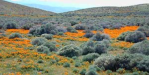
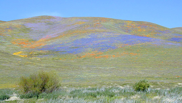
the beaches on the Sea of Cortez. The Mojave joins in Sonoran desert in Joshua Tree National Park, which is reason enough to explore this fabulous landscape. Anza Borrego Desert has way more cacti and vegetation than the barren Death Valley terrain. But Death Valley offers abundant acreage, seclusion, hot springs, scenic canyons, mining history, the tallest mountain peaks and the lower point in the nation. Inyo has impressive mountains that sit just east of the Sierra Nevada and is a volcanic wonderland along Highway 395 with indian petroglyphs, cinder cones and ancient lava flows.

  • Anza Borrego Hikes – San Diego Back country: Blair Valley Indian Pictographs
  • Bodie Ghost Town – High desert mining camp, off Hwy 395
  • Darwin Falls Hike – High desert waterfall, near Death Valley
  • Death Valley Hiking
  • Fossil Falls – Lava Flow on Hwy 395
  • Hiking Las Vegas
  • Inscription Canyon – Mojave Desert, Barstow
  • Joshua Tree Hiking Trails
  • Mojave Desert Hiking
  • Panamint Valley & Canyons
  • Rainbow Basin – Mojave Desert, Barstow
  • Randsburg Mining Town
  • Telescope Peak Hike
  • Goat Trestle Anza Borrego Desert
    Goat Trestle Anza Borrego Desert

    California Desert Hiking Maps

    bajaalmanac2010
    Baja Almanac

    Baja Map Set by NatGeo
    Bodie Ghost Town Map
    Death Valley Maps
    Inyo National Forest
    Jawbone Canyon Map
    Joshua Tree Maps
    Mojave Desert by Tom Harrison
    Mojave Map by NatGeo
    Mono Lake Map
    San Diego Backcountry Map
    Anza Borrego Desert Map
    Verdugo Mountains Map

    Spicer Reservoir

    spicer terrain


    Spicer Meadow Reservoir

    Spicer Meadows, Spicer Reservoir, Rd #7N01
    Spicer Lake, Stanislaus National Forest

    lake elevation 6418′
    227 surface acres

    public boat ramp
    hiking trail around lake
    more lakes nearby

    Ebbetts Pass Sierra Hwy 4

    Ancient volcanic peaks mix with Sierra Nevada granite rock, pine forests and fresh, clear, clean mountain water! California, of course.

    Stanislaus Forest Road #7N01 leads down from Highway 4 to this popular series of alpine lakes and reservoirs. Camping, fishing, hiking and mountain biking. Sailing, canoeing, kayaking, swimming, floating and fishing are also popular water activities.

    Rules of the Reservoir:
    10 mph speed limit on Western Arm.
    No motorized boating in Eastern Arm.
    Camp only in developed Campgrounds.

    NFS
    2 NFS Campgrounds at west end of lake:

  • Spicer Campground (60 sites)
  • Spicer Group Camp (75 people max)
  • Campgrounds only open June-September. Some campsites at the campground are wheelchair accessible.

    Additionally, Stanislaus River Campground w/ only 8 sites, is located just off the main access road #7N01, right near the river.

    spicer lake shore

    Spicer #7N01

    Numerous smaller lakes in the region make this a hot spot for summer vacations. Union and Utica Reservoirs (both with dirt road access) are good for kayaking and canoes, while power or sail boats prefer the larger Spicer Lake. Summit Lake and Elephant Rock Lake are perfect for quite picnics and day hikes. Trails (many unmarked) connect the lakes to each other. Area gets buried with snow in winter, so these roads are generally only open half the year.

    More reservoirs and lakes nearby:
    Highland Lakes
    Mosquito Lakes
    Lake Alpine, CA
    (all along Hwy 4)

    Stanislaus National Forest Map USDA
    Stanislaus National Forest Map USDA

    Nearby mountain towns:
    ARNOLD, CA
    BEAR VALLEY, CA
    Lake Alpine, CA

    7N83 – Stanislaus NF

    whitehorse

    Forest Road #7N83 – Clark Fork Rd
    Paved spur road, off Highway 108, Sonora Pass

    Stanislaus National Forest
    Clark Creek, flows west to Middle Fork Stanislaus River
    Horse camping, Campground Camping, close to trailheads

    NFS Campgrounds on this road:
    NFS

    Clark Fork Campground
    Clark Horse Campground
    Sand Flat Campground

    Clark Canyon is a popular horse camping area in Stanislaus, located in between 9000′ – 10,000′ elevation peaks. This Sierra Nevada area is known for volcanic features and nice meadows. A small set of (hidden) cabins and pay phone along highway will be the best landmark for identifying the Clark turn off.

    Hiking trailheads on this road:

    Iceberg Meadow Trailhead
    Carson Iceberg Wilderness Area

    Forest Road #6N06, a dirt road to higher elevations and primitive camps, is also close by. Traversing up above the Fence Creek Campground (NFS).

    Topo Maps of this Region:

    Stanislaus National Forest Map USDA
    Carson Iceberg Wilderness Map USDA
    Carson, Emigrant, Mokelumne Map NatGeo
    Sierra Nevada Topo Map

    clarkstrails

    Closest towns:

    Dardanelle, CA
    Pinecrest Lake, CA
    Twain Harte, CA

    Los Angeles Mountains

    LA forest / Los Angeles Mountain / LA National Forest

    wrightwood

    Los Angeles forest & parks –

    San Bernardino National Forest
    Angeles National Forest
    Los Padres National Forest

    Santa Monica Mountains NRA
    Malibu Creek State Park
    Verdugo Mountains Park
    Mount San Jacinto State Park

    + numerous Wilderness Areas

    Los Angeles Mountains
    Maps & Hiking Trails –

    Los Angeles mountain towns –
    Big Bear, Angelus Oaks, Arrowhead, Forest Falls, Green Valley Lake, Idyllwild, Wrightwood

    Tunnel thru Rock

    Angeles Crest Highway
    Angeles Crest Highway 2

    El Dorado Campgrounds

    El Dorado Camping

    Kirkwood Lake
    Kirkwood Lake, California

    El Dorado National Forest
    Carson Pass Hwy 88, Ebbetts Pass Hwy 4, Gold Rush Country
    Sierra Nevada Mountains, Alpine Lakes

    campground elev spots veg toilet water notes
    Airport Flat Campground 5300′ 16 vault no Ice House Reservoir
    Azalea Cove Campground 4900′ 10 vault lake Union Valley Reservoir
    Big Meadows Campground 5300′ 54 pines flush piped handicap access
    Blue Lake Lower Camp 8100′ 16 vault piped PG&E; fish, boat, camp
    Blue Lake Dam Upper 8200′ 25 vault piped PG&E; fish, boat, camp
    Caples Lake Campground 7800′ 35 pines vault piped fishing lake
    Capps Crossing Campground 5200′ 12 pines vault piped gold panning
    China Flat Campground 4800′ 25 vault piped Silver Fork Rd
    Dru Barner Campground 3200′ 16 flush piped equestrian trails
    Gerle Creek Campground 5300′ 50 pines vault piped handicap access
    Fashoda Campground 4900′ 30 vault piped handicap access
    Hell Hole Campground 5200′ 10 vault piped walk-in
    Upper Hell Hole Campground 4600′ 15 vault lake Hell Hole Reservoir
    Ice House Reservoir Camp 5500′ 83 vault lake handicap access
    Jones Fork Campground 4900′ 10 vault lake Union Valley Reservoir
    Kirkwood Campground 7600′ 12 pines vault piped narrow road; fishing
    Lone Rock Campground 4800′ 5 vault lake Union Valley Reservoir
    Loon Lake Campground 6500′ 62 pines vault piped equestrian; group site too
    Lovers Leap Campground 5800′ 21 pines vault piped rock climbing
    Lumberyard Campground 6500′ 5 pines vault RV access
    Middle Creek Campground 8200′ 5 pines vault piped fishing creek
    Middle Fork Cosumnes River 6780′ 5 vault crk PG&E, swim, fish
    Mokelumne River Camp 3200′ 8 vault crk swim
    Moore Creek Campground 3200′ 8 vault crk swim
    Northshore Campground 6378′ 15 vault lake Loon Lake Campground
    Northwind Campground 5500′ 9 vault lake Ice House Reservoir
    Pardoes Point Campground 5900′ 10 pit no Bear River Reservoir Rd
    Pipi Campground 3900′ 51 pit no handicap access
    Sand Flat Campground 3900′ 29 pit no fishing
    Silver Fork Campground 5500′ 35 vault piped fishing
    Silver Lake Campground 7200′ 62 pines vault piped boating lake
    South Fork Campground 5200′ 17 vault piped fishing
    South Shore Campground 5900′ 22 vault piped Bear River Reservoir
    Strawberry Point Camp 5500′ 10 vault lake Ice House Reservoir
    Stumpy Meadows Campgr 4400′ 10 vault lake handicap access
    Sugar Pine Campground 6000′ 10 vault no boating
    Sunset Campground 4900′ 131 vault piped boating
    Wench Creek Campground 4900′ 100 vault crk boating
    Wentworth Springs Camp 6200′ 8 vault crk 4WD recommended
    West Point Campground 4875′ 8 vault lake Union Valley Reservoir
    White Azalea Campground 3500′ 6 vault crk Mokelumne River
    Wolf Creek Campground 8200′ 42 vault piped boating, fishing
    Woods Lake Campground 4900′ 25 vault pump handicap access
    Yellowjacket Campground 4900′ 40 vault piped boating, fishing

    see more about El Dorado National Forest

    waterfalls

    nearby towns –

    El Dorado Forest Maps –

    Ansel Adams Wilderness

    anselwoodsign

    Alpine high country hiking, Sierra Nevada mountains, California

    Ansel Adams Wilderness Area

    Ansel Adams Trail Map, Tom Harrison
    Ansel Adams Map, Forest Service USDA
    Ansel Adams Map, NatGeo

    Ansel Adams Hiking Map
    The Ansel Adams Wilderness is an area in the Sierra Nevada of California. The wilderness is part of the Sierra and Inyo National Forests, in the Eastern Sierra portion of the range, overlooking Mono Lake. Yosemite EAST is what NatGeo likes to call it. The wilderness spans 231,533 acres with Yosemite National Park lies to the north and northwest, while the John Muir Wilderness lies to the south.

    The wilderness was established as part of the original Wilderness Act in 1964 as the Minarets Wilderness. The 109,500-acre Minarets Wilderness was created by enlarging and renaming the Mount Dana-Minarets Primitive Area.

    In 1984, after his death, the area was expanded and renamed in honor of Ansel Adams, well-known environmentalist and nature photographer who is famous for his black and white landscape photographs of the Sierra Nevada.

    Ansel Adams Wilderness Map

    outdoor recreation –

    • backpacking
    • camping
    • fishing
    • hiking
    • horseback
    • ice climbing
    • lakes
    • mountaineering
    • peaks
    • wildflowers

    surrounding park & forest lands –

    nearby towns –

    leeviningvalley
    lee vining canyon

    Ansel Adams Wiki
    Ansel Adams Hiking on Summit Post

    Day hikes or overnight backpacking trips require a Wilderness permit and can be obtained at the local ranger station. A good topo map will also prove invaluable on your hike. Access trailheads for Ansel Adams Wilderness from EAST and WESTERN sides of the Sierra Nevada range.

    Ansel Adams Trailheads from the west –

    Onion Springs Meadow trailhead, Vermillion @ Lake Edison (Sierra NF)

    Isberg trailhead & Mammoth trailhead @ Granite Creek Campground via Beasore Road, way up behind Bass Lake (Sierra NF)

    Isberg Pass trailhead from Yosemite National Park

    Ansel Adams Trailheads from the east –

    Bloody Canyon, Walker Lake trailhead, near Grant Lake on June Lake Loop (Inyo NF)

    Rush Creek / Fern Lake trailhead, near Silver Lake on June Lake Loop (Inyo NF)

    Agnew Meadows trailhead & Minaret Vista trailhead, Mammoth Lakes CA (Inyo NF)

    Devil’s Postpile trailhead, behind Mammoth Lakes CA (Inyo NF)

    Fern Lake Reflection
    Fern Lake, day hike from Hwy 158 (June Lake Loop)

    California Camping Maps

    California Campground Maps

    Maps are the key to finding your very own slice of heaven in the Wilderness. Online map sources can barely get you to your city destination correctly, much less the remote waterfall you desire. You will need a real map for your adventure. A topographical map, with all the details, dirt roads & hiking trails. If you are seeking to stay away from the touristy crowds, this is the best possible place you can be…. on this site, searching for ways to make it happen – this weekend.

    BACKPACKERS BACKPACKING MAPS –

    maps of California
    Mount Whitney, John Muir & way beyond the High Sierra. DanaMite has all the California Wilderness maps on the new map shop. Various brands and types of maps. Most are printed on waterproof plastic now & are tear-resistant.

    CAR CAMPING MAPS –

    El Dorado Camping
    Planning on camping outside of the developed campgrounds & finding that perfect stream side spot without the reservation & the fees? Then you will need a free fire permit (from a ranger station), plus a good map of the forests & a vehicle capable of handling the rugged the back roads. Much of California is prone to wildfires, so make sure campfires are even allowed on the backroads, before you get out there. Call the “field rangers” for back road advice and current recommendations.

    CALIFORNIA OFF ROAD MAPS –

    Wanna take that 4×4 vehicle somewhere really special this season? Camp well beyond the masses, way down that dirt road. We have OHV maps for SoCal, the deserts & all the National Forest maps too.

    CALIF CAMPGROUND MAPS –

    Start your search on the perfect campground or camp site with the destination in mind. Mountains, deserts, coastal. Parks & forests all have their own maps with all nearby camp grounds listed. We feature all the National Forest maps, as well as some State Park & National Park maps

    See all California topo, hiking, camping maps

    Sierra Nevada maps

    coolsprings

  • California A to Z
  • California Camping
  • California Elevations
  • Camp Firewood
  • Camp Potty
  • RV camping deep in the Sierra
    RV camping at it's best in the Sierra; This rig found themselves deep in the alpine lush meadows with towering trees and a view and a very private camp site.
    Big Bend CA
    Big Bend Ranger Station, off I-80

    Northern California Redwoods

    Northern California Coast Hotels & Camps

    redwoods parks
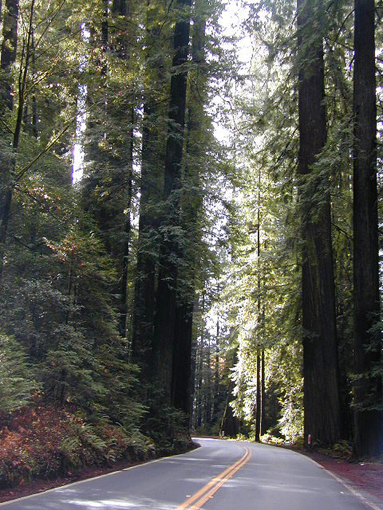
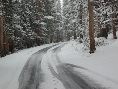
The north coast of California is dubbed the Redwood Empire, and driving north on US Hwy 101 passing the well-known wine country and communities near Clear Lake, means you’ve entered the official redwood region of Cali.

    With over 150 mile stretch between Ukiah & Crescent City, on the Oregon border, coastal redwoods thrive in this wet climate. All along US Highway 101 you can find every assortment of lodging, from standard hotels walking distance to village shops, to small secluded cottages tucked behind a winery. Sonoma & Mendocino vineyards merge on ridge lines, at the edge of oak countryside, with redwood forests & recreational rivers to the north.

    BALD HILLS ROAD: Old logging roads lead way up in elevation, behind Redwood National Park, where you can find free camping spots and firewood piles all over the clearings. A real 4×4 vehicle will be needed in wet or snowy weather conditions. AWD wagons should be cautious of deep mud and know the weather conditions ahead of time. The main gravel/dirt route traverses the Bald Hills range at 3000′ elevation and ‘epic view’ campsites are abundant. Pine Creek Road drops east into Klamath River Canyon down to Klamath Hwy 96.

    Bald Hills Rd

    USAL BEACH: In the olden days, USA Lumber Company had a prime place on the Lost Coast. Now it is a wonderful destination w/ remote beach campground hidden in the trees, next to the redwoods and creek, and the cliffs – and a big sandy beach w/ giant driftwood!

    Towns w/ Redwood Lodging in NorCal – 

    Redwood Parks in NorCal –

    (from south to north, with closest town)

    REDWOOD MAP


    Redwood Map Topo

    Topographic hiking and camping maps of the NorCal Redwood region –

    Dinkey Creek

    Dinkey Creek, California

    dinky what?

    Dinkey Creek California
    Dinkey Creek really ain’t all that small is it?

    Dinkey Creek elevation 5700′

    Dinkey is a major feeder creek originating with high altitude lakes in the Wilderness above, flowing down to the Kings River. Dinkey Creek has a seasonal large campground and a general store that is open during the summer months. Campground Reservation are common since this is a well-known destination of the Western Sierra.

    in the mountains above Fresno

    Located deep in the Sierra National Forest, 15 miles south of Hwy 168 @ Shaver Lake, via a very long, winding, paved road. Not suitable for large motorhomes.

    Dinkey Creek Road becomes McKinley Grove Road @ intersection of historic, wooden Dinkey Creek Bridge. McKinley Grove Rd  leads further south, past Sequoia trees, numerous other NFS campgrounds and on to the 2 big reservoir lakes (Wishon & Courtright). The Dinkey Road is usually only open during warmer months (MAY-OCT), snow & weather permitting.

    Dinkey Creek Store

    A very popular place for summer vacations, fishing, hiking and picnicking. The day use area near the historic wooden bridge has numerous dirt parking lots, trails, picnic tables and pit toilets. Excellent place for exploring on foot with the family, or creek fishing from the boulders.

    mountains backroad horseback trails picnic fishing mountain bike camps hikesnight skiesNFS

    wooden bridge
    Historic Dinkey Creek Bridge

    Dinkey Creek Campground RV camping

    • Elevation: 5,700′
    • Number of Sites: 128
    • Water: piped
    • Toilets: flush
    • Amenities: showers, horse corrals
    • Vehicle Accessibility: 30′ max RV
    • Campsites Reservation: Yes
    • Length of Stay: 14 Days
    • Season: May – September
    • Trailheads: Dinkey Lakes Wilderness

    Mckinley Grove intersection

    hikesDinkey Lakes Wilderness 

    Dinkey Lakes Wildernesstopo mapsDinkey Lake Trail Map


    Back roads are abundant around Dinkey, leading higher up to large, granite reservoirs (with more camping options) and numerous forest dirt roads zig-zag across the mountain terrain wherever possible.

    Dusy Ershim Trail is a famous Sierra 4×4 route that connects Courtright Lake to the Kaiser Pass. Granite everywhere, slow-go rock crawling, skirting in between two Wilderness Areas.

    Sierra Forest Road #11S12, is a dirt road that leads downhill, past the North Fork of Kings River, from high elevations near Dinkey to the Black Rock Reservoir and meeting up with Kings River near Pine Flat. An excellent loop trip for those wanting to experience dispersed camping on the back roads, but a high-clearance vehicle is required. This road is gated and closed for winter, so call ahead to the rangers, to see if it is open before you make the journey.

    Wilderness Wishon California
    Wilderness Wishon

    This whole Western Sierra is home to major hydroelectric dams that create a water supply for farms and cities located in the Central Valley below.

    nearby lakes –


    Reyes Peak

    CA 33 N
    Ojai Camping
    North of Ojai, CA

    Camp out among tall pines, well above the coastal fog.
    Los Padres National Forest Road #6N06

    Ojai, CA – NORTH on HWY 33
    a very scenic drive, in North Los Angeles County

    Coastal Foothills

    Near the Pine Mountain Summit (elev 5080′) on California Highway 33, the small sign only reads PINE MTN and points east, to a rugged side road. By far one of the worst paved roads around.

    This Reyes Pine Mountain, should not to be mistaken for the golf course community of Pine Mountain Club, many miles north of here, around the other side of Mount Abel.

    This is Reyes Peak, also known as Pine Mountain Ridge “north of Ojai”, on the sorta paved Pine Mountain Road. (Los Padres National Forest Rd # 6N06)

    overozena
    The view above is from one huge dirt pull out, on the left – over looking Ozena Valley, on the west end of Lockwood Valley Rd. Motorhomes, trailers, off-roaders and hunters like this as a last minute camp site, very close to the highway.

    If your vehicle can endure 9 long miles of poor pavement, pot-holed roads, then maybe you can find seclusion back in the woods around here.

    Six or more primitive campsites, spread out along a forested ridge line (around 5000′ elevation). Tables and fire rings only. No fees, no toilets. Bring a shovel and plenty water. No pipes, no running water up here.

    The scattered camp sites are located far enough away from each other, that the location provides some privacy and still relatively close to town. Some sites are in forested settings, while others have big boulders, but are exposed to wind and sun. Although these few sky view camps are perfect for the stargazers.

    Dark night skies can be okay, if the coastal fog stays low. Neighboring Mount Pinos is all paved – usually best choice for RV campers w/ telescopes, who need large areas of flat level ground.

    reyespeakcamp

    One particular camp site is located at a very decent view spot. Boulders, pine trees and mountain views to the south. Click the image above to expand.

    PRIMITIVE CAMPGROUNDS
    Campfire permits are required.

    Launch Spot

    The end of the road is a top destination LAUNCH spot for hang gliders & para-sailers. Watch them jump on YouTube compliments of DanaMite.

    Youtube


    The hiking Trailhead for Reyes Peak and the Chorro Grande Trail #23W05 are also at the end of this dead end road #6N06. Reyes Peak Trail leads east, out to 7510′ elevation, overlooking the whole lower Los Padres region – Lockwood Valley, Ozena, Piedra Blanca, Sespe Gorge, Potrero Seco.

    reyespeaktrail

    Get outside this weekend. There are no more excuses!

    MAPS: Los Padres National Forest Maps

    NEAREST TOWNS:

    Poppy Stompers

    California Golden Poppy

    The official state flower of California is the POPPY

    Spring usually means it’s warming up, to a great wildflower season in California. Time to get outdoors more! Hike, bike and picnic near the wildflowers and see some poppies.

    poppy fields

    California Golden Poppies can be found throughout the state, in small patches near the roadways, rolling hills behind vineyards, in high desert flats (where wind gets whipping) or even out near a ranch, with oak hills and fields of golden orange.

    POPPIES can blanket hillsides, resulting in a show stopping event – which can be deadly on freeways? N of L.A. interstate 5 (the Grapevine) TEJON PASS (Lebec, Gorman, Junction 138) >> Please pull to nearest exit and stop the car. (It will be safest and well worth the 10 minute stretch break.)

    Golden poppies can be found all over California. Flowers like lupine and owls clover can often be found nearby. Wildflowers may only last a few weeks, so go enjoy them while they last.

    Bright yellow, gold, deep orange – or any shade in between!

    best places to find poppies

    NORTHERN CALIFORNIA

    Table Mountain @ Cherokee Road
    North of Oroville, CA

    wine country

    Wine Country NorCal

    Alexander Valley Road

    Railroad Tracks @ Santa Rosa, CA
    Napa County
    Sonoma County

    Santa Rosa Tracks

    CENTRAL CALIFORNIA

    Kern County

    Fort Tejon State Historic Park @ I-5
    Cerro Noroeste Road & Klipstein Canyon
    Carrizo Plain National Monument BLM
    Kern River Canyon
    S of Walker Basin @ Caliente Bodfish Rd
    North of Tehachapi, CA

    Santa Lucia Mountains
    Rock Front Ranch
    Schoolhouse Canyon
    Cottonwood
    Hwy 166, West of New Cuyama, CA

    Figueroa Mountain Road
    Los Padres National Forest
    East of Santa Ynez, CA

    Pine Flat Reservoir
    @ Kings River, Sierra National Forest
    East of Fresno, CA

    East Bay San Francisco
    The rural hills out east are the best places to find poppies in the Bay Area.

    Mojave Desert Preserve
    Providence Mountain SRA
    Interstate 40
    East of Barstow, CA

    Central Coast California

    Gold Country Hiking

    Gold Country California

    Auburn, CA
    Central California Reservoirs
    Located all around most rivers w/ dams (reservoirs) poppies can easily be found along highways, rural roads and on oak hillsides.


    SOUTHERN CALIFORNIA

    Boulder Creek Road (dirt)
    Descanso to Julian, CA
    San Diego Mountain Foothills

    SoCal poppies

    Lancaster Poppy: Antelope Valley Poppy Reserve

    Poppy Hotline (661) 724-1180

    Remember, stay on the trail!  Getting a picture of that one really nice poppy will crush all the plants along the way, and compact the ground leaving lifeless bare dirt for the next year or longer.  If someone else has started a trail, do not add to the damage.  Please be a responsible park visitor and leave the park as nice as you found it.

    Or you can avoid the crowds & tour buses at the Poppy Park to head off on your own adventure. All along both sides of high desert Hwy 138 you can find fields of California Poppies, from the small town of Neenach, CA east to Hwy 14. Plus the hills of Gorman are usually full of color.

    Gorman @ I-5
    Gorman CA – Interstate 5 @ jct Hwy 138