Maps are the key to finding your very own slice of heaven in the Wilderness. Online map sources can barely get you to your city destination correctly, much less the remote waterfall you desire. You will need a real map for your adventure. A topographical map, with all the details, dirt roads & hiking trails. If you are seeking to stay away from the touristy crowds, this is the best possible place you can be…. on this site, searching for ways to make it happen – this weekend.
BACKPACKERS BACKPACKING MAPS –
Mount Whitney, John Muir & way beyond the High Sierra. DanaMite has all the California Wilderness maps on the new map shop. Various brands and types of maps. Most are printed on waterproof plastic now & are tear-resistant.
Planning on camping outside of the developed campgrounds & finding that perfect stream side spot without the reservation & the fees? Then you will need a free fire permit (from a ranger station), plus a good map of the forests & a vehicle capable of handling the rugged the back roads. Much of California is prone to wildfires, so make sure campfires are even allowed on the backroads, before you get out there. Call the “field rangers” for back road advice and current recommendations.
Wanna take that 4×4 vehicle somewhere really special this season? Camp well beyond the masses, way down that dirt road. We have OHV maps for SoCal, the deserts & all the National Forest maps too.
Start your search on the perfect campground or camp site with the destination in mind. Mountains, deserts, coastal. Parks & forests all have their own maps with all nearby camp grounds listed. We feature all the National Forest maps, as well as some State Park & National Park maps
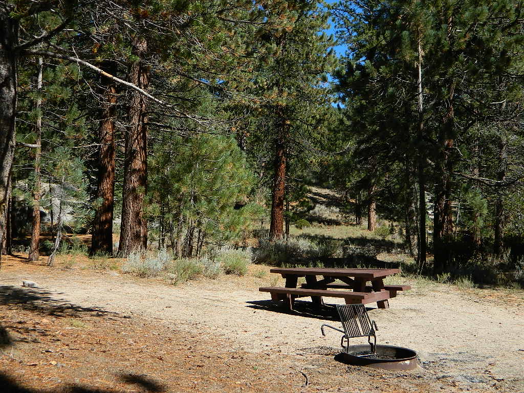
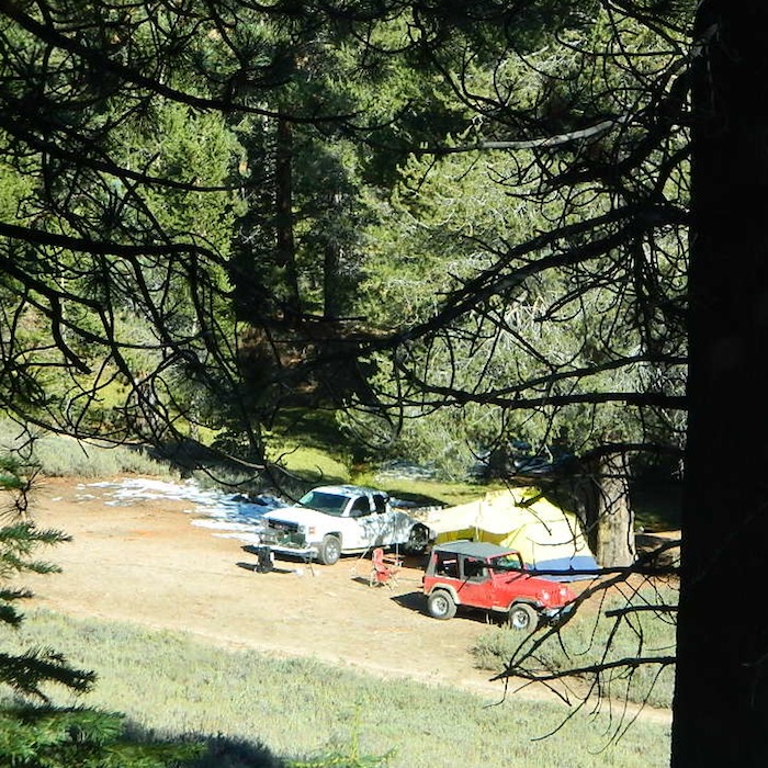
RV camping at it's best in the Sierra; This rig found themselves deep in the alpine lush meadows with towering trees and a view and a very private camp site.Big Bend Ranger Station, off I-80
Sequoia trees naturally grow in the Sierra Nevada mountains, on the west side of the range. Several parks & forests make up what is known as “the Sequoias” – in the Southern Sierra, Sequoia National Forest; Giant Sequoia National Monument; Mountain Home State Forest; Central Sierra is home to Sequoia National Park & neighboring Kings Canyon NP; Sierra National Forest & Yosemite NP. Yep, all those areas have Sequoia groves!
If you are searching for tallest species, the Coastal Redwoods located on the shores of Northern California, then you can find them over here – NorCal Redwoods
lake camp, hike, mountain bike, off-road, ski, snowmobile
Tahoe Trail Maps / Tahoe National Forest
Numerous State Parks dot the shoreline at Tahoe, while the National Forest lands and Wilderness Areas span most of the peaks above. Camping, backpacking, boating, kayaking, fishing, climbing, mountaineering, mountain biking, snow skiing, snowmobiling are all popular recreation in this Sierra region. US Highway 50 and Interstate 80 are the main western access routes to Lake Tahoe. US Hwy 395 leads to Tahoe, up from the Eastern Sierra and Southern California.
Wanna find every waterfall or every creek to fish? This is the place that will help you find them. Easily, with good old fashion printed maps. Hard copies, some waterproof & tear resistant, most with topographical data and all roads, trails, campgrounds and parks. Whether or not you water ski or cross country ski, these maps will save your ass – when you are way back there in the boonies.
Tahoe’s Rubicon Trail connects the historic Gold Country to the alpine lake via granite wilderness sky ways above 7000′ elevation, but a real 4×4 and overnights are required. The back roads and trails are endless in these parts of the Central Sierra Nevada mountains.
shop online with the links below and help keep this web site alive
maps, books, gear
outdoor person gift list
Over the decades Total Escape has seen many affiliate programs dissolve, but Amazon has always held true, which is why we still link to them. Follow links to the new shop pages!
Near the Pine Mountain Summit (elev 5080′) on California Highway 33, the small sign only reads PINE MTN and points east, to a rugged side road. By far one of the worst paved roads around.
This Reyes Pine Mountain, should not to be mistaken for the golf course community of Pine Mountain Club, many miles north of here, around the other side of Mount Abel.
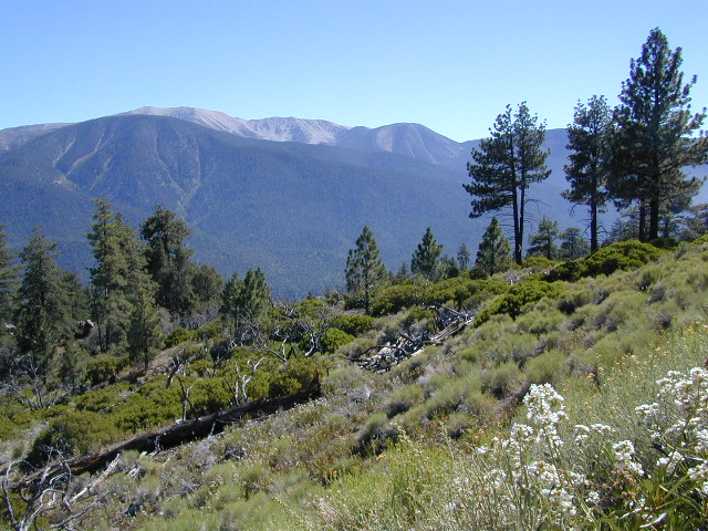
This is Reyes Peak, also known as Pine Mountain Ridge “north of Ojai”, on the sorta paved Pine Mountain Road. (Los Padres National Forest Rd # 6N06)
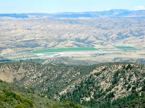
The view above is from one huge dirt pull out, on the left – over looking Ozena Valley, on the west end of Lockwood Valley Rd. Motorhomes, trailers, off-roaders and hunters like this as a last minute camp site, very close to the highway.
If your vehicle can endure 9 long miles of poor pavement, pot-holed roads, then maybe you can find seclusion back in the woods around here.
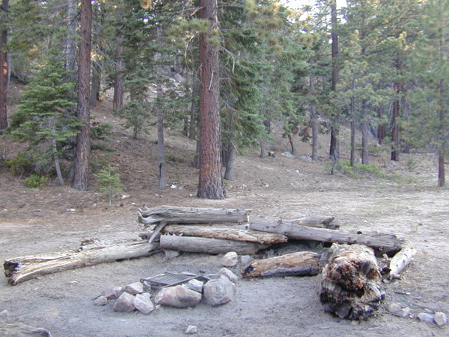
Six or more primitive campsites, spread out along a forested ridge line (around 5000′ elevation). Tables and fire rings only. No fees, no toilets. Bring a shovel and plenty water. No pipes, no running water up here.
The scattered camp sites are located far enough away from each other, that the location provides some privacy and still relatively close to town. Some sites are in forested settings, while others have big boulders, but are exposed to wind and sun. Although these few sky view camps are perfect for the stargazers.
Dark night skies can be okay, if the coastal fog stays low. Neighboring Mount Pinos is all paved – usually best choice for RV campers w/ telescopes, who need large areas of flat level ground.
One particular camp site is located at a very decent view spot. Boulders, pine trees and mountain views to the south. Click the image above to expand.
PRIMITIVE CAMPGROUNDS
Campfire permits are required.
The end of the road is a top destination LAUNCH spot for hang gliders & para-sailers. Watch them jump on YouTube compliments of DanaMite.
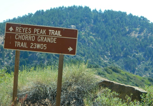
The hiking Trailhead for Reyes Peak and the Chorro Grande Trail #23W05 are also at the end of this dead end road #6N06. Reyes Peak Trail leads east, out to 7510′ elevation, overlooking the whole lower Los Padres region – Lockwood Valley, Ozena, Piedra Blanca, Sespe Gorge, Potrero Seco.
Get outside this weekend. There are no more excuses!
San Diego Backcountry
600,000 acres of SoCal desert
BLOOM: mid-March thru May Anza Park elevations range from low to high. Lowest near eastern border (next to the Salton Sea) to the upper reaches of the western slopes @ 4000′. Wide, deep, sandy, long desert washes, native petroglphs, wind caves, slot canyons and split mountain. This uncrowded state park has the most acreages than all of the parks.
OPEN CAMPING
Camp in a developed campground, a small back country site or camp primitive on nearly any dirt road. Car camping to 4×4, this park has lots to offer folks wishing to really escape. No ground fires allowed, so bring your metal campfire bucket and large trash bag to carry out your ashes. The last thing you want is to scar these pristine white desert washes.
DESERT WILDFLOWERS
Steep rocky canyons on the Laguna mountain foothills can be challenging terrain, so bring good, sturdy hiking boots. Wildflowers can be abundant on certain years. Lower elevations sprout up first; Higher elevations along County Rd S-2 & S-22 bloom later in Spring. By June 1st most of the color is gone in and around Borrego Springs, so this is a real Winter and Spring vacation kinda spot. California desert wildflowers include primrose, barrel cactus, prickly pear, monkey flower, ocotillo & many more.
This is the largest State Park in California and “open car camping” is allowed on the back roads. (also referred to as primitive camping, free camping or 4×4 camping) One of the few places in Southern California that you can camp outside of a developed Campground and still have a campfire. You gotta bring a large metal bucket to have your campfire in – as ashes scar white sandy washes and ground fires are not allowed.
The mysterious topographic map maker, Landon Crumpton, is gone. Although his Baja Almanac book of the Mexican peninsula is still as popular as ever.
The Total Escape crew has been using this amazing topo map for Baja Mexico since our the very first excursions in 1990. Click below to read more about the famous, hard-to-find Baja Almanac publication.
California Highway 78 cuts across Southern California and right thru the middle of the largest State Park in the lower 48. Anza Borrego Desert State Park is a place that must be visited more than once to really take in all the beauty it has to offer. Free camping in Southern California is abundant here, if you are willing to follow the primitive camp fire rules of the park and you are comfortable camping away from developed campgrounds.
North-South:San Diego County Road S2 skirts the western border with Laguna Mountain towering above. It starts at Ocotillo @ Interstate 8 and heads Northwest to Lake Henshaw at Warner Springs.
East-West: a major route S22, connects Ranchita /Montezuma Valley to the Borrego Valley, and continues East to the Salton Sea. The center of the parks is pretty much the town of Borrego Springs, where the State Parks visitors center is located. San Diego County Road S3 leads from Hwy 78 down the the town of Borrego Springs Valley.
free camping: While the camping facilities listed above provide picnic tables and toilets, or more luxury camping… Total Escape thinks the best part of camping in Anza Borrego Desert is the vast amount of free, open camping available on most back roads. Hundreds of dirt roads lead off in all directions, so you can find the peace and solitude that few inside busy campgrounds ever experience.
Many Anza desert routes are sandy washes, dirt roads, some for high clearance vehicles only, or 4WD in several canyons. Often there is no signs telling you need 4×4 to proceed. May only find out when its too late and you’re stuck.
Have a good dirt road map with you and know your vehicles limitations. Passenger cars should be very cautious off road. Cell phone coverage is spotty out here in the most remote wilderness areas.
San Diego Backcountry
600,000 acres of SoCal desert
BLOOM: February thru May Anza Park elevations range from low to high. Lowest near eastern border of park (next to the Salton Sea) to the upper reaches of the western slopes @ 4000′ of the Laguna mountains. Lower elevations sprout up first; Micro flowers, Easter-egg-color splendor in the dry washes. Higher elevations bloom later (along w/ areas on San Diego County Rd S-2, the Great Overland Stage Route)
Drive from Temecula to Warner Springs, and then proceed east – out to the Salton Sea via Back Road Highway #S22 (Montezuma Grade). A great route to take thru the Borrego State Park – for the full gamut in vegetation & altitude. Grapevine Canyon is an alternate off road route down a scenic canyon. Culp Valley has a small campground, plus lots of boulders and decent views to the Borrego Valley. Off the highway, on dirt, one-lane side roads lead to many primitive spots. Perfect for private picnics, stargazing or overnight camping.
Sierra Nevada North / Northern Sierra Nevada Mountains
the sierra buttes
Northern Gold Country, Yuba River
Sierra granite rock meets volcanic rock at Lakes Basin & Lassen NP
Some California maps consider Mount Lassen to be the top of the Sierra Nevada range, while other maps cut it off at Lakes Basin @ Sierra Buttes, much further south. Lassen Peak is actually part of the Cascade Range of mountains that go up the coast of the Pacific Northwest. Either way, we’ve included Lassen maps in this list.
Southern California / San Jacinto Wilderness Area / San Jacinto Mountain / Palm Springs Mountain Hike
The well-photographed snowy mountain backdrop behind the desert deluxe resort-land known as Palm Springs, Mount San Jacinto is the second tallest peak in Southern Cal.
Mighty San Gorgonio peak, across to the east – on the other side of the valley, is the very highest mountain in this desert region. Granite Jacinto peak is located in between the mountains of Idyllwild and the low deserts of Palm Springs.
Day hikes, picnic in the forest, backpacking, horseback rodes w/ SUPER easy access via the fantastic Palm Spring Tram ride, up to 8000′ elevation.
The San Jacinto Wilderness is managed by 2 different agencies: The National Forest Service and California Department of Parks & Recreation.
If you are camping overnight in the forest, you must get your wilderness permit from the agency that administers the area where you plan to spend the night. Day-use permits can be obtained on the day of your trip by visiting one of the ranger stations below. Day-use permits issued by either agency are honored by both, except during the busy summer months when permits to enter the Wilderness via Devil’s Slide Trail can be obtained only from the National Forest Service.
Camping permits can be obtained in advance by mail, in person, or online w/ PDF. National Forest Service accepts requests up to 90 days in advance; Mount San Jacinto State Park accepts them up to 56 days in advance. You can also get them on the day of your trip, if any are available at that time.
USDA National Forest Service
San Jacinto Ranger District
54270 Pine Crest Ave
Idyllwild, CA 92549
951-659-2117
Mount San Jacinto State Wilderness
25905 Highway 243
Idyllwild, CA 92549
951-659-2607
Old Greyback, San Gorgonio Mountain – as seen from forest road #2N93
Southern California /San Gorgonio Wilderness Area / San Gorgonio Mountain Peak Hikes / Backpack Gorgonio
The tallest mountain peak in Southern California towers over the often smoggy basin of the Inland Empire, Riverside & San Bernardino. Coachella Valley lies to the southeast. Joshua Tree National Park lies due east.
Old Greyback is a fitting nickname for the peak. The massive, bald, decomposed granite gravel paves the whole top layer, above treeline (altitude nearing 12,000 feet above sea level) and this impressive peak can be seen from most of the Los Angeles basin and the Palm Springs desert. The expanding view of the Pacific Ocean can be seen 70 miles to the west, but only if the skies are clear. Windy, winter days are excellent conditions for viewing, but plan your hike accordingly as this peak could be covered in deep snow during winter or springtime.
This is a very popular backpacking weekend trip to escape from the big urban populations. San Diegans and Angelinos can easily access this location in a few hours from home, via Interstate 10 and some mountain driving on a 2 lane highway.
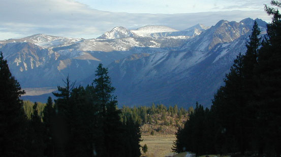
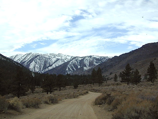
Rugged Sierra Nevada high country. The highest peaks in the Sierra Nevada mountains can be found inside this Wilderness. Many peaks are well above 13,000 feet. Granite, glaciated basins, big snow, alpine lakes, meadows, wildflowers, streams, creeks, cliffs, jagged peaks. Mount Whitney stands as the tallest mountain in the lower 48 states.
Hundreds of miles of hiking trails, some of the highest peaks in the nation. Trails open to equestrian and foot traffic only. Trailhead quotas limit the amount of day hikers and backpackers that an access the Wilderness daily. Wilderness permit required: Inyo National Forest Permits
Eastern Sierra Visitor Center Inyo Visitors Office
USDA National Forest
USFS, NPS, BLM
Eastern Sierra Interagency Office US Hwy 395 @ SR 136 Lone Pine, CA 93545 760-876-6200
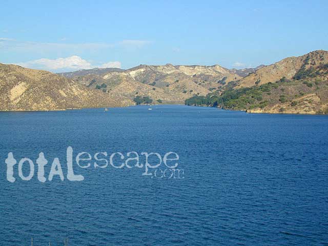
Mojave Reservoir @ Colorado River: AZ / NV / CA
@ the V, bottom of Nevada state = Arizona – Nevada – California, all merge together
The Colorado River travels through the southwest desert, splitting the Grand Canyon and further south, separating California from Arizona at the southern tip of Nevada. Agriculture lines the big river down to Baja, Sea of Cortez, Mexico.
Up near Las Vegas and down to Searchlight, NV
Above Hoover Dam is Lake Mead, sediment from Utah National Parks. Red dirt and silt shorelines. South of Hoover dam is a super deep rock gorge w/ hike-in hot springs. Beyond that, this beauty called Lake Mohave – with the super clear water, secluded coves and abundant fishing.
Lake Mohave: elevation 647′
Desert peaks in this region are around 2000-3000′ elevation. Mohave Lake is actually a wide section of the Colorado River, spanning the region from massive Black Canyon south to busy Laughlin w/ river casinos. This lake is long and skinny in spots with lots of shoreline cliffs, canyons and coves. Minimal vegetation, so please bring your own firewood and don’t chop down the few trees trying to survive. Summer temps exceed 100 degrees, so plan your visit for the winter time.
Lake Mohave Ranger Stations
Cottonwood Cove
Katherine Landing
boating, camping, fishing, hiking, hot springs, kayaking, off-road, picnics, viewpoints
El Dorado Canyon Road, main paved route can be accessed near California’s state border. North of Searchlight, Nevada – off main highway 95, on side route 165 to Nelson, NV
Secluded dirt roads up and down canyons near El Dorado Canyon Rd. Minimal vegetation, maximum open scenery and dark skies. Kayak rentals @ El Dorado Canyon.
desert badlands erosion
Ireteba Peaks Wilderness
4×4 camping routes: 15 day camping limit
Find your own route with many to choose from, drive the soft sandy washes (with a few boulders to dodge) and camp for free, right at the waters edge. Adventurers: Only for the self-contained campers. Some routes marked 4WD only, so pay attention to signs. AWD (all wheel drive) vehicles should fare well on the sandy roads; but standard passenger cars and vans will need to keep their speed up in the soft sand areas.
No garbage collection. Pack it in, pack it out.
No facilities, no fees. No buildings. No campfire rings, no picnic tables, very few vault toilets. Bring your shovel!
Driving off the roads is strictly prohibited. Primitive camp sites can be found both at numerous coves and also inland inside the canyons. The ridges get windy in the deserts, but are favorable for night sky views and self contained camper vans.
Always know the weather forecast, cuz flash floods are possible and these dirt roads will be impassible during big rain. This is the main drainage to the big river!
DRIVING TIPS
Most desert washes here are signed routes 4×4, but mini vans, AWD sport-wagons, trucks, SUVs, small RVs can all be found camping near Lake Mohave. That is – if you know how to ‘drive off road’, which is not fast, but not too slow either.
Avoid getting stuck in the deep sand: keep speed up, do not turn sharply and do not brake hard. Carry tow strap in case you need an emergency pull. Be nice to strangers and you may find help.
Campfires are allowed, but you need to bring firewood. Dogs are allowed. Party animals tend to trash these desert coves, so be warned that there is a fair amount of litter. Bring a black trash bag and take some out! This trash problem could get the area closed off to vehicles so keep that in mind.
The canyons here have giant power lines that cross @ Aztec Wash; they can easily be avoided.
4×4 recommended @ MOHAVE:
Eagle Wash Road #46 – popular spot
Montana Wash #45 – camping ok
Placer Wash #47 – no camping
The rangers don’t wanna be pulling your ass out of the sand, which is why they post the 4×4 signs. Don’t expect to find help without walking a few miles first, or waiting several hours.
desert wilderness
Several wilderness areas are located along the west side of this lake & river. Often dirt roads will parallel a portion of the wilderness boundary, providing excellent access to secluded coves and beaches. Emergency CALL boxes are placed in remote parts of these shores.
Ireteba Peaks Wilderness (northwest, next to El Dorado Canyon)
Nellis Wash Wilderness (western side)
Spirit Mountain Wilderness (southwest)
Bridge Canyon Wilderness (southwest, near Laughlin)
COTTONWOOD COVE
developed campground, boat launch, marina, lodging, hiking, picnic areas
LAUGHLIN, NV
Nevada, California and Arizona states join down in this part of the world. Katherine Landing, full service marina, slip rentals, lodging, city services and casinos.
Mojave Desert – This river-created lake is located on the Colorado River, in between Las Vegas, Nevada and Needles, California. The river water here is crystal clear, very swimmable and the fishing is decent. No paved boat ramps
nearby towns: (with elevation)
Avi Casino
Bullhead City, AZ (540′)
Laughlin, NV (535′)
Kingman, AZ (3340′)
Needles, CA
Nelson, NV (2954′) Nipton, CA (3042′) Oatman, AZ
Searchlight, NV (3470′)
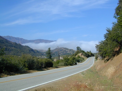
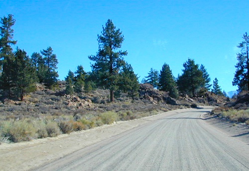
California back roads are plentiful, beautiful and exquisitely wonderful – if you know where to look.
Off Road typically means “off the pavement”
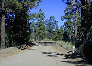
While many argue the phrase “off-road” means only hard core 4×4 routes, rock crawling or rally racing, here at Total Escape, any road that is not paved is a dirt road and “off road” to us, and always well worth exploring. Graded dirt roads, gravel roads, access roads, washboard routes, forest roads, fire roads, secondary roads, desert washes, one laners, single tracks, OHV trails – can all be dirt roads.
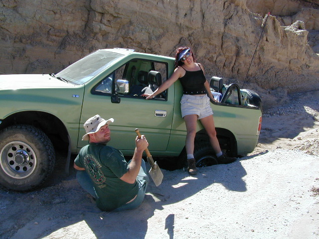
Whether or not your vehicle can handle them is your decision, but believe me, you do NOT need a modified Jeep to start your adventuring. Most dirt roads can easily be accessed with a normal passenger car – if you pay close attention to terrain, deep mud ruts and the rocks in the road.
Vehicle clearance is usually the first thing that will have you hesitating. If you own a truck or SUV – this is enough to be considered a “high clearance vehicle” and good to go on 90% of dirt roads in Cali. Many dirt roads will become 4×4 required or recommended when mud or snow are present, and no signs to warn you, so always check the weather forecast in advance. And most importantly, BRING A REAL MAP.
Paper Maps vs. Online Maps
Driving on Interstates and state highways is one thing, exploring and discovering new routes and real sightseeing is another animal all together. Go prepared to be delayed: to stop and sit, to listen to the wind, to picnic outside, to watch the weather change, photograph the clouds forming above your head, enjoy the process. Remember the journey: Half the fun is getting there!
If you’ve ever tried to travel across the state with a GoogleMap, YahooMap or MapQuest one page printout, you will soon realize the limitations. Stuck in a small town called Julian, at night, on Christmas Eve, arguing with your partner, trying to find your way over to Interstate 10. Not a good plan! A statewide atlaswill save you from many unexpected route changes, as well as prove to be an invaluable tool while traveling. Free as a bird, ready to explore the open road and well prepared is the key to less stress in route.
Know your vehicle limitations, and if in doubt, pull over, get out and look. Examine the ruts, the mud depth, the height of the rocks. Sometimes a good camp site is dependent on how far up that dirt road you can drive. RV campers like to stick to the wider, graded dirt roads and plenty can be found on typical topo maps. Tom Harrison, National Geographic & National Forest maps all have dirt roads as well as trails, trailheads, campgrounds listed.
Nearly every map sold on Total Escape has dirt roads noted:
US National Forest Maps have all the main routes, the dirt roads and some main hiking trails. Trailheads, ranger stations and campgrounds are well marked.
CA Wilderness Map collection have the topographical features you will need to hike the region, peaks, streams, and all dirt roads leading up to the trail heads. Nearby campgrounds will be shown. Equestrian (horse back riding) is okay, but no mountain biking is allowed inside these Wilderness Areas.
OHV Routes & Maps will display the “off highway vehicle” routes, which include single tracks for dirt bikes/motorcycles, wider routes for quads and all roads rated for 4×4 only use. Several selected maps will also show hiking biking and equestrian routes.
Recreation Maps can feature various types of activities all on one map, from off-roading to snowmobiling, river rafting to waterfalls. These maps cover a smaller area or popular region to enjoy.
dirt roads lead to:
canyons
caves
creeks
dirt bike trails
fire lookouts
fishing holes
forests
groves
hiking trails
horseback trails
hot springs
meadows
mountain biking trails
mountain peaks
off-road trails
petroglyphs
picnic sites
ranches
rafting spots
rivers
scenic viewpoints
secluded campsites
small campgrounds
swimming holes
trailheads
waterfalls
wildflowers
Salmon Creek, Kern Plateau –
Sequoia National Forest
Looking to stay away from the masses camping at the Kern River?
Horse Meadow Campground can be found on the east side of the Kern River, up on the Kern Plateau. Up the infamous, steep and rugged Shermans Pass Road. How exciting!
Climb the hill slowly and cautiously, no guardrails. Up the grade, Shermans eastbound – out of the dryness of the Kern canyon. Find Cherry Hill Road, that is also the Big Meadow turn off: Forest Road# 22S12, a long, narrow dirt road leads from paved Shermans Pass Road, 10 miles out to this ideal campground. Far enough off the main road, so you won’t see much of a crowd out here.
Hunters, horse campers and hikers really like this spot. Mountain bikers are known to frequent the region as well. Forest, meadows, trails, creeks, nature, all around. Dome Land Wilderness is close by; Waterfalls hikes, swimming holes, viewpoints. Fishing, hunting, horseback trails. Dirt roads and single track trails all over – all within the vicinity of Big Meadow.
From the main Rd #22S12, the camp access road #23S08 will lead out to the NFS Campground – HORSE MEADOW. Located at higher elevation forests – 3000′ feet higher than the Kern River!
Nice forested, high country camp spots in a developed campground. The long, access road is worth it for all the scenery and seclusion. Vault toilets, piped water, maybe a small fee. Open summer into autumn, closes for winter months.
Horse Meadow Campground
• Elevation: 7600′
• Number of Sites: 41
• Vehicle Access: RV 23′ max
• Campsites Reservation: No
• Camp Fee: Yes
• Length of Stay: 14 Days
• Season: June – November
• Trailheads: Salmon Creek
Developed Campground @ Salmon Creek Trail #33E36. Hiking trailheads lead off to various destinations like, Salmon Creek Falls, Big Meadow, Cannel Meadows and Dome Lands.
SUMMERTIME: If you are coming in from Kennedy Meadows on the EAST (or the Mojave desert US 395) – first verify that the Sherman Pass is OPEN for through traffic. Ask road conditions with local rangers ahead of time. ANY amount of snow will close this whole paved route for the winter season, up until June sometimes.
Over 30 miles (one way) to the nearest general store for supplies. Pack ‘block ice’ in the cooler, instead of cubes.
Big Meadow: Forest Road# 22S12 – Sequoia National Forest
Take Sierra Hwy. N of Kernville, past Fairview & over the Johnsondale bridge; Right turn on Sherman’s Pass Road & drive up to a signed intersection (near a snow gate). NOTE: This area may not be accessible during winter months.
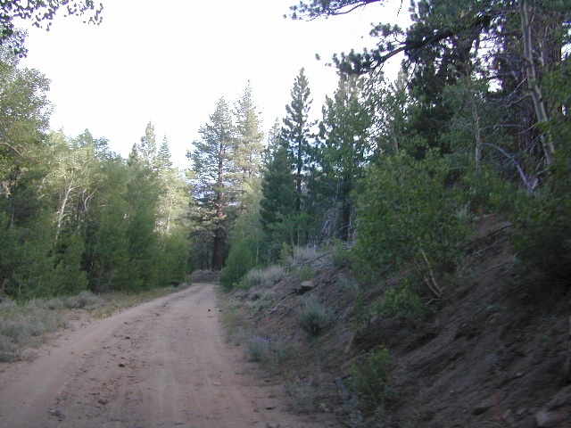
Turn right on Big Meadow Road, aka Forest Service Rd# 22S12. This is a very long road which is paved for the first few miles. 22S12 becomes a graded dirt road, suitable for horse trailers; it forks off to other smaller dirt roads, as it progresses through the forests & dead ends back by Cannell Meadow. The main routes are passenger car accessible, but some of the smaller dirt roads can get quite bumpy. A truck or SUV would be advisable to explore these secondary routes. Certain areas have suffered from wildfires 2000-2002.
Horses & equestrian camping are very popular in this region. There is also a fair amount of backpackers heading into the Domeland Wilderness and mountain bikers looking for premium backcountry rides, away from the crowds at the Kern River.
NFS developed Horse Meadow Campground can be found on the right via road# 23S08. Located at 7400′ elevation w/ 41 spots, in the forest. Trailhead to Salmon Creek leads directly from camp.
SPUR – side routes include:
#23S14 Cherry Hill – a few camp spots near creek & a meadow with views at the very end
#23S41 Poison Meadow
#23S13 Salmon Creek
#22S07 Big Meadow – loop road around the “Big Meadow”. Plenty of primitive camp sites around Big Meadow, but they are the first ones to fill up during a popular summer weekend. The region is perfect for backpackers or day hikers wanting to access Manter Mdw. & the Domelands Wilderness.
#24S13 feeds the last stretch of road to Rattlesnake Meadow. Taylor Creek near 24S43, features numerous waterfalls leading to the South Fork of the Kern River
#24S12 Cannell Meadow & Pine Flat. The Cannell Meadow National Recreation Trail runs thru here, from Big Meadow down to Kernville, CA.

 BACKPACKERS BACKPACKING MAPS –
 CAR CAMPING MAPS –
 CALIFORNIA OFF ROAD MAPS –
 CALIF CAMPGROUND MAPS –


 . The center of the parks is pretty much the town of Borrego Springs, where the State Parks visitors center is located. San Diego County Road S3 leads from Hwy 78 down the the town of


 Lake Mohave Ranger Stations


 If you’ve ever tried to travel across the state with a GoogleMap, YahooMap or MapQuest one page printout, you will soon realize the limitations. Stuck in a small town called Julian, at night, on Christmas Eve, arguing with your partner, trying to find your way over to Interstate 10. Not a good plan! A


