Tag Archives: hiking

Lassen Forest Roads

Lassen Backroads

Lassen National Forest roads and trailheads, surrounding Lassen NP

Lassen Forest

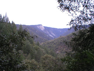
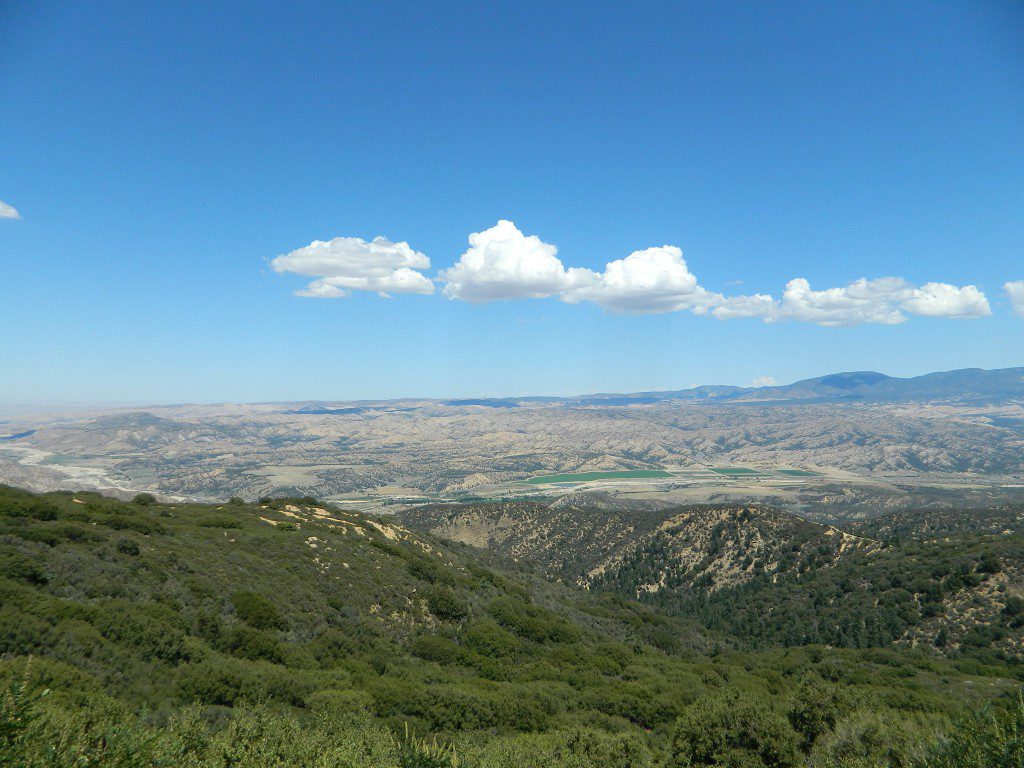
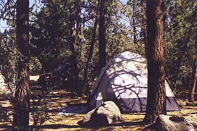
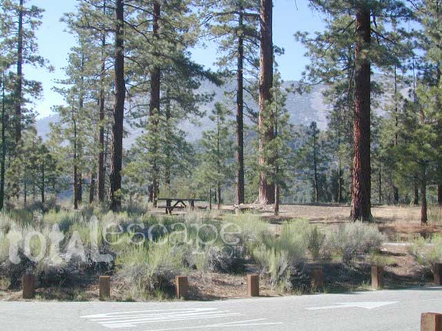
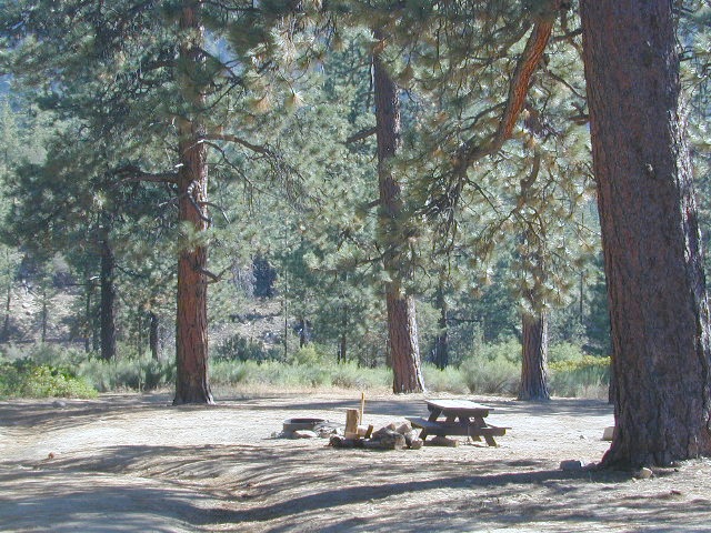
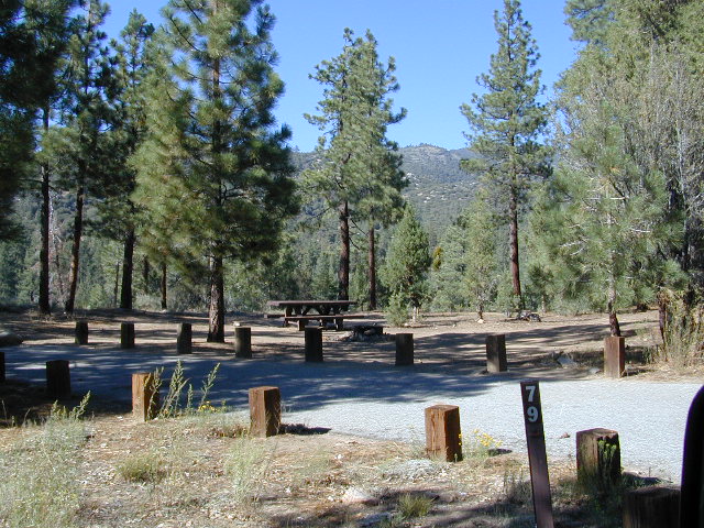
Lassen National Park is completely encompassed by National Forest land with dirt roads, off road trails, serene lakes, secluded camp sites, hiking trailheads and wilderness access

California State Route 89 (highway 89) runs north/south thru the middle of the park and closes for months due to winter snow.

California State Route 36 (highway 36) runs east/west on the south side of the National Park, connecting Red Bluff to Susanville, CA

California State Route 44 (highway 44) runs east/west on the north side of the National Park, connecting Redding to Susanville, CA

camp

East of Lassen National Park

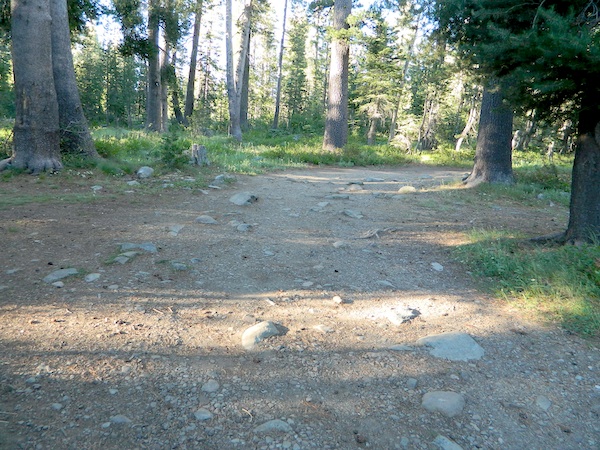
Lassen Forest Road #10
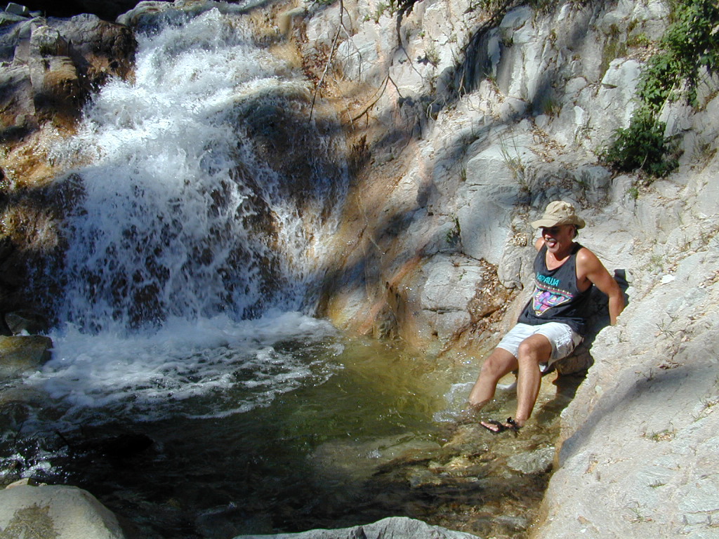
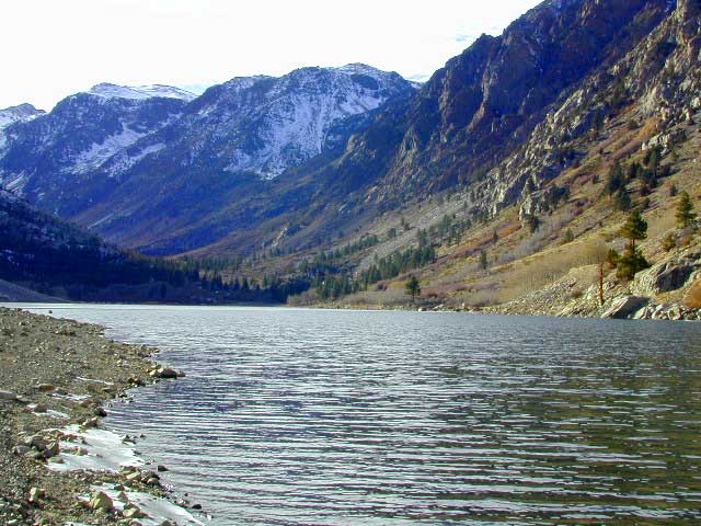
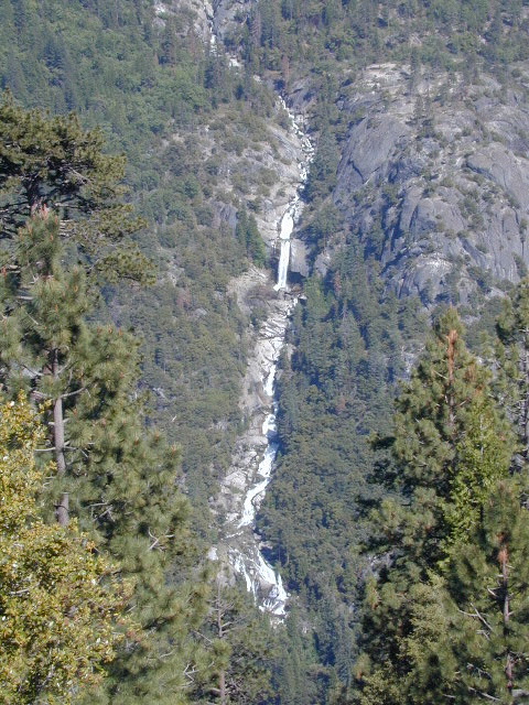
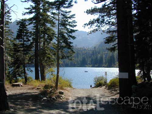
Echo Lake, Silver Lake, Caribou Lake. Campgrounds, trailheads, backpacking, day hikes, parking, equestrian.

Crater Lake on the north side of Hwy 44

Lassen Forest Road #318
Juniper Lake Road (aka Chester Juniper Lake Rd)
N of Chester, CA
paved first 5 miles, then becomes graded dirt road for another 5.

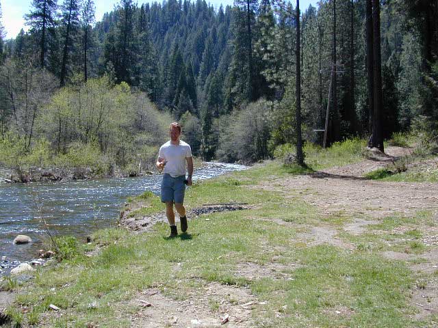
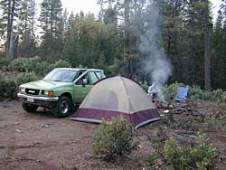
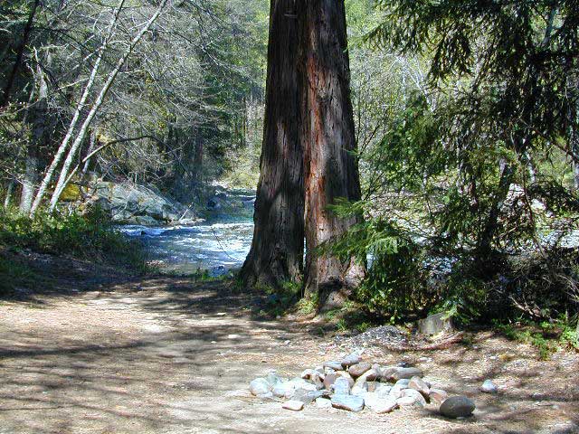
Benner Creek runs along the first half of this route w/ Banner Creek Campground: elevation 5562′ / 9 camp sites / open May-Nov

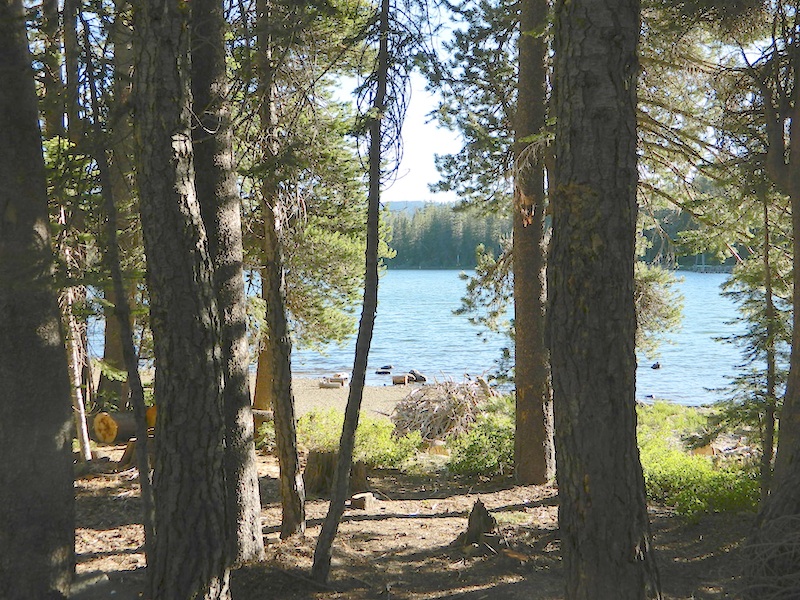
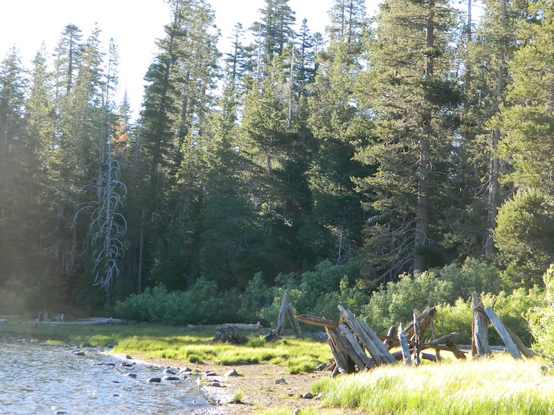
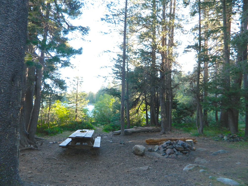
Juniper Lake at end of road w/ NPS campground
elevation 6792′ / 18 camp sites / open June-Sept

Lassen Forest Road #312
Warner Valley Road (aka Drakesbad Road)
N of Chester, CA
10 miles long, paved most of the way, then becomes graded dirt road out to Drakesbad meadow.

Lassen Forest Road #311
W of Chester, CA

Wilson Lake Road, connects Hwy 36 to Road #312
Domingo Springs Campground: elevation 5060′ / 18 camp sites / open May-Nov

fish

Lassen Road #29N18
W of Chester, CA
Loop route off Forest Road #311 w/ North Fork of the Feather River, leading to Elizabeth Lake trailhead

Lassen Road #29N19
W of Chester, CA
Graded dirt road w/easy access. Connects Forest Road #311 to highway, paralleling Hwy 36. Lost Creek runs along this route w/ Willow Springs Campground: elevation 5100′ / 14 camp sites / open May-Nov

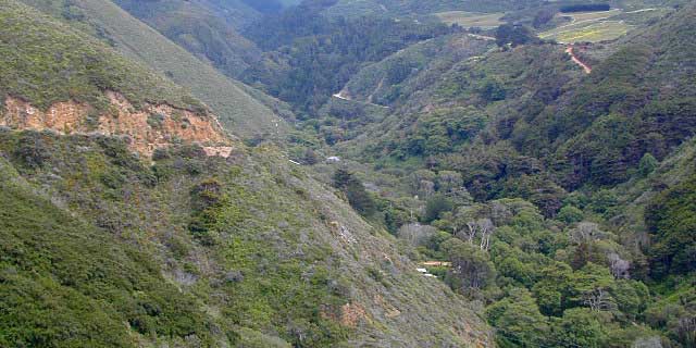
West of Lassen National Park

Lassen Forest Road #17
W of Lassen NP
North-South dirt road that connects highway 36 to highway 44.

Heart Lake trailhead
At the south end on Hwy 36 is Battle Creek Campground: elevation 4800′ / 50 camp sites / open April-Oct

Lassen Forest Road #29N22
Mineral Road connects Hwy 89 to Viola on Hwy 44
McGowan Lake Winter Recreation Area at South entrance of Lassen National Park

nlassen
Camping North Lassen

North of Lassen National Park

Lassen Forest Road #32N13
Lassen Forest Road #32N22 (PCT crosses this route)
Twin Bridges networks dirt roads @ Hat Creek.
near Old Station Visitors Center (junction Hwy 89 & 44).

Hat Creek and Cave Campground on highway 89, Big Pine Campground off highway; Numerous dirt back roads for dispersed camping, near the viewpoint on highway 44

Road #32N20
Road #32N56 – road just south of Subway Cave near Old Station, off SR Hwy 44 lead to small Baker Lake.

Road #32N92Y side route leading from Hwy 44 to Road #32N21 along Butte Creek.
Butte Lake Ranger Station and Butte Lake Campground: elevation 5600′ / 20 camp sites /open May-Oct

Road #32N09 connects Forest Road #10 to Widow Lake trailhead and Butte Lake.
Road #32N60 is Bogart Winter Recreation Area, at Hwy 44

Hat Creek Lassen Road #18 runs north/south along Hat Creek Rim. Dirt road parallels Hat Creek Valley on the east side of Hwy 89
Road #22 connects Hwy 89 to Hat Creek Rim. A popular hang glider launch area after the University of California Radio Astronomy Observatory, then the road continues eastbound to cross Pittville Rd #111 and ends up at Little Valley

Lassen NF Road #111 is Pittville Rd, runs north/south paralleling Hat Creek Rim to the east side. This 30 mile long route connects Hwy 44 to Pitt River at Hwy 299 near Fall River Mills, CA
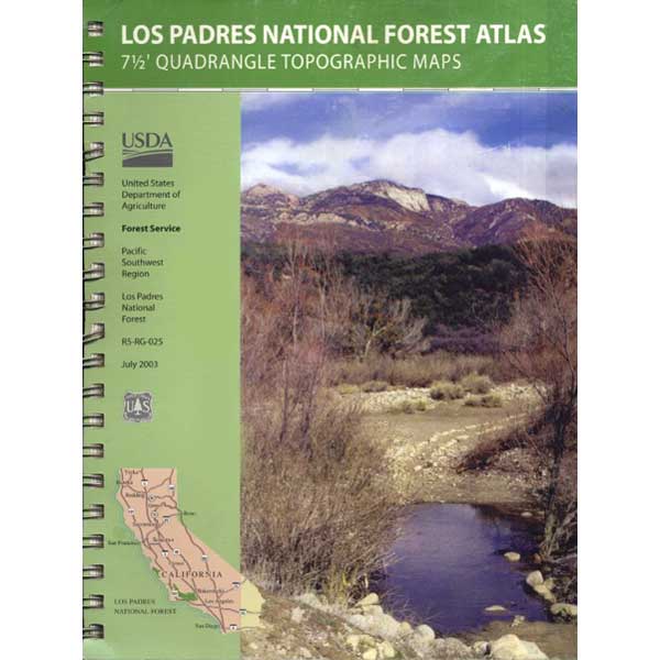
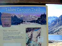
LASSEN MAPS

Lassen Camping for Free, Mill Creek @ 172
Lassen Camping for Free on Mill Creek

campfire

see also – Thousand Lakes Wilderness & Lassen Lakes

Dome Trail 3

Dome Trail

Dome Trail Hike
near Bald Rock in Berry Creek

Plumas National Forest Trail #6E21
Access Road #21N51Y
Middle Fork – Feather River
Sierra Nevada mountains @ Berry Creek, CA

On paved Bald Rock Road a rusted metal sign reads “Dome Trail 3” which is where the fun begins, on the dirt.

3 mile drive to trailhead from pavement
4.6 miles RT hike
w/ a 2000 feet elevation drop to the river

Plumas Forest Rd #21N51Y is located in the forested community of Berry Creek – opposite from Upper Zink Road. Road 21N51Y becomes Bean Creek Rd #21N36: The forested route passes a few private properties and gates, the dirt road leads 3 miles down to an old wildfire (2008) burn area and eventually dead-ends at the Dome trailhead. The hiking trail descends down while overlooking the Bald Rock Canyon with the Middle Fork of the Feather River.

Rated as a moderately difficult hike: Steep hillsides, plenty switchbacks, downed trees across trail, boulder hopping, cliff edges, extreme heights and rock slides. Delighted by dozens of wildflowers, the old metal staircase still in use, steel pipe railings and the minimal fencing and of course, the big river deep inside an impressive rock canyon. Sierra Nevada spectacular!

Trailhead Parking

Indian Creek spills down into Curtain Falls up the canyon, sometimes within view. Secluded Milsap Bar Campground is also up the river from here. The stretch of the whitewater river is popular with rafters and kayaks. Rock climbers gravitate to the big walls above. Bring a picnic lunch and water filter for this amazing all day hike.

Granite Domes & Bald Rocks

P4080034.JPG

There are numerous granite domes and bald rocks within the Plumas National Forest, most located near the big river canyons. This particular granite dome is situated overlooking the Middle Fork of the Feather River, and it is called Bald Rock Dome w/ 3509′ elevation.

MIddleForkFeather

Not to be confused with another shorter hike nearby on Bald Rock Road at a well marked trailhead for Bald Rock, which over looks the forest and valley to the west side. The official peak is named “Big Bald Rock” as listed on most maps.


Los Padres Topo

Los Padres Monterey

Los Padres National Forest Maps

Los Padres atlas
Los Padres National Forest USDA Topographic Atlas

7 minute QUADS (topo maps) inside a spiral bound book. Covers both north & south part of Los Padres National Forest. This map book can be found at ranger station – Los Padres USFS or click the book above to take you to the Total Escape Map Shop!

Los Padres Monterey Los Padres Ojai

Waterproof plastic map; USDA National Forest Service Maps

Additional topo maps for Los Padres region –

Forests

see more about Los Padres National Forest

Big Sur Coast

dirtbikeshiker

Links for Los Padres National Forest destinations

hwy33overlook
North of Ojai, CA – Highway 33 winds up to Los Padres NF

Hiking Trails Los Angeles

Los Angeles Hikes, Angeles National Forest, Angeles Crest, Baldy, Wrightwood, Palmdale, Tujunga, Frazier, and Malibu Coast

DSCN0048
You relocated to California for college or your career – and to enjoy the outdoors more, but you ended up in the Los Angeles Basin instead, breathing smog daily. You will need to escape – soon, for sanity sake.

check

Total Escape – this is your new favorite web site on California outdoors. Bookmark it dude. And be proud to love nature!

PCT hikes – Pacific Crest Trail
The world renowned  hiking trail that runs the entire length of the entire West Coast US. Canada to Baja, by way of Washington, Oregon and California – all on foot.

More PCT MAPS: Pacific Crest Trail Maps

Mount Pinos Recreation Area

Los Angeles Hiking Maps

th_angeles_d

Angeles Front Country
Angeles High Country
Angeles National Forest
Channel Islands Map
Cucamonga Wilderness
Dick Smith Wilderness
Joshua Tree Park Map
Los Padres National Forest Map
Malibu Creek Map
Mojave Preserve Map
Mount Baldy Map
Mount Wilson Trail Map
Pacific Crest Trail Maps
Point Mugu Map
San Bernardino National Forest Map
San Berdoo Mountains Maps
San Diego Backcountry Map
San Gorgonio Wilderness Map
San Jacinto Wilderness Map
Sespe Wilderness Map
Topanga Trail Map
Verdugo Mountains Trail Map
Zuma / Trancas Canyons Map

pinetree

And when you finally get bored with hiking only in Southern California, there’s a whole lot more California to explore – up state!

NORCAL – Well beyond San Francisco and Yosemite, there are meadows to be found. Seclusion and tranquility in nature, without the crowds. Too many dirt roads to drive and dozens of rivers to see. Waterfalls abound, with wildflowers and amazing scenery all around. Small towns to discover!

Fly fishing rivers, kayaking lakes, wineries, organic farms, geysers, volcanoes, caves, old bridges and so much more to find in NorCal.

DanaMite loves to cover the real nooks and crannies of California, just for you – right here on Total Escape.

hiker

Dick Smith Wilderness

Santa Barbara Mountains
Ojai Backpacking, Ventura, CA

old cabin cuyama
Old Cabin at Cuyama Peak Fire Lookout, Dick Smith Wilderness Area in the background

64,800 acres

30 miles N of Ojai, CA
Los Padres National Forest

Dick Smith Wildernessreyes lift off

  • backpacking
  • camping
  • hang gliding
  • hiking
  • horseback riding
  • parasailing
  • OHV trails nearby

Los Padres National Forest – Located in between the Santa Barbara coastline and the Cuyama Valley, this coastal wilderness area is situated miles north of Ojai, off Highway 33.

The Dick Smith Wilderness is where the San Rafael Mountains and the Sierra Madre Mountains merge on the east side, next to Pine Mountain Summit (elevation 5080′ @ highway).

This PINE MTN turn off should not to be confused w/ the Pine Mountain Club, on the north side of Cerro Noroeste.

Significant mountain peaks within Dick Smith Wilderness Area:

Big Pine Mountain – 6828′ elevation
Cuyama Peak – 5875′
Lizard Head – 5350′
Madulce Peak – 6536′
Samon Peak – 6527′

Closer to Ojai, Matilija Wilderness is on the southern boundary of DickSmith and the San Rafael Wilderness sits to the west side. Native American petroglyphs can be found in this mountainous region.  Access to “Painted Rock” on the Sierra Madre ridge, via Road #32S13 (which has a locked gate on both ends), is a long one so you might want to bring the mountain bike. The dirt road hike is about 10 miles (one way) and it starts at the Santa Barbara Canyon trailhead. If you plan to visit the rock art from the west side – take the dirt road up past Bates Canyon Campground. The turn off on Hwy 166 is called Cottonwood Canyon. Park at the hog pen trailhead and follow Road #32S13 for miles.

Dick Smith Trails
hiking trailheads –

  • Chorro Grande (Hwy 33)
  • Potrero Seco (Hwy 33)
  • Santa Barbara Canyon (Hwy 166)

 area campgrounds –

 nearby towns –

more Ojai camping

ojai backpacking

Dick SMith Wilderness

Ozena Valley Badlands

Eastern Sierra Camping

tallpeaktower

Inyo Forest Campgrounds – Eastern Sierra Campgrounds

areas include: Lone Pine, Mount Whitney, Independence, Onion Valley, Ancient Bristlecone Pines, Big Pine, Bishop [Hwy 168], High Sierra, Owens River, Lake Crowley, Rock Creek, Mammoth Lakes [Hwy 203], June Lake Loop [Hwy 158], Lee Vining & East Yosemite National Park [Hwy 120]. Camping on Eastern Sierra Highway 395

Eastern Sierra recreation – backpacking, horse packing, day hiking, creek fishing, mountain biking, mountaineering, rock climbing

Listed below are Inyo National Forest campgrounds, County Parks, BLM public camps for outdoor recreation. Many campgrounds are closed for winter months. Blue links lead to more camp information. Boldface links to detailed information & photos on campground.

campground elev spots veg toilet water notes
Agnew Meadows 8400′ 21 pines chem piped Mammoth; Jun-Sept
Baker Creek Campground 4100′ 40 cottn vault no Big Pine, BLM; RV 30′
Big Bend Campground 7800′ 17 pines vault piped Lee Vining, April-Oct
Big Meadow 8600′ 11 pines flush piped Rock Creek; May-Oct
Big Pine Creek 9000′ 30 pines vault piped W of Big Pine; May-Oct
Big Trees Campground 7500′ 9 pines flush piped W of Bishop ; April-Sept
Bishop Park Group Camp 8400′ 20 pines flush piped No RVs;
Bishop Creek
Crowley Lake Camp 6800′ 47 sage vault piped BLM Camp; Apr-Oct
East Fork Campground 9000′ 133 aspens flush piped fishing camp Rock Creek
Ellery Lake Campground 9500′ 12 pines flush piped E Yosemite; June-Oct
Forks Campground 7800′ 8 pines flush piped W of Bishop,; April-Oct
Four Jefferey 8100′ 106 pines vault piped W of Bishop; April-Oct
Glacier View Campground 4000′ 40 cttnwd flush piped Big Pine, CA; open all yr
Goodale Creek 4000′ 43 cttnwd vault no BLM Camp; April-Nov
Grandview Campground 8600′ 26 pinyon vault no Ancient Bristlecone Pines
Grays Meadow 6000′ 52 pines flush piped W of Independence
Gull Lake Campground 7600′ 11 aspens flush piped June Loop; April-Nov
Hartley Springs 8400′ 20 pines vault no Glass Creek, June-Oct
Horseshoe Meadow 10,000′ 10 pines vault piped 1 day limit; horses; More
Horton Creek 4975′ 49 pines vault piped BLM Bishop; May-Oct
Independence Creek 4000′ 25 cottn vault no Independence, BLM; RV 30′
Intake Campground 7500′ 8 pines flush piped W of Bishop; April-Oct
Iris Meadow Campgr 8300′ 14 pines flush piped W of Bishop; May-Oct
June Lake Campground 7600′ 22 pines flush piped fishing/hiking
Junction Campground 9600′ 13 pines vault lake E Yosemite; June-Oct
Lake George Campground 9000 16 pines flush piped fish, June-Sept
Lone Pine Campground 5500′ 43 pinyon vault piped W of Hwy 395
McGee Creek 7600′ 26 aspen flush piped Tom’s Place, Hwy 395
New Shady Rest 7800′ 94 pines flush piped Mammoth, in town
North Lake Campground 9500′ 11 pines vault piped W of Bishop; June-Oct
Oh Ridge Campground 6000′ 148 pines flush piped June Lake
Old Shady Rest Camp 7800′ 51 pines flush piped Hwy 203, Mammoth
Onion Valley Campground 9000′ 15 aspen vault piped High Sierra access
Palisade Campground 8600′ 5 aspen flush piped Rock Creek; May-Oct
Pine City Campground 8900′ 10 pines flush piped Lake Mary, June-Sept
Pine Grove Campgr 9300′ 11 pines flush piped May-Oct
Pleasant Valley Res. 4500′ 75 sage vault piped BLM, US 395; open all yr
Pumice Flat 7700′ 17 flush piped June-Sept
Reversed Creek Campground 7600′ 17 aspen flush piped June Loop; May-Oct
Rock Creek Lake 7600′ 25 aspen flush piped Tom’s Place; May-Oct
Sabrina Campground 9000′ 18 pines vault piped W of Bishop; May-Oct
Saddlebag Lake 10,000′ 20 pines vault piped highest camp; June-Oct
Sherwin Creek Camp 7600′ 87 pines flush piped Mammoth Lakes
Taboose Creek 3900′ 55 shade vault stream Big Pine;
open all yr
Tinemaha Creek 4400′ 55 shade vault stream Independence, Inyo Co Park
Tioga Lake Campgr 9700′ 13 pines vault piped fish Yosemite, June-Oct
Tuff Campground 7000′ 34 pines flush piped Rock Creek; RV 22′
Tuttle Creek 5120′ 83 sage vault seasonal Lone Pine; open all yr
Upper Pine Grove 9400′ 8 pines piped May-Oct
Upper Sage Flat 7600′ 21 pines vault piped W Big Pine; April-Oct
Whitney Portal Camp 9000′ 44 pines flush piped Trailhead; May-Oct
Whitney Trailhead 9000′ 10 pines vault piped Trailhead; May-Oct

sunsetgrandview

see Group Campgrounds in Inyo National Forest, Eastern Sierra

8

Eastern Sierra Vacation, see also –

Topo maps, wilderness hiking maps, fishing maps
Equestrian trails, 4×4 routes, OHV maps –

Twin Lakes
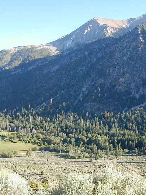
Eastern Sierra communities include:

Dogs in Lake

California Meadows

Cherry Mdws

California Meadows

California meadow is a common term people search for when dreaming of their mountain retreat vacation or upcoming weekend camping trip.

Meadows are places in the forest where cool air collects and settles. Deer among other wildlife, can often be found here grazing around dawn and dusk. Alpine meadows are usually surrounded by trees with lush green grasses, located at higher altitudes above 6000′ – the ‘highcountry’ as most like to say.

Find meadows on National Forest lands from 3000-10,000′ elevation, and it is not uncommon to see cattle grazing in these same regions. California National Parks have some of the most protected meadows in the golden state!

MT SAGE – mountain sage meadows

High desert mountains have drier landscapes, with large sage brush meadows surrounded by sparse pinon pine and/or juniper forest. The Mojave desert’s sagebrush reaches out westward to the peaks of West Kern County. High deserts and mountain meadows can both have significant wildflower blooms. The deserts start to show color in March & April, while the highest elevations of the Sierra Nevada can bloom as late as July & August. All California Wildflowers depend on autumn seasonal rains & snow melt.

Kennedy Meadows from Bald
Kennedy Meadows from Bald Mountain Fire Lookout

Wilderness Meadows

The best places to find secluded wildflower meadows is on the high country trails of various mountains – Mount Pinos, Sierra Nevada, Shasta, Trinity & Lassen – all have marvelous meadows, some have easy access w/ parking nearby and others are hike-in only. Locate hiking trailheads for meadows and possibly find camp nearby.

Excellent near Meadows:
Stargazing, Wildflowers, Wildlife Viewing, Horse Camping

Explore dirt back roads of California to find your very own meadow. If you would like to explore at this level, a good topo map is highly advised. The Sierra Nevada mountains have the most beautiful meadows in the state (by far). Their scenery w/ granite outcroppings and wild flowers, surpasses all else. Although on rare occasions, even the Antelope Valley can look amazing — with poppies.

Common Wildflowers

BEST PLACES TO FIND MEADOWS

Lupine Drive

Rules of the Meadow

Mountain Meadows are sacred spaces: Do not disturb the lush, grassy landscape, as wildlife rely on these areas for survival.

No driving on meadows. No camping on meadows; No Campfires; Camp next to (or nearby), but not on top of the meadow. Picnicking should be kept on the sidelines.

4x4
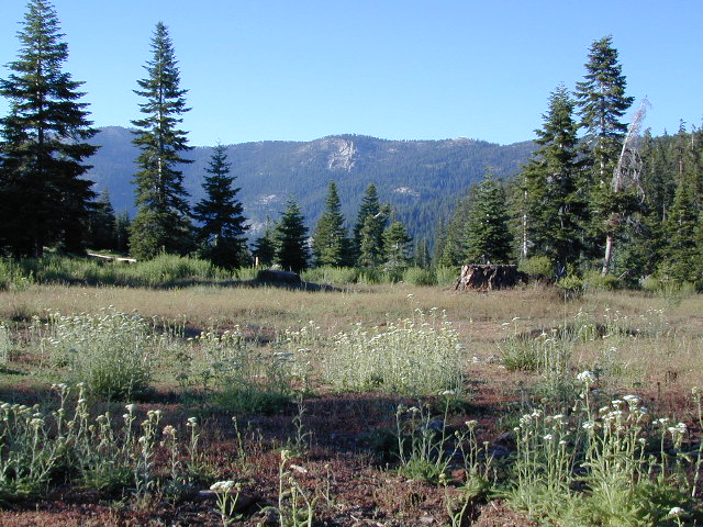
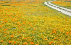
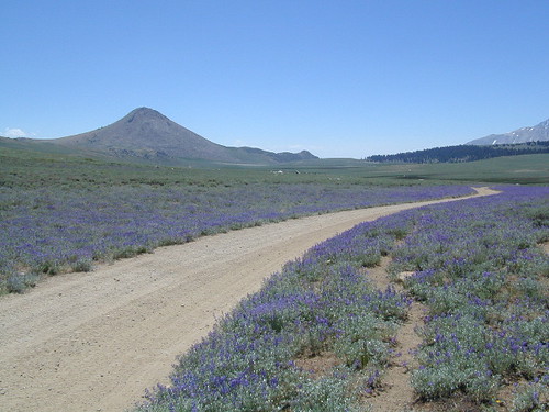
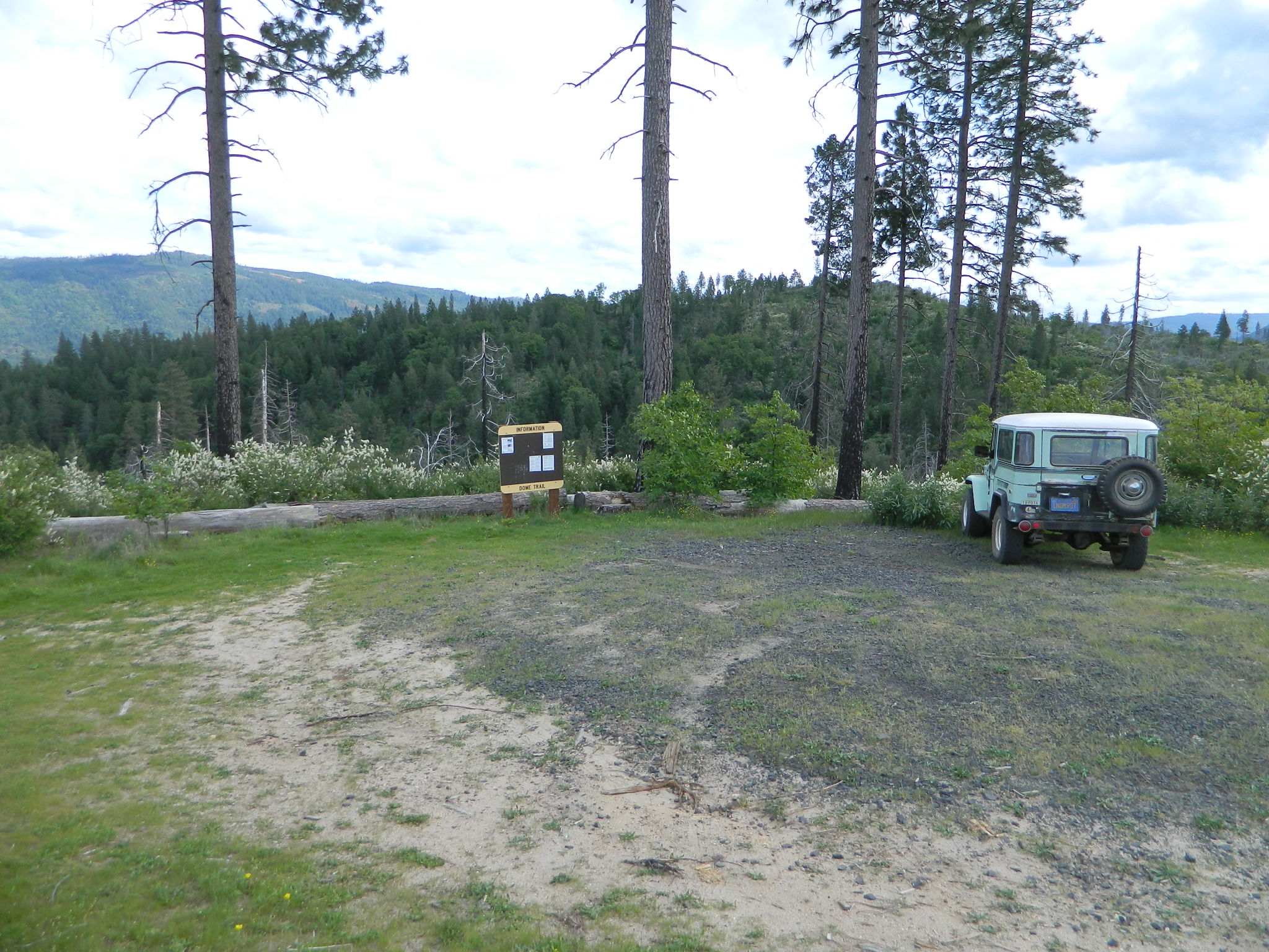
Stay on designated dirt roads: No tires across the meadow; No mountain biking, No dirt bikes, No off roading. You’re not spreading the seeds, you’re destroying a fragile ecosystem.

Ranch FENCING w/ barbed-wire is quite common around meadows, to keep cattle out of certain problem areas. Fences also help keep the wandering public out of private lands or sensitive areas.

hikerWhen hiking – stay out of the muddy spots and know that if you choose to hike directly across meadow, you may encounter water and deep, sinking mud. HINT: There is usually a shallow creek running through most meadows, during all times of the year.

Winter snow usually blankets these fragile areas in winter, and when deep enough – making this terrain prime destinations for snowmobilers.

Snow Mobiling

highmeadows

meadow views

California Parks List

California Parks and Recreation

State Parks, State Forests, State Recreation Area, National Parks, National Monuments, National Forests – What is the Difference?

public lands

Forest, Park, Reserve, Monument, Recreation Area, BLM, Nature Preserve… arghh!

Don’t let all the park and forest names confuse you. It is all California and it is your public land! No bikes on trails, No gathering wood, No dogs here, No camping there; Now what?

Below is our overview graph for all California parks and forests – the basic concepts & the rules broken down for anyone to understand. Permits may be needed in certain areas. Only the government officials understand the true nature of all the ridiculous red tape.

CA Wilderness Areas California Wilderness Back country lands very protected from roads and human impact. Off limits to vehicles & mountain bikes. Only accessible by backpacking, hiking or horseback. Endangered species; Hard to reach terrains in the High Sierra. Overnight visits may require a wilderness permit.
CA National Parks California
National Parks – NPS: National Park Service
Federal lands are national parks, preserves & monuments; highly regarded as some of the most scenic in world & protected.  Very popular places and crowds often in summer. Limited use areas for camping & recreation. No mountain biking on trails. No dogs on trails. Try off-season. Drive thru entrance fees.
NM: California
National Monument
Located within the National Park System & more specific to a region. Historic buildings, geological features and deserts ruins qualify. Some National Monuments become National Parks. Many locations have entrance fees.
NRA: National Recreation Area Located within the National Park System & somewhat specific to a waterways, coastlines, lakes and reservoirs. Some locations have entrance fees.
NSA:
National Scenic Area National Seashore
Located within the National Park System & is basically scenic area worth preserving. Usually no entrance fees.
California National Parks
California USFS:
CA National Forests
USDA Forest Service
Areas of forest lands throughout state; some surround the National Parks. 18 national forests make up 20 million acres of federal land. Multiple use areas: snow skiing, mining, grazing, off-roading. OHV & SVRA Tons of small campgrounds, recreation & primitive spots for real seclusion. Best bet for finding a spot away from the crowds. Get a free fire permit & camp on back roads. No entrance fees, some parking or day use fees; SoCal requires an Adventure Pass.
California State Parks
California SP:
California State Parks
California Department of Parks & Recreation manages more than 260 parks. These smaller parks are located near cities with historical parks, as well as remote wild state land & coastal beaches. Entrance fees, day use, picnic and some have campgrounds. State Parks charge fees for day use, parking and overnight camping.
California SF: California State Forest California Demonstration Forests, areas to be protected. Redwoods & Sequoia Groves; fragile eco-systems. Handle with care. May charge entrance fee or day use fee.
California SRA:
State Recreation Areas
California Department of Parks and Recreation. Lakes, Reservoirs, Rivers. Many have boat rentals and active marina. Recreation lakes charge entrance, day use, parking or boat launch fees.
California OHV & SVRA: Off Hwy Vehicle Area and State Vehicle Recreation Areas Off Roading folks and dirt bikes can have their fun wheelin. Lands set aside for OHV use; dune buggies, quads & 4×4 enthusiasts. Most in desert regions; forest lands. Developed campgrounds large enough to accommodate RVs and trailers. Fees may apply in these off-road areas for day use or camping.
California County Parks Desert hot springs, oak foothills and campgrounds, local hills w/ hikes, parks close to urban regions. Back roads & rural land protected from freeways & development. May require parking or entrance fees. Find these listed on the California A-Z town pages
City Parks in California Urban Parks & Recreation, inside the city limits. Usually no entrance fees. Find these on California A-Z town pages
blm camps
BLM: public lands Bureau of Land Management All public lands that do not fall into the above categories. Little to no fees for day use, recreation or overnight camping. Plenty of desert & off roading areas. Some forest lands, certain lakes. Small campgrounds or open camping allowed. Fees may apply in developed campgrounds. Camp overnight almost anywhere out here for free, with a ranger issued camp fire permit.

califrepublic


Sequoia – which one?
Sequoia National Park
Sequoia National Forest
Giant Sequoia National Monument

Imagine that the Southern Sierra mountains is home to 3 different public parks named Sequoia. Yep, it’s true. Sequoia National Park, Sequoia National Forest, and Giant Sequoia National Monument. Other parks that have Sequoia groves are – Mountain Home State Forest, Calaveras Big Trees State Park, as well as Yosemite National Park.

As far as the Coastal Redwoods, most are included under State Parks. Find these parks on the Central Coast Big Sur and Santa Cruz mountains, plus Marin County, and all along the north coast US Hwy 101 from Mendocino to the Oregon border. Numerous redwoods parks are located along rivers.

we break it all down here on
Big, Tall, Old Trees

The super scenic Big Sur coastline is home to Julia Pfieffer Burns State Park and to the similarly named Pfieffer Big Sur State Park. Leave it to park personnel, state officials or the non-locals to create such a confusing naming system within our most-visited state.

hiker

Park Maps & Topos  topo maps

National Forest Atlas
National Forest Maps
National Park Maps
State Park Maps
BLM Maps

Lava Blue Lake
Lava Rock @ Blue Lake in Modoc County
holcombcamp
Holcomb Valley Camp, Big Bear Lake, CA
Wilderness with Horses Sierra Ski Maps Camping California Wilderness Rangers Snow Ski Topo Maps Mountain Biking Maps
Wilderness Hikes Wilderness Hiking Maps Wilderness Topo Maps Sierra Fishing Maps Sierra Topo Maps California Hiking Maps
holeinthegroundsign
Lassen Camping near a creek in Northern California

California Outdoor Recreation:
All parks, forests, preserves, monuments, public lands, lakes, rivers, wilderness, historical sites and museums can be found listed separately on our super duper local A-Z town pages

fout springs
Fout Springs, near Stonyford, Northern California

dirtbikes

7N01 – Stanislaus NF

Spicer Meadow Reservoir & more lakes: Paved Forest Rd #7N01

Spicer, Utica & Union Reservoirs, Central Sierra, Stanislaus National Forest

summit lake

Stanislaus National Forest
North Fork of the Stanislaus River
Highland Creek
Carson Iceberg Wilderness Area
Spicer Meadow Reservoir (6418′ elev)
Union Reservoir (6850′ elev)
Utica Reservoir

Spicer Meadow Reservoir can also be found on various publications, listed as Spicer Meadows, Spicer Mdws, Spicer Lake and Spicer Reservoir.

tent camping

Ebbett’s Pass is California State Route (SR 4) Highway 4, which cuts thru the middle of the Sierra Nevada mountains (east-west). Wilderness peaks and rivers surround this whole region. Deep snow pack is common, so much of this region is off-limits half the year (or more). Always check with local rangers by phone before venturing out, as winter conditions can keep these roads closed late into the year.

Topo Maps of this Region:

Stanislaus National Forest Map USDA
Carson Iceberg Wilderness Map USDA
Carson, Emigrant, Mokelumne Map NatGeo
Sierra Nevada Topo Map

Wilderness Maps

N of Arnold, California; Continue up SR 4. Passing Calaveras Big Trees State Park & Camp Connell; After Big Meadow Campground, take the paved right turn for Spicer Meadow; This is forest road 7N01. Meandering thru a forest and descending in elevation, road will dead end at Spicer Reservoir.

7N01, the main paved mountain road, is located on the south side of the highway. The highway turn off reads ‘Spicer Reservoir’. Suitable for travel w/ RVs and trucks with boat trailers. Quite curvy, scenic and about 7 miles long. There are developed campgrounds in the vicinity.

The dirt side roads off the pavement can be narrow, muddy, rocky and overgrown, so be cautious when exploring. Choosing a dispersed camp site should be done during daylight hours, and will require a campfire permit ahead of time. Use an existing camp site whenever possible, instead of creating new ones.

freespice

Several man-made reservoirs attract outdoor seekers, mountain bikers, campers, canoes and fishermen. Kayakers tend to love Union and Utica, but power boats and sail boats prefer Spicer Lake.

hiker

Volcanic features mix with Sierra granite in this part of the forest, and geologic formations make for interesting hikes. Mountain biking is common around these lakes, as well as day hiking and backpacking.

Spicer Lake

NFSlogo

NFS Campgrounds in the region:

  • Stanislaus River Campground
  • Spicer Campground
  • Spicer Group Camp

Campgrounds only open June-September. Some campsites at the campground are wheelchair accessible. Boat ramp located near campgrounds.

camp

outdoor recreation:
backpacking
boating
bouldering
camping
canoeing
fishing
floating
granite
hiking
kayaking
mountain biking
lakes
sailing
swimming
trails
wildflowers

wildflower

Left fork turn off, Dirt Road #7N05 leads out to Utica & Union Reservoirs. Granite rock, alpines lakes w/ forests surrounding. No motorized boats allowed on those two lakes. Very popular among the stand up paddlers (SUP), all kayaks and canoes.

canoe
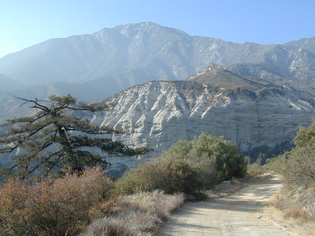
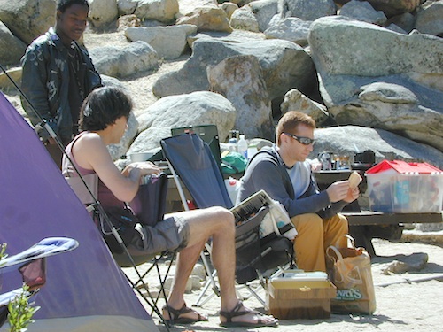
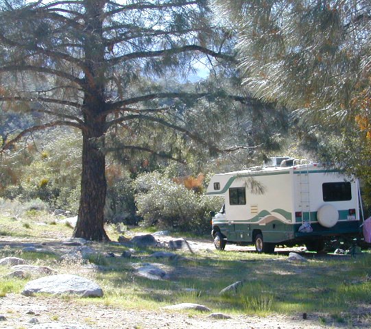
No developed campgrounds back that way either. No flush toilets, nor paved roads. No flat RV spots; only primitive style camping. These 2 scenic lakes get crowded during summer weekends, so opt for a mid-week stay if possible.

Another dirt road treks steeply up the hill from Union Reservoir to Lake Alpine (at the highway). That primitive truck trail is actually a (somewhat designated, but not well-signed) 4×4 route and suitable for high clearance vehicles only.

car camping lakes

Spur Road #7N29Y is another small dirt road which leads a couple miles into the forest, over to overgrown trailheads and primitive camping options. Ideal for accessing all the lakes (on foot) from this prime location. A camp fire permit is required. No water, no bathrooms, no facilities, no garbage services.

Pack it in, pack it out.

  • Elephant Rock Lake
  • Summit Lake (7068′ elev)

elephant rock

Closest small towns are:

ARNOLD
BEAR VALLEY
LAKE ALPINE, CA

lake camps

7N01 – Los Padres NF
There is another USFS Road in California named 7N01, but that one is a 4×4 OHV access route @ Dutchman Campground, located in South Central California; the southern part of Los Padres National Forest. We have mention of it on the page for Frazier Park Camping.

4x4

Creekside Camping

California Creek Camping

California Camping CreeksClear cool stream waters flow from snow melt at 10,000′ elevation, down to these pristine camps at under 4000′ on both sides of the Sierra. The further you drive up the mountain, the better it gets. Where the Eastern Sierra side tends to be more dramatic desert like with sage brush, the western range is much more lush with ferns & dense trees.

Everyone dreams of it. The perfect camp, along the creek. Maybe a waterfall or two, a shady hammock spot & plenty of trees, a flat tent spot, maybe a view. A big, sturdy, rock fire ring (without a bunch of broken glass in it).

This dreamy camp isn’t only in your imagination, nor is it at the local county campground a few miles from home. This kinda beauty & rare finds are out there, deep in the back woods, the mountains. You gotta know where to look & what to bring in order to have a good, easy, relaxing time.

These secluded sites really are around in your favorite forest, way back there. Best of all, they are free.

forest mapsHaving the opportunity to camp in your very own private, secluded spot, along dirt roads, outside of the annoying rules and fees of a developed campground is a privilege. Use these lands wisely and be a responsible camper. Camp eco-wise! Respecting the land, knowing some basics and following fire safety precautions is all mandatory. A topographic hiking map or a National Forest map is optional, but highly recommended.

Creekside Camping CaliforniaCreek water can make an easy refrigerator if the cooler is full. Chill that bottle of wine, keep the watermelon cool .. just don’t forget about it. (cuz that kinda litter maybe a welcomed good surprise for the next camper.) Secure your wet creek valuables. Even a heavy watermelon can float! Put some rocks around items or tye them in a mesh bag, with rope, something to keep them from getting away in the swift water.

There is nothing that beats a good detailed forest map of where you are going. If you are the type of person who can never make a straight B-line for home on Sunday afternoon, and find yourself wandering just for the sake of wandering – then it’s best to have a larger state wide map like this beauty from Benchmark Maps.

California Creekside Camp Sites

Small Campgrounds on a Creek

Primitive Style – Dispersed Camping secluded camp sites

If you are the kinda sport who can really rough it, you may learn to love it. After your first real back woods camping experience, the privacy, serenity and beauty of the land will inspire and relax you so much, that the drawback on the lack of toilet won’t bother you.

Make a new hobby of learning how to stay away from the crowds. The less cars you see at camp, the better. Learn to be immersed within nature and enjoy your space outside. Unwind, next to the creek in the shade, with a chair and read for hours, or bring the sketchbook, or just daydream as butterflies go floating by.

  • Remember to be camp clean, California is black bear country.
  • You’ll need a free camp fire permit; pick up at the local rangers station.
  • Classic camp potty info.  Proper disposal of human waste is important.
  • Use biodegradable soaps when outside.

Streamside Camping Basics

what you need:

capable vehicle – SUV or Truck, high clearance is best. 4×4 is NOT required. AWD wagons should be more cautious when venturing out on the back roads. 2WD is fine for most graded dirt roads, but way out exploring dirt roads, deep mud and snow is quite possible.

destination – Pick a locale. A general area you wanna check out. Not a quickie overnight deal, but an enjoyable lazy multi-day camping trip.

exploration – Narrow down a canyon or river that you have always wanted to explore. The Sierra Nevada & NorCal is the place to concentrate your efforts, as SoCal is near desert climate w/ way too much development.

more maps please – National Forest map or similar backroads Map/Atlas. Large topo maps may be too detailed, but will do okay for finding dirt roads (& backpacker trailheads also).

The more homework you do before hand, the better chances of finding that secret camp spot, especially on holiday weekends. Go ahead & call the forest rangers. Have your decent topo maps handy, along with pen and paper. That’s what they are there for. Have a list of questions on specific areas you want more info on. If you do the prep work well in advance, it makes a more enjoyable camp trip. Cuz you’ll be less worried about finding the ultimate places (before dark, or before the other guy does). With your new profound Wilderness Vision, you will have not only a plan B ready, but a plan C as well.

what to look for:

getting permits – If you really wanna camp like this, all secluded on the dirt back roads without the hordes of other campers nearby…. you’ll need a capable vehicle, a camp fire permit & the understanding of the concept “totally self sufficient campers”. This means bringing your own water, a bucket, a shovel, maybe some firewood, plus packing out all your own garbage, plus any litter left over by the last campers. It’s the least you can do, not having to make reservations. Visit the FireSafe page

it’s on your map – After you have a general area narrowed down, some place you always wanted to go, then it’s time to get your maps out & start reading them. Or at least staring at them – maybe over a meal, whenever you have free time to study it. Look for dirt roads, the further off the paved roads is not necessarily the better. Some of the best camp sites are within a few short miles from the pavement, so get them maps out & start visualizing.

gas up – Make sure you fuel your vehicle before you head into remote areas (like the ones we are mentioning). Maybe even an extra can of gasoline too, just in case.

the blue lines – You’ll know a decent road when you see it. When you start planning at home, you need to concentrate of what dirt roads are along what water sources. And will these streams be flowing at this time of year? Many are seasonal creeks & can dry up in summer. The most likely place to find great water flow is to look for the streams flowing directly into a major river or Lake/ Reservoir.

Are you willing to clean up your camp, before & after, leaving it pristine?
Yes indeed, it is free to camp outside of developed campgrounds.

Finding a Creek & Reading a Map

Campground San Bernardino

whitecliffs

Big Bear – San Bernardino National Forest Camping & Campgrounds

areas include:
Big Bear Lake, Fawnskin, San Gorgonio, Lake Arrowhead, Forest Falls, Green Valley Lake & Idyllwild

Listed below are all the San Bernardino National Forest campgrounds, public lands for outdoor recreation. SoCal campground reservations can be booked online with the linked campsites below.

Big Bear Campgrounds near Big Bear Lake & Fawnskin area

campground elev spots veg toilet water notes
Applewhite Campground 6800′ 42 pines vault piped disabled access, RV 30′
Barton Flats Campground 6300′ 52 pines vault shwrs disabled access, RV 45′
Big Pine Flats Horse Camp 6800′ 17 pines vault piped Way back 3N14, year round
Cold Brook Campground 7000′ 36 pines vault piped RV max 25′
Crab Flats Campground 6200′ 29 pines vault piped 3N16, Green Valley Lk
Dogwood Campground 7000′ 90 pines vault piped disabled access, RV 22′
Green Valley Campground 7000′ 37 pines vault piped Green Valley Lake
Hanna Flat Campground 7000′ 88 pines vault RV max 25′
Heart Bar Campground 6900′ 94 pines vault seasonal Hwy 38, equestrian
Holcomb Valley Campgr 7400′ 19 pines vault no Rd 3N16, year round
Horse Springs Campgr 5800′ 17 pines vault no Rd 3N17, year round
North Shore Arrowhead 5100′ 27 vault piped disabled access
Pineknot Campground 6400′ 48 vault piped disabled access, RV 45′
San Gorgonio Campground 7000′ 54 pines vault shwrs Hwy 38, disabled, RV 43′
South Fork Campground 6400′ 24 pines vault piped Hwy 38, RV max 30′

site12

San Jacinto Campgrounds near Idyllwild area

campground elev spots veg toilet water notes
Black Mountain Group 6000′ 16 pines pit piped group site
Boulder Basin Campground 7300′ 34 pines pit piped CLOSED
Dark Canyon 5800′ 22 pines pit piped CLOSED
Fern Basin Campground 6000′ 22 pines vault piped Rd# 4S02
Marion Mountain Campground 6400′ 24 pines vault piped Rd# 4S02
Pinyon Flat Campground 4000′ 18 pinyon vault piped bighorn sheep, year round
Santa Rosa Springs Camp 7000′ 3 pines pit no no RVs, Toro Peak
Thomas Mountain Camp 6800′ 6 mixed vault no no RVs, Rd 6S13; Lk Hemet
Tool Box Spring Campground 6500′ 6 mixed vault piped no RVs, above Lake Hemet
Toro Campground 7800′ 5 pines pit no Santa Rosa Wilderness

Southern California Camping see also –

Topo maps, wilderness hiking maps, Equestrian trails, OHV maps –

SoCal mountain communities include:

Big Bear Campsites

Heart Bar Campground

Heartbar

San Bernardino National Forest: Heart Bar Campground
National Forest Service

At Hwy 38 & Forest Road #1N02 is a huge, pine forested valley, right next to San Gorgonio Wilderness. Heartbar Campground, Heart Bar Horse Camps, RV Dispersed Sites. Highway 38 – SE of Big Bear Lake, California; Mountain Bike, Hiking & Equestrian Trails with ridges of 10,000′ elevation. SAN GORGONIO peak nearby. Best high elevation scenery for SoCal by far.

  • backpacking
  • camping
  • fishing
  • hiking
  • mountain biking
  • mountain peaks
  • waterfalls
yellows
Primitive Camps on the Back Road #1N02

Heart Bar Campground

Big Bear Forest –  HEART BAR

This gorgeous valley is a developed recreation area w/ 89 camp sites, plus big equestrian area. Picnic, hiking, mountain biking, horseback trails, plenty RV spots, even a creek. (Oooops I meant the Santa Ana River) Highway 38 is kinda the long way into Big Bear Lake, up thru Angelus Oaks. Locals call this stretch of the highway Barton Flats.

spot79

horse camp
Bring the Horses & RVs

Group Campground facilities
Barton Flats – San Gorgonio Recreation Area

out back

Leading out the back way of HeartBar, past the horse camp – is a nice one lane dirt road, narrow in spots, with random, primitive camp sites along the roadway. Authorities refer to these spots as yellow post camp sites.

This backcountry route is marked as Forest Service Rd #1N02 – graded dirt road that leads back to Coon Creek Cabin.

Coon Cabin
Coon Cabin Backside

Big Bear Discovery Center
at Big Bear Lake
909-382-2790

ranger

Southern California forest 

San Bernardino maps:

nearby mountain communities:

ForestFalls
Forest Falls, late afternoon

Forest Falls is well worth a stop for a quick picnic or hike – and head dunk. Weekends can be busy and crowded. Since this location is close to Southern California and the population centers, expect weekends to be busy in the Big Bear mountains. Plan a trip for week days to experience less people, and more nature.


Lundy Lake California

Lunar Lundy Lake

Eastern Sierra
Lundy Lake

Lundy Canyon is located at the very northern boundaries of the Inyo National Forest, bordering the Humboldt Toiyabe National Forest & Virginia Lakes. Mill Creek flows down Lundy Canyon from the Sierra Nevada; Lundy is a small lake in a deep, rugged canyon with wilderness trailheads, East of Yosemite National Park.

Lundy Lake
West of Mono Lake, California
US 395
Lee Vining, CA

elevation: 7800′
Seasonal access, closed for winter

backpack, camp, canoe, fish, hike, kayak
aspen groves, autumn colors
wildflowers, waterfalls


Frozen Edge

camp

Lundy Campgrounds

  • Lundy Canyon Campground
    Mono County Dept of Public Works
    760-932-5440
    36 camp sites w/ picnic tables, fire-rings & bear boxes
  • Lundy Lake Resort
    Bait, tackle, general store, fishing lake, boat ramp.
    626-309-0415
    21 camp sites, 8 cabins, 3 camp huts, 5 RV camp sites

camping

National ForestsThere is not any NFS Campgrounds in this Lundy Canyon, but plenty can be found nearby at Lee Vining Canyon, at junction US 395 & Hwy 120.

Mono Lake also has camping at the county park. And free camping (boondocking) can be found – all up and down US 395

Lakes Canyon Trailhead

hikerLakes Canyon Trailhead

Backpackers & Horse Packer Trains have excellent access to the Hoover Wilderness in the High Sierras. Plus this prime Lundy Canyon location is situated at the back door of Yosemite NP.

Mono County Tourism
800-845-7922

Reflections

Lundy Area Maps:
Hoover Wilderness Trail Map (Tom Harrison)
Inyo National Forest Map (USDA)
Yosemite High Country Map (Tom Harrison)


View Larger Map

Links for Lundy Canyon:

Lundy Lake Road
Lundy Lake Rd, the paved road up climbs the steep canyon to an elevation of over 7500′

11S12 – Sierra NF

engineering_x

Black Rock Road #11S12
– Sierra National Forest

North Fork of the Kings River, Blackrock Rd

connects Kings River @ Pine Flat to Blackrock Reservoir.
Road closed seasonally for winter; call ahead.

This impressive Sierra Nevada route literally climbs a granite cliff high above the Kings River, near Pine Flat Lake north of Sequoia Parks, inside Sierra NF. This granite gorge is due east of farm city Fresno at the edge of Kings Canyon National Park.

If you are a nervous, inexperienced driver and scared of heights – be forewarned: this is not the road for you. The views are amazing, but the terrain can be unforgiving, even deadly.

Paved, narrow, one lane, giant rock overhangs, no guard rails (except on the bridge) the route skirts the North Fork of the Kings, coming down from Wishon Reservoir.

Blackrock Road

Click image above to enlarge and see the tiny Kings River far below the road.


Black Rock Lake

Blackrock Reservoir, located up the road – has a PG&E campground in a secluded canyon, with lake fishing and hiking, so it is well worth trouble to take this crazy road. Granite rock canyon, steep mountains, minimal roads.  Seclusion can be found, up this way.

Utmost safety should be taken on this road due to the extreme terrain. When driving one lane roads always keep an eye out for possible turn-outs and oncoming traffic. Forest and lake personnel have living quarters at the base of this road @ BALCH CAMP, so keep driving when passing thru. Follow signs to Blackrock.

breaktime

Above Blackrock Reservoir, further up the canyon, the road becomes DIRT when the pavement stops; this continues to Sawmill Flat Campground and eventually on to Dinkey Creek Road. This whole upper (dirt road) portion is gated for winter and closed during the wetter months. Call ahead to the ranger station at Trimmer to find out if this road is open.

Sierra National Forest
Trimmer Ranger Station
559-855-8321

Sierra Kings River Camping

Sierra National Forest Map USFS
northkings
North fork of Kings River
gorgeview
Road #11S12, gorge view

Snag Lake California

Snag Lake California


Lakes Basin Recreation Area
Snag Lake

A free lake camp in between Truckee & Quincy, CA

This is one of many small lakes situated within the Lakes Basin Recreation Area , in the Northern Sierra Nevada mountains. Just north of Downieville & Historic Gold Country. Snag Lake is nothing special compared to the rest of the scenic lakes close by, but it is worth a mention due to a few fun facts.

Sierra Nevada Lake

One thing this small lake campground does have is convenience, located right on the Gold Lake Highway – next to Goose Lake, plus hiking distance to the largest of the lakes, Gold Lake. The second feature is the campground is small, 16 primitive sites, picnic tables & one vault toilet. The third thing is that this is a FREE campground; no charge.

campsite snag lake

Snag Lake Campground

• Elevation: 6600′
• Number of Sites: 16
• Vehicle Accessibility: Small RVs
• Campsites Reservation: No
• Camp Fee: No
• Length of Stay: 14 Days
• Season: June – October
• Trailheads: Gold Lake

Boulder Hopping

dirt drive (no pavement)

No motorized boats allowed. No paved boat ramps. Kayaks & canoes can hand launch from several spots. The dirt driveway is easily missed, especially at night. The old wooden, forest service sign is not reflective. The vault toilet is close to the highway and the camp sites are along the lake edge. No pavement anywhere!

Upon arrival, camper trailers will want to get out and select the best route to a camp site. The small boulders, dead trees, root and rock obstacles are abundant on the dirt road entry, all around the campground, and at each camp site. High clearance vehicles would fair best at this camp, but some passenger cars may be able to manage the rocky entrance. Get out and look at the road, before scraping across the biggest rock. Slowly, carefully, maybe… and preferably an arrival before dark.

LOCALS TIP: The wind tends to pick up at night around these lakes, so brace your tent well and position your vehicle appropriately.

NFS lake camping lake fishin hiking lakes lakes

fishing lake?

rainbow trout

Obviously with a name like SNAG, you can imagine that the fishing here is not the best, since roots and old tree stumps make up a good portion of the shoreline. Luckily there are a dozen alpine lakes within a 20 mile radius to choose from for another fishing spot. Some lakes are hike-in only, some require 4×4 to reach and others have cabin resorts.

towns nearby –

sierra snow

SEASONAL SNOW CLOSURES

snowmobile
Gold Lake Hwy (or Gold Lake Road) closes in the winter months (NOV-APRIL) due to snow and the region is used as a winter recreation area. Cross-country skiing and snow-mobiling are both popular activities.

driftwood

Lassen – Snag Lake

ANOTHER SNAG LAKE in NorCal, can be found by foot, hiking into the Lassen Volcanic Wilderness. Backpacking the lake loop is approx 17 miles RT and includes 3 lakes – Snag Lake, Widow Lake, and Jakey Lake. Trailhead is located at Juniper Lake, at the north shore.

read more about this hike

hiker

SIERRA LAKES

4×4 lakes
backpacking lake
camping lakes
canoeing lake
fishing lakes
hiking lake
kayaking lakes
waterfalls

El Dorado Camping

Primitive Camping in El Dorado County

Camping Rivers

More & more people are venturing off the beaten path. Tourist flocks to Gold Country, and many do not even leave Highway 49. Get up the mountains, higher than the foothills.camp

Getting outta the developed campgrounds to discover the joys of dispersed back woods camping is a new adventure, not to be taken lightly.

With truck or SUV ownership come some great rewards! Order a good map & go find some dirt roads. Waterfalls, dense forests, secluded creekside camp sites & more await you. Obtaining a camp fire permit is mandatory for this style of camping.

campfire

fish

Campfires are often banned in California, due to extreme wildfire danger. Since the gold mining foothills are usually oak and dry grass, with large steep river canyons, extra caution should be given. Always know the fire conditions before you build a campfire. Caldor Camping

Discover the hidden back roads: like Caldor Road off of Grizzly Flat Rd. – above Placerville CA

Hey, now this is what we’re talking about. Plenty of great dispersed camping down by the Cosumnes River & Consumnes Mine Rd. There are hundreds of miles of small roads to discover back behind this historic mining area. Rivers, waterfalls & decent fishing too. Make sure you clean up some litter. This is the only price you pay for the beauty, serenity, peace & quiet & no neighbor campers next to you.

hiker

Out exploring these parts, you may run into a dead end road that peters out at some Private Property, which is usually signed & fenced. Make nice with the old crazy miner dude & turn your ass around politely, everything will be okay as soon as you are not within gun shot of him. Yes, there still are plenty of small time mining experts tucked away back here in the hills.

river camping
Premium and secluded river side camp sites in El Dorado National Forest

Plenty creeks and rivers run throughout this central Sierra region, so you can fish all day – until your hearts desire. River rafting and river kayaking opportunities are also great reasons to get wet.

canoe

Several mountain reservoirs around offer camping and boating too. Eldorado lakes are listed below.

  • Caples Lake @ Carson Pass
  • Ice House Reservoir
  • Jenkinson Lake – US Hwy 50
  • Kirkwood Lake
  • Lower Bear River Reservoir – South Shore Campground
  • Salt Springs Reservoir
  • Silver Lake @ Carson Pass
  • Union Valley Reservoir

mountains

nearby towns –

El Dorado Forest Maps –

Sardine Lake California

Sardine Lake California Camping

Lakes Basin California, Northern Sierra

Lakes Basin Recreation Area

The granite spires of the Sierra Buttes (8591′) tower above both Upper & Lower Sardine, making for a glorious backdrop to these two lakes. This is a popular fishing lake with no swimming allowed. The water is so clear that at noon you can see to the bottom!fish

There are numerous, super-scenic, small lakes in this region and one trip here is not nearly enough. Total Escape rates this collection of small lakes up there w/ the ‘best hiking lakes’ in California. The Pacific Crest Trail runs through this awesome lakes area, which is located north of Truckee, east of Downieville.

backpacking
boating
camping
canoeing
fine dining
fishing
hiking
granite peaks
kayaking
mountain biking
off-roading
stargazing
waterfalls
wildflowers


snowmelt lake snowmelt lake snowmelt lake
high elevation means snow

Plumas Co Road #24 is the Gold Lake Road, also referred to as the Gold Lake Highway – which skirts the lakes, the buttes and connects Historic Gold Country Hwy 49 to Graeagle Golfing @ Hwy 89. SNOW CLOSES THIS ROAD, but the area remains open for winter recreation.camp

SARDINE LAKE ROAD, a paved turn off the main road. NFS Campground is located one mile from the shore at Lower Sardine. Sardine Lake Resort rents cabins and the restaurant serves dinners w/ lake view!

fishing lake Gold Country Lake hiking trailheads National Forest Service Developed Campground

Sardine Lake Campground

• Elevation: 5800′
• Number of Sites: 29
• Vehicle Accessibility: RV 22′
• Campsites Reservation: Yes
• Camp Fee: Yes
• Facilities: piped water, vault toilet
• Length of Stay: 14 Days
• Season: June – October
• Trailheads: Sierra Buttes & PCT

sardine campground sign

National Forest Service Rangers Quarters

Sardine Peak Lookout
SARDINE PEAK FIRE TOWER LOOKOUT (NFS)
Built in 1935, a three story enclosed tower with external stairs. 2019 – No longer available as an overnight rental. (elevation 8138′)

panoramic

Upper Sardine Lake California

Upper Sardine Lake: Takes only a short hike to get to. This is a pure glacial bowl; the rock plunges straight into the water, no beach at all. Great fishing; ice-cold swimming.

local contacts for this lake:

Sardine Lake Resort
530-862-1196

Row boat rentals on Sardine Lakecanoe
530-862-1196

Canoes rentals on nearby Packer Lake
530-862-1221

Plumas County Visitors Bureau:
800-326-2247

Plumas National Forest Rangers:
530-862-1368

Sierra County Visitors Bureau:
800-200-4949ranger

nearby towns:
Downieville, CA
Graeagle, CA
Sierra City, CA

nearby lakes:
Gold Lake
Sand Pond
Packer Lake

maps of the region:
Lakes Basin Map USDA
NatGeo Sierra Buttes Map
Plumas National Forest Map
Tahoe National Forest Map

Kern River Campgrounds

limestonerun

Kern River Campgrounds – NFS

canoeSequoia National Forest Campgrounds
Kern River, Southern Sierra Nevada

All the developed campgrounds listed below charge an overnight fee. Some are open year round, while others close for winter. Few are walking distance to the market, some may have piped running water, and garbage collection. Most have paved loop driveways and can accommodate large RVs. All campgrounds have bathroom facilities.

kern campgrounds California NFS Kern RVing

Upper Kern River
North of Kernville, California

campground

elev

spots

veg

toilet

notes

Fairview Campground

3500′

55

mixed

vault

Upper Kern; RV 45′

Gold Ledge Campground

3200′

37

mixed

vault

Upper Kern; RV 30′

Headquarters Campground

2800′

44

alder

vault

Kern River; RV 27′

Hospital Flat Campground

3000′

40

alder

vault

Kern River; RV 30′

Limestone Campground

3800′

22

mixed

vault

Upper Kern; RV 30′

gold ledge lupine
Gold Ledge – blooming Lupine in Springtime

fishNo day use parking lot inside the campgrounds. Park outside the camping grounds for recreation: fishing, hiking, mountain biking, rafting or wildflowers.

This entire canyon is dedicated to outdoor recreation w/ very few residential streets. Southern Sierra Nevada mountains – the whole Kern River area draws a lot of traffic from its proximity to Southern California.

headquarters kern

eriklovinglife
Outdoors, enjoying lIfe


South Creek Falls
South Creek Falls

RV campgrounds campgrounds hiking fishing campgrounds mt biking campgrounds

Lake Isabella
Lake Isabella, Kern Canyon California

Lower Kern River
South of Kernville, California

Granite Boulders

campground

elev

spots

veg

toilet

notes

Sandy Flat Campground

2300′

38

mixed

vault

open all year

Hobo Campground

2300′

35

mixed

vault

2019 closed due to landslide

NFS
Sequoia National Forest
Kernville Ranger Station
760-376-3781

Additional Info on Kern Camping –

Kern Flats Camping: Free Camps
Lake Isabella
Keyesville OHV

North Meadow

Big Meadow Sequoia 

dirtbikescamp hiker

Kennedy Meadows, South Fork of Kern River
Chimney Peak Backcountry Byway
Dome Land Wilderness

Kern River Canyon
Kern River Hot Springs

Road’s End Resort
(destroyed by wildfire 2002)

Forks of the Kern
Lloyds Meadow Road #22S82

kernrvcamper

Plumas Camping

Lil' Northfork Campsite
Primitive (dispersed) camping near Lil’ Northfork

Plumas National Forest Camping – Primitive Camp Sites

Spanish Creek, Quincy, CA

Plumas Forest Camping

NFSlogoNorth Sierra Nevada, Northern California

Listed below are primitive campgrounds w/ minimal facilities or open camping areas in Plumas National Forest. Plumas has excellent fishing as the big rivers & numerous creeks run thru this northern Sierra Nevada landscape. Open camping is allowed on almost any dirt road w/ a current campfire permit

see also – Plumas Campgrounds

driftwood

Brady’s Camp
[on Pine Creek near Argentine Rock]
near Quincy, CA – east on Squirrel Creek Rd. & go 8 mi. to the campground. Elevation 7200′ / Open May – October

pct

Bucks Lake has numerous NFS Campgrounds and PCT access; Overall elevation 5000′ w/ abundant boating, fishing and hiking. Snow in winter closes roads. Cabins, marina, lodge, restaurants. Bucks Lake Wilderness, Gold Lake, Silver Lake

Deanes Valley Campground camp
[along Rock Creek] Hwy.70 Quincy, go 3.5 mi. west on Buck Lake Rd. Head south & 7 mi. to the campground. Elevation 4400′ / Open April – October


35 mph

Ishi Wilderness hiker

Backpacking trails w/ dirt road access. Above Chico, beyond Cohassett; on the border of Tehema Co. and Butte Co. (Lassen NF & Plumas NF)

Inskip, CA – Way up beyond the Ridge, well past Magalia and Stirling City – find dense forests, dirt roads and camping. Philbrook Reservoir w/ West Branch Campground NFS. Elevation 5546′

24N10 – Plumas NF

Lakes Basin Recreation Area

lakesbasinhikers
lakes basin day hikers

Snag Lake California

4x4 dirtbikes fish

Ohio Valley – Seneca Road
[off Hwy 89 to southside] Primitive forest camping near Lake Almanor. ATV trails, hunting. Creeks and river camping closer to Seneca. High clearance or 4WD may be needed on these dirt back roads – depending on snow and mud. There is plenty dirt roads back here to explore.

Snake Lakecanoe
[good fishing area] Hwy.70 Quincy, go 5 mi. west on Buck Lake Rd. Head north & 5 mi. to the campground at the lake. Elevation 4200′ / Open April – October

Snake Lake, California

Taylorsville Campground

Indian Valley - Plumas California

pinetree


digger pines
Bald Rock Road in Berry Creek, CA

see also – Feather River California

foreman creek
Foreman Creek @ Lake Oroville, (maxed out) FEB 2017

nearby towns –

Belden Town
Berry Creek, CA
Bucks Lakes, CA
Butte Meadows
Chico, CA
Greenville, CA
Oroville, CA
Paradise, CA
Portola, CA
Quincy, CA
Twain, CA


Canon Sin Nombre Slot Canyons

Happy Jan

Canon Sin Nombre – Anza Borrego
Mud Caves and Slot Canyon Hikes

Anza Borrego Desert State Park
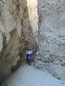
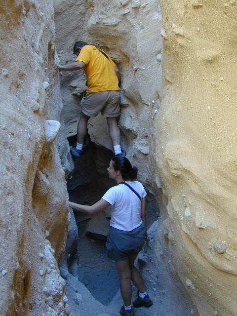
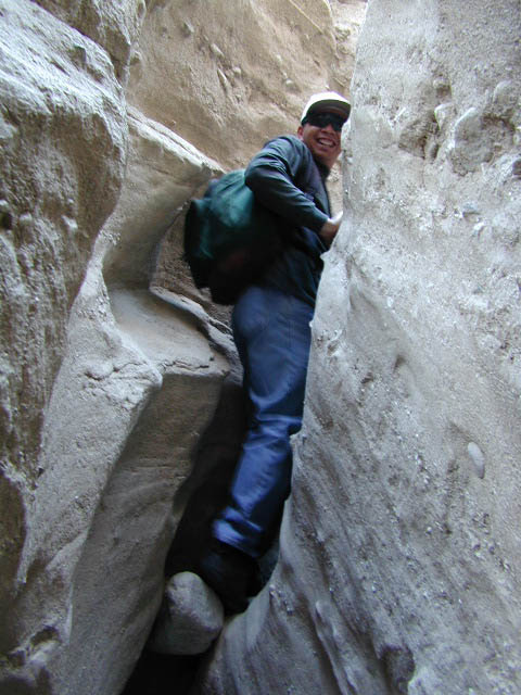
Desert Slot Canyons – South Anza Borrego State Park region, just off County Road S-2 east of the ‘badlands overlook’ view point is a whole network of narrow walkways & skinny canyon trails to explore. Some are so tight you have to turn side ways to fit through. There are more than one of these sandstone topless caverns. Finding a new one each time you visit is a fun challenge. Just north in the Diablo canyon there are dry mud tunnels & trails as well. Explore & be careful not to get lost. And don’t camp at the canyon openings during the threat of heavy rains…duh.

Drive down steep, sandy road into Canon Sin Nombre entrance (the dirt road just to the north of Badlands Overlook). A high clearance vehicle is recommended and 4WD may be required in soft sand. 2WD SUVs/trucks should keep their speed up through the soft sandy areas & try not to turn or stop suddenly. Go slow in narrow sections of the canyon & slow over the rocks to save your oil pan.Anza Borrego photos

Clock your mileage 1 mile exactly from the paved road (s2) & park out in desert wash, pull over between the smoke trees. Hike over to the left side & look for an opening in the canyon walls to a deep secluded trench. A campsite may exists here.

hikerHike up the first canyon which does require some rock scrambling. The gorge lets you out at the very top with an impressive view over the Sweeney Pass area. The canyon walls are so tight in some spots you may have to turn sideways to fit through. Upper body strength is needed to climb high ledges & boulder scramble through this natural maze.

Once on top, wander on the ridge & check out the views; keeping to the right & then follow the next wash down to start the much longer & easier exit. Hike down in the main slot canyon which leads out to a big camp site & clearing. Exit slot area and turn right, walking back to the vehicle in the big wash.Slot Canyon

This particular hike is a blast on a full moon night, but not for a first timers try.

campBest time to visit: October – April

HIGH CLEARANCE VEHICLE access to reach trailhead. Moderate hike, boulder scrambling w/ dangerous mud walls. Flash floods here are possible during rains.

Plenty of 4×4 roads, SUV trails, & box canyons in the desert region.

Open primitive camping (free) all over
Anza Borrego State Park

The 2 nearest developed campgrounds:
Bow Willow Campground
Vallecito County Park

The Wall Walker

Smile Cheps