Tag Archives: Wilderness

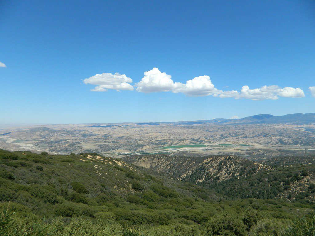
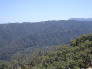
Dick Smith Wilderness

Santa Barbara Mountains
Ojai Backpacking, Ventura, CA

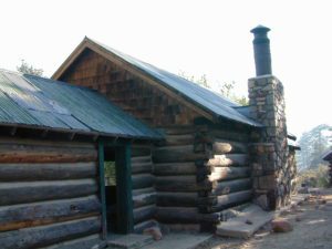
old cabin cuyama
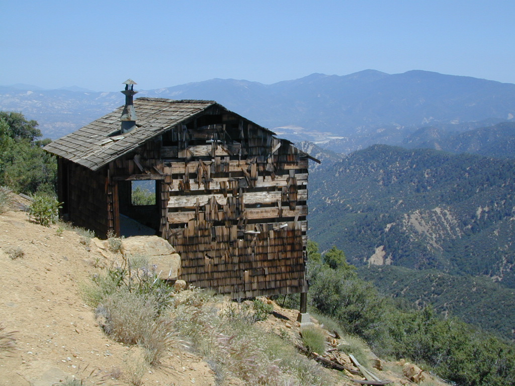
Old Cabin at Cuyama Peak Fire Lookout, Dick Smith Wilderness Area in the background

64,800 acres

30 miles N of Ojai, CA
Los Padres National Forest

Dick Smith Wildernessreyes lift off

  • backpacking
  • camping
  • hang gliding
  • hiking
  • horseback riding
  • parasailing
  • OHV trails nearby

Los Padres National Forest – Located in between the Santa Barbara coastline and the Cuyama Valley, this coastal wilderness area is situated miles north of Ojai, off Highway 33.

The Dick Smith Wilderness is where the San Rafael Mountains and the Sierra Madre Mountains merge on the east side, next to Pine Mountain Summit (elevation 5080′ @ highway).

This PINE MTN turn off should not to be confused w/ the Pine Mountain Club, on the north side of Cerro Noroeste.

Significant mountain peaks within Dick Smith Wilderness Area:

Big Pine Mountain – 6828′ elevation
Cuyama Peak – 5875′
Lizard Head – 5350′
Madulce Peak – 6536′
Samon Peak – 6527′

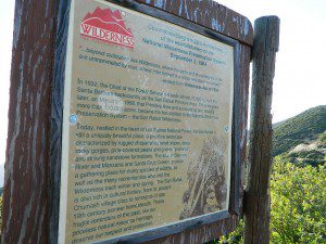
Closer to Ojai, Matilija Wilderness is on the southern boundary of DickSmith and the San Rafael Wilderness sits to the west side. Native American petroglyphs can be found in this mountainous region.  Access to “Painted Rock” on the Sierra Madre ridge, via Road #32S13 (which has a locked gate on both ends), is a long one so you might want to bring the mountain bike. The dirt road hike is about 10 miles (one way) and it starts at the Santa Barbara Canyon trailhead. If you plan to visit the rock art from the west side – take the dirt road up past Bates Canyon Campground. The turn off on Hwy 166 is called Cottonwood Canyon. Park at the hog pen trailhead and follow Road #32S13 for miles.

Dick Smith Trails
hiking trailheads –

  • Chorro Grande (Hwy 33)
  • Potrero Seco (Hwy 33)
  • Santa Barbara Canyon (Hwy 166)

 area campgrounds –

 nearby towns –

more Ojai camping

ojai backpacking

Dick SMith Wilderness

Ozena Valley Badlands

California Meadows

Cherry Mdws

California Meadows

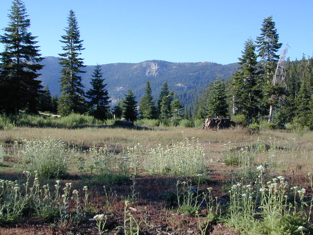
California meadow is a common term people search for when dreaming of their mountain retreat vacation or upcoming weekend camping trip.

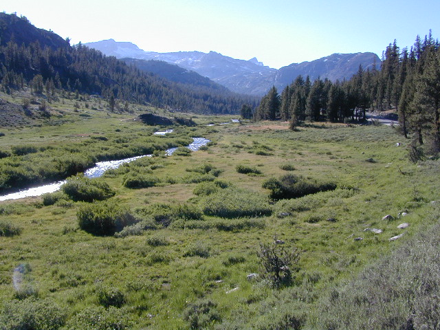
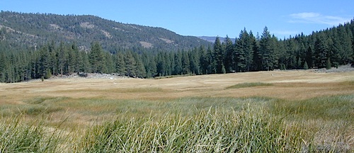
Meadows are places in the forest where cool air collects and settles. Deer among other wildlife, can often be found here grazing around dawn and dusk. Alpine meadows are usually surrounded by trees with lush green grasses, located at higher altitudes above 6000′ – the ‘highcountry’ as most like to say.

Find meadows on National Forest lands from 3000-10,000′ elevation, and it is not uncommon to see cattle grazing in these same regions. California National Parks have some of the most protected meadows in the golden state!

MT SAGE – mountain sage meadows

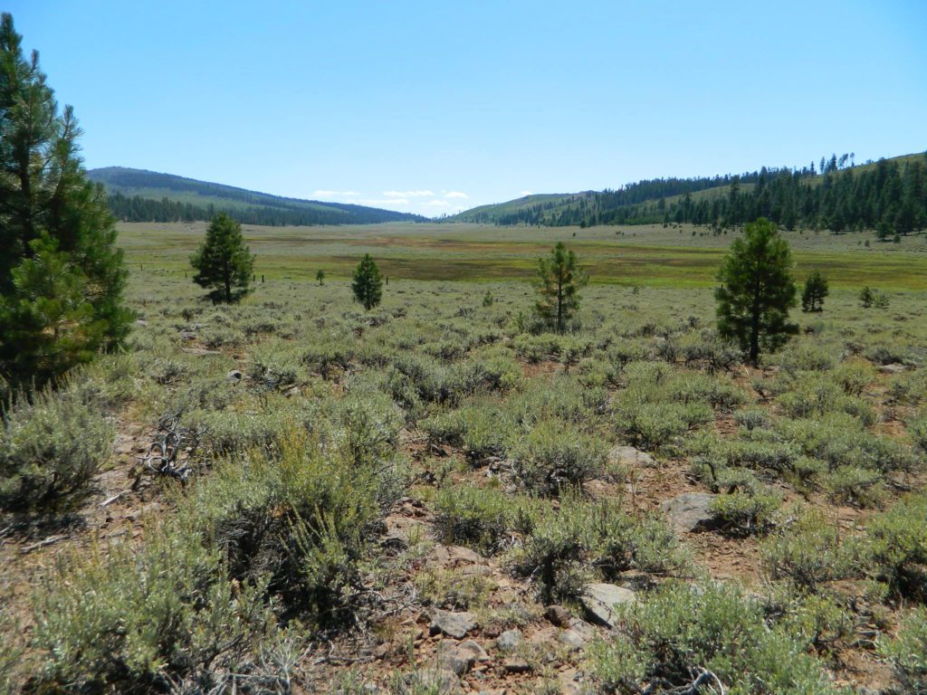
High desert mountains have drier landscapes, with large sage brush meadows surrounded by sparse pinon pine and/or juniper forest. The Mojave desert’s sagebrush reaches out westward to the peaks of West Kern County. High deserts and mountain meadows can both have significant wildflower blooms. The deserts start to show color in March & April, while the highest elevations of the Sierra Nevada can bloom as late as July & August. All California Wildflowers depend on autumn seasonal rains & snow melt.

Kennedy Meadows from Bald
Kennedy Meadows from Bald Mountain Fire Lookout

Wilderness Meadows

The best places to find secluded wildflower meadows is on the high country trails of various mountains – Mount Pinos, Sierra Nevada, Shasta, Trinity & Lassen – all have marvelous meadows, some have easy access w/ parking nearby and others are hike-in only. Locate hiking trailheads for meadows and possibly find camp nearby.

Excellent near Meadows:
Stargazing, Wildflowers, Wildlife Viewing, Horse Camping

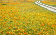
Explore dirt back roads of California to find your very own meadow. If you would like to explore at this level, a good topo map is highly advised. The Sierra Nevada mountains have the most beautiful meadows in the state (by far). Their scenery w/ granite outcroppings and wild flowers, surpasses all else. Although on rare occasions, even the Antelope Valley can look amazing — with poppies.

Common Wildflowers

BEST PLACES TO FIND MEADOWS

Lupine Drive

Rules of the Meadow

Mountain Meadows are sacred spaces: Do not disturb the lush, grassy landscape, as wildlife rely on these areas for survival.

No driving on meadows. No camping on meadows; No Campfires; Camp next to (or nearby), but not on top of the meadow. Picnicking should be kept on the sidelines.

4x4Stay on designated dirt roads: No tires across the meadow; No mountain biking, No dirt bikes, No off roading. You’re not spreading the seeds, you’re destroying a fragile ecosystem.

Ranch FENCING w/ barbed-wire is quite common around meadows, to keep cattle out of certain problem areas. Fences also help keep the wandering public out of private lands or sensitive areas.

hikerWhen hiking – stay out of the muddy spots and know that if you choose to hike directly across meadow, you may encounter water and deep, sinking mud. HINT: There is usually a shallow creek running through most meadows, during all times of the year.

Winter snow usually blankets these fragile areas in winter, and when deep enough – making this terrain prime destinations for snowmobilers.

Snow Mobiling

highmeadows

meadow views

Bear in California

black bear

California Black Bears

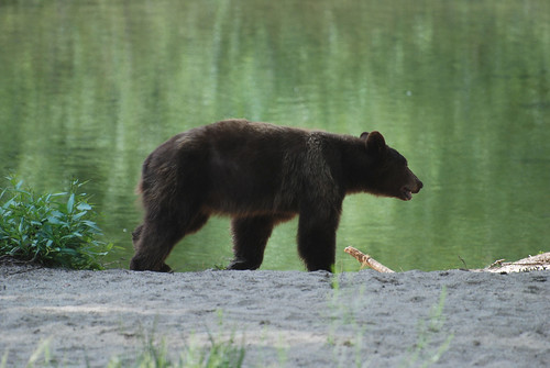
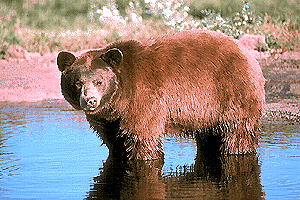
califrepublicAlthough the grizzly bear image graces the state flag, grizzlies were killed off during the gold rush days. Black bears are found in California mountains and foothills, down to lowest elevations in NorCal. California black bears come in more than one color –  light brown, cinnamon, dark brown, and of course, black. For the most part, bears usually stay away from people.

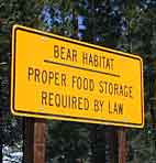
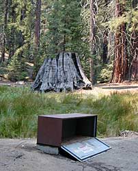
Some areas are more prone to bear problems due in large part to the overpopulation of tourists and abundance of food Bear Habitatprovided by them. Certain California National Parks are particularly notorious for their brazen bear populations. Concentrated bear problems are sometimes posted so be very aware and read signs. If you see steel bear boxes, leave no food or drink in your vehicle. Use the boxes to keep bears from breaking into your car!

California Black Bears

Follow some simple rules:

  • Keep a very clean campsite
  • Clean up all dirty dishes & beverage containers (especially before bedtime)
  • Keep clothing & sleeping bags free from food odors or heavy scents
  • Never leave any type of food garbage ‘bagged up’, sitting outside of a cabin rental, motorhome, trailer, or mountain home
  • Store garbage properly inside a locked, sturdy container inside garage or a shed
  • Stay away from bear cubs, there is sure to be a protective (aggressive) mother in close proximity
  • Try not to hike alone. Make noise & sing on trails to scare away any unwanted animals.
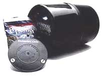
  • Bear storage canisters are available at sporting good stores & at stores in most National Parks.

Proper Food Storage Outdoors:

Bear Boxes @ Campground

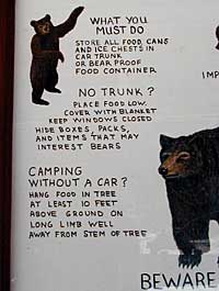
Store food in closed up automobile, not visible. Store food correctly: in trunk of your car, or hidden from sight; in campground food lockers when available.

Lock all food, beverages and coolers in the provided metal bear boxes or bear lockers where available.

Toothpaste, deodorant & anything that has a scent should be thought of as food and stored accordingly.

Bears are so strong they can rip your car door open (in places like Yosemite, where bears are problem and you can get cited for not storing food items properly)

Bears are so strong they can break open a garage door to get to the smelly trash inside, so make sure you utilize the curbside pickup service available in some mountain communities or take a trip to the dump once per week.

carcampers

DO NOT LEAVE FOOD OUT, UNATTENDED, outdoors…
during a picnic lunch, a quick snack, maybe a barbeque, or dinner around the campfire.

Birds, dogs, squirrels and wild animals can move in quickly.

hiker

Backpackers should hang food in nylon bag & drape over weak branch in high in tree: hang your food using the counterbalance method. Ranger who issues your wilderness permit can explain the hanging procedure;

2 stuff sacks (with drawstrings) for your food items, and 60 feet of medium weight cord. 2 carabiners make hanging much easier.

Bear Canisters

Bear Canisters

for your food when exploring the wilderness

hikers tent campers mountains rivers picnic lakes

Bear Repellent / Bear Mace
Bear Pepper Spray


camp  4x4 campfire fish

Additional Storage Tip

As for storing food inside cars:

When primitive car camping on a dirt road, which does not have campgrounds, nor bear lockers, it is possible to store food in the vehicle. BEST location is on the front floorboards with towel over it. With the car alarm set at bedtime, any ruckus should trigger a decent alarm. Any large animal trying to break in will get blasted with alarm siren & most likely will run away. The noise will wake you up as well, to deal with the intruder, if need be.

If a bear does get into your camp area:

  • At night, bring bear repellent can into tent, storing it close to the door. Bring a weapon for added protection.
  • Make as much noise as possible: yell, bang pots/pans, whistle, air horn and get your bear mace or pepper spray ready in hand
  • Raise your hands up to appear larger; lift clothing, increase appearance of size and yell aggressively toward bear.
  • Get your entire camp group together, join hands and spread out; Everyone at the camp should be outside the tents in order to be as effective as possible
  • Throw rocks & small objects; pots, pans, chairs
  • If possible, try to get to your car for protection
  • Sound the alarm on a vehicle &/or honk the horn

If you encounter a bear on a hiking trail:

  • Make as much noise as possible while walking solo. Hum, sing, talk to the birds. Sing or talk to yourself – out loud. Bear bells can be worn on hiking boots. Do not hike w/ headphones on listening to music/radio.
  • Carry bear spray (mace or pepper) in a belt holster, or easy to reach pack.
  • If a bear approaches: stand still, slowly retreat, say a few calming words in a friendly voice and calmly retreat, keep eyes on the bear

encountering a bear  – see more on this topic 

bearcreek

camptruck pinetree  ranger

Bear Meadow
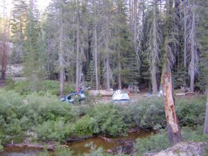
Camp Site at Bear Meadow, Sequoia NF

dirtbikes

Bear Box in Mineral King

driftwood

San Rafael Wilderness

Sierra Madre Mountains
Cachuma Lake to Cuyama Valley

Sierra Madre Mountains

197,380 acres
Central Coast Foothills
Los Padres National Forest

NFSlogoNorth of Santa Barbara, CA
East of Santa Maria, CA
South of New Cuyama, CA
West of Ventucopa, CA

San Rafael Wilderness is otherwise known as the Santa Barbara backcountry. The Sierra Madre mountains and San Rafael mountains make up the this chunk of wilderness, a vast open space near the coast – which extends from Lake Cachuma to the Cuyama River Valley. This is the southern ridge line along Highway 166, with few pine trees, mostly oaks, leading west to Santa Maria River.

hikerFigueroa Mountain and Lake Cachuma are to the south near Santa Barbara. Vineyards and wineries skirt the western hills of Santa Maria, cattle grazing, oil fields and agriculture line the northern borders near Cuyama Valley. Dick Smith Wilderness is just to the east a little bit, spanning over toward Hwy 33.

OHV: better known as off-roading and dirt biking is common in the foothills behind Santa Barbara, as well as on the west side of the San Rafael Wilderness, near Miranda Pine and Tepusquet Road. Numerous small campgrounds on dirt roads are positioned around the perimeter, but no OHV trails lead into the wilderness areas.

McPherson Peak – 5749′ elevation
Peak Mountain – 5843′DSCN5759
Timber Peak – 4764′
Miranda Pine Mountain – 4120′
Wheat Peak – 2436′

trailheads –

  • via Figueroa Road #8N09
  • Cachuma Saddle
  • Davy Brown
  • McPherson Peak, on Sierra Madre Ridge
  • Painted Rock, on Sierra Madre Ridge
  • Santa Barbara Canyon, off Hwy 166

developed campgrounds surrounding the wilderness

  • Davy Brown Campground
  • Nira Campground
  • Cachuma Campground
  • Figueroa Campground
  • Manzana Schoolhouse
  • Colson Canyon (OHV) #11N04
  • Brookshire Springs
  • Miranda Pine #11N03
  • Horseshoe Springs
  • Lazy Campground
  • Wagon Flat Campground
  • Barrel Springs #10N06
  • Alesandro Campground

back road access –

  • Figueroa Mountain Road #8N09
  • Tepusquet Road, off Hwy 166
  • Miranda Pine Road #11N03
  • Sierra Madre Ridge Road #32S13
  • Cottonwood Canyon Rd @ Hwy 166
  • Santa Barbara Canyon Rd, off Hwy 166

indian rock art

Native American petroglyphs can be found in this remote region of Central California, but may require topographic skills, detective work, trekking and at least a full day of physical action.

PigPen Trailhead

Access to ”Painted Rock” on Sierra Madre ridge is hike/bike in only. The dirt road that access these trailheads are rough road and not maintained. High clearance may be needed. This day trip is an all-day adventure and you might want to consider bringing the mountain bike. Just stay on the road, as rangers will ticket for riding in the designated Wilderness Areas.

from the west – If you plan to visit the rock art from the west side, take Cottonwood Canyon (small sign) turn off of Hwy 166. Pay attention to private property signs, cuz the locals are serious about their lands. Keep on driving up the mountain. Above Bates Canyon Campground up on the ridge, turn left, east on dirt road #32S13 – proceed several miles to the dirt parking area at the pig pen w/ locked gated and signed trailhead.

from the east – dirt road hike is about 10 miles (one way) and it starts at the Santa Barbara Canyon trailhead @ locked gated. Rural back road access requires a good topo map. Find Cuyama River @ Hwy 166, take the route on west side of bridge. East of New Cuyama, CA

nearby towns –

California Parks List

California Parks and Recreation

State Parks, State Forests, State Recreation Area, National Parks, National Monuments, National Forests – What is the Difference?

public lands

Forest, Park, Reserve, Monument, Recreation Area, BLM, Nature Preserve… arghh!

Don’t let all the park and forest names confuse you. It is all California and it is your public land! No bikes on trails, No gathering wood, No dogs here, No camping there; Now what?

Below is our overview graph for all California parks and forests – the basic concepts & the rules broken down for anyone to understand. Permits may be needed in certain areas. Only the government officials understand the true nature of all the ridiculous red tape.

CA Wilderness Areas California Wilderness Back country lands very protected from roads and human impact. Off limits to vehicles & mountain bikes. Only accessible by backpacking, hiking or horseback. Endangered species; Hard to reach terrains in the High Sierra. Overnight visits may require a wilderness permit.
CA National Parks California
National Parks – NPS: National Park Service
Federal lands are national parks, preserves & monuments; highly regarded as some of the most scenic in world & protected.  Very popular places and crowds often in summer. Limited use areas for camping & recreation. No mountain biking on trails. No dogs on trails. Try off-season. Drive thru entrance fees.
NM: California
National Monument
Located within the National Park System & more specific to a region. Historic buildings, geological features and deserts ruins qualify. Some National Monuments become National Parks. Many locations have entrance fees.
NRA: National Recreation Area Located within the National Park System & somewhat specific to a waterways, coastlines, lakes and reservoirs. Some locations have entrance fees.
NSA:
National Scenic Area National Seashore
Located within the National Park System & is basically scenic area worth preserving. Usually no entrance fees.
California National Parks
California USFS:
CA National Forests
USDA Forest Service
Areas of forest lands throughout state; some surround the National Parks. 18 national forests make up 20 million acres of federal land. Multiple use areas: snow skiing, mining, grazing, off-roading. OHV & SVRA Tons of small campgrounds, recreation & primitive spots for real seclusion. Best bet for finding a spot away from the crowds. Get a free fire permit & camp on back roads. No entrance fees, some parking or day use fees; SoCal requires an Adventure Pass.
California State Parks
California SP:
California State Parks
California Department of Parks & Recreation manages more than 260 parks. These smaller parks are located near cities with historical parks, as well as remote wild state land & coastal beaches. Entrance fees, day use, picnic and some have campgrounds. State Parks charge fees for day use, parking and overnight camping.
California SF: California State Forest California Demonstration Forests, areas to be protected. Redwoods & Sequoia Groves; fragile eco-systems. Handle with care. May charge entrance fee or day use fee.
California SRA:
State Recreation Areas
California Department of Parks and Recreation. Lakes, Reservoirs, Rivers. Many have boat rentals and active marina. Recreation lakes charge entrance, day use, parking or boat launch fees.
California OHV & SVRA: Off Hwy Vehicle Area and State Vehicle Recreation Areas Off Roading folks and dirt bikes can have their fun wheelin. Lands set aside for OHV use; dune buggies, quads & 4×4 enthusiasts. Most in desert regions; forest lands. Developed campgrounds large enough to accommodate RVs and trailers. Fees may apply in these off-road areas for day use or camping.
California County Parks Desert hot springs, oak foothills and campgrounds, local hills w/ hikes, parks close to urban regions. Back roads & rural land protected from freeways & development. May require parking or entrance fees. Find these listed on the California A-Z town pages
City Parks in California Urban Parks & Recreation, inside the city limits. Usually no entrance fees. Find these on California A-Z town pages
blm camps
BLM: public lands Bureau of Land Management All public lands that do not fall into the above categories. Little to no fees for day use, recreation or overnight camping. Plenty of desert & off roading areas. Some forest lands, certain lakes. Small campgrounds or open camping allowed. Fees may apply in developed campgrounds. Camp overnight almost anywhere out here for free, with a ranger issued camp fire permit.

califrepublic


Sequoia – which one?
Sequoia National Park
Sequoia National Forest
Giant Sequoia National Monument

Imagine that the Southern Sierra mountains is home to 3 different public parks named Sequoia. Yep, it’s true. Sequoia National Park, Sequoia National Forest, and Giant Sequoia National Monument. Other parks that have Sequoia groves are – Mountain Home State Forest, Calaveras Big Trees State Park, as well as Yosemite National Park.

As far as the Coastal Redwoods, most are included under State Parks. Find these parks on the Central Coast Big Sur and Santa Cruz mountains, plus Marin County, and all along the north coast US Hwy 101 from Mendocino to the Oregon border. Numerous redwoods parks are located along rivers.

we break it all down here on
Big, Tall, Old Trees

The super scenic Big Sur coastline is home to Julia Pfieffer Burns State Park and to the similarly named Pfieffer Big Sur State Park. Leave it to park personnel, state officials or the non-locals to create such a confusing naming system within our most-visited state.

hiker

Park Maps & Topos  topo maps

National Forest Atlas
National Forest Maps
National Park Maps
State Park Maps
BLM Maps

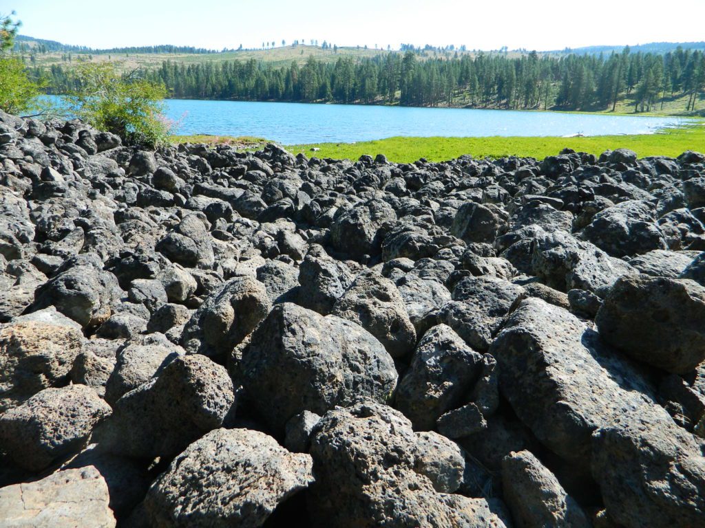
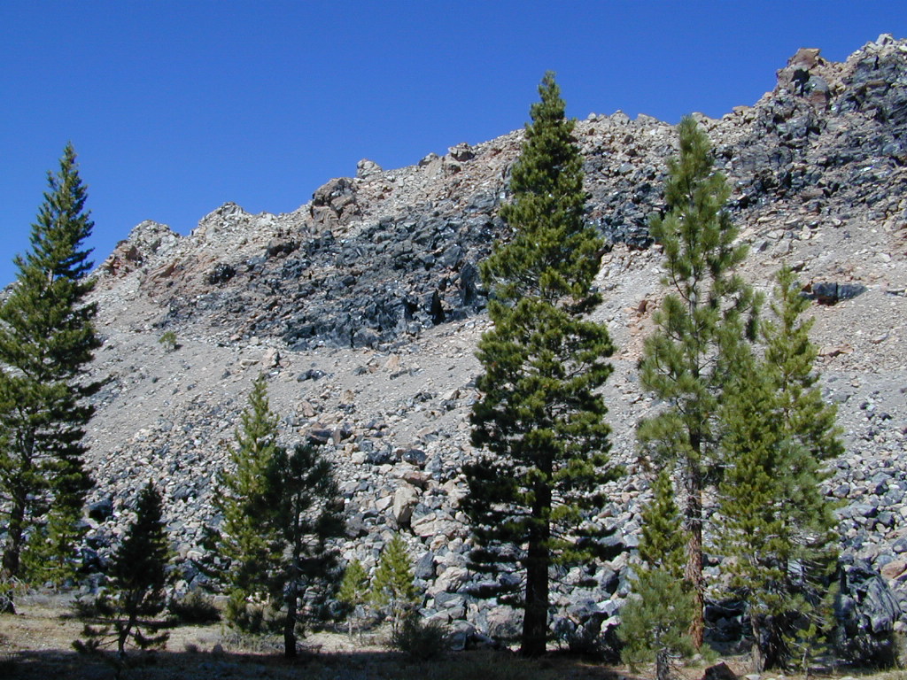
Lava Blue Lake
Lava Rock @ Blue Lake in Modoc County
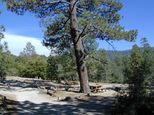
holcombcamp
Holcomb Valley Camp, Big Bear Lake, CA
Wilderness with Horses Sierra Ski Maps Camping California Wilderness Rangers Snow Ski Topo Maps Mountain Biking Maps
Wilderness Hikes Wilderness Hiking Maps Wilderness Topo Maps Sierra Fishing Maps Sierra Topo Maps California Hiking Maps
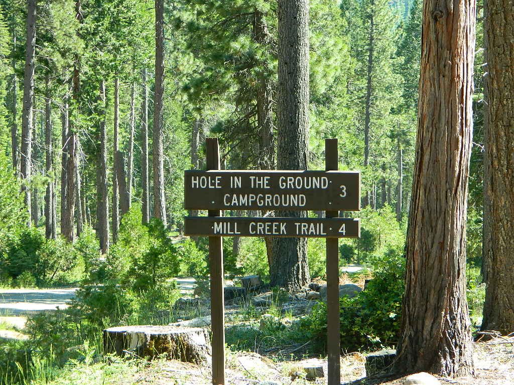
holeinthegroundsign
Lassen Camping near a creek in Northern California

California Outdoor Recreation:
All parks, forests, preserves, monuments, public lands, lakes, rivers, wilderness, historical sites and museums can be found listed separately on our super duper local A-Z town pages

fout springs
Fout Springs, near Stonyford, Northern California

dirtbikes

Stanislaus Campgrounds

Stanislaus Camping / Sonora Pass Camping

dardanelleNFS
NFS Dardanelle Campground along Sonora Pass Highway

camp

Sierra Nevada  Campgrounds inside the Stanislaus National Forest

Hwy 4, Stanislaus National Forest Camping

campground elev spots veg toilet water notes
Big Meadow Campground 6200′ 30 pines flush piped Hi Sierra; no RV hookups
Bloomfield Campground 7800′ 20 pines vault pump Mokelumne River fishing
Board’s Crossing Camp 3800′ 5 pines vault creek Stanislaus River fishing
Hermit Valley Campground 7100′ 8 pines vault creek June-Oct
Lake Alpine Campground 7300′ 25 pines flush piped June-Oct
Mosquito Lakes Camp 8260′ 8 pines vault lake Sierra river fishing
Pacific Valley Campground 7600′ 9 pines vault no meadow, June-Oct
Sand Flat Campground 5900′ 6 pines vault creek 4WD camp, June-Oct
Silvertip Campground 7300′ 23 pines flush piped June-Oct
Silver Valley Campground 7400′ 21 pines flush piped June-Oct
Stanislaus River Campground 6200′ 25 pines vault pump Sierra river fishing

Hwy 120, Groveland Yosemite Camping

campground elev spots veg toilet water notes
Lost Claim Campground 3100′ 10 pines vault pump May-Sep
Lumsden Campground 1500′ 11 mixed vault creek Tuolumne River fishing
Lumsden Bridge Camp 1500′ 9 mixed vault creek Tuolumne River fishing
South Fork Campground 1500′ 8 vault creek Tuolumne River fishing

Hwy 108, Sonora Pass Camping Stanislaus

campground elev spots veg toilet water notes
Crandall OHV Camp 5000′ disp no no May-Oct
Dardanelle RV Park & Cabins 5700′ park pines flush piped 209-965-4355
Boulder Flat Campground 5600′ 20 pines vault piped Stanislaus River
Cascade Creek Campground 6000′ 12 pines vault creek May-Oct
Deadman Campground 6200′ 17 pines vault piped Stanislaus River fishing
Herring Creek Campground 7350′ 7 pines pit creek May-Oct
Mill Creek Campground 6200′ 19 pines vault creek May-Oct
Niagara Creek Campground 6600′ 10 pines vault creek May-Oct
Niagara Creek OHV Camp 6600′ 10 pines vault creek 4×4 camps, May-Oct
Sand Bar Flat Campground 3000′ 10 pines vault piped Stanislaus River fishing
Trout Creek Campground 5400′ disp. chem creek equestrian, May-Oct

GOLD COUNTRY CALIFORNIA Hwy 49

pinetree

see also
Calaveras Big Trees State Park

Calaveras Big Trees

butterfly

nearby towns –

hiker

maps of this Sierra Nevada region –

6N06 – Stanislaus NF

graded road

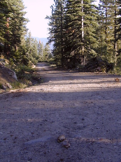
Forest Rd #6N06 – County Line Road, Fence Creek, Stanislaus National Forest

Central Sierra Nevada Mountains, California
N of Hwy 108; W of Sonora Pass

On the very edge of wilderness
Stanislaus National Forest
County Line Road
Fence Creek Campground (NFS)

Graded dirt road near Clarks Fork junction @ SR 108. Dirt road travels up into forest, hiking trails and meadows; South side of the volcanic Dardanelles @ Tuolumne Co. & Alpine Co. boundary

Carson Iceberg Map

County Line Trailhead
Wheats Meadow Trailhead
Carson Iceberg Wilderness Area
The Dardanelles (9524′ elev)

Clark Fork, Middle Stanislaus River

Topo Maps of this Region:

Stanislaus National Forest Map USDA
Carson Iceberg Wilderness Map USDA
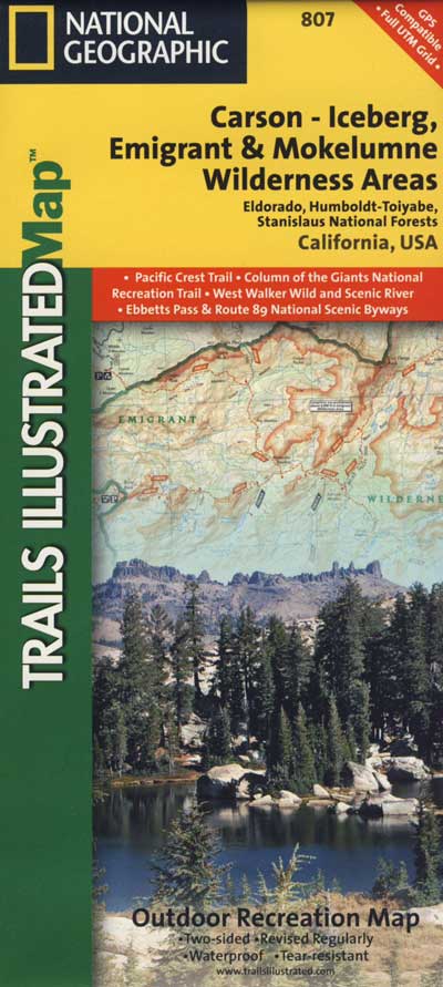
Carson, Emigrant, Mokelumne Map NatGeo
Sierra Nevada Topo Map

hiker

  • backpacker access
  • day hiking
  • horse camping
  • primitive camping
  • trailhead camping

winter road closure, annually
check with local rangers on road access and conditions.

Rd# 6N06, climbs to mountain scenery at upper elevations, well of the main highway. Route is a 2-lane wide road at times, narrower and private towards the end of roads; several dirt roads, overgrown 2 tracks w/ many camp sites to choose from. Dispersed primitive camping requires a camp fire permit.

6N06rd

OHV off-roaders will only find dead ends on dirt route 6N06. NO motorized access in nearby wilderness. Wheelers should try south of Highway 108 @ Niagra Campgrounds; Niagra Off Road #5N01 for all the noise-makers, gear heads, dirt bikes, and toy boxes. Niagra Creek, Niagra OHV, Niagra 4×4.

dirtbikes

nearest towns:

Dardanelle
Pinecrest Lake
Twain Harte

volcano mdws

Salmon River California


salmon river
Photo Credit Erik Meldrum

Salmon River
Forks of the Salmon

NORTHERN CALIF

One of the most remote & biologically intact watersheds left inside California. The headwaters of the Salmon River flow from the Trinity Alps, Marble Mountains, and the Russian Wilderness Areas. 850,000 acres of Wilderness surrounding the Salmon River watershed.

You gotta know how to read a map if you wanna find this hidden gem. For those who love seclusion! This NorCal river region is a prime destination for true nature lovers: campers, hikers, fishermen, river rafters, river kayakers, mountain bikers, backpackers, birdwatchers and horse enthusiasts. Summer is the busiest time and of course, the best weather. The remainder of the year, you’ll basically have the place all to yourself. Winters can be wet and sloppy, so don’t get stuck in the mud. Cell phone reception is minimal in these densely forested backwoods.

Rafting, river beaches, kayak spots. Campground camping, RV camping, tent camping, primitive and wilderness too.

A significant part of the Klamath River’s watershed is in the Karuk Tribe’s Ancestral Territory. Karuk Indians have carefully managed their lands through an integrated continuum with the aquatic and terrestrial ecosystem functions for thousands of years. Salmon, or “Ama” in the Karuk language, was a major source of food and spiritual renewal.

Forests & Parks along Salmon River:

Frazier Park Camping

Mount Pinos Camping & Frazier Park Campgrounds

Drum Circle Camp
Mount Pinos Fire Circle Camp Spot
camp5
Gold Hill Campground (which is now closed) – right next to Piru Creek.

camp

Frazier Park and neighboring towns, like freeway-close Lebec and Gorman, is where the Los Angeles hills meet the Kern County mountains. Mojave Desert meets to Coastal Range. EXIT I-5 @ Tejon Pass (elev 4144′)

Wildflower hills, seasonal creeks, forested peaks, high desert canyons. Bike trails, hike trails, off road routes. High elevation backpacking, hang gliding, mountain biking and camping in every direction.

MTB SOCAL
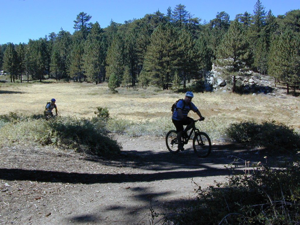
Mountain Bikers love the trails at Mount Pinos.

High desert washes, oak creeks, pinyon pine forests, mountain meadows and numerous peaks – Frazier Peak, Reyes Peak, Alamo Mountain, Mount Pinos, Mount Abel (Cerro Noroeste) and north facing San Emigdio ridge.

Mt. Pinos District:

campground elev spots veg toilet water notes
Aliso Park, Cuyama 3200′ 11 oak pit no Aliso Cyn Rd. (#10N04)
Ballinger OHV Camp 3000′ 20 pinyon vault no Rd# 9N10, Cuyama Valley
Camp-O Alto 8286′ 12 jefferey pit no ridge, Cerro Noroeste
Caballo Campground 5850′ 5 oaks pit no Rd# 9N27, Cerro Noroeste
Cherry Creek 4×4 5200′ 2 oak no spring 4WD trail, Cuddy Valley
Chuchapate Campground 6000′ 30 pines vault piped Rd# 8N04, closed winter
Chula Vista Walk-In Camp 8300′ 12 pines vault no walk-in camps & RV lot
Cottonwood Campground 4600′ 2 ctnwd no creek 4WD only trail, fish
Dome Springs Camp 4800′ 4 oak pit no Rd# 8N40, Lockwood
Dutchman Camp 6800′ 8 pines no no Rd# 7N01, 4WD trails
Half Moon Campground 4700′ 10 pines pit no Rd #7N03, May-Oct
Kings Campground 4250′ 7 pinyon vault no OHV & Piru Creek
Marian Campground 6600′ 5 pine pit no closed in winter
McGill Campground 7500′ 50+ pine vault seasonal mountain biking
Mount Pinos Campground 7800′ 19 pine vault seasonal closed winter
Nettle Springs Camp 4400′ 9 pinyon vault no Rd# 8N06, Apache Cyn
Ozena Campground 3660′ 12 cottnwd vault no Lockwood Rd
Pine Springs Camp 5800′ 12 pinyon pit no Road #7N03
Pleito Campsite 5000′ 2 mixed no no dirt rd access, dispersed
Rancho Nuevo 3550′ 2 mixed no no river crossing
Reyes Creek 4000′ 30 oaks vault yes creek camping
Reyes Peak Pine Mt 5200′ 6 pines none no ridge camping
Salt Creek 4×4 3000′ 2 mixed no no 4WD only
Sunset Campground 4300′ 2 cottonwd no no Lockwood / Piru Creek
Thorn Meadows 5000′ 5 pine pit no Rd# 7N03C, horse corral
Tinta Campground 3600′ 3 pinyon pit no river crossing
Toad Springs Camp 5700′ 5 pinyon pit no Rd# 9N09, Quatal Cyn
Twin Pines Camp 6600′ 5 pine vault no Dry weather only
Valle Vista Camp 4800′ 7 mixed pit no condors, new toilet

See Mount Pinos Recreation Campgrounds only

Group Camping Sites in Los Padres Forest

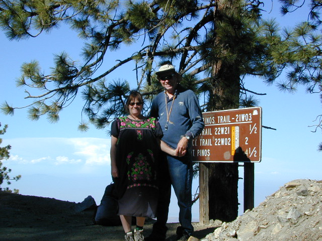
Hiking Pinos Signs
Mount Pinos – Peak to Peak hike.

Maps of Los Padres NF –nettle spring camp

Los Padres mountain towns –

DSCN0043

Toad Springs Campground atop Quatal Canyon. Small camps located in Los Padres NF have no fees, and often no toilets – so bring the shovel.

Many dirt roads are gated seasonally for wet weather or snow. Call rangers to find out which routes are open before you plan your weekend. Or have a plan B and C camp site ready if route is closed. Flashfloods, thunderstorms, and erosion means you may all-of-a-sudden need to use your 4WD. This is the mountains after all. UNpredictable weather is common.

frazier park camping

Primitive Camping in Quatal Wash, next to the OHV Route and the Chumash Wilderness

PeaktoPeak
Peak-to-Peak Hike: the toughest climb you’ll do, this decade.


Heart Bar Campground

Heartbar

San Bernardino National Forest: Heart Bar Campground
National Forest Service

At Hwy 38 & Forest Road #1N02 is a huge, pine forested valley, right next to San Gorgonio Wilderness. Heartbar Campground, Heart Bar Horse Camps, RV Dispersed Sites. Highway 38 – SE of Big Bear Lake, California; Mountain Bike, Hiking & Equestrian Trails with ridges of 10,000′ elevation. SAN GORGONIO peak nearby. Best high elevation scenery for SoCal by far.

  • backpacking
  • camping
  • fishing
  • hiking
  • mountain biking
  • mountain peaks
  • waterfalls
yellows
Primitive Camps on the Back Road #1N02

Heart Bar Campground

Big Bear Forest –  HEART BAR

This gorgeous valley is a developed recreation area w/ 89 camp sites, plus big equestrian area. Picnic, hiking, mountain biking, horseback trails, plenty RV spots, even a creek. (Oooops I meant the Santa Ana River) Highway 38 is kinda the long way into Big Bear Lake, up thru Angelus Oaks. Locals call this stretch of the highway Barton Flats.

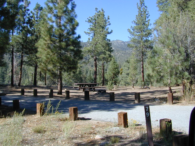
spot79

horse camp
Bring the Horses & RVs

Group Campground facilities
Barton Flats – San Gorgonio Recreation Area

out back

Leading out the back way of HeartBar, past the horse camp – is a nice one lane dirt road, narrow in spots, with random, primitive camp sites along the roadway. Authorities refer to these spots as yellow post camp sites.

This backcountry route is marked as Forest Service Rd #1N02 – graded dirt road that leads back to Coon Creek Cabin.

Coon Cabin
Coon Cabin Backside

Big Bear Discovery Center
at Big Bear Lake
909-382-2790

ranger

Southern California forest 

San Bernardino maps:

nearby mountain communities:

ForestFalls
Forest Falls, late afternoon

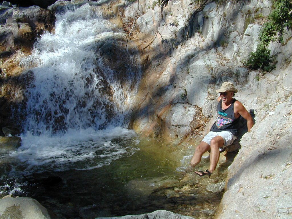
Forest Falls is well worth a stop for a quick picnic or hike – and head dunk. Weekends can be busy and crowded. Since this location is close to Southern California and the population centers, expect weekends to be busy in the Big Bear mountains. Plan a trip for week days to experience less people, and more nature.


Lundy Lake California

Lunar Lundy Lake

Eastern Sierra
Lundy Lake

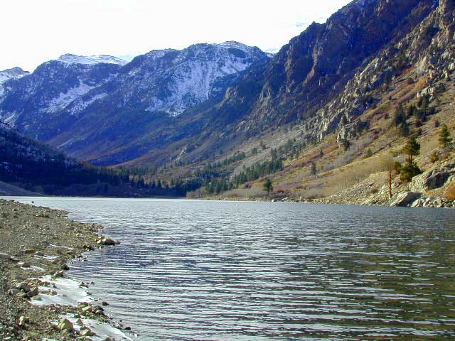
Lundy Canyon is located at the very northern boundaries of the Inyo National Forest, bordering the Humboldt Toiyabe National Forest & Virginia Lakes. Mill Creek flows down Lundy Canyon from the Sierra Nevada; Lundy is a small lake in a deep, rugged canyon with wilderness trailheads, East of Yosemite National Park.

Lundy Lake
West of Mono Lake, California
US 395
Lee Vining, CA

elevation: 7800′
Seasonal access, closed for winter

backpack, camp, canoe, fish, hike, kayak
aspen groves, autumn colors
wildflowers, waterfalls


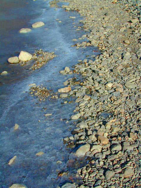
Frozen Edge

camp

Lundy Campgrounds

  • Lundy Canyon Campground
    Mono County Dept of Public Works
    760-932-5440
    36 camp sites w/ picnic tables, fire-rings & bear boxes
  • Lundy Lake Resort
    Bait, tackle, general store, fishing lake, boat ramp.
    626-309-0415
    21 camp sites, 8 cabins, 3 camp huts, 5 RV camp sites

camping

National ForestsThere is not any NFS Campgrounds in this Lundy Canyon, but plenty can be found nearby at Lee Vining Canyon, at junction US 395 & Hwy 120.

Mono Lake also has camping at the county park. And free camping (boondocking) can be found – all up and down US 395

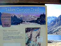
Lakes Canyon Trailhead

hikerLakes Canyon Trailhead

Backpackers & Horse Packer Trains have excellent access to the Hoover Wilderness in the High Sierras. Plus this prime Lundy Canyon location is situated at the back door of Yosemite NP.

Mono County Tourism
800-845-7922

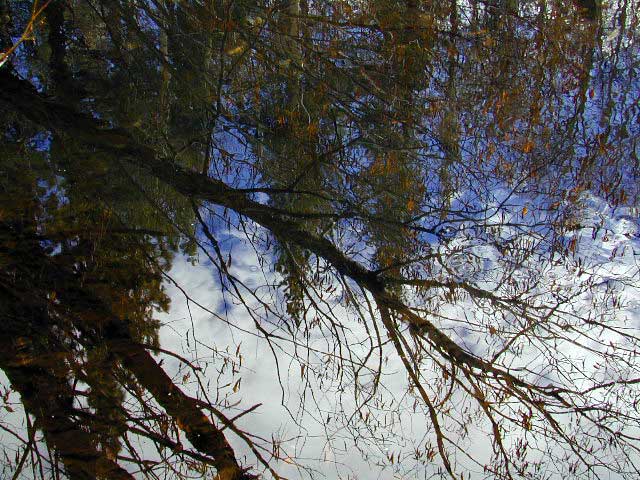
Reflections

Lundy Area Maps:
Hoover Wilderness Trail Map (Tom Harrison)
Inyo National Forest Map (USDA)
Yosemite High Country Map (Tom Harrison)


View Larger Map

Links for Lundy Canyon:

Lundy Lake Road
Lundy Lake Rd, the paved road up climbs the steep canyon to an elevation of over 7500′

Snag Lake California

Snag Lake California


Lakes Basin Recreation Area
Snag Lake

A free lake camp in between Truckee & Quincy, CA

This is one of many small lakes situated within the Lakes Basin Recreation Area , in the Northern Sierra Nevada mountains. Just north of Downieville & Historic Gold Country. Snag Lake is nothing special compared to the rest of the scenic lakes close by, but it is worth a mention due to a few fun facts.

Sierra Nevada Lake

One thing this small lake campground does have is convenience, located right on the Gold Lake Highway – next to Goose Lake, plus hiking distance to the largest of the lakes, Gold Lake. The second feature is the campground is small, 16 primitive sites, picnic tables & one vault toilet. The third thing is that this is a FREE campground; no charge.

campsite snag lake

Snag Lake Campground

• Elevation: 6600′
• Number of Sites: 16
• Vehicle Accessibility: Small RVs
• Campsites Reservation: No
• Camp Fee: No
• Length of Stay: 14 Days
• Season: June – October
• Trailheads: Gold Lake

Boulder Hopping

dirt drive (no pavement)

No motorized boats allowed. No paved boat ramps. Kayaks & canoes can hand launch from several spots. The dirt driveway is easily missed, especially at night. The old wooden, forest service sign is not reflective. The vault toilet is close to the highway and the camp sites are along the lake edge. No pavement anywhere!

Upon arrival, camper trailers will want to get out and select the best route to a camp site. The small boulders, dead trees, root and rock obstacles are abundant on the dirt road entry, all around the campground, and at each camp site. High clearance vehicles would fair best at this camp, but some passenger cars may be able to manage the rocky entrance. Get out and look at the road, before scraping across the biggest rock. Slowly, carefully, maybe… and preferably an arrival before dark.

LOCALS TIP: The wind tends to pick up at night around these lakes, so brace your tent well and position your vehicle appropriately.

NFS lake camping lake fishin hiking lakes lakes

fishing lake?

rainbow trout

Obviously with a name like SNAG, you can imagine that the fishing here is not the best, since roots and old tree stumps make up a good portion of the shoreline. Luckily there are a dozen alpine lakes within a 20 mile radius to choose from for another fishing spot. Some lakes are hike-in only, some require 4×4 to reach and others have cabin resorts.

towns nearby –

sierra snow

SEASONAL SNOW CLOSURES

snowmobile
Gold Lake Hwy (or Gold Lake Road) closes in the winter months (NOV-APRIL) due to snow and the region is used as a winter recreation area. Cross-country skiing and snow-mobiling are both popular activities.

driftwood

Lassen – Snag Lake

ANOTHER SNAG LAKE in NorCal, can be found by foot, hiking into the Lassen Volcanic Wilderness. Backpacking the lake loop is approx 17 miles RT and includes 3 lakes – Snag Lake, Widow Lake, and Jakey Lake. Trailhead is located at Juniper Lake, at the north shore.

read more about this hike

hiker

SIERRA LAKES

4×4 lakes
backpacking lake
camping lakes
canoeing lake
fishing lakes
hiking lake
kayaking lakes
waterfalls

Camp Clueless

Camping Tips

California Camping Tips

New to California? Never camped before? Haven’t been out in years? No idea of where to start? Total Escape is here to help with all your camping questions, local destinations and share tips; Introducing you to the big adventure in inexpensive vacationing, primarily outdoors. Find rural, remote locations, ranches, small towns, rivers, lakes, creeks, well away from the crowds. Get outta town more often for less money.

WhiteFir Camp

Camp at Echo Lake

click here for all kindsa cool
california camping destinations

National Parks National Forests State Parks California BLM OHV routes California Wilderness
Beach Camping
California Forests
Wineries
Desert Parks
California Back Roads California Lakes

boon-docking basicscheck

  • be a self sufficient camper
  • get a campfire permit
  • have a shovel, bucket and water
  • bring topographic maps
  • get off the paved roads
  • arrive before dark, or bring GPS
  • expect to find best camp spots already taken, have a plan B & C
  • prepare for bears @ camp, if camping in the forest
  • minimal, if any, cell phone signal

free RV camping

RV

free Campgrounds Sierra

camp

Creekside Camp
California Creekside Camps
roundtentcamp
Mammoth Fishing & Camping
bigdoortent
Flat, level, private, free. >>>> Find the perfect tent spot!

El Dorado Camping

Primitive Camping in El Dorado County

Camping Rivers

More & more people are venturing off the beaten path. Tourist flocks to Gold Country, and many do not even leave Highway 49. Get up the mountains, higher than the foothills.camp

Getting outta the developed campgrounds to discover the joys of dispersed back woods camping is a new adventure, not to be taken lightly.

With truck or SUV ownership come some great rewards! Order a good map & go find some dirt roads. Waterfalls, dense forests, secluded creekside camp sites & more await you. Obtaining a camp fire permit is mandatory for this style of camping.

campfire

fish

Campfires are often banned in California, due to extreme wildfire danger. Since the gold mining foothills are usually oak and dry grass, with large steep river canyons, extra caution should be given. Always know the fire conditions before you build a campfire. Caldor Camping

Discover the hidden back roads: like Caldor Road off of Grizzly Flat Rd. – above Placerville CA

Hey, now this is what we’re talking about. Plenty of great dispersed camping down by the Cosumnes River & Consumnes Mine Rd. There are hundreds of miles of small roads to discover back behind this historic mining area. Rivers, waterfalls & decent fishing too. Make sure you clean up some litter. This is the only price you pay for the beauty, serenity, peace & quiet & no neighbor campers next to you.

hiker

Out exploring these parts, you may run into a dead end road that peters out at some Private Property, which is usually signed & fenced. Make nice with the old crazy miner dude & turn your ass around politely, everything will be okay as soon as you are not within gun shot of him. Yes, there still are plenty of small time mining experts tucked away back here in the hills.

river camping
Premium and secluded river side camp sites in El Dorado National Forest

Plenty creeks and rivers run throughout this central Sierra region, so you can fish all day – until your hearts desire. River rafting and river kayaking opportunities are also great reasons to get wet.

canoe

Several mountain reservoirs around offer camping and boating too. Eldorado lakes are listed below.

  • Caples Lake @ Carson Pass
  • Ice House Reservoir
  • Jenkinson Lake – US Hwy 50
  • Kirkwood Lake
  • Lower Bear River Reservoir – South Shore Campground
  • Salt Springs Reservoir
  • Silver Lake @ Carson Pass
  • Union Valley Reservoir

mountains

nearby towns –

El Dorado Forest Maps –

South Warner Wilderness

Warner Mountains
Modoc Country
Northeast California

Road 64

Wide open spaces, mountains, rivers and ranch lands. The very last of the unexplored high country of California. Rural and rustic regions are full of forested mountain ranges with sage brush meadows lying below. Valleys are high elevation deserts with a base terrain sitting above 4000′; Peaks @ 8000′ above sea level.

South Warner Wilderness

70,000 acres
80 miles N of Susanville, CA
Modoc National Forest
NFS

South Warner Wilderness is in the southern portion of the Warner Mountains, a north south positioned range, located in the top corner of the golden state. Surprise Valley lies to the east, bordering the Nevada state line and Alturas w/ US Hwy 395 on the west side.

California SR 299
Hwy 299, the only paved thoroughfare cuts right through the middle of the Warner Mountains. Paved Parker Creek Road #56 climbs up Parker Creek from Alturas, accessing camping, hiking, dirt back roads and wilderness trailheads. Warner Mountains State Game Refuge is north of the wilderness area.

One dirt route skirts the wilderness boundary – West Warner Road #5, which leads from Parker Creek due south to Jess Valley Rd #64. Blue Lake Road, Patterson Mill and Road #39N15 are nearest to East Creek. Winter driving tips from NFS.

butterfly

  • backpacking
  • camping
  • creeks
  • fishing
  • hiking
  • horseback riding
  • hot springs
  • lakes
  • waterfalls
  • wildflowers
  • wildlife

South Warner Lakes & Reservoirs lake

  • Clear Lake
  • Patterson Lake
  • Porter Reservoir (elev 6682′)
  • West Valley Reservoir (elev 4761′)
  • Blue Lake
  • Sworinger Reservoir (elev 5868′)

South Warner Trailheads hikes

  • Summit North Trailhead (Road #31)
  • Pine Creek Trailhead (Road #5)
  • Mill Creek Trailhead (Road #40N24)
  • Clear Lake Trailhead (Road #5)
  • Summit South Trailhead (Road #64)

mill creek falls modoc

South Warner Campgrounds camp

All these campgrounds listed can be accessed by a vehicle, most by narrow back roads (some dirt). If you prefer to drive on paved roads only, then you’ll need to choose Blue Lake or Mill Creek Falls. Deep snow closes forest roads and campgrounds are generally only open a few months per year, from May to October.

South Warner Mountain Peaks

  • Squaw Peak (elev 8646′)
  • Warren Peak (elev 9710′)
  • Dusenbury Peak (elev 9710′)
  • Eagle Peak (elev 9892′)
  • Cole Peak (elev 8970′)
  • Emerson Peak (elev 8989′)
  • Hat Mountain (elev 8737′)
  • Red Rock Mountain (elev 8518′)

south warner mountains map

Wilderness permits can be obtained at local ranger station: NFS
Modoc National Forest
225 West 8th Street
Alturas, CA 96101
530-233-5811

Blue Lake Modoc
Blue Lake Modoc

nearby towns –

Group Campgrounds Eastern Sierra

agnewmdws

Group Campgrounds in the Inyo National Forest camping

These group camping facilities are available by advanced reservation only; open for summer and usually closed during winter months .

campground elev spots veg toilet water notes
Agnew Meadow Horse Camp 8400′ 4 pines chem piped Group & Equestrian
Mammoth
Aspen Group 8100′ 4 aspen flush piped Rock Creek
Big Pine Canyon Group 7600′ 1 pines vault piped W of Big Pine; May-Oct
Bishop Park Group 7500′ 21 oaks flush piped Group Camping; May-Oct
Fossil Group Camp 7220′ 11 pines vault no Hwy 168; E of Big Pine
Juniper Group Camp 7000′ 5 juniper vault piped Hwy 168; E of Big Pine
Obsidian Flat Group 6000′ 50 pines vault no Group Camp Mammoth
Pumice Flat Group 7700′ 17 pines flush piped June-Sept; Mammoth
Rock Creek Lake Group 7600′ 1 aspen flush piped Group Camping; May-Oct

RESERVATIONS REQUIRED

Call ranger station to reserve.
Inyo National Forest
351 Pacu Lane #200
Bishop, CA 93514
760-873-2400

see developed tent & RV Campgrounds – Inyo National Forest

rockcreekcliffs

Obsidian near Hwy 395 & Mammoth
Eastern Sierra Obsidian Dome – near US Hwy 395 & Mammoth Lakes, CA

Eastern Sierra maps –

Topo maps, wilderness hiking maps, fishing maps
Equestrian trails, 4×4 routes, OHV maps –

lake mary

southforkbishop

Bishop Creek near Aspendell, CA

Mill Creek Falls Modoc

mill creek falls

Mill Creek Falls
Modoc National Forest

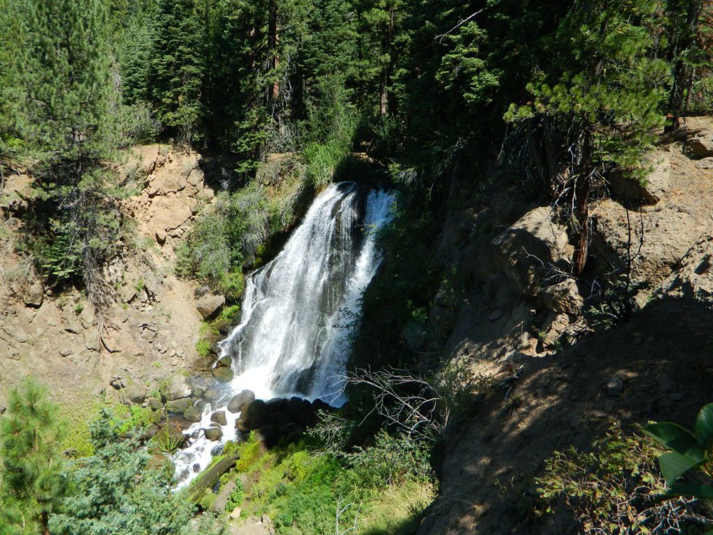
Just found another MILL CREEK in Northern California; a waterfall on the west side of the South Warner Wilderness. Located at the headwaters to the Pit River; about 6 miles east of Likely, CA

A small developed campground on a wooded slope; with new bathrooms, shady camp sites, a paved loop, and a short hike to the falls.Hiking trailhead leads into the wilderness area for fishing, hiking, lakes and backcountry access.

Open less than half the year, due to winter snow. Campground access off US Hwy 395, via Jess Valley Road #64

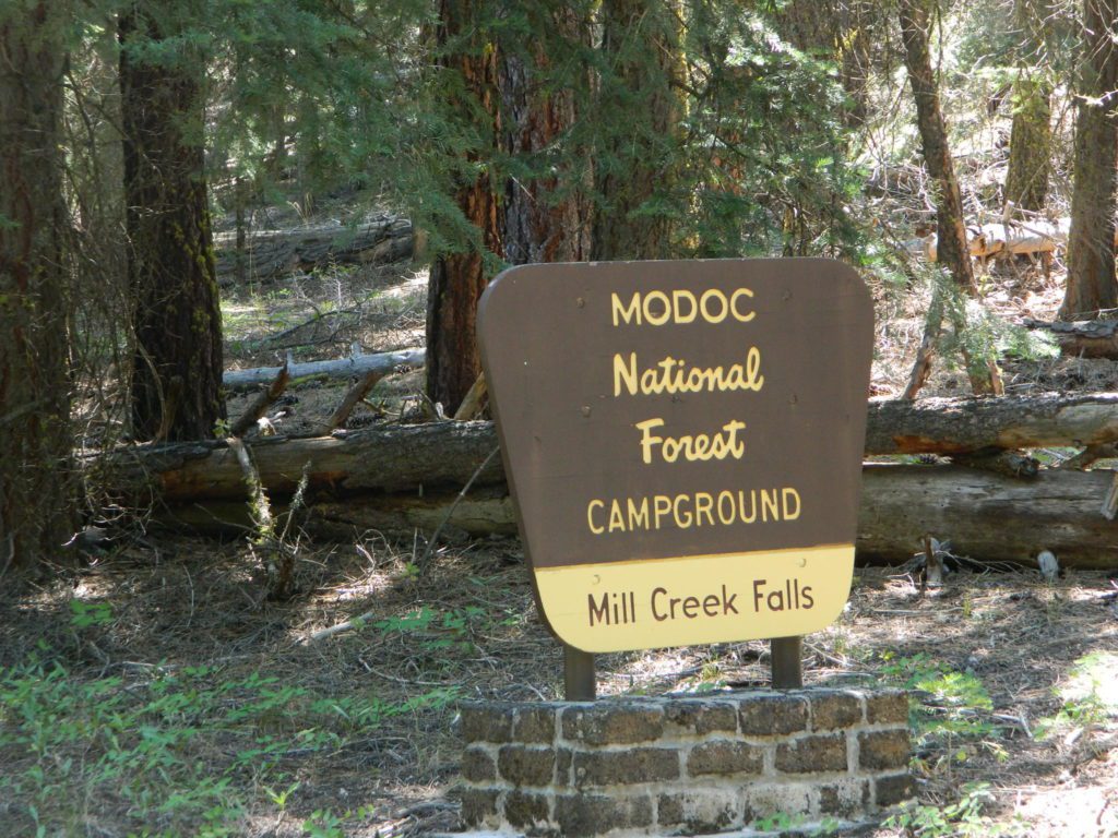
Mill Creek Falls Campground NFS

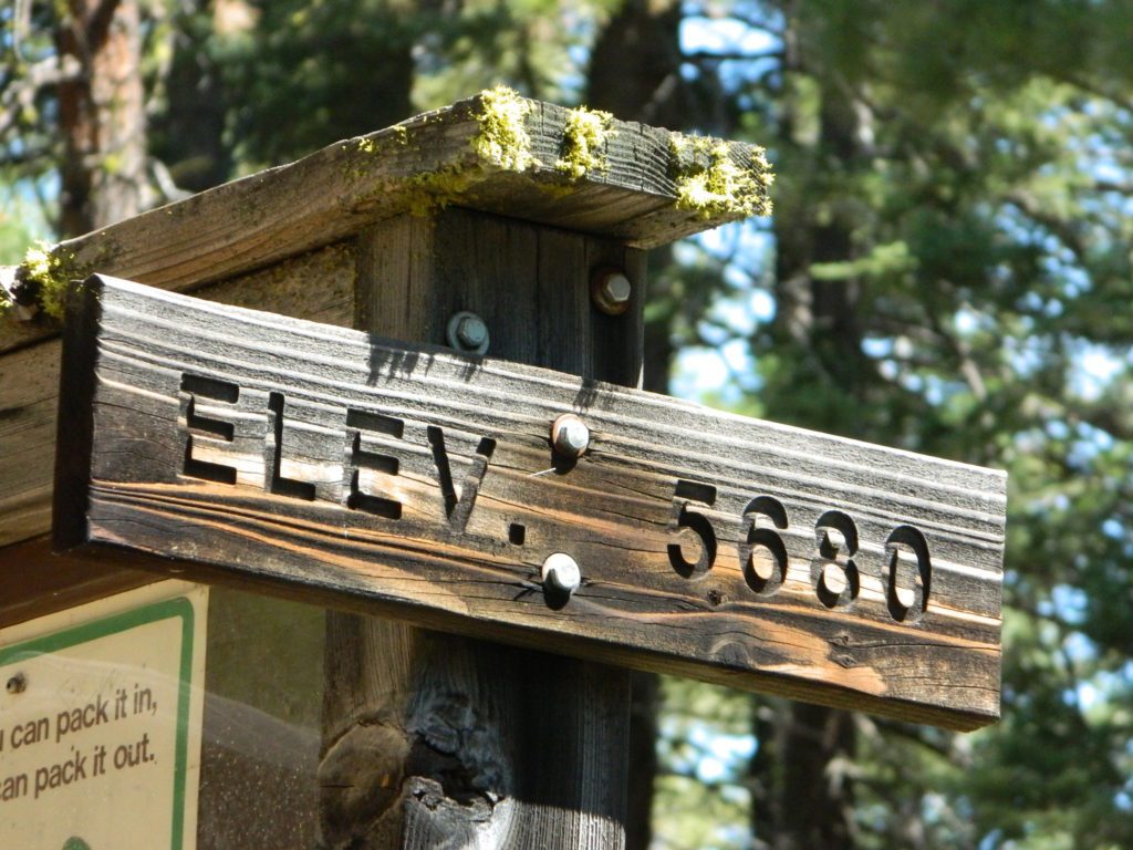
• Elevation: 5,680′
• Number of Sites: 20
• Vehicle Accessibility: RV 22′
• Camp Fee: Yes
• Campsites Reservation: No
• Piped Water: Yes
• Length of Stay: 14 Days
• Season: June – October
• Trailheads: South Warner Wilderness, Clear Lake

millcreek modoc

NFSlogo

Modoc National Forest
Warner Mountain Ranger District
530-279-6116

mill creek falls modoc

paved camp loop

Modoc Blue Lake Campground is also located off  Jess Valley Road.

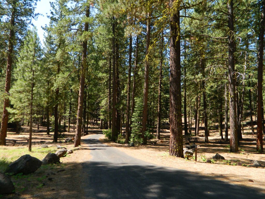
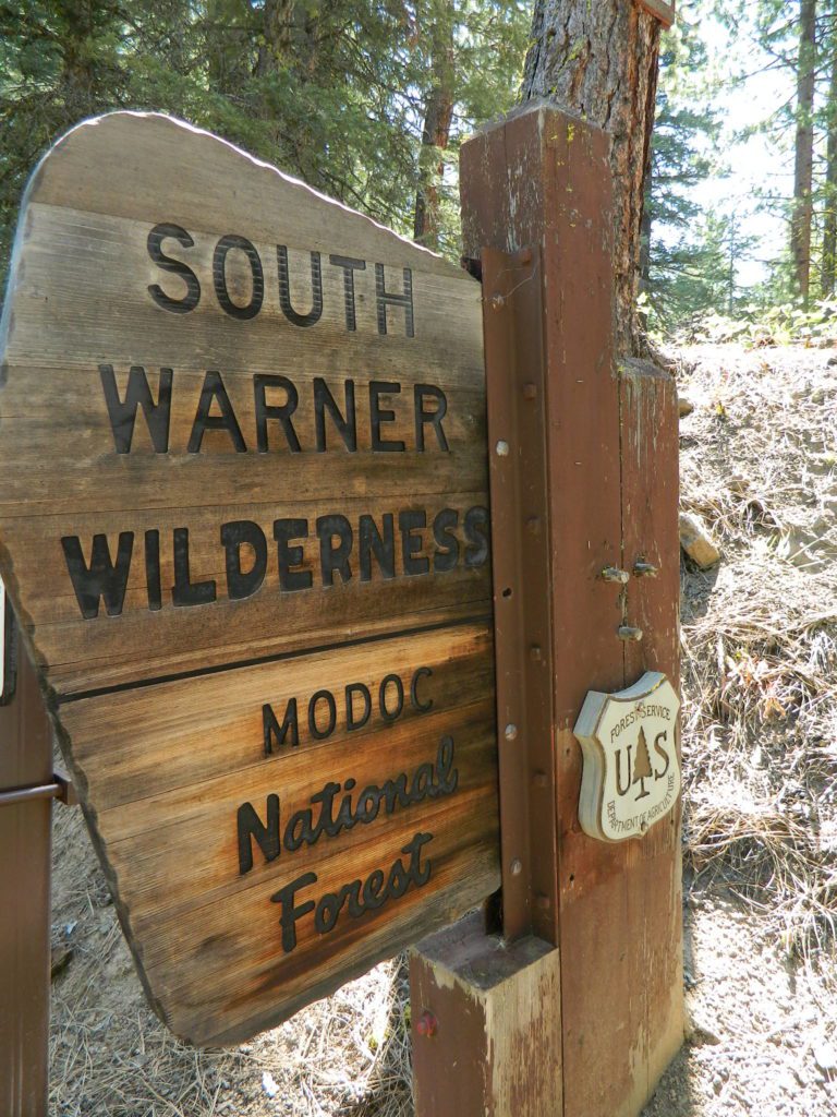
south warner sign

Parking area for day use hikers and overnight backpackers. Hiking trail to waterfall is a short, half mile hike.

Clear Lake is further upstream, above the falls. If you want to find swimming holes, below the falls – then head down river from camp.

elevation 5680

see more MILL CREEKS in California


Wishon Reservoir

Lake Wishon – Sierra NF

Western Sierra Nevada Lake
Central Sierra California
lake wishon

East of Fresno, CA
East of Shaver Lake

EB from Fresno, Hwy 168 up to Shaver, w/ another 30+ miles on paved backroads
(Dinkey Creek Rd & then McKinley Grove Rd)
Way, way back, beyond Dinkey

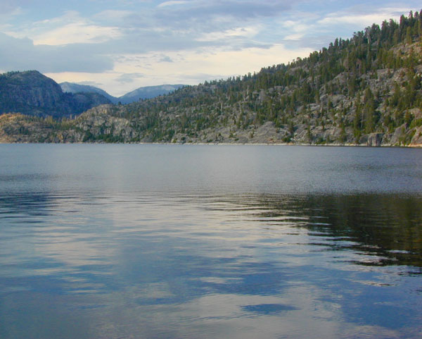
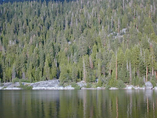
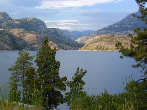
You gotta really wanna BE at places like this. Magical High Sierra mountains – California’s finest. Sheer beauty surrounds this lake w/ granite domes, granite cliffs, granite trails, forests, peaks and plenty hiking, fishing, water and boating. It does take planning (way ahead) to make it out here, cuz the area is only accessible during summer months. Typical of high altitude lakes, snow buries them annually and the roads get closed off to the public (usually NOV-MAY is winter). Some backcountry routes become snowmobiling trails during winter, and the Sierra National Forest has plenty of great snomo action (if snow is deep).

Wishon Lake, California
elevation: 6600′

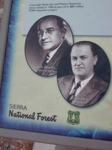
High Sierra Granite Reservoir with pines trees and rocky, granite shoreline. Not nearly as amazing as its cousin w/ the domes to the north, Courtright, Wishon has less granite & less wind, but more accessible backroads to explore, plus more car camping options. Both lakes are part of the Helms Creek hydro-electric project (dams) that make up the PG&E water infrastructure out in these parts – The Kings River Drainage System.

Backpacker trailheads, Woodchuck, Rancheria & Crown Valley all lead to dead end dirt roads – with nothing but solitude for miles & miles. Some might be passenger car accessible. Winter weather changes dirt road conditions (often).

The Kings River Geological Area is nearby, as well as both the John Muir Wilderness & Dinkey Lakes Wilderness.
Wishon Sierra Nevada

Large Reservoir with 8,000-10,000′ high sierra mountain peaks surrounding. Pine forests, views, fishing, camping, hiking in every direction, secluded dirt roads. Perfect high elevation trailheads, next to John Muir Wilderness. Great for backpackers!

All boating, but no waterski or jet ski.
One public boat ramp. Fishing boat rentals available.

WARNING: Water level changes daily.


lake area recreation:

Backpacking
Boating
Campground Camping
Dinkey Lakes Wilderness
Fishing
Hiking
Horse Pack Trips
John Muir Wilderness
Mountain Biking
Primitive Camping
Sierra National Forest
Snowmobiling the Sierras
Spanish Lake 4×4 Route
bridgewishon

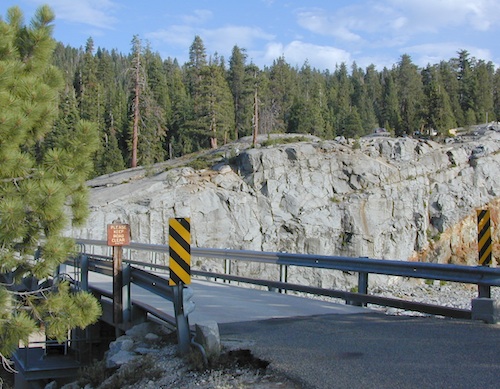
Wishon is a summer vacation paradise for trout fishing, hiking, backpacking and back road exploring.

CLOSED FOR WINTER: NOV-APRIL = Snow closes the road for winter. For all you hardcore campers and hikers, you must call ahead to see if roads are open. It is rural forest, well traveled, but snow storms will shut everything down out here (for many months). Although, in some mild winters you can drive as far as Dinkey Creek on pavement. Gates are locked beyond that.

Central Sierra Wishon Lake Camping

LilyPad Campground @ Wishon Lake

Upper Kings Group Campground (by reservation only)

helpful numbers:

High Sierra Rangers Office: 559-855-5355
Pineridge and Kings River Ranger Districts
29688 Auberry Road, Prather, CA 93651

Dinkey Creek Ranger Station
(June thru September)
559-841-3404

Wishon Village RV
66500 McKinley Grove Road, Shaver Lake, CA 93664
559-865-5361
Engineering

Other places nearby


Black Rock Lake
Sierra Forest Road #11S12
Courtright Lake
Dusy Ershim 4×4 Trail

Dinkey Creek Campground
Dorabelle Campground
Gigantea Campground
McKinley Sequoia Grove
Sawmill Campground (dirt road)

Free, primitive or open camping abundant on the dirt backroads in Sierra National Forest. 4 wheel drive is not required for most routes, but a high clearance rig would help. Some gravel roads are graded annually and suitable for passenger cars – during summer months and only for about the first mile or two, off of the main road (pavement). Mud and snow are common on backroads!
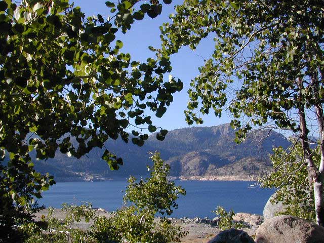
Aspens @ Wishon, Western Sierra
nearby towns:
Fresno, CA
Huntington Lake
Lakeshore
Pine Flat
Prather
Shaver Lake
 

Sierra National Forest Map
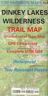
Dinkey Lakes Map
Dinkey Lakes Map
John Muir Wilderness Trail Maps Sierra Nevada Topo Map

Wilderness Wishon California

wish on

NOT TO BE CONFUSED WITH:
Wishon in Giant Sequoia & Wishon @ Bass Lake

There is another popular camp spot called Wishon Camp – on the Western Divide Highway, much further south in the Sequoia National Forest.

Wishon Campground on the Tule River in the Giant Sequoia National Monument. Just up from Springville, CA

And also, the Bass Lake Wishon; there is another WISHON Campground at popular Bass Lake, South of Yosemite NP.
Campgrounds in Mendocino

Mendocino Campgrounds

Camping in Northern California / Camp Mendo

foutspicnic

2018 & 2019
Hit especially hard by wildfires recently. Certain campgrounds and roads are closed to the public, due to the significant fire damage.

Mendocino National Forest has an abundance of small campgrounds and 4×4 camps, many of which, due to snow & elevation, can only be accessed in summer months. Many developed campgrounds are located on dirt roads, so know the road conditions before you get out there.

NOTE: all camps 2000′ elevation or lower are OPEN ALL YEAR LONG
Red text for OHV = off road use, dirt bikes, quads, 4x4s, trailers.

campground elev spots veg toilet water notes
Atchison Campground 4300′ 6 mixed yes creek road# 22N11
dispersed
Bear Creek Campground 2000′ 16 yes creek CLOSED
Cedar Camp Campground 4300′ 5 pines yes no No trailers, June-Oct
Davis Flat Campground 1700′ 28 vault no Fouts Springs OHV
Deer Valley Campground 3700′ 13 yes no Upper Lake
OHV
Dixie Glade Campground 3700′ 8 mixed yes no CLOSED
Eel River Campground 1500′ 16 oaks vault piped bike trails
Fouts Campground 1700′ 11 mixed vault piped Fouts Springs OHV
Georges Valley Campground 5000′ 3 no no Yolla Bolly Wilderness
Green Springs Campground 6000′ 4 pines yes spring Yolla Bolly Wilderness
Hammerhorn Lake Campground 3500′ 9 pines vault piped 1 handicap spot
Howard Lake Campground 3500′ 12 vault lake high clearance vehicle
Kingsley Glade Campground 4500′ 4 vault piped June-Oct
Letts Lake Campground 4500′ 44 no CLOSED
Little Doe Campground 3600′ 13 pines vault no June-Oct
Little Stony Campground 1500′ 8 pines vault no OHV trails
Lower Nye Campground 3300′ 6 mixed vault no May-Sept
Middle Creek Campground 2000′ 12 yes no Upper Lake
OHV
Mill Creek Campground 1700′ 5 yes no Fouts Springs OHV
Mill Valley Campground 4200′ 16 vault piped OHV trails
Navy Camp Campground 1800′ 20 vault piped PG&E Camp @
Lake Pillsbury
North Fork Campground 1700′ 10 oaks yes creek Snow Mountain
Oak Flat Campground 1700′ 12 pines yes no Lake Pillsbury
Old Mill Campground 3700′ 10 pines yes no narrow road
Plaskett Meadows Campground 6000′ 35 pines yes piped Plaskett Ridge
Penny Pines Campground 3600′ 5 pines yes piped Upper Lake OHV
Pogie Point Campground 1900′ 50 oaks yes piped Lake Pillsbury
Soldier Ridge Campground 6000′ 3 no no Yolla Bolly Wilderness
South Fork Campground 1700′ 4 vault creek Stony Creek, OHV
Sugar Spring Campground 5400′ 3 vault no Burnt Creek / Eel River
Sugarfoot Glade Campground 4200′ 4 mixed vault creek May-Nov
Sunset Campground 1800′ 54 mixed vault creek May-Nov
Surveyor Camp 3900′ 2 yes no OHV, Rd# 7
Sycamore Grove Camp 300′ 30 mixed yes no Red Bluff,
open all yr
Three Prong Campground 4800′ 6 pine vault piped June-Oct
Wells Cabin Campground 6300′ 15 pines vault piped July-Oct
Whitlock Campground 4300′ 4 mixed vault piped June-Oct

OFF-ROADERS NOTE: 3 OHV camps are located in higher elevations; the rest are 2000′ or lower and open year round. Always check with National Forest for road closures and conditions.

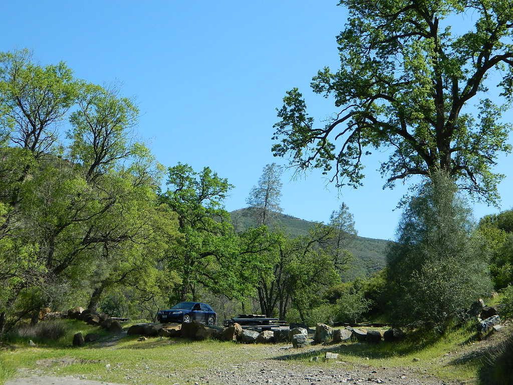
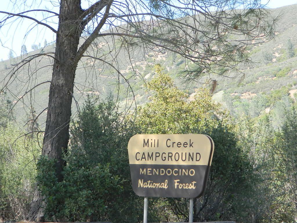
Mill Creek Camp @ Mendo
Mill Creek Camp @ Fouts Springs

Mendocino Ranger Stations can be found on link below

NFSMendocino National Forest


MENDO GROUP CAMPGROUNDS
(reservations required)

GRAY PINE GROUP CAMP @ Stonyford

MASTERSON GROUP CAMP @  Plaskett Lakegroup campground

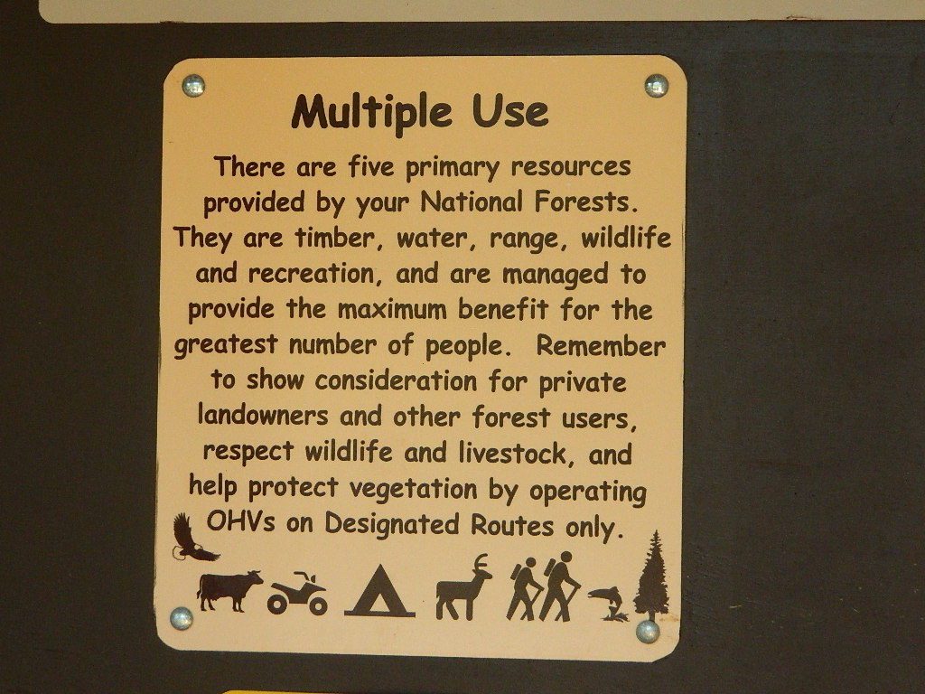
multiuse_sign

cement_table

group camps Mendocino

Mendocino & North Coast Maps

Plumas Camping

Lil' Northfork Campsite
Primitive (dispersed) camping near Lil’ Northfork

Plumas National Forest Camping – Primitive Camp Sites

Spanish Creek, Quincy, CA

Plumas Forest Camping

NFSlogoNorth Sierra Nevada, Northern California

Listed below are primitive campgrounds w/ minimal facilities or open camping areas in Plumas National Forest. Plumas has excellent fishing as the big rivers & numerous creeks run thru this northern Sierra Nevada landscape. Open camping is allowed on almost any dirt road w/ a current campfire permit

see also – Plumas Campgrounds

driftwood

Brady’s Camp
[on Pine Creek near Argentine Rock]
near Quincy, CA – east on Squirrel Creek Rd. & go 8 mi. to the campground. Elevation 7200′ / Open May – October

pct

Bucks Lake has numerous NFS Campgrounds and PCT access; Overall elevation 5000′ w/ abundant boating, fishing and hiking. Snow in winter closes roads. Cabins, marina, lodge, restaurants. Bucks Lake Wilderness, Gold Lake, Silver Lake

Deanes Valley Campground camp
[along Rock Creek] Hwy.70 Quincy, go 3.5 mi. west on Buck Lake Rd. Head south & 7 mi. to the campground. Elevation 4400′ / Open April – October


35 mph

Ishi Wilderness hiker

Backpacking trails w/ dirt road access. Above Chico, beyond Cohassett; on the border of Tehema Co. and Butte Co. (Lassen NF & Plumas NF)

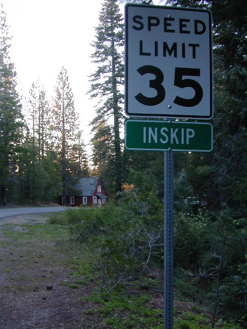
Inskip, CA – Way up beyond the Ridge, well past Magalia and Stirling City – find dense forests, dirt roads and camping. Philbrook Reservoir w/ West Branch Campground NFS. Elevation 5546′

24N10 – Plumas NF

Lakes Basin Recreation Area

lakesbasinhikers
lakes basin day hikers

Snag Lake California

4x4 dirtbikes fish

Ohio Valley – Seneca Road
[off Hwy 89 to southside] Primitive forest camping near Lake Almanor. ATV trails, hunting. Creeks and river camping closer to Seneca. High clearance or 4WD may be needed on these dirt back roads – depending on snow and mud. There is plenty dirt roads back here to explore.

Snake Lakecanoe
[good fishing area] Hwy.70 Quincy, go 5 mi. west on Buck Lake Rd. Head north & 5 mi. to the campground at the lake. Elevation 4200′ / Open April – October

Snake Lake, California

Taylorsville Campground

Indian Valley - Plumas California

pinetree


digger pines
Bald Rock Road in Berry Creek, CA

see also – Feather River California

foreman creek
Foreman Creek @ Lake Oroville, (maxed out) FEB 2017

nearby towns –

Belden Town
Berry Creek, CA
Bucks Lakes, CA
Butte Meadows
Chico, CA
Greenville, CA
Oroville, CA
Paradise, CA
Portola, CA
Quincy, CA
Twain, CA